For historical information only, do not use for navigation or aviation purposes!
| Coordinates | N503224 E0150024 (WGS84) Google Maps |
| Elevation | 801 ft |
| Location indicator | LKMH |
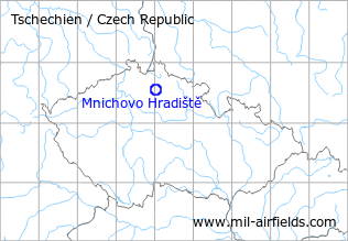
The history of the Cold War airfields: Mnichovo Hradiště
During the Cold War
Usage during the Cold War
Reserve airfield.
Runways
- 07/25: 2500 m x 30 m
Radio communication
The radio call sign of the airfield was UHELNIK (1990).
According to western signals intelligence (SIGINT), the airfield was also called "Navigacni Punkt 360" by the Czechoslovak Air Force.
Installations
Simple layout with runway, parallel taxiway and 2 ramps at each end.
Today
Use today
General aviation.
 Follow mil-airfields on Facebook