For historical information only, do not use for navigation or aviation purposes!
| Coordinates | N525525 E0081014 (WGS84) Google Maps |
| Elevation | 120' |
| Airfield Id | NLP II/7 |
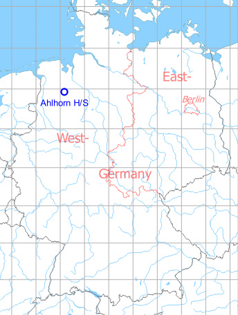
Germany during the Cold War Map
The history of the Cold War airfields: Ahlhorn
General
On the Autobahn A 29 northwest of Ahlhorn, an emergency landing field with concrete middle strip and three parking areas was built during the Cold War. Shortly before the commissioning of this section of the motorway, an exercise took place here in 1984. After the reunification, the highway strip was abandoned.
Location of airfield
Autobahn A29, between intersections Ahlhorn and Großenkneten
During the Cold War
Usage during the Cold War
Highway Strip.
Runways
- 02/20: 2400 m
There are three parkings: two at the southern end, one at the northern end (on the eastern side).
Images
Highway 84
The following pictures were taken during the exercise "Highway 84" in march 1984. Source: DoD, photographer TSGT ROD PROUTY, SRA GLENDA PELLUM, with additional information from Helmut Friz. Thank you very much!
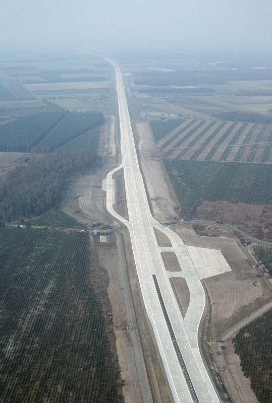
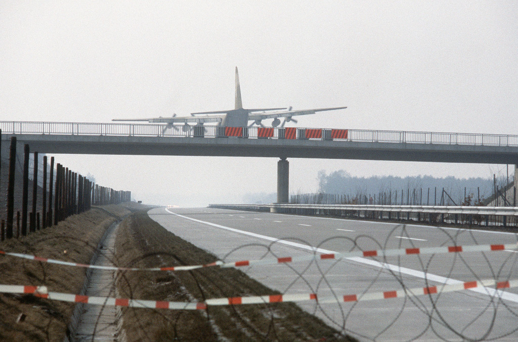
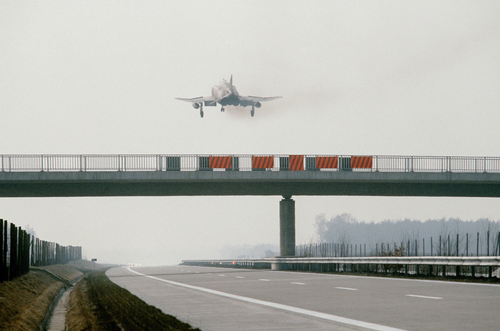
Aerial picture from 28 March 1984
Source: DoD, photographer TSGT ROD PROUTY
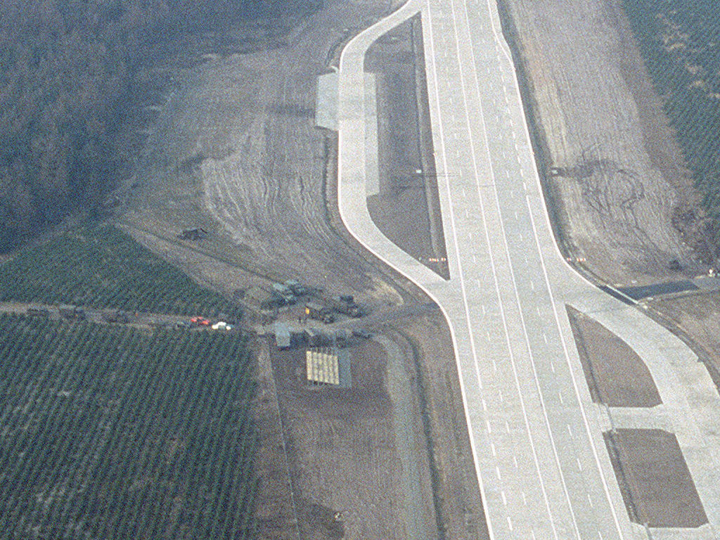
Detail view with road, mobile control tower and viewing platform.
During the exercise, there were two mobile control towers deployed: one for air trafic control, mid of runway, on the western side. The other as exercise command post, at the southern end on the western side, near the visitor's stand.
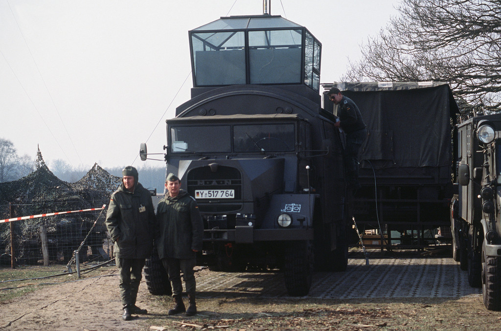
Mobile control tower from JaboG 43 Oldenburg for air traffic control.
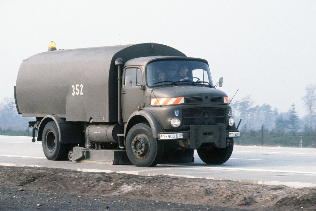
Flight line sweeper vehicle (JaboG 43)
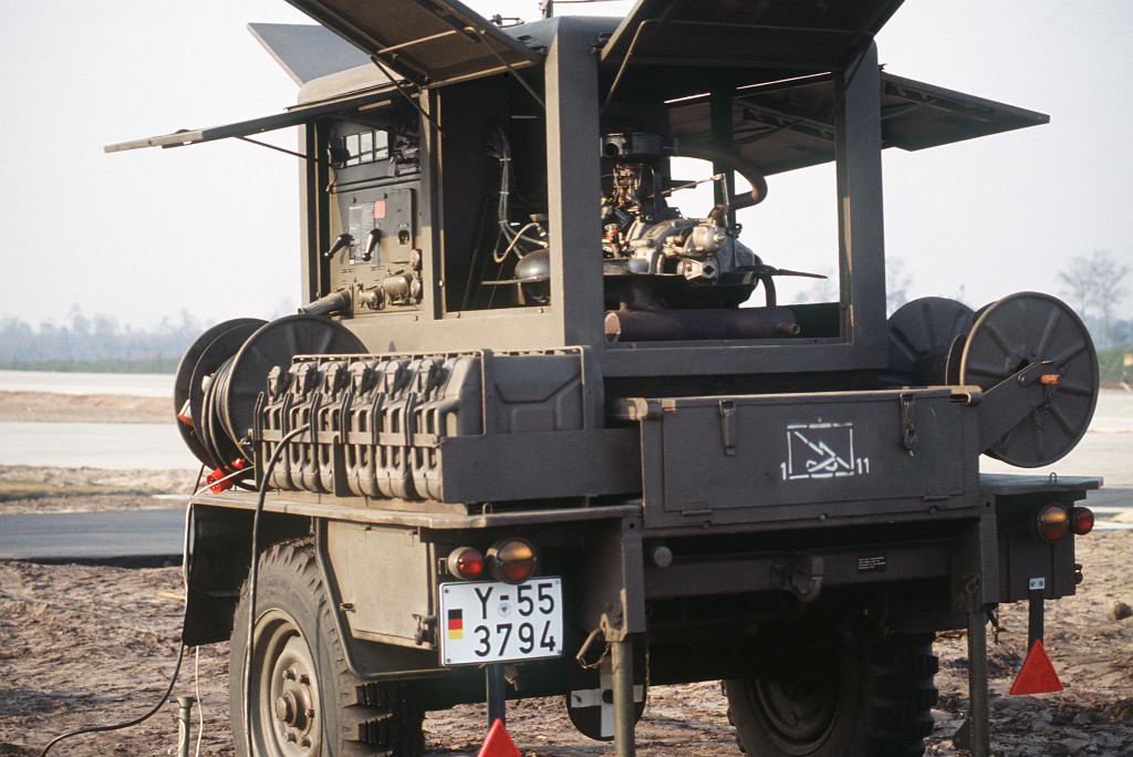
Generator
Besides the aircraft types below, videos from this exercise (see links below) also show German Air Force Alpha Jets, Netherlands Air Force NF-5, RAF Jaguars. Also a formation landing of two C-160 Transall, followed by a C-130.
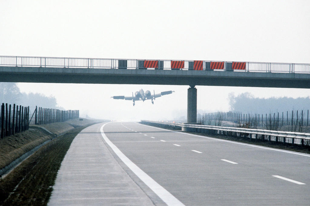
A-10 before touchdown. Viewing direction south.
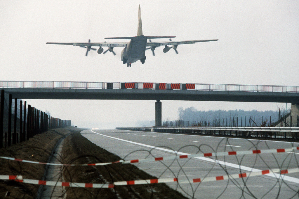
C-130 Hercules
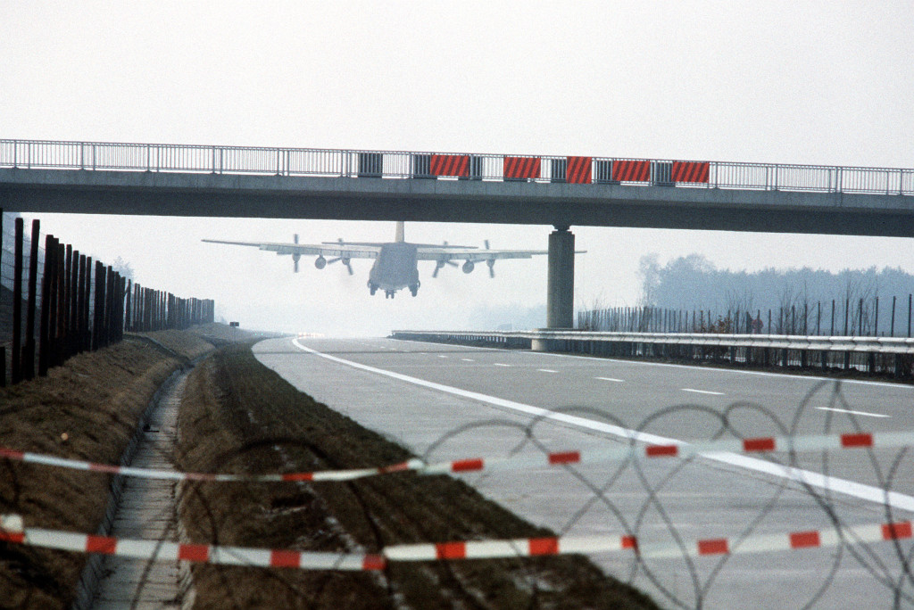
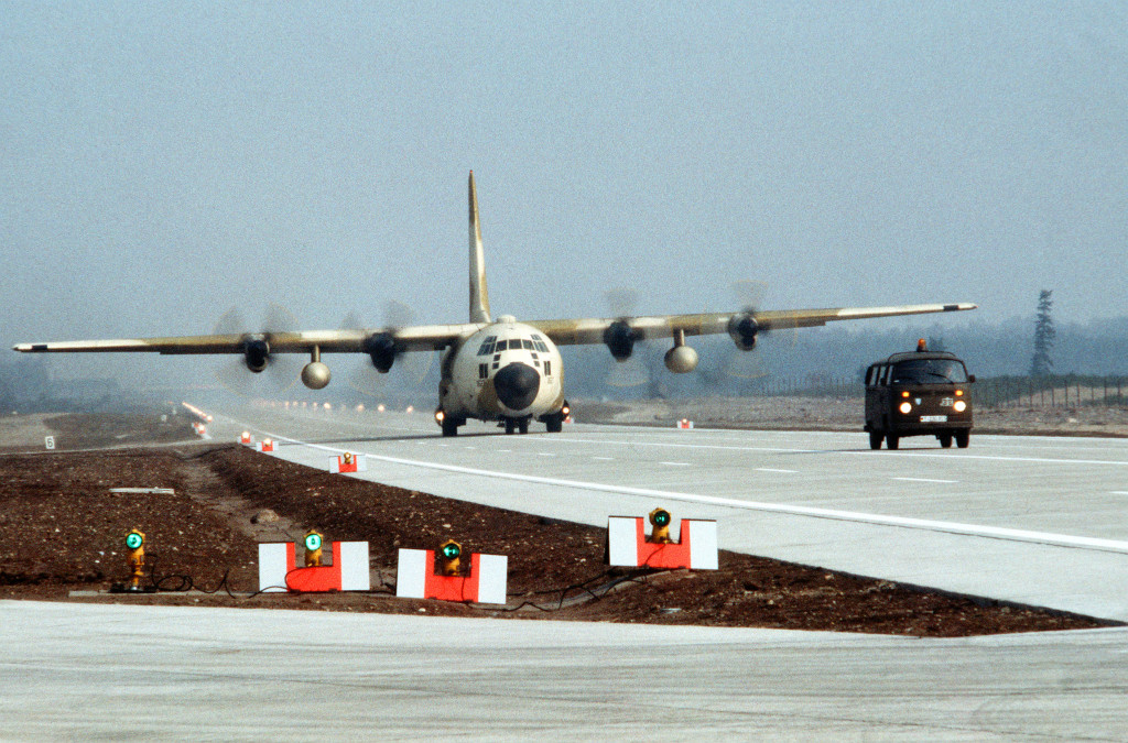
C-130 Hercules taxiing south.
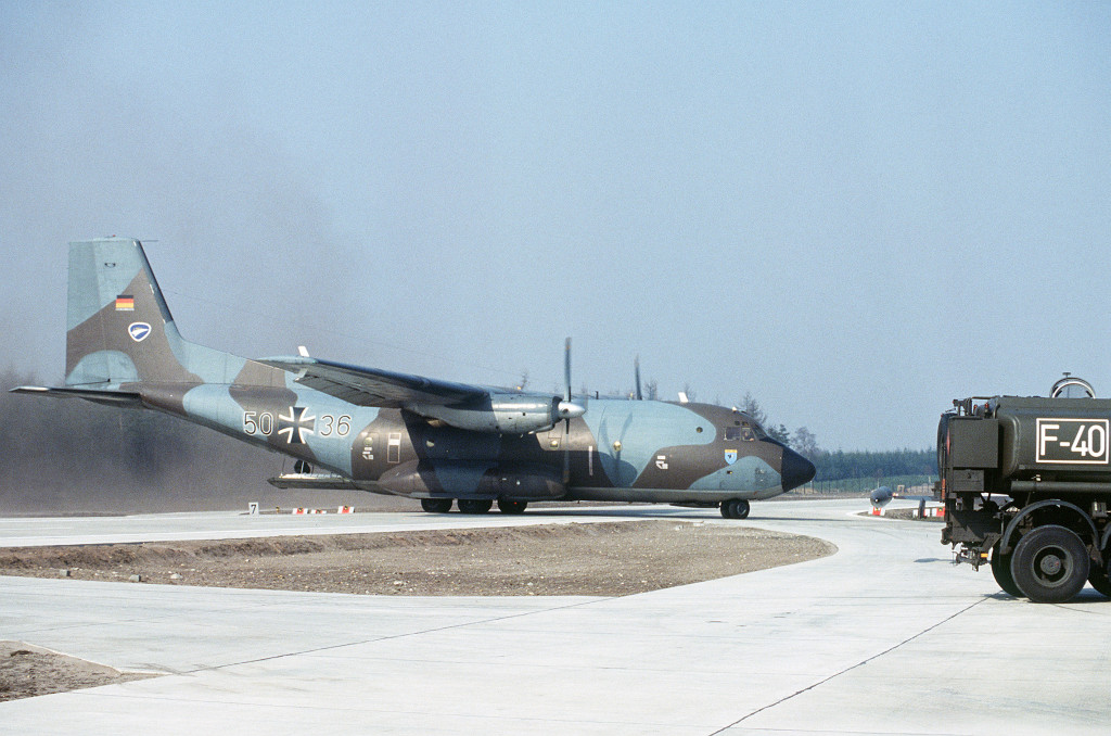
A C-160 Transall (LTG 62 Wunstorf) at the southern parking. The plane behind the fuel truck could be a F-5.
F-4 Phantom landing
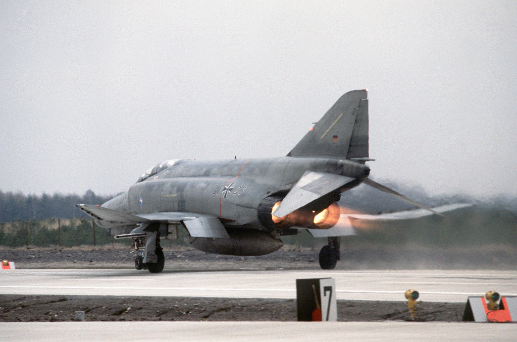
F-4F Phantom (JaboG 36 "Westfalen" Hopsten)
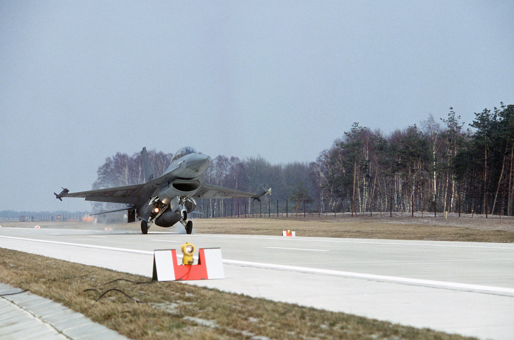
A F-16 landing, armed with AIM 9 Sidewinder (J-654, Netherlands Air Force)
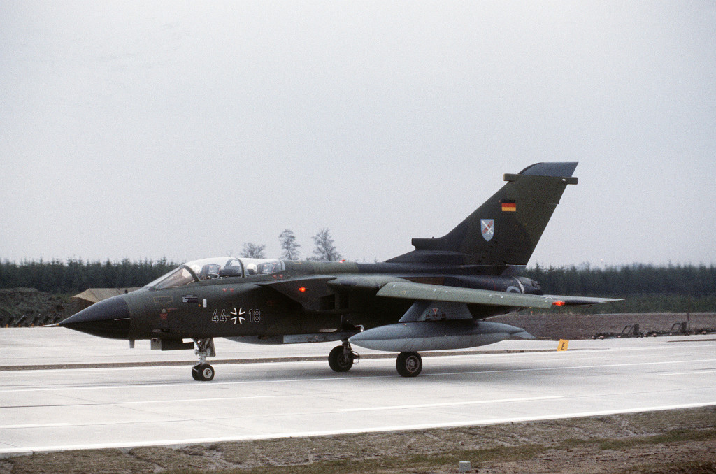
German Air Force Tornado (JaboG 31 "Boelcke" Nörvenich)
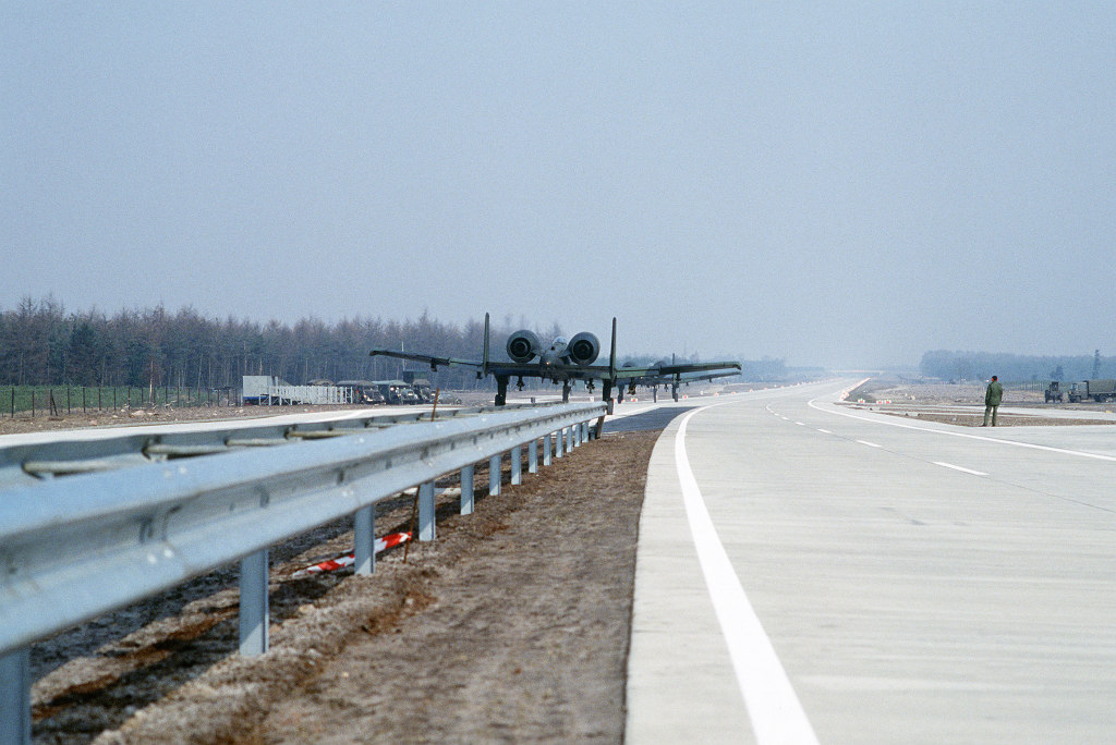
Two A-10, looking north. In the background, you can see the exercise command post tower and the visitor stand.
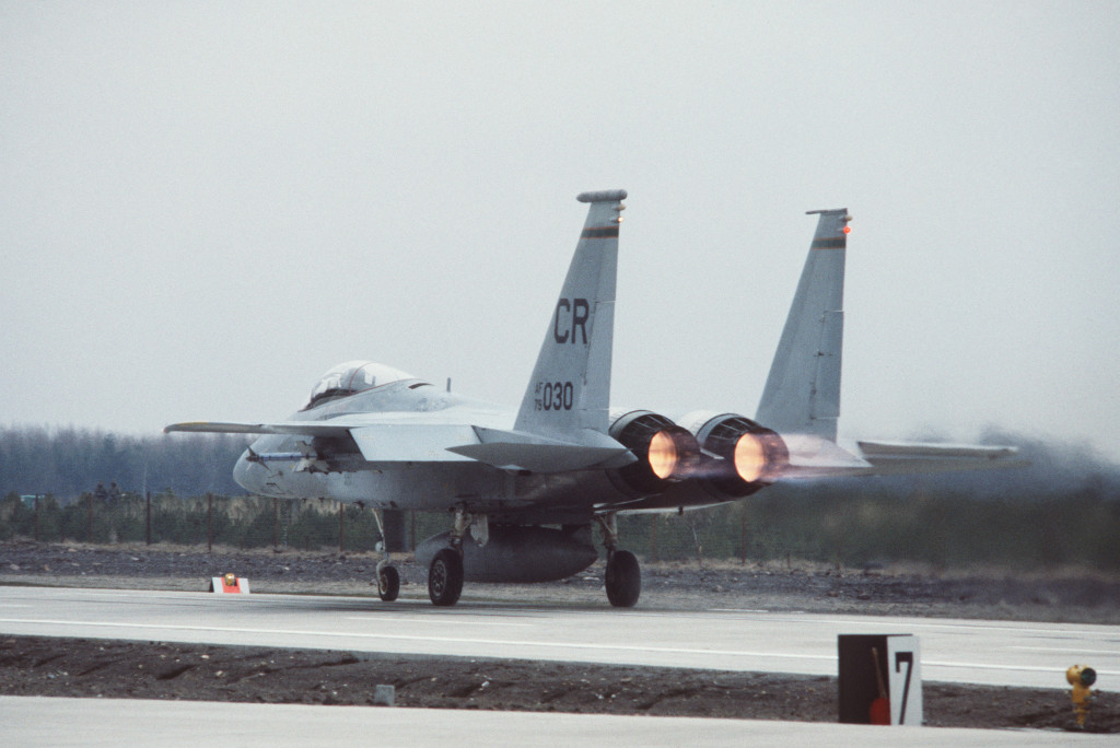
F-15 on take-off (32rd TFS, Soesterberg / Camp New Amsterdam)
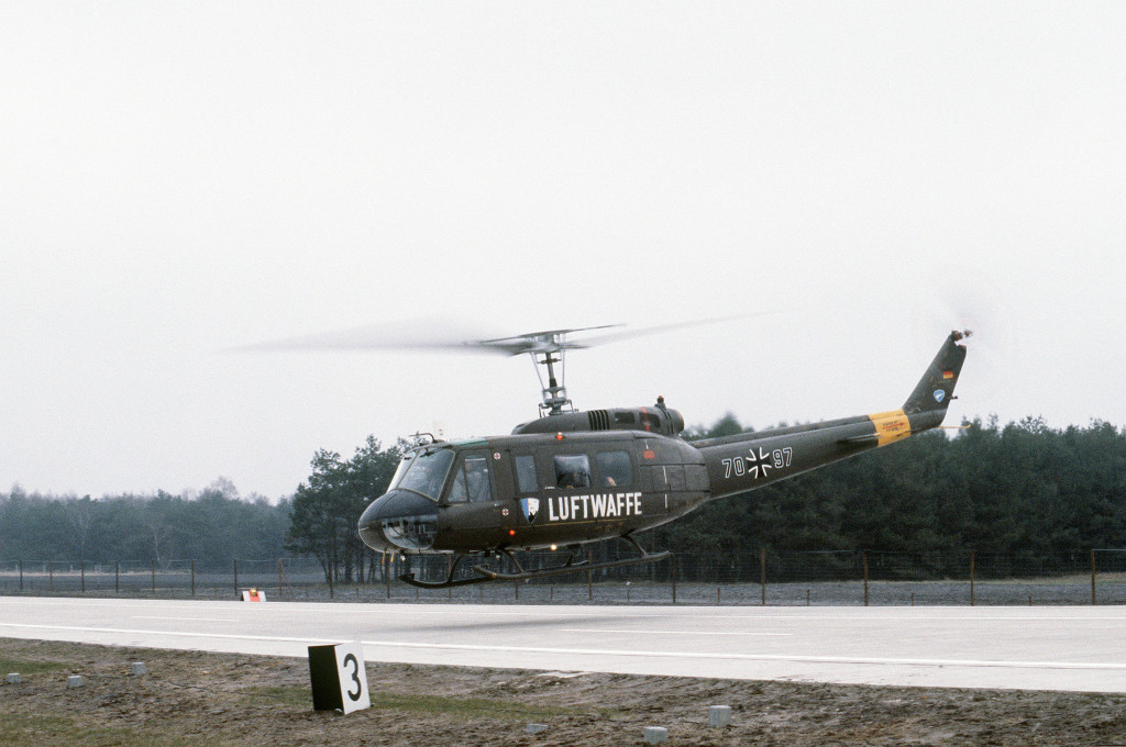
German Air Force Bell UH-1D (HTG 64 Ahlhorn)
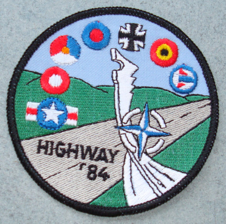
Sticker with the participating air forces (USAF, Denmark, Netherlands, UK, Germany, Belgium, Norway) and JaboG 43 (Source: Helmut Friz)
Today
Use today
Closed.
Links
- Relikte in Niedersachsen und Bremen - Der Autobahn-Notlandeplatz II/7 Ahlhorn
- Videos from the exercise "Highway 84" at Ahlhorn highway strip.
- geschichtsspuren.de - Autobahn-Flugplätze (NLP-Str)
Airfields in the vicinity
- 132°/6km Ahlhorn: Air Base (RAF Ahlhorn)
- 259°/9km Varrelbusch: Air Base (planned)
- 180°/24km Bakum: Highway Strip (Notlandeplatz NLP)
- 083°/25km Wildeshausen: Highway Strip (Autobahn-Notlandeplatz NLP)
- 359°/29km Oldenburg: Air Base
Categories
Highway Strips WorldwideMilitary Airfields GermanyMilitary Airfields in former West GermanyHighway Strips in former West GermanyRecommended
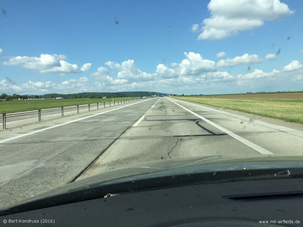
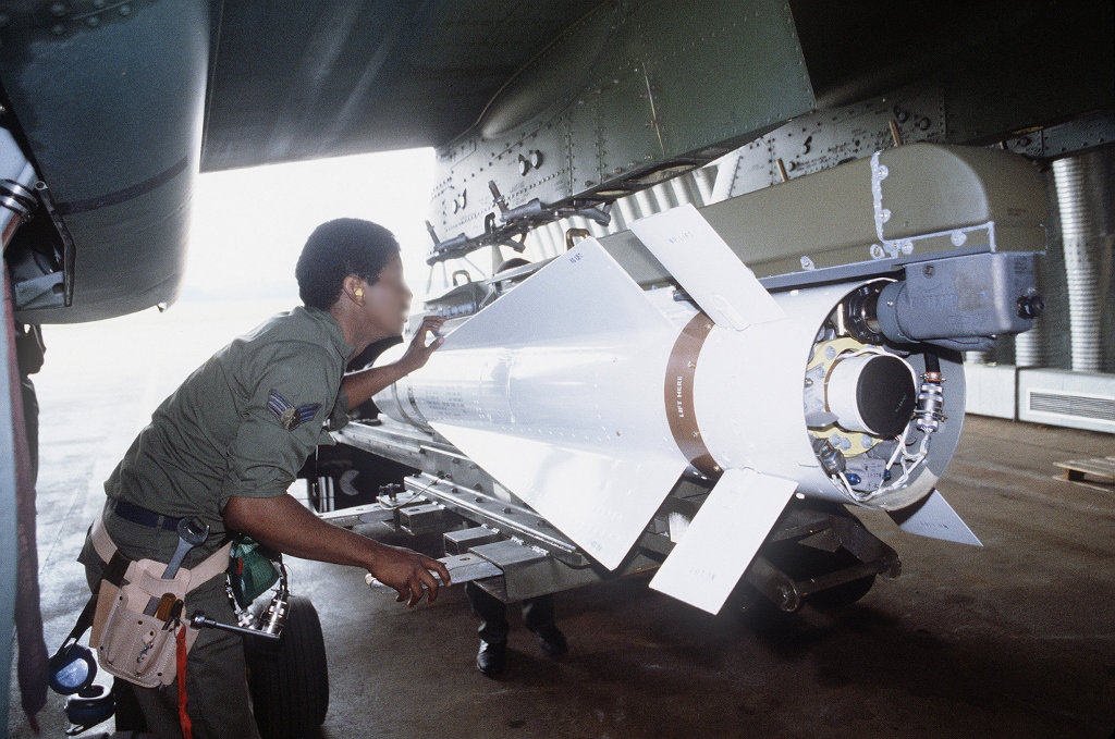
Image credits are shown on the respective target page, click on the preview to open it.