For historical information only, do not use for navigation or aviation purposes!
| Coordinates | N525320 E0081400 (WGS84) Google Maps |
| Elevation | 162 ft |
| Federal state | Niedersachsen (Lower Saxony) |
| Location indicator | DAAH (RAF), EDNA (Luftwaffe), ETNA, EDHA |
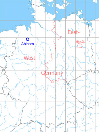
Germany during the Cold War Map
The history of the Cold War airfields: Ahlhorn
General
In World War I, Ahlhorn was an airship port and in World War II a Luftwaffe airfield. In the 1950s the field was expanded and used by the Royal Air Force. In the late 1950s, Ahlhorn was handed over to the German Luftwaffe, which based here combat, transport and helicopter units through the years. At the end of the 1970er years Ahlhorn became additionally a forward operating location for aircraft A-10 Thunderbolt of the US Air Force. The aviation use ended in the early 1990s. At the end of 2005, the facility was abandoned by the Bundeswehr.
During World War II
Use
Luftwaffe airfield.
Situation
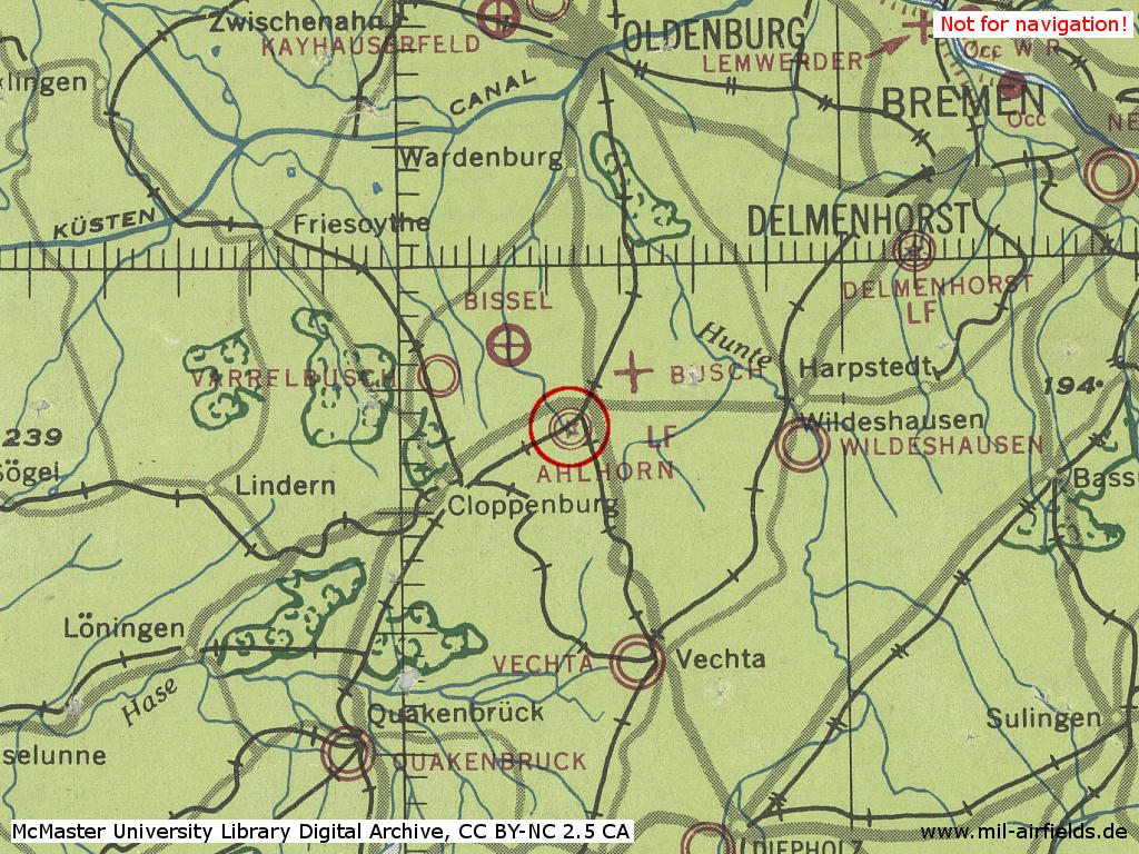
Ahlhorn Air Base in World War II on a US map from 1943
Source: McMaster University Library Digital Archive, Lizenz: Creative Commons Attribution-NonCommercial 2.5 CC BY-NC 2.5 CA
Overview
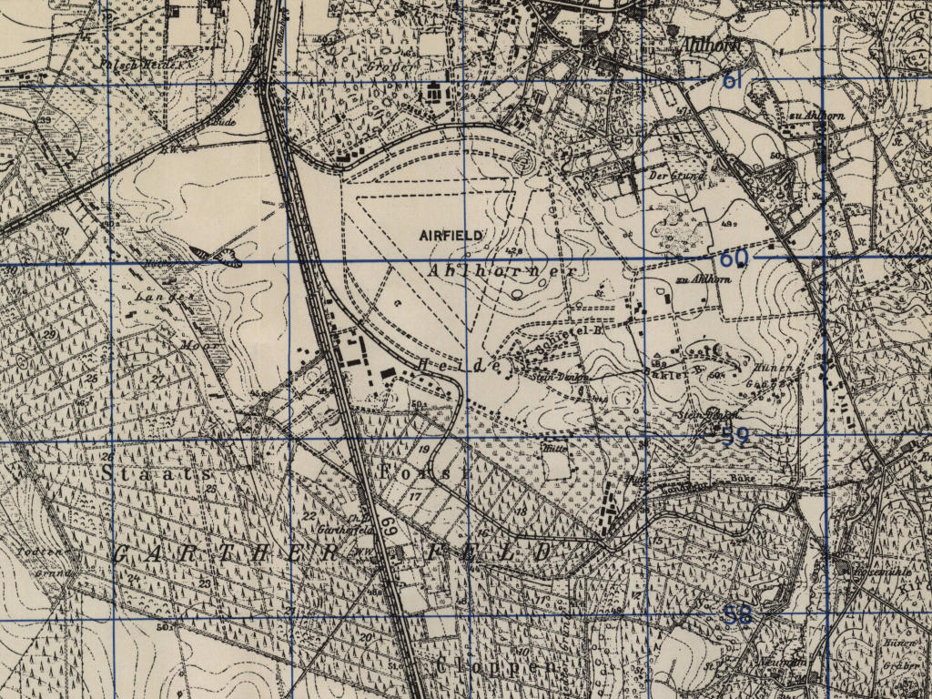
Ahlhorn Air Base on a US map from 1951 - The map should represent the expansion of the 1940s with three runways. Noticable is the curved course of the railway siding in the south.
Source: AMS M841 GSGS 4414, Courtesy Harold B. Lee Library, Brigham Young University
During the Cold War
RAF Ahlhorn (- 1958)
Use
The Royal Air Force (RAF) used Ahlhorn until 1958.
Overview
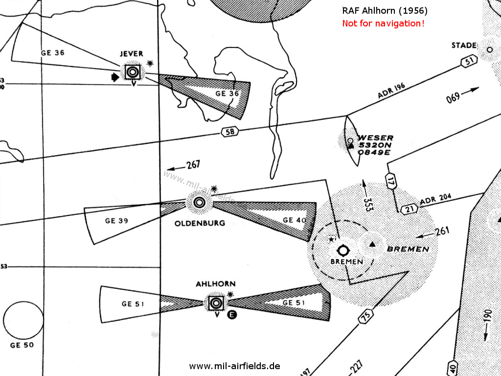
RAF Ahlhorn on a map from 1956 - The approach areas of the three British airfields Ahlhorn, Oldenburg and Jever are protected by restricted areas. The white "E" in the circle symbolizes the Eureka radio beacon, used by the British at this time. The square around the airport symbol with the "V" underneath shows an VHF direction finder. The black star stands for the coded beacons which is characteristical for British airfields
Lights
Red airfield beacon with morse code AN
Radio beacons
- NDB: 282 "AN", Power 30 W
- Eureka: 218R, 213T "AN"
Radar
GCA
Radio communication
- Approach 130.68, 111.42, 117.9, 121.5, 133.38, 152.1, 111.78
- Tower 133.38, 111.42, 117.9, 130.68
Airspace and procedures
Operating times Monday, Tuesday, Thursday, Friday from 07:00Z until 16:00Z, Wednesday and Saturday from 07:00Z until 11:00Z
Ahlhorn air base from 1958
In the 1960s
Overview
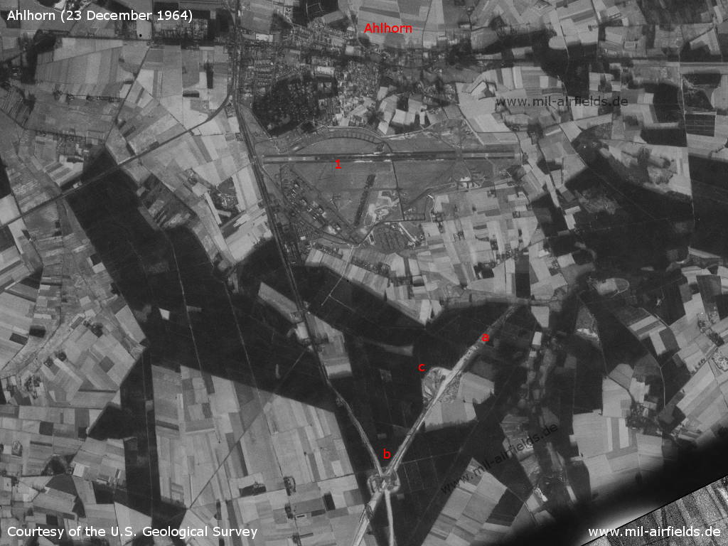
Ahlhorn Air Base on a US satellite image from Wednesday 23 December 1964 - 1: airfield. a: Autobahn A1 under construction, b: junction Ahlhorner Heide, c: clear area - was a parking lot planned here?
Source: U.S. Geological Survey
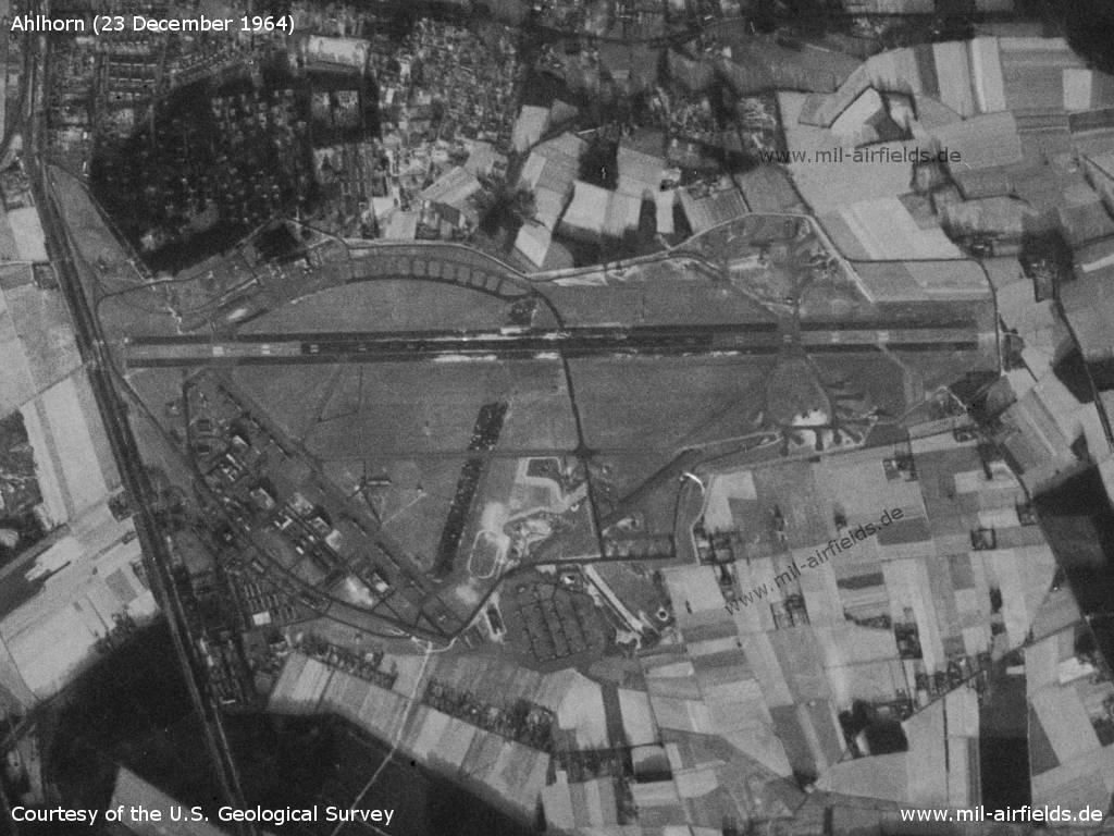
Airfield
Source: U.S. Geological Survey
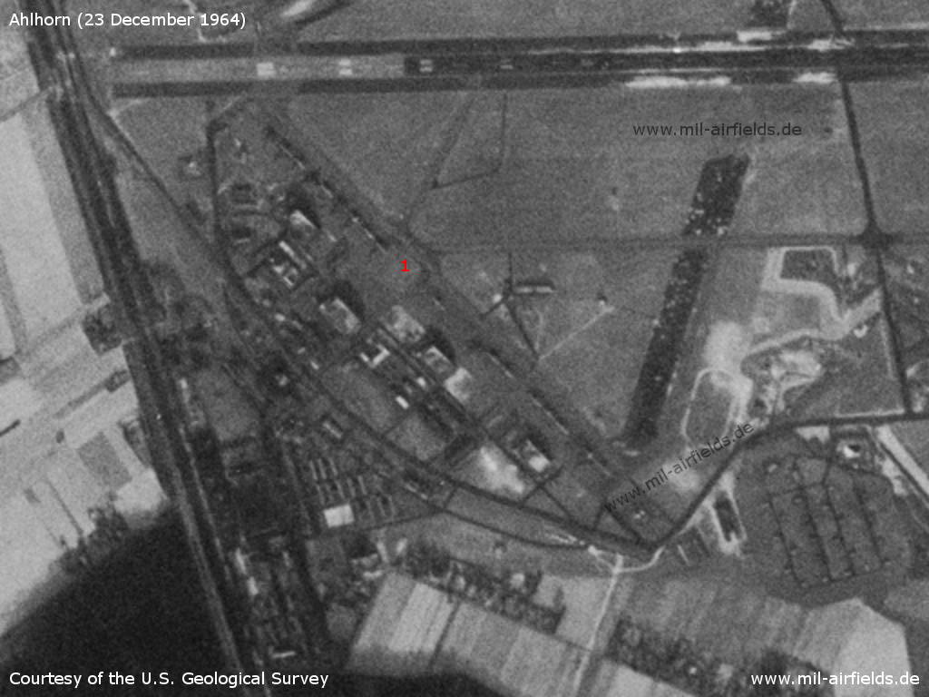
Enlargement - 1: There are 10 to 15 aircraft on the southwest apron. These could be Noratlas transport aircraft of the Air Transport Wing 62 of the German Air Force (LTG 62), which was stationed in Ahlhorn at that time.
Source: U.S. Geological Survey
In the 1970s
Situation
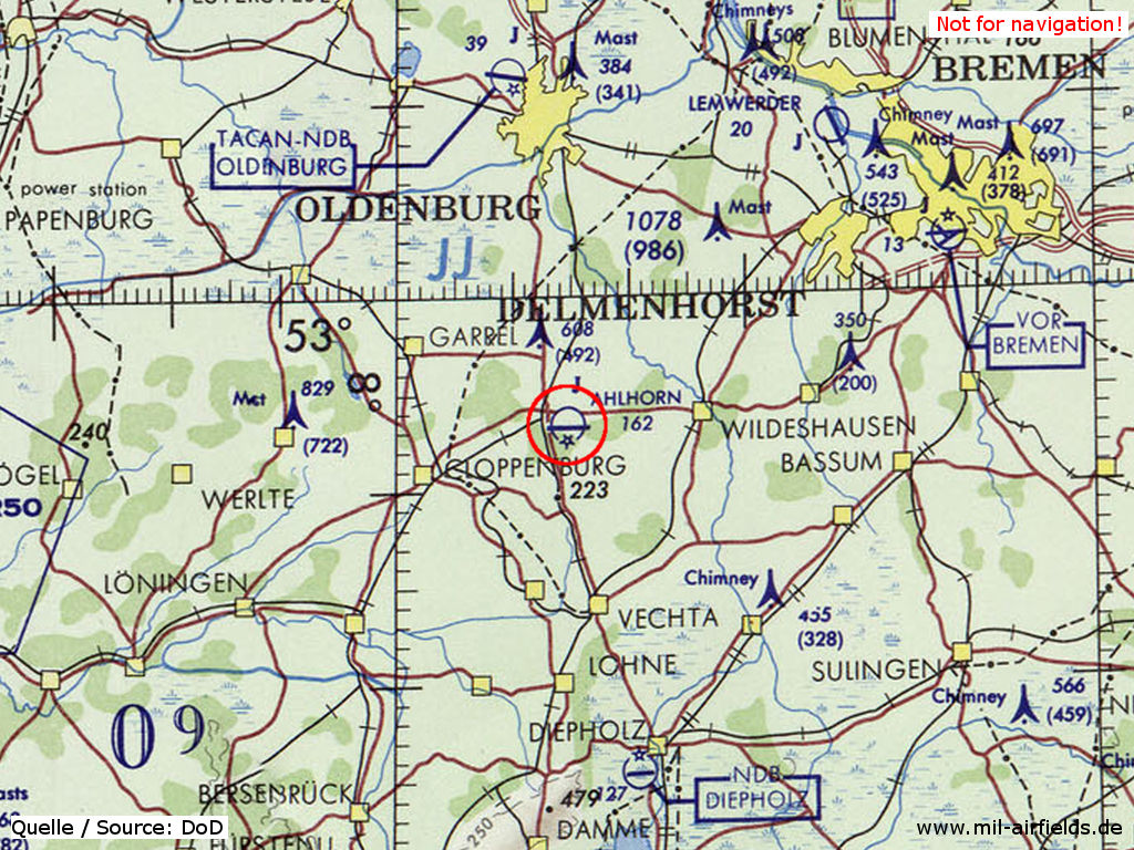
Ahlhorn Air Base on a map of the US Department of Defense from 1972 - Not shown here are the later built Autobahn A 1 and A 29, which lead past the field in the south and in the west. Thus the Ahlhorn Highway Strip is also missing, which is situated a little further to the north on the A 29.
Source: ONC E-2 (1972), Perry-Castañeda Library Map Collection, University of Texas at Austin
Radio beacons
Data for the year 1971:
- NDB: 290 "AHL"
Airspace and procedures
HI NDB approach to runway 09 (1973). Source: DoD Flight Information Publication (Terminal) - High Altitude Instrument Approach Procedures Europe and North Africa, effective 16 August 1973 to 13 September 1973
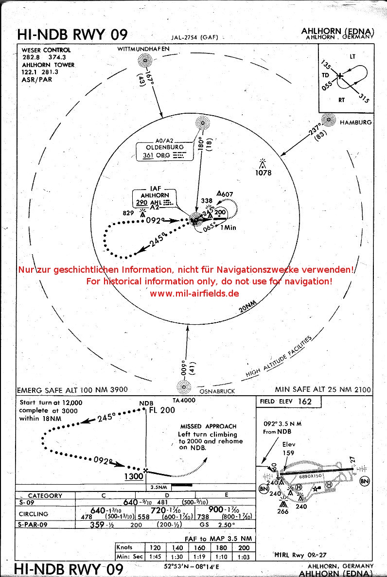
Source: US DoD
In the 1980s and early 1990s
Overview
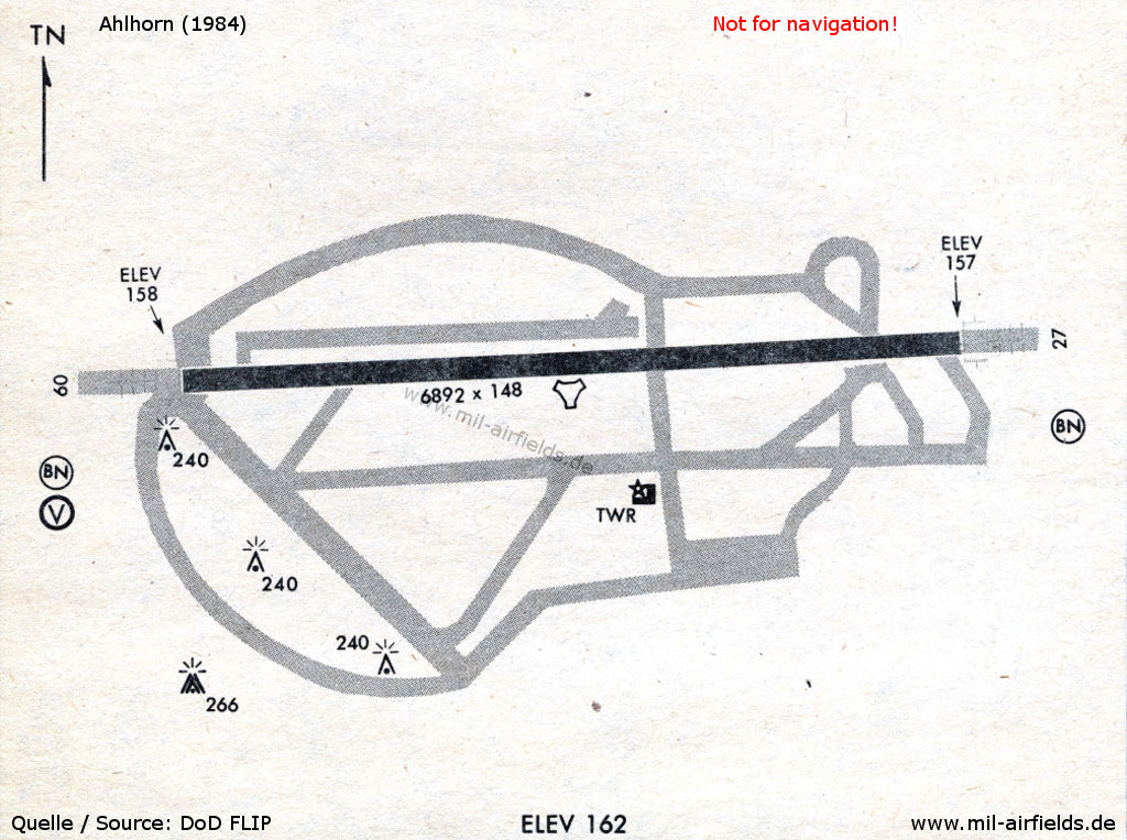
Map from 1984 - In the west the triangular layout is still visible.
Source: US DoD
Runways
- 09/27: 2101 m x 45 m Asphalt/Concrete
Radio beacons
- NDB: 361 "HHN", to RWY 27
- NDB: 290 "AHL", to RWY 09
- TACAN: CH17 "AHL"
- ILS 27: 109.3 "AHL"
Radar
ASR, PAR
Units
Units 1990:
HTG 64 UH-1D
Det 3, 10th TFW A-10
HTG 64 UH-1D
Det 3, 10th TFW A-10
Images
The following pictures were taken in May 1983, during the exercise CHECKERED FLAG '83. Source: Department of Defense, Scene Camera Operator: TSGT G. Dennis Plummer
Look across the field from east to west
Source: US DoD
Enlargement: Ladder-shaped parking area in the north
Source: US DoD
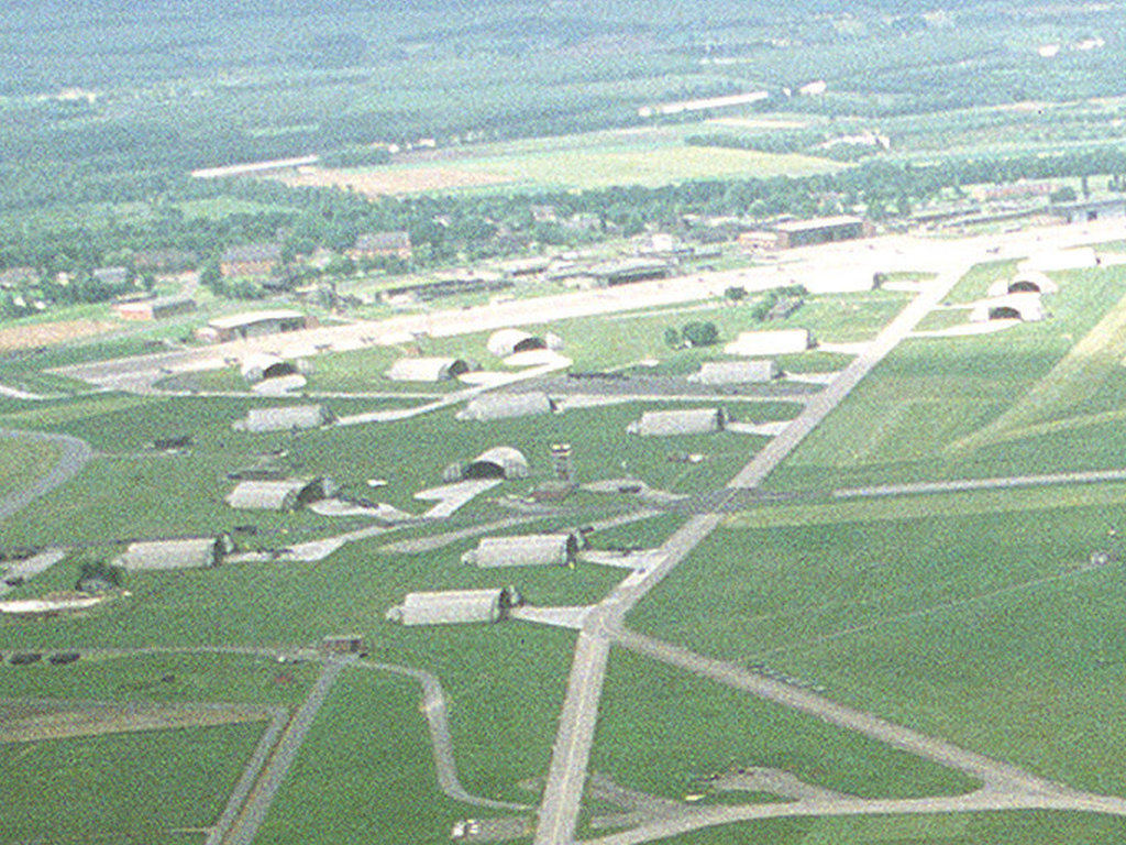
Enlargement: Shelter area in the south
Source: US DoD
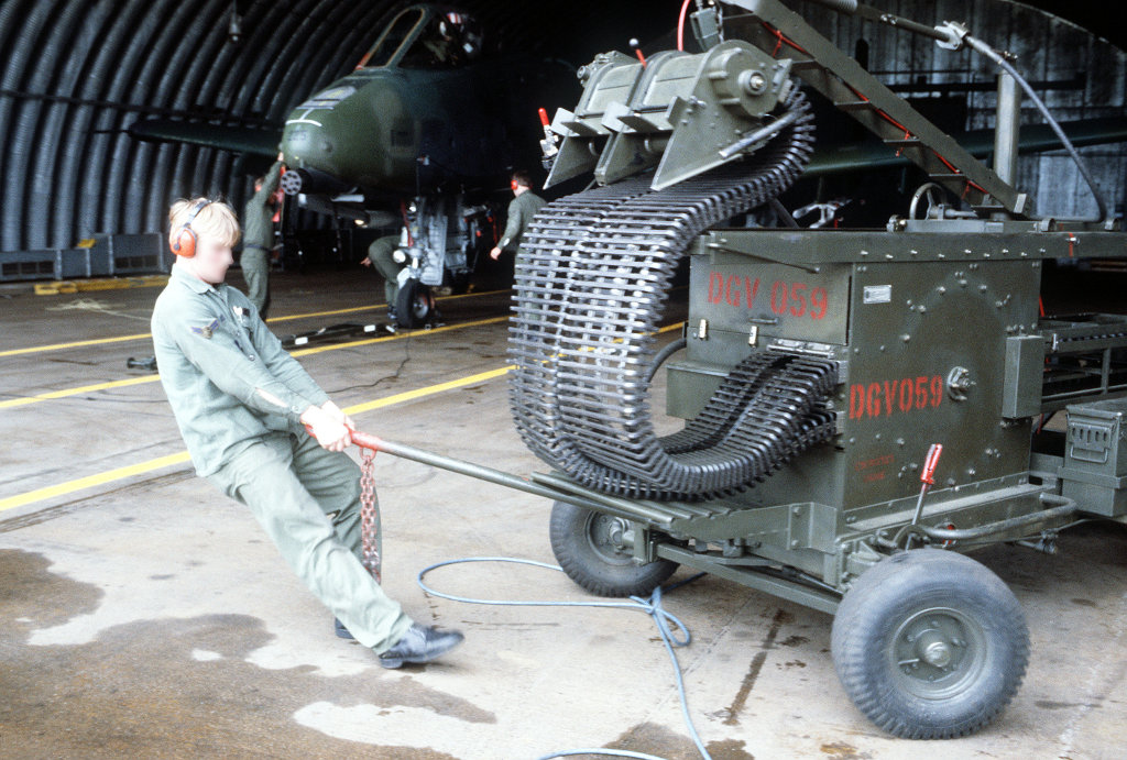
A munitions maintenance specialist pulls an ammunition loader into position for loading the GAU-8/A 30 mm gun of an A-10 Thunderbolt II aircraft
Source: US DoD
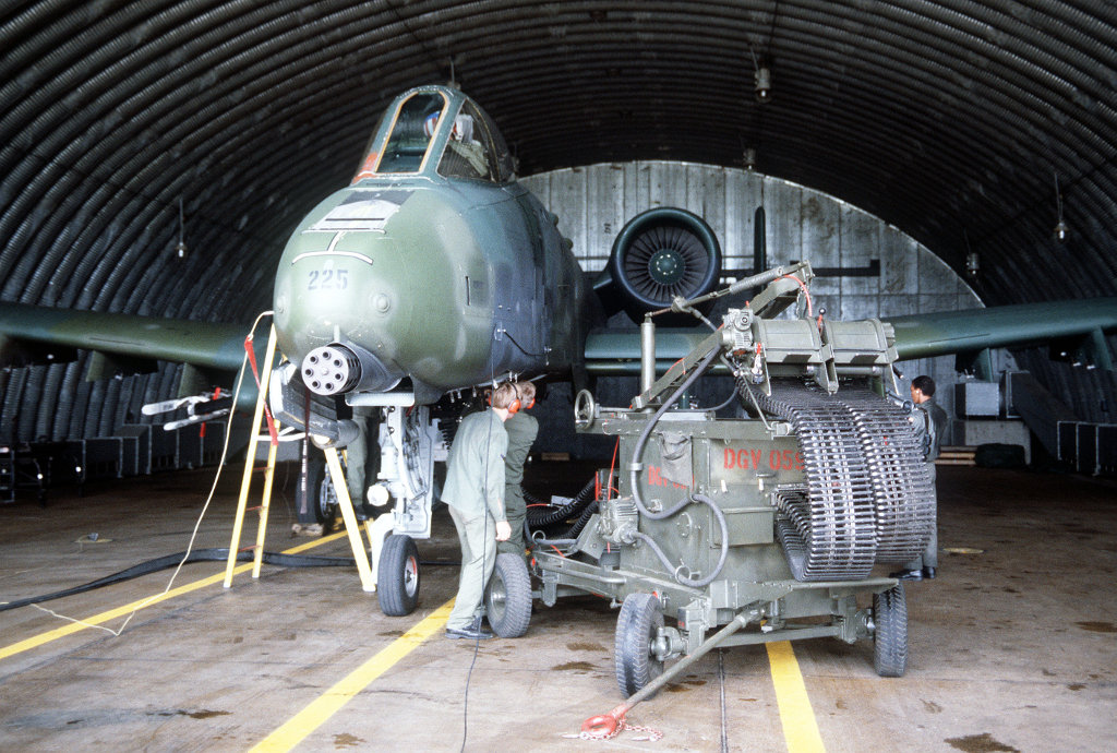
Munitions maintenance personnel use an ammunition loader to load the GAU-8/A 30mm gun of an A-10 Thunderbolt II aircraft
Source: US DoD
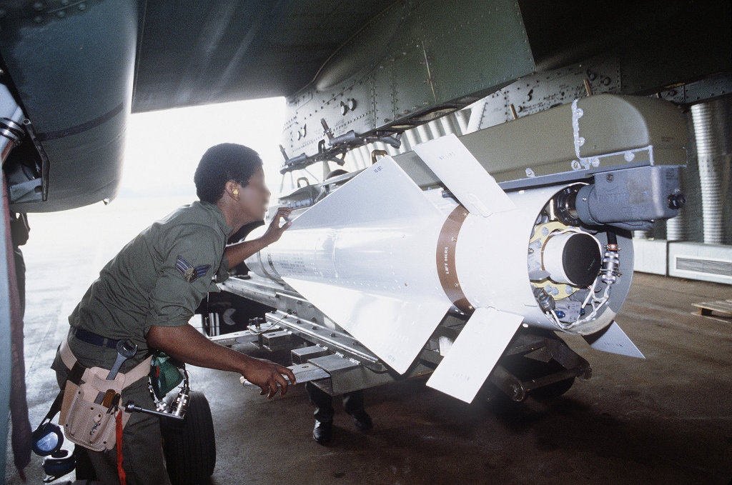
A member of a munitions maintenance crew loads an AGM-5 Maverick missile onto the wing pylon of an A-10 Thunderbolt II aircraft
Source: US DoD
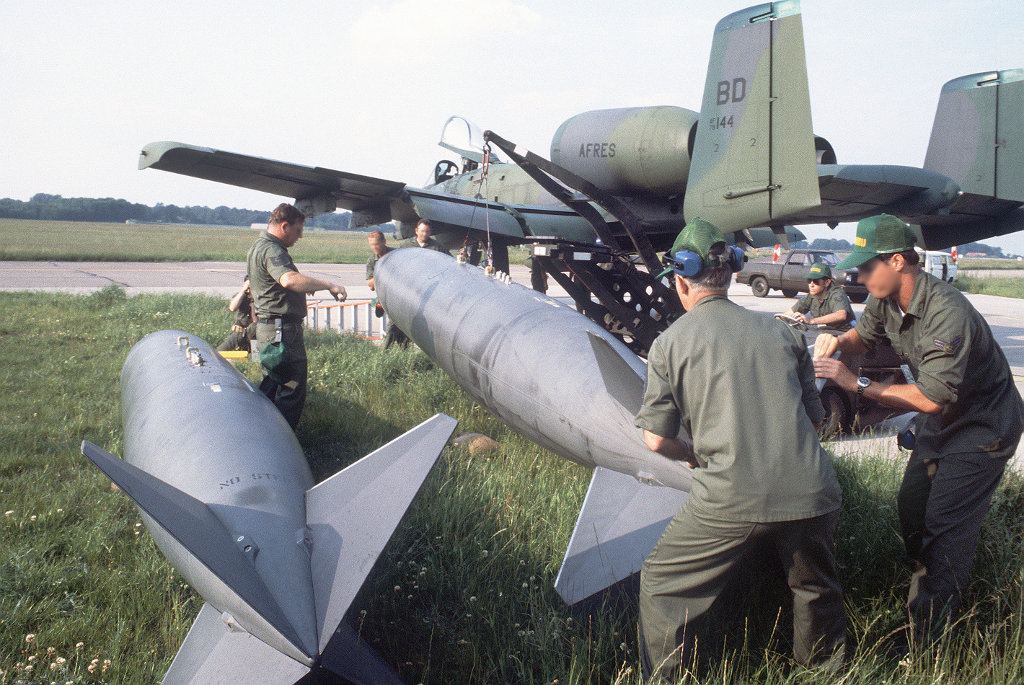
Maintenance personnel remove the wing tanks from an Air Force Reserve A-10 Thunderbolt II aircraft from Barksdale after its arrival
Source: US DoD
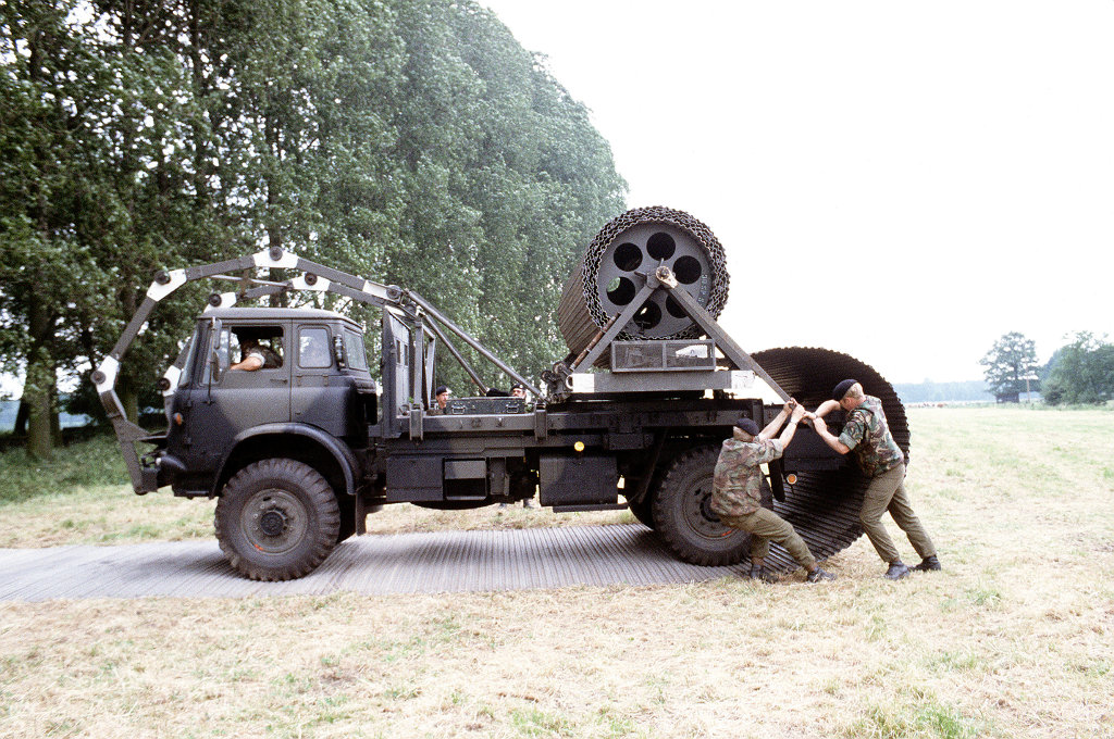
British Army personnel deploy a Class 30 Trackway portable roadway from a Bedford Mark 4 X 4 4-ton truck
Source: US DoD
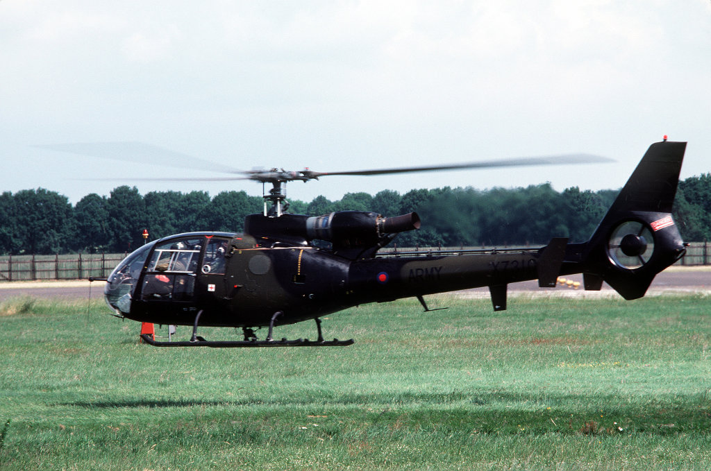
A left side view of a British Army AH. Mark 1 Gazelle helicopter hovering a few feet off the ground
Source: US DoD
Today
Use
General aviation airfield.
Overview
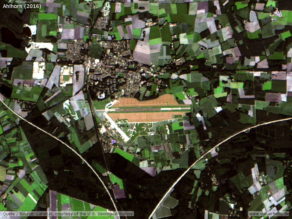
Landsat image from 2016 - There are solar modules on both sides of the runway
Links
- http://www.metropolpark-hansalinie.de/ - Metropolpark Hansalinie
- https://www.relikte.com/ahlhorn/index.htm - Relikte in Niedersachsen und Bremen
- http://www.buergerverein-ahlhorn.de/fliegerhorst/ - Bürgerverein Ahlhorn
Airfields in the vicinity
Categories
Military Airfields GermanyMilitary Airfields in former West GermanyGerman Air Force Air BasesRoyal Air Force (RAF) Bases in GermanyAir Bases of the United States Air Force (USAF) in GermanyRecommended
Image credits are shown on the respective target page, click on the preview to open it.
 Follow mil-airfields on Facebook