For historical information only, do not use for navigation or aviation purposes!
| Coordinates | N514954 E0121134 (WGS84) Google Maps |
| Former East Germany (GDR) | District of Halle |
| Federal state | Sachsen-Anhalt (Saxony-Anhalt) |
| Location indicator | EDAD |

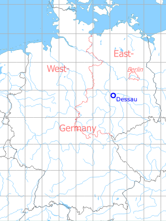
Germany during the Cold War Map
The history of the Cold War airfields: Dessau
Location of airfield
Kühnauer Str.
During the 1920s/1930s
Business owner / Administrator
Junkers-Flugzeugwerke A. G., Dessau.
Cable address: lfa Dessau.
Cable address: lfa Dessau.
Transport companies / Airlines
Deutsche Verkehrsflug A. G., Fürth, flight control Dessau.
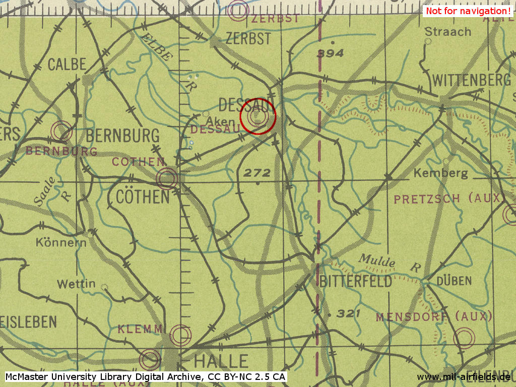
Situation
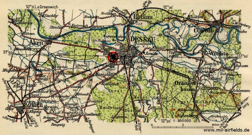
Map with Dessau Airport and surroundings
Source: Flughandbuch für das Deutsche Reich 1928
Overview
Flughafen II. Ordnung Dessau - The Junkers aircraft plants are located south of the railway line from Dessau to Köthen (on the map marked as "Flugzeug-werke").
Source: Flughandbuch für das Deutsche Reich 1928
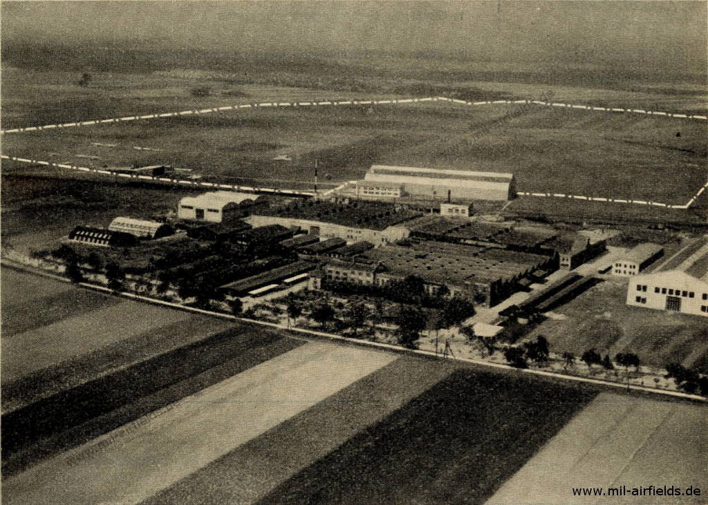
Aerial photo with view in northwest direction over the Junkers aircraft plants to the airfield
Source: Flughandbuch für das Deutsche Reich 1928
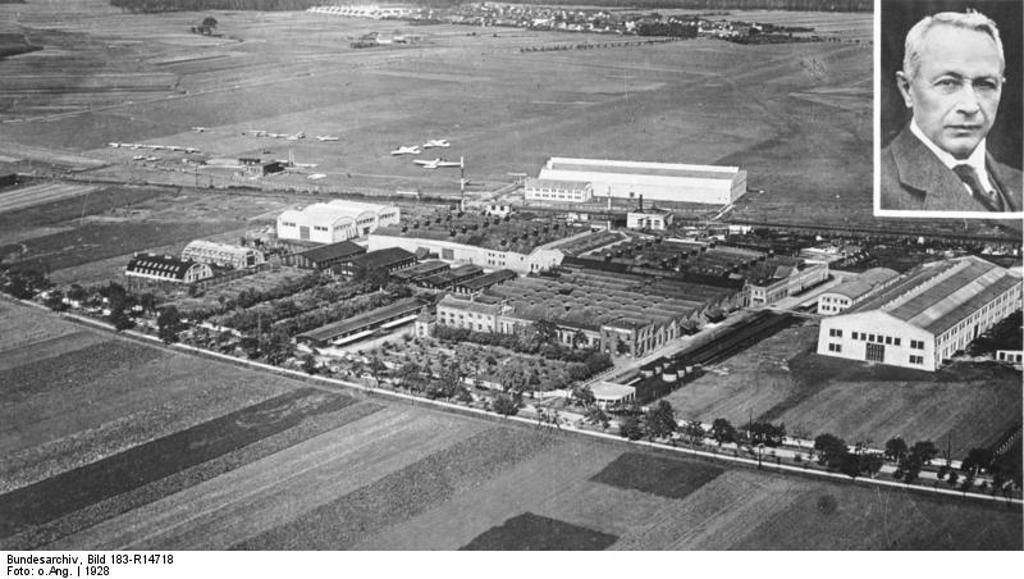
Junkers plants in Dessau und portrait of the founder Prof. Junkers, 1928
Source: Bundesarchiv image 183-R14718, via Wikimedia Commons, License CC-BY-SA 3.0
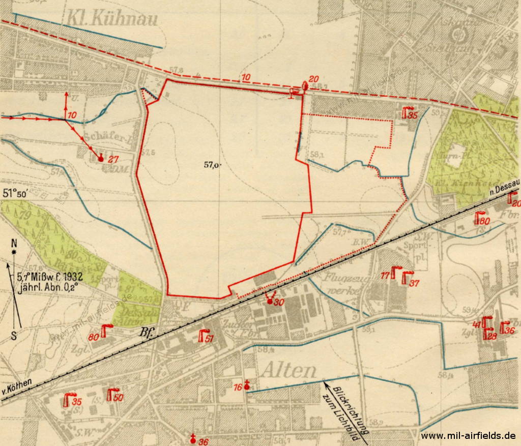
Airfield characteristics at daytime
The airfield is located about 3 km west of the Reichsbahnhof (main station) Dessau between the road to Aken and the Reichsbahn railway line to Köthen. In the south factories. Windsock at the start house. On request at the police auxiliary air station landing signs. Movement area border marked in the north and west by roads, in the south by railway line, in the east by field railway track.
Airfield characteristics at night
No permanent night flying lighting. On request at the administrator:
Pilot light:
Flashing light on 2 red-white radio masts,
Identifier: Flashing - - - - - - - - in intervals of 5 to 5 seconds.
Height of fire above ground level: 30 m.
Type of light source: Electric incandescent light (Osram Nitra).
The radio mast tips are marked by 2 red Pintsch edge lights (Osram nitral light of 300 watts each).
In addition, 4 fires each w. vertically on top of each other.
Luminous intensity per radio mast: 17 300 HK
Identifier: as above.
Lighting times: On request according to agreement. The fires are guarded.
(HK = Hefnerkerze = Hefner candle, unit of light intensity)
Runways, taxiways, aprons
Good turf on clay soil.
Shortest rolling length: in east-west direction 800 m.
Shortest rolling length: in east-west direction 800 m.
Radio communication
Radio station available in the plant of the company.
Weather station
Available in the plant of the company.
Fuel equipment
Request from the administrator.
First aid in the case of accidents
To be provided by the administrator's personnel. Medical room available, next doctor in Dessau-Siedlung (1.8 km distance).
Customs, post office, passport
Customs clearance is possible, passport control by police station.
Accommodation of passengers
In the air traffic control building and in Dessau.
Connections
No shuttle service. Taxi cabs on call at any time. Tram and bus station at the airport.
(Source: Flughandbuch für das Deutsche Reich 1932)
During World War II
Use
Airfield of the Junkers Flugzeug- und Motorenwerke.
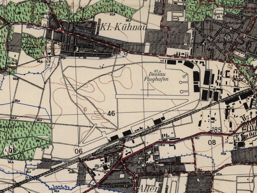
Situation
Dessau Airfield in World War II on a US map from 1944
Source: McMaster University Library Digital Archive, License: Creative Commons Attribution-NonCommercial 2.5 CC BY-NC 2.5 CA
Overview
Dessau Alten on a US map from 1956
Source: AMS M841 GSGS 4414, Courtesy Harold B. Lee Library, Brigham Young University
Post-war period
Use
In the years 1945 to 1946, aircraft of the types EF-126, EF-127, EF-131 and EF-132 were still being designed in Dessau under Soviet leadership. In mid-1946, around 4,000 people worked in the aircraft factories.
From summer 1946, a large number of engineers were deported to the Soviet Union to continue development projects there. From autumn onwards, the aircraft factories in Dessau are dismantled, and this work continues until 1947.
During the Cold War
Use
In autumn 1947 the airfield was occupied for three weeks by Soviet fighters from Köthen and Zerbst, which took part in manoeuvres from here. In June 1948 Dessau was again occupied by about 25 aircraft from Zerbst.
In 1949 the runway was extended and the work was completed in summer. In September 1949 already 60 to 80 airplanes are stationed on the airfield, presumably two regiments with Lavochkin La-9. About February 1950 the first Soviet jets come to Dessau with airplanes of the types MiG-15 and Yakovlev Yak-17. In the following months the propeller-driven La-9s are taken out of service and a regiment with about 30 MiG-15s and a few training aircraft remains on the airfield. The MiG-15s have red three-digit numbers starting with a 3. Four airplanes are in constant readiness.
At the beginning of October 1951 the MiG-15 were withdrawn from Dessau. A few days later, on October 5, 1951, the Soviet ground attack regiment with about 50 aircraft Ilyushin Il-10 previously stationed at the Berlin-Staaken Airfield moves to Dessau. On 26 December 1952 the regiment was transferred to Brandis Airfield.

Aircraft of the Soviet Forces at Dessau airfield
Lavochkin La-9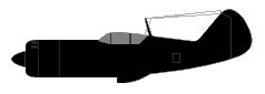
Yakovlev Yak-17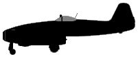
Mikoyan MiG-15 FAGOT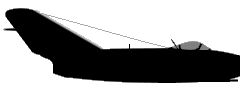
Ilyushin Il-10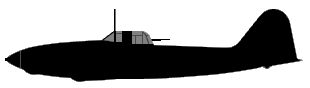
The airfield is taken over by the East Germany and already in December 1952 the reconstruction of the Junkers factories for a GDR aviation industry begins. In cooperation with other companies, MiG-15 aircraft are to be produced here. The drawings were prepared by the "Materialamt" Pirna-Sonnenstein. A MiG-15 was also assembled in Pirna, which was to be transferred to Dessau in August 1953 for use in the flight testing department for training. Also the Reichsbahnausbesserungswerk (Raw) railway repair shop Dessau is planned to be integrated into the production process and rebuilt accordingly, to deliver the first MiG-15 in December 1953. After the popular uprising on 17 June 1953, however, all activities are stopped. The Pirna Materialamt is dissolved and the Raw Dessau hall is sold back to the Deutsche Reichsbahn for 3.5 million East Marks.
In late summer 1953, the Kasernierte Volkspolizei (KVP), the covered forerunner of the National People's Army, moved into the airfield buildings. However, there are no aircraft stationed on the airfield, only occasionally it is used by Soviet air units during manoeuvres. In March/April 1955, prefabricated parts for two halls were transported to Pirna-Sonnenstein. The halls were originally to be built in Dessau, for which the foundations were cast in March/April 1953. However, after the construction of the GDR aviation industry was stopped in June 1953, the parts lay unused on the airfield.
From 1957 transport aircraft of the GDR's National People's Army (NVA) are stationed in Dessau, which carry out training operations, as "Transport Flying School". Airplanes of the types Aero L-60, Antonov An-2 and Ilyushin Il-14 as well as helicopters Mil Mi-4 and Mi-1/SM-1 are used. On 4 November 1963 the Il-14 move to Dresden-Klotzsche Airfield and Dessau is primarily used only by gliders of the East German pre-military organization "Gesellschaft für Sport und Technik". In 1979 gliding is stopped and the airfield closed. NVA documents indicate, however, that also in the 1980s the area is assigned to the Fliegertechnische Bataillon 34 (FTB-34) from Brandenburg Briest and thus at least the intention of a renewed aeronautical use could not be completely excluded. At this time the airfield is probably also the helipad HSLP 1025 for the Radio Reconnaissance Regiment 2 (FuAR-2), which have its barracks at the airfield.
Aircraft and helicopters of the East German National People's Army (NVA) at Dessau airfield
Ilyushin Il-14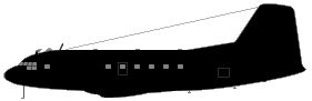
Antonov An-2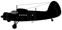
Mil Mi-1 / PZL SM-1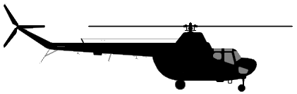
Mil Mi-4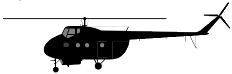
(Sources: CIA and others; Aicraft silhouettes: AirVectors / GVG, Public Domain)
In the 1960s
Overview
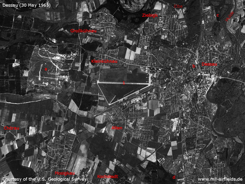
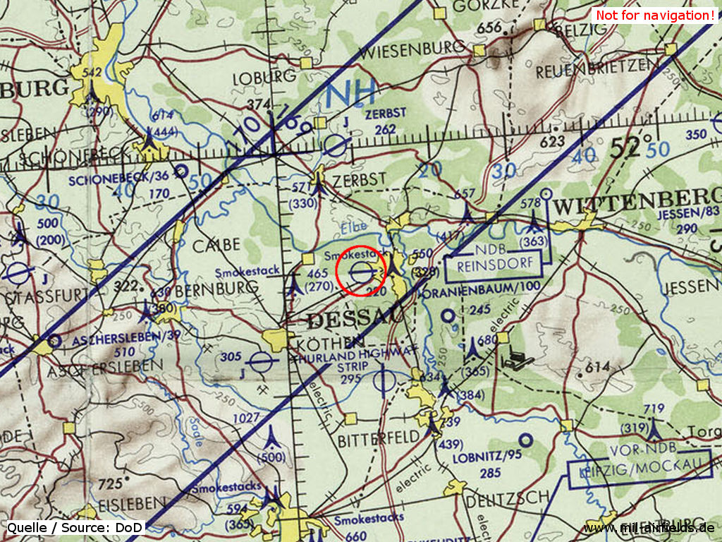
Dessau and surroundings on a US satellite image from 30 May 1965 - 1: airfield. Other facilities: a: military training area; b: Dessau main station; c: VEB Waggonbau Dessau rolling stock factory; d: RAW Dessau Süd railway workshop. Other places: Chörau, Großkühnau, Kleinkühnau, Kochstedt, Mosigkau, Ziebigk. Gewässer: Elbe, Mulde.
Source: U.S. Geological Survey
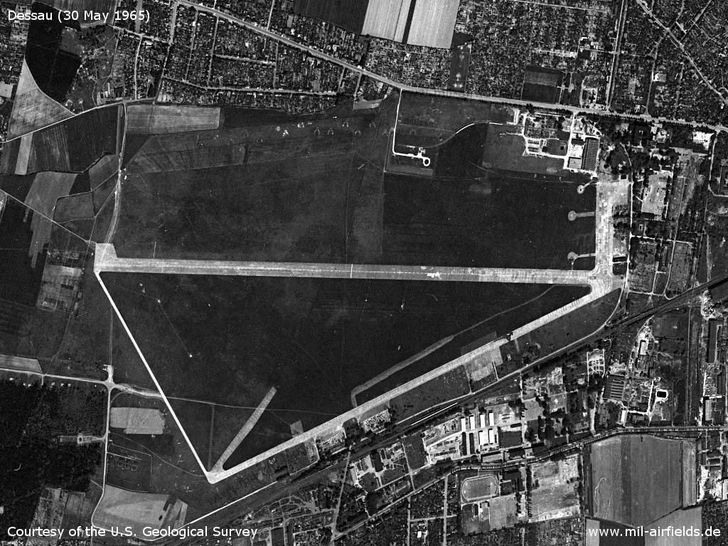
The airfield, about 2 years after the East German NVA transport aircraft left
Source: U.S. Geological Survey
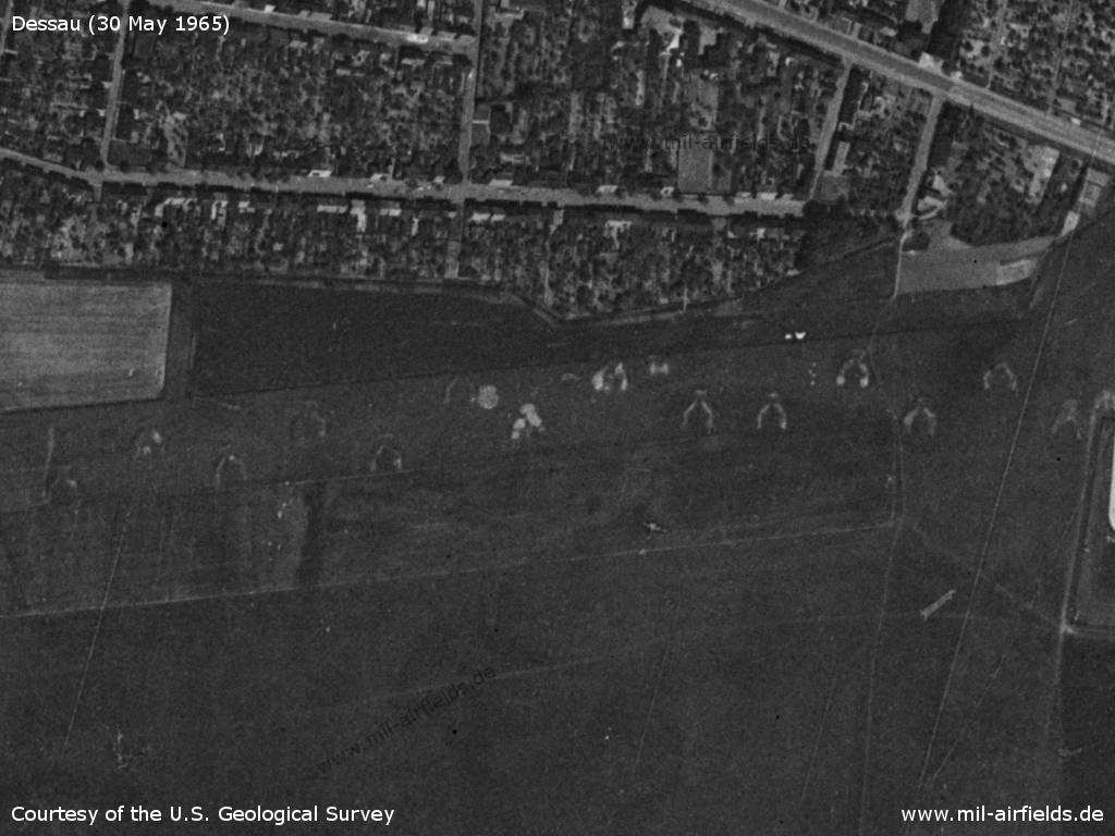
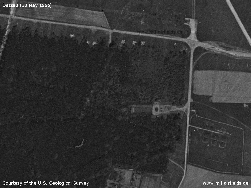
Old aircraft revetments south of Kleinkühnau
Source: U.S. Geological Survey
The installation on the left is probably the fuel dump. - On the siding there are two units of railway wagons.
Source: U.S. Geological Survey
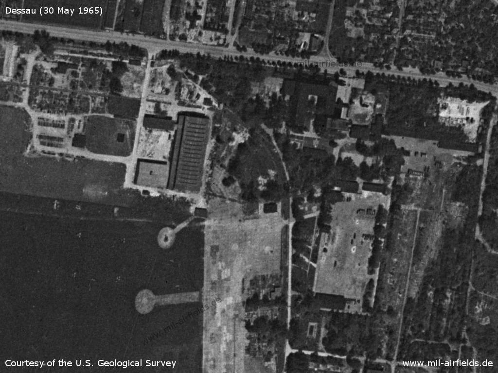
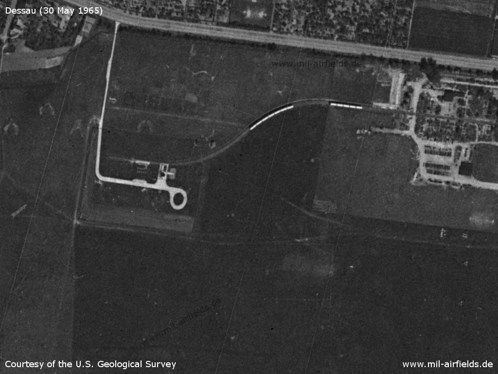
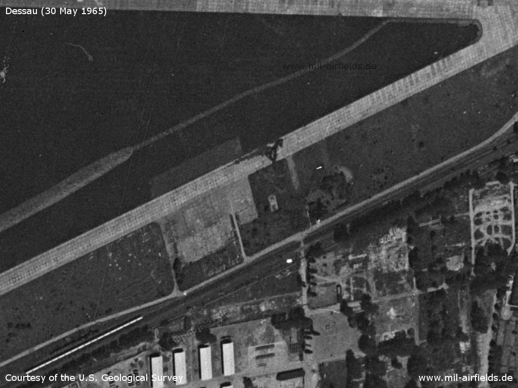
Northeastern corner of the airfield - Here stands a large hall, in which houses the technology museum today. The four groups, each with three bright points at the bottom left, could be antenna foundations of the radio reconnaissance regiment.
Source: U.S. Geological Survey
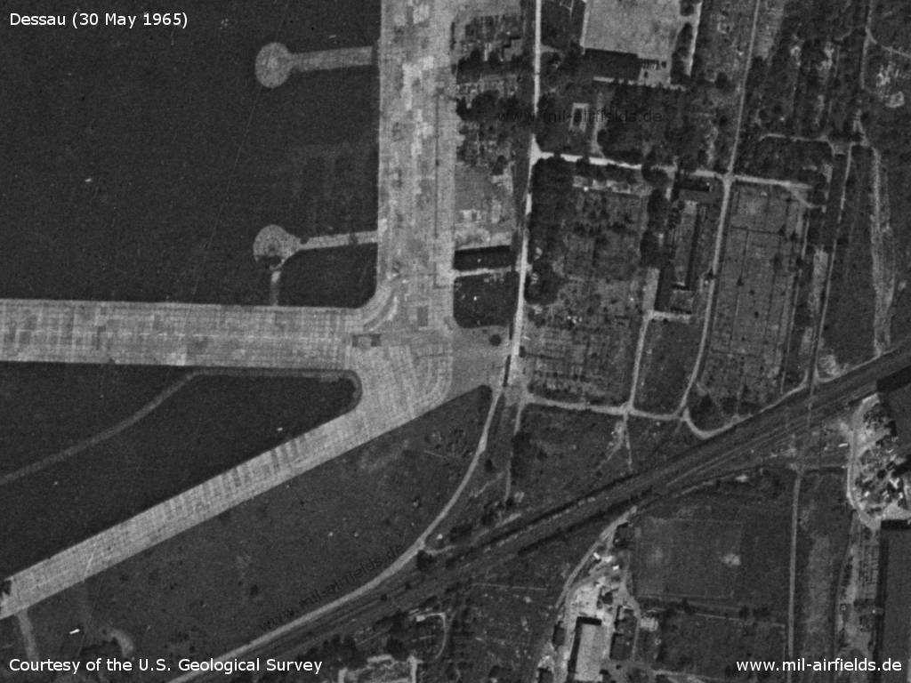
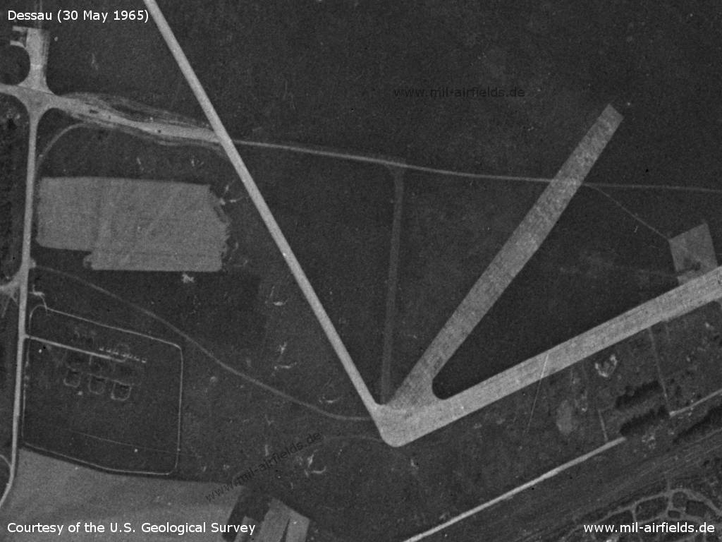
Eastern end of the runway
Source: U.S. Geological Survey
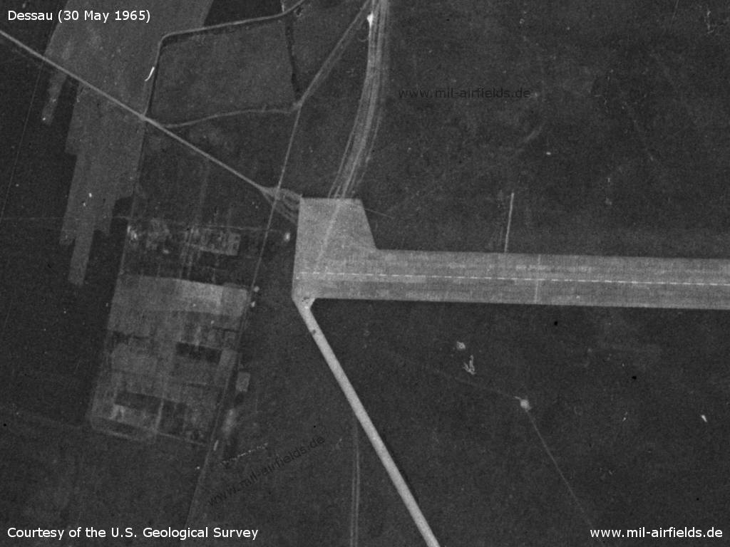
Western end of the runway
Source: U.S. Geological Survey
Former dispersal area in the southwest, former adjustment stand and storage facility
Source: U.S. Geological Survey
Southwestern corner with taxiways and old aircraft revetments
Source: U.S. Geological Survey
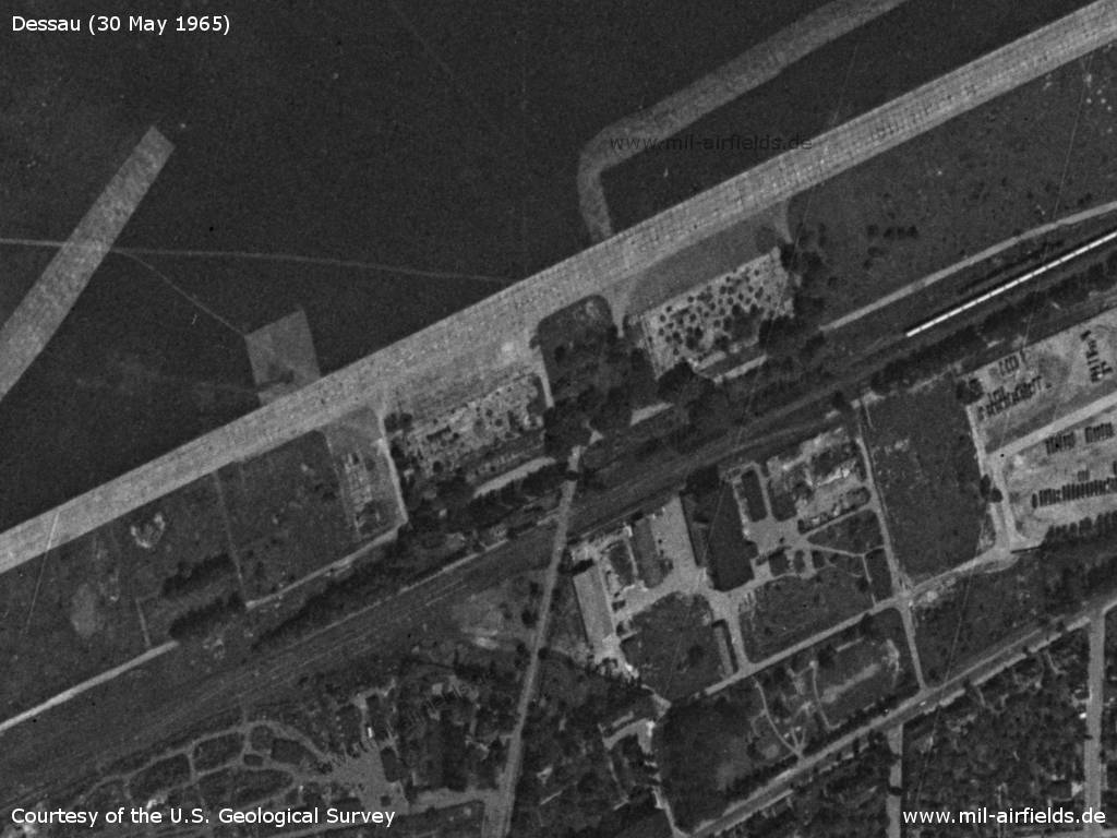
Demolished hangars in the south, Dessau-Alten train station - Until 1945, parts of the Junkers plants were also south of the railway line
Source: U.S. Geological Survey
Southeastern part with taxiway and demolished hangar.
Source: U.S. Geological Survey
Runways
- 09/27: 2250 m x 50 m Concrete
Radio beacons
- LOM 27: 765 "WN"
- LMM 27 "W"
Radio communication
Call sign: WURZEN
In the 1970s
Use
The airfield was primarily only used by gliders of the pre-military organization "Gesellschaft für Sport und Technik".
Situation
Dessau Alten Airfield on a map of the US Department of Defense from 1972 - The blue lines mark the southern corridor (GDR terminology: temporary air link), in which allied aircraft can fly between West Germany and Berlin. Thus, the Dessau airfield could be flown over by western airplanes at will and thus well reconnoitred.
Source: ONC E-2 (1972), Perry-Castañeda Library Map Collection, University of Texas at Austin
Overview
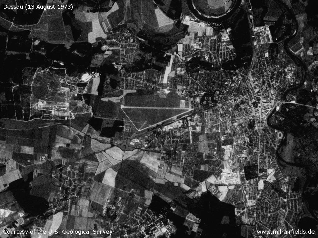
Dessau on Monday 13 August 1973
Source: U.S. Geological Survey
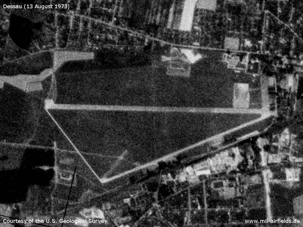
The airfield
Source: U.S. Geological Survey
In the 1980s and early 1990s
Overview
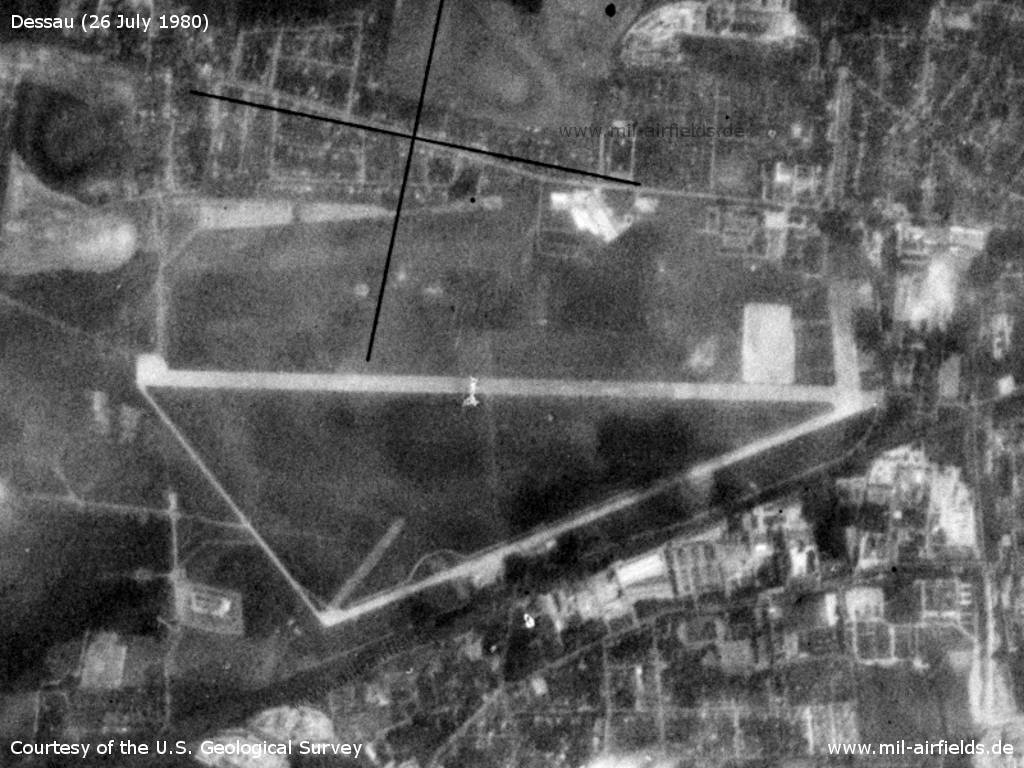
Dessau on Saturday 26 July 1980 - The airfield is closed for about a year and the area is used by the East German Radio Reconnaissance Regiment 2 (Funkaufklärungsregiment -2, FuAR-2).
Source: U.S. Geological Survey
Units
FTB-34 (PF 36035)
Real property
East German National People's Army installation id 08/115.
Today
Use
General aviation (EDAD).
Sources
- https://lib.byu.edu/collections/german-maps/http:/... - German Maps (Topographische Karte 1:25,000)German Maps (Topographische Karte 1:25,000)
- https://www.cia.gov/ - CIA: Central Intelligence Agency
- https://www.usgs.gov/ - USGS U.S. Geological Survey
- http://www.airvectors.net/ - AirVectors by Greg Goebel
Links
- https://www.flugplatz-dessau.de/ - Flugplatz Dessau Homepage
- https://technikmuseum-dessau.org/ - Technikmuseum "Hugo Junkers"
Bibliography
- Ries, Karl; Dierich, Wolfgang: "Fliegerhorste und Einsatzhäfen der Luftwaffe" Motorbuch Verlag Stuttgart, 1993 - Allied map
- Grenzdörfer, Joachim; Seifert, Karl-Dieter: "Geschichte der ostdeutschen Verkehrsflughäfen" Bernard & Graefe Verlag, Bonn, 1997 - 4 pages description, history, map and aerial picture (1928)
- Freundt, Lutz: "Sowjetische Fliegerkräfte in Deutschland 1945-1994, Band 1" Freundt Eigenverlag, Diepholz 1998 - Short description, aerial picture (1953)
- Freundt, Lutz: "Sowjetische Fliegerkräfte in Deutschland 1945-1994, Band 4" Edition Freundt Eigenverlag, Diepholz 2000 - Additional information about flight operations in 1949
- Freundt, Lutz (Hrsg.), Büttner, Stefan: "Rote Plätze - Russische Militärflugplätze in Deutschland 1945 - 1994" AeroLit Verlag, 2007 - Short description, aerial picture (1953)
- Spur, Franz: "MilitärTransportflieger Dessau - Dresden - Ein Beitrag zur 35-jährigen Geschichte des DDR-Transportflugwesens" AeroLit, 2003
- Billig, Detlef; Meyer, Manfred: "Flugzeuge der DDR, I. Band bis 1962" TOM Modellbau, Friedland, 2002 - Picture of Il-14 and helicopters 1958 at Dessau
Related topics
Airfields in the vicinity
Categories
Military Airfields GermanyMilitary Airfields in former East GermanyAir bases of former National People's ArmyHelipads of former National People's ArmyRecommended
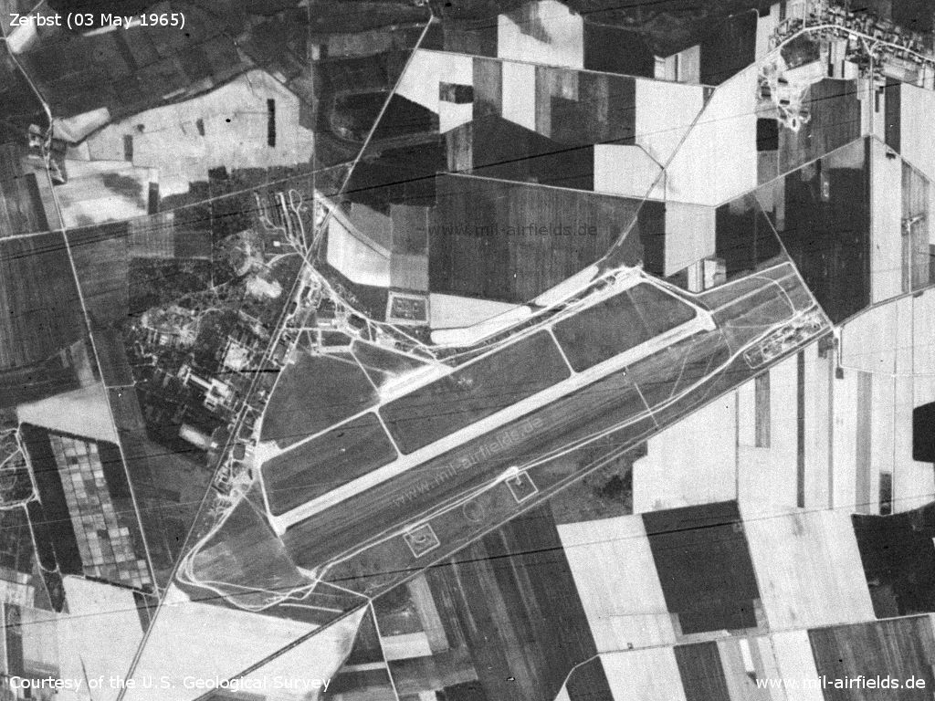
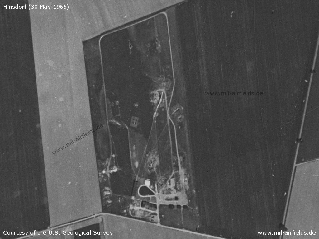
Image credits are shown on the respective target page, click on the preview to open it.
 Follow mil-airfields on Facebook