For historical information only, do not use for navigation or aviation purposes!
| Coordinates | N510804 E0134605 (WGS84) Google Maps |
| Elevation | 230 m |
| Former East Germany (GDR) | District of Dresden |
| Federal state | Sachsen (Saxony) |
| Region | Elbe |
| Location indicator | EDXD (196x), ETDN (-199x), EDDC (199x-) |
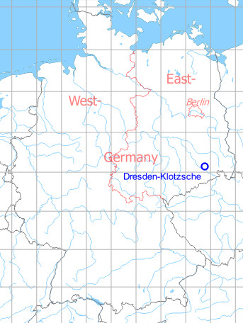
Germany during the Cold War Map
The history of the Cold War airfields: Dresden
Contents
Page 1: From the beginnings to the 1960s ← you are here
Page 2: From the 1970s until today
Page 3: Dresden Klotzsche Airport
General
Dresden-Klotzsche Airport was established in the mid-1930s as a replacement for Dresden-Heller Airport and as an air base with the Luftkriegsschule, with buildings located about 1 km east of the airport. At the beginning of the Second World War, the field was solely used for military purposes.
In 1945 the airfield was occupied by Soviet troops which stationed various flying and non-flying units here in the course of the next few years. In the mid-1950s, Dresden-Klotzsche was gradually transferred to GDR administration, where the Dresden aircraft factory was built. Initially, aircraft of the type Ilyushin Il-14 were manufactured under licence, but with the Baade 152, an own commercial jet aircraft was under development. After it became apparent that the 152 was not going to have any commercial success, the ambitious aircraft construction for the economically weak GDR was completely discontinued in 1961. The aircraft plant was converted into the Dresden Aircraft Maintenance Plant (FWD), which carried out maintenance on military aircraft for the East German air force until the end of the GDR in 1990, but also for other countries, e. g. from the Middle East.
In addition to the aviation industry, the transport aircraft Ilyushin Il-14 and later Antonov An-26 of the East German National People's Army (NVA) were stationed in Dresden, which flew in the later Transport Squadron 24 (TS-24). From the beginning of the 1960s onwards, civil air traffic developed again in Dresden. The GDR airline Interflug flew from here to various destinations in the Eastern Bloc.
After reunification, the airport was expanded and adapted to the requirements of modern air traffic. Among other things, a new runway was built, which is located directly west of the old runway, which was then demolished. For a few years, Dresden also remained a base of the German Air Force. A large aircraft maintenance plant is still at the airport.
Location of airfield
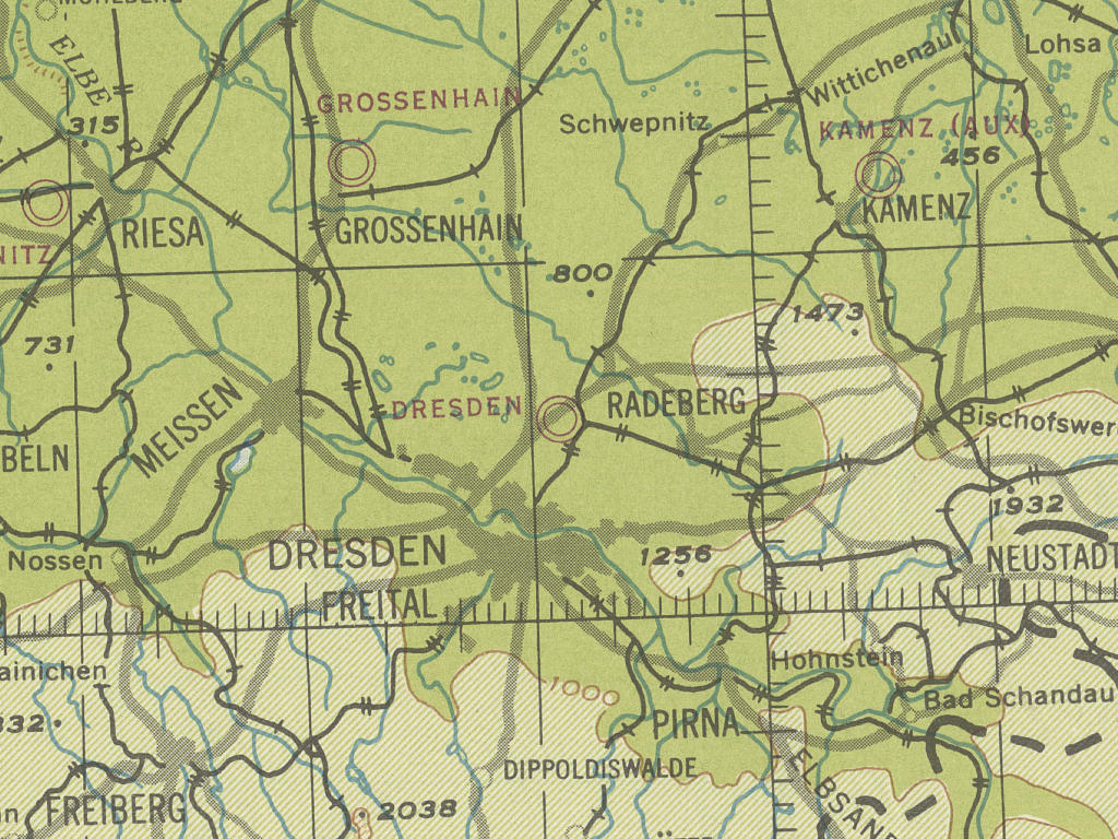
The airfield is located north-north east of Dresden.
During the 1930s
Use
Dresden Klotzsche was opened in the mid 1930s and was used as a commercial airport and military airfield.
Timetable
Spring/Summer 1939
The timetable for spring/summer of 1939 shows the following scheduled flights:
(Days: 1=Monday ... 7=Sunday)
(Days: 1=Monday ... 7=Sunday)
32: Berlin (Tempelhof) - Dresden (Klotzsche) - Prague (Ruzyně) - Wien (Aspern)
- Deutsche Lufthansa, Junkers Ju 52 / CLS (Československá letecká společnost, Praha), Douglas DC-2:
1234567 | Berlin 14:50 - 15:40 Dresden 15:55 - 16:40 Prague 17:00 - 18:15 Vienna - Deutsche Lufthansa, Junkers Ju 52 / CLS (Československá letecká společnost, Praha), Douglas DC-2:
1234567 | Vienna 09:00 - 10:15 Prague 10:35 - 11:20 Dresden 11:35 - 12:25 Berlin
34: Berlin (Tempelhof) - Dresden (Klotzsche) - Reichenberg (Liberec)
- Deutsche Lufthansa, Focke-Wulf Fw 58:
123456– | Berlin 17:40 - 18:30 Dresden 18:40 - 19:15 Reichenberg
(Times for the period between 01 May to 31 August 1939) - Deutsche Lufthansa, Focke-Wulf Fw 58:
123456– | Reichenberg 07:50 - 08:25 Dresden 08:35 - 09:25 Berlin
(Times for the period between 01 May to 07 October 1939)
119: Breslau (Gandau) - Dresden (Klotzsche) - Halle/Leipzig (Schkeuditz) - Erfurt (Nord) - Frankfurt (Rhein/Main)
- Deutsche Lufthansa, Heinkel He 111:
123456– | Breslau 06:00 - 07:05 Dresden 07:15 - 07:50 Halle/Leipzig 08:00 - 08:30 Erfurt 08:40 - 09:40 Frankfurt/M - Deutsche Lufthansa, Heinkel He 111:
123456– | Frankfurt/M 17:10 - 18:25 Halle/Leipzig 19:00 - 19:30 Dresden 19:40 - 20:40 Breslau
(No stop in Erfurt)
156: Dresden (Klotzsche) - Halle/Leipzig (Schkeuditz) - Dortmund (Brackel) - Cologne (Butzweilerhof) - Düsseldorf (Lohausen)
- Deutsche Lufthansa, Junkers Ju 86:
123456– | Dresden 16:30 - 17:10 Halle/Leipzig 17:20 - 19:05 Dortmund 19:15 - 19:45 Cologne 20:05 - 20:20 Düsseldorf - Deutsche Lufthansa, Junkers Ju 86:
123456– | Düsseldorf 10:25 - 10:40 Cologne 10:50 - 11:20 Dortmund 11:30 - 13:00 Halle/Leipzig 13:10 - 13:45 Dresden
PF174: Berlin (Tempelhof) - Halle/Leipzig (Schkeuditz) - Dresden (Klotzsche)
- Deutsche Lufthansa, Focke-Wulf Fw 58:
–234567 | Berlin 04:25 - 05:20 Halle/Leipzig 05:35 - 06:20 Dresden
Air mail and freight transport only; not from Sundays to Mondays - Deutsche Lufthansa, Focke-Wulf Fw 58:
123456– | Dresden 21:10 - 21:55 Halle/Leipzig 22:10 - 23:05 Berlin
Air mail and freight transport only; not from Sundays to Mondays
Departures and arrivals by time
| Days | Time | Dep/Arr | Route | Operator | Aircraft type | to/from |
|---|---|---|---|---|---|---|
| –234567 | 06:20 | Arr | PF174 | Deutsche Lufthansa | Focke-Wulf Fw 58 | Berlin - Halle/Leipzig |
| 123456– | 07:05 | Arr | 119 | Deutsche Lufthansa | Heinkel He 111 | Breslau |
| 123456– | 07:15 | Dep | 119 | Deutsche Lufthansa | Heinkel He 111 | Halle/Leipzig - Erfurt - Frankfurt/M |
| 123456– | 08:25 | Arr | 34 | Deutsche Lufthansa | Focke-Wulf Fw 58 | Reichenberg |
| 123456– | 08:35 | Dep | 34 | Deutsche Lufthansa | Focke-Wulf Fw 58 | Berlin |
| 1234567 | 11:20 | Arr | 32 | Deutsche Lufthansa / CLS (Československá letecká společnost, Praha) | Junkers Ju 52 / Douglas DC-2 | Vienna - Prague |
| 1234567 | 11:35 | Dep | 32 | Deutsche Lufthansa / CLS (Československá letecká společnost, Praha) | Junkers Ju 52 / Douglas DC-2 | Berlin |
| 123456– | 13:45 | Arr | 156 | Deutsche Lufthansa | Junkers Ju 86 | Düsseldorf - Cologne - Dortmund - Halle/Leipzig |
| 1234567 | 15:40 | Arr | 32 | Deutsche Lufthansa / CLS (Československá letecká společnost, Praha) | Junkers Ju 52 / Douglas DC-2 | Berlin |
| 1234567 | 15:55 | Dep | 32 | Deutsche Lufthansa / CLS (Československá letecká společnost, Praha) | Junkers Ju 52 / Douglas DC-2 | Prague - Vienna |
| 123456– | 16:30 | Dep | 156 | Deutsche Lufthansa | Junkers Ju 86 | Halle/Leipzig - Dortmund - Cologne - Düsseldorf |
| 123456– | 18:30 | Arr | 34 | Deutsche Lufthansa | Focke-Wulf Fw 58 | Berlin |
| 123456– | 18:40 | Dep | 34 | Deutsche Lufthansa | Focke-Wulf Fw 58 | Reichenberg |
| 123456– | 19:30 | Arr | 119 | Deutsche Lufthansa | Heinkel He 111 | Frankfurt/M - Halle/Leipzig |
| 123456– | 19:40 | Dep | 119 | Deutsche Lufthansa | Heinkel He 111 | Breslau |
| 123456– | 21:10 | Dep | PF174 | Deutsche Lufthansa | Focke-Wulf Fw 58 | Halle/Leipzig - Berlin |
Air Base
During World War II
Usage until 1945
Airport and Luftwaffe airfield.
Situation
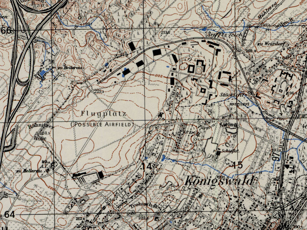
Dresden Klotzsche in World War II on a US map from 194x
Source: McMaster University Library Digital Archive, License: Creative Commons Attribution-NonCommercial 2.5 CC BY-NC 2.5 CA /MULDA/
Overview
Dresden Klotzsche airfield on a US map from 1952 - Dresden-Klotzsche airport on a US map from 1952
Source: AMS M841 GSGS 4414, Courtesy Harold B. Lee Library, Brigham Young University /BYU/
During the Cold War
Usage during the Cold War
1945 occupied by the Red Army. Flugzeugwerk Dresden (FWD, aircraft construction), later Flugzeugwerft Dresden (FWD, aircraft maintenance). Base for East German airforce transport aircraft (Il-14, An-26). Also used by Interflug airline.
Soviet use
1945 until mid-1950s
Overview
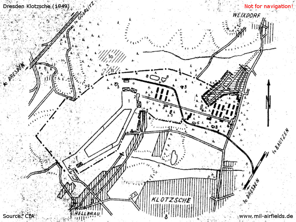
Sketch of the Dresden-Klotzsche airfield, which was used by Soviet troops at that time, about 1949
Source: CIA
| 1 | Landing field with concrete strips |
| 2 | Administrative buildings |
| 3 | Heating installation |
| 4 | Guardhouse and garage for five motor vehicles |
| 5 | Post exchanges and kitchens |
| 6 | Dispensary |
| 7 | Fire point |
| 8 | Athletic field |
| 9 | Gymnasium and bath |
| 10 | Destroyed cantonment |
| 11 | Wrecked aircraft |
| Crosses | Sentries |
| Buildings with cross | Hangars |
| Buildings black | Enlisted men quarters |
| Building horizontally hatched | Officers' billets |
History
- CIA report from October 1949
The installations of the field were neglected. The boundary lights, the DF station and a signal communication bunker were destroyed. The sandy landing field had a neglected grass cover. The two taxiways were in a poor condition. (Source: CIA)
GDR Aircraft Plant
Use
From the mid-1950s onwards, the airfield was expanded to house the Dresden Aircraft Plant. On 04 March 1959, the prototype of the 152 jet airliner with the registration DM-ZYA crashes near Dresden. In 1961 the construction of aircraft ceased.
Overview
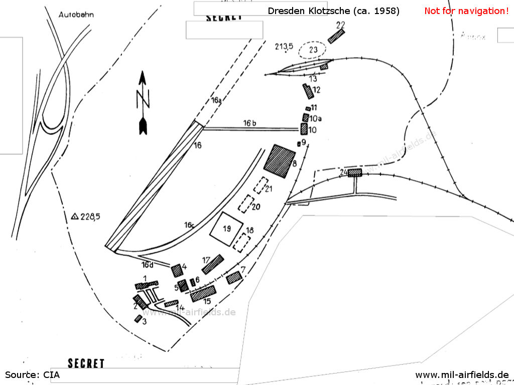
Sketch from the time of the expansion of the airfield and the aircraft works, ca. 1958 - The runway (no. 16 in the sketch) had a length of 1000 m at this time, but the further extension towards the northeast (16a) was in progress.
Source: CIA
In the 1960s
Overview
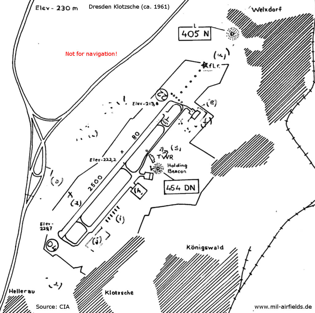
Landing chart, approx. 1961
Source: CIA
| a | Soviet independent lighting system |
| b | Wire-fenced area (will be removed) |
| c | Soviet search radar 100 cm (Aerial System X) |
| d | Soviet precision approach radar (GCA) and VHF direction finder |
| e | B 152. Engines were being run up. |
| f | Construction hangar |
| g | Decimeter aerials to transmitting station |
| h | Construction building |
| i | Farm machinery park |
| j | Civil terminal building |
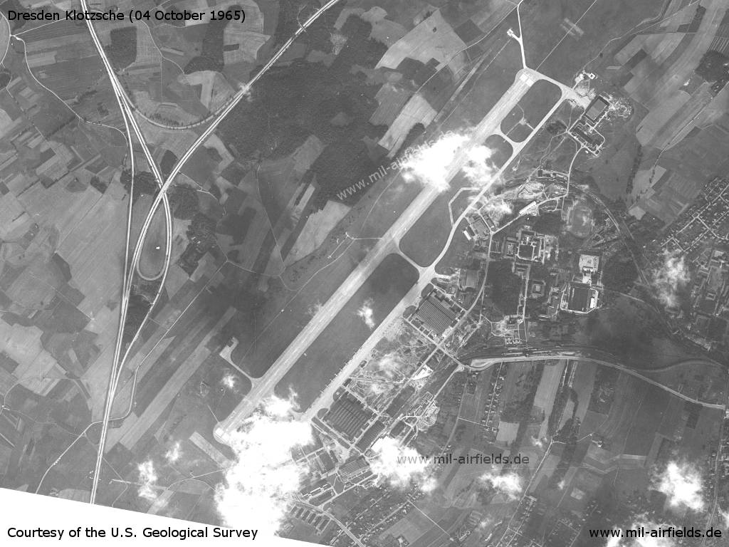
Satellite picture of Dresden-Klotzsche Airport, East Germany (GDR), 1965
Source: U.S. Geological Survey
Approach lights in the northeast
Source: U.S. Geological Survey
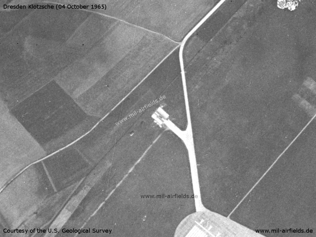
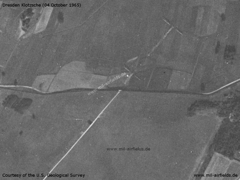
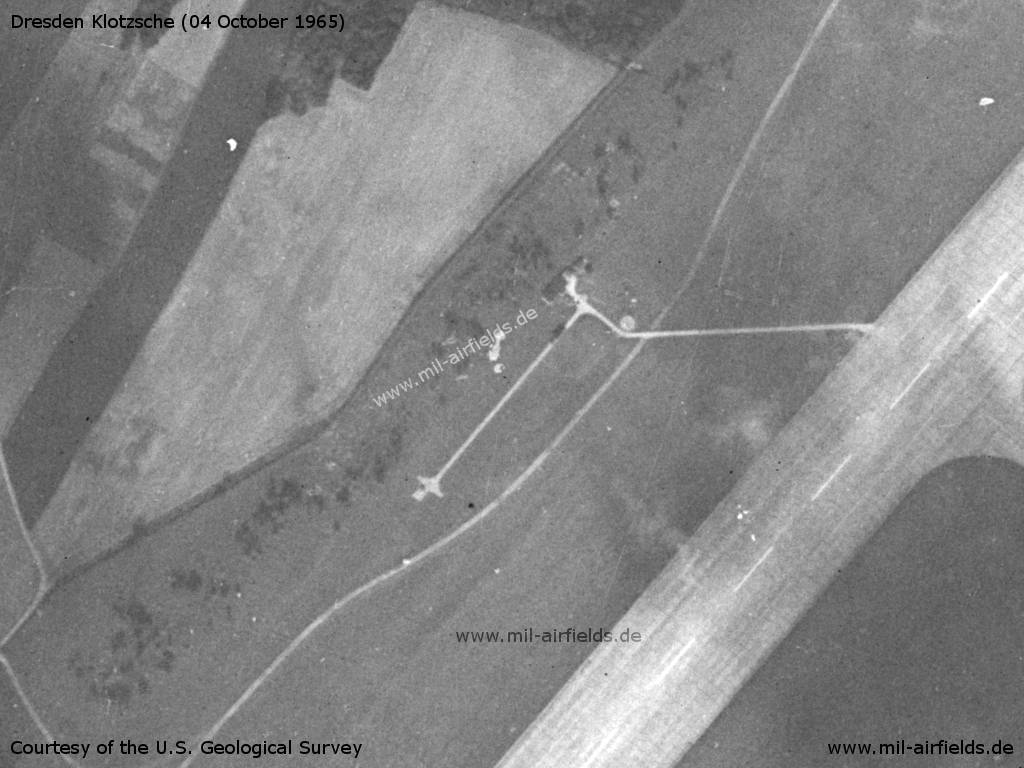
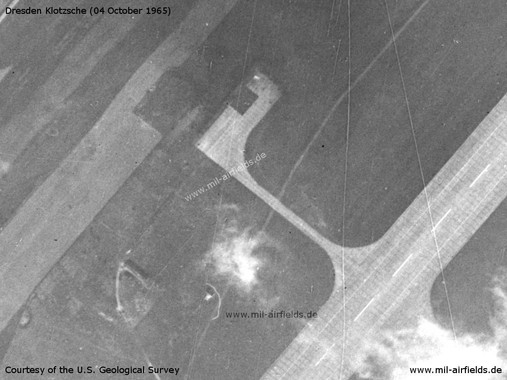
Platform at the northen end of the runway - Further north is the connection to the autobahn, presumably for the nearby Weixdorf Highway Strip, which is prepared for aircraft operations.
Source: U.S. Geological Survey
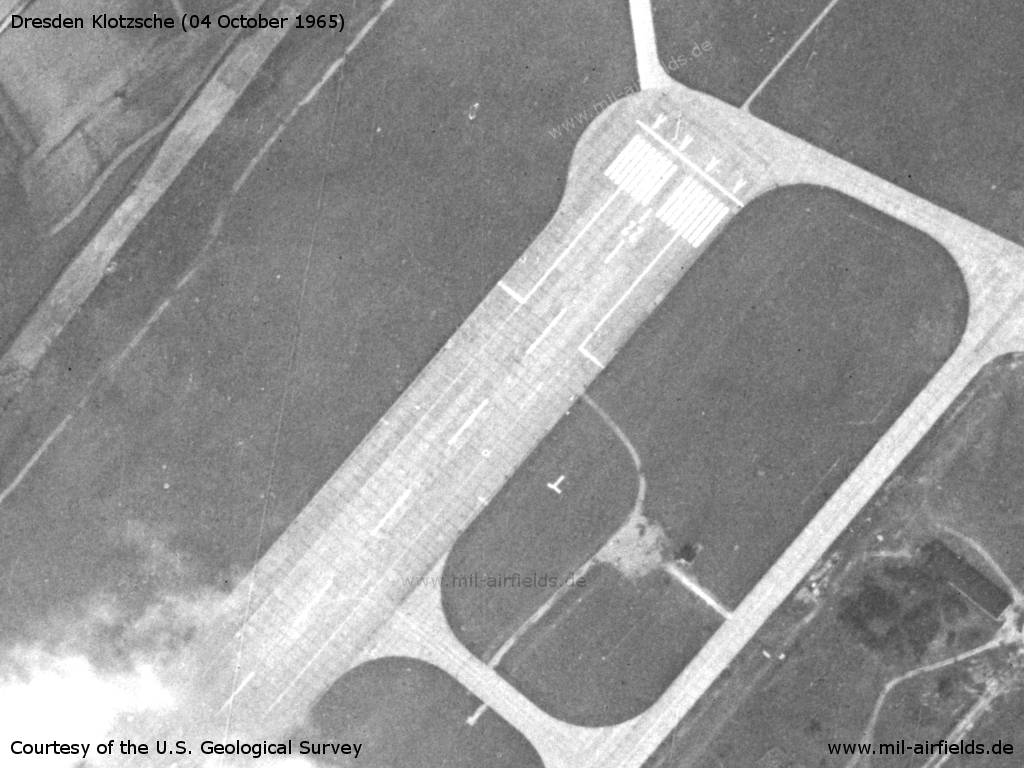
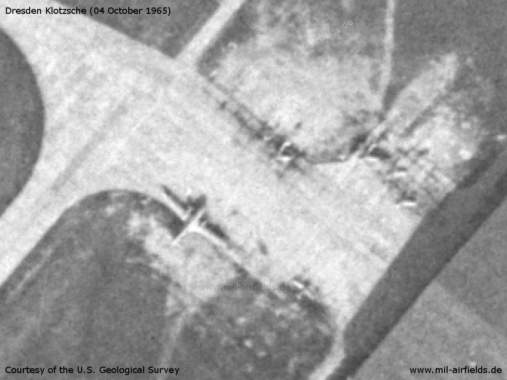
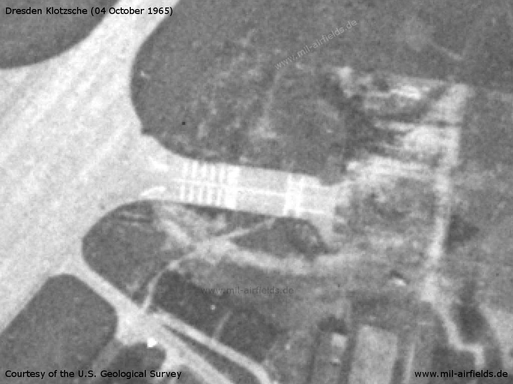
Northeastern end of the runway - The marking of the runway is interesting. With 80 m, the runway is extraordinarily wide, but initially a narrower area is marked.
Source: U.S. Geological Survey
Hangar at the northeast end, in front of it an Il-14 and other airplanes. - A helicopter appears to be standing on the platform at the top of the picture
Source: U.S. Geological Survey
Detail: Helicopter
Source: U.S. Geological Survey
Source: U.S. Geological Survey
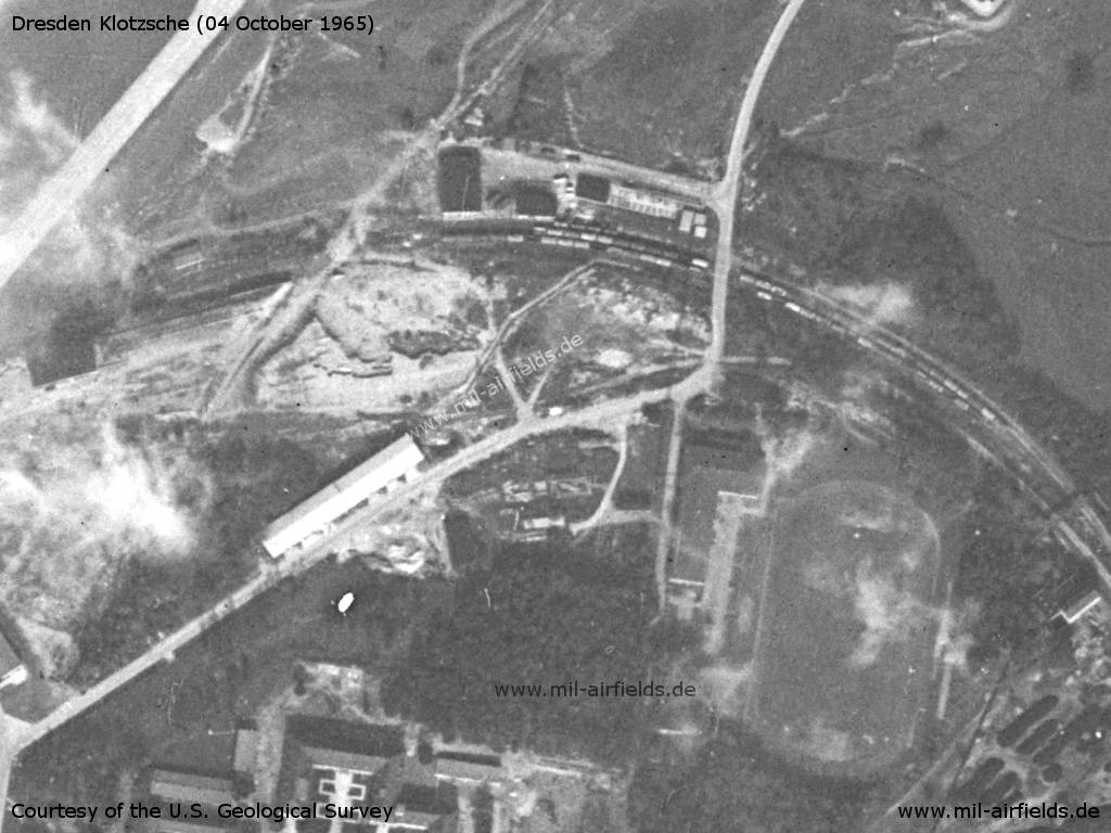
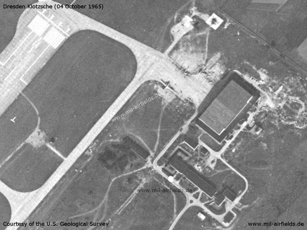
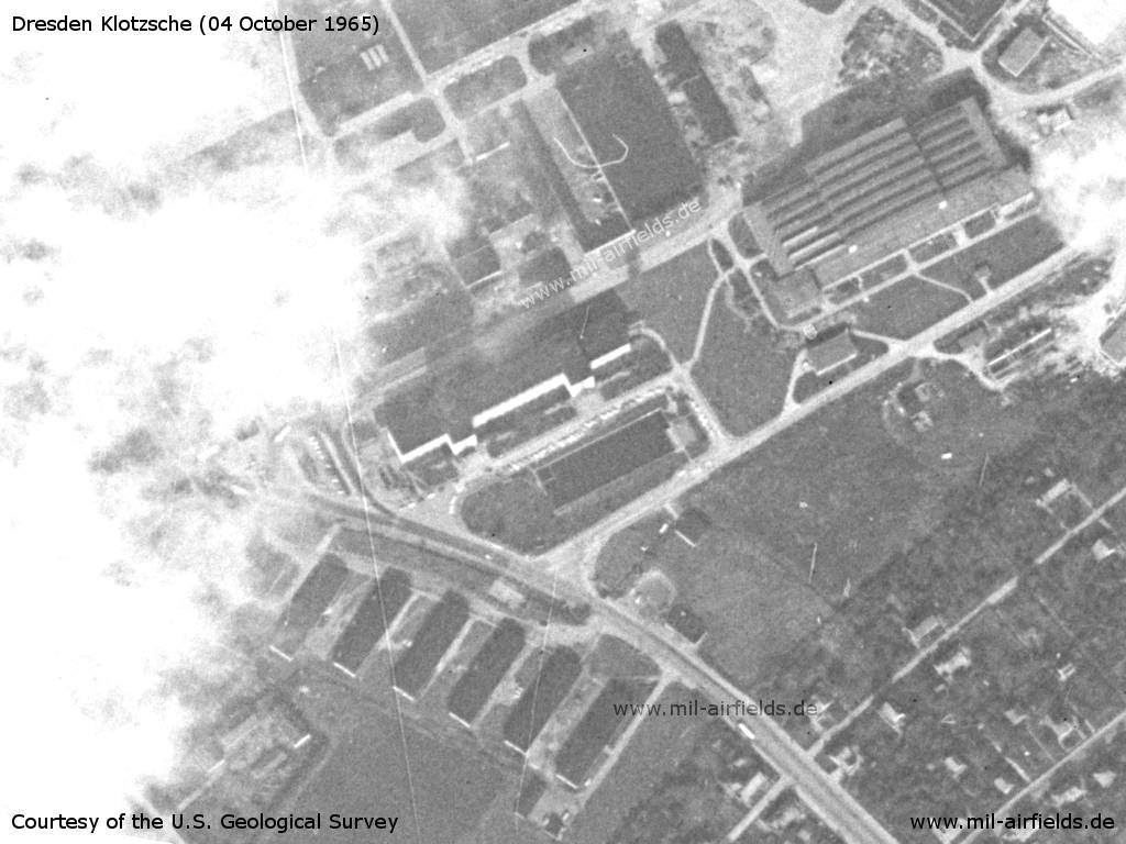
Northern railway spur and sports field - It is occupied with numerous freight cars
Source: U.S. Geological Survey
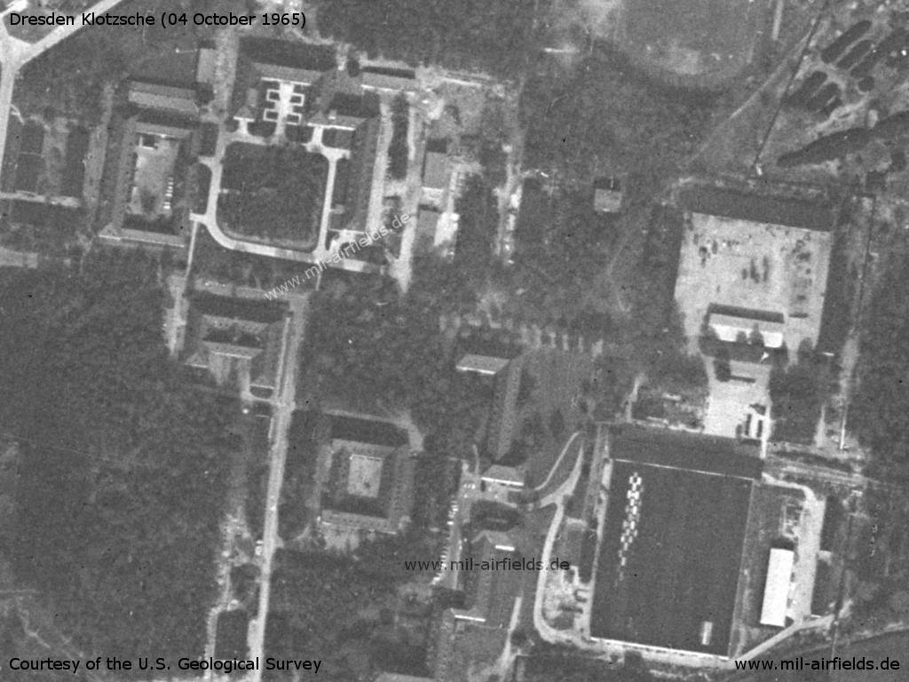
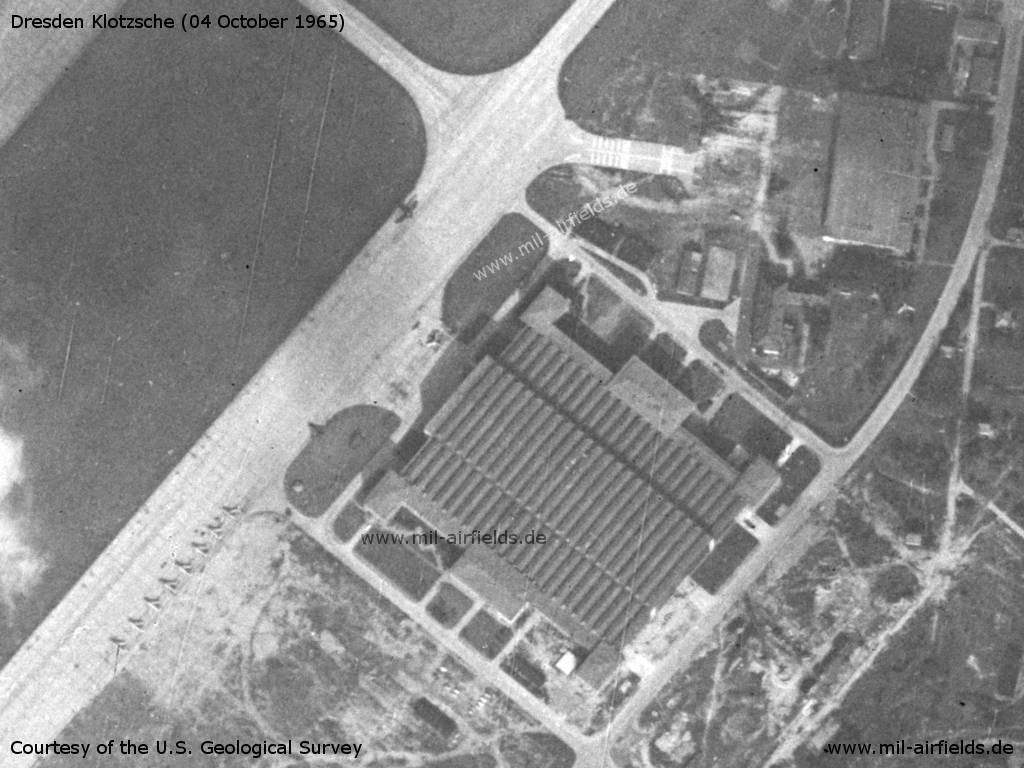
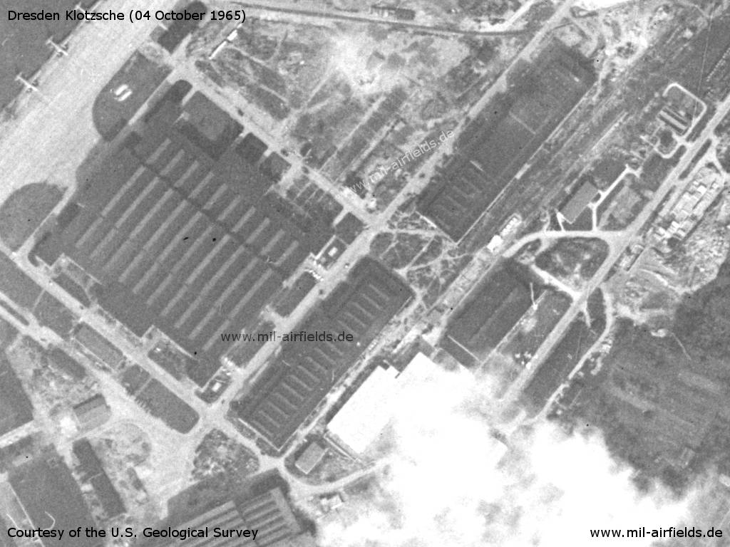
Buildings
Source: U.S. Geological Survey
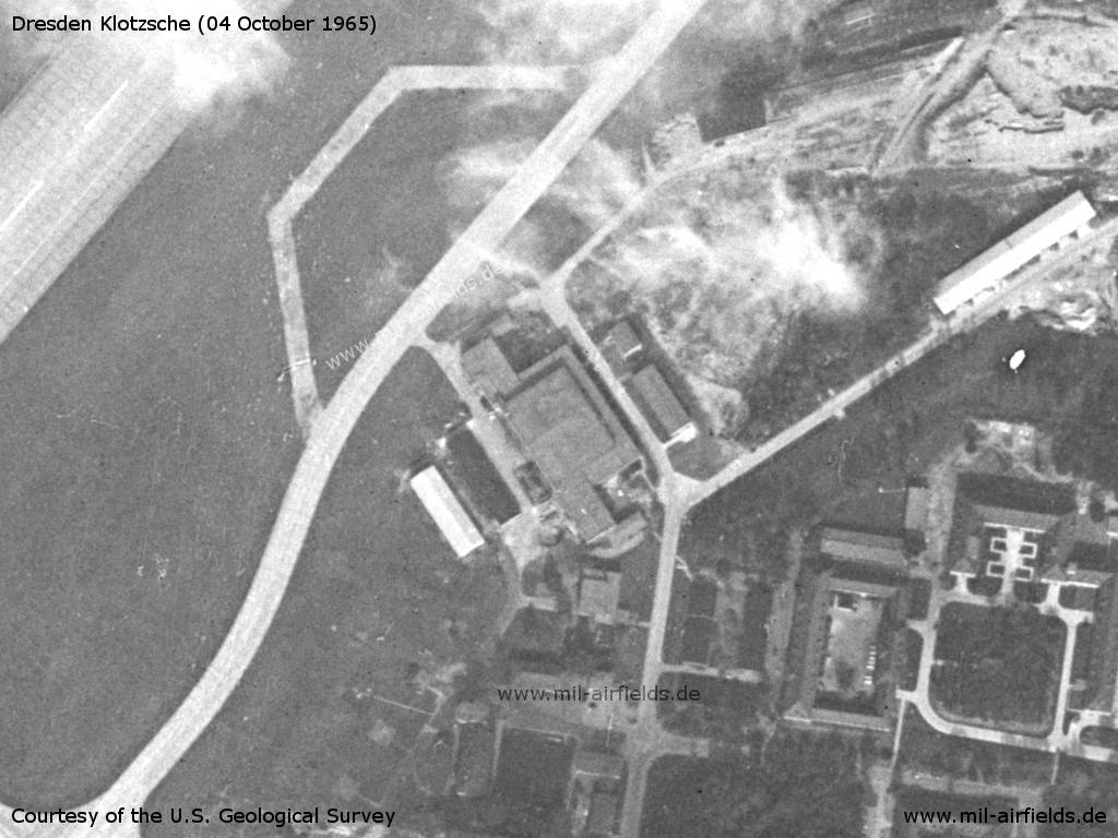
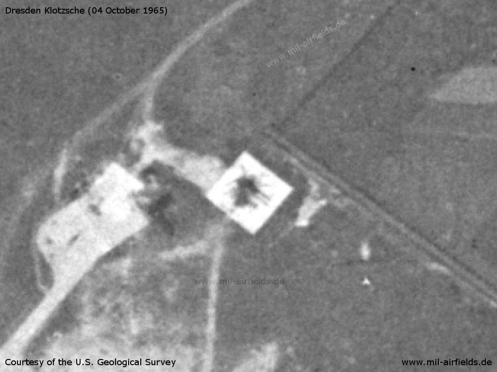
Another hangar
Source: U.S. Geological Survey
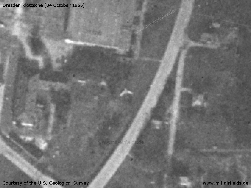
On the western side of the runway there are several installations, probably radar facilities
Source: U.S. Geological Survey
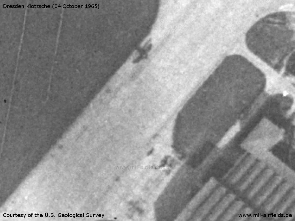
Northern large hangarl. There are 9 fighter planes and an An-2 (?) - An arrow-shaped object is visible to the right between the hangars. It could be another plane, possibly decommissioned. Interesting is the strip-shaped marking on the taxiway in front of the hangar in the upper right-hand corner.
Source: U.S. Geological Survey
Detail: An-2 at the edge and fighter plane in front of the hangar
Source: U.S. Geological Survey
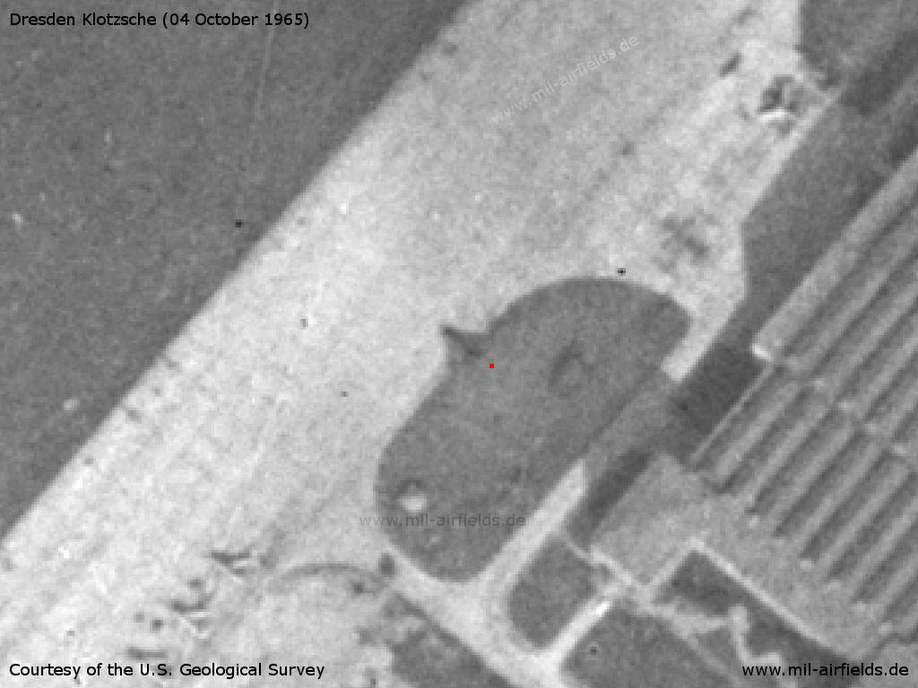
Detail: Unusually dark aircraft silhouette (marked with red dot)
Source: U.S. Geological Survey
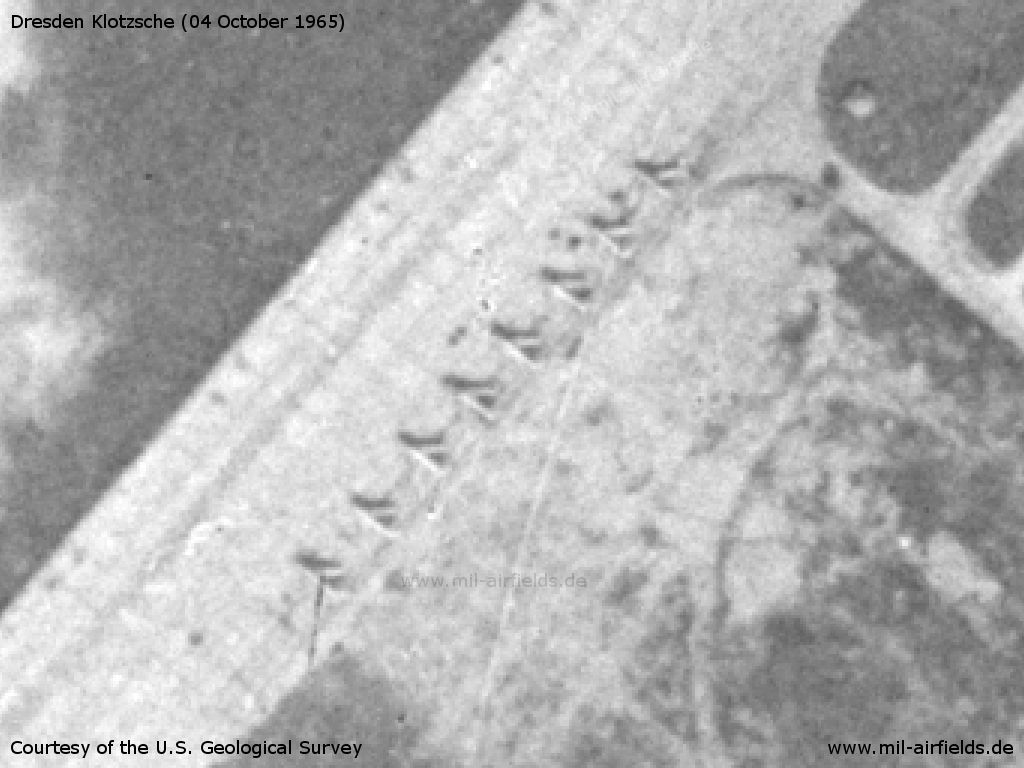
Detail: 8 fighter aircraft
Source: U.S. Geological Survey
Detail: Stripe-shaped marking on the taxiway
Source: U.S. Geological Survey
Detail: MiG aircraft in the area behind the hangars
Source: U.S. Geological Survey
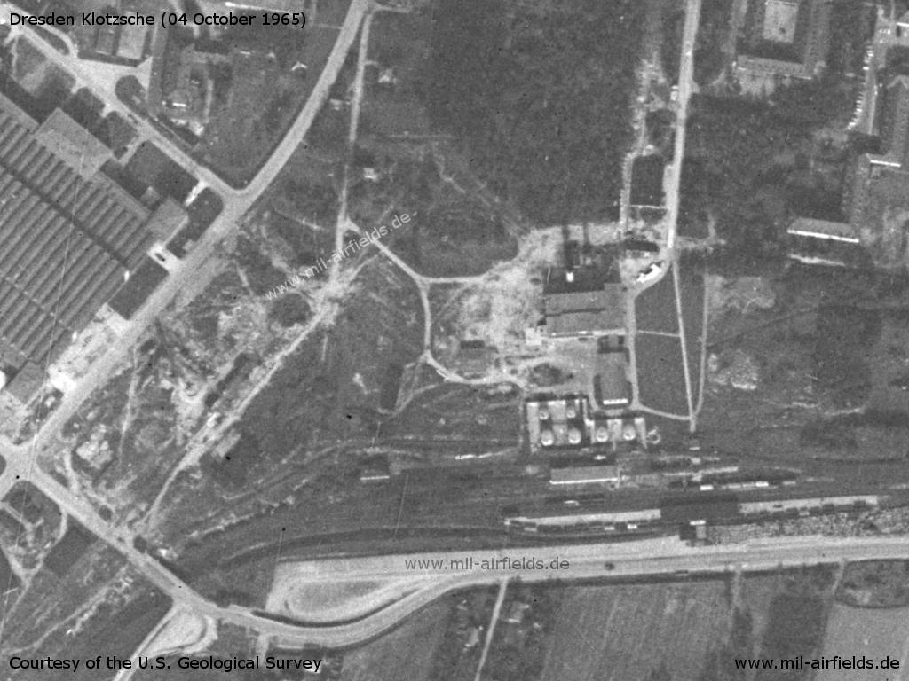
Southern railway connection and tank farm - Some freight cars are standing on the tracks
Source: U.S. Geological Survey
The platform at the southwest end is empty
Source: U.S. Geological Survey
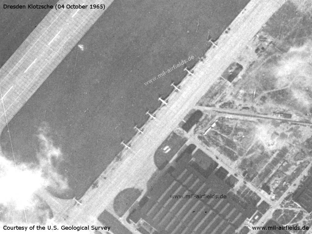
On the military apron of the East German National People's Army (NVA) there are 8 aircraft Il-14 and 2 An-2
Source: U.S. Geological Survey
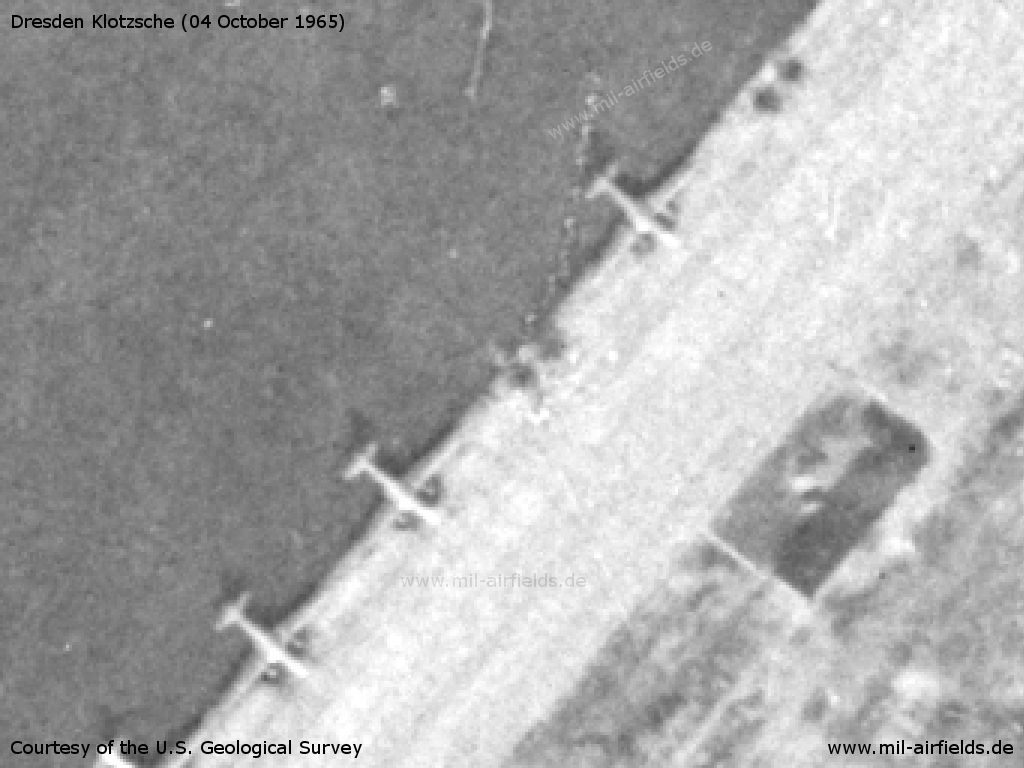
Detail: East German National People's Army (NVA) transport aircraft Il-14 and two empty parking positions
Source: U.S. Geological Survey
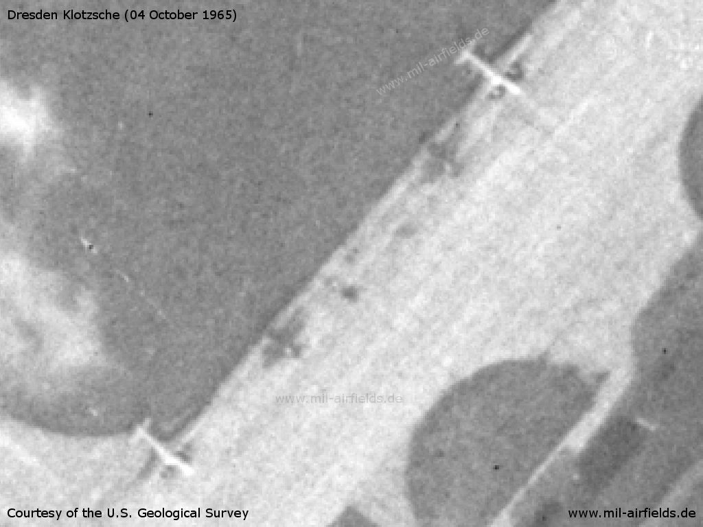
Detail: Airplanes Ilyushin Il-14 and Antonov An-2
Source: U.S. Geological Survey
Large hangar
Source: U.S. Geological Survey
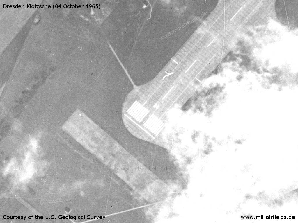
Southwestern end of the runway
Source: U.S. Geological Survey
The facilities in the southern part of the field are only partially visible due to clouds.
Source: U.S. Geological Survey
Contents
Page 1: From the beginnings to the 1960s ← you are here
Page 2: From the 1970s until today
Page 3: Dresden Klotzsche Airport
 Follow mil-airfields on Facebook