For historical information only, do not use for navigation or aviation purposes!
| Coordinates | N535953 E0110633 (WGS84) Google Maps |
| Former East Germany (GDR) | District of Rostock |
| Federal state | Mecklenburg-Vorpommern (Mecklenburg-Western Pomerania) |
| Airfield Id | 3356 |
Germany during the Cold War Map
The history of the Cold War airfields: Elmenhorst
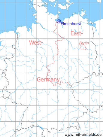
Location of airfield
0.5 km northeast of Elmenhorst.
Usage during the Cold War
Helipad 3356 for Radar Company 233 (FuTK-233) of former East German Air Force (NVA LSK/LV).
Use today
Closed.
Runways, taxiways, aprons
Dimensions: 60 m x 50 m,
main takeoff and landing direction: 270°,
surface: soil, usable after harvest only,
capacity: 1 helicopter.
main takeoff and landing direction: 270°,
surface: soil, usable after harvest only,
capacity: 1 helicopter.
Telephone
Stabsnetz S1 ü 43301
Airspace and procedures
Usable at day during good weather conditions.
Alert time: 60 minutes.
Alert time: 60 minutes.
Obstacles
Antenna P-14: direction 350°, height 33 m,
Antenna P-15: direction 10°, height 35 m.
Antenna P-15: direction 10°, height 35 m.
Airfields in the vicinity
- 176°/14km Gostorf: Agricultural Airfield
- 089°/21km Kirchdorf: Helipad 3324 (HSLP / HLP 3324)
- 149°/32km Alt Meteln: Agricultural Airfield
- 154°/33km Hof Meteln: Agricultural Airfield
- 171°/33km Vietlübbe: Agricultural Airfield
- 211°/33km Groß Molzahn: Helipad 3370 (HSLP / HLP 3370)
- 126°/35km Kleekamp: Highway Strip (planned)
 Follow mil-airfields on Facebook