For historical information only, do not use for navigation or aviation purposes!
| Coordinates | N513248 E0131259 (WGS84) Google Maps |
| Elevation | 285 ft |
| Former East Germany (GDR) | District of Cottbus |
| Federal state | Brandenburg |
| Location indicator | EDUF |
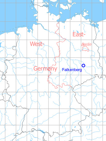
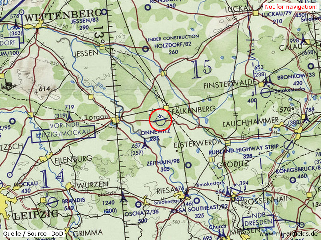
Germany during the Cold War Map
The history of the Cold War airfields: Falkenberg
General
Falkenberg airfield came into existence in the 1930s as Alt Lönnewitz air base. After the war, the field was used and continously extended by the Soviet Air Force. Last unit at Falkenberg was the 31st Guards Fighter Regiment with MiG-29 and MiG-23UB.
After the withdrawal of the Russian troops in the early 1990s, it became the special airfield Falkenberg/Lönnewitz EDUF. The runway was shortened to 1200 m (3,937 ft). Today, large portions of the area are used as solar park.
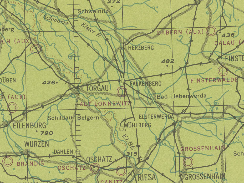
Location of airfield
2 km south-southwest of Falkenberg.
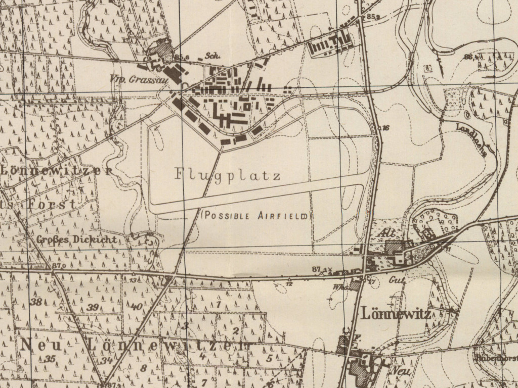
During World War II
Use
Luftwaffe airfield (Alt-Lönnewitz).
Situation
Falkenberg Air Base in World War II on a US map from 194x
Source: McMaster University Library Digital Archive, Lizenz: Creative Commons Attribution-NonCommercial 2.5 CC BY-NC 2.5 CA
Overview
Fliegerhorst Alt Lonnewitz airfield on a US map from 1952
Source: AMS M841 GSGS 4414, Courtesy Harold B. Lee Library, Brigham Young University
During the Cold War
Use
Soviet fighter base until 1992.
In the 1950s
Units
Units in 1954
- Headquarters Soviet ground attack division
- Soviet ground attack regiment (P. O. Box 62 326),
- A total of 14 MiG-15/MiG-15U were counted at the airfield.
Source: BND/Bundesarchiv B 206/3033
(For the P. O. Box numbers the digits 3 and 5 may be confused, because they are difficult to distinguish in the source document)
- Soviet ground attack regiment (P. O. Box 62 326),
- A total of 14 MiG-15/MiG-15U were counted at the airfield.
Source: BND/Bundesarchiv B 206/3033
(For the P. O. Box numbers the digits 3 and 5 may be confused, because they are difficult to distinguish in the source document)
In the 1960s
Overview
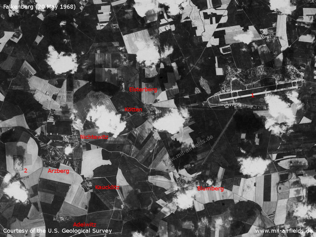
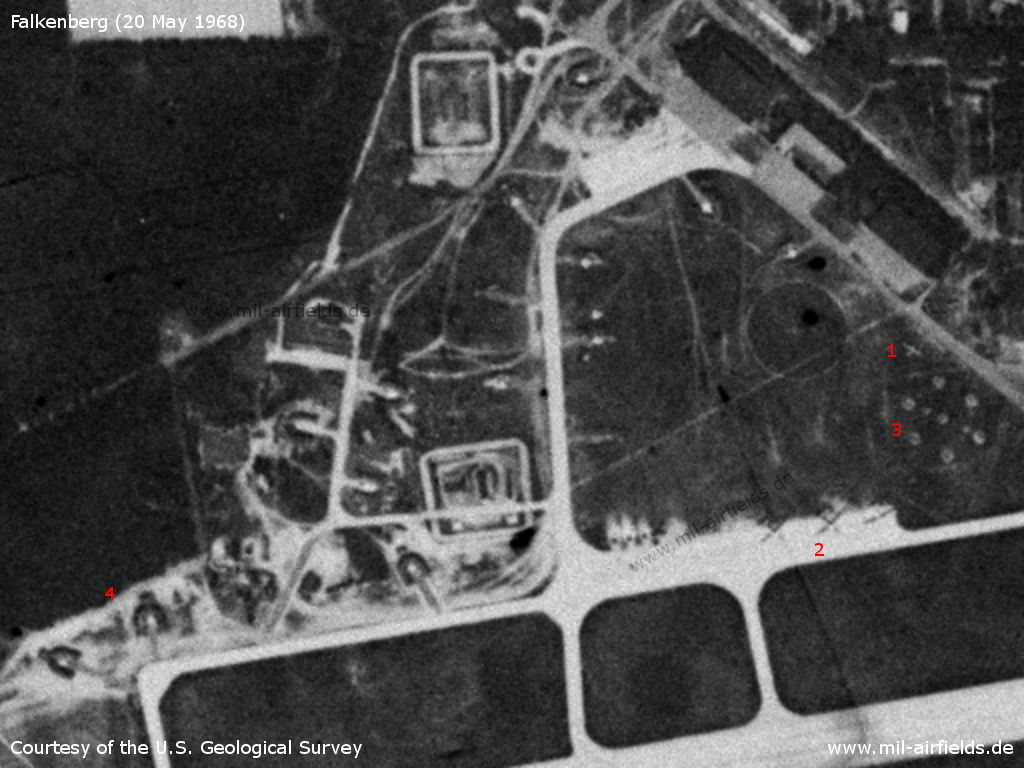
Falkenberg Airfield and the area west of it on a US satellite image from 20 May 1968 - 1: Airfield; 2: SAM site near Arzberg. More places: Adelwitz, Blumberg, Elsterberg, Kaucklitz, Kötten and Nichtewitz. Remarkable is the cutting leading southwest from the airfield to Blumberg. But it is neither a taxiway nor a runway.
Source: U.S. Geological Survey
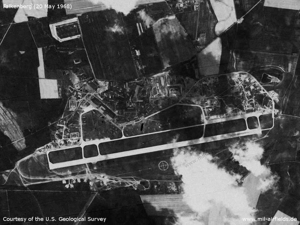
Falkenberg Air Base - At this time, the runway had a length of 2,500 m.
Source: U.S. Geological Survey
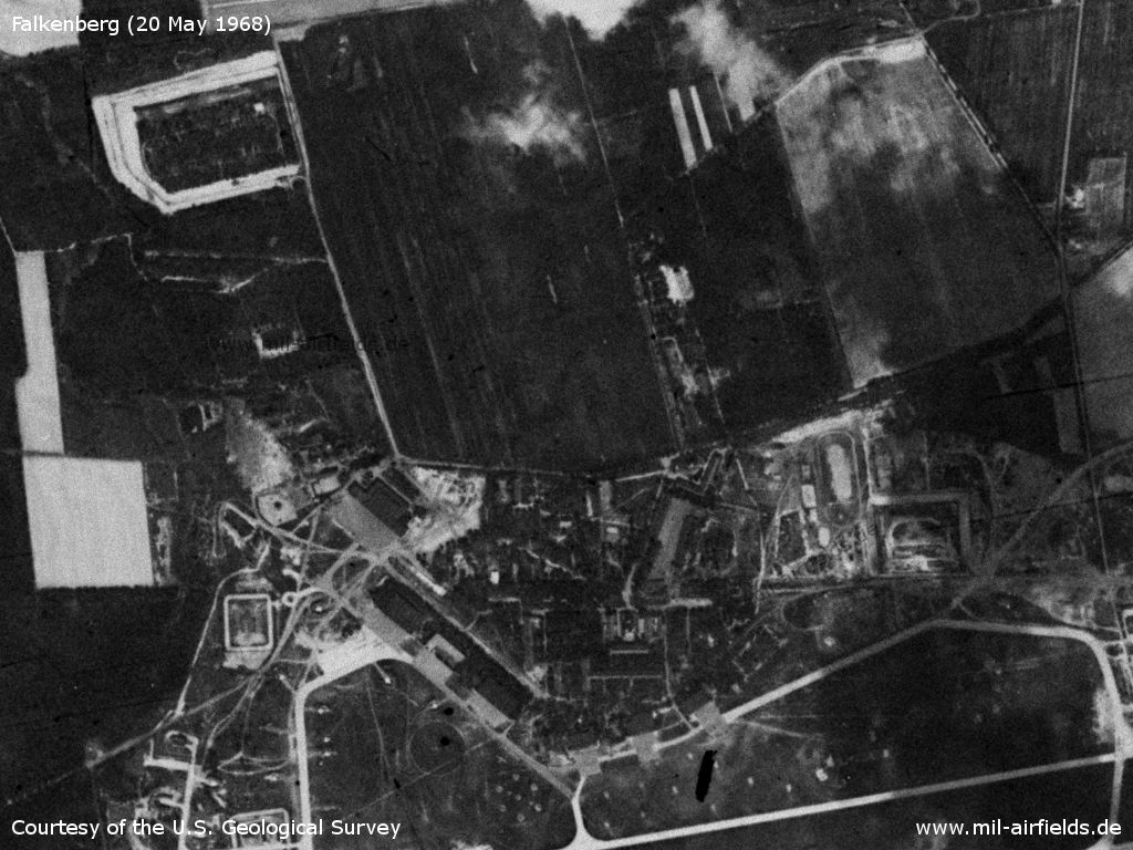
Northern part
Source: U.S. Geological Survey
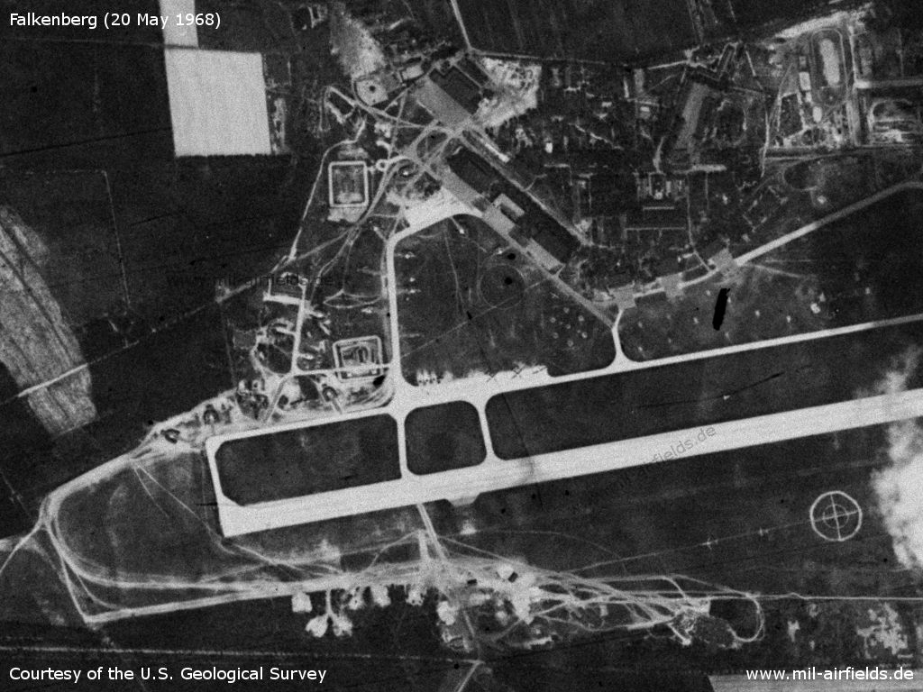
Western part
Source: U.S. Geological Survey
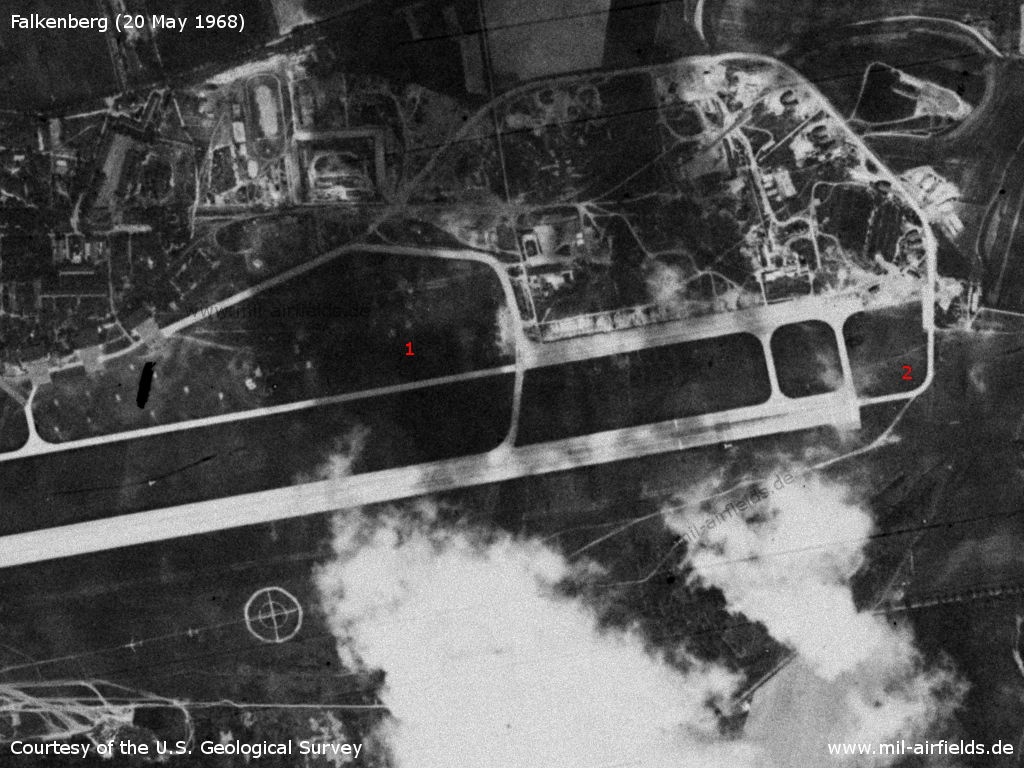
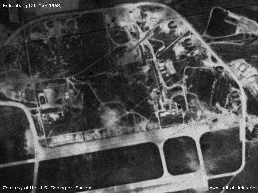
Eastern part - 1: Another hexagonal structure, probably another air defence position; 2: The taxiway ends at the beginning of the runway. This unusual configuration was later replaced.
Source: U.S. Geological Survey
Northwestern part - 1: Airplane in the grass? 2: Three larger airplanes; 3: The hexagonal structure is probably an anti-aircraft position 4: In this area, the aircraft revetments are clearly visible
Source: U.S. Geological Survey
Southern part with airplane silhouettes
Source: U.S. Geological Survey
Eastern part
Source: U.S. Geological Survey
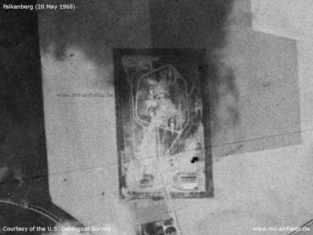
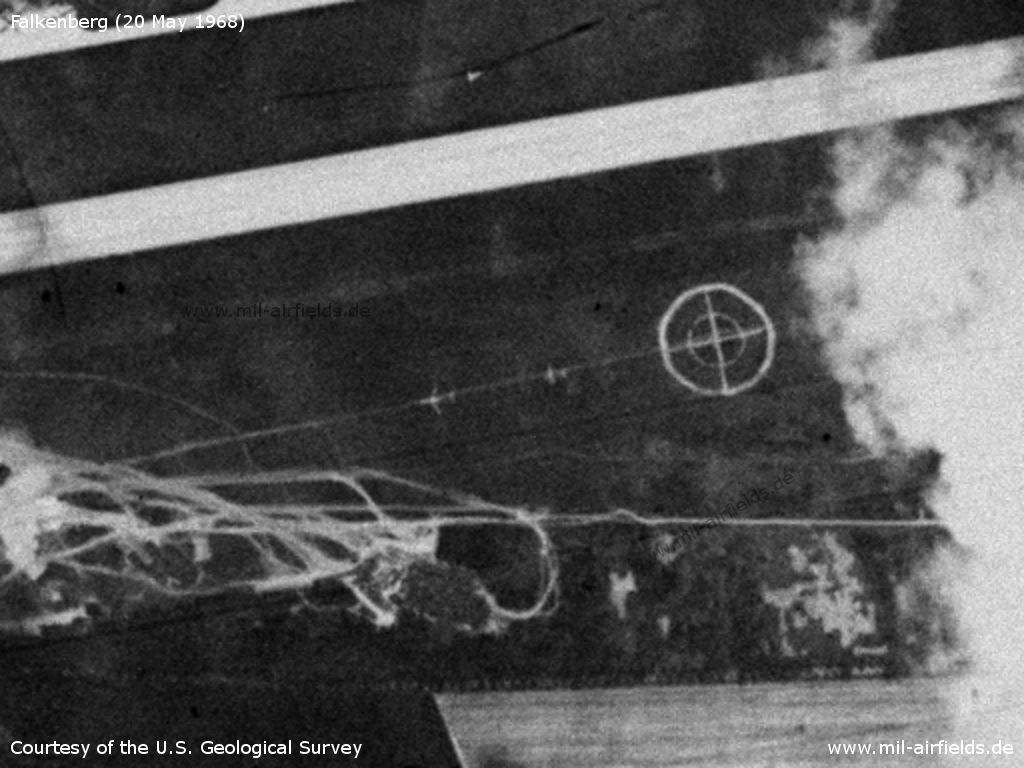
The surface-to-air missile (SAM) site at Arzberg - It was equipped with S-125 Newa missiles (NATO designator SA-3 Goa)
Source: U.S. Geological Survey
History
- September 1966
A USMLM team observed modified missile launching rails on a FISHBED D from Alt Lönnewitz. The same rails had been earlier observed on a FISHBED F. (Source: USMLM 1966)
In the 1970s
Situation
Falkenberg Air Base on a map of the US Department of Defense from 1972
Source: ONC E-2 (1972), Perry-Castañeda Library Map Collection, University of Texas at Austin
In the 1980s and early 1990s
Runways
- 08/26: 3000 m x 60 m Concrete
- 08/26: 2200 m x 60 m Grass south of the hard surfaced runway
Radio beacons
- RSBN: CH 34 "BL", N513300 E0131327 (S42/83?)
- LOM 26: 462 "BL", 3910 m to threshold 26
- LMM 26: 938 "B", 1070 m to threshold 26
- LOM 08: 462 "BL", 4130 m to threshold 08
- LMM 08: 938 "S", 850 m to threshold 08
Radio communication
The radio call sign was BAIKAL (БАЙКАЛ).
Standard training routes
"Flüge der LSK/LV der NVA und der LSK der GSSD im Rahmen der Gefechtsausbildung sind entsprechend der Grafik der Flugtage / -nächte auf der Grundlage der "Hauptflugregeln zum Fliegen im Luftraum der Deutschen Demokratischen Republik" auf Standardflugstrecken in den dazu festgelegten Flughöhen durchzuführen. ..." (Quelle: "Verzeichnis der Standardflugstrecken der LSK/LV der NVA und der LSK der GSSD"
As of 1989:
283 Falkenberg, Soellichau, Schoenewalde, Finsterwalde, Falkenberg
Altitude: 600 - 1200 m, from abeam Sonnenwalde 1200 m
Interception leg: Kemberg, Schoenewalde, Sonnenwalde
Altitude: 600 - 1200 m, from abeam Sonnenwalde 1200 m
Interception leg: Kemberg, Schoenewalde, Sonnenwalde
283a (during flying activities at Holzdorf Air Base)
Falkenberg, Finsterwalde, Meissen, Groeditz, Falkenberg
Altitude: 600 - 1850 m
Interception leg: Finsterwalde, Meissen
Falkenberg, Finsterwalde, Meissen, Groeditz, Falkenberg
Altitude: 600 - 1850 m
Interception leg: Finsterwalde, Meissen
284 Falkenberg, Soellichau, Schoenewalde, Falkenberg
Altitude: 600 - 1200 m
Interception leg: Kemberg, Schoenewalde
Altitude: 600 - 1200 m
Interception leg: Kemberg, Schoenewalde
285 Falkenberg, Soellichau, Schoenewalde, Golssen, Baruth, Heidehof range, Markendorf, Falkenberg
Altitude: enroute to the range 600 - 1200 m, on return 4250 m (climb above the range)
Altitude: enroute to the range 600 - 1200 m, on return 4250 m (climb above the range)
285a (during flying activities at Holzdorf Air Base)
Falkenberg, Sonnewalde, Luckau, position 3 km south of Baruth, Heidehof range, Finsterwalde, Falkenberg
Altitude: enroute to the range 300 - 1200 m; on return 4250 m (in coordination with Brand Command Post)
Falkenberg, Sonnewalde, Luckau, position 3 km south of Baruth, Heidehof range, Finsterwalde, Falkenberg
Altitude: enroute to the range 300 - 1200 m; on return 4250 m (in coordination with Brand Command Post)
287 Falkenberg, Soellichau, Schoenewalde, Finsterwalde, Glaubitz, Belgern range, Falkenberg
Altitude: 600 - 1200 m, from abeam Sonnewalde 1200 m
Altitude: 600 - 1200 m, from abeam Sonnewalde 1200 m
287a (during flying activities at Holzdorf Air Base)
Falkenberg, Finsterwalde, Meissen, Muehlberg, Belgern range, Falkenberg
Altitude: 600 - 1200 m
Falkenberg, Finsterwalde, Meissen, Muehlberg, Belgern range, Falkenberg
Altitude: 600 - 1200 m
288 Falkenberg, Bitterfeld, Soemmerda, Meissen, Falkenberg
Altitude: 8550 - 9450 m, 11900 - 18000 m
Interception leg: Apolda, Meissen
Climb: Bitterfeld
Descend: Meissen
Altitude: 8550 - 9450 m, 11900 - 18000 m
Interception leg: Apolda, Meissen
Climb: Bitterfeld
Descend: Meissen
Units
31 GwIAP: MiG-29, MiG-29UB, MiG-23UB
Installations
- Railway siding from Falkenberg to the northern part of the airfield.
- Locator / Outer Marker East: north of Beiersdorf,
- Locator / Middle Marker East: ca. 1000 m east of threshold 26,
- Locator / Outer Marker West: ca. 700 m northeast of Nichtewitz,
- Locator / Middle Marker West: ca. 800 m west of old threshold 08.
- Anti-aircraft missile site north of Kathewitz.
History
- 1988
Observation by the US Military Liaison Mission: "This year, the (Tupolev Tu-22M) BACKFIRE deployed into Falkenberg Soviet Airfield twice, in March and August 1988. Both times, close-up still photography and video coverage of its landings and take-offs were acquired. This coverage offers a rare glimpse of the non-naval bombers." (Source: USMLM 1988) - March 10th, 1988
Observation of A-50 MAINSTAY by the British Military Liaison Mission BRIXMIS in Falkenberg. (Source: USMLM 1988)
Images
Tupolev Tu-22M BACKFIRE B at Falkenberg (1988) Source: USMLM Unit History 1988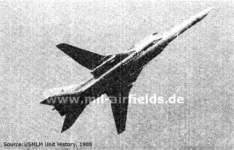
Today
Use
Special airfield.
Sources
- http://lib.byu.edu/collections/german-maps/ - German Maps (Topographische Karte 1:25,000)
- http://www.history.hqusareur.army.mil/uslmannual.htm (offline): http://www.history.hqusareur.army.mil/uslmannual.h... - Report about modified launching rails on MiG-21 Fishbed D from Falkenberg
- http://www.history.hqusareur.army.mil/uslmannual.htm (offline): http://www.history.hqusareur.army.mil/uslmannual.h... - First observation of a MiG-21 Fishbed F at Falkenberg; Exercise of Falkenberg aircrafts at the Belgern range
- http://www.history.hqusareur.army.mil/uslmannual.htm (offline): http://www.history.hqusareur.army.mil/uslmannual.h... - Report about deployment of 34 MiG-21 Fishbed D und F from Falkenberg to Cochstedt Airfield at 09.06.1972
- http://www.history.hqusareur.army.mil/uslmannual.htm (offline): http://www.history.hqusareur.army.mil/uslmannual.h... - Falkenberg has received MiG-21 Fishbed F from Jüterbog and Damgarten; a squadron has received MiG-23.
- http://www.history.hqusareur.army.mil/uslmannual.htm (offline): http://www.history.hqusareur.army.mil/uslmannual.h... - MiG-23 Flogger B with AA-7 and AA-8; first photo of camouflaged Flogger B
- http://www.history.hqusareur.army.mil/uslmannual.htm (offline): http://www.history.hqusareur.army.mil/uslmannual.h... - Short report and picture about a deployment of Flogger
Links
- http://www.sachsenschiene.net/bunker/flp/flp_35.ht... - Sachsenbunker
- http://www.eduf.info/ - Flugplatz Falkenberg/Lönnewitz EDUF
Bibliography
- Ries, Karl; Dierich, Wolfgang: "Fliegerhorste und Einsatzhäfen der Luftwaffe" Motorbuch Verlag Stuttgart, 1993 - Allied maps
- Freundt, Lutz: "Sowjetische Fliegerkräfte in Deutschland 1945-1994, Band 1" Freundt Eigenverlag, Diepholz 1998 - Description, areal picture, map
- /USMLM 1988USMLM 1988/:
United States Military Liaison MissionUnited States Military Liaison Mission: "Unit History 1988Unit History 1988"
Related topics
Airfields in the vicinity
- 151°/17km Zeithain: Airfield
- 073°/23km Doberlug-Kirchhain: Helipad 1031 (HSLP / HLP 1031)
- 294°/24km Vogelgesang: Helipad 1035 (HSLP / HLP 1035)
- 075°/25km Doberlug-Kirchhain: Helipad 3042 (HSLP / HLP 3042)
- 352°/25km Holzdorf: Air Base
Categories
Military Airfields GermanyMilitary Airfields in former East GermanyAirfields of the Soviet Forces in GermanyRecommended
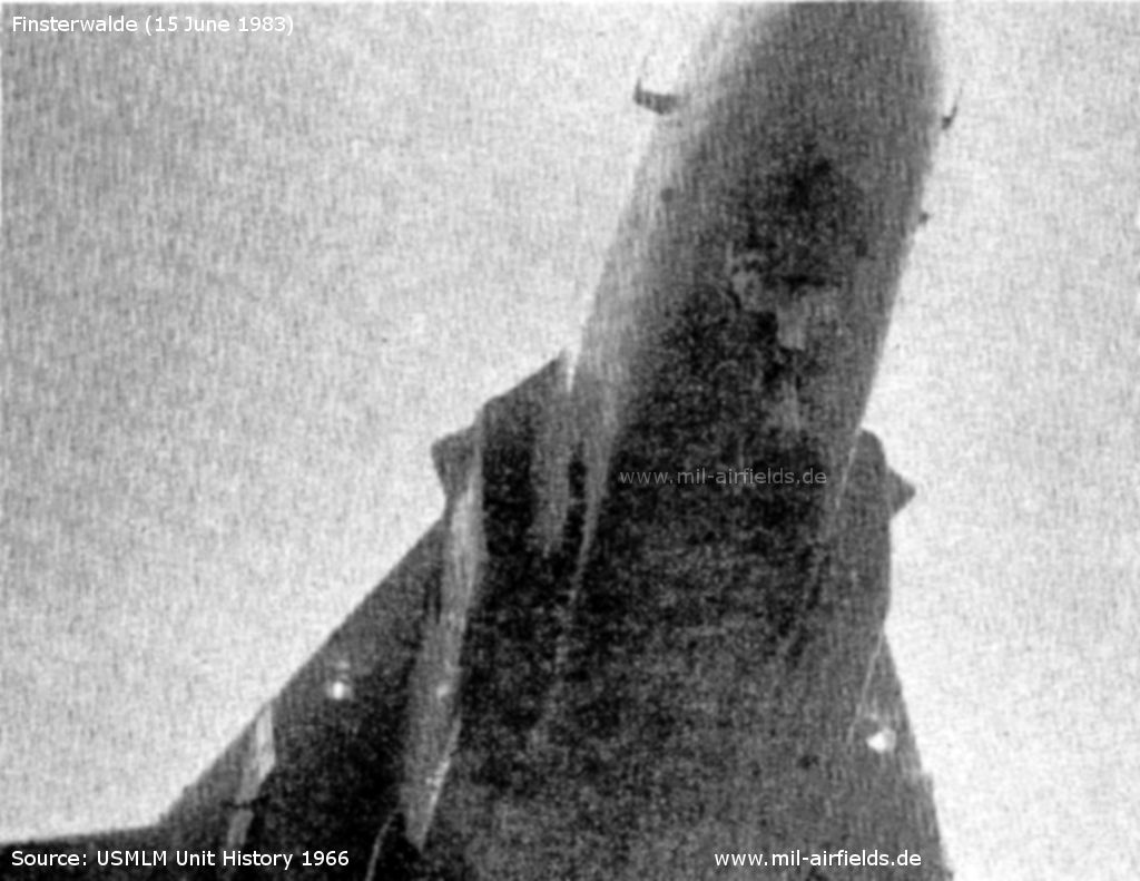
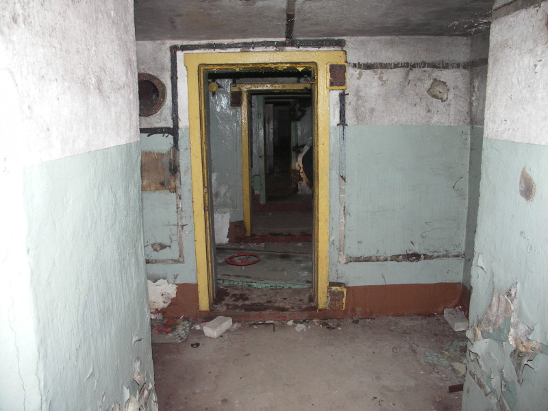
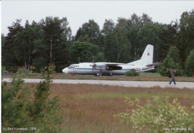
Image credits are shown on the respective target page, click on the preview to open it.
 Follow mil-airfields on Facebook