Forst: Highway Strip
Autobahnabschnitt ABA, Groß Bademeusel, Preschen Highway Strip
For historical information only, do not use for navigation or aviation purposes!
| Coordinates | N514107 E0144054 (WGS84) Google Maps |
| Former East Germany (GDR) | District of Cottbus |
| Federal state | Brandenburg |
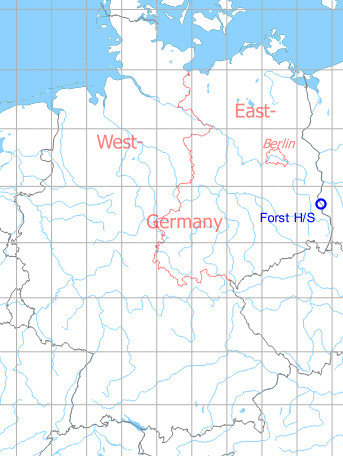
Germany during the Cold War Map
The history of the Cold War airfields: Forst
General
A section of the Autobahn between Cottbus and the Polish border (GDR Autobahn A5, today A15) was prepared by the East German National People's Army (NVA) for flight operations and was regularly used for exercises. This Highway Strip had a direct connection to the nearby Preschen Air Base. Radio beacons were set up for the approach from the southeast. By NATO it has been called differently over the years: Forst, Groß Bademeusel, Preschen Highway Strip. Today it is closed.
During the Cold War
Use
Highway strip.
In the 1960s
Overview
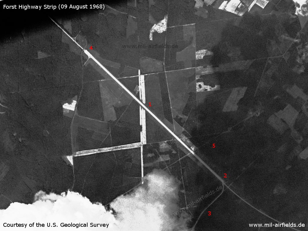
Forst Highway Strip on a US satellite image from 09 August 1968 - 1: Runway, approx. 2330 m long; 2: the southern end lies in the shadow of a cloud; 3: taxiway to Preschen airfield; 4: northern end; 5: Preschen approach lane
Source: U.S. Geological Survey
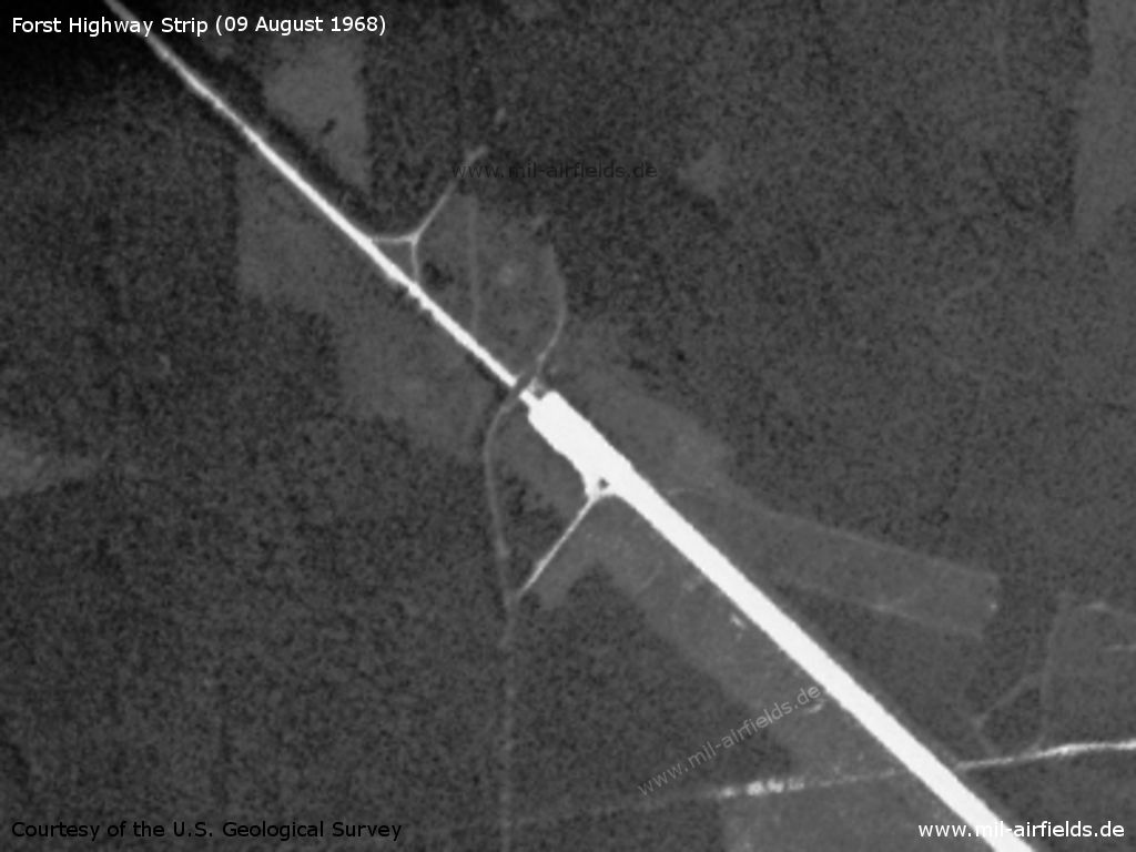
Enlargement northern end - The last 100 meters are a little wider. The Autobahn continues to the north with only one lane for each direction. Directly to the north there is a bridge over which a path leads. From this path there are two accesses to the Autobahn or to the Highway Strip.
Source: U.S. Geological Survey
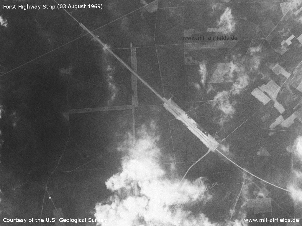
At this picture of 03.08.1969 the southern part is better illuminated.
Source: U.S. Geological Survey
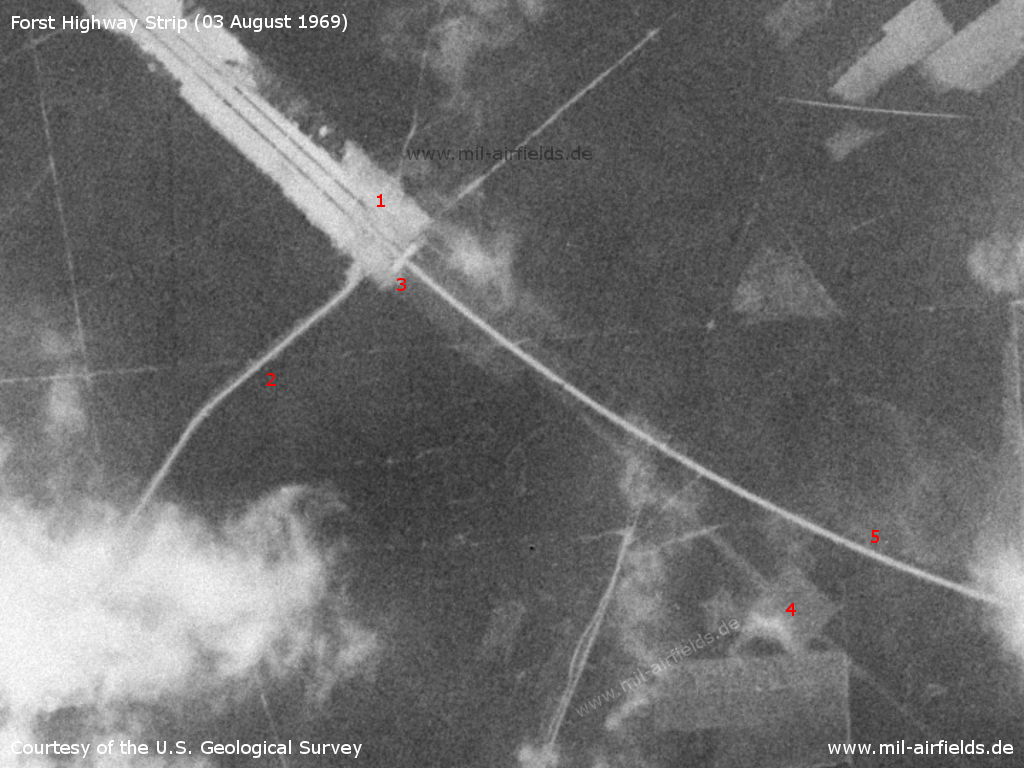
Enlargement southern end - 1: Southern end; 2: taxiway to Preschen aerodrome; 3: bridge over motorway; 4: approach lane and site for near radio beacon; 5: Autobahn to Poland with only one lane for each direction
Source: U.S. Geological Survey
In the 1970s
Situation
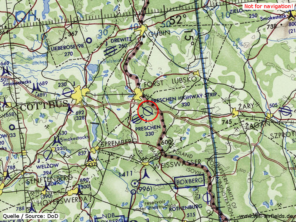
On this map from the US Department of Defense from 1972 it is named "Preschen Highway Strip" - It is located directly on the Polish border.
Source: ONC E-2 (1972), Perry-Castañeda Library Map Collection, University of Texas at Austin
Overview
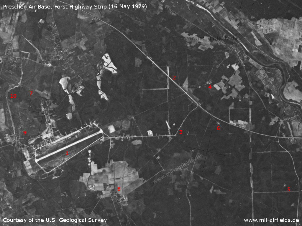
Preschen Air Base and Forst Highway Strip on a US satellite image from 16 May 1979 - 1: Preschen Air Base; 2: Forst Highway Strip; 3: Taxiway between the air base and the highway strip; 4: Approach lane and outer marker Preschen; 5: Outer marker highway strip; 6: Middle Marker highway strip; 7: railway siding; 8: Preschen village; 9: Jocksdorf village; 10: Connecting road under construction, possibly because of a bypass of the storage area in the north. In the upper right corner you can see the Neisse river, which forms the border to Poland.
Source: U.S. Geological Survey
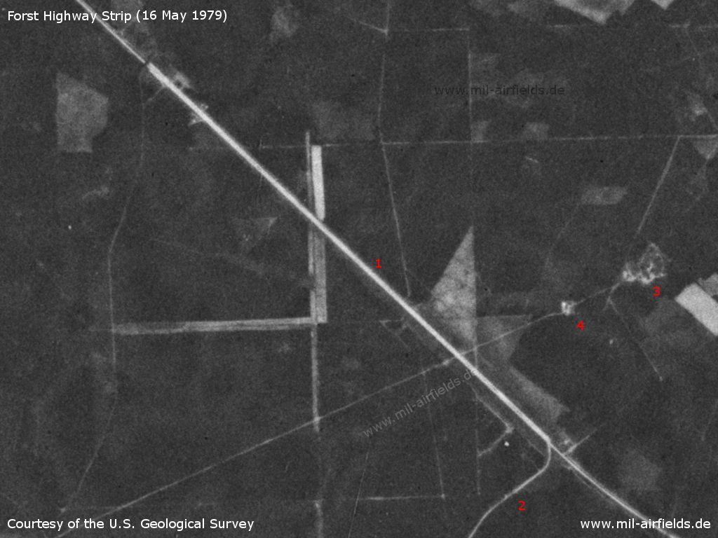
Enlargement: Forst Highway Strip - 1: Highway strip, which is wider than the normal autobahn; 2: Taxiway to Preschen Air Base; 3, 4: Radio beacons and other facilities (possibly direction finder) on the Preschen approach path. The car park on the west side of the northern end of the highway strip does not yet exist at this time. The bridge in the north is still there, while in the south no bridge can be seen anymore.
Source: U.S. Geological Survey
In the 1980s and early 1990s
Overview
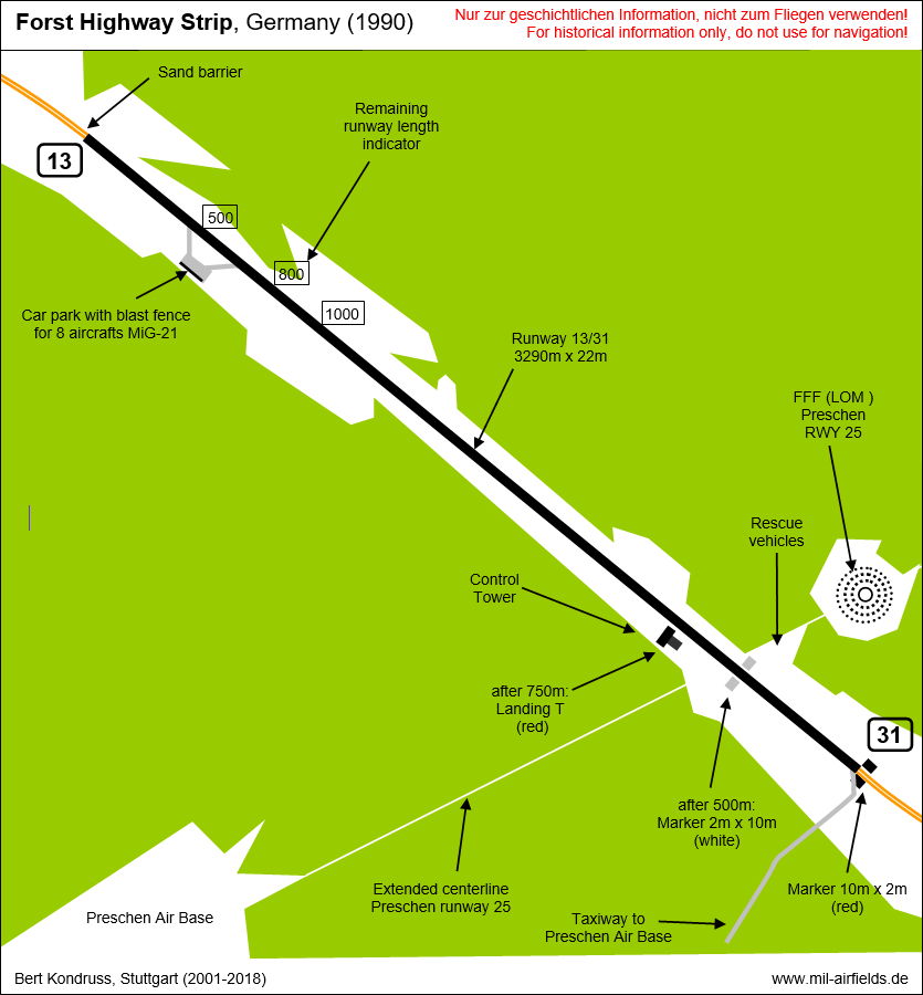
Runways
- 13/31: 2300 m x 20 m
Radio beacons
- LOM 31: 238.5 "SN", 4360 m to threshold 31
- LMM 31: 997 "S", 1150 m to threshold 31
Radio communication
The call sign was SEKTION.
Images
The following pictures were taken in 1990 and show the car park at the northern end.
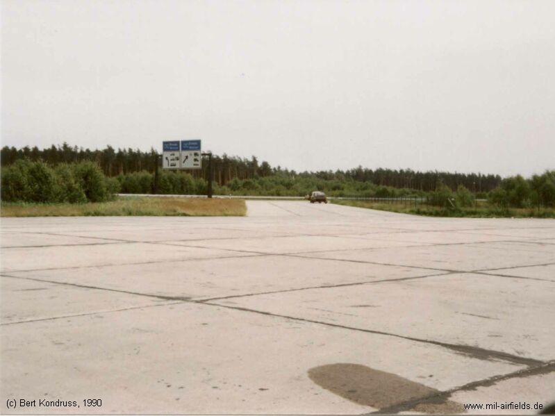
Route from the car park to the highway strip
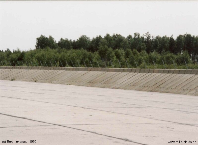
Ramp for 8 aircraft MiG-21 with blast fence
Today
Use
Closed.
Aerial image 2019
The following aerial photo was taken by Frank B., whom I thank very much!
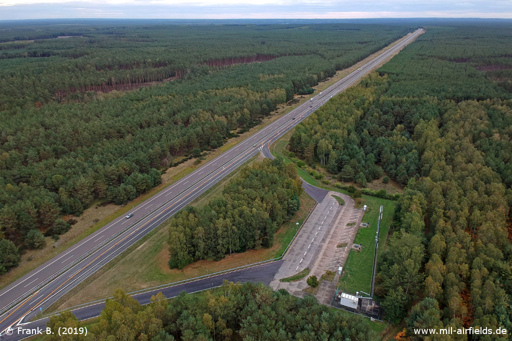
Aerial view of the former highway strip, looking approximately southeast. - In the foreground the parking lot at the northwestern end.
Source: Frank B.
Airfields in the vicinity
- 234°/4km Preschen: Air Base (Jocksdorf)
- 342°/6km Forst: Helipad 1010 (HSLP / HLP 1010)
- 209°/9km Döbern: Helipad 3160 (HSLP / HLP 3160)
- 257°/23km Groß Döbbern: Helipad 3132 (HSLP / HLP 3132)
- 336°/25km Drewitz: Air Base (Jänschwalde Ost, Cottbus-Drewitz)
- 289°/28km Cottbus: Air Base
- 275°/30km Leuthen: Helipad 3021 (HSLP 3021)
Categories
Highway Strips WorldwideMilitary Airfields GermanyMilitary Airfields in former East GermanyHighway Strips in former East GermanyRecommended
Image credits are shown on the respective target page, click on the preview to open it.
 Follow mil-airfields on Facebook