Fürstenwalde: Airfield
For historical information only, do not use for navigation or aviation purposes!
| Coordinates | N522322 E0140544 (WGS84) Google Maps |
| Elevation | 184 ft |
| Former East Germany (GDR) | District of Frankfurt/O |
| Federal state | Brandenburg |
| Location indicator | EDAL (200x) |
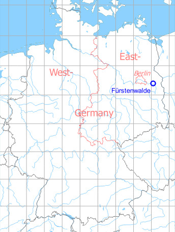
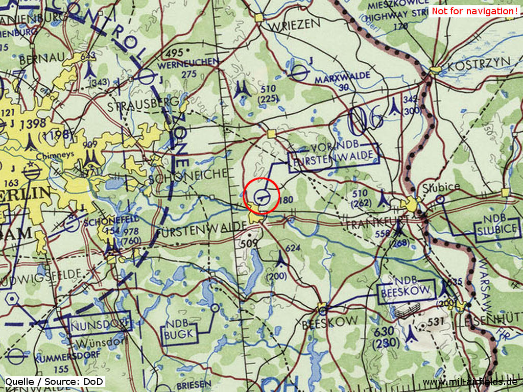
Germany during the Cold War Map
The history of the Cold War airfields: Fürstenwalde
Location of airfield
3 km northeast of Furstenwalde center.
During World War II
Use
Luftwaffe airfield
Situation
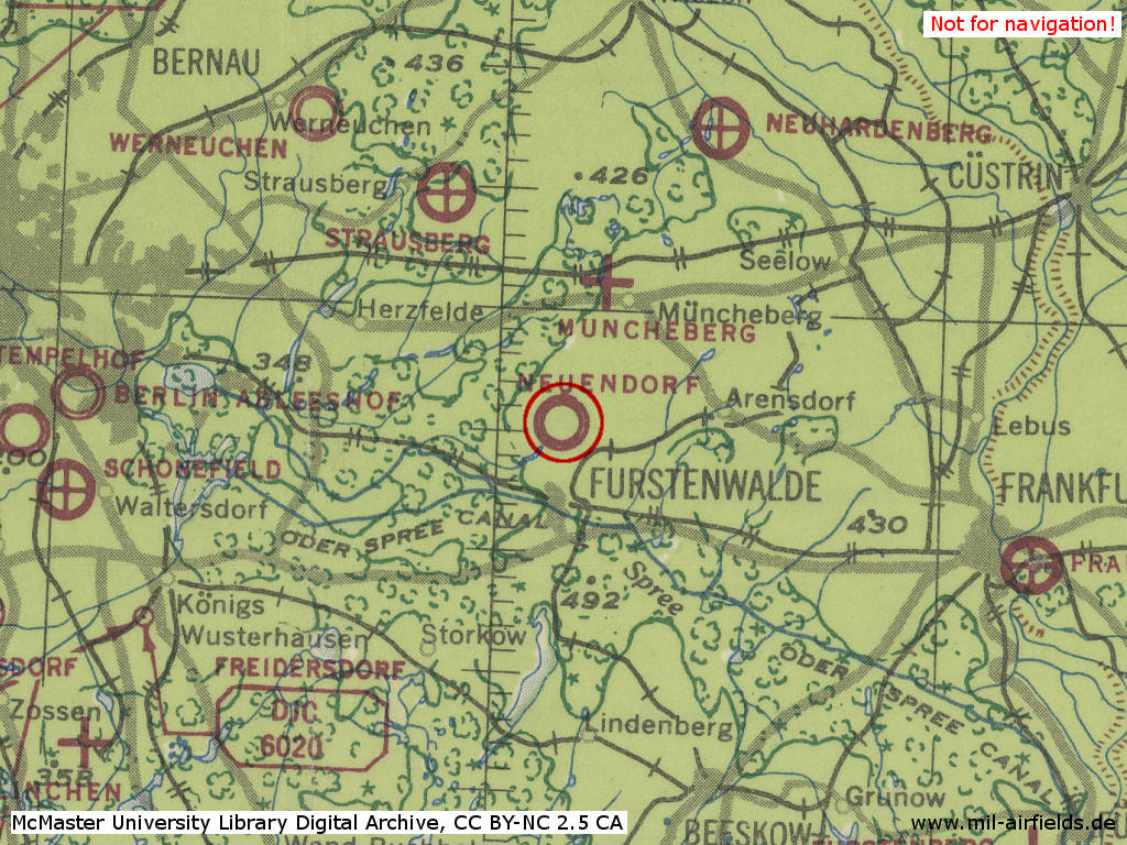
Fürstenwalde Air Base in World War II on a US map from 194x
Source: McMaster University Library Digital Archive, License: Creative Commons Attribution-NonCommercial 2.5 CC BY-NC 2.5 CA
Overview
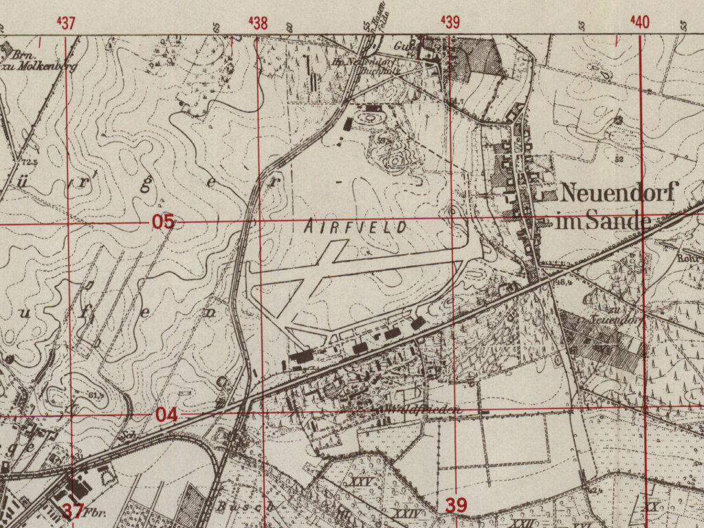
Fürstenwalde Air Base on a US map from 1952
Source: AMS M841 GSGS 4414, Courtesy Harold B. Lee Library, Brigham Young University
During the Cold War
Use
Base for soviet transport helicopters until mid-1970s. Then agricultural airfield of Interflug state airline. In addition, the East German National People's Army listed the airfield under the ID "A 05-11".
In the 1950s
Overview
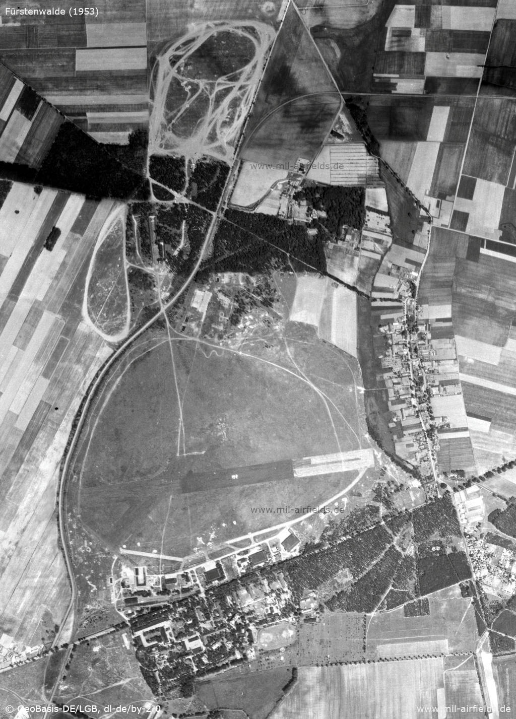
The former airbase on an aerial image from 1953 - To the north-northwest of the airfield is a shooting range, and further to the north is a training area. There, also the railroad swings to the east in the direction of Hasenfelde.
Source: Geoportal Brandenburg, Datenlizenz Deutschland - Namensnennung - Version 2.0
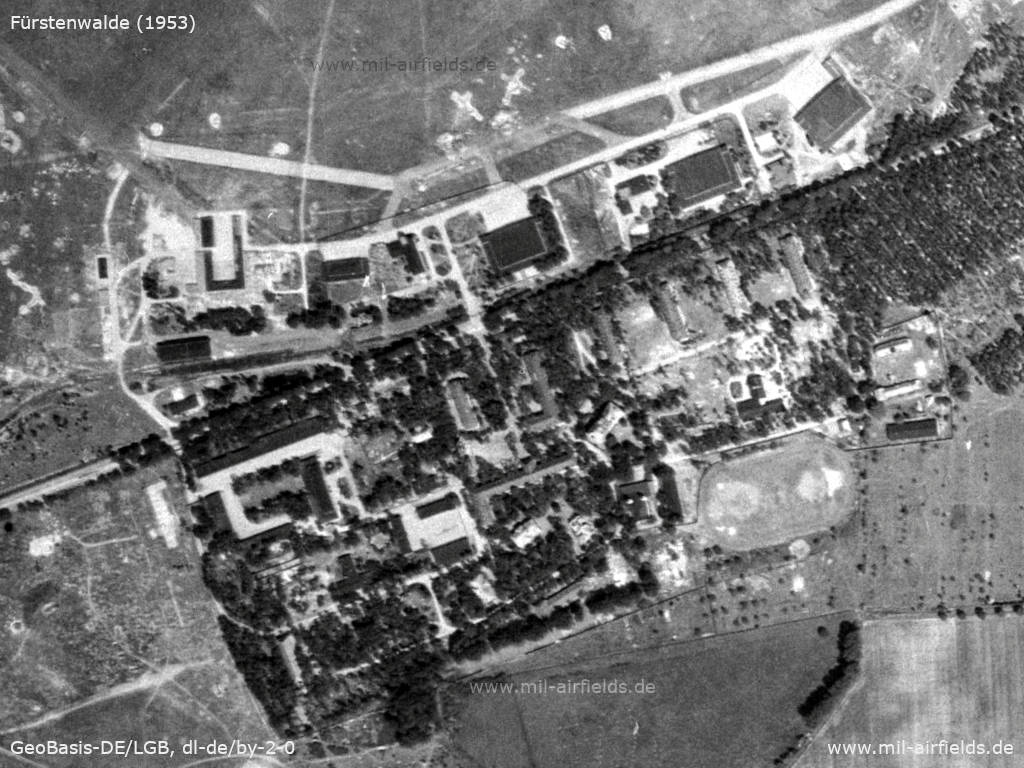
Enlargement: Hangars, barracks
Source: Geoportal Brandenburg, Datenlizenz Deutschland - Namensnennung - Version 2.0
Railway siding
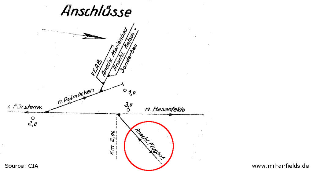
Track diagram of the installations southwest of the airfield from 1952 - Marienbad probably means Marienhütte, Palmücken probably Palmnicken. The siding to the airfield is marked red.
Source: CIA / Deutsche Reichsbahn
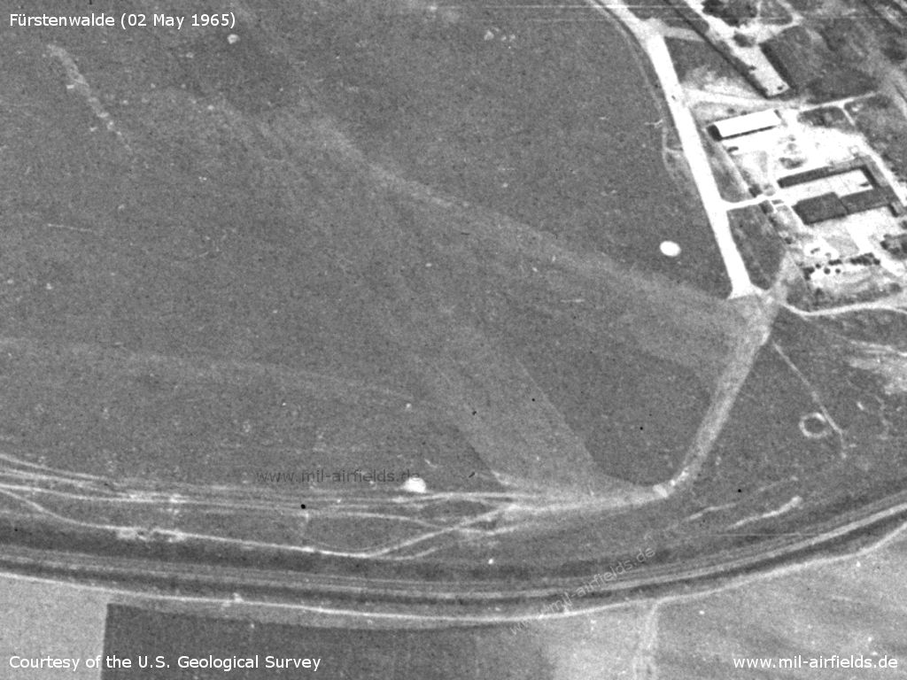
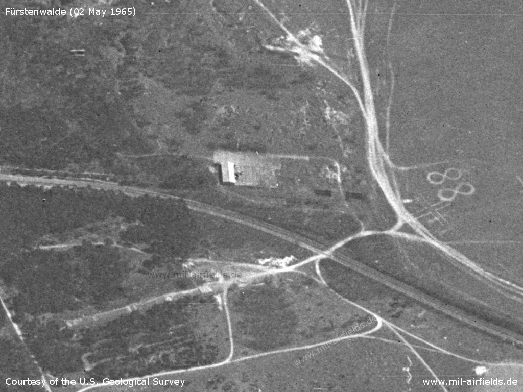
In the 1960s
Overview
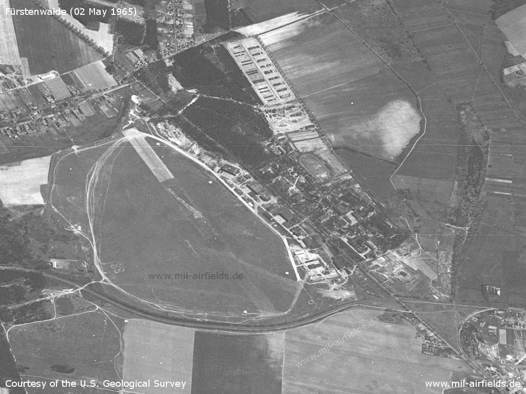
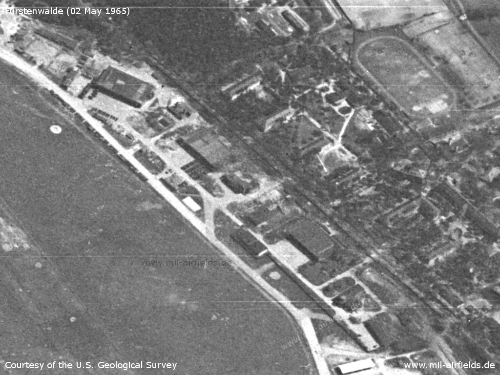
Fürstenwalde Airfield on 02 May 1965 - The viewing direction is approximately southeast
Source: U.S. Geological Survey
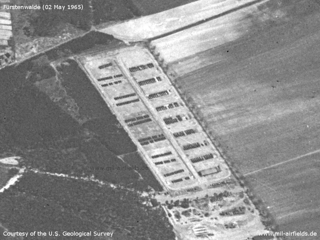
Storage area
Source: U.S. Geological Survey
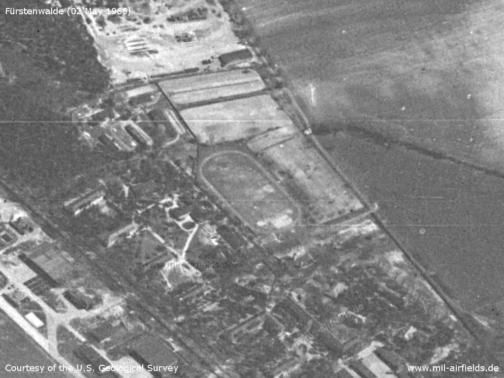
Barracks with sports field
Source: U.S. Geological Survey
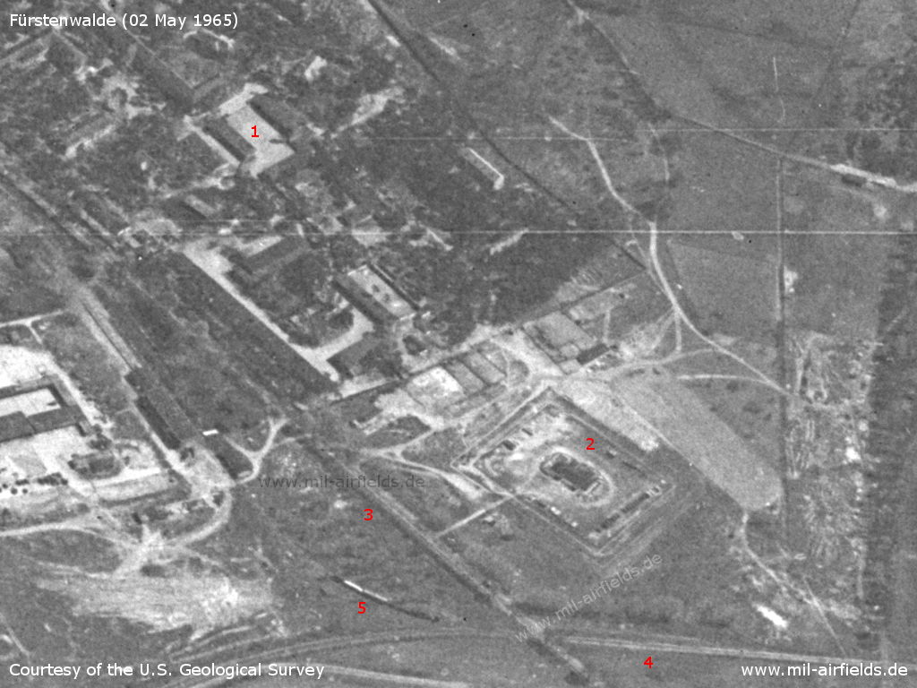
Southwestern part - 1: Barracks; 2: Object of unknown purpose; 3: Steinhöfeler Chaussee; 4: Railway Fürstenwalde-Steinhöfel-Hasenfelde; 5: A train at the railway siding
Source: U.S. Geological Survey
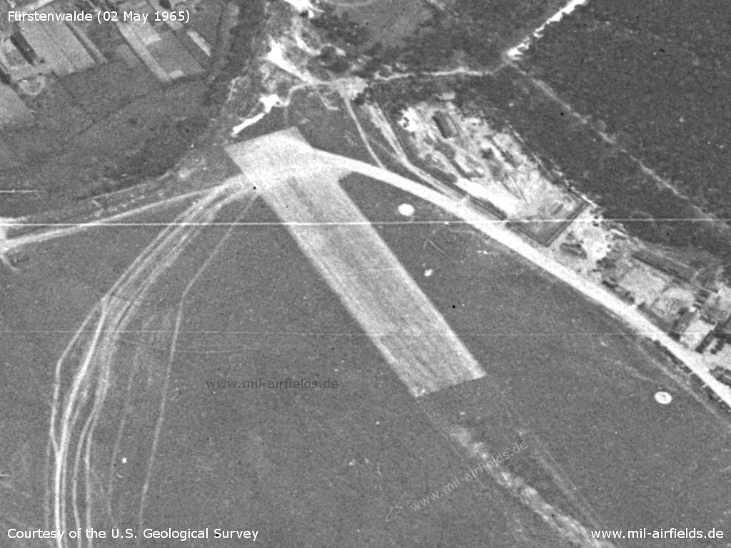
Eastern end of the runway
Source: U.S. Geological Survey
Hangars - There are numerous vehicles in front of all hangars. The airfield seems to be no longer used for flying.
Source: U.S. Geological Survey
Western part at the Buchholzer Chaussee
Source: U.S. Geological Survey
Northern part
Source: U.S. Geological Survey
In the 1970s
Situation
Fürstenwalde Airfield on a map of the US Department of Defense from 1972
Source: ONC E-2 (1972), Perry-Castañeda Library Map Collection, University of Texas at Austin
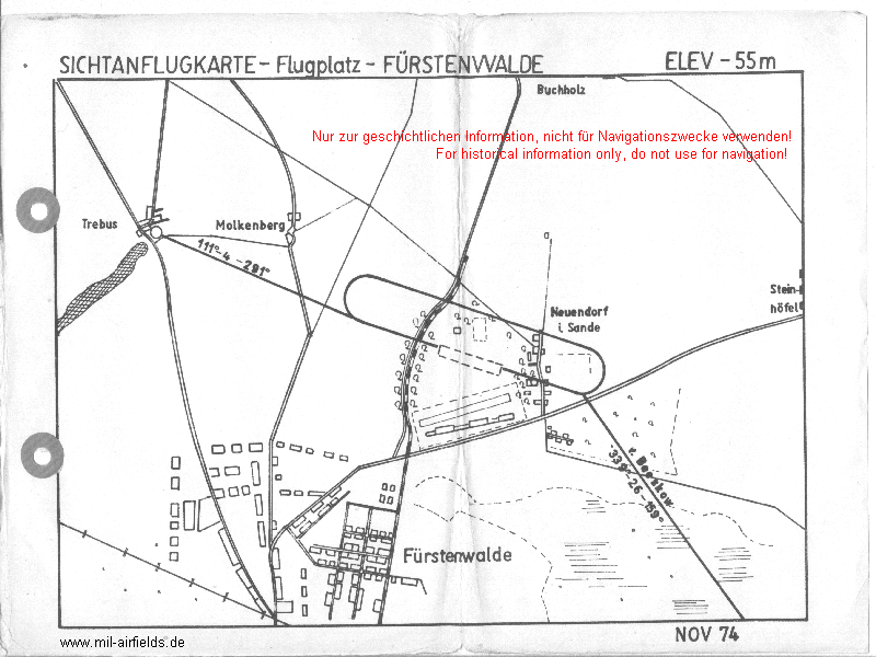
Visual approach map for agricultural aviation from 1974
Source: VFR-Luftfahrthandbuch für die Interflug Betrieb Agrarflug
Overview
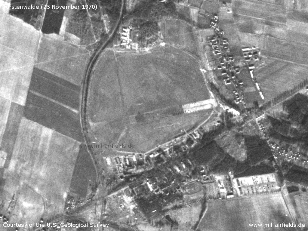
Fürstenwalde Airfield on a US satellite image from 25 November 1970
Source: U.S. Geological Survey
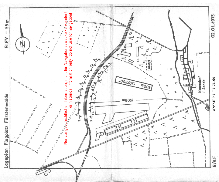
Situation map from 1975, turned into approximate north direction. - The paved runway is closed, the agricultural aviation uses a 600 m long grass runway in the north.
Source: VFR-Luftfahrthandbuch für die Interflug Betrieb Agrarflug
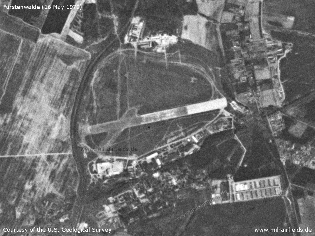
US satellite image from 16 May 1979 - The northern part used by Interflug has been extended
Source: U.S. Geological Survey
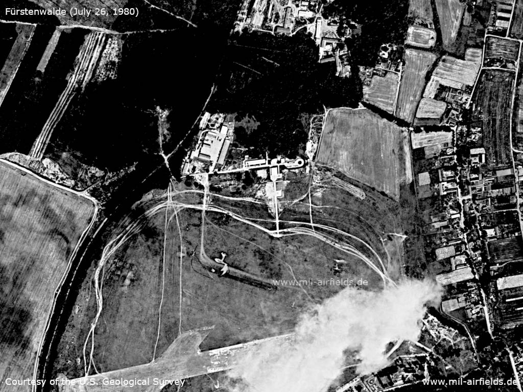
In the 1980s and early 1990s
Overview
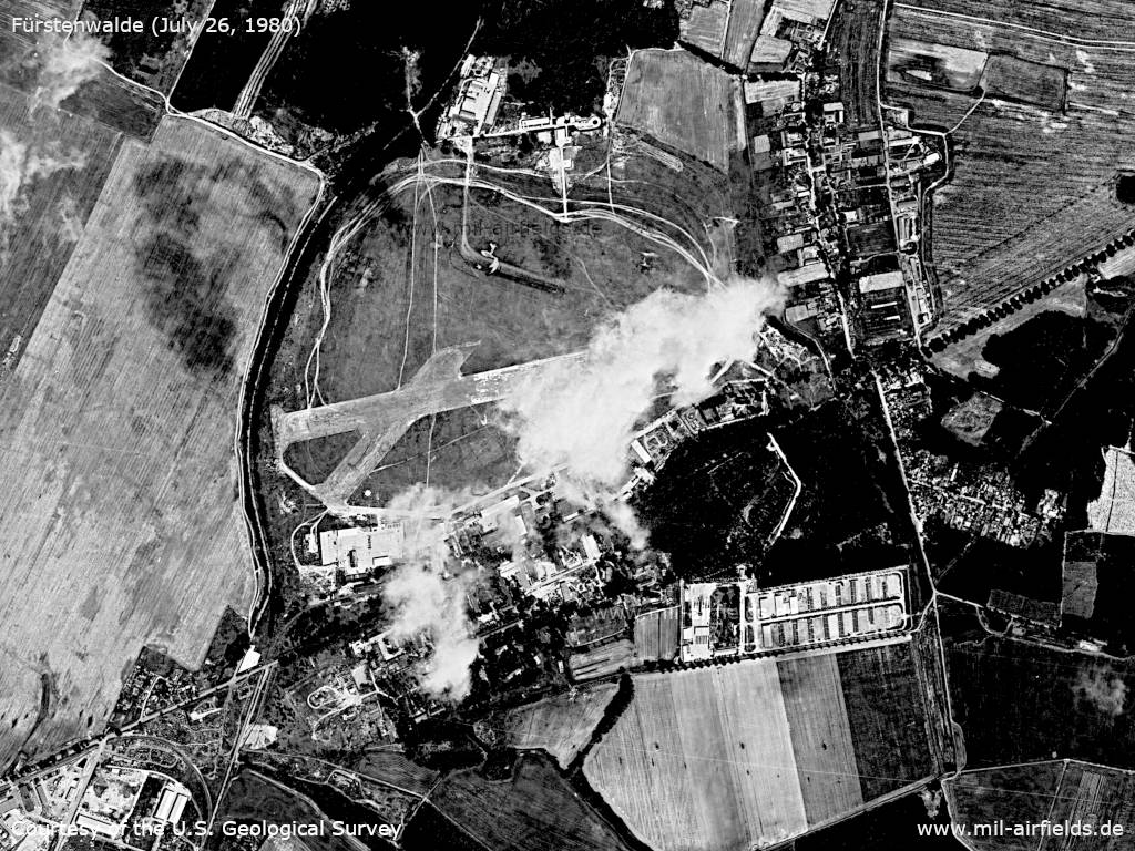
Satellite image from July 26, 1980 - The view is partially obstructed by a cloud.
Source: U.S. Geological Survey
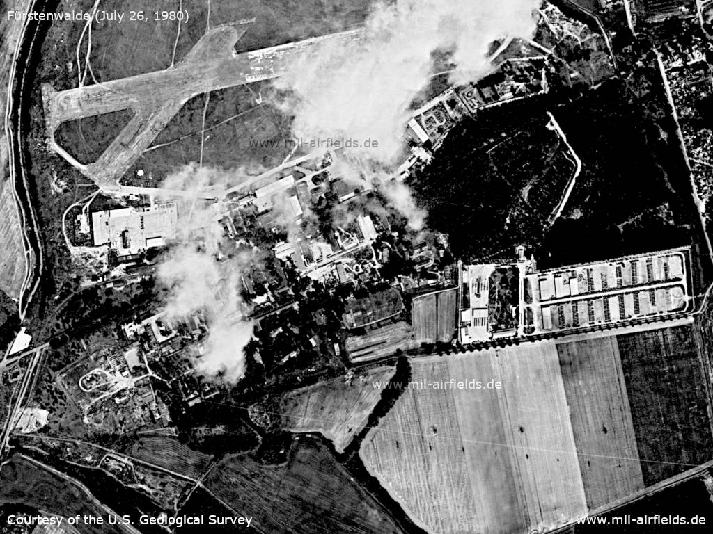
Enlargement: Northern part
Source: U.S. Geological Survey
Enlargement: Southern part
Source: U.S. Geological Survey
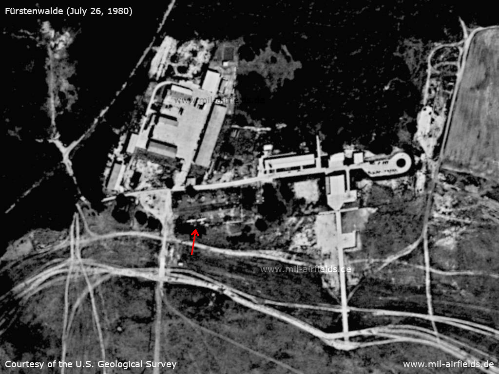
Enlargement: Agricultural aviation base in the north - Red arrow: 2 agricultural planes
Source: U.S. Geological Survey
Runways
Data for the year 1990:
- 08/26: 1200 m Bit closed / unusable
- 12/30: 800 m Grass
Connections between visual approach and departure routes and local flying routes
Connecting routes between the visual approach and departure routes of the airfields and the Local Flying Routes (as of March 1st, 1982): Shortes flying route from the airfield to the local flying route No. 31 (leg Prötzel - Autobahn intersection Fürstenwalde).
Explanation: The "Local Flying routes" were a network of VFR routes in the former East Germany. The routes were numbered and the legs were defined as straight lines between geographic points.
In the 1990s
Overview
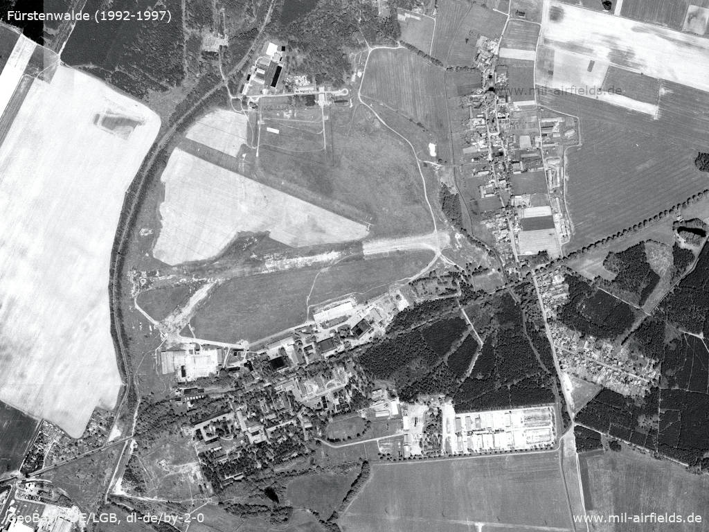
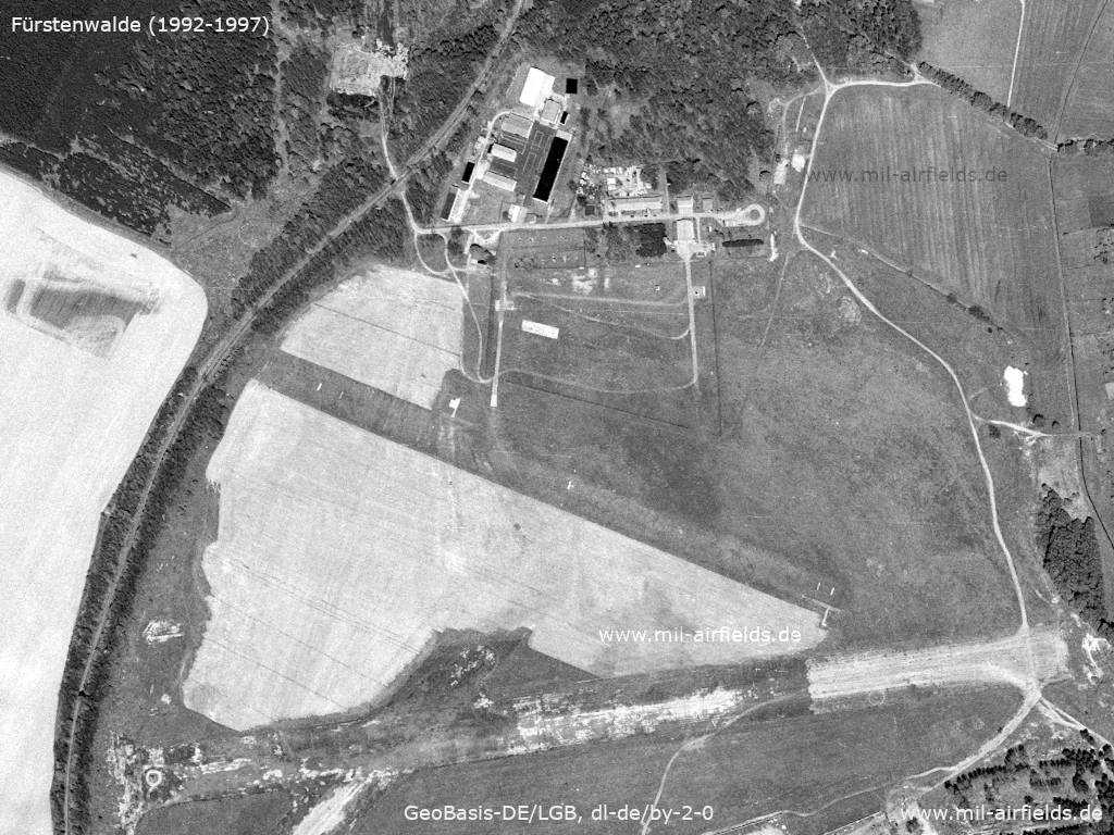
Aerial image from between 1992 and 1997
Source: Geoportal Brandenburg, Datenlizenz Deutschland - Namensnennung - Version 2.0
Enlargement: Northern part - General aviation airfield
Source: Geoportal Brandenburg, Datenlizenz Deutschland - Namensnennung - Version 2.0
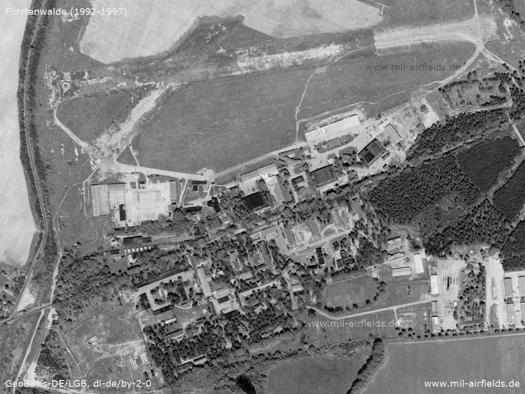
Enlargement: Southern part - Decayed runway and former Russian barracks
Source: Geoportal Brandenburg, Datenlizenz Deutschland - Namensnennung - Version 2.0
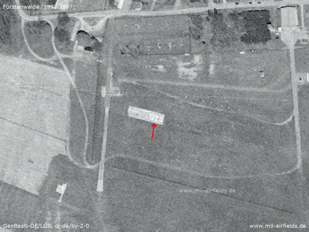
In the northern part the radio frequency of the airfield 122.5 MHz on the ground is shown
Source: Geoportal Brandenburg, Datenlizenz Deutschland - Namensnennung - Version 2.0
Today
Use
Closed, the area is used for a solar power plant.
Overview
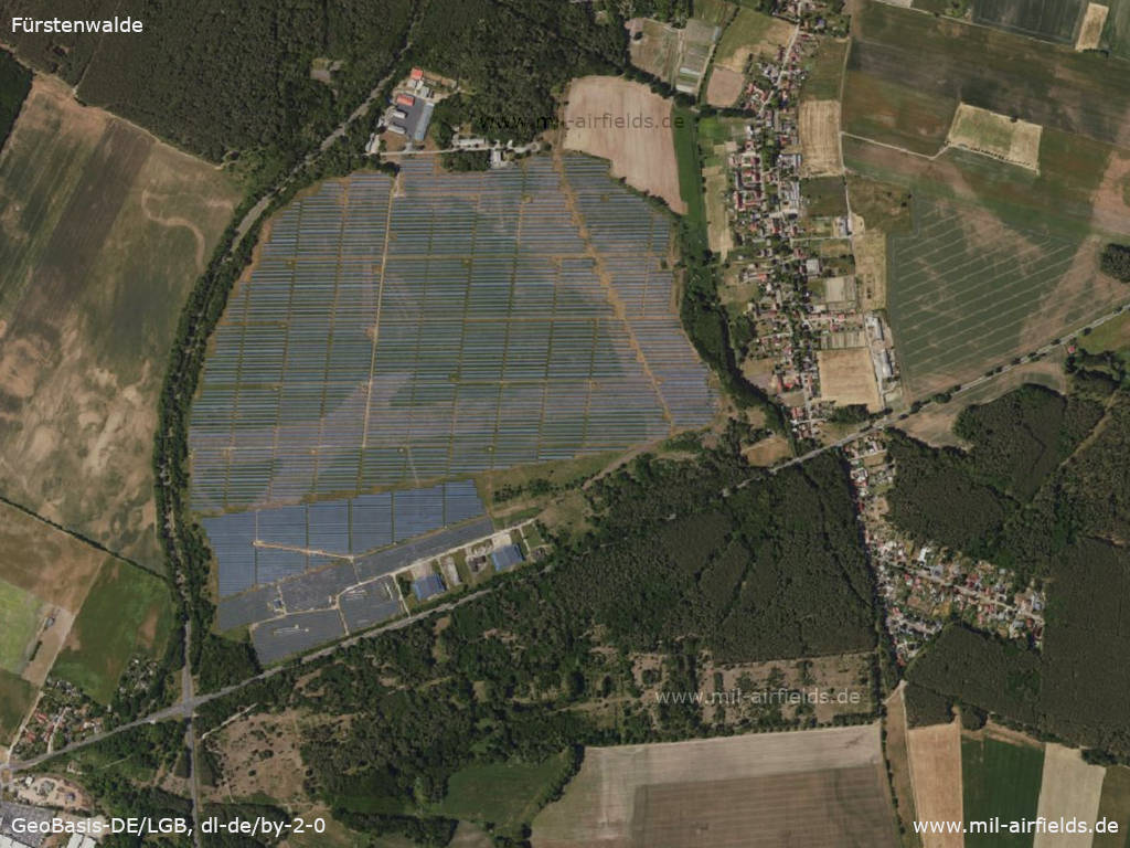
Aerial picture of the solar park, approx. 2022
Source: Geoportal Brandenburg, Datenlizenz Deutschland - Namensnennung - Version 2.0
Links
- http://lib.byu.edu/collections/german-maps/ - German Maps (Topographische Karte 1:25,000)
Bibliography
- Freundt, Lutz: "Sowjetische Fliegerkräfte in Deutschland 1945-1994, Band 1" Freundt Eigenverlag, Diepholz 1998 - Short description, aerial picture from 1953
Airfields in the vicinity
Categories
Military Airfields GermanyAgricultural Airfields in former East GermanyMilitary Airfields in former East GermanyAirfields of the Soviet Forces in GermanyRecommended
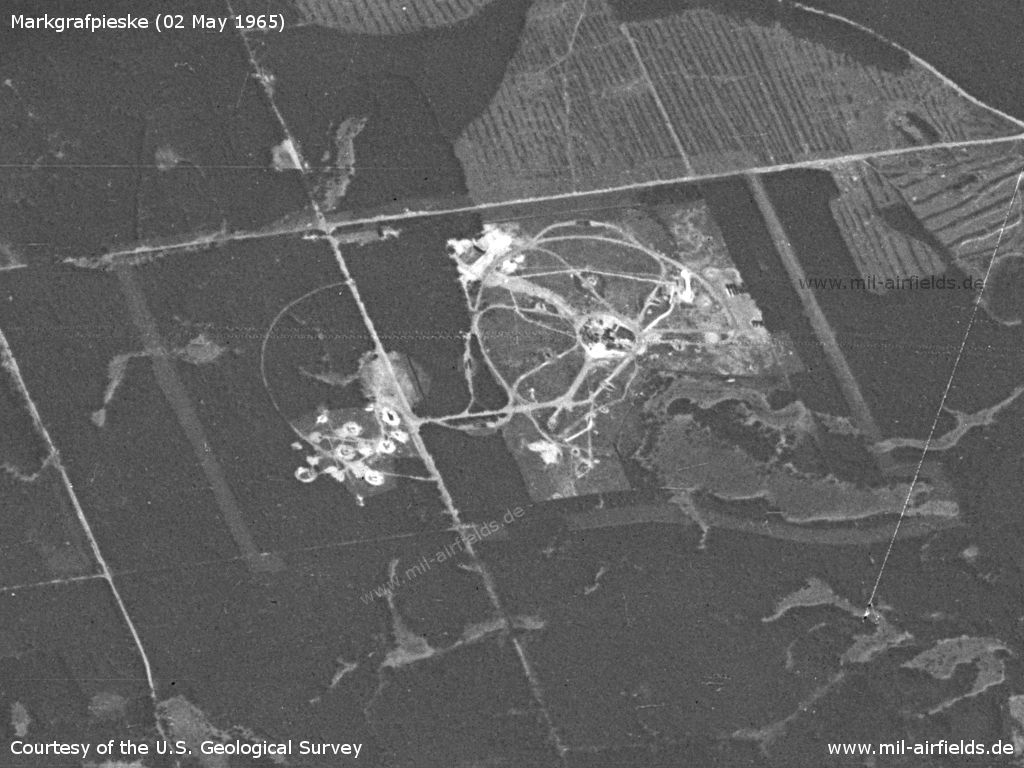
Image credits are shown on the respective target page, click on the preview to open it.
 Follow mil-airfields on Facebook