For historical information only, do not use for navigation or aviation purposes!
| Coordinates | N494155 E0115625 (WGS84) Google Maps |
| Federal state | Bayern (Bavaria) |
| Location indicator | EDIC (-1995), ETIC (1995-) |
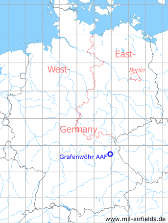
Germany during the Cold War Map
The history of the Cold War airfields: Grafenwöhr
During World War II
Use
Airfield.
During the Cold War
Use
US Army airfield.
Situation
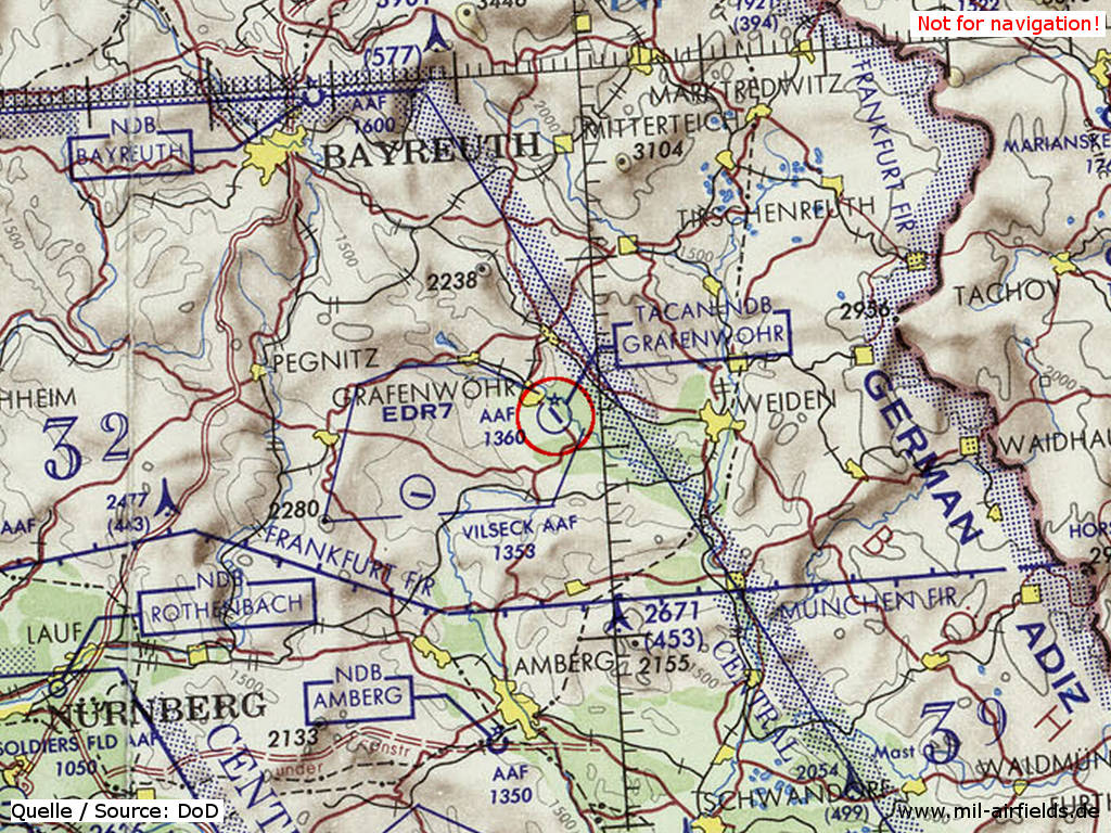
Grafenwöhr Army Air Field (AAF) on a map of the US Department of Defense from 1972
Source: ONC E-2 (1972), Perry-Castañeda Library Map Collection, University of Texas at Austin
Overview
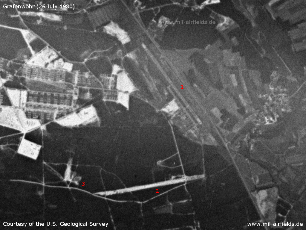
Grafenwöhr Airfield Field on a US satellite image from 26 July 1980 - 1: airfield; 2: sod strip; 3: FARP
Source: U.S. Geological Survey
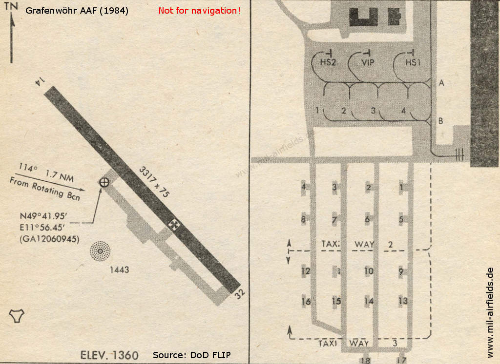
Map from 1984
Source: US DoD
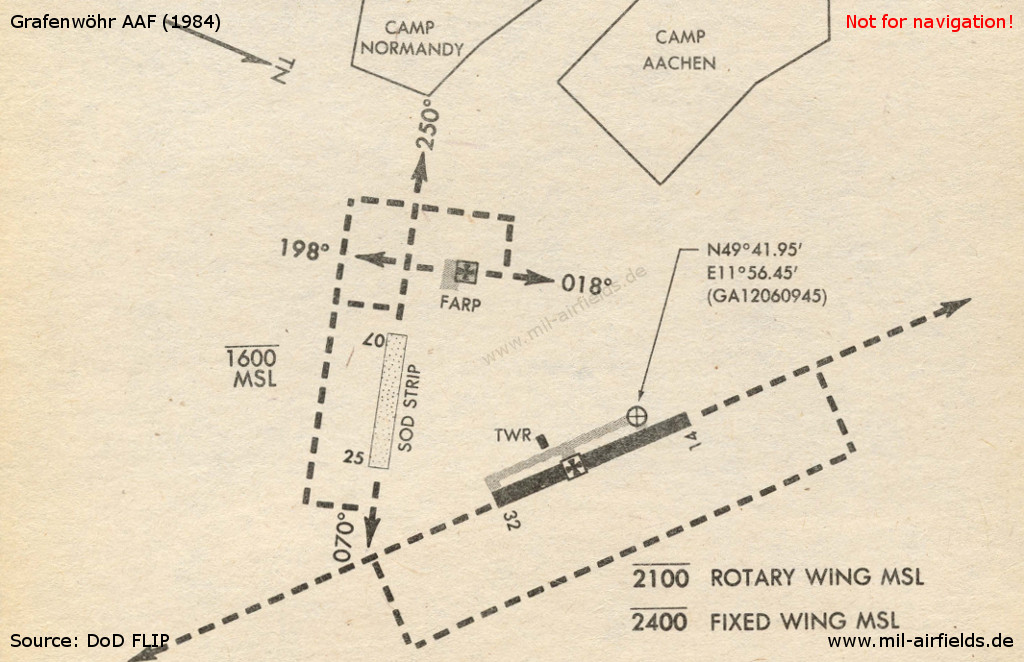
Sod runway and FARP (Forward Arming and Refueling Point)
Source: US DoD
Runways
Data for the year 1990:
- 14/32: 1020 m x 22 m Asphalt
Radio beacons
Data for the year 1990:
- NDB: 405 "GRW", at field
- TACAN: CH55 "GRF", at field
Radar
ASR/PAR (1990)
Units
7th ATC (7th USAR) 3 UH-1H (1990)
Today
Overview
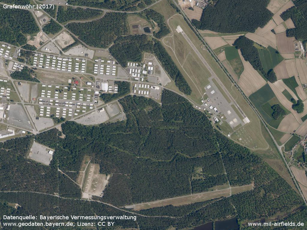
Aerial image (2017) - Airfield (top right), sod strip (bottom) and FARP (bottom left)
Source: Datenquelle: Bayerische Vermessungsverwaltung www.geodaten.bayern.de, License: Creative Commons Namensnennung 3.0 Deutschland (CC BY 3.0 DE)
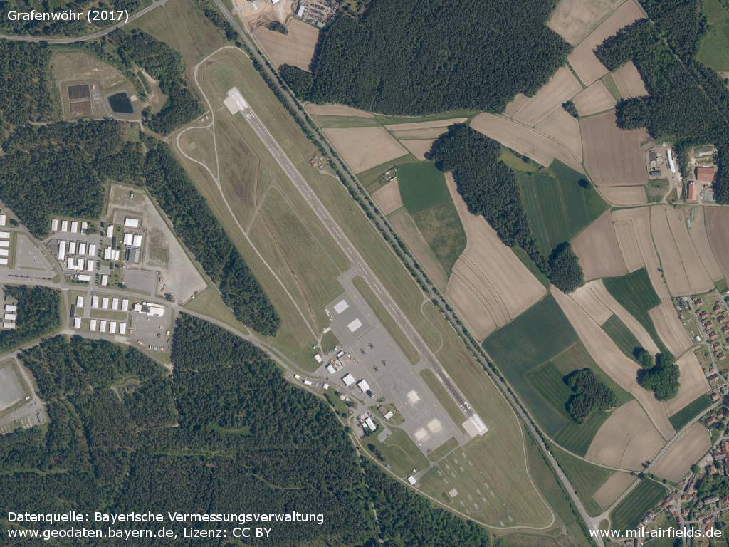
Airfield
Source: Datenquelle: Bayerische Vermessungsverwaltung www.geodaten.bayern.de, License: Creative Commons Namensnennung 3.0 Deutschland (CC BY 3.0 DE)
Sources
- https://www.usgs.gov/ - USGS U.S. Geological Survey
- https://geoportal.bayern.de/ - Geoportal Bayern
Airfields in the vicinity
Categories
Military Airfields GermanyMilitary Airfields in former West GermanyUS Army Airfields and Heliports in GermanyRecommended
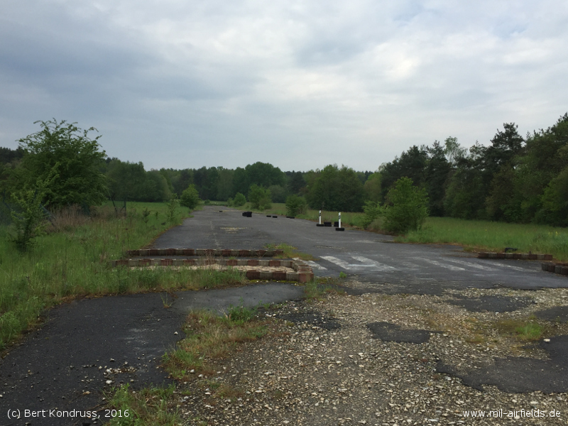
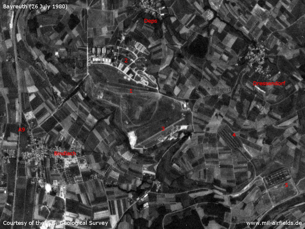
Image credits are shown on the respective target page, click on the preview to open it.
 Follow mil-airfields on Facebook