For historical information only, do not use for navigation or aviation purposes!
| Coordinates | N505930 E0102848 (WGS84) Google Maps |
| Former East Germany (GDR) | District of Erfurt |
| Federal state | Thüringen (Thuringia) |
| Location indicator | EDGE |
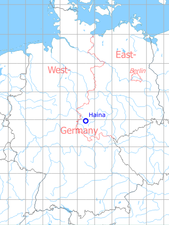
Germany during the Cold War Map
The history of the Cold War airfields: Haina
During World War II
Use
West-northwest of the later Haina airfield was the Wenigenlupnitz Luftwaffe airfield.
During the Cold War
General
Haina was a Soviet auxiliary airfield with paved runway, tarmarcs and two radio beacons for approaches from the east. It was only 19 km away from the inner German border and below the southern allied air corridor to and from Berlin, which probably restricted the possibilities of use. Today it is an airfield for general aviation.
In the 1970s
Situation
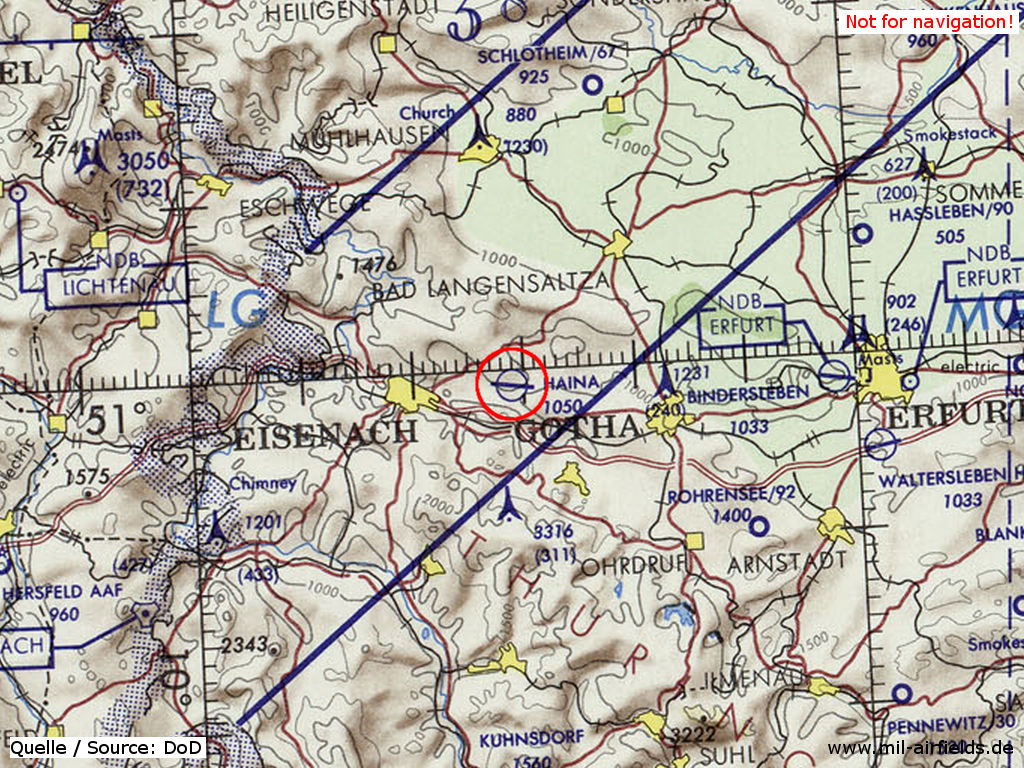
Haina Airfield on a map of the US Department of Defense from 1972 - The difficult location is recognizable by the proximity to the demarcation line to the Federal Republic (on the left) as well as by the southern allied corridor (blue lines).
Source: ONC E-2 (1972), Perry-Castañeda Library Map Collection, University of Texas at Austin
Runways
- 10/28: 2300 m Concrete
Radio beacons
- LOM 28: 650 "UV"
- LMM 28: 315 "U"
Radio communication
The call sign was LIDER.
In the 1980s and early 1990s
Overview
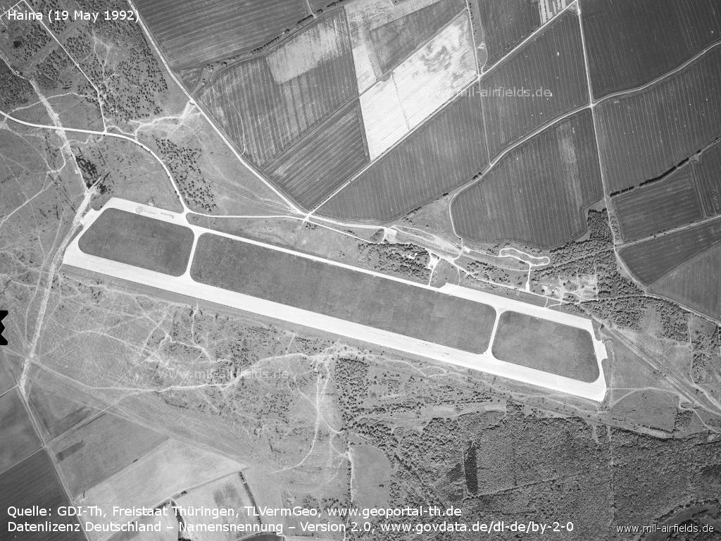
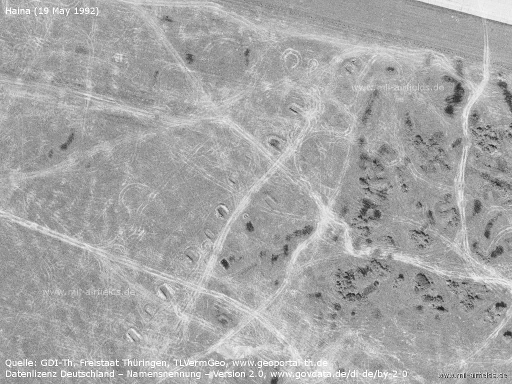
Aerial image from 19 May 1992
Source: GDI-Th, Freistaat Thüringen, TLVermGeo - www.geoportal-th.de, Data licence Germany – attribution – version 2.0, www.govdata.de/dl-de/by-2-0
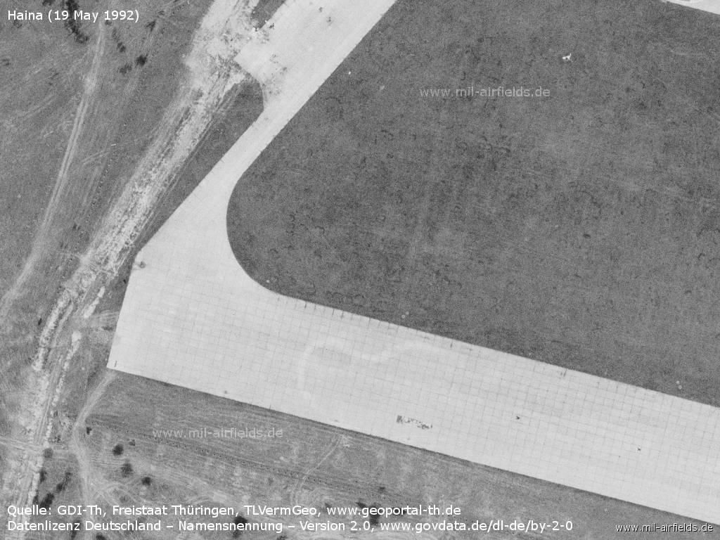
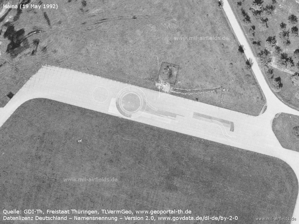
Runway in the west
Source: GDI-Th, Freistaat Thüringen, TLVermGeo - www.geoportal-th.de, Datenlizenz Deutschland – Namensnennung – Version 2.0, www.govdata.de/dl-de/by-2-0
Flightline in the west - Here are markings for car driving exercises applied.
Source: GDI-Th, Freistaat Thüringen, TLVermGeo - www.geoportal-th.de, Datenlizenz Deutschland – Namensnennung – Version 2.0, www.govdata.de/dl-de/by-2-0
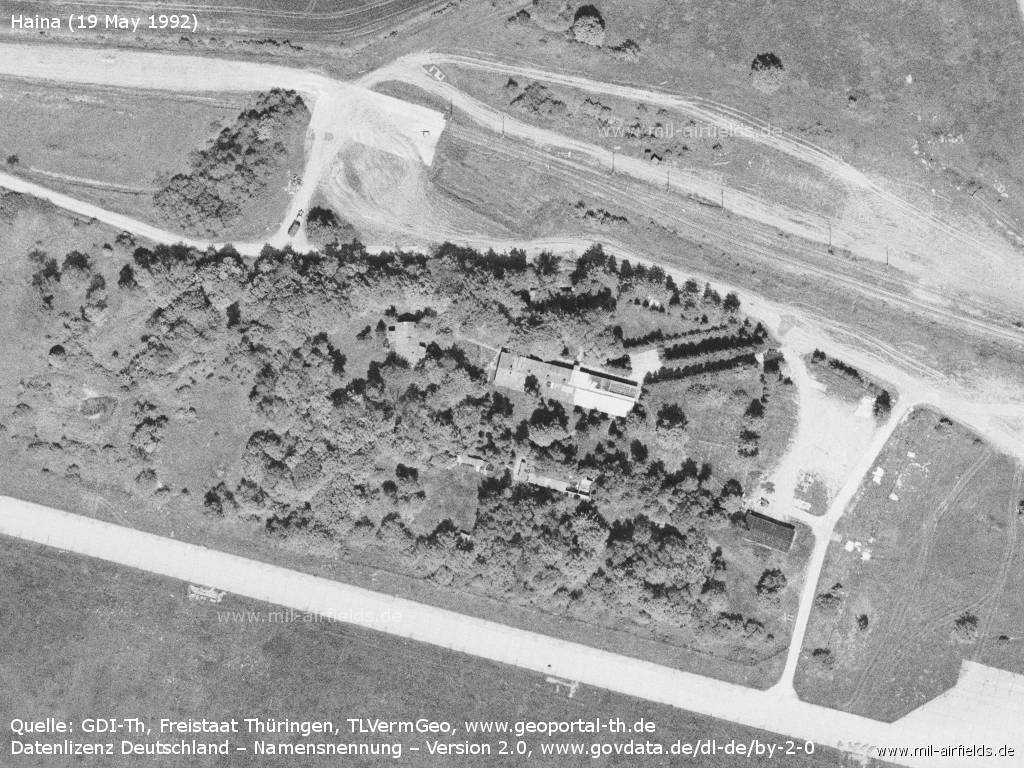
Buildings - In the upper half of the picture the tracks of the railway siding can be seen.
Source: GDI-Th, Freistaat Thüringen, TLVermGeo - www.geoportal-th.de, Datenlizenz Deutschland – Namensnennung – Version 2.0, www.govdata.de/dl-de/by-2-0
Installations
Source: GDI-Th, Freistaat Thüringen, TLVermGeo - www.geoportal-th.de, Datenlizenz Deutschland – Namensnennung – Version 2.0, www.govdata.de/dl-de/by-2-0
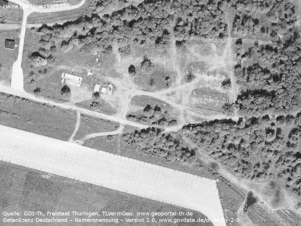
Installations
Source: GDI-Th, Freistaat Thüringen, TLVermGeo - www.geoportal-th.de, Datenlizenz Deutschland – Namensnennung – Version 2.0, www.govdata.de/dl-de/by-2-0
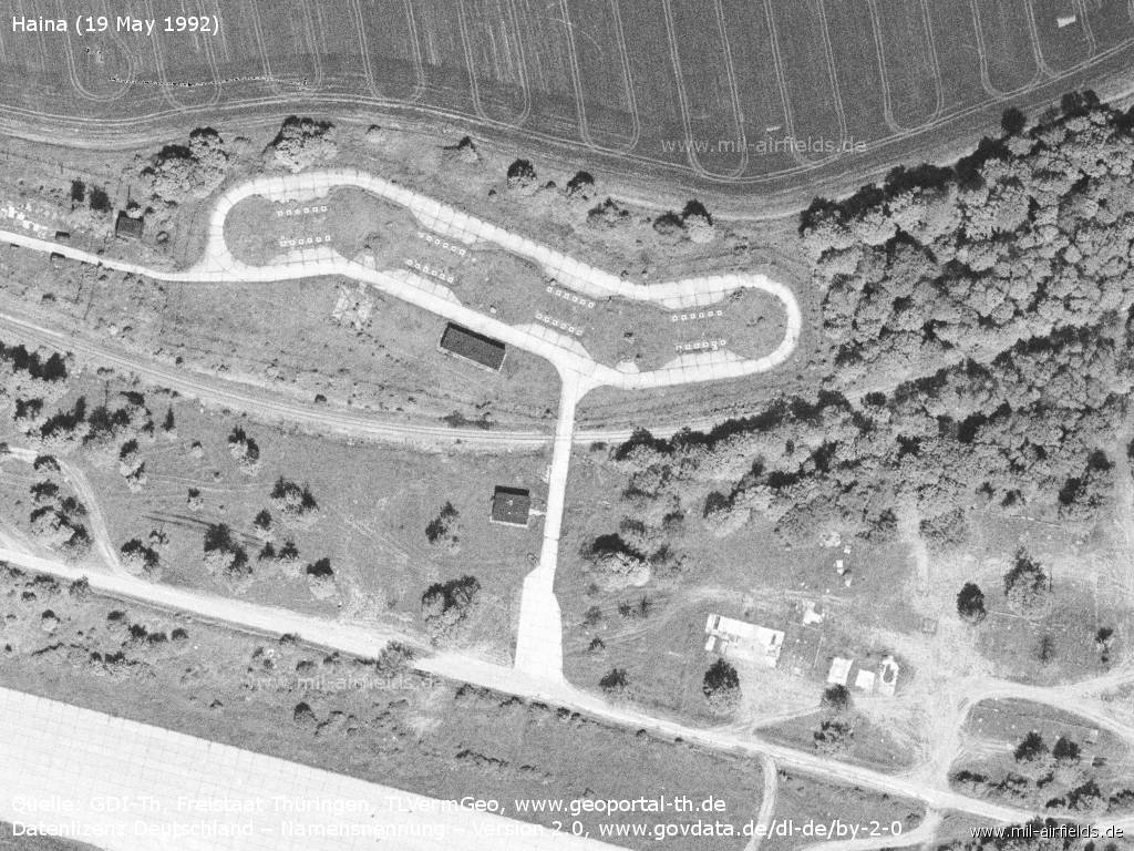
Vehicle revetments south of the runway
Source: GDI-Th, Freistaat Thüringen, TLVermGeo - www.geoportal-th.de, Datenlizenz Deutschland – Namensnennung – Version 2.0, www.govdata.de/dl-de/by-2-0
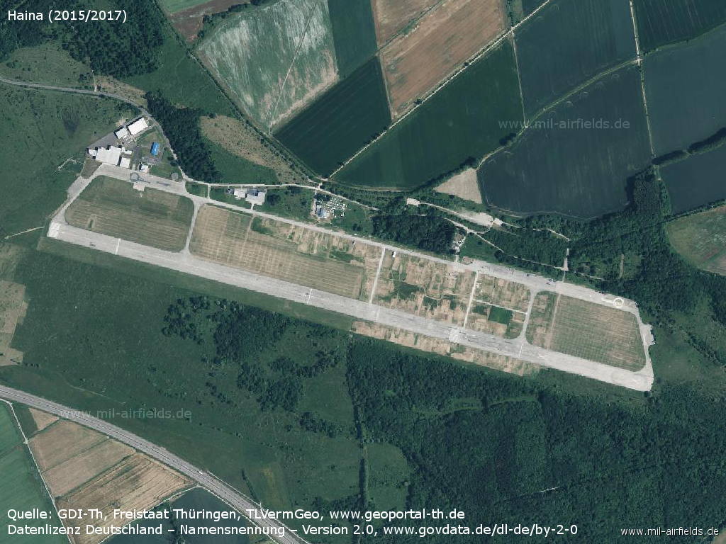
Today
Use
General aviation.
Overview
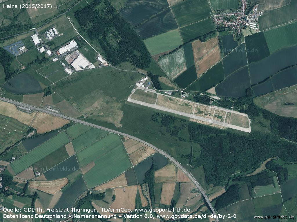
Aerial picture 2015/2017 with the former Wenigenlupnitz airfield (top left) and Eisenach airfield. - The picture also shows the new course of the Autobahn A4, which ran about 3 km more to the south through the Hörsel mountains until 2010.
Source: GDI-Th, Freistaat Thüringen, TLVermGeo - www.geoportal-th.de, Datenlizenz Deutschland – Namensnennung – Version 2.0, www.govdata.de/dl-de/by-2-0
Source: GDI-Th, Freistaat Thüringen, TLVermGeo - www.geoportal-th.de, Datenlizenz Deutschland – Namensnennung – Version 2.0, www.govdata.de/dl-de/by-2-0
Links
- https://www.flugplatz-eisenach.de/de/ - Eisenach Airfield
Sources
- https://www.geoportal-th.de/ - Geoportal Thüringen
Airfields in the vicinity
- 111°/23km Seebergen: Helipad 3148 (HSLP / HLP 3148)
- 123°/30km Röhrensee: Airfield (Ohrdruf)
Categories
Military Airfields GermanyMilitary Airfields in former East GermanyAirfields of the Soviet Forces in GermanyRecommended
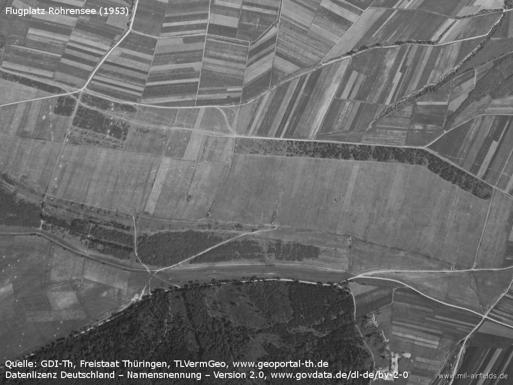
Image credits are shown on the respective target page, click on the preview to open it.
 Follow mil-airfields on Facebook