For historical information only, do not use for navigation or aviation purposes!
| Coordinates | N502710 E0130003 ca. (WGS84) Google Maps |
| Former East Germany (GDR) | District of Karl-Marx-Stadt |
| Federal state | Sachsen (Saxony) |
Germany during the Cold War
The history of the Cold War airfields: Hammerunterwiesenthal
General
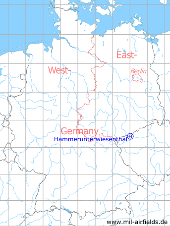
Hammerunterwiesenthal is a village in todays federal state of Sachsen (Saxony), directly on the border to the Czech Republic. During the Cold War, this area belonged to East Germany. For the 1980s, a helipad was listed for Sub Depot 1 of Signals Depot 2 (TL-1/NGL-2) of the East German National People's Army (NVA). The exact location of the field cannot be determined from the available information. Probably there were no facilities. With the German reunification and the end of the NVA, the helicopter landing site was closed.
Location of airfield
1 km northwest of Hammerunterwiesenthal, the exact location cannot be determined.
During the Cold War
Use
Helipad 1017 for Sub Depot 1 of Signals Depot 2 (TL-1/NGL-2) of former East German Ministry of Defense (MfNV).
Runways, taxiways, aprons
Dimensions: 200 m x 200 m,
Main takeoff and landing direction: 90°,
Surface: Meadow,
Capacity: 3 helicopters.
Main takeoff and landing direction: 90°,
Surface: Meadow,
Capacity: 3 helicopters.
Telephone
Fe-Feldvermittlung 800 m auf Fe-Vermittlung OB 62-10, auf dieser HDAP und S-1 (Fs vorhanden).
Airspace and procedures
Usable at day and night during good weather conditions.
Alert time: 90 minutes.
Alert time: 90 minutes.
Obstacles
None.
Today
Use
Closed.
Airfields in the vicinity
- 192°/28km Karlovy Vary: Airport (Letiště Karlovy Vary)
- 112°/39km Žatec: Macerka Airfield (Letiště Žatec Macerka, Ceradice)
- 185°/41km Přílezy: Airfield (Letiště Přílezy, Toužim)
- 102°/43km Žatec: Air Base (Letiště Žatec, Zatec, Postoloprty)
- 051°/46km Cämmerswalde: Helipad 1018 (HSLP / HLP 1018)
- 271°/48km Neustadt (Vogtland): Helipad 3163 (HSLP / HLP 3163)
 Follow mil-airfields on Facebook