Husum: Schwesing Air Base
For historical information only, do not use for navigation or aviation purposes!
| Coordinates | N543058 E0090842 (WGS84) Google Maps |
| Elevation | 93 ft |
| Federal state | Schleswig-Holstein |
| Location indicator | EDNH (196x-1993), EDXJ (200x-) |
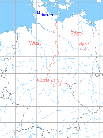
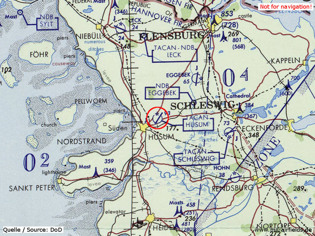
Germany during the Cold War Map
The history of the Cold War airfields: Husum
General
The history of Husum-Schwesing airfield began in the late 1930s with the construction of a decoy airfield.
At the end of the 1950s, a new German Air Force base was put to service at the same location. It was used until the early 1990s. Main unit was the multiple-renamed JaboG 35 / LeKG 41 / JaboG 41 (Fighter-Bomber Wing 35, Light Fighter Wing 41 / Fighter-Bomber Wing 41), with Alpha Jets as last equipment.
Today the northeastern part of the former air base is still used by the Air Force, while the southwestern part houses the Husum airport.
During the Cold War
In the 1960s
Situation
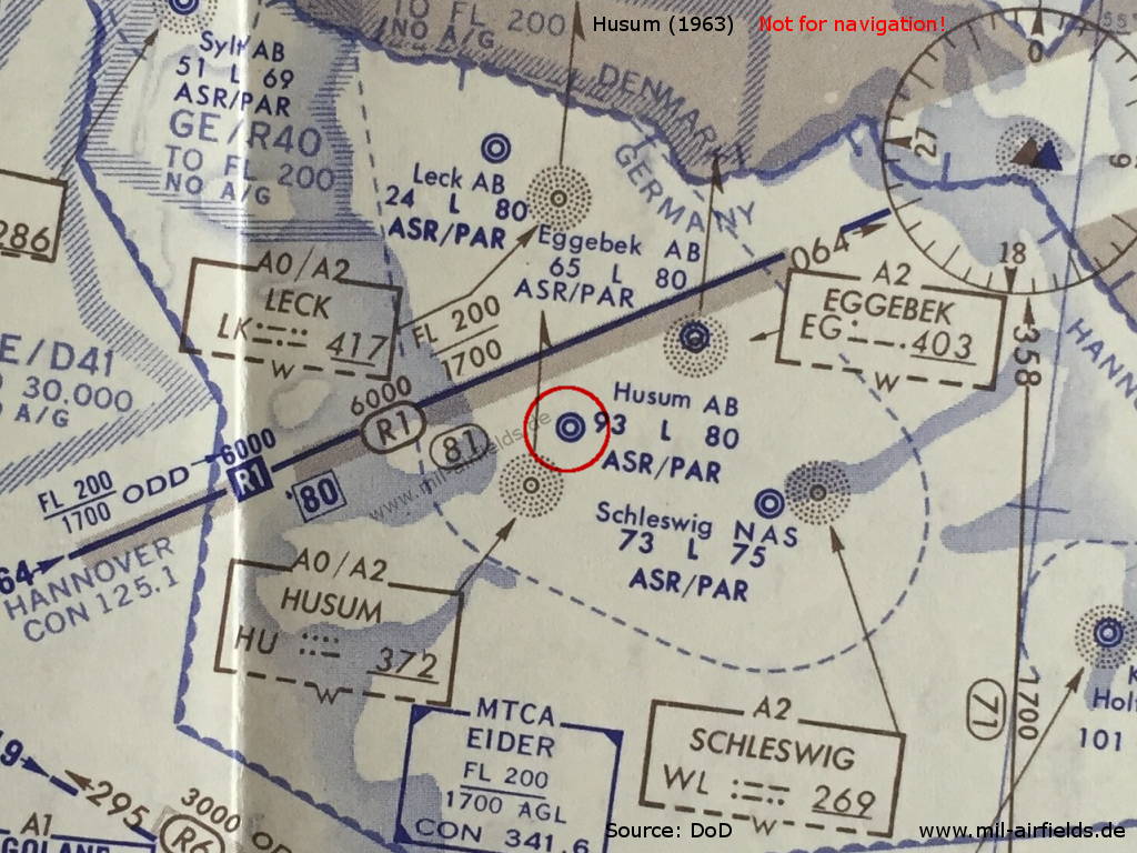
Map with airspace around Husum Air Base from 1963
Overview
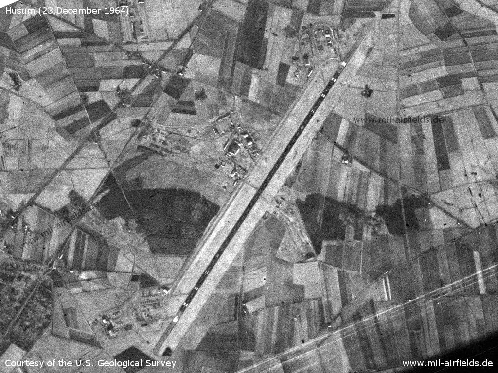
Husum Schwesing Air Base on a US satellite image from 23 December 1964
Source: U.S. Geological Survey
Radio beacons
- NDB: 372 "HU", 037°/3.1 NM to field
Radar
ASR, PAR
Radio communication
- Eider Control 271.6, 362.3, 353.8, 341.6, 327.9, 132.0, 135.36, 119.7
- GCA 324.1, 287.1, 155.34, 385.4, 344.0, 140.58
- Tower 304.8, 257.8, 134.1, 117.9
Airspace and procedures
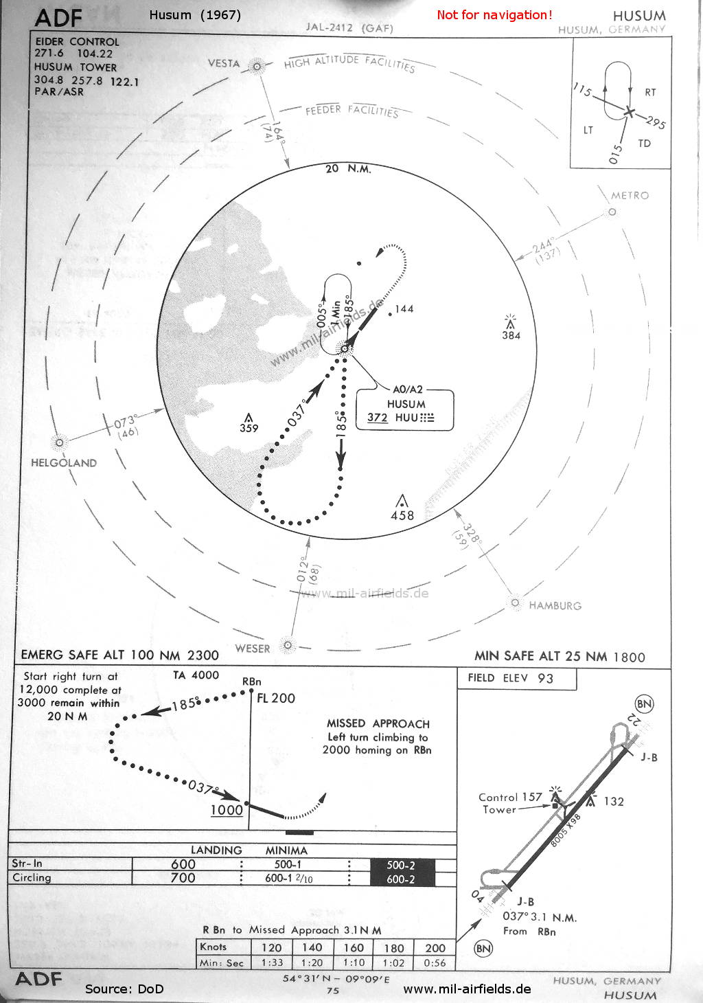
High NDB approach to Husum airfield 1967
In the 1970s
Situation
Husum Air Base on a map of the US Department of Defense from 1972 - (ONC E-2 (1972), Perry-Castañeda Library Map Collection, University of Texas at Austin /PCL MC/)
Overview
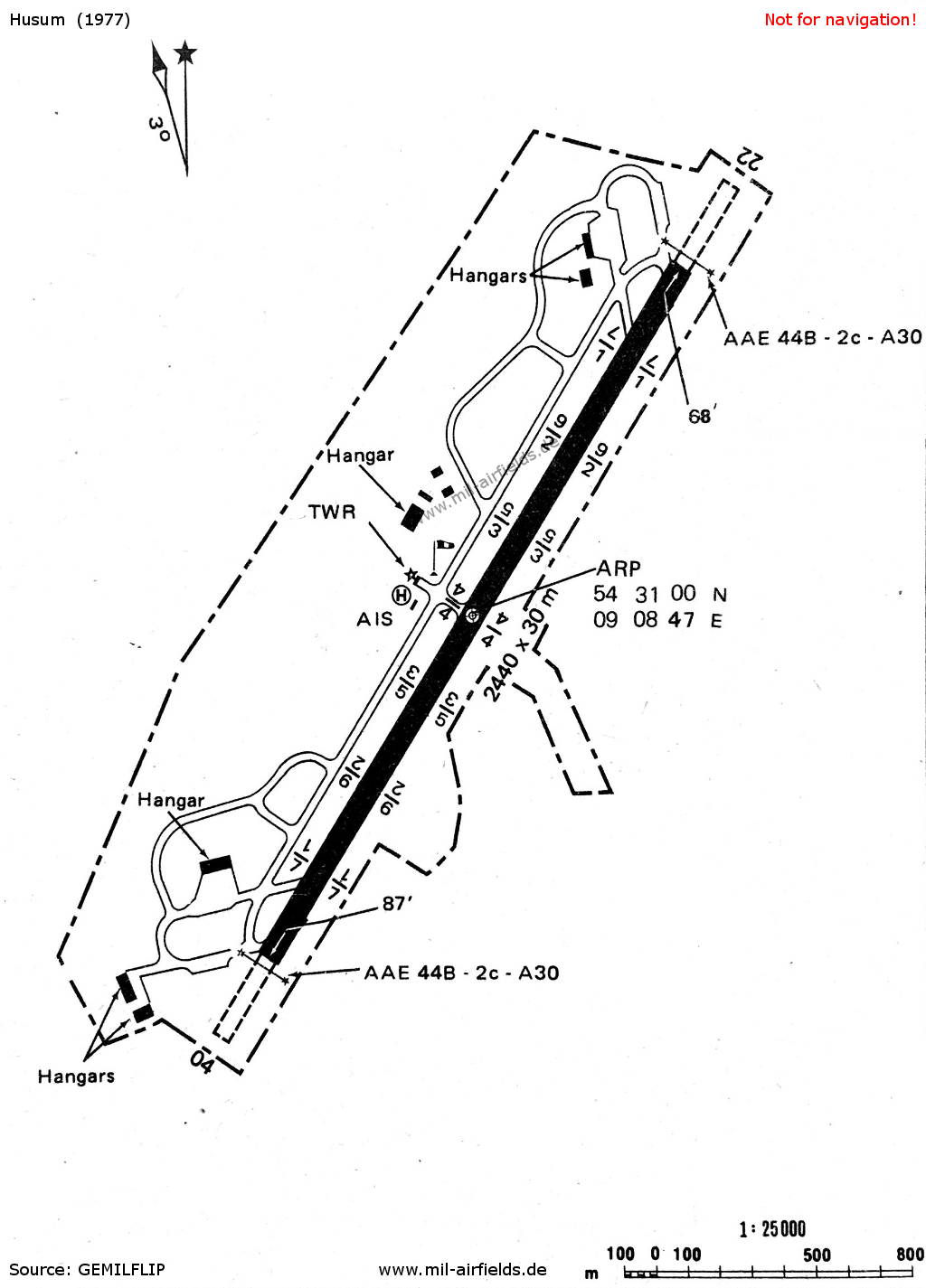
Map of Husum Air Base 1977
Radio beacons
- NDB: 372 "HUU", 036°/3.1 NM to field
- TACAN: CH 85 "HUU", at field
Radio communication
- Bremen Radar 253.6, 120.75
- GCA 246.0, 374.8, 344.0, 287.1, 234.1, 229.5
- PAR 385.4, 324.1, 129.85, 123.3
- Tower 290.3, 257.8, 122.1
- Ground 246.0
In the 1980s
Runways
- 03/21: 2440 m x 30 m Asphalt
Radio beacons
- NDB: 372 "HUU", 036°/3.1 NM to field
- TACAN: CH 85 "HUU", at field
Radio communication
- Weser Radar 120.75, 346.85
- Tower 122.1, 311.85, 257.8
- Ground 396.4
Videos
- https://www.youtube.com/watch?v=bp4TxbF_iWo - noch ein Tag auf der Flight JaBoG 41 Husum 1990
- https://www.youtube.com/watch?v=6d-JpzoUhFk - JaBoG 41 Husum
- https://www.youtube.com/watch?v=QqrSXtMugTk - JaboG41 Nachtflug
Airfields in the vicinity
- 047°/18km Eggebek: Air Base (Langstedt)
- 057°/23km Bollingstedt: Highway Strip (Notlandeplatz NLP)
- 104°/25km Schleswig: Air Base (Jagel, RAF Schleswigland)
- 107°/30km Brekendorf: Highway Strip
Categories
Military Airfields GermanyMilitary Airfields in former West GermanyGerman Air Force Air BasesRecommended
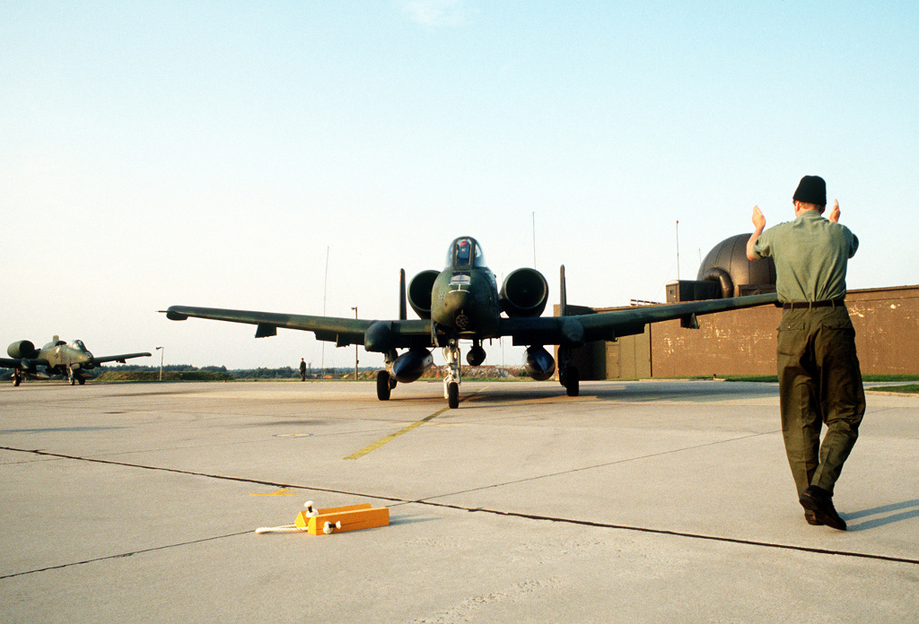
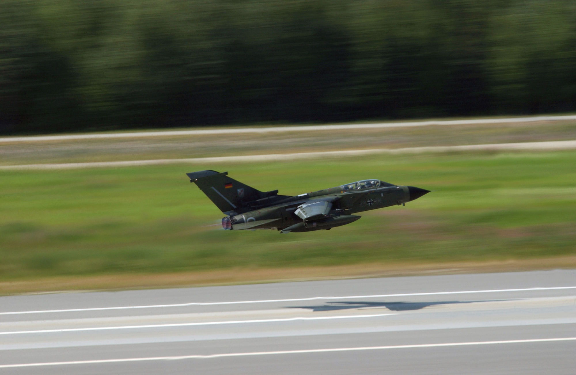
Image credits are shown on the respective target page, click on the preview to open it.
 Follow mil-airfields on Facebook