Kamenz: Airfield
For historical information only, do not use for navigation or aviation purposes!
| Coordinates | N511747 E0140739 (WGS84) Google Maps |
| Elevation | 150,8 m |
| Former East Germany (GDR) | District of Dresden |
| Federal state | Sachsen (Saxony) |
| Location indicator | ETKA (ca. 1985..1990), EDCM (2000) |
| Airfield Id | 2126 |
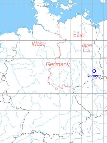
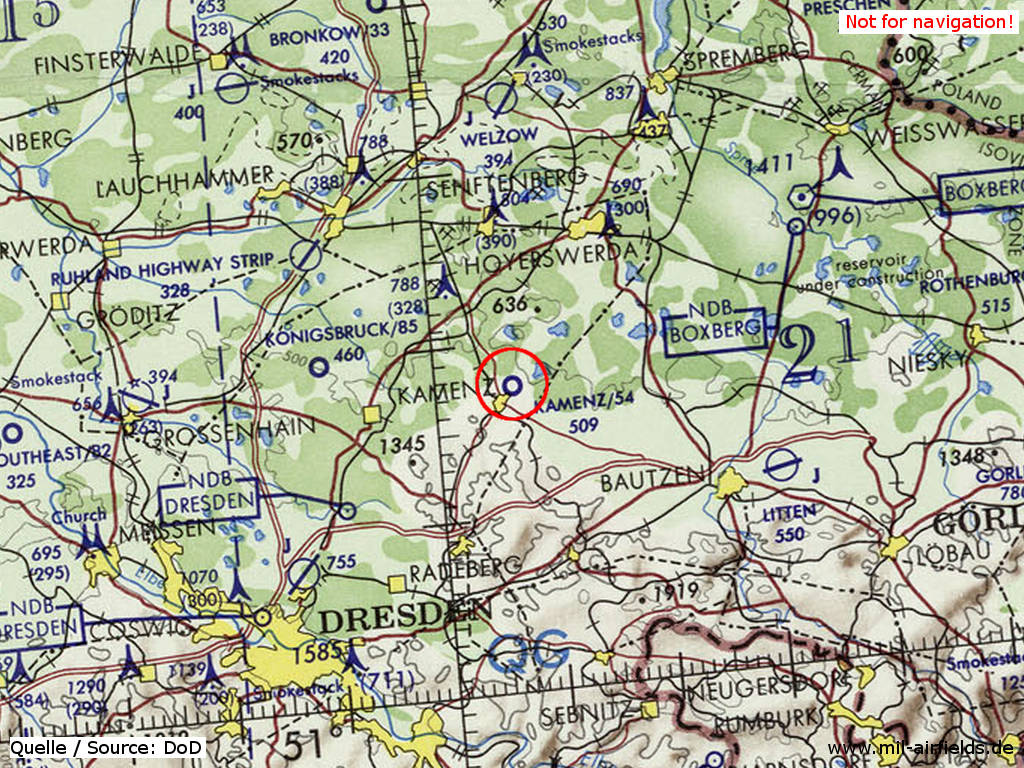
Germany during the Cold War Map
The history of the Cold War airfields: Kamenz
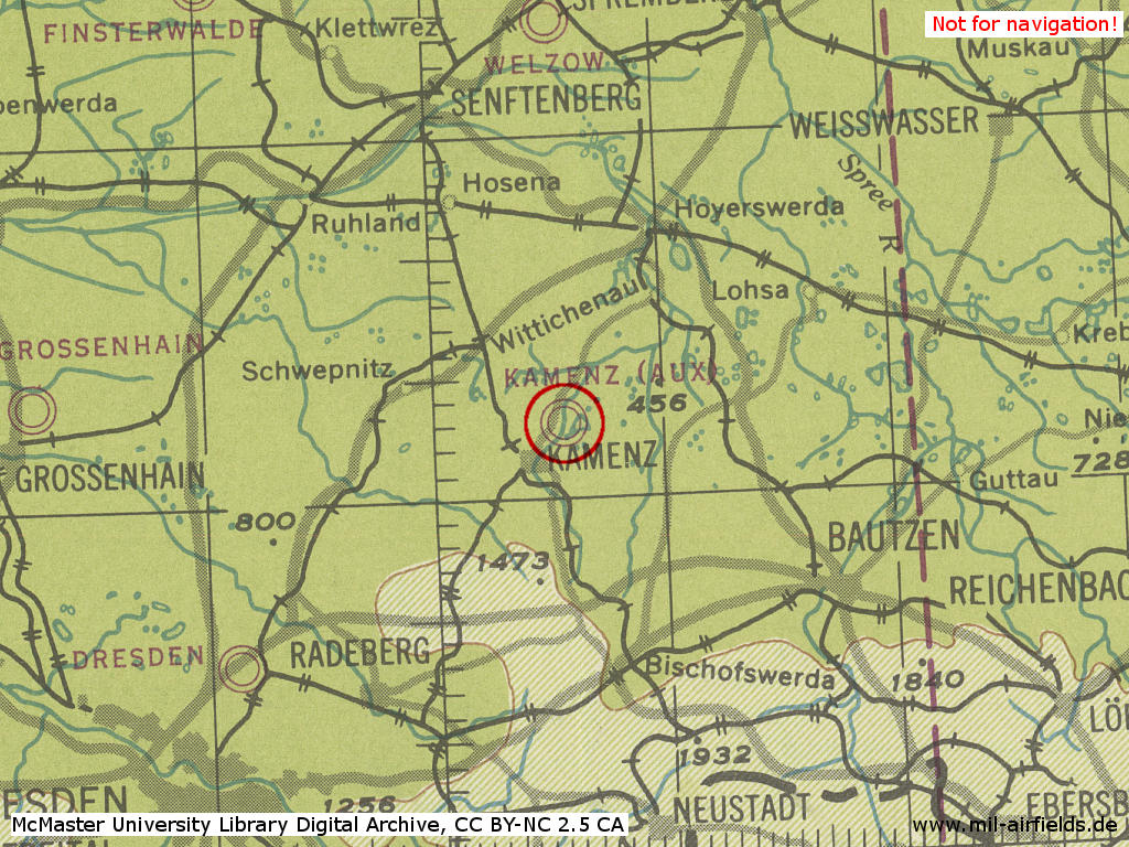
Location of airfield
3 km northeast of Kamenz city center.
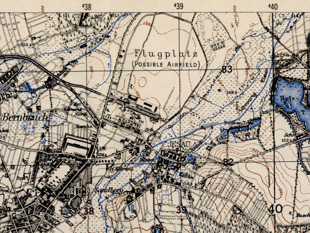
During World War II
Use
Luftwaffe Air Base.
Situation
Kamenz Airfield in World War II on a US map from 1944
Source: McMaster University Library Digital Archive, Lizenz: Creative Commons Attribution-NonCommercial 2.5 CC BY-NC 2.5 CA
Overview
Kamenz airfield on a US map from 1952
Source: AMS M841 GSGS 4414, Courtesy Harold B. Lee Library, Brigham Young University
During the Cold War
Use
Airfield of former East German Air Force. The airfield ID was 2126. Kamenz was also used by the pre-military organization Gesellschaft für Sport und Technik (GST).
In the 1960s
Overview
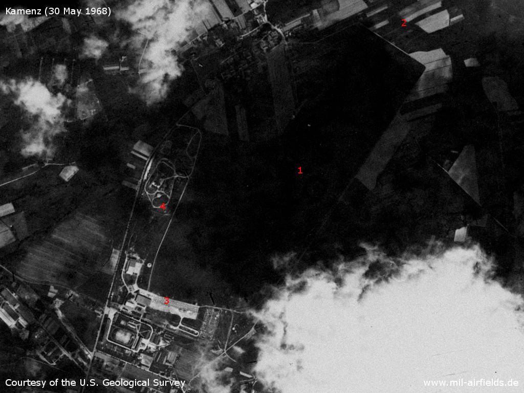
Kamenz Airfield on a US satellite image from 30 May 1968. The picture is affected by clouds. - 1: movement area; 2: at this time, no approach lane recognizable in the northeast; 3: apron; 4: surface-to-air missile (SAM) training site?
Source: U.S. Geological Survey U.S. Geological Survey
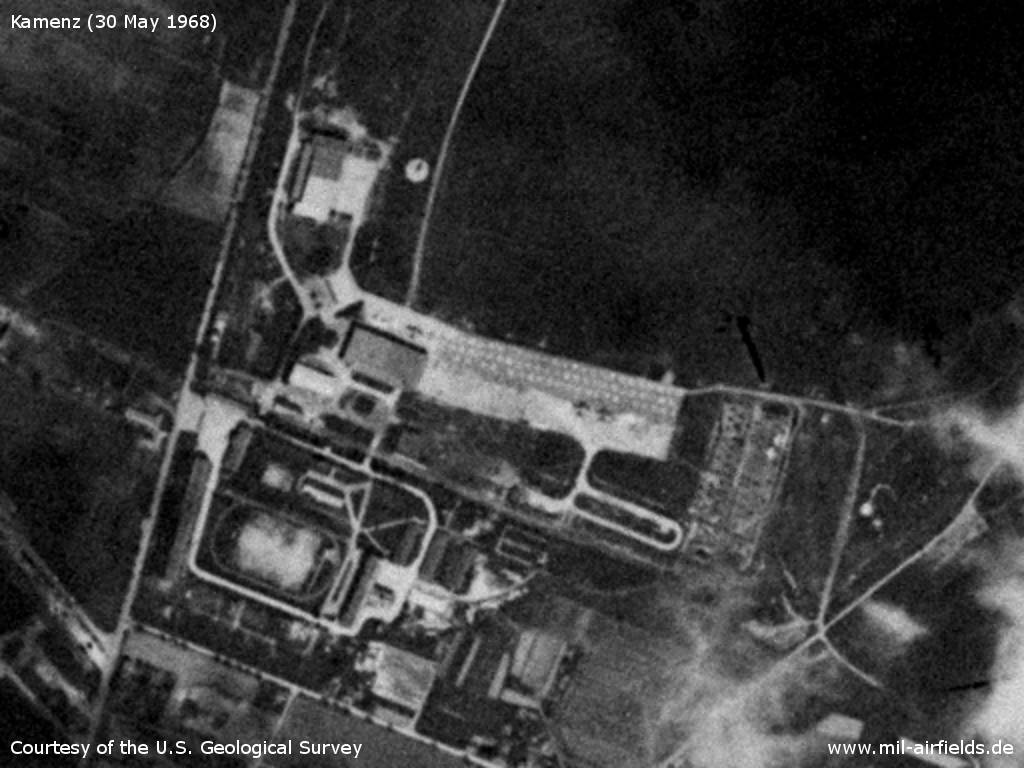
Three airplanes are recognizable on the parking ramp.
Source: U.S. Geological Survey
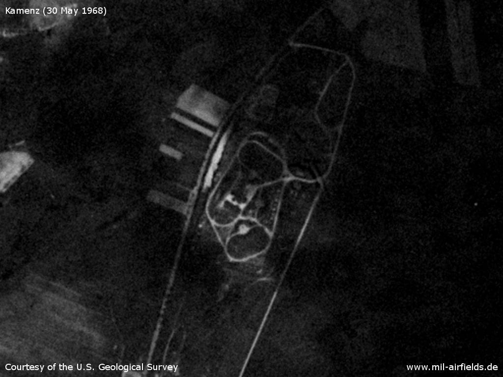
This facility looks like a half S-75 (NATO: SA-2 Guideline) SAM site - Possibly it is a training site of the Air Force Academy (Offiziershochschule der Luftkräfte/Luftverteidigung - OHS der LSK/LV "Franz Mehring".)
Source: U.S. Geological Survey
In the 1970s
Situation
Kamenz Airfield on a map of the US Department of Defense from 1972
Source: ONC E-2 (1972), Perry-Castañeda Library Map Collection, University of Texas at Austin
Overview
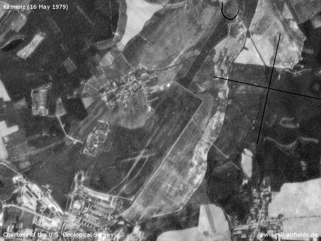
Kamenz Airfield on a US satellite image from 16 May 1979 - In the northeast the approach lane is recognizable. The concrete runway was built later.
Source: U.S. Geological Survey
In the 1980s and early 1990s
Overview
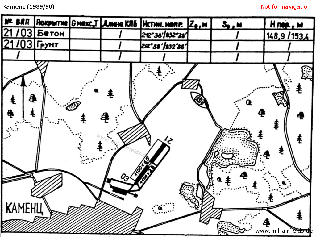
Kamenz Airfield on a map in the East German "Directory 012" (Verzeichnis 012, formerly "Top Secret") from about 1989/1990. - Hand-drawn maps were not unusual in the eastern block. The map shows the location northeast of Kamenz. The airfield has a concrete runway, a parallel grass strip and taxiways. Also this field has a railway siding. In the northeast is the locator/middle marker.
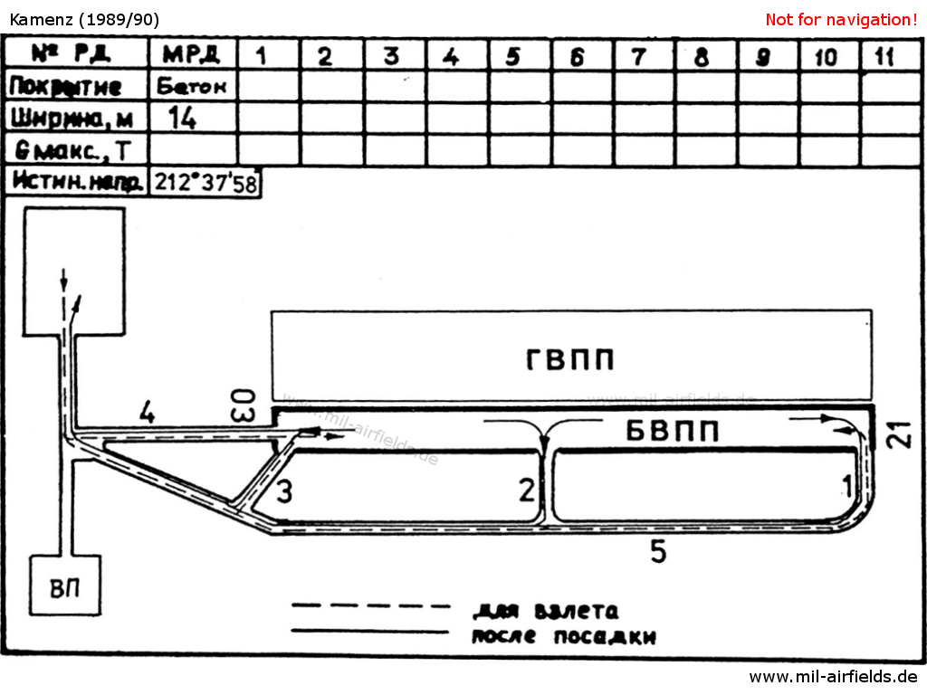
Runway and taxi tracks for take-off and after landing - still from Directory 012 - In the Warsaw Pact, taxiways had numbers. Also recognizable is the unusual layout of taxiway 4, which leads away from the front side of the runway.
Runways
- 03/21: 1100 m x 25 m Concrete
- 03/21: 1100 m x 65 m Grass northwest parallel to the concrete runway
Lights
In landing direction 213°, approach lights were deployed up to 700 m. The taxiways were not lighted.
Radio beacons
- LOM 21: 413,0 "KZ", 3590 m
- LMM 21: 840,0 "K", 1450 m
The idents were derived from the first and last letter of the radio call sign, here KONSTANZ.
In the approach sector 160°-200° (area Vetschau - Cottbus) deviations up to +/- 10°. On approach course 213° deviations up to +7° (in 1990).
During the 1980, the locator at outer marker was also used as navigational aid for the approach to Dresden Klotzsche Airport. This was remarkable in the fact that in the GDR the data of military radio beacons were subject to secrecy otherwise.
Radio communication
The airfield radio call sign was KONSTANZ. The Tower was KONSTANZ-START on 126.5 and 124.0 MHz.
As for some other secondary airfields of the former East German National People's Army, Kamenz had with KONSTANZ a radio call sign bearing the first and last letter of the town name.
Telephone
Former East German Sondernetz/Stabsnetz S1:
TAS-45: ü 9829-88, call sign "Werkbank";
Command post TAS-45: call sign "Jungaktivist"
Command post TAS-45: call sign "Jungaktivist"
Standard training routes
1990 gab es die Standardflugstrecken 920, 922, 923, 924, 925 und 926
Units
Units in 1990:
Transport Pilots Training Squadron 45 (Transportfliegerausbildungsstaffel 45, TAS-45),
Flight-technical Battalion 45 (Fliegertechnisches Bataillon 45, FTB-45),
Aircraft Repair Workshop 24 (Flugzeugreparaturwerkstatt 24, FRW-24)
Flight-technical Battalion 45 (Fliegertechnisches Bataillon 45, FTB-45),
Aircraft Repair Workshop 24 (Flugzeugreparaturwerkstatt 24, FRW-24)
Installations
Eisenbahnanschluss aus Richtung Bernbruch zum südlichen Teil des Flugplatzes.
Today
Use
General Aviation.
Links
- http://www.sachsenschiene.net/bunker/flp/flp_06.ht... - Sachsenbunker
Bibliography
- Ries, Karl; Dierich, Wolfgang: "Fliegerhorste und Einsatzhäfen der Luftwaffe" Motorbuch Verlag Stuttgart, 1993 - Allied map
Related topics
Airfields in the vicinity
Categories
Military Airfields GermanyMilitary Airfields in former East GermanyAir bases of former National People's ArmyRecommended
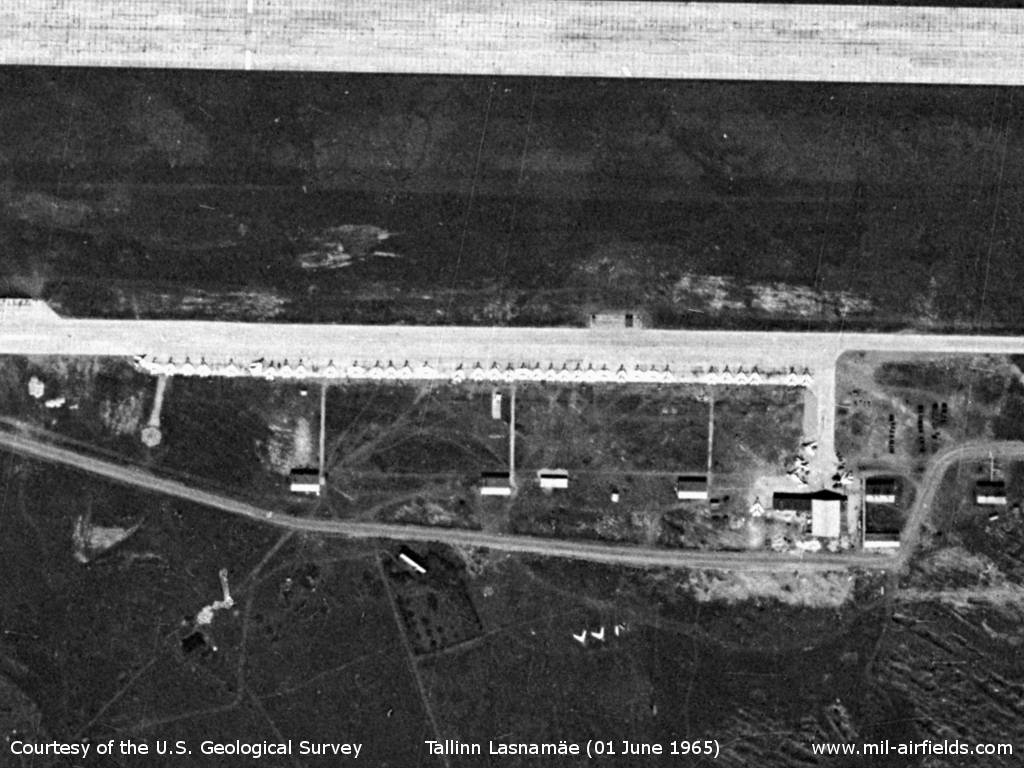
Image credits are shown on the respective target page, click on the preview to open it.
 Follow mil-airfields on Facebook