For historical information only, do not use for navigation or aviation purposes!
| Coordinates | N511514 E0135331 (WGS84) Google Maps |
| Former East Germany (GDR) | District of Dresden |
| Federal state | Sachsen (Saxony) |
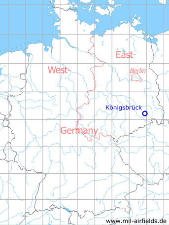
Germany during the Cold War Map
The history of the Cold War airfields: Königsbrück
Location of airfield
1 km southwest of Königsbrück center.
Usage during the Cold War
Agricultural airfield and Helipad 3044 for Institute of Aviation Medicine (Institut für Luftfahrtmedizin, ILM) of former East German Air Force (NVA LSK/LV).
Use today
Closed.
Runways, taxiways, aprons
Dimensions: 250 m x 500 m,
main takeoff and landing direction: 90°/270°,
surface: solid sod (agricultural airfield),
usable without crop damage,
capacity: 5..10 helicopters
main takeoff and landing direction: 90°/270°,
surface: solid sod (agricultural airfield),
usable without crop damage,
capacity: 5..10 helicopters
Telephone
Stabsnetz S1 ü 9453-88
Airspace and procedures
Usable at day and night at good weather conditions.
Alert time: 60 minutes.
Alert time: 60 minutes.
Obstacles
Smokestack: distance 500 m, height 30 m.
Airfields in the vicinity
- 214°/13km Weixdorf: Highway Strip (Autobahnabschnitt ABA Dresden, Ottendorf-Okrilla Highway Strip)
- 340°/13km Kroppen: Anti-aircraft Missile Unit 313 (National People's Army Helipad 3136)
- 053°/16km Straßgräbchen: Helipad 3130 (HSLP / HLP 3130)
- 213°/16km Dresden: Klotzsche Airport (Dresden Airport, DRS)
- 074°/17km Kamenz: Airfield
- 141°/18km Großröhrsdorf: Helipad 3138 (HSLP / HLP 3138)
- 210°/20km Dresden: Heller Heliport (Hellerau)
- 347°/20km Ruhland: Highway Strip (Autobahnabschnitt ABA)
 Follow mil-airfields on Facebook