For historical information only, do not use for navigation or aviation purposes!
| Coordinates | N512204 E0134938 (WGS84) Google Maps |
| Former East Germany (GDR) | District of Cottbus, District of Dresden |
| Federal state | Sachsen (Saxony), Brandenburg |
| Region | Oberlausitz |
Germany during the Cold War Map
The history of the Cold War airfields: Kroppen Helipad
Location of airfield
2.8 km southeast of Kroppen.
The village of Kroppen was located in the GDR district of Cottbus, now the federal state of Brandenburg, while the launching site was in the GDR district of Dresden, now the federal state of Sachsen (Saxony). The border between the two districts or federal states ran / runs approximately on the northwest side of the launching site.
During the Cold War
In the 1960s
Overview
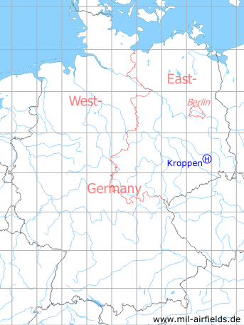
Kroppen Surface-to-Air Missile Unit 113 on a US satellite image from 04 October 1965 - 1: launching are; 2: barracks?
Source: U.S. Geological Survey
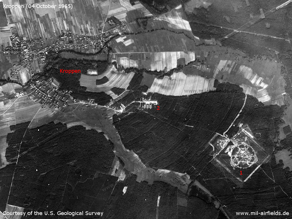
Enlargement: Launching area
Source: U.S. Geological Survey
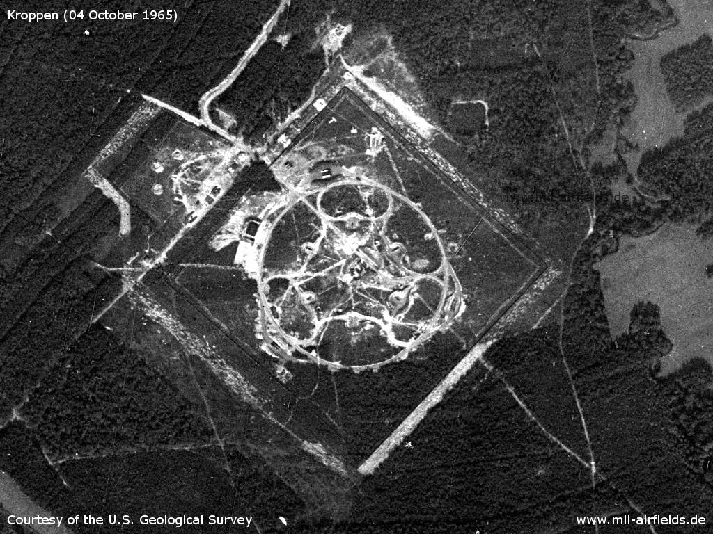
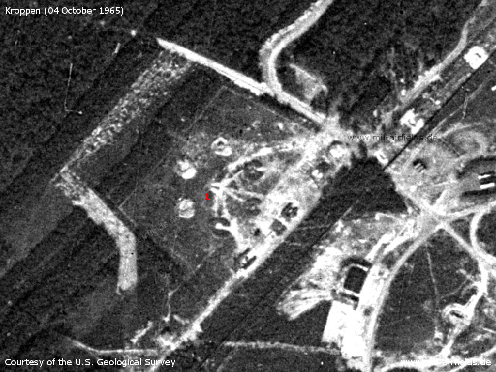
Northern part - 1: object, which looks like a landing-T? 2: possible missile S-75 Wolchow (NATO designator SA-2 Guideline).
Source: U.S. Geological Survey
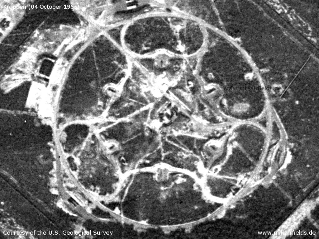
6 launchers for S-75 in circular arrangement. - It's hard to tell which of them are equipped with missiles. In the center are the fire control systems.
Source: U.S. Geological Survey
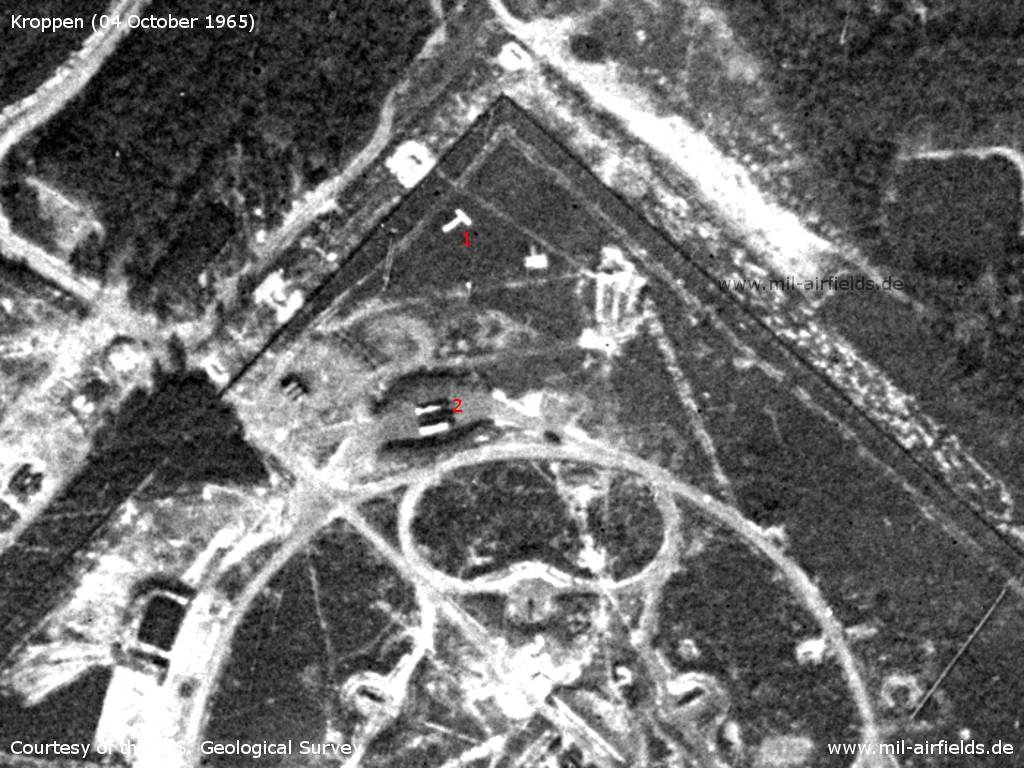
1: Six positions in a circular arrangement, which could be an anti-aircraft site within the anti-aircraft missile site.
Source: U.S. Geological Survey
In the 1980s and early 1990s
Use
Helipad 3136 for Anti-aircraft Missile Unit 313 (FRA-313) of East German Air Force (NVA LSK/LV).
Overview
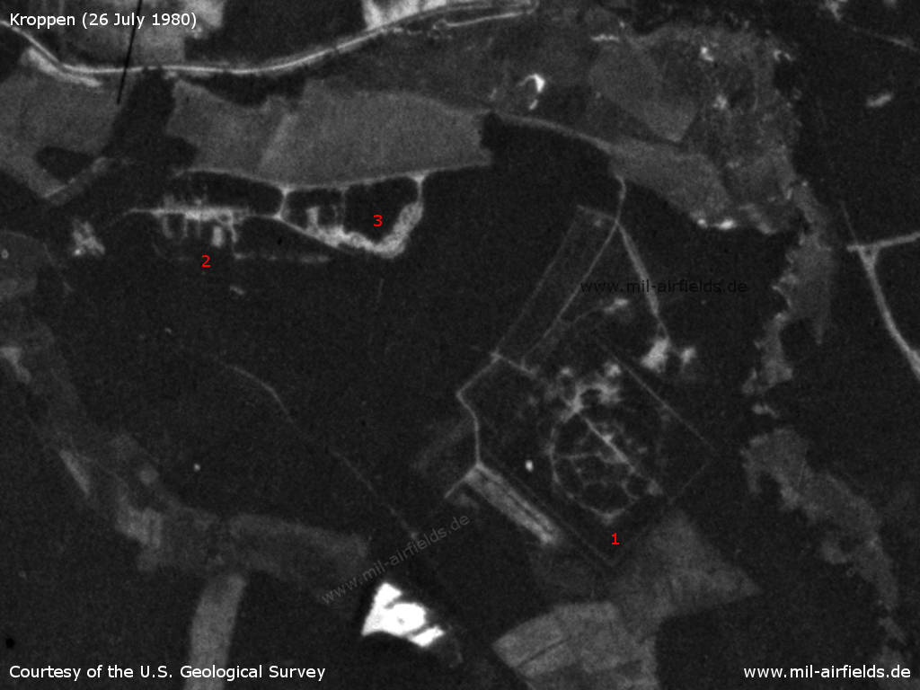
Satellite image from 26 July 1980 - 1: launcher area; 2: barracks; 3: east of the barracks, an additional object has been built.
Source: U.S. Geological Survey
Runways, taxiways, aprons
- Dimensions: 160 m x 200 m,
- main takeoff and landing direction: 200°,
- surface: sand overgrown with grass,
- usable without crop damage,
- capacity: 1 helicopter.
Telephone
Stabsnetz S1 9446-66-825
Airspace and procedures
Usable at day during good weather conditions.
Alert time: 30 minutes.
Alert time: 30 minutes.
Obstacles
Timber forest: direction 0°, 180°, 270°, distance 100-200 m.
Unit hierarchy in 1989
- Ministry of National Defense (MfNV)
-- National People's Army (NVA)
--- Air Force/Air Defense (LSK/LV)
---- 1st Air Defense Division (1. LVD)
----- Anti-aircraft Missile Regiment 31 (FRR-31)
------ Anti-aircraft Missile Unit 313 (FRA-313)
-- National People's Army (NVA)
--- Air Force/Air Defense (LSK/LV)
---- 1st Air Defense Division (1. LVD)
----- Anti-aircraft Missile Regiment 31 (FRR-31)
------ Anti-aircraft Missile Unit 313 (FRA-313)
Address:
Post box 44105
Post box 44105
Installation:
Military installation number: 06/214
Military installation number: 06/214
Today
Use
Closed.
Links
- http://www.sachsenschiene.net/bunker/dep/dep_05.ht... - Sperrgebiete.eu
Airfields in the vicinity
Categories
Military Airfields GermanyMilitary Airfields in former East GermanyHelipads of former National People's ArmyRecommended
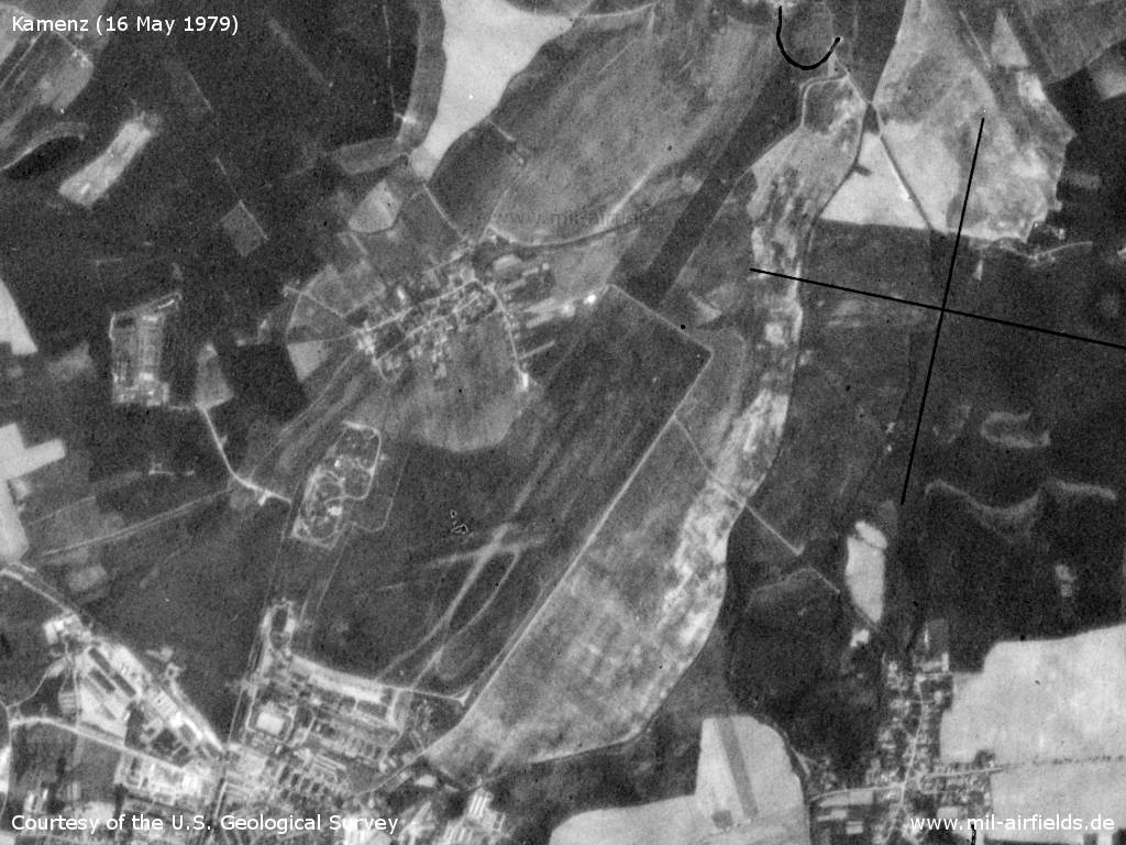
Image credits are shown on the respective target page, click on the preview to open it.
 Follow mil-airfields on Facebook