For historical information only, do not use for navigation or aviation purposes!
| Coordinates | N521904 E0135801 (WGS84) Google Maps |
| Former East Germany (GDR) | District of Frankfurt/O |
| Federal state | Brandenburg |
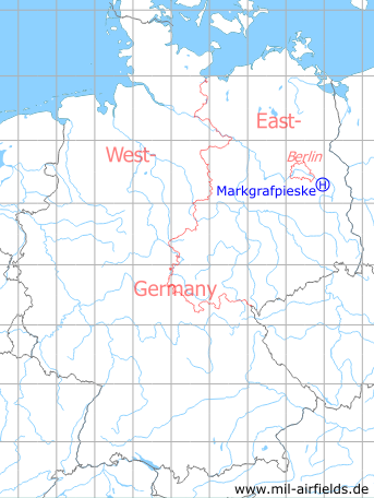
Germany during the Cold War Map
The history of the Cold War airfields: Markgrafpieske
General
Markgrafpieske is located about 45 km southeast of the city center of Berlin and 9 km southwest of Fürstenwalde. In GDR times there was an anti-aircraft missile site of the National People's Army (NVA) about 3 km east of the village. It was equipped with missiles of the type SA-2 Guideline (S-75 Dwina/Wolchow). In the 1980s, the unit was referred to as Anti-Aircraft Missile Unit 4121 (FRA-4121). A helipad was designated for this site, which is described below.
Location of airfield
According to the coordinates, the helicopter landing pad was not directly at the missile site, but 1.5 km southeast of the center of Markgrafpieske, between the village and the Autobahn.
During the Cold War
Usage during the Cold War
Helipad 3110 of Anti-Aircraft Missile Unit 4121 (FRA-4121) of former East German Air Force (NVA LSK/LV).
In the 1960s
Overview
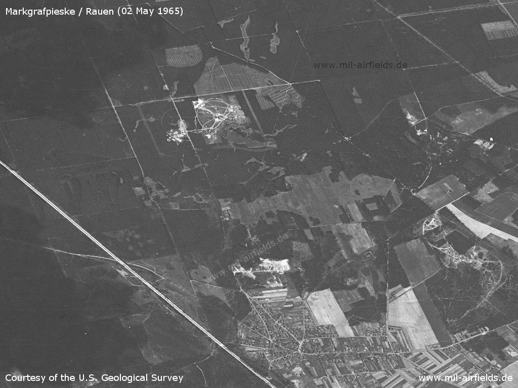
Markgrafpieske Helipad 3110 on a US satellite image from 02 May 1965. Viewing direction is approximately west. - At the bottom of the picture, the village of Rauen is shown. To the left of it is the Berlin - Frankfurt/Oder Autobahn. On the right side of the picture you can see the Kiesweg barracks.
Source: U.S. Geological Survey
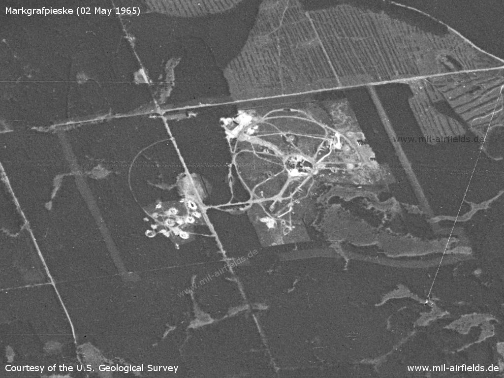
Enlargement - The object is surrounded by a wide corridor in which the fence runs. In the northeast corner (on the picture below right) the fence seems to make a special bulge due to the topography of the terrain. The topography also seems to be the reason why this site is not fully circular, compared to other SA-2 sites. Here, the northeastern section of the circle is missing. Interesting is also the area with the semicircle in the south (on the picture on the left).
Source: U.S. Geological Survey
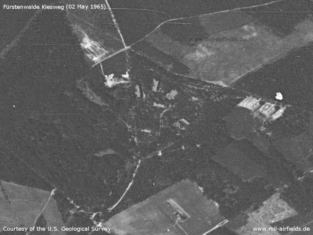
Fürstenwalde Kiesweg barracks
Source: U.S. Geological Survey
In the 1970s
Overview
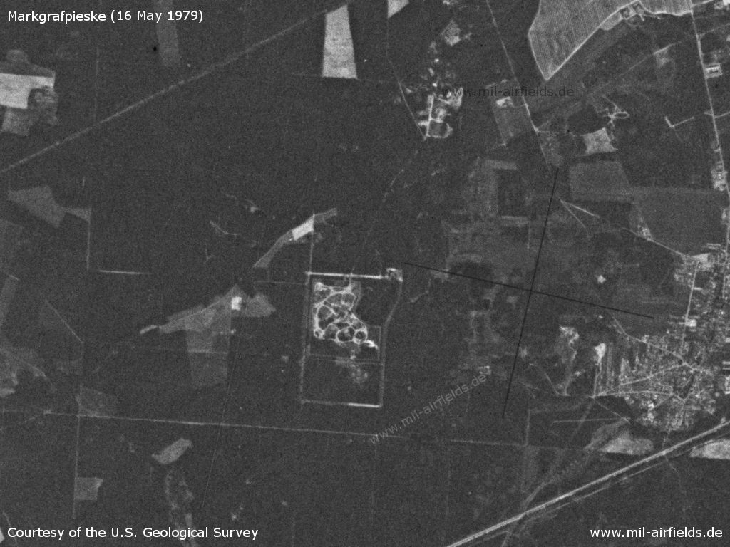
The installation on 16 May 1979 - In the meantime there is a connecting road from the launching site to the barracks in the north
Source: U.S. Geological Survey
In the 1980s and early 1990s
Overview
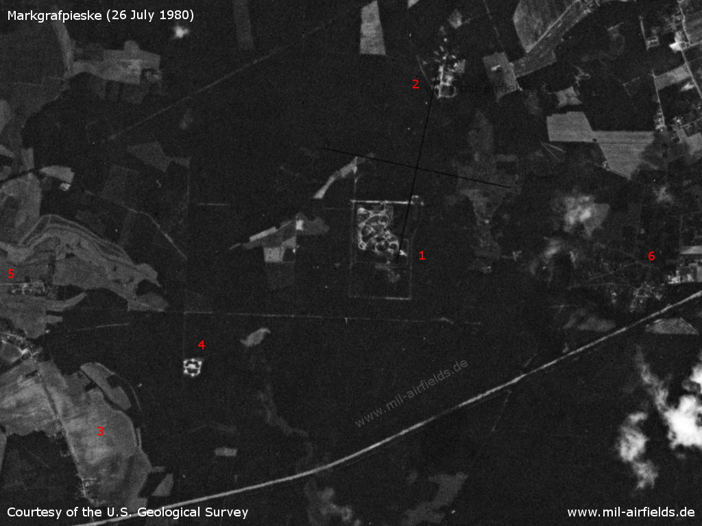
Markgrafpieske Anti-aircraft missile site on 26 July 1980. - 1: firing site; 2: barracks; 3: the helipad should have been in this area; 4: noticeable structure, apparently something has been built here recently, one year before this area was inconspicuous (see picture above), purpose unknown; 5: eastern edge of Markgrafpieske; 6: Rauen
Source: U.S. Geological Survey
Runways, taxiways, aprons
Main takeoff and landing direction: 270°,
surface: overgrown sand,
usable without crop damage,
Capacity: 1 helicopter.
surface: overgrown sand,
usable without crop damage,
Capacity: 1 helicopter.
Communication
Stabsnetz S1 2734-759-88
Airspace and procedures
Usable at day and good weather conditions.
Alert time: 60 minutes
Alert time: 60 minutes
Obstacles
Timber-forest: direction 0°, height 15 m.
Today
Use today
Closed
Links
- https://www.untergrund-brandenburg.de/Sub_Sites/NV... - Feuerstellung der Fla-Raketenabteilung 4121 bei Markgrafpieske Images
Airfields in the vicinity
Categories
Military Airfields GermanyMilitary Airfields in former East GermanyHelipads of former National People's ArmyRecommended
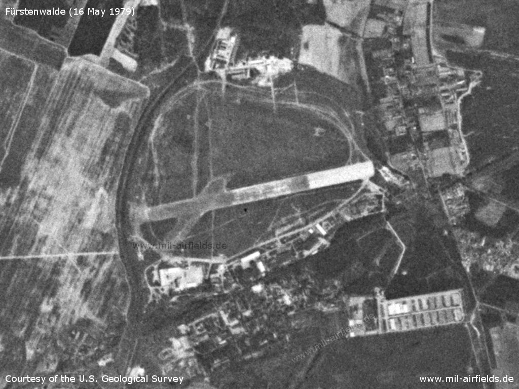
Image credits are shown on the respective target page, click on the preview to open it.
 Follow mil-airfields on Facebook