Meiningen: Airfield / Heliport
For historical information only, do not use for navigation or aviation purposes!
| Coordinates | N503413 E0102656 (WGS84) Google Maps |
| Former East Germany (GDR) | District of Suhl |
| Federal state | Thüringen (Thuringia) |
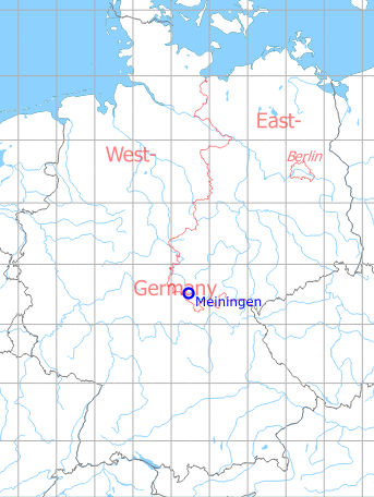
Germany during the Cold War Map
The history of the Cold War airfields: Meiningen
Location of airfield
The airfield was located ca. 2 km east of Meiningen, at the Rohrer Berg hill.
During the 1920s/1930s
Use
Opened during the 1920s as civil airport
Business owner / Administrator
Stadtvorstand Meiningen, Drahtanschrift: Magistrat Meiningen
Transport companies / Airlines
Nordbayerische Verkehrsflug G. m. b. H., Nürnberg, flight dispatch Meiningen, Verkehrslandeplatz; cable address: Verkehrsflug Meiningen
Situation
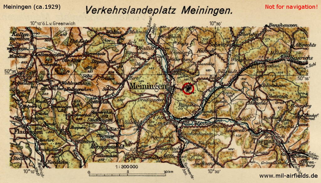
On this map from 1929, the location of Meiningen airfield, Germany, is marked
Overview
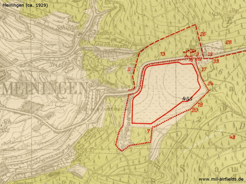
Meiningen airfield
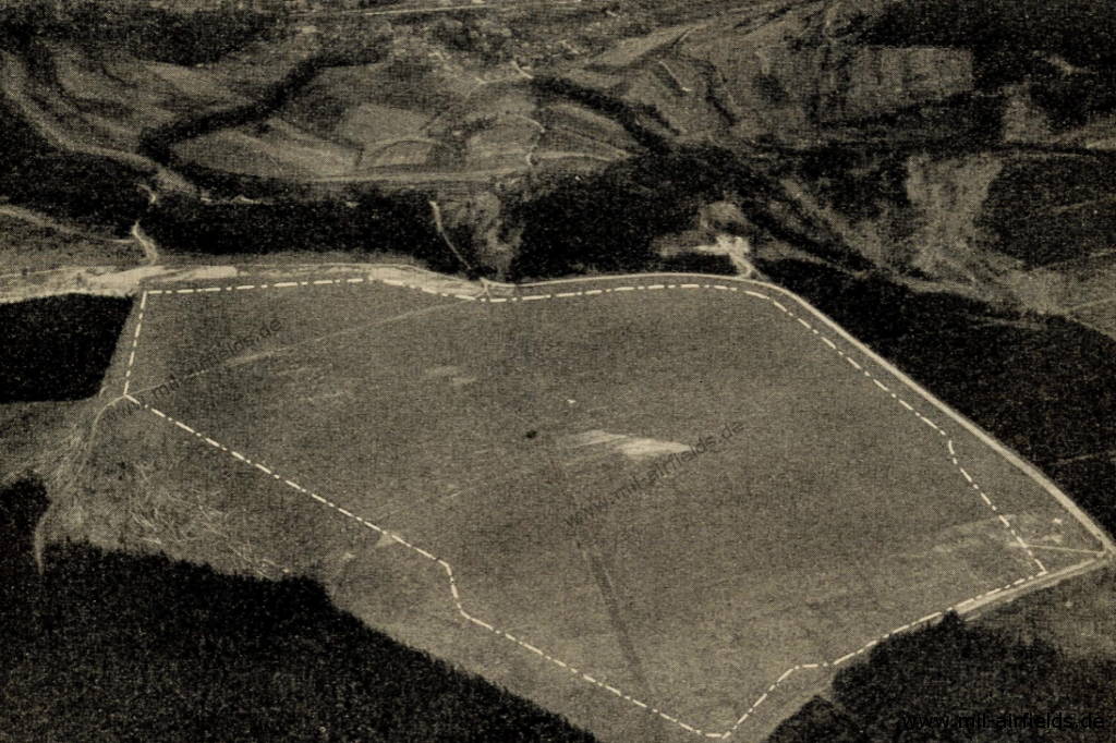
The aerial photo from the 1920s has a view approximately to the west.
Airfield characteristics at daytime
The movement area is located about 2.5 km east of the town of Meininge on the road to Suhl. White landing sign is always deployed. Windsock set up at the northeastern field corner. Field boundaries partly marked by fences.
Airfield characteristics at night
No night lighting is provided.
Runways, taxiways, aprons
Good sod on loamy limestone soil.
Runways
Shortest rolling length 400 m in direction southeast-northwest.
Telephone
Operator, administrator, fire call: Meiningen 5,
Airline, police station, ambulance station: Meiningen 546,
Doctors: Meiningen 451 and 521,
Cab call: Meiningen 285.
Airline, police station, ambulance station: Meiningen 546,
Doctors: Meiningen 451 and 521,
Cab call: Meiningen 285.
Fuel equipment
Dapolin tank system for 2000 k. About 140 l petrol and 160 l benzene in cans always in stock.
First aid in the case of accidents
Will be provided by police station. First aid kit available. Nearest doctor in Meiningen (2.5 km away).
Customs, post office, passport
Auxiliary postal office at the police station available.
Accommodation of passengers
In town.
Connections
No shuttle service. Taxi cabs on call at any time.
Timetable
Summer 1928
The timetable for summer of 1928 shows the following scheduled flights:
(Days: 1=Monday ... 7=Sunday)
(Days: 1=Monday ... 7=Sunday)
304: Rudolstadt/Saalfeld - Weimar - Erfurt (Nord) - Meiningen - Schweinfurt/Bad Kissingen - Fürth (Atzenhof)
- Nordbayerische Verkehrsflug G. m. b. H.:
123456– | Rudolstadt/Saalfeld 07:20 - 07:40 Weimar 07:50 - 08:00 Erfurt 08:15 - 09:00 Meiningen 09:20 - 09:55 Schweinfurt/Bad Kissingen 10:10 - 10:55 Fürth
Flights to Weimar on demand only - Nordbayerische Verkehrsflug G. m. b. H.:
123456– | Fürth 07:25 - 08:10 Schweinfurt/Bad Kissingen 08:25 - 09:00 Meiningen 09:15 - 10:00 Erfurt 10:15 - 10:25 Weimar 10:35 - 10:55 Rudolstadt/Saalfeld
Flights to Weimar on demand only
Departures and arrivals by time
| Days | Time | Dep/Arr | Route | Operator | Aircraft type | to/from |
|---|---|---|---|---|---|---|
| 123456– | 09:00 | Arr | 304 | Nordbayerische Verkehrsflug G. m. b. H. | Fürth - Schweinfurt/Bad Kissingen | |
| 123456– | 09:00 | Arr | 304 | Nordbayerische Verkehrsflug G. m. b. H. | Rudolstadt/Saalfeld - Weimar - Erfurt | |
| 123456– | 09:15 | Dep | 304 | Nordbayerische Verkehrsflug G. m. b. H. | Erfurt - Weimar - Rudolstadt/Saalfeld | |
| 123456– | 09:20 | Dep | 304 | Nordbayerische Verkehrsflug G. m. b. H. | Schweinfurt/Bad Kissingen - Fürth |
During World War II
Situation
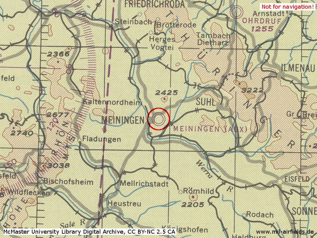
Meiningen Airfield in World War II on a US map from 1944
Source: McMaster University Library Digital Archive, License: Creative Commons Attribution-NonCommercial 2.5 CC BY-NC 2.5 CA
Overview
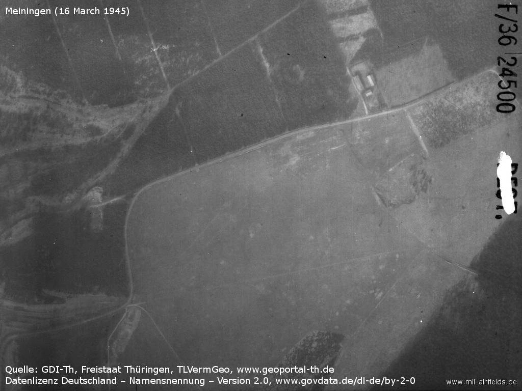
The airfield on 16 March 1945 - No airplanes can be seen on this section.
Source: GDI-Th, Freistaat Thüringen, TLVermGeo, www.geoportal-th.de, Data licence Germany – attribution – version 2.0, www.govdata.de/dl-de/by-2-0
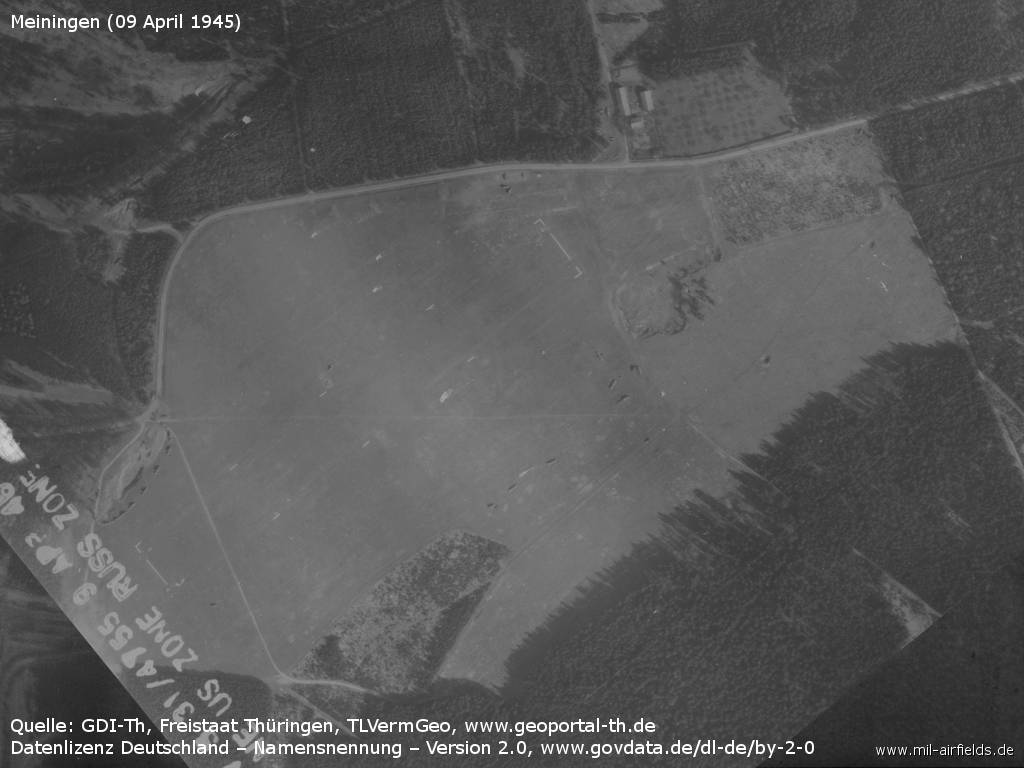
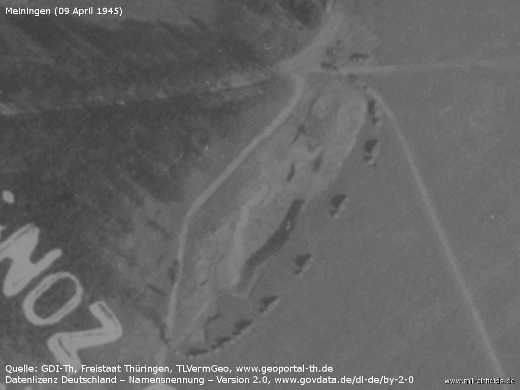
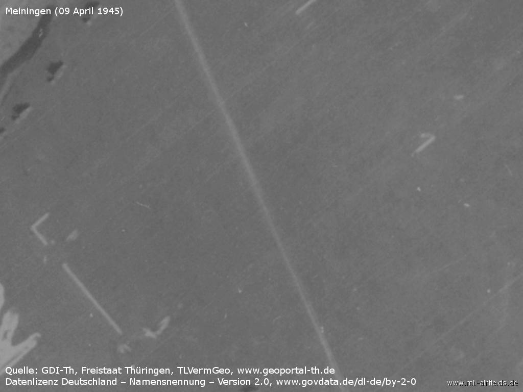
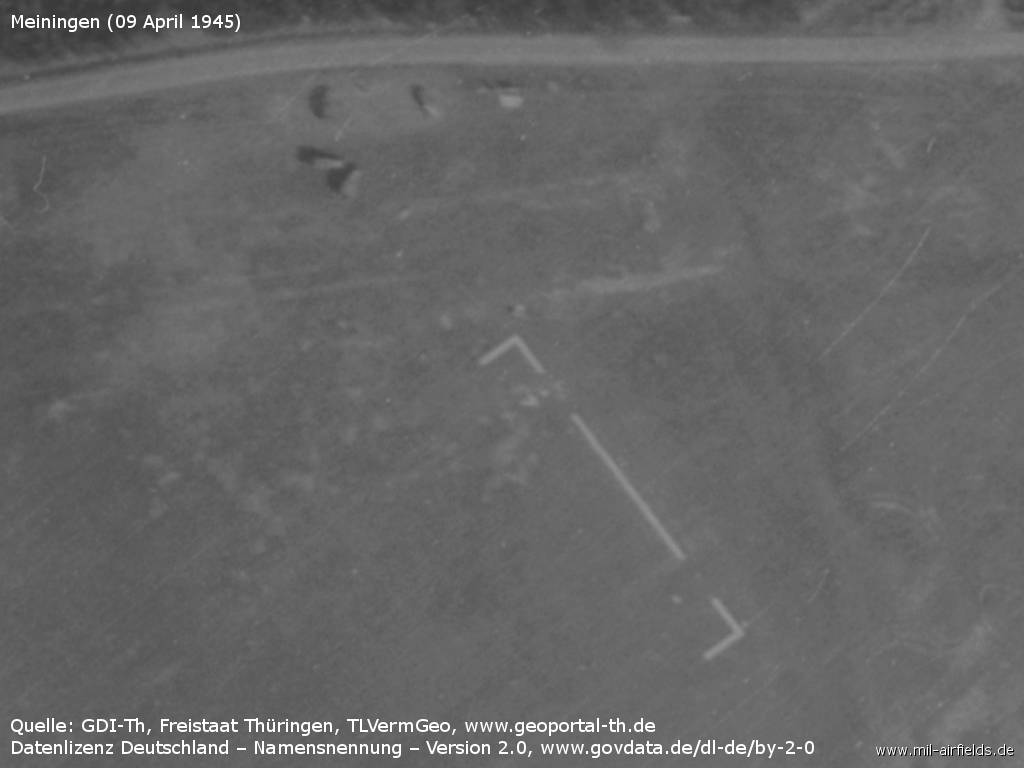
The airfield on 09 April 1945 - The place was probably occupied by US units shortly before.
Source: GDI-Th, Freistaat Thüringen, TLVermGeo, www.geoportal-th.de, Data licence Germany – attribution – version 2.0, www.govdata.de/dl-de/by-2-0
Now a runway is marked
Source: GDI-Th, Freistaat Thüringen, TLVermGeo, www.geoportal-th.de, Data licence Germany – attribution – version 2.0, www.govdata.de/dl-de/by-2-0
Convoy of vehicles at the western border of the field
Source: GDI-Th, Freistaat Thüringen, TLVermGeo, www.geoportal-th.de, Data licence Germany – attribution – version 2.0, www.govdata.de/dl-de/by-2-0
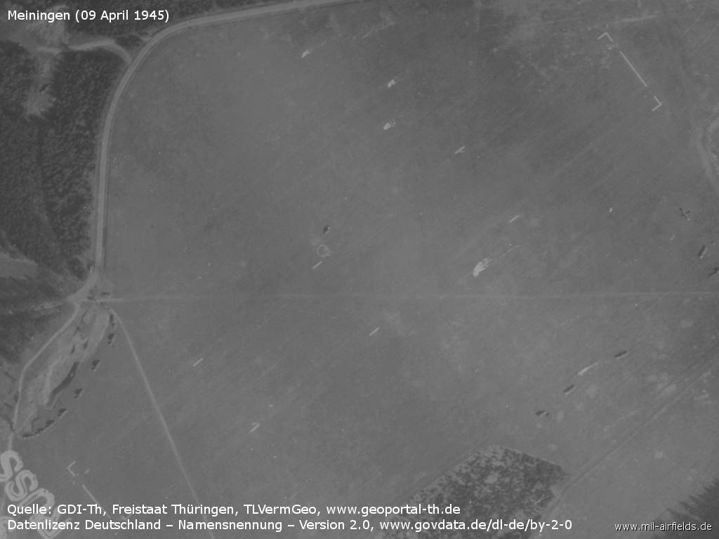
Southwestern end of the runway
Source: GDI-Th, Freistaat Thüringen, TLVermGeo, www.geoportal-th.de, Data licence Germany – attribution – version 2.0, www.govdata.de/dl-de/by-2-0
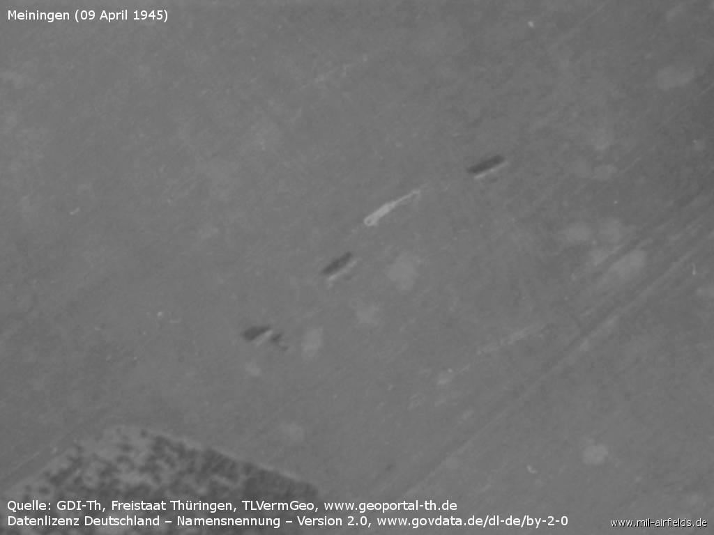
Vehicles
Source: GDI-Th, Freistaat Thüringen, TLVermGeo, www.geoportal-th.de, Data licence Germany – attribution – version 2.0, www.govdata.de/dl-de/by-2-0
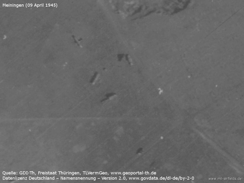
Vehicles and aircraft
Source: GDI-Th, Freistaat Thüringen, TLVermGeo, www.geoportal-th.de, Data licence Germany – attribution – version 2.0, www.govdata.de/dl-de/by-2-0
Northeastern end of runway
Source: GDI-Th, Freistaat Thüringen, TLVermGeo, www.geoportal-th.de, Data licence Germany – attribution – version 2.0, www.govdata.de/dl-de/by-2-0
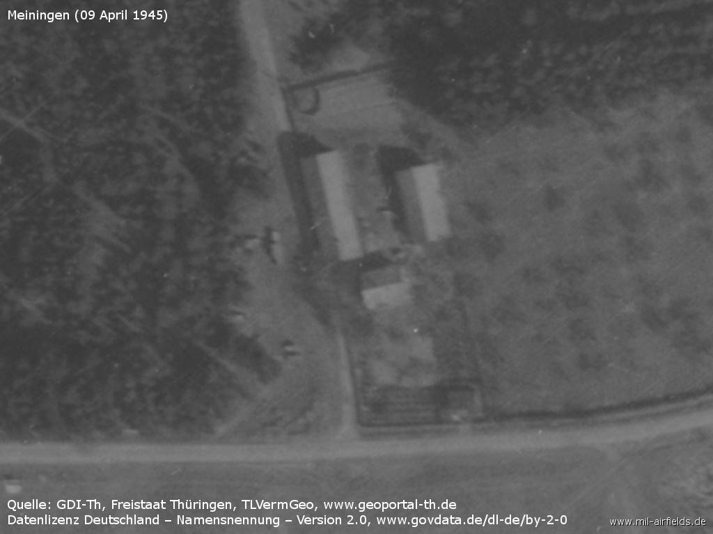
Buildings in the north
Source: GDI-Th, Freistaat Thüringen, TLVermGeo, www.geoportal-th.de, Data licence Germany – attribution – version 2.0, www.govdata.de/dl-de/by-2-0
During the Cold War
Use
Base for Helicopter Squadron 16 (Hubschrauberstaffel 16. HS-16) of fomer East German border troops.
 Helicopter of the East German Border Troops at Meiningen (not to scale)
Helicopter of the East German Border Troops at Meiningen (not to scale)
Mil Mi-1 / PZL SM-1 HARE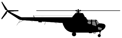
Mil Mi-4 HOUND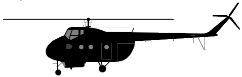
Mil Mi-8 HIP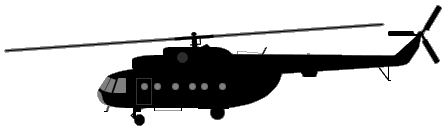
Mil Mi-2 HOPLITE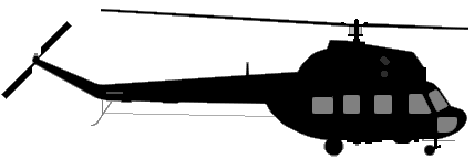
(Sources: Aicraft silhouettes: AirVectors / GVG, Public Domain)
In the 1960s
Overview
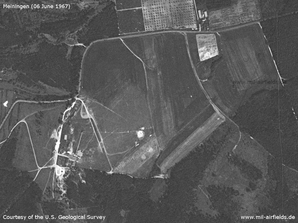
Meiningen Airfield on a US satellite image from 06 June 1967
Source: U.S. Geological Survey
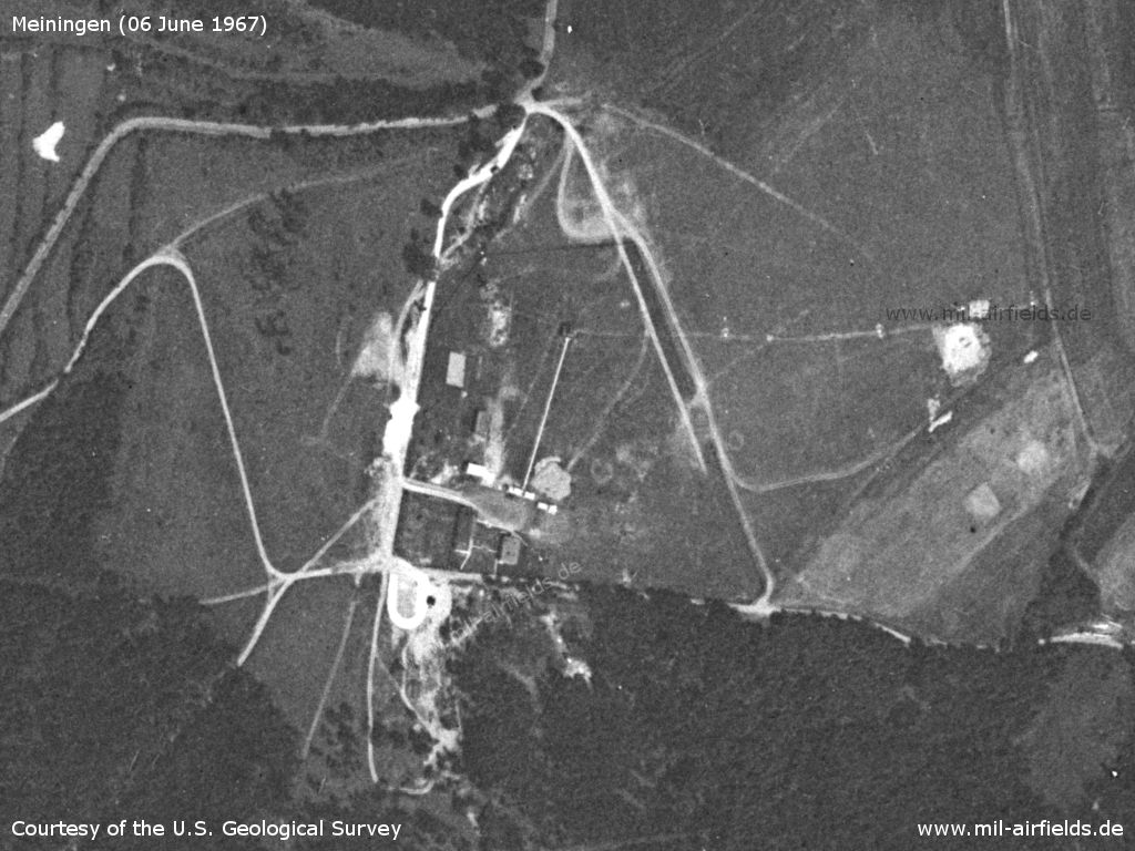
Enlargement - The buildings are located in a fenced area
Source: U.S. Geological Survey
In the 1980s and early 1990s
Runways
Dimensions: 600m x 400m
Radio beacons
There was a non-directional radio beacon with the ident WS at the field, which transmitted on medium waves. The ident is made of the first and the last letter of the radio call sign WÜSTENFUCHS (deset fox).
- : 367,0 "WS", at field
Radio communication
The call sign of the airfield was WÜSTENFUCHS.
Telephone
Sondernetz/Stabsnetz S1: via 7444-88
Today
Use
The airfield is closed.
Overview
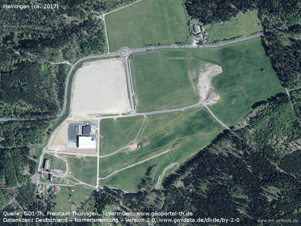
Old airfield, about 2017
Source: GDI-Th, Freistaat Thüringen, TLVermGeo, www.geoportal-th.de, Data licence Germany – attribution – version 2.0, www.govdata.de/dl-de/by-2-0
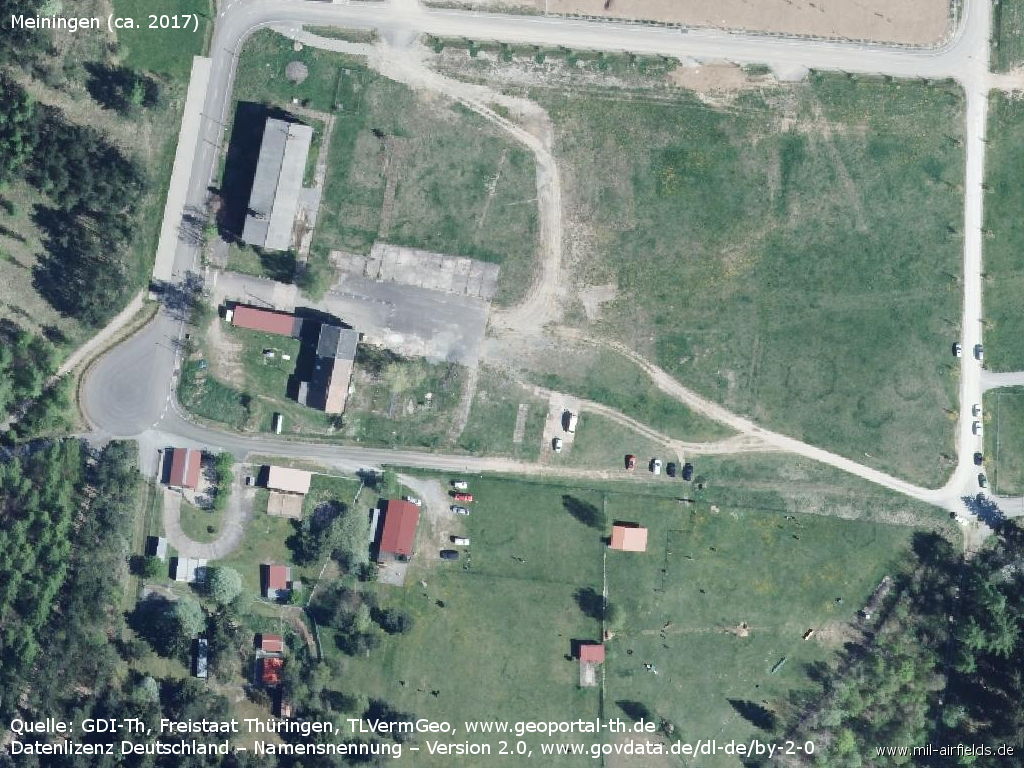
Enlargement
Source: GDI-Th, Freistaat Thüringen, TLVermGeo, www.geoportal-th.de, Data licence Germany – attribution – version 2.0, www.govdata.de/dl-de/by-2-0
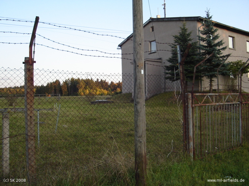
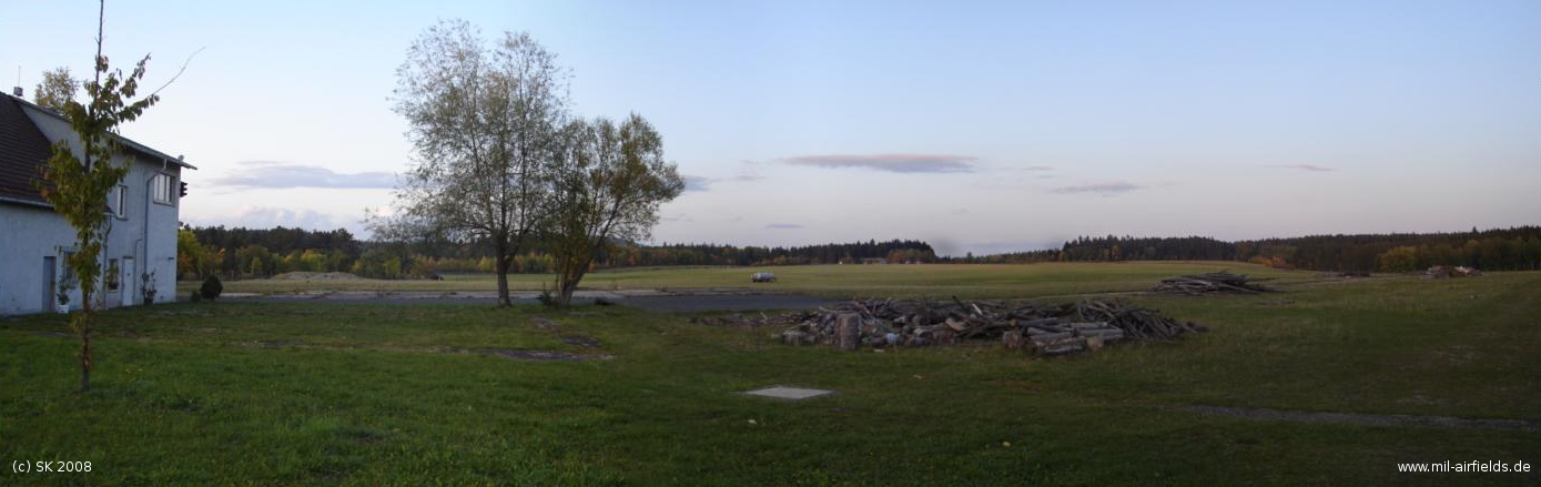
Images
The following pictures were taken in october 2008, courtesy of SK. Many thanks!
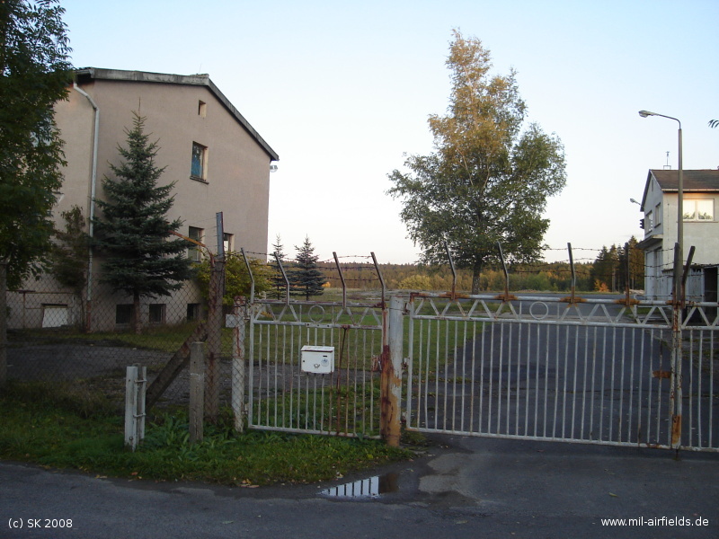
Gate and buildings.
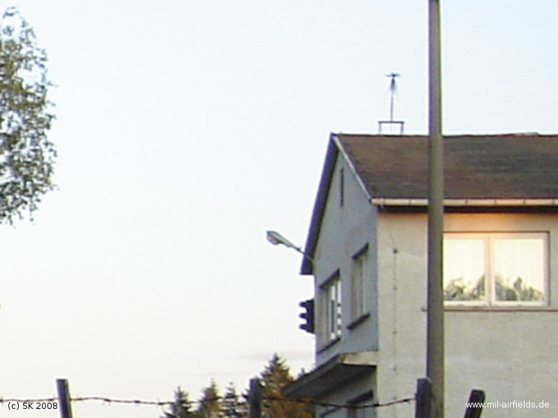
Tower building? Traffic light and antenna
Northwestern building
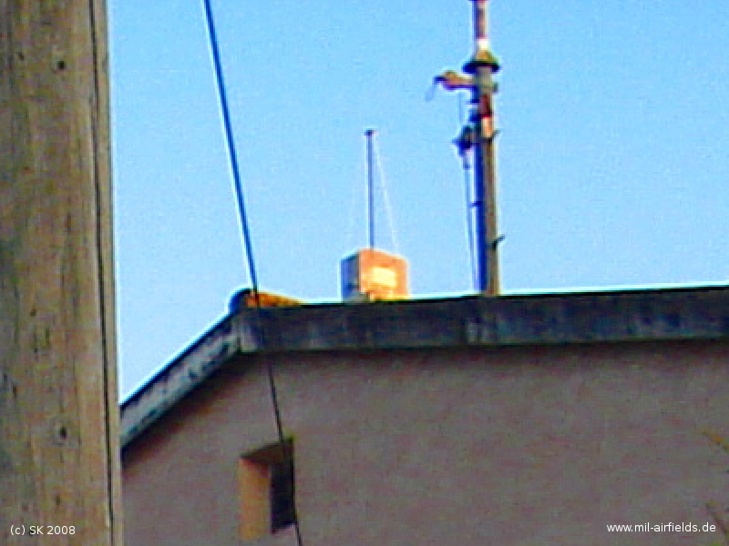
Obstacle light on the roof of the building
Looking across the airfield. This picture was created out of three pictures, with the help of AutoStich (www.autostitch.net).
Links
- http://www.nva-flieger.de/index.php/nva-hs-plaetze... - nva-flieger.de - Meiningen heliport Picture and a historical document "Ordnung zum Fliegen auf dem Landeplatz Meiningen" (Instruction for flying at the landing ground Meiningen) from 1986.
- https://www.geoportal-th.de/ - Geoportal Thüringen
Bibliography
- Grenzdörfer, Joachim; Seifert, Karl-Dieter: "Geschichte der ostdeutschen Verkehrsflughäfen" Bernard & Graefe Verlag, Bonn, 1997 - Description of the time between 1927 and 1938, maps, aerial picture
Related topics
Airfields in the vicinity
- 323°/24km Breitungen: Helipad 3176 (HSLP / HLP 3176)
- 042°/41km Röhrensee: Airfield (Ohrdruf)
- 243°/42km Wildflecken: Army Airfield AAF
Recommended
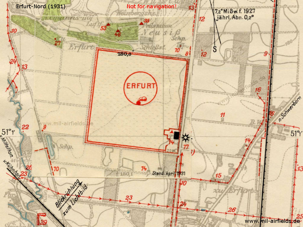

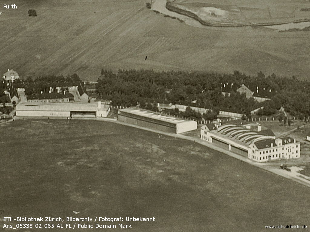
Image credits are shown on the respective target page, click on the preview to open it.
 Follow mil-airfields on Facebook