For historical information only, do not use for navigation or aviation purposes!
| Coordinates | N484303 E0091604 (WGS84) Google Maps |
| Elevation | 1260 ft |
| Federal state | Baden-Württemberg |
| Location indicator | DBNL (195x), EDIS (196x-1992) |
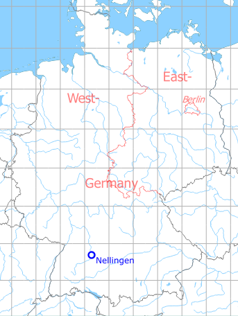
Germany during the Cold War Map
The history of the Cold War airfields: Nellingen
General
At the end of the 1930s a Luftwaffe air base was established in Nellingen. After 1945 the object was occupied by US troops, which built here the "Nellingen Barracks" barracks. This included a heliport on which numerous machines were stationed, including Dust Off helicopters for casualty evacuation. In 1992 the US troops withdrew and the area was converted to the town district Scharnhauser Park.
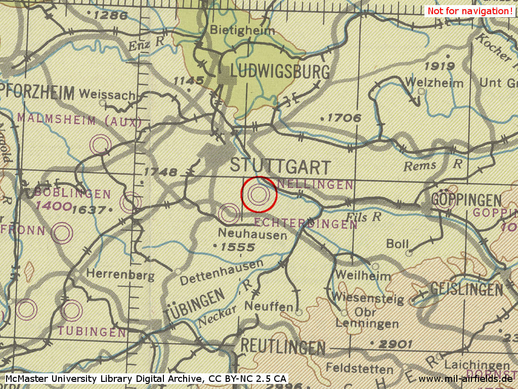
Location of airfield
The airfield was located about 12 km southeast of Stuttgart city center.
During World War II
Use
Luftwaffe air base.
Situation
Nellingen Air Base in World War II on a US map from 1944 - (McMaster University Library Digital Archive, License: Creative Commons Attribution-NonCommercial 2.5 CC BY-NC 2.5 CA /MULDA/)
Overview
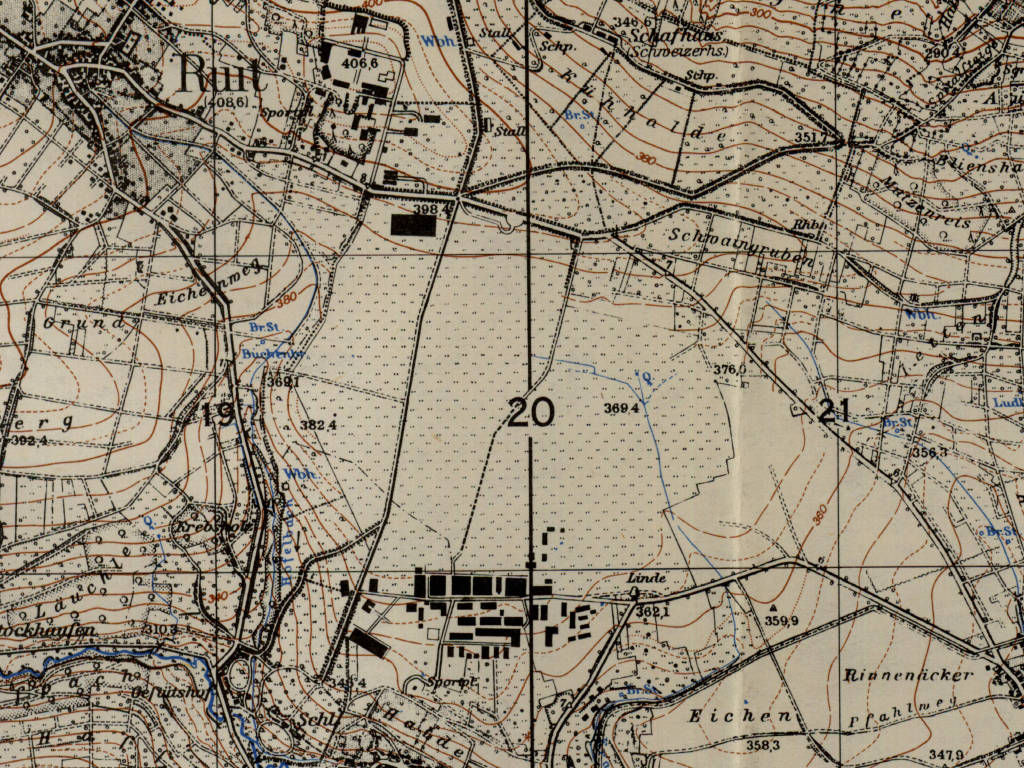
The installations of the former Nellingen Air Base on a US map from 1952 - (AMS M841 GSGS 4414, Courtesy Harold B. Lee Library, Brigham Young University /BYU/)
During the Cold War
Use
US Army helicopter base until early 1990s.
In the 1940s
Situation
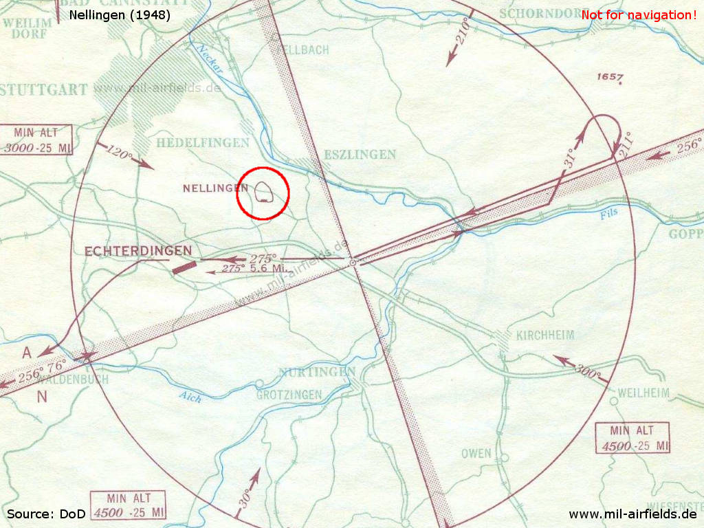
On this approach chart for Stuttgart airport from 1948, Nellingen is either still or already again listed as landing ground.
In the 1950s
Situation
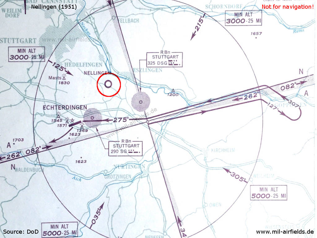
Nellingen on a map from 1951
Additional information
Airfield Survey 1953
In 1953 and 1954, survey tours took place to identify future air bases for the German Air Force. Old airfields were visited and assessed, if a field can be used, if technical facilities and housing are available und if an extension of the runway up to 2500 m or 3000 m is possible.
For Nellingen it was found that the already small movement area (800 m x 1000 m, 2625 ft x 3280 ft) is now even smaller due to newly built quarters and four-storied family buildings. In addition, roads and stands for tanks are under construction. It was believed that the area is unusable, not extendable and unsuitable to be used as an airfield.
In the 1960s
Overview
Nellingen Heliport on a map from 1967
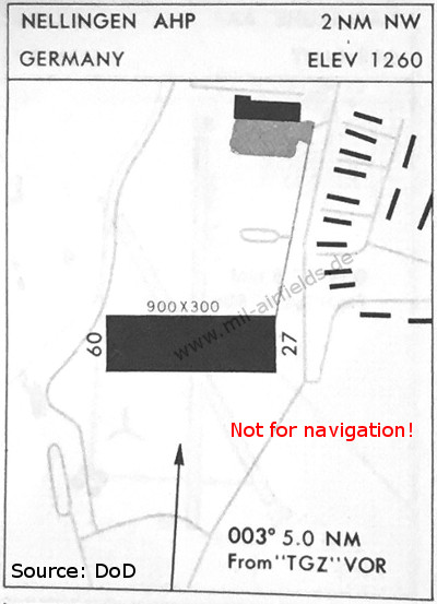
Runways
- 09/27: 274 m x 91 m Asphalt
Radio communication
- Nellingen Radio 122.1, 33.6, 31.8
Telephone
Nellingen Mil 737, 821.
Airspace and procedures
Operated Monday-Friday 0700-1600Z, Saturday 0700-1100Z; use on Sundays, US and German holidays require prior permission.
Approach 090°, departure 270°. Traffic pattern to the north in 2000 ft MSL, avoid overflight of kaserne and housing area.
Obstacles
An antenna 22 m high is located 150 m southeast of runway 27.
Additional information
In 1963, Malmsheim is an auxiliary airfield for Nellingen.
In the 1970s
Overview
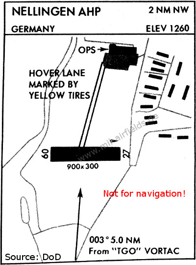
Map from 1976 - The eastern taxiway from the hangar ramp to the runway has been closed and replaced by a hover lane more to the west.
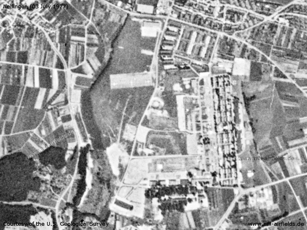
Nellingen Army Heliport AHP an Nellingen Barracks on a US satellite image from 03 July 1977
Source: U.S. Geological Survey
Telephone
Mil 2724, extension 7227
In the 1980s and early 1990s
Overview
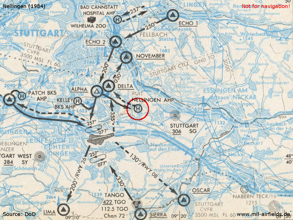
Map with airspace around Stuttgart in 1984
Runways
Data for the year 1990:
- 09/27: 274 m x 91 m
Radio communication
- Nellingen Advisory/Radio 30.6, 30.75, 138.6, 358.2
Telephone
DSN 421 -6xxx (1990)
Obstacles
Two antennas 24 m high 46 m southeast of main parking area. Lighted windspeed direction indicator 6 m high is located 164 m northwest of the main parking area.
Units
45th MedCo: 15 UH-60A; 7-159 Avn: 4 UH-1H (1990)
Installations
The area of the Nellingen Barracks covered 124,335 ha (Source: BICC)
In the 1990s and 2000s
Images
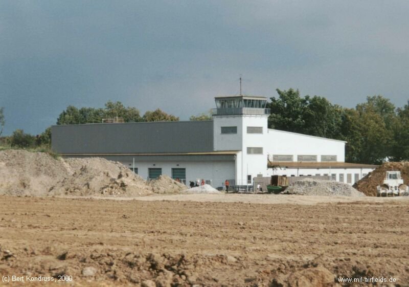
Tower (2000)
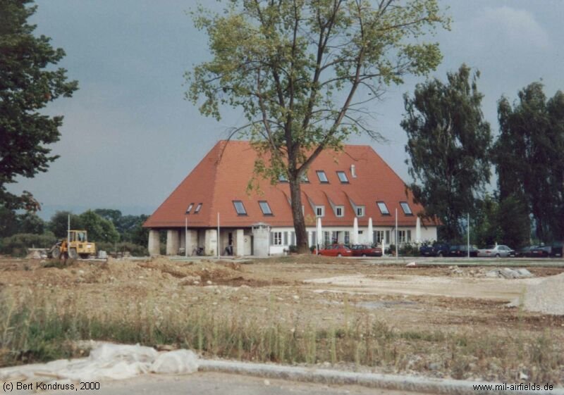
Building (2000)
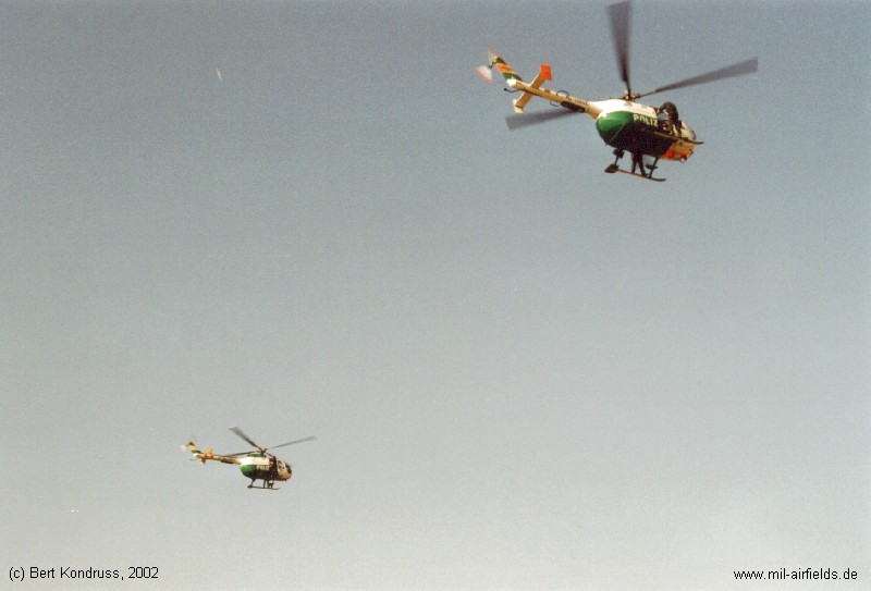
10 years after the US helicopters have left Nellingen ...
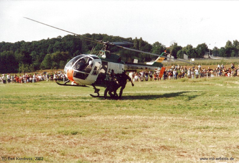
... there is helicopter action again at the former airfield during a police show (2002)
Today
Use
The airfield is closed. The area (Barracks and Airfield) has been converted to the housing area "Scharnhauser Park".
Links
- http://www.dustoff.org/photo/images/101104-1.jpg - DUSTOFF Helicopter in Nellingen
- http://usarmygermany.com/Units/Corps/USAREUR_VIICo... - Parade
- http://www.billybils.de/index.html - Site dedicated to Nellingen barracks
- https://www.youtube.com/watch?v=9F_FHHGilBM - Bell UH-1D in Nellingen Barracks ca 78/79 The UH-1 arrives over the asphalt runway and then follows the hover lane to the hangar ramp.
Bibliography
- Ries, Karl; Dierich, Wolfgang: "Fliegerhorste und Einsatzhäfen der Luftwaffe" Motorbuch Verlag Stuttgart, 1993 - Allied map
Airfields in the vicinity
- 227°/5km Stuttgart: Airport, Army Airfield (Echterdingen AAF)
- 347°/11km Stuttgart: Bad Cannstatt Hospital AHP
- 349°/17km Ludwigsburg: Army Airfield AAF (Pattonville Airfield, Kornwestheim)
- 261°/20km Böblingen: Stuttgart-Böblingen Airport, Maintenance Facility (Flugfeld)
- 286°/27km Malmsheim: Airfield
- 092°/31km Göppingen: Army Air Field AAF (Goppingen, Cooke Barracks)
 Follow mil-airfields on Facebook