Neuburg/Donau: Air Base
For historical information only, do not use for navigation or aviation purposes!
| Coordinates | N484240 E0111245 (WGS84) Google Maps |
| Federal state | Bayern (Bavaria) |
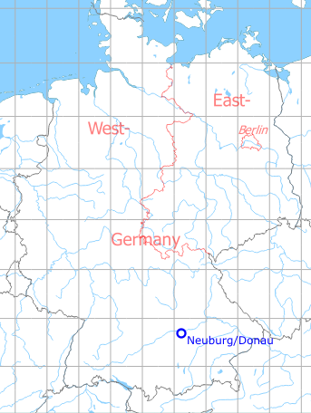
Germany during the Cold War Map
The history of the Cold War airfields: Neuburg/Donau
During the Cold War
Use
German Air Force base.
In the 1970s
Situation
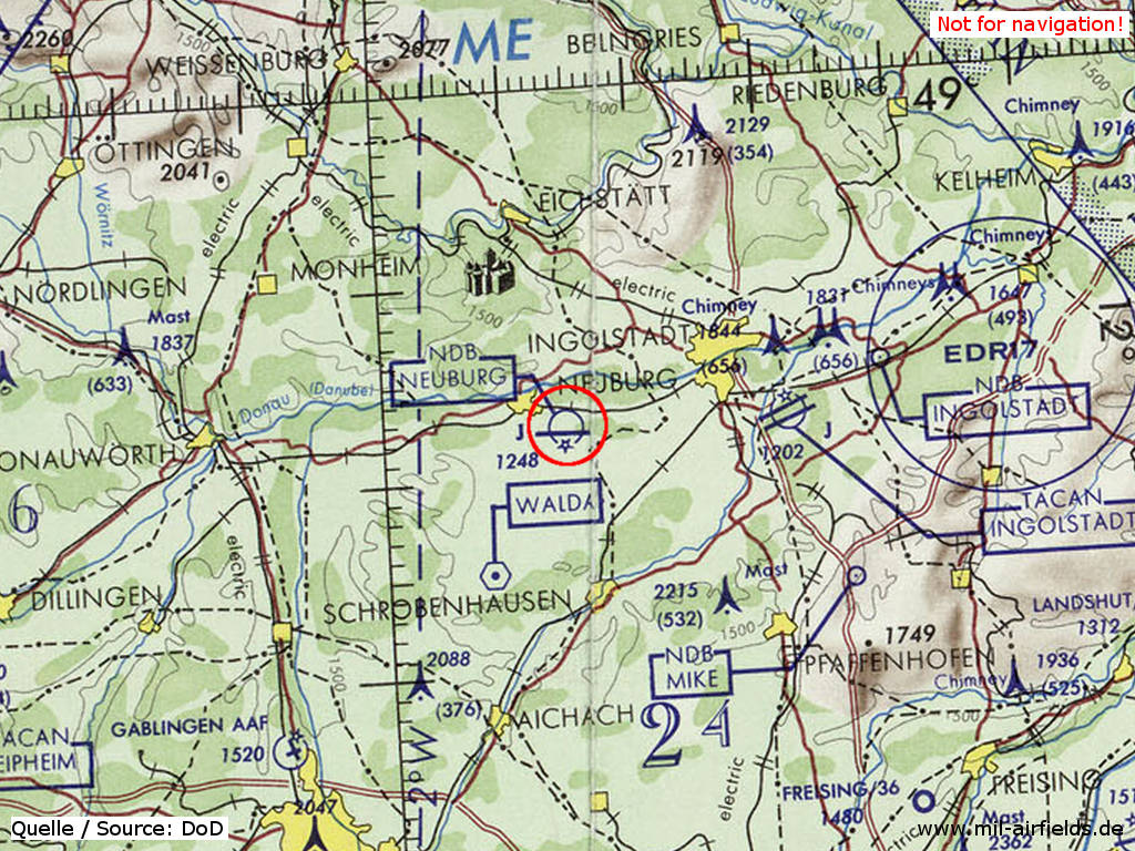
Neuburg/Donau Air Base on a map of the US Department of Defense from 1972
Source: ONC E-2 (1972), Perry-Castañeda Library Map Collection, University of Texas at Austin
Overview
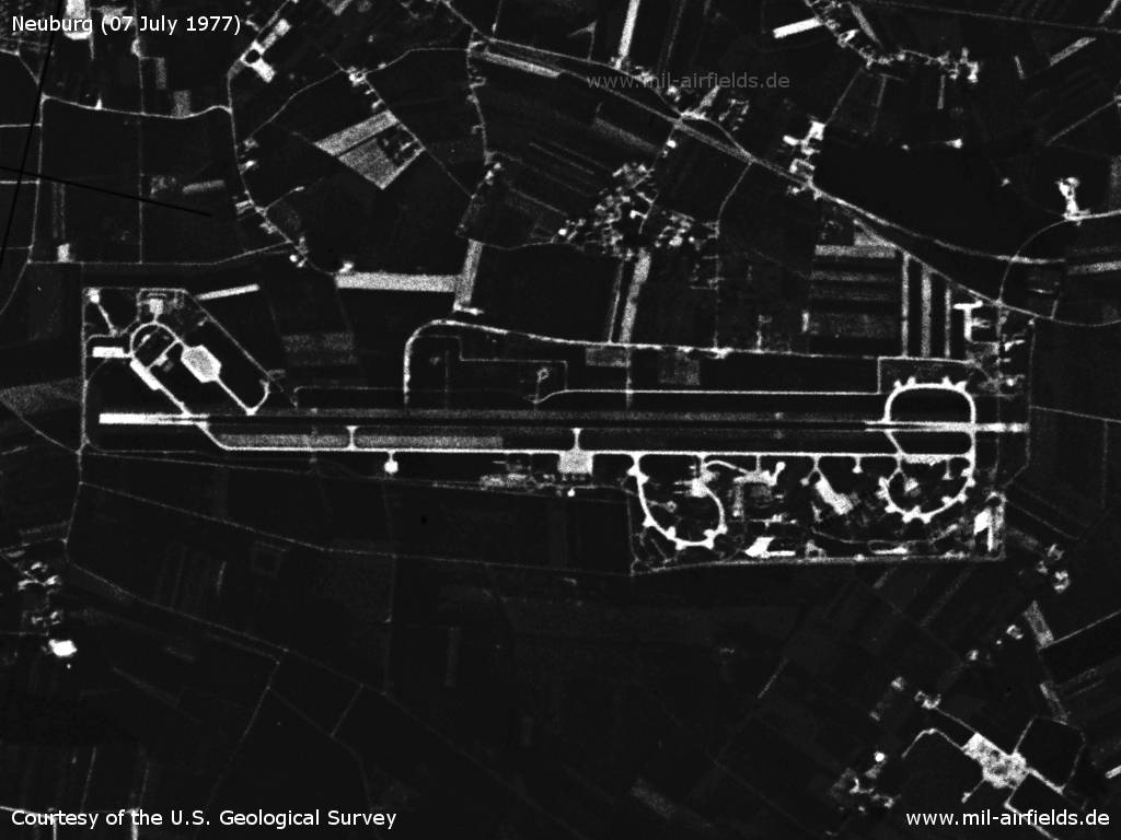
Neuburg/Donau Air Base on a US satellite image from 07 July 1977
Source: U.S. Geological Survey
In the 1980s
Overview
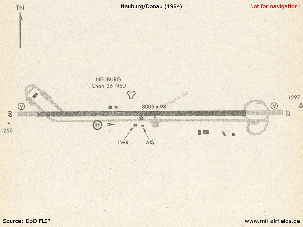
Neuburg in 1984
Source: US DoD
Runways
- 09/27: 2440 m x 30 m Asphalt
Radio beacons
- TACAN: CH 26 "NEU", at field
Today
Use
German Air Force airbase.
Overview
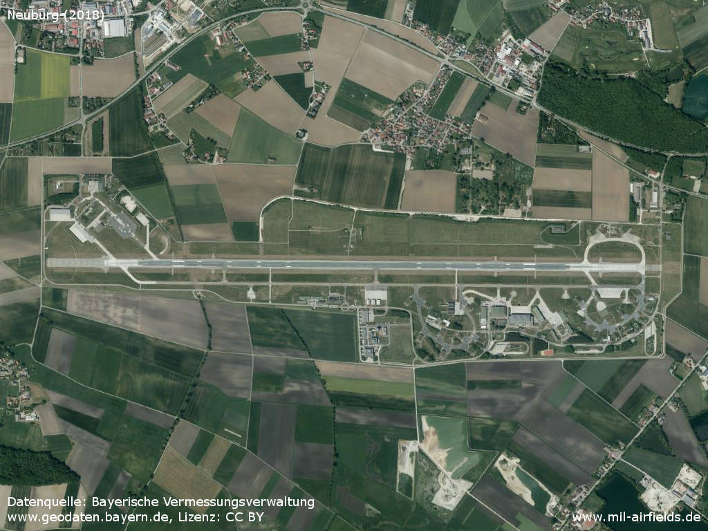
Aerial image (2018)
Source: Datenquelle: Bayerische Vermessungsverwaltung www.geodaten.bayern.de, License: Creative Commons Namensnennung 3.0 Deutschland (CC BY 3.0 DE)
Sources
- https://geoportal.bayern.de/ - Geoportal Bayern
Airfields in the vicinity
Categories
Military Airfields GermanyMilitary Airfields in former West GermanyGerman Air Force Air BasesRecommended
Image credits are shown on the respective target page, click on the preview to open it.
 Follow mil-airfields on Facebook