For historical information only, do not use for navigation or aviation purposes!
| Coordinates | N523647 E0141433 (WGS84) Google Maps |
| Elevation | 33 ft |
| Former East Germany (GDR) | District of Frankfurt/O |
| Federal state | Brandenburg |
| Region | Oder, Oderbruch |
| Location indicator | ETWN |
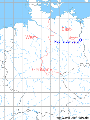
Germany during the Cold War Map
The history of the Cold War airfields: Neuhardenberg (Marxwalde)
Location
The village is located ca. 50 km east-northeast of Berlin. In former East Germany, the municipality and therefore the airfield had the name "Marxwalde". It was situated in the district (Bezirk) Frankfurt/O. After German reunification, the village was renamed back to "Neuhardenberg" and today it belongs to the Federal State of Brandenburg.
Location of airfield
The airfield is located northeast of Neuhardenberg
During World War II
Use
Luftwaffe airfield.
Situation
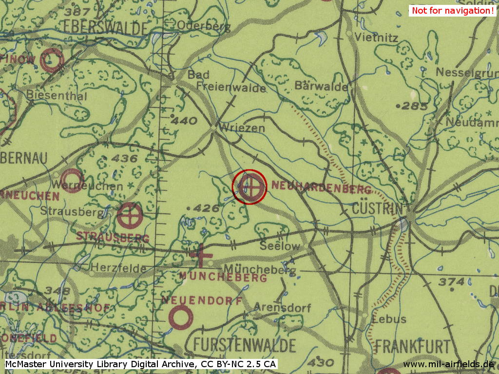
Neuhardenberg Air Base in World War II on a US map from 1943
Source: McMaster University Library Digital Archive, License: Creative Commons Attribution-NonCommercial 2.5 CC BY-NC 2.5 CA
During the Cold War
Use
Airfield of the East German Air Force (NVA LSK/LV). Base of Fighter Wing 8 (JG-8) and of the GDR governmental VIP transport, first as Independent Transport Flight Squadron, later Transport Flight Squadron 29 (TFS-29) and finally as Transport Flight Wing 44 (TFG-44, TG-44).
In the 1960s
Overview
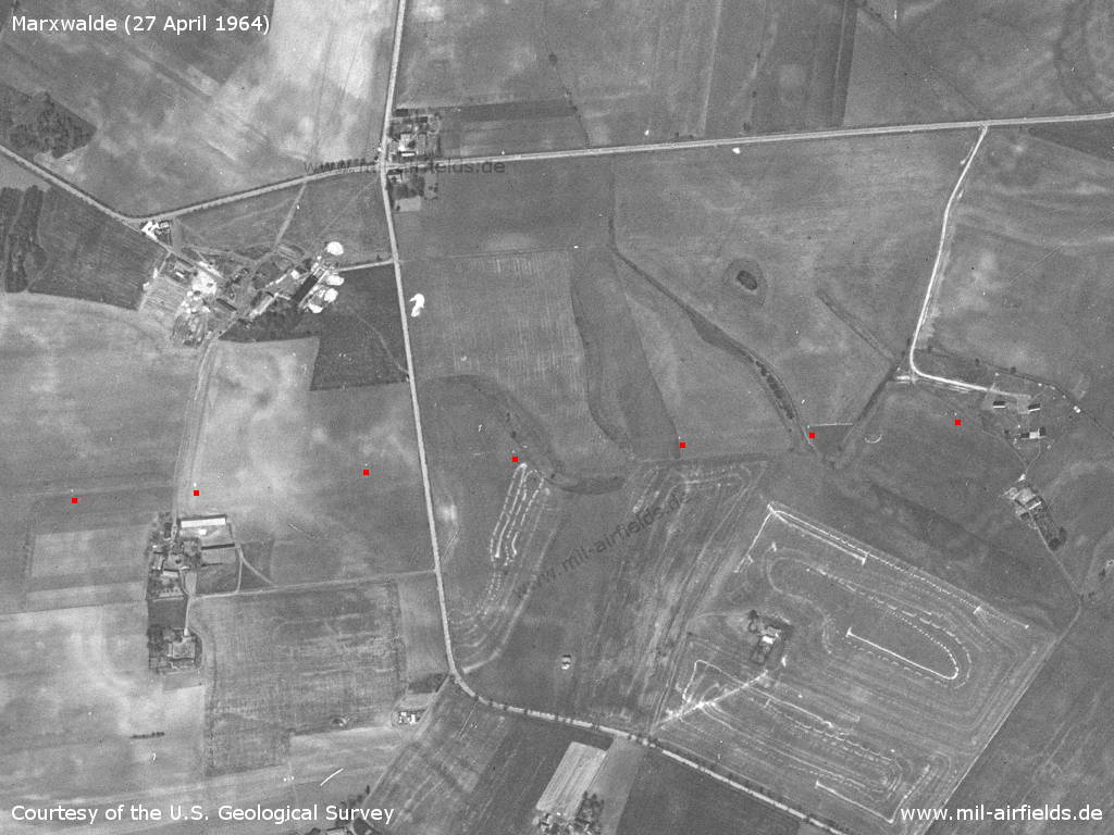
1964
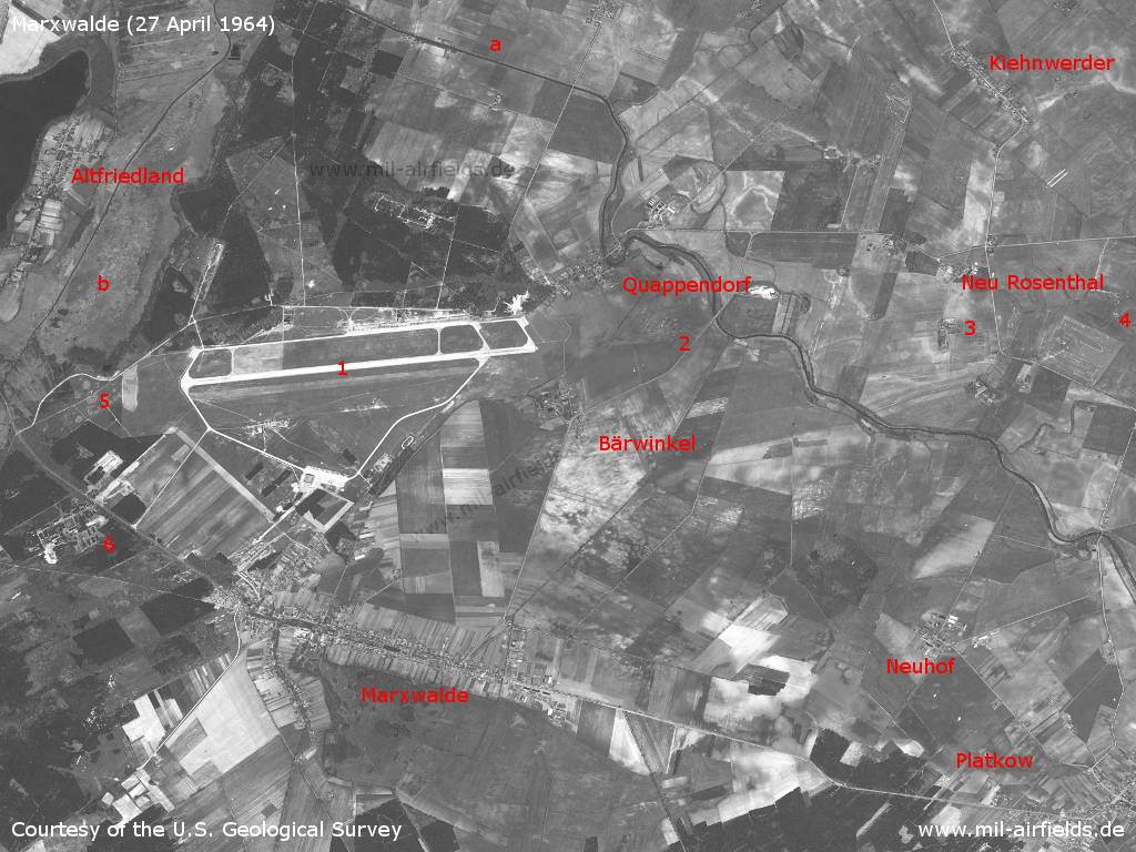
Marxwalde, GDR, on a US satellite image from Monday 27 April 1964 - 1: airfield; 2: inner radio beacon east; 3: direction finder?; 4: outer radio beacon east; 5: inner radio beacon west; 6: barracks. Places: Altfriedland, Bärwinkel, Kiehnwerder, Neu Rosenthal, Neuhof, Quappendorf. a: Quappendorfer Kanal / Gusower Alte Oder; b: At this time the Lake Kietzer See was silted up.
Source: U.S. Geological Survey
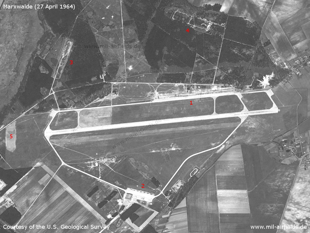
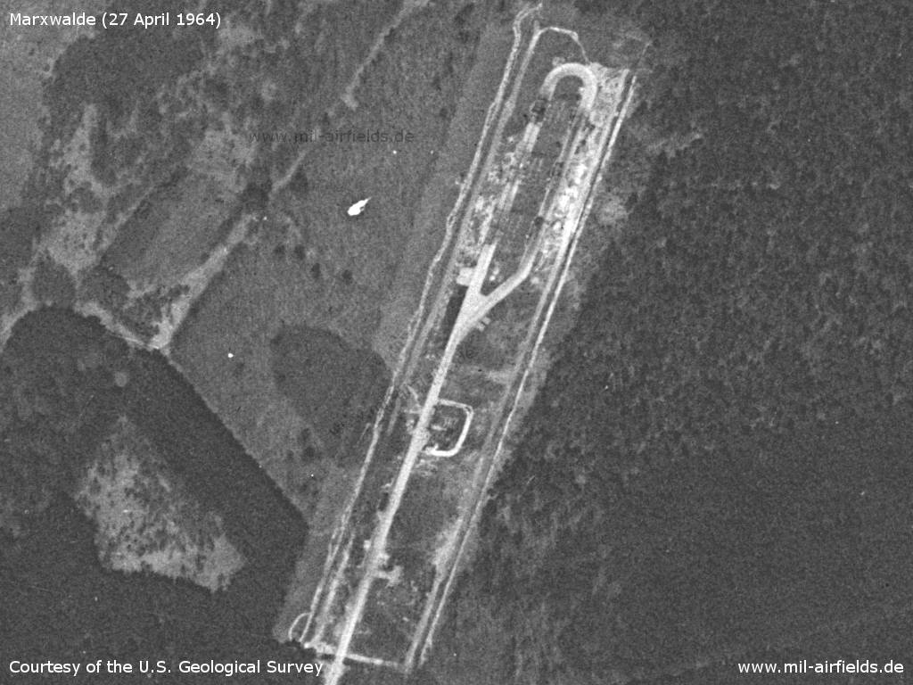
Airfield - 1: flightline of Fighter Wing 8; 2: ramp of Transport Flight Squadron 3: fuel dump; 4: ammunition dump; 5: earth stopping surface.
Source: U.S. Geological Survey
Fuel dump
Source: U.S. Geological Survey
Ammunition dump
Source: U.S. Geological Survey

Parked fighter aircraft (1)
Source: U.S. Geological Survey
There are older aircrafts, probably MiG-15/MiG-17 as well as newer aircrafts, probably MiG-21.
Source: U.S. Geological Survey
Further airplanes
Source: U.S. Geological Survey
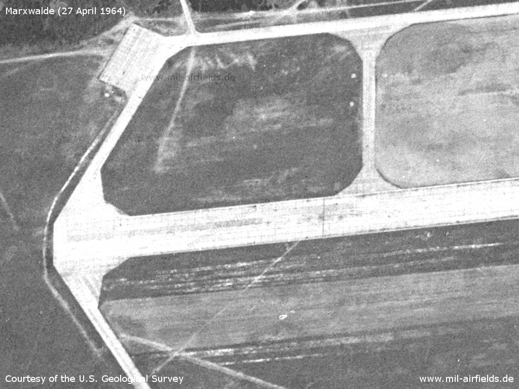
Western end of the runway - Directly to the south a parallel grass runway was created.
Source: U.S. Geological Survey
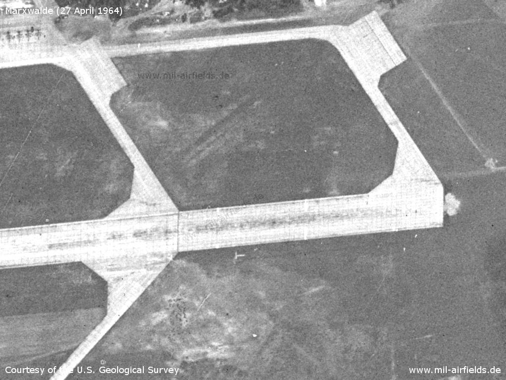
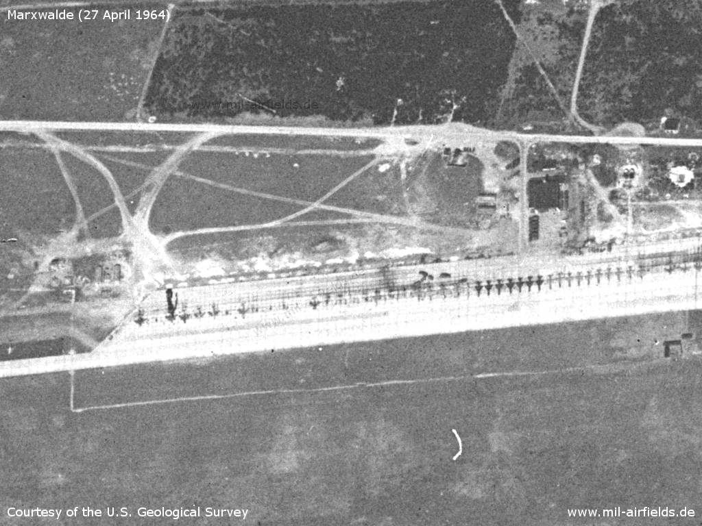
Eastern end of the runway with landing-T - Apparently the runway was lengthened in the past by about 300 to the east.
Source: U.S. Geological Survey
Facilities south of the runway
Source: U.S. Geological Survey
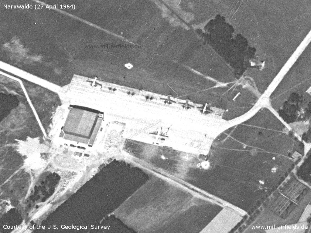
Ramp of the Independent Transport Flight Squadron. - Four aircraft of type Il-14 and one Il-18 are visible.
Source: U.S. Geological Survey
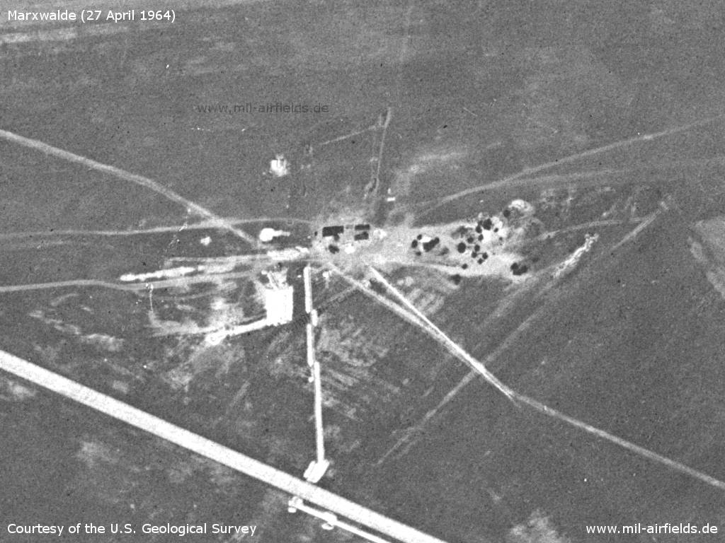
Further installations in the southeast
Source: U.S. Geological Survey
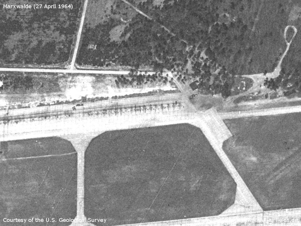
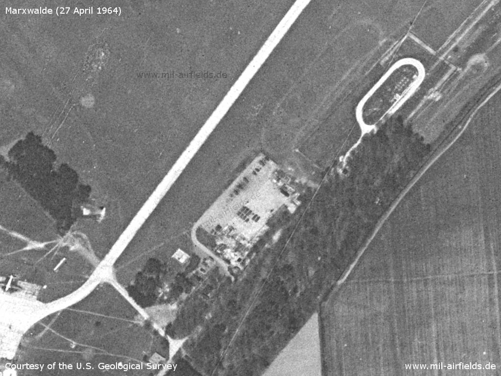
Inner radio marker east
Source: U.S. Geological Survey
Direction finder?
Source: U.S. Geological Survey
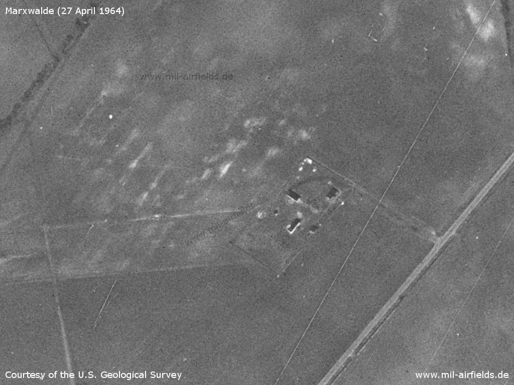
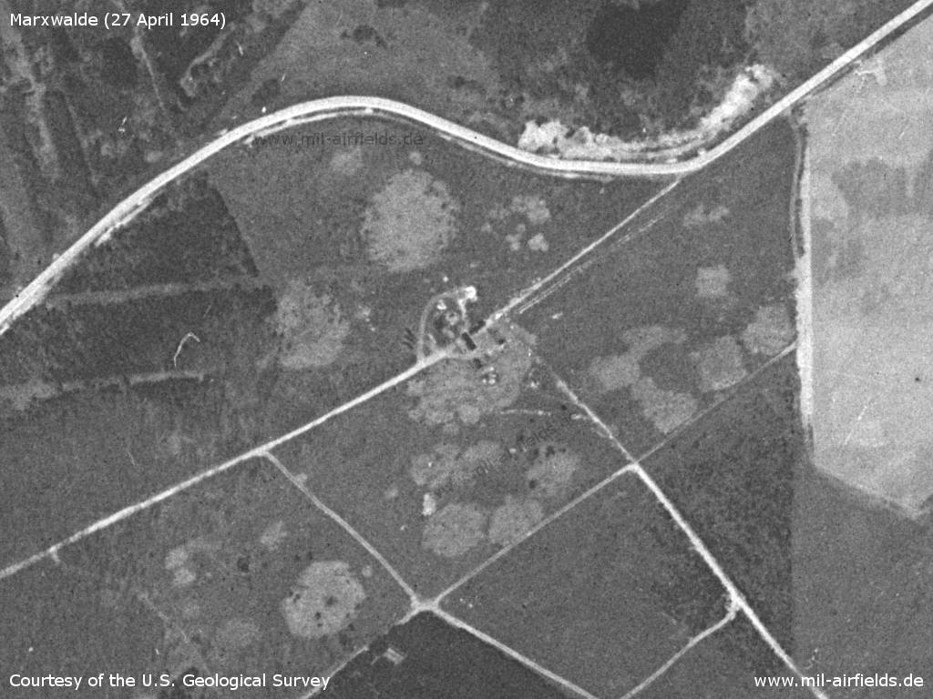
Outer radio marker east
Source: U.S. Geological Survey
From the outer radio marker, the approach course is marked on the ground - At intervals of approx. 200 m there are markings - here illustrated with red dots
Source: U.S. Geological Survey
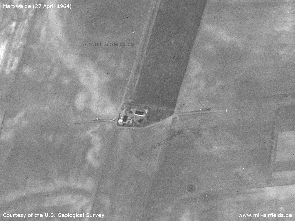
Inner radio marker west
Source: U.S. Geological Survey
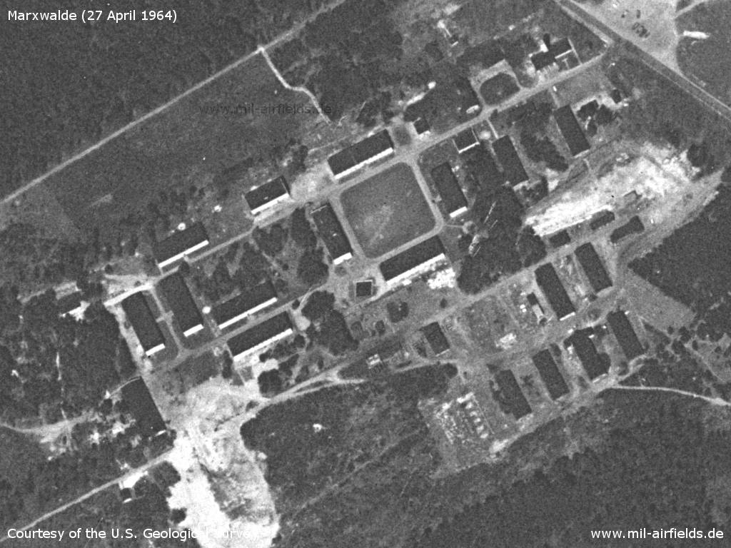
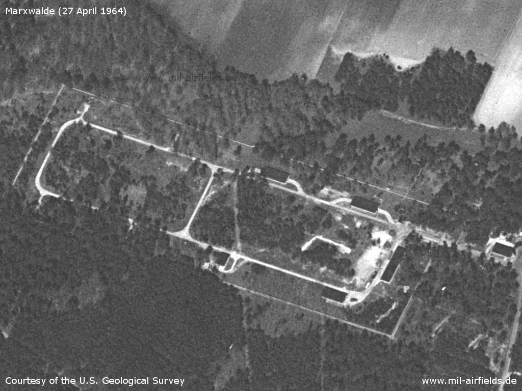
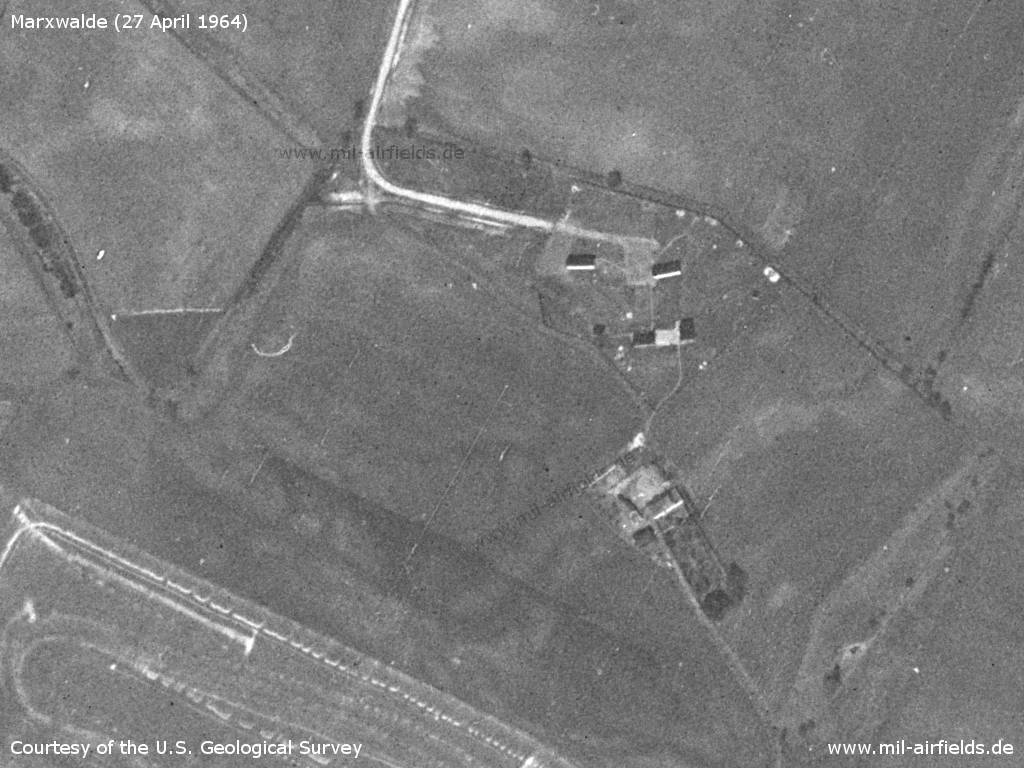
Barracks
Source: U.S. Geological Survey
1965
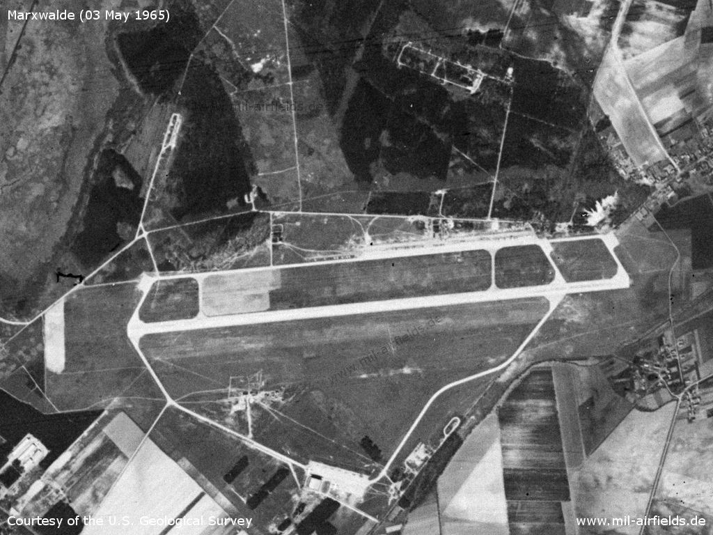
Monday 03 May 1965 - The situation appears to be largely unchanged from the previous year.
Source: U.S. Geological Survey
1968
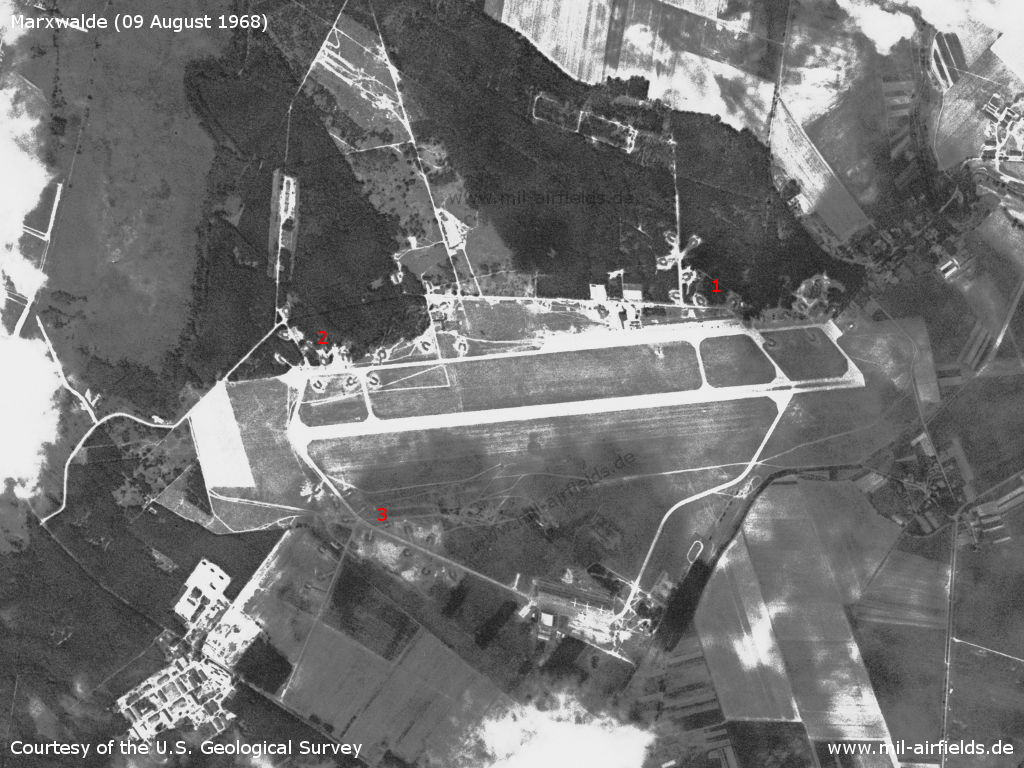
The airfield on Friday 09 August 1968 - There are three dispersal areas with open aircraft revetments recognizable (1, 2, 3).
Source: U.S. Geological Survey
1969
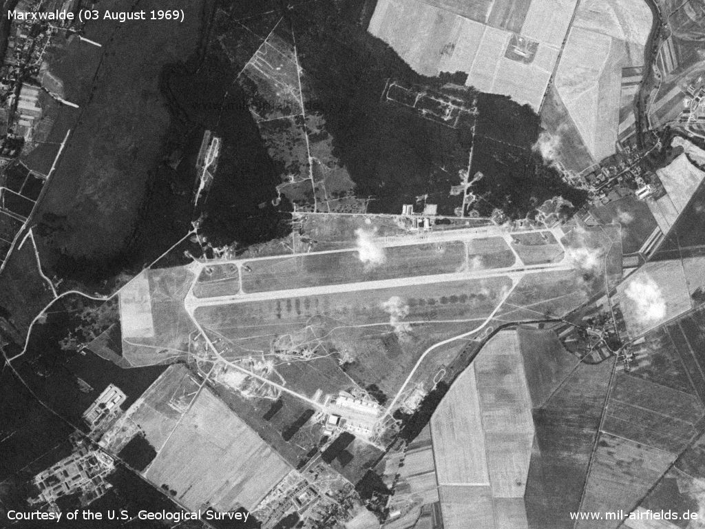
Marxwalde on Sunday, 03 August 1969
Source: U.S. Geological Survey
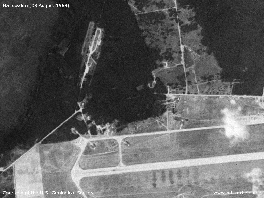
Northwestern part
Source: U.S. Geological Survey
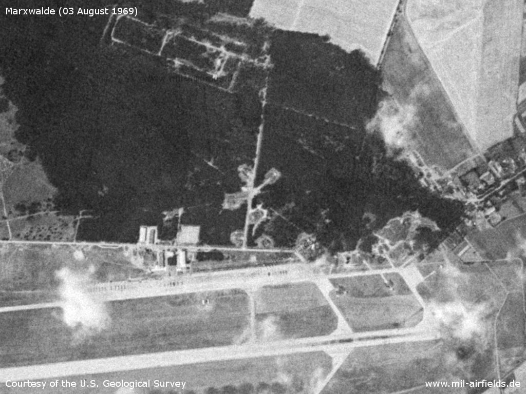
Northeastern part
Source: U.S. Geological Survey
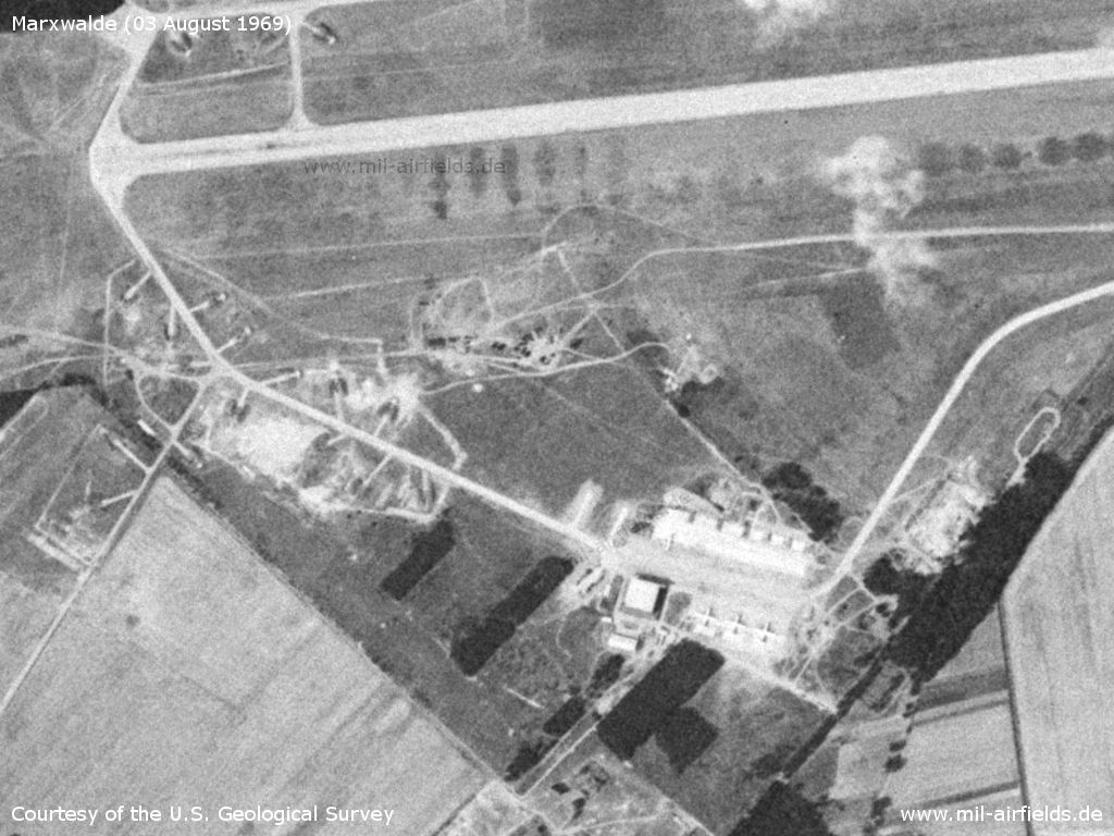
Southern part
Source: U.S. Geological Survey
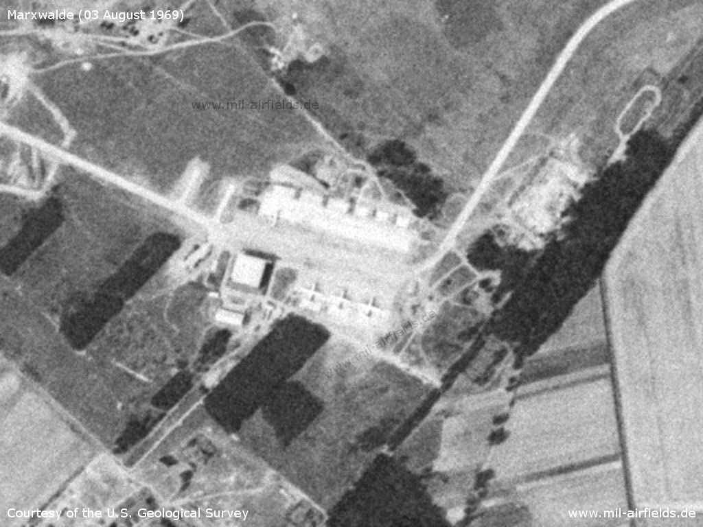
Ramp of Transport Flight Squadron 29 (TFS-29) - Next to the hangar there are 3 aircraft Il-18. The aircraft opposite the hangar could have arrow-shaped wings, i.e. a Tu-124 or a first Tu-134.
Source: U.S. Geological Survey
In the 1970s
Situation
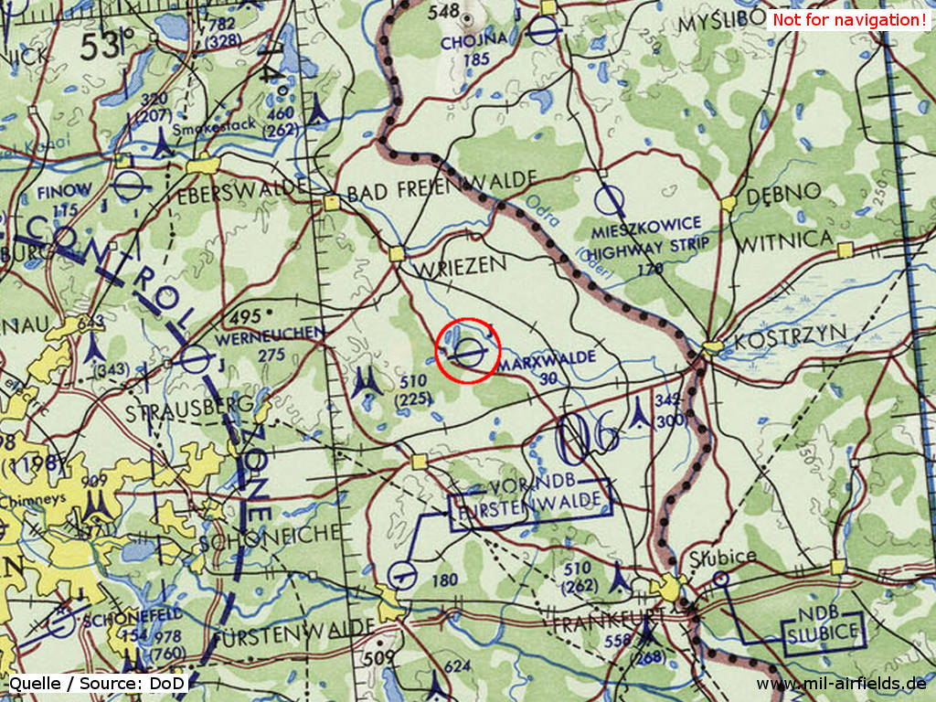
Neuhardenberg / Marxwalde Air Base on a map of the US Department of Defense from 1972
Source: ONC E-2 (1972), Perry-Castañeda Library Map Collection, University of Texas at Austin
Overview
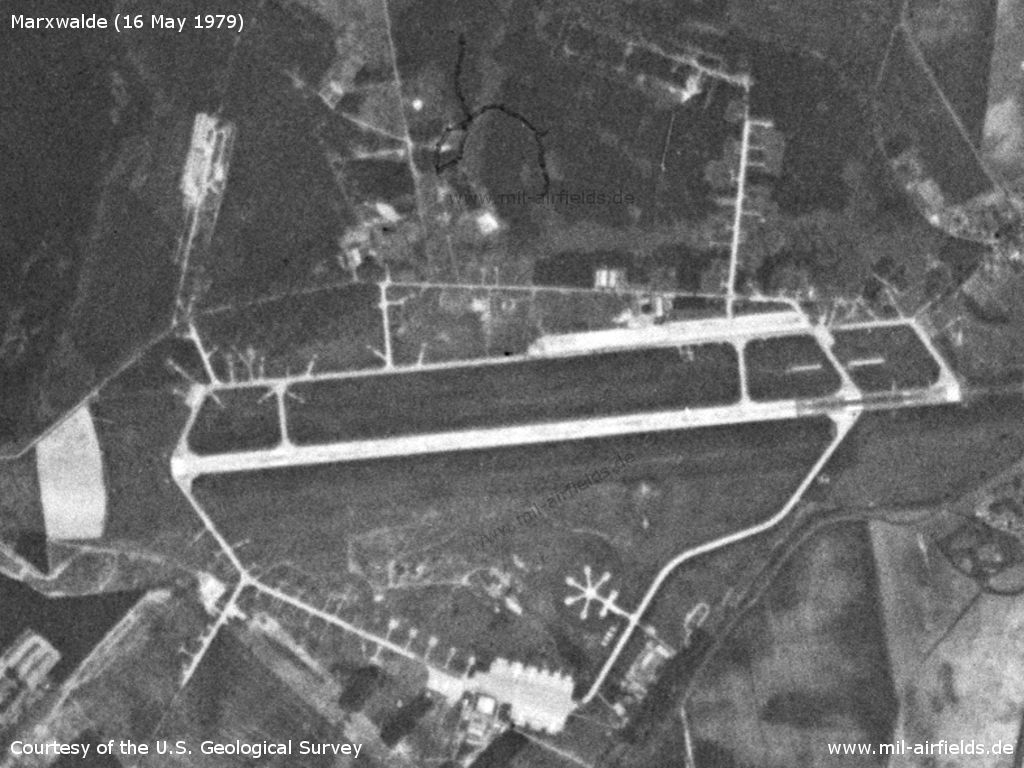
Satellite image Wednesday 16 May 1979 - Compared to the situation 10 years ago, the facilities have been considerably expanded. There are aircraft shelters for two squadrons. And in the south, the "star" as parking place for helicopters of the Transport Aviation Wing 44 (TG-44) is recognizable.
Source: U.S. Geological Survey
In the 1980s and early 1990s
Overview
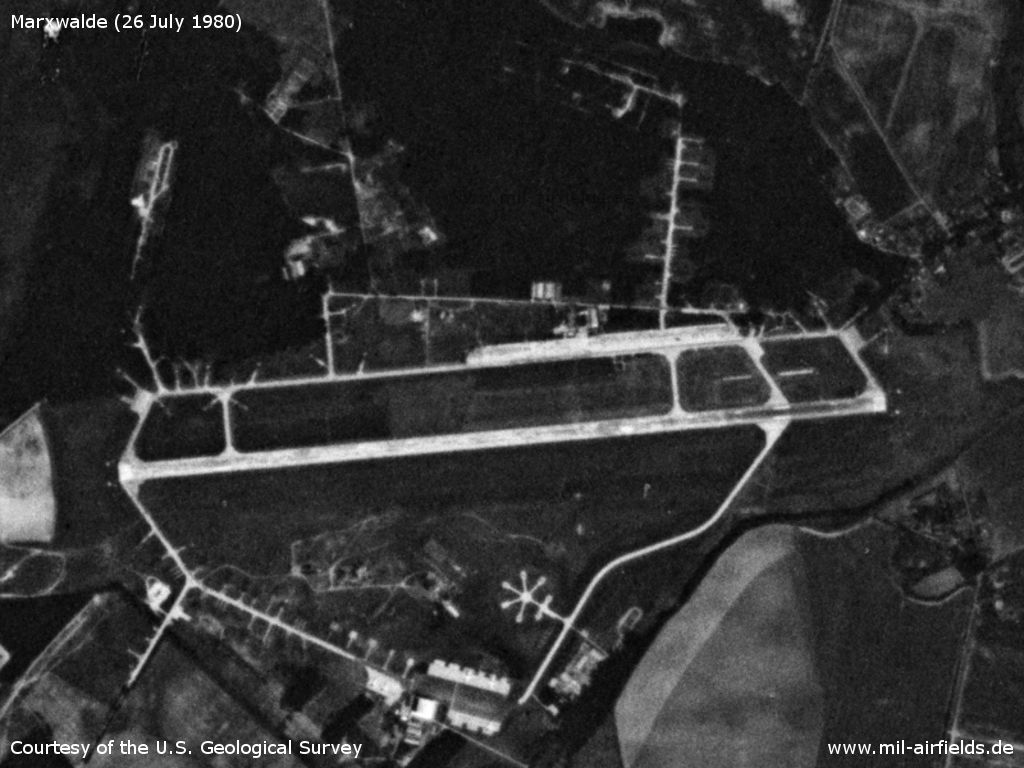
Saturday 26 July 1980
Source: U.S. Geological Survey
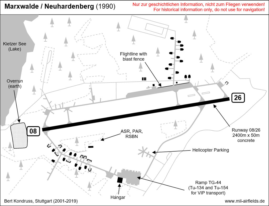
Runways
- 08/26: 2400 m x 50 m Concrete
- 08/26: 1800 m x 40 m Grass
Radio beacons
- RSBN
- LOM 26: 472 "BU", 3920m to THR26
- LMM 26: 958 "B", 930m to THR26
- LOM 08: 472 "UB", 3900m to THR26
- LMM 08: 958 "U", 900m to THR26
- ILS 26: 110.9
- PRGM
Radio communication
The airfield call sign was "BERGBAU" (German word for "mining").
Telephone
Sondernetz S1 25738 call signs: BEIWAGEN, GRUNDLINIE (1990)
Maps
Maps from the "Directory 012" (Verzeichnis 012), containing aeronautical information about military airfields of the former East Germany National People's Army (NVA) and Border Troops (GT). The document was classified as "Secret".
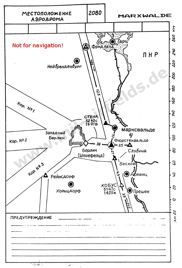
Location in relation to airways.
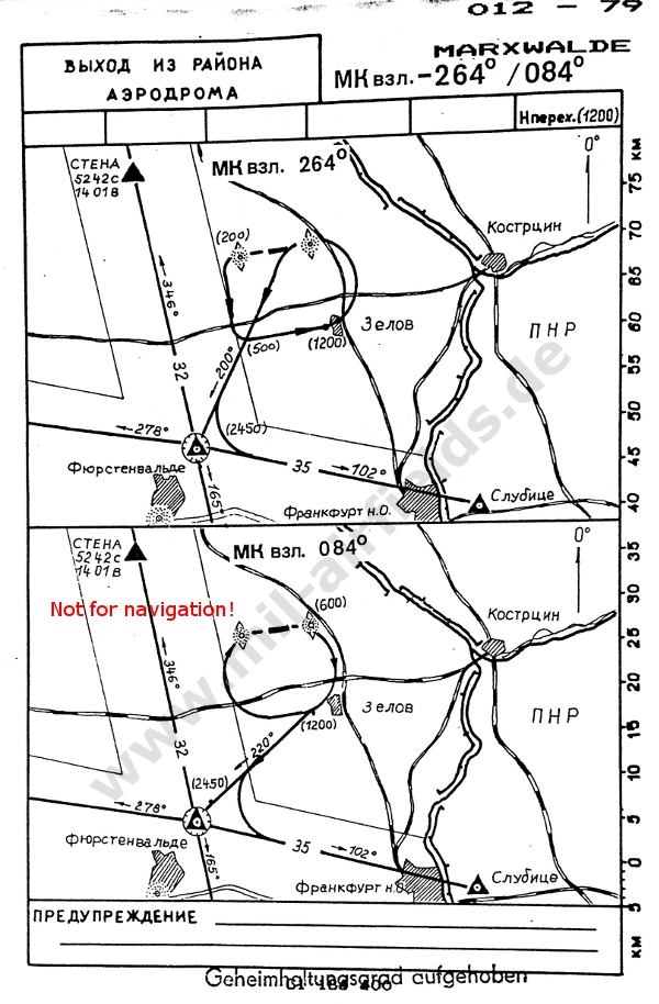
Departure routes from the airfield to the airways
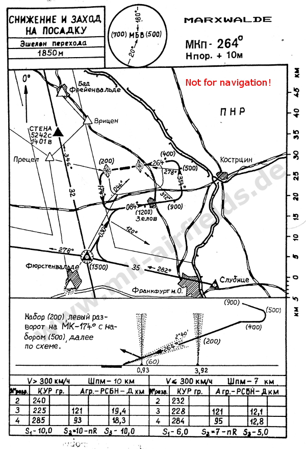
NDB approach in main landing direction 264°
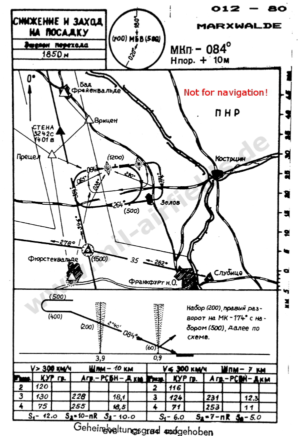
NDB approach in secondary landing direction 084°
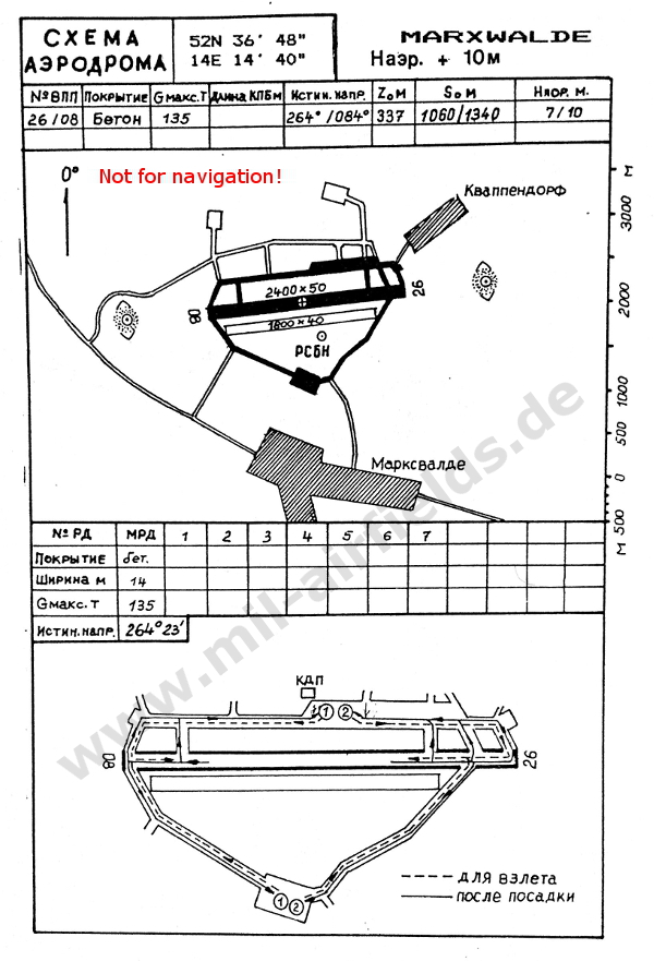
Airfield map
Units
Jagdfliegergeschwader 8 (JG-8) (Fighter Wing 8) "Hermann Matern"
- Address: Postbox PF 44192
- Aircraft: MiG-21bis, MiG-21UM (1990)
- Address: Postbox PF 44192
- Aircraft: MiG-21bis, MiG-21UM (1990)
Fliegertechnisches Bataillon 8 (FTB-8)
- Address: Postbox 63910
- Address: Postbox 63910
Nachrichten- und Flugsicherungsbataillon 8 (NFB-8)
- Address: Postbox 86196
- Address: Postbox 86196
Transportfliegergeschwader 44 (TG-44) (Transport Flight Wing 44) "Arthur Pieck"
- Address: Postbox 33672
- Aircraft: Tu-134A, Tu-154M, Mi-8 (1990)
- Address: Postbox 33672
- Aircraft: Tu-134A, Tu-154M, Mi-8 (1990)
Fliegertechnisches Bataillon 44
- Address: Postbox 33636
- Address: Postbox 33636
Installations
The wing command post was collocated with the Radio-technical Bataillon 61 (Radar Bataillon 61) in Müncheberg, 12 km south-southwest of the airfield.
A fuel depot was located at Trebnitz railway station, 8 km to the south. This probably served as delivery and buffer storage, as Marxwalde was one of only a few East German air bases without a direct railway connection.
Further installations:
- 05/264 Lietzen, Wassermühle: Fläche 0,2 ha, Unterkunft: 29 Plätze (JG-8)
- 05/335 Ringenwalde, Am Dolgensee: Fläche 6,9 ha (JG-8)
- 05/264 Lietzen, Wassermühle: Fläche 0,2 ha, Unterkunft: 29 Plätze (JG-8)
- 05/335 Ringenwalde, Am Dolgensee: Fläche 6,9 ha (JG-8)
Additional information
Crash of MiG-21bis "844" 19FEB1990
MiG-21bis was on a training flight when it encounters an engine problem. The pilot tries to get back to the air base, but lost height continuously. He had to give up the plane and ejected late at a height of 200 m and only after resolute commands by the flight director (tower). The plane went down near Kostrzyn (Poland), ca. 30 km east-southeast of Marxwalde.
The following transcript is the radio communication of the final minutes. It starts with a call of the pilot of the "844" (call sign "487") to Marxwalde flight director (call sign "BERGBAU START"). At this time, the plane is accompanied by another MiG-21, piloted by the wing commander (call sign "402"). The transcripts ends with the message from the other MiG-21 that the ejected pilot fired a red signal light (Rotfeuer) to show his succesful landing.
Normally, radio communication was done in russian language. But in special cases like this it was permitted to use german language as well.
The transcript is courtesy of HR, thanks a lot!
Explanation
| 487 | Ejected pilot |
| 402 | Second MiG-21 |
| 527, 691 | Other aircraft |
| FL | Flight director (Tower), call sign "BERGBAU START" |
| LL | Landeleiter (Final Controller) |
| (GE) | German language |
| (RU) | Russian language |
Transkript
| 487 | BERGBAU START, 487 auf Kanal 7 im Verband mit der 402, Kurs 350, Höhe 800, leicht gleitend |
| FL | 487, habe Sie verstanden, KL7 (?) erlaubt |
| FL | 402, Sie beobachten die 487? |
| 402 | Er ist zur Zeit hinter mir. Ich sehe ihn zwar noch, aber ich kann nicht halten, ja. ... Ich versuche noch mal zurück |
| FL | Ich habe verstanden |
| 487 | BERGBAU START von der 487. Habe 5%? Drehzahl, 400 km/h. Läßt sich nicht beschleunigen. Komme so weit wie möglich an den Platz ran. Fahre dann ganz zum Schluß das Fahrwerk aus zur Landung. |
| FL | 487, ist Ihre Schubdüse offen? |
| 487 | Nein |
| 402 | Die 487 hat rechts hinten ein sehr großes Loch |
| FL | Ja ich habe verstanden |
| 527 | 527 25 ... (RU) |
| FL | 487, Ihre Höhe? |
| 487 | 350, 400 km/h, stark abnehmend jetzt |
| FL | 487, Sie bereiten das Katapultieren vor! Flugzeug in freie Richtung! |
| 487 | Ja Moment noch. Geht noch |
| FL | 487, beachten Sie Höhe und Geschwindigkeit! |
| 487 | 487, meine Höhe jetzt 200m, Geschwindigkeit 350, stark ... 402, ist das jetzt eine freie Richtung für mich? |
| FL | 487, Sie katapultieren! |
| 487 | 402, kann ich hier katapultieren? |
| FL | Sie katapultieren, 487! |
| 487 | Ich katapultiere. |
| 527 | 527, K7 ... (RU) |
| FL | Verstanden (RU), 527 (GE) |
| 402 | Schirm offen, Maschine abgestürzt und brennt. |
| FL | 402, ich habe Sie verstanden. Der Schirm ist offen, die Maschine brennt |
| FL | 402 Standort, ungefähr? |
| 402 | ca. 5 km südlich Küstrin |
| FL | 402, ich habe verstanden. Beobachten Sie die Landung der 487 am Schirm! |
| ? | 527 (RU) |
| 402 | Sie ist gelandet! |
| ? | ... (RU) |
| ? | sehe (RU) |
| FL | ... Aufgabe über Rechenwinkel zur Landung |
| ? | ja verstanden. |
| ? | 6 (RU) |
| ? | 10 (RU) |
| 527 | FFF, ... Landung 527 (RU) |
| FL | Landung (RU) |
| LL | Anflug ist zu hoch, 527 |
| ? | 402 ... (RU) |
| ? | ... |
| ? | ... punkt |
| ? | 360 (RU) |
| 691 | 691, 2., Anflug ... (RU) |
| ? | verstanden (RU) |
| 402 | Überstanden, 402, Rotfeuer gezündet. |
Today
Use
General aviation.
Links
- https://www.airportpark-berlin-neuhardenberg.de/ - AirportPark Berlin-Neuhardenberg
- https://flugplatzmuseumneuhardenberg.de/ - Flugplatzmuseum Neuhardenberg
Bibliography
- Ries, Karl; Dierich, Wolfgang: "Fliegerhorste und Einsatzhäfen der Luftwaffe" Motorbuch Verlag Stuttgart, 1993 - Allied map
- Lang, Dietbert; Materna, Horst: "Der Flugplatz Neuhardenberg Marxwalde Neuhardenberg" Verlag Willmuth Arenhövel, Berlin 1998 - Vom geheimen Einsatzhafen des Dritten Reichs zum Regierungsflugplatz der DDR
Airfields in the vicinity
Categories
Military Airfields GermanyMilitary Airfields in former East GermanyAir bases of former National People's ArmyRecommended
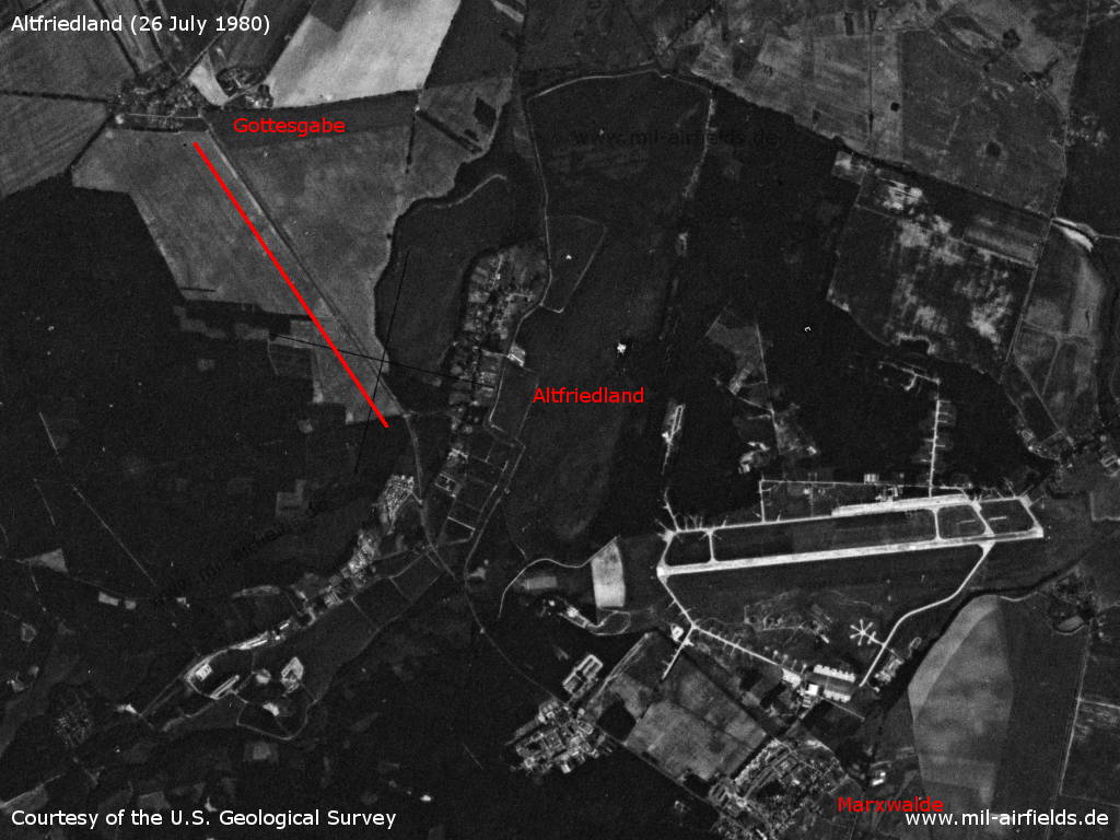
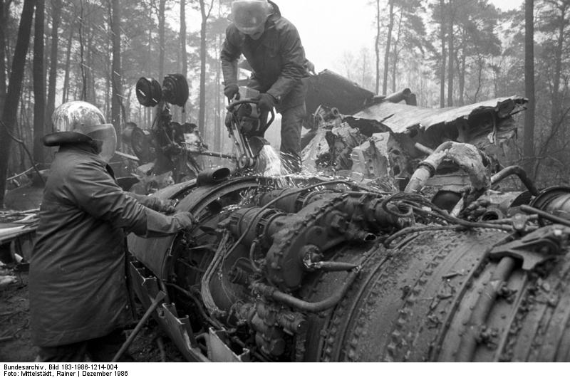
Image credits are shown on the respective target page, click on the preview to open it.
 Follow mil-airfields on Facebook