Parow: Airfield
For historical information only, do not use for navigation or aviation purposes!
| Coordinates | N542209 E0130457 (WGS84) Google Maps |
| Former East Germany (GDR) | District of Rostock |
| Federal state | Mecklenburg-Vorpommern (Mecklenburg-Western Pomerania) |
| Region | Baltic coast |
| Location indicator | ETPA (ca. 1985..1990) |
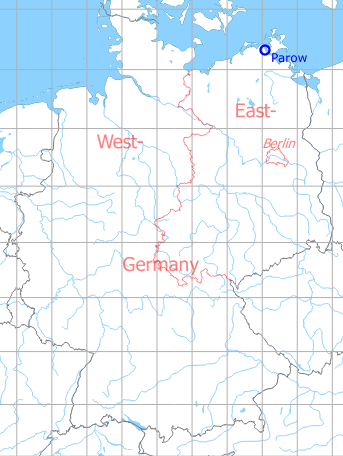
Germany during the Cold War Map
The history of the Cold War airfields: Parow
During World War II
Use
Luftwaffe airbase.
Situation
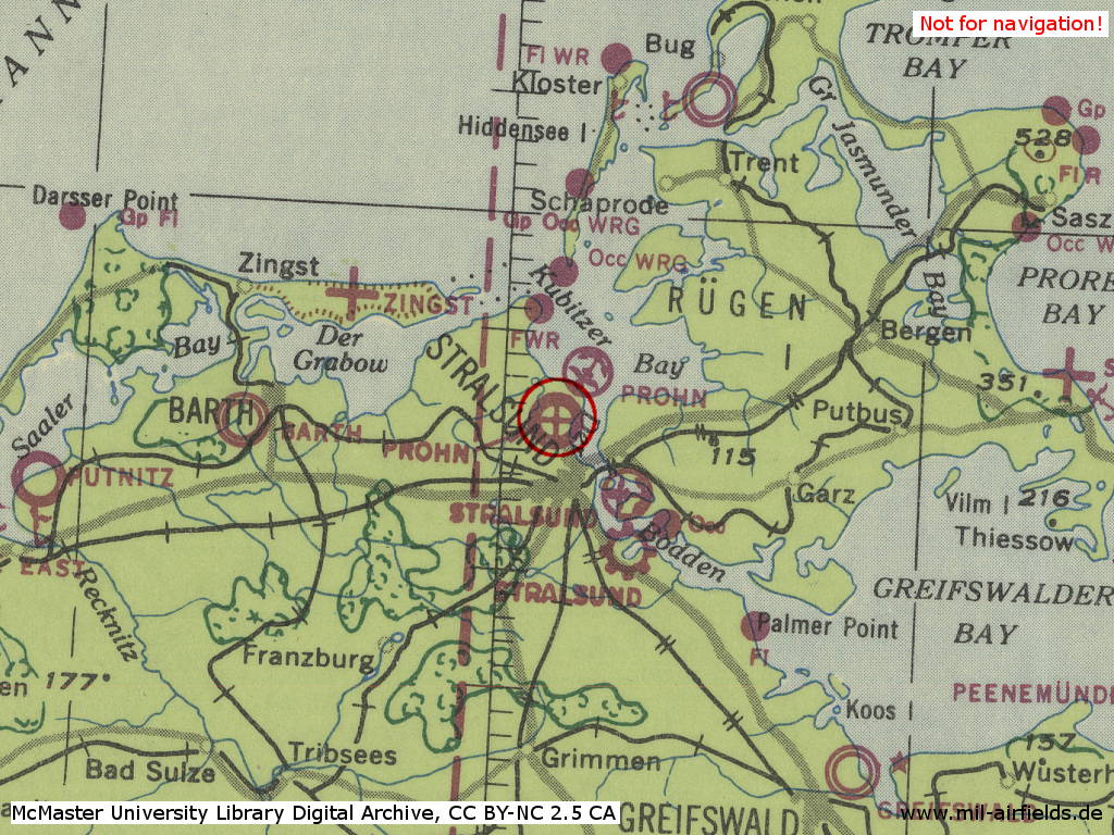
Parow Air Base, here as "Prohn", in World War II on a US map from 1943
Source: McMaster University Library Digital Archive, License: Creative Commons Attribution-NonCommercial 2.5 CC BY-NC 2.5 CA
Overview
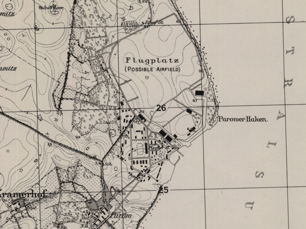
Parow Air Base on a US map from 1952 - The map shows the approximate state of development during the Second World War.
Source: AMS M841 GSGS 4414, Courtesy Harold B. Lee Library, Brigham Young University
During the Cold War
Use
Helicopter base of former East German Navy, e.g. Navy Helicopter Wing 18 (MHG-18).
In the 1960s
Overview
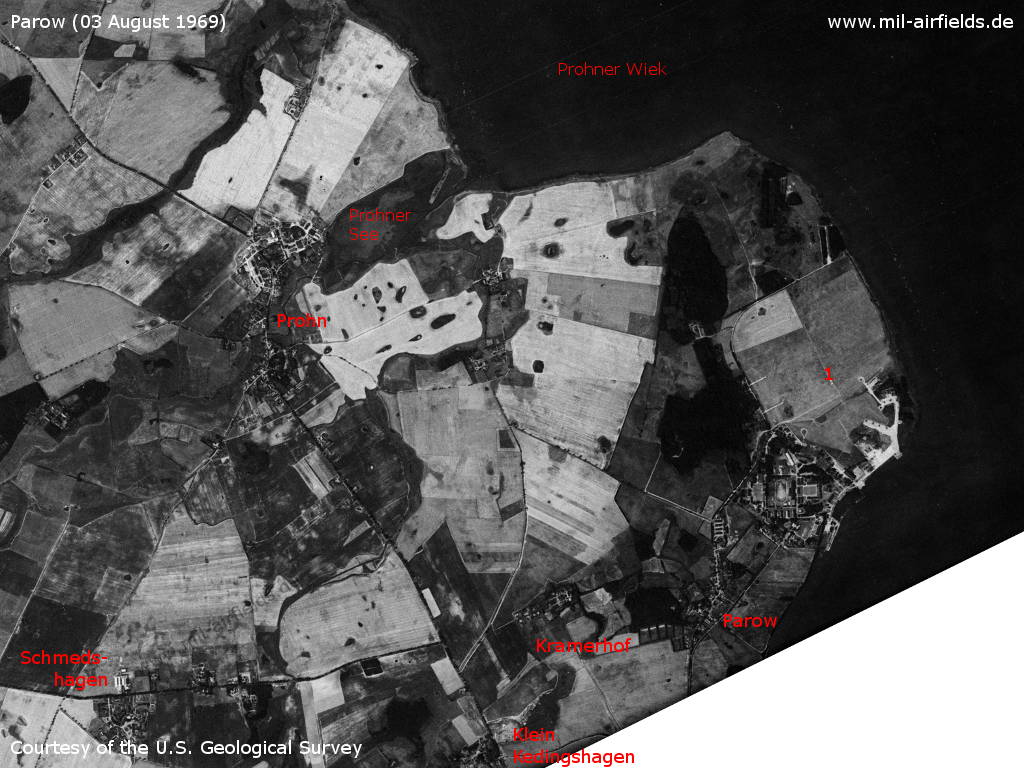
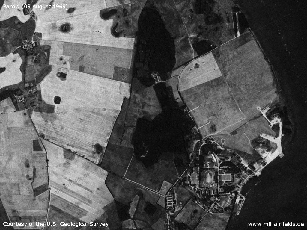
Parow and surroundings on a US satellite image from 03 August 1969 - 1: airfield. Places: Klein Kedingshagen, Kramerhof, Prohn, Schmedshagen. Waters: Prohner See, Prohner Wiek.
Source: U.S. Geological Survey
Parow barracks and airfield
Source: U.S. Geological Survey
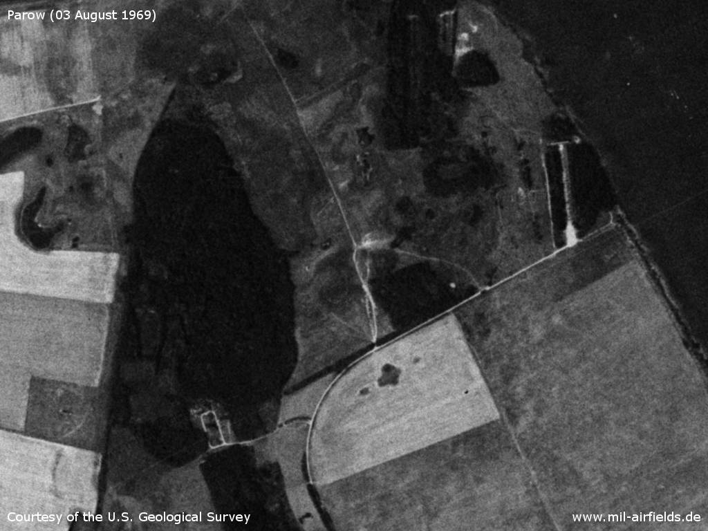
Northern part
Source: U.S. Geological Survey
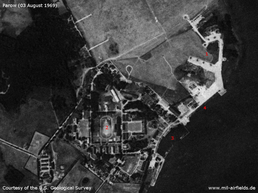
Southern part - 1: helicopter parking positions; 2: Flottenschule naval school; 3: port; 4: former seaplane station.
Source: U.S. Geological Survey
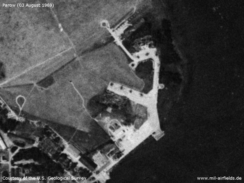
East German Volksmarine helicopters
Source: U.S. Geological Survey
In the 1970s
Radio beacons
- NFF: 287 "LO"
In the 1980s and early 1990s
Runways
- 09/27: 250 m x 30 m Concrete
- 09/27: 800 m x 60 m Grass
Radio beacons
- LMM: 465 "LO", 1000 m
Radio communication
Call sign "LOLO"
Telephone
Sondernetz/Stabsnetz S1 6834-88 "Sperrkreis"
Standard training routes
"Flüge der LSK/LV der NVA und der LSK der GSSD im Rahmen der Gefechtsausbildung sind entsprechend der Grafik der Flugtage / -nächte auf der Grundlage der "Hauptflugregeln zum Fliegen im Luftraum der Deutschen Demokratischen Republik" auf Standardflugstrecken in den dazu festgelegten Flughöhen durchzuführen. ..." (Quelle: "Verzeichnis der Standardflugstrecken der LSK/LV der NVA und der LSK der GSSD")
Stand 1989:
822 Ahlbeck, 54°07'30'' n.B. 14°14' ö.L., 54°40' n.B. 14°00' ö.L., 54°53' n.B. 13°30' ö.L., 54°48' n.B. 12°47' ö.L., 54°36'40'' n.B. 12°23'18'' ö.L., 54°21'10'' n.B. 12°08'40'' ö.L., 54°21'10'' n.B. 11°48' ö.L., Kühlungsborn, Warnemünde, Darßer Ort, Barth, Parow
Flughöhe: 15 - 300 m
Flughöhe: 15 - 300 m
Diese Strecke kann nach Abstimmung mit der VHZ auch teilweise beflogen werden. Dabei kann der Flug zwischen dem FP Parow und den entsprechenden Wendepunkten auf folgenden Streckenabschnitten durchgeführt werden:
A: Parow, Greifswald, Ahlbeck
B: Parow, Sellin, Greifswalder Oie
C: Parow, Stubbenkammer
D: Parow, Arkona
E: Parow, Dornbusch
F: Parow, Barth, Darßer Ort
G: Parow, Barth, Darßer Ort, Warnemünde
H: Parow, Barth, Darßer Ort, Warnemünde, Kühlungsborn
A: Parow, Greifswald, Ahlbeck
B: Parow, Sellin, Greifswalder Oie
C: Parow, Stubbenkammer
D: Parow, Arkona
E: Parow, Dornbusch
F: Parow, Barth, Darßer Ort
G: Parow, Barth, Darßer Ort, Warnemünde
H: Parow, Barth, Darßer Ort, Warnemünde, Kühlungsborn
823 Parow, Grimmen, Greifswald, Bergen, Dornbusch, Parow
Flughöhe: 15 - 600 m
Höheneinnahme: Traverse Grimmen
Höhenaufgabe: Dornbusch
Flughöhe: 15 - 600 m
Höheneinnahme: Traverse Grimmen
Höhenaufgabe: Dornbusch
824 Parow, Demmin, Basepohl, Spantekow, Greifswald, Trent, Parow
Flughöhe: 15 - 600 m, 900 m, 1200 m
Flughöhe: 15 - 600 m, 900 m, 1200 m
825 Parow, Trent, Parow
Flughöhe: 15 - 600 m
Flughöhe: 15 - 600 m
827 Parow, Greifswald, Peenemünde, Trent, Parow
Flughöhe: 600 m, 900 m, 1200 m
Flughöhe: 600 m, 900 m, 1200 m
828 Parow, Thiessow, Peenemünde, Göhren, Parow
Flughöhe: 15 - 200 m
Flughöhe: 15 - 200 m
829 Parow, Greifswald, Stolpe, Peenemünde, Trent, Parow
Flughöhe: 15 - 600 m, 900 m, 1200 m
Flughöhe: 15 - 600 m, 900 m, 1200 m
Units
Data for the year 1990: Naval Helicopter Wing 18 (MHG-18) "Kurt Barthel" (Postbox PF 74829) with Mi-8S, Mi-8T, Mi-8TB, Mi-14BT, Mi-14PL; FTB-18 (Postbox PF 74833).
Real property
Former National People's Army installation ID: 01/001.
Today
Use today
Closed. Now Naval Engineering School, with helipad.
Videos
- Letzter NVA Flug MHG 18 - Last flight of Naval Helicopter Wing 18 with takeoff and landing at Parow in 1990.
Sources
- https://lib.byu.edu/collections/german-maps/ - Brigham Young University Library
Links
- www.parow-info.de - History and pictures of the community and the former airfield.
Bibliography
- Ries, Karl; Dierich, Wolfgang: "Fliegerhorste und Einsatzhäfen der Luftwaffe" Motorbuch Verlag Stuttgart, 1993 - Allied map of the Parow airbase.
- Billig, Detlef; Meyer, Manfred: "Flugzeuge der DDR, III. Band bis 1990" TOM Modellbau, Friedland, 2003 - Pictures of Mi-14 at Parow.
Airfields in the vicinity
Categories
Military Airfields GermanyMilitary Airfields in former East GermanyAir bases of former National People's ArmyRecommended
Image credits are shown on the respective target page, click on the preview to open it.
 Follow mil-airfields on Facebook