For historical information only, do not use for navigation or aviation purposes!
| Coordinates | N533223 E0132343 (WGS84) Google Maps (approximate location) |
| Former East Germany (GDR) | District of Neubrandenburg |
| Federal state | Mecklenburg-Vorpommern (Mecklenburg-Western Pomerania) |

Germany during the Cold War Map
The history of the Cold War airfields: Pragsdorf
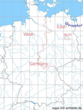
Location of airfield
At Pragsdorf.
Usage during the Cold War
Helipad 3350 for reserve command post 3rd Air Defence Division (WGS 3. LVD) and command post Fighter Wing 2 (GS JG-2) / Radar bataillon 23 (FuTB-23) of former East German Air Force (NVA LSK/LV).
Use today
Closed.
Runways, taxiways, aprons
Dimensions: 60 m x 50 m,
main takeoff and landing direction: 315°,
surface: solid grass,
capacity: 1 helicopter.
main takeoff and landing direction: 315°,
surface: solid grass,
capacity: 1 helicopter.
Telephone
Stabsnetz S1 43301
Airspace and procedures
Usable at day during good weather conditions.
Alert time: 60 minutes.
Alert time: 60 minutes.
Obstacles
Power transmission line: direction 270°, distance 100 m, height 15 m.
Airfields in the vicinity
- 141°/4km Cölpin: Helipad 3301 (HSLP / HLP 3301)
- 090°/5km Katzenhagen: Helipad 3302 (HSLP / HLP 3302)
- 238°/6km Burg Stargard: Agricultural Airfield, Helipad 3336 (HSLP / HLP 3336, Lindenhof)
- 320°/9km Neubrandenburg: Air Base (Trollenhagen)
- 094°/11km Ulrichshof: Helipad 3014 (HSLP / HLP 3014)
- 243°/13km Klein Nemerow: Helipad 3006 (HSLP / HLP 3006)
- 163°/18km Wendorf: Helipad 3027 (HSLP / HLP 3027)
 Follow mil-airfields on Facebook