For historical information only, do not use for navigation or aviation purposes!
| Coordinates | N521646 E0132547 (WGS84) Google Maps |
| Former East Germany (GDR) | District of Potsdam |
| Federal state | Brandenburg |
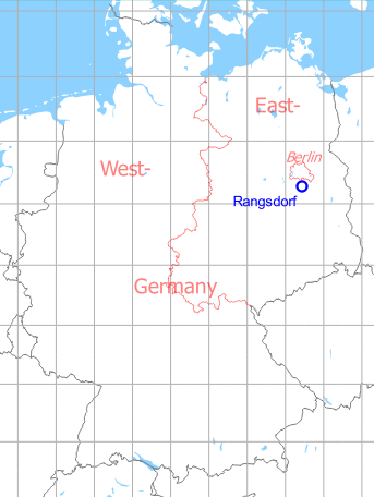
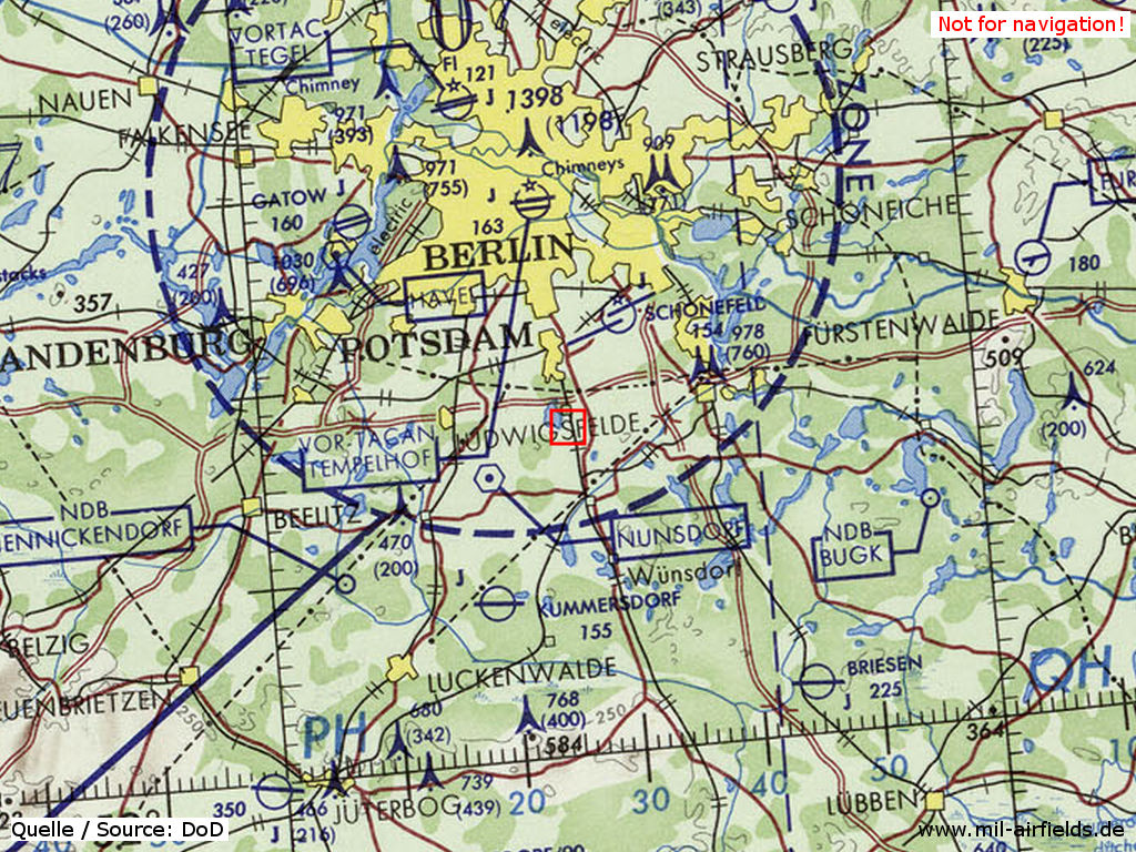
Germany during the Cold War Map
The history of the Cold War airfields: Rangsdorf
General
The Rangsdorf airfield was built in the mid-1930s as a sports airfield. It consisted of a land airfield and a seaplane airfield on Lake Rangsdorf. The Bücker aircraft factory was also located here. At the end of the Second World War the airfield was occupied by Soviet troops, which used it until 1994. There was a maintenance facility for helicopters and an aircraft scrap yard. Today the airfield is closed.
During World War II
Overview
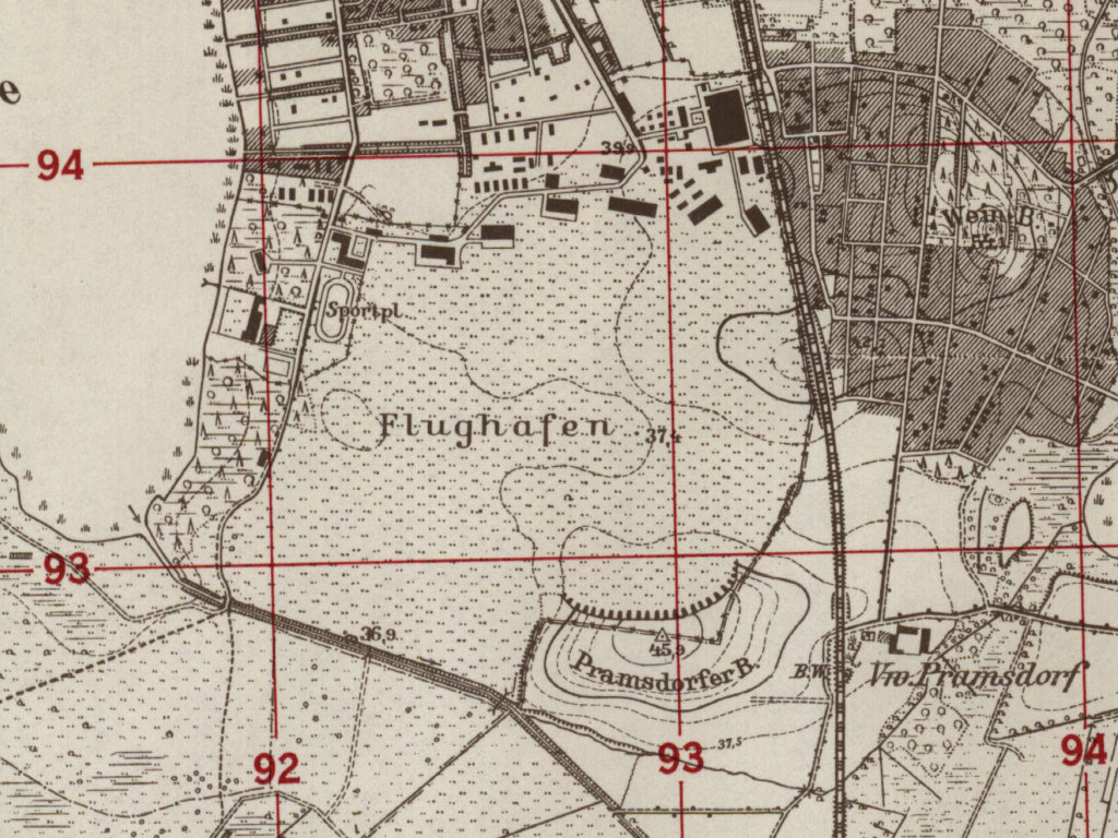
Rangsdorf airfield on a US map from 1952 - The seaplane base was located at the lake on the west side.
Source: AMS M841 GSGS 4414, Courtesy Harold B. Lee Library, Brigham Young University
During the Cold War
Use
Rangsdorf airfield was used by the Soviet forces for the maintenance of helicopters and as an aircraft scrap yard.
In the 1960s
Situation
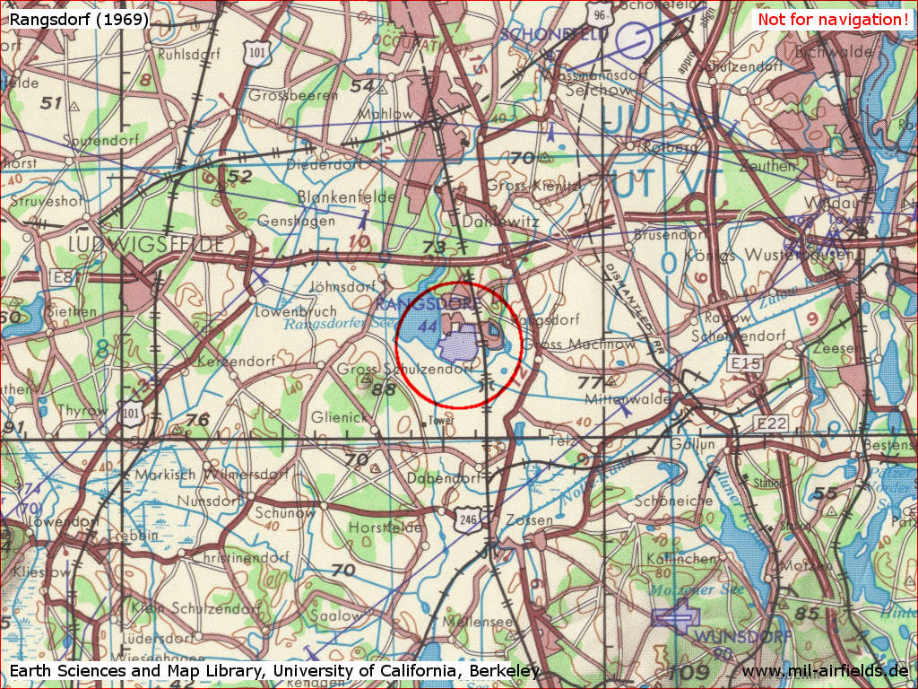
Rangsdorf Airfield on a US map from 1969
Source: Earth Sciences and Map Library, University of California, Berkeley
Overview
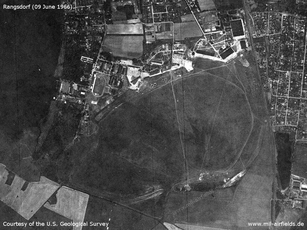
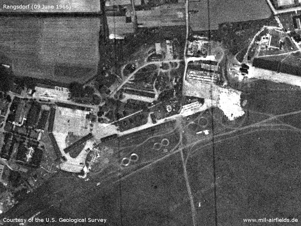
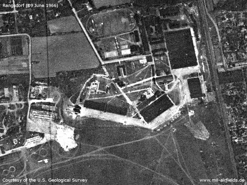
Rangsdorf Airfield on a US satellite image from 09 June 1966
Source: U.S. Geological Survey
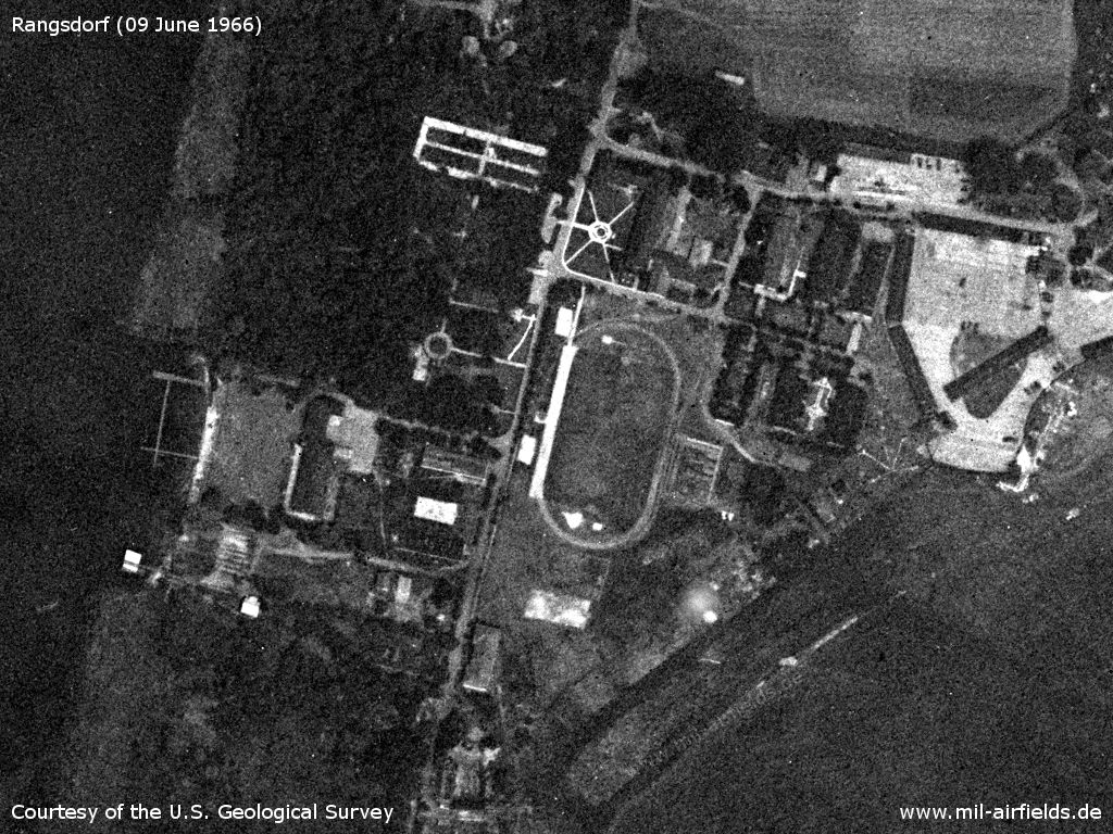
Western part with buildings
Source: U.S. Geological Survey
Central part
Source: U.S. Geological Survey
Eastern part with hangars - On the top right the hall of the former Bücker aircraft factory. On the right side is the Berlin-Dresden railway line
Source: U.S. Geological Survey
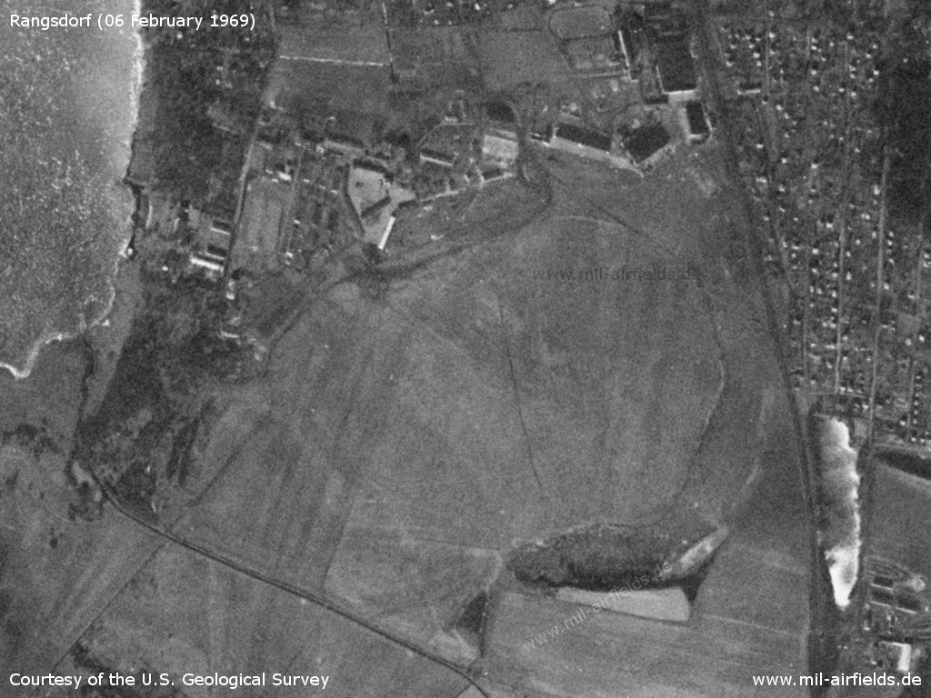
Satellite image from 06 February 1969 - On this picture the practice eights "8" before the apron cannot be recognized any more.
Source: U.S. Geological Survey
In the 1970s
Situation
Location of Rangsdorf airfield marked on a map of the US Department of Defense from 1972 - Rangsdorf was located well within the Berlin control zone (BKZ, dotted circle) and could therefore easily be spotted by Western Allied aircraft.
Source: ONC E-2 (1972), Perry-Castañeda Library Map Collection, University of Texas at Austin
Overview
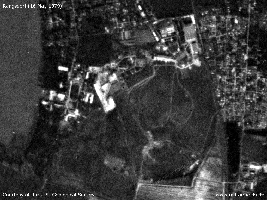
At this satellite picture of 16 May 1979 little is to recognize. - However, the installations do not appear to have fundamentally changed.
Source: U.S. Geological Survey
In the 1980s and early 1990s
Radio communication
The call sign was POSOR.
Images
Photos from 1993. They were taken from the eastern airfield fence.
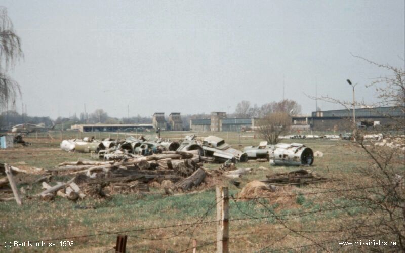
Remains of planes. - In the background a Soviet helicopter Mi-8/17 and the airfield buildings.
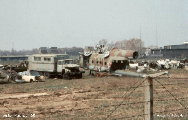
Car, truck and remains of a Soviet helicopter Mi-8/Mi-17 with the number "yellow 45"
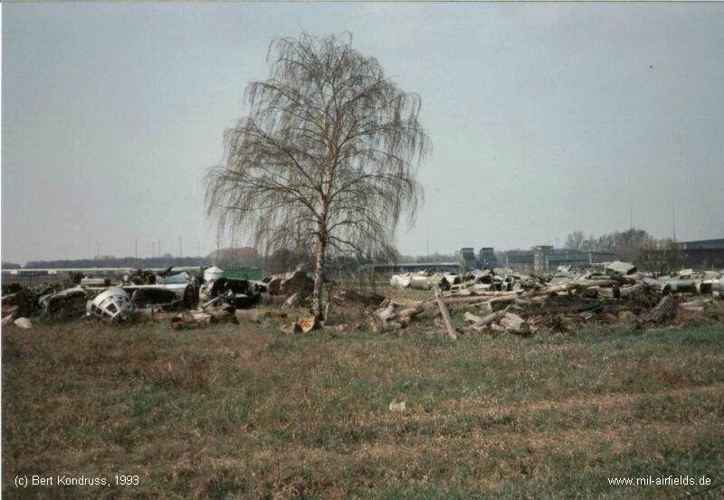
Remains of dismantled aircraft - In the background multiple aerial masts.
Today
Use
Closed.
Sources
- http://lib.byu.edu/collections/german-maps/ - German Maps (Topographische Karte 1:25,000)
- https://www.usgs.gov/ - USGS U.S. Geological Survey
Airfields in the vicinity
- 146°/11km Zossen/Wünsdorf
- 029°/13km Berlin: Schönefeld Airport (Zentralflughafen Berlin-Schönefeld, SXF)
- 272°/13km Ludwigsfelde: Helipad 1012 (HSLP 1012)
- 020°/18km Berlin: Johannisthal Airfield (Adlershof, Аэродром Берлин Йоханнисталь Адлерсхоф)
- 067°/18km Niederlehme: Helipads 1011, 3041
- 208°/18km Sperenberg: Air Base (Kummersdorf, Аэродром Шперенберг)
- 326°/18km Berlin: Berlin Command Airstrip
Recommended
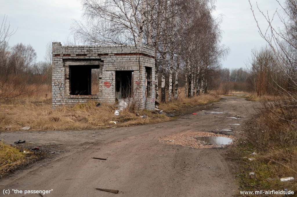
Image credits are shown on the respective target page, click on the preview to open it.
 Follow mil-airfields on Facebook