For historical information only, do not use for navigation or aviation purposes!
| Coordinates | N532048 E0124426 (WGS84) |
| Former East Germany (GDR) | District of Neubrandenburg |
| Federal state | Mecklenburg-Vorpommern (Mecklenburg-Western Pomerania) |
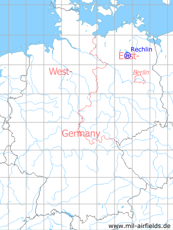
Germany during the Cold War Map
The history of the Cold War airfields: Rechlin
Location of airfield
1.5 km northeast of Rechlin, 1 km east-southeast of Rechlin-Nord, at the eastern part of the former Rechlin Luftwaffe air base (east of road K3).
Usage during the Cold War
Helipad 1014 for Signals Depot 2 (Nachrichtengerätelager 2, NGL-2) of former East German Ministry of National Defense (MfNV).
Use today
Closed.
Runways, taxiways, aprons
Dimensions: 300 m x 200 m,
Main takeoff and landing direction: 120°,
Surface: Agricultural area,
Capacity: 10 helicopters.
Main takeoff and landing direction: 120°,
Surface: Agricultural area,
Capacity: 10 helicopters.
Telephone
Telephone of the helipad: 800 m Fe-Feldverbindung zum Anschluss auf DVG-10 (mit HADP, Stabsnetz).
Telephone of NGL-2: Sondernetz/Stabsnetz S1 4331-11, call sign "Großlautsprecher".
Airspace and procedures
Usable at day and night during good weather conditions.
Alert time: 50 minutes.
Alert time: 50 minutes.
Obstacles
None.
Bibliography
- Ries, Karl; Dierich, Wolfgang: "Fliegerhorste und Einsatzhäfen der Luftwaffe" Motorbuch Verlag Stuttgart, 1993 - Allied map of the former air base from the years 194x
- Freundt, Lutz (Hrsg.), Büttner, Stefan: "Rote Plätze - Russische Militärflugplätze in Deutschland 1945 - 1994" AeroLit Verlag, 2007 - Soviet use of the former air base.
Airfields in the vicinity
- 169°/5km Lärz: Air Base (Mirow, Rechlin-Lärz)
- 298°/15km Groß Kelle: Agricultural Airfield
- 079°/21km Neustrelitz (Нойштрелиц)
- 080°/21km Neustrelitz (Нойштрелиц)
 Follow mil-airfields on Facebook