For historical information only, do not use for navigation or aviation purposes!
| Coordinates | N491303 E0110601 (WGS84) Google Maps |
| Federal state | Bayern (Bavaria) |
| Location indicator | EDPR (1990), ETHR (200x) |
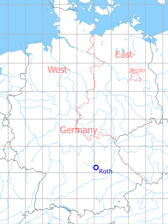
Germany during the Cold War Map
The history of the Cold War airfields: Roth
During World War II
Location
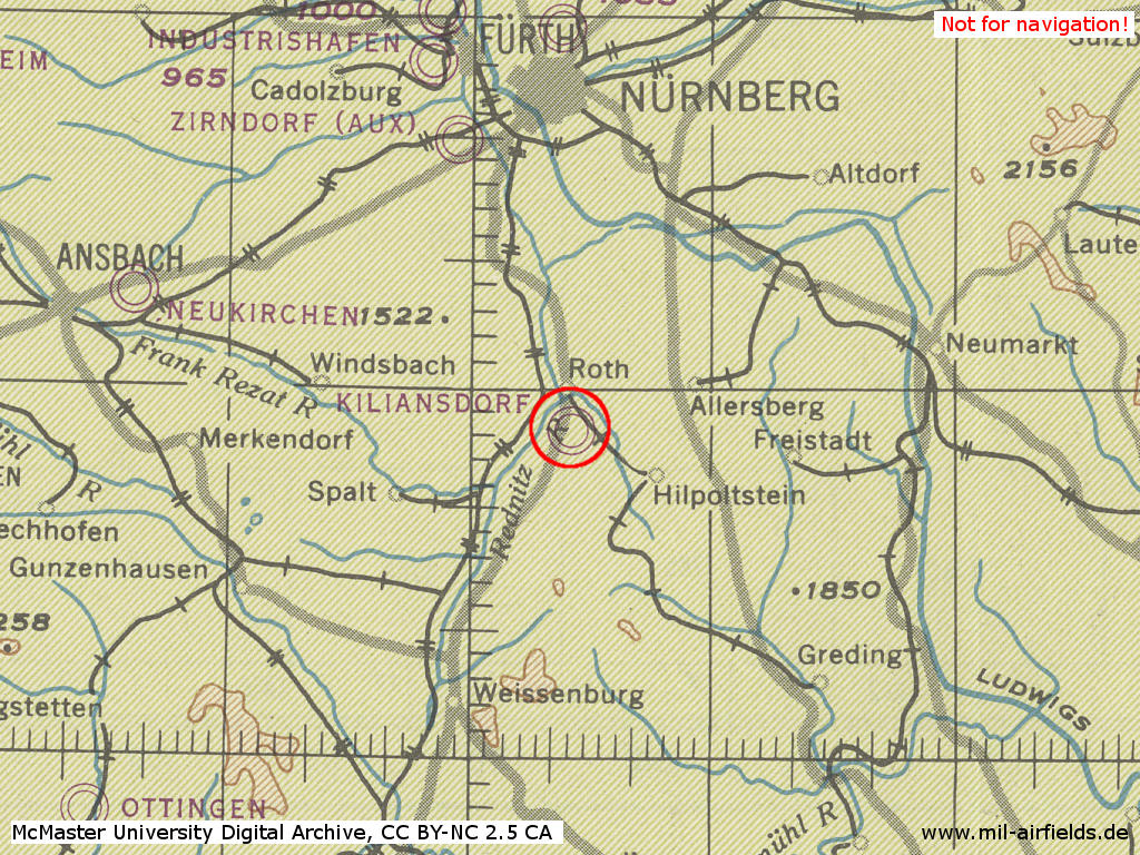
Roth air base in World War II on a US map from 1944
Source: McMaster University Library Digital Archive, Lizenz: Creative Commons Attribution-NonCommercial 2.5 CC BY-NC 2.5 CA
Use
Luftwaffe airbase.
During the Cold War
Use
German Army aviation.
Overview
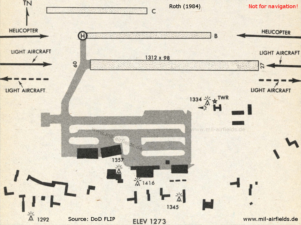
Roth airfield on a map from 1984.
Source: US DoD
Runways
Data for the year 1990:
- 09/27: 535 m x 30 m Asphalt
Today
Use
The airfield is closed, the barracks still exist.
Overview
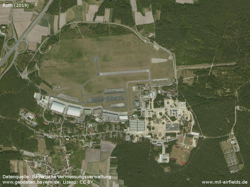
Aerial image (2019)
Source: Datenquelle: Bayerische Vermessungsverwaltung www.geodaten.bayern.de, License: Creative Commons Namensnennung 3.0 Deutschland (CC BY 3.0 DE)
Sources
- https://geoportal.bayern.de/ - Geoportal Bayern
Airfields in the vicinity
- 016°/20km Feucht: Army Airfield AAF (Feucht Army Airfield AAF)
- 003°/23km Nürnberg: Soldiers Field Army Airfield (AAF, Nurnberg New, Great Road)
- 340°/29km Fürth: Dambach Housing Area Helipad
- 340°/31km Fürth: Industrieflughafen Airport (Nuremberg-Fürth Industriehafen Airfield, Fürth Industrie)
- 342°/33km Fürth: Army Airfield AAF (Nürnberg-Fürth Airport, Atzenhof, Monteith Barracks Army Heliport Furth)
- 287°/35km Ansbach: Army Airfield / Heliport (Katterbach Kaserne)
Recommended
Image credits are shown on the respective target page, click on the preview to open it.
 Follow mil-airfields on Facebook