For historical information only, do not use for navigation or aviation purposes!
| Coordinates | N493023 E0075150 (WGS84) Google Maps |
| Elevation | 1052 ft |
| Federal state | Rheinland-Pfalz (Rhineland-Palatinate) |
| Location indicator | EDAS (1990) |
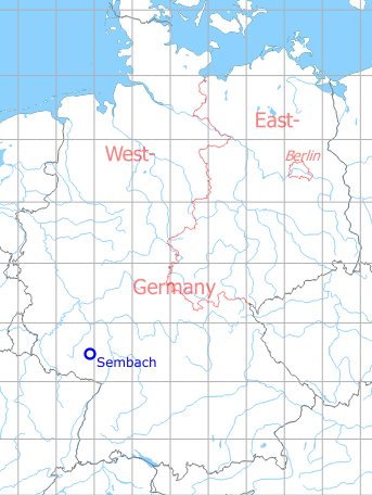
Germany during the Cold War Map
The history of the Cold War airfields: Sembach
During the Cold War
Situation
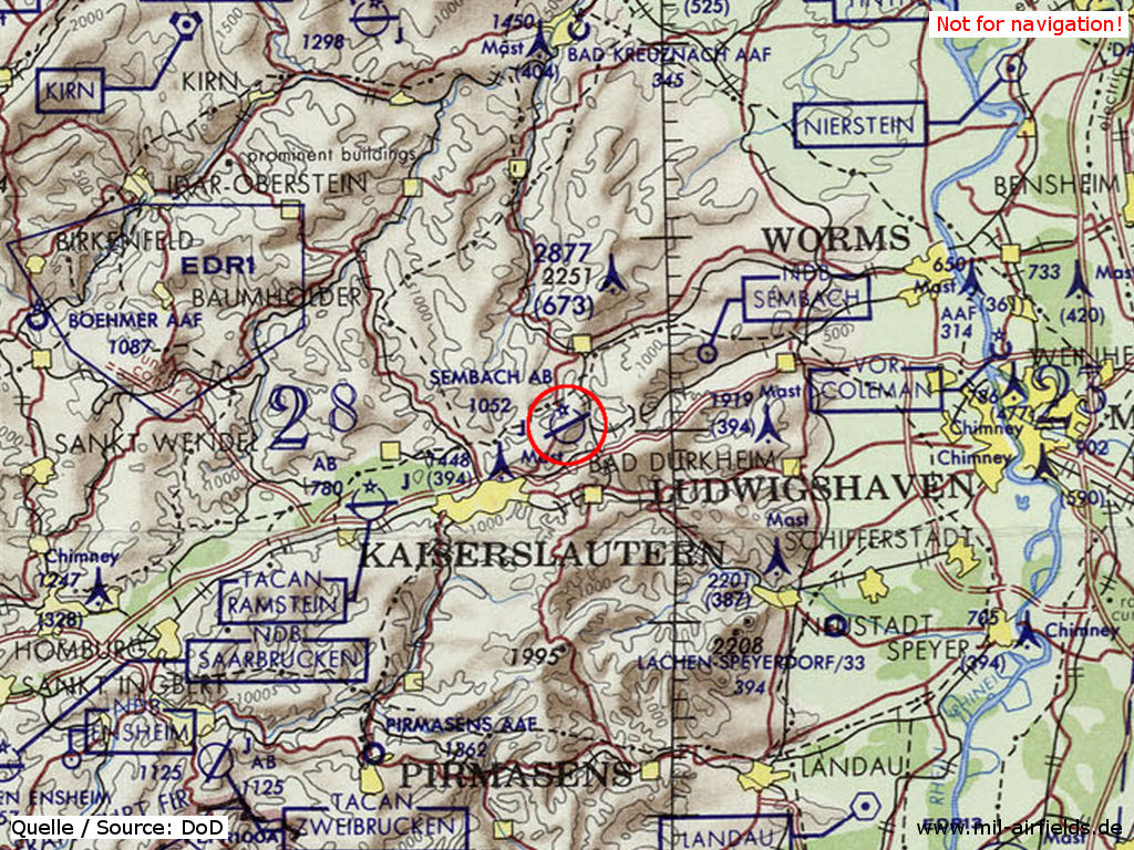
Sembach Air Base on a map of the US Department of Defense from 1972
Runways
Data for the year 1990:
- 07/25: 2402 m x 45 m Asphalt
(Direction, runway length x width, surface)
Radio beacons
Data for the year 1990:
- NDB: 428 "SEX", 245°/7.4 NM to field
- TACAN: CH28 "SEM", at field
Units
1971: 601st TAC
1980: 20th TASS (601st TCW): OV-10A; 601st TASS (601st TCW): CH-53C; 704th TASS (601st TCW): OV-10A
1985: 601st TCW : CH-53C
1990: 43rd ECS (66th ECW): EC-130H; 601st TCW
Images
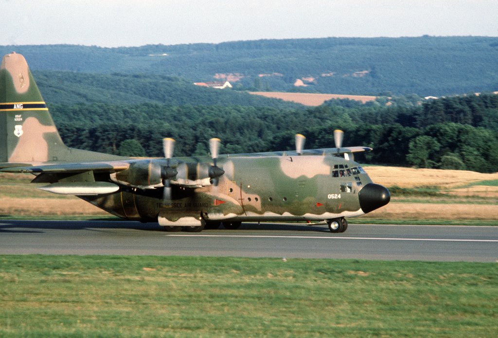
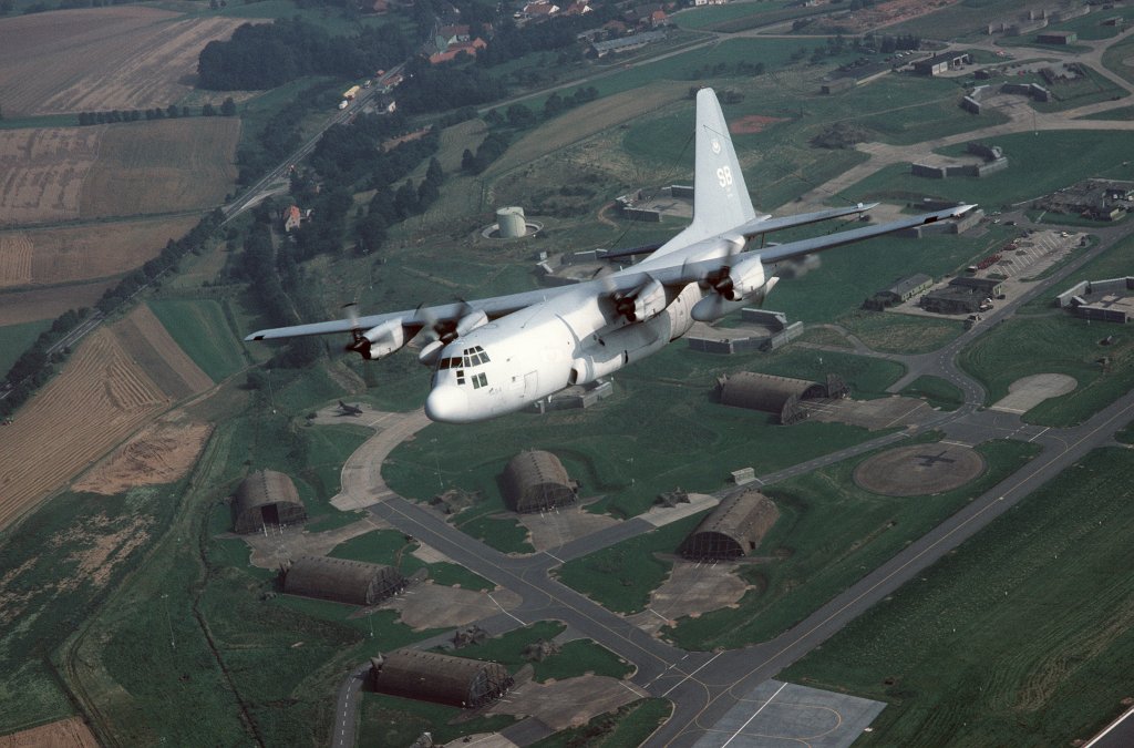
Landing of a C-130E of the Tennessee Air National Guard (15.08.1980). Source: Department of Defense, photographer: SSGT JAMES R. PEARSON
Members of the 241st Electronic Installation Squadron, Tennessee Air National Guard, are leaving the base. Source: Department of Defense, photographer: SSGT JAMES R. PEARSON
Pictures from the Exercise UREX '82
22APR1982, Source: Department of Defense, photographer: SUTHERLAND
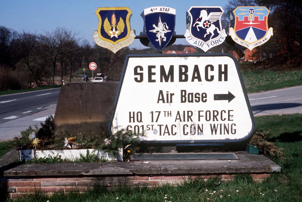
Road sign: "Sembach Air Base - HQ 17th Air Force, 601st Tac Con Wing"
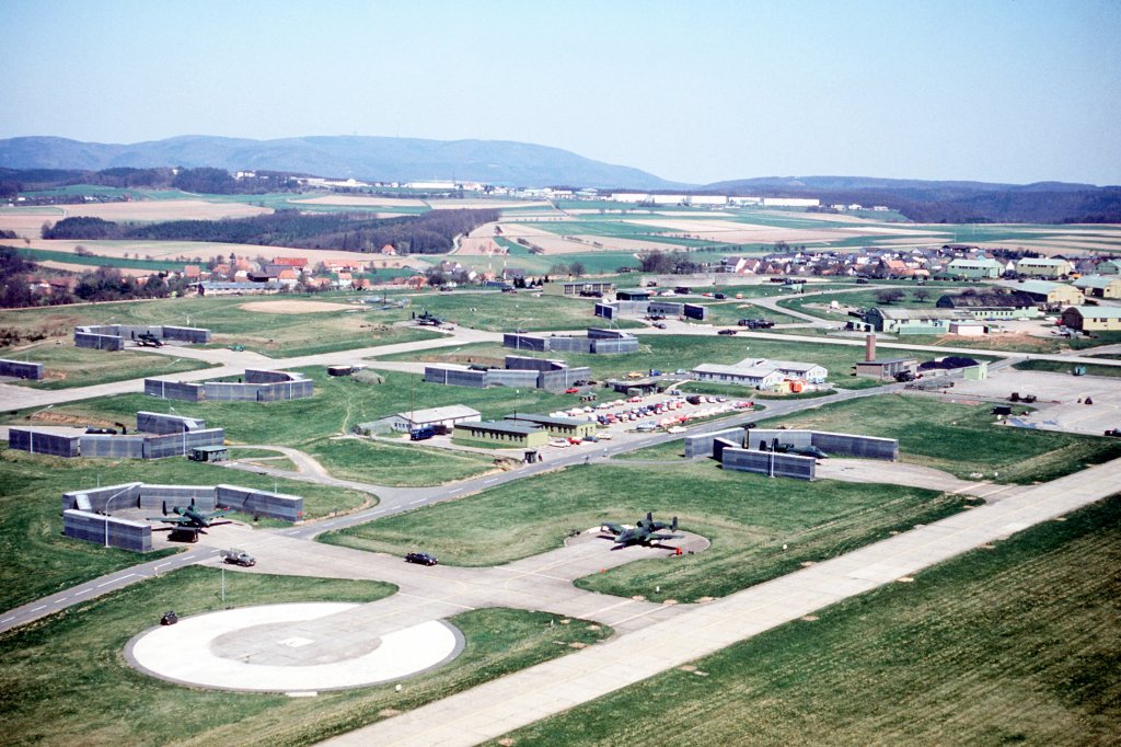
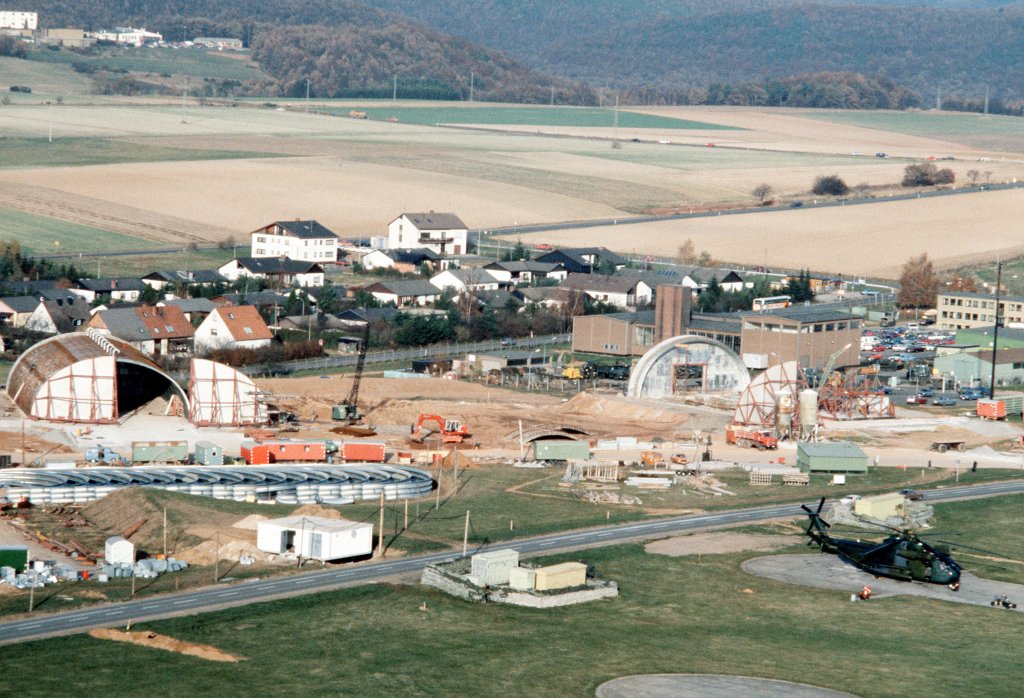
Aerial view of the western part om Sembach (22.04.1982)
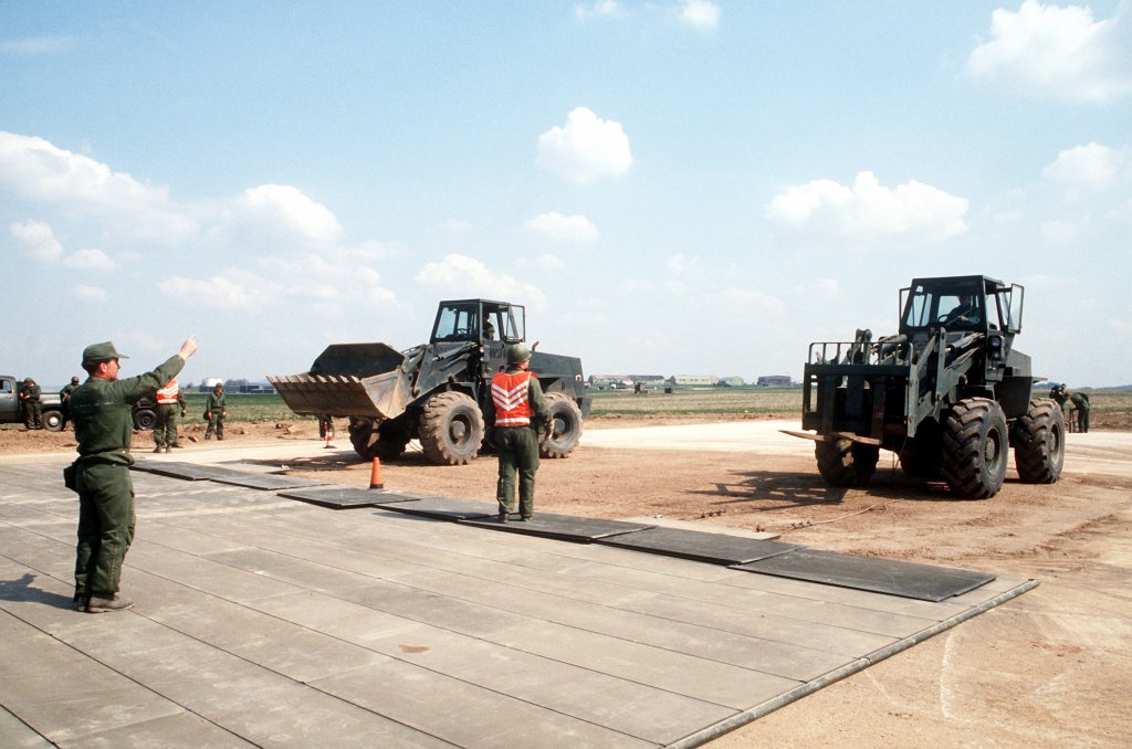
A rapid runway repair team of the 601st Civil Engineering Squadron
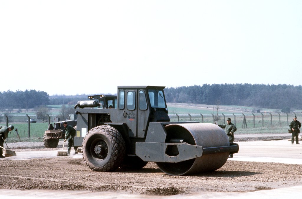
Filling a simulated bomb crater
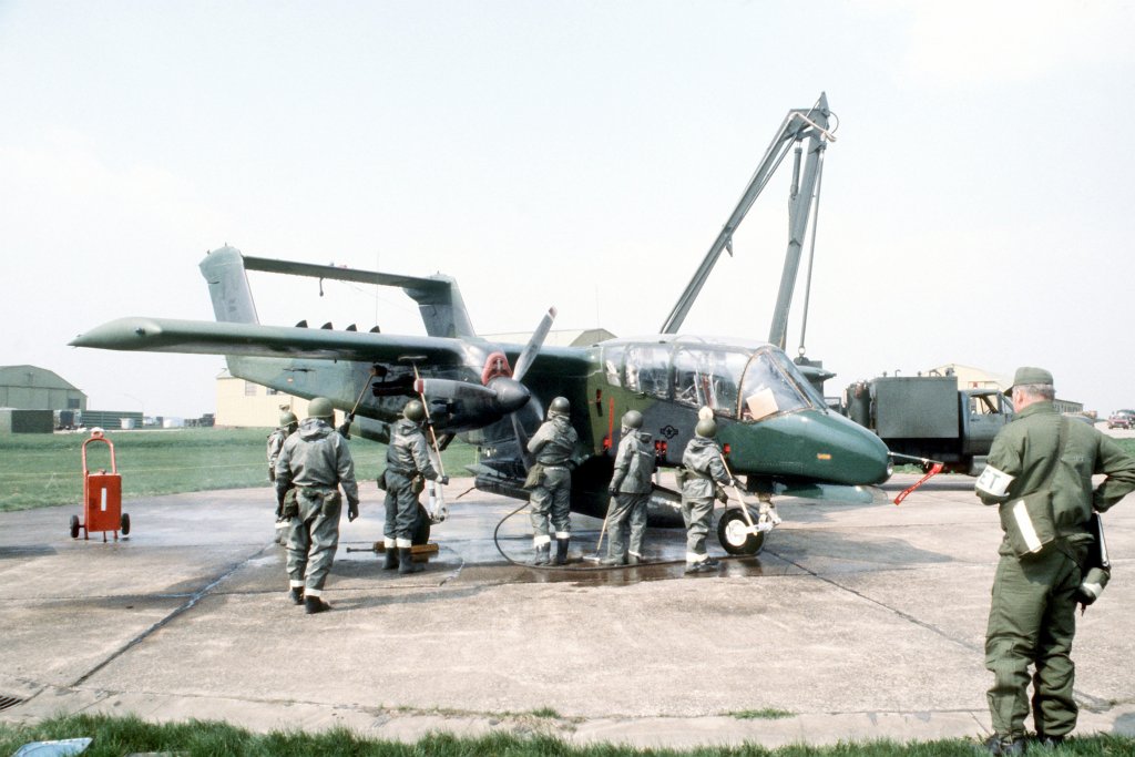
Decontamination of a OV-10 Bronco
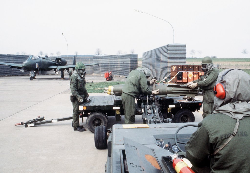
Preparation of Mark 82 bombs
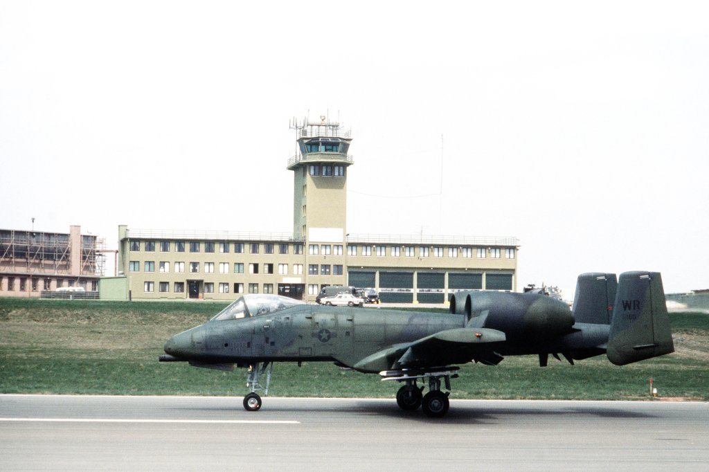
A-10 in front of the control tower
More Pictures
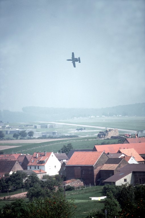
An A-10 Thunderbolt over Sembach during exercise REFORGER '82; Source: Department of Defense, photographer: KEN HACKMAN
Hangars under construction (29.11.1983). Source: Department of Defense, photographer: TSGT ADRIAN DELAINE
A plane EC-130H "Compass Call" of the 43rd Electronic Combat Squadron above Sembach (30.08.1987). Source: Department of Defense, photographer: SSGT FERNANDO SERNA
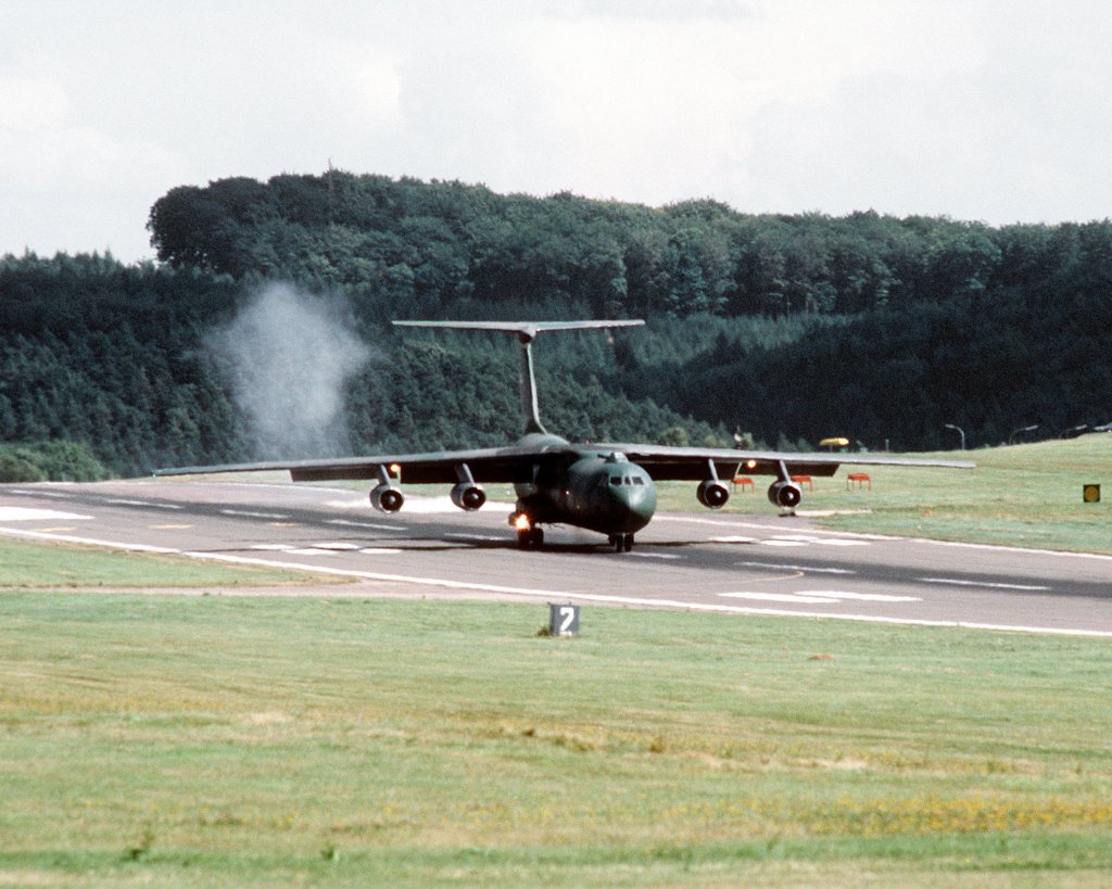
Airplane C-141 Starlifter from the 65th MAW (1988). Source: Department of Defense, photographer: A1C KELVIN DAVIS.
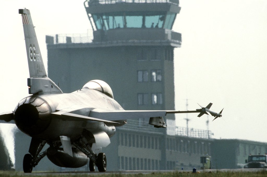
A F-16C of the 86th TFW in front of the control tower during Exercise "Central Enterprise '89". Source: Department of Defense, photographer: SSGT JAMES M. HOWARD
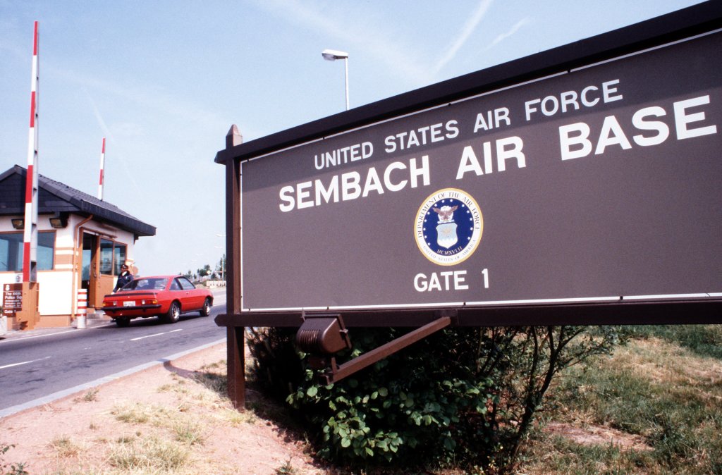
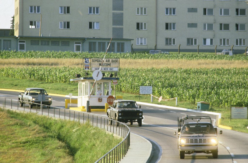
Gate 1. Source: Department of Defense, photographer: SRA MICHAEL RICE
Today: Former airfield
Use
Closed (new ICAO location indicator ETAS was assigned, but propably not used)
Overview
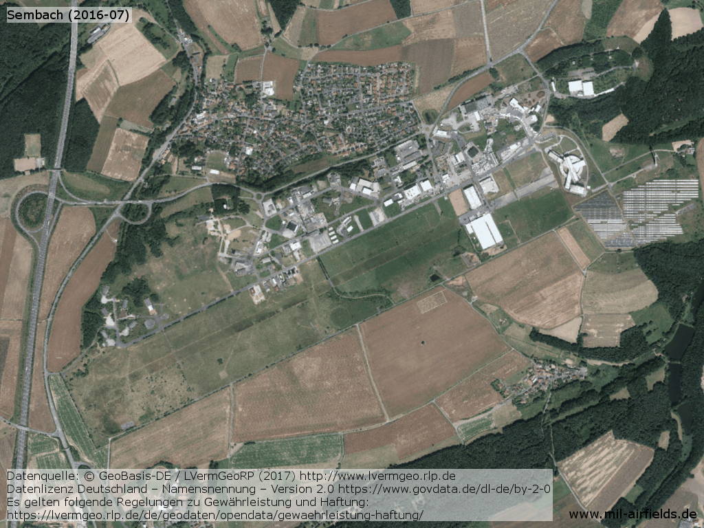
Aerial picture of former Sembach Air Base from July 2016 - Runway and taxiways are largely removed.
Links
- http://www.airbase-sembach.de/ - Sembach Airbase History of Sembach Airbase (German language only)
- http://www.gewerbepark-sembach.de/ - Gewerbepark Sembach Commercial area Sembach
Sources
- https://www.archives.gov/ - National Archives
- http://www.lvermgeo.rlp.de/ - Geoportal Rheinland-Pfalz
Airfields in the vicinity
Categories
Military Airfields GermanyMilitary Airfields in former West GermanyAir Bases of the United States Air Force (USAF) in GermanyRecommended

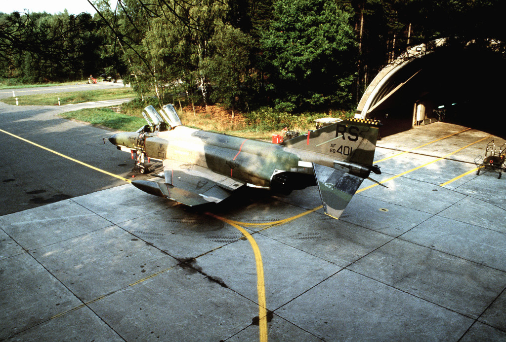
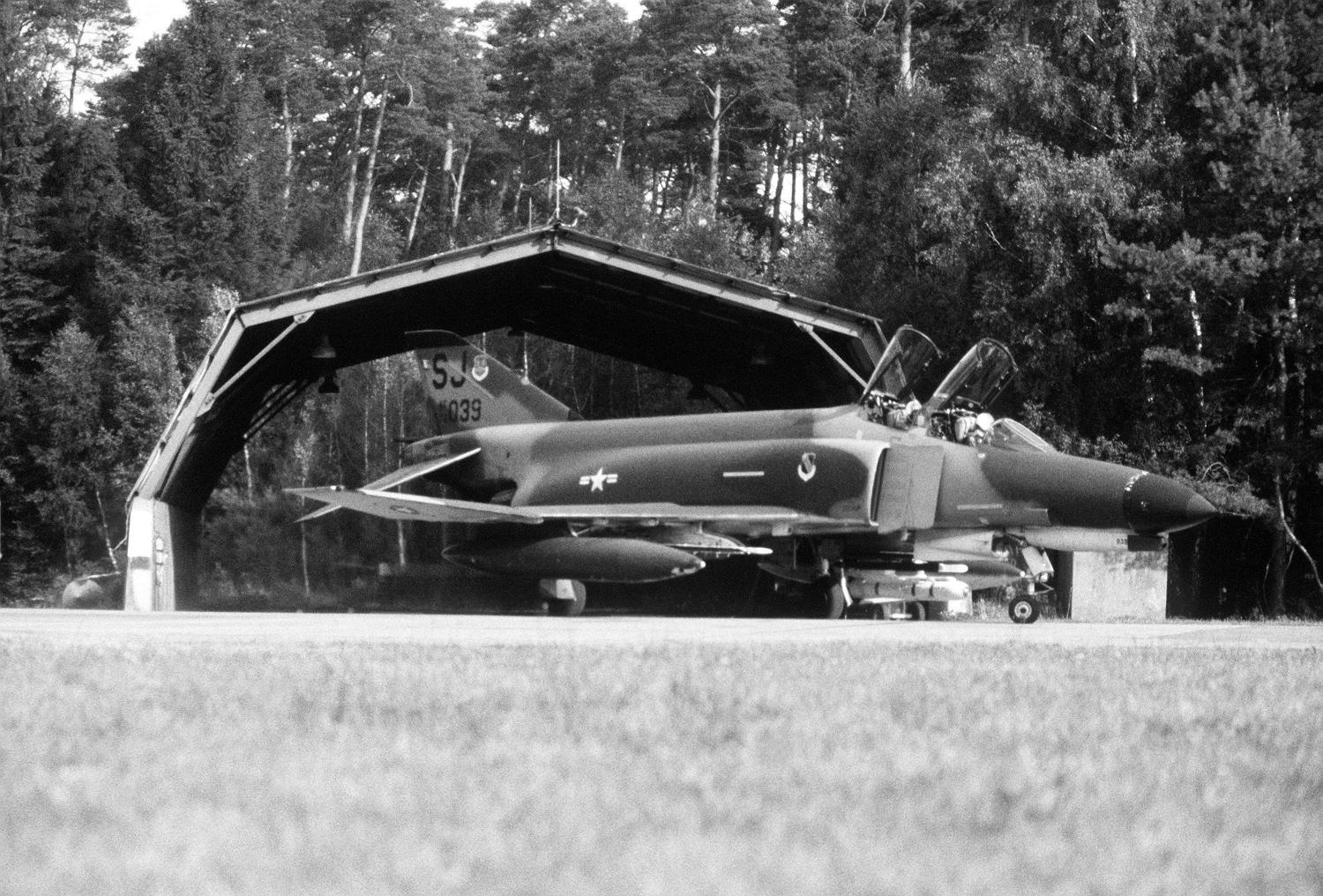
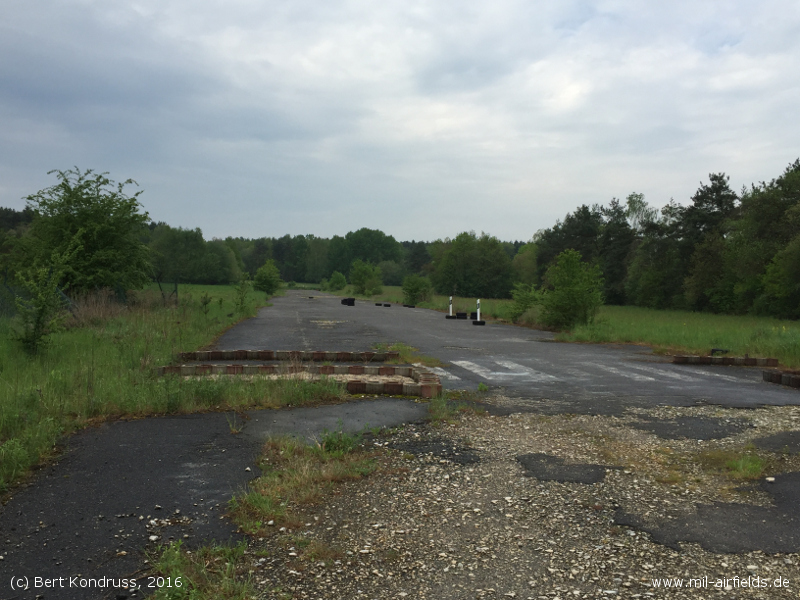
Image credits are shown on the respective target page, click on the preview to open it.
 Follow mil-airfields on Facebook