For historical information only, do not use for navigation or aviation purposes!
| Coordinates | N534749 E0114010 (WGS84) Google Maps |
| Former East Germany (GDR) | District of Schwerin |
| Federal state | Mecklenburg-Vorpommern (Mecklenburg-Western Pomerania) |
| Airfield Id | 3342 |
Germany during the Cold War Map
The history of the Cold War airfields: Warin
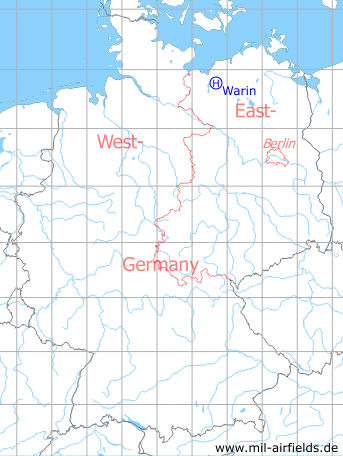
Location of airfield
2.3 km west of Warin.
Usage during the Cold War
Helipad 3342 for Anti-aircraft Missile Unit 131 (FRA-131) of former East German Air Force (NVA LSK/LV).
Use today
Closed.
Runways, taxiways, aprons
Dimensions: 120 m x 180 m,
main takeoff and landing direction: 300° - 360°,
surface: Grass, pastureland,
capacity: 2 Helicopters.
main takeoff and landing direction: 300° - 360°,
surface: Grass, pastureland,
capacity: 2 Helicopters.
Telephone
Stabsnetz S1 8487-841
Airspace and procedures
Usable at day during good weather conditions.
Alert time: 60 minutes.
Alert time: 60 minutes.
Obstacles
Forrest: direction 180° - 360°, distance 50 m, height 15 m.
Airfields in the vicinity
- 283°/9km Kleekamp: Highway Strip (planned)
- 016°/18km Alt Poorstorf: Agricultural Airfield
- 256°/21km Alt Meteln: Agricultural Airfield
- 251°/24km Hof Meteln: Agricultural Airfield
- 325°/27km Kirchdorf: Helipad 3324 (HSLP / HLP 3324)
- 180°/30km Tramm: Helipad 3344 (HSLP / HLP 3344)
- 026°/32km Retschow: Helipad 3314 (HSLP / HLP 3314)
- 252°/33km Vietlübbe: Agricultural Airfield
- 211°/34km Sülte: Airfield (Boldela, Buchholz)
 Follow mil-airfields on Facebook