For historical information only, do not use for navigation or aviation purposes!
| Coordinates | N532310 E0132825 (WGS84) Google Maps |
| Former East Germany (GDR) | District of Neubrandenburg |
| Federal state | Mecklenburg-Vorpommern (Mecklenburg-Western Pomerania) |
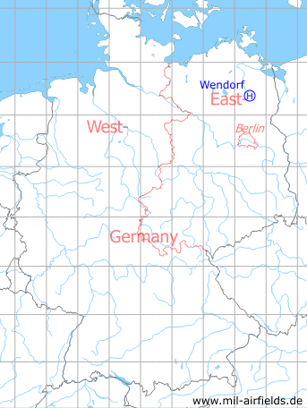
Germany during the Cold War Map
The history of the Cold War airfields: Wendorf
Location of airfield
1.2 km southwest of Wendorf.
Usage during the Cold War
Helipad 3027 for Microwave Site 7 (RFB-7) of former East German Air Force (NVA LSK/LV).
Use today
Closed.
Runways, taxiways, aprons
Dimensions: 200 m x 200 m,
main takeoff and landing direction: 270° - 360°,
surface: loam,
capacity: 1 helicopter.
main takeoff and landing direction: 270° - 360°,
surface: loam,
capacity: 1 helicopter.
Telephone
Sondernetz/Stabsnetz S1 4323-88
Airspace and procedures
Usable at day during good weather conditions.
Alert time: 20 minutes.
Alert time: 20 minutes.
Obstacles
Antenna mast: direction 270°, distance 300 m, height 30 m.
Links
- http://www.nachrichtenbetriebsamt.de/rfb7.htm - Die Richtfunkbetriebsstelle 7 (RFB-7)
Airfields in the vicinity
- 149°/12km Buchenhain: Agricultural Airfield
- 132°/13km Weggun: Helipad 3338 (HSLP / HLP 3338)
- 350°/14km Cölpin: Helipad 3301 (HSLP / HLP 3301)
- 000°/17km Katzenhagen: Helipad 3302 (HSLP / HLP 3302)
- 019°/17km Ulrichshof: Helipad 3014 (HSLP / HLP 3014)
- 325°/17km Burg Stargard: Agricultural Airfield, Helipad 3336 (HSLP / HLP 3336, Lindenhof)
- 343°/18km Pragsdorf: Helipad 3350 (HSLP / HLP 3350)
- 303°/20km Klein Nemerow: Helipad 3006 (HSLP / HLP 3006)
 Follow mil-airfields on Facebook