For historical information only, do not use for navigation or aviation purposes!
| Coordinates | N533253 E0074007 (WGS84) Google Maps |
| Elevation | 26 ft |
| Federal state | Niedersachsen (Lower Saxony) |
| Location indicator | EDNT (-1995), ETNT (1995-) |
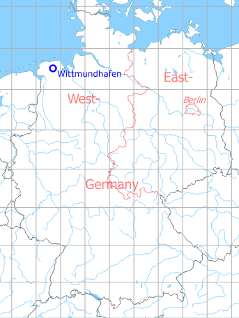
Germany during the Cold War Map
The history of the Cold War airfields: Wittmundhafen
Location of airfield
8 km west-southwest of Wittmund.
During World War II
Use
Luftwaffe airfield.
Overview
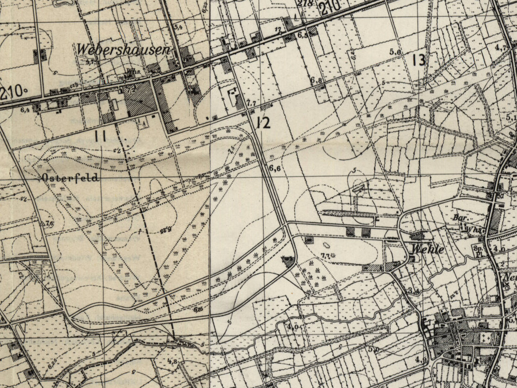
The remains of the former Wittmundhafen air base on a US map from 1954 - The old runway system is clearly visible. Notable is the trail of the very long runway with a length of about 2900 m in approximate east-west direction. It is mentioned in the text below about the 1954 airfield survey (AMS M841 GSGS 4414, Courtesy Harold B. Lee Library, Brigham Young University /BYU/)
During the Cold War
Use
Luftwaffe airbase.
In the 1950s
Airfield Survey in 1954
In 1953 and 1954, survey tours took place in the Federal Republic of Germany to identify future air bases for the German Air Force. Old airfields were visited and assessed, if a field can be used, if technical facilities and housing are available und if an extension of the runway up to 2500 m (8203 ft) or 3000 m (9843 ft) is possible.
For "Wittmundhaven" was found in 1954: The old movement area 1600 m x 500 m (5250 ft x 1641 ft) is fully used agriculturally. Three former runways are completely destroyed, one of them 3000 m; no quarters; 5 smaller hangars, each with 400 m² were converted to a homestead; there are supply or aeronautical installations. The field cannot be used, but a new runway would be possible up to 3000 m (9843 ft); all installations needs to be rebuild.
In a distance of 5 km, an additional airfield 3000 m x 500 m (9843 ft x 1641 ft) at the former operational airfield Brokzetel is available, currently used agriculturally.
In the 1970s
Situation
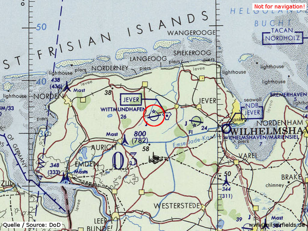
Wittmundhafen Air Base on a map of the US Department of Defense from 1972
Source: ONC E-2 (1972), Perry-Castañeda Library Map Collection, University of Texas at Austin
Overview
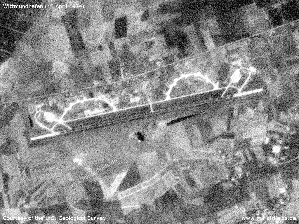
Wittmundhafen Air Base on a US satellite image from 13 April 1974
Source: U.S. Geological Survey
Radio beacons
Data for the year 1971:
- NDB: 250 "WM", 262°/4.2NM to fld
In the 1980s
Runways
- 08/26: 2440 m x 30 m Asphalt
Radio beacons
- TACAN: CH101 "WTM", 262°/2.1NM to fld
Radar
ASR, PAR (1990)
Radio communication
Call sign: "WITTMUND".
Units
Fighter Wing 71 (JG 71) with F-4F Phantom.
Pictures from joint US-West German the exercise CORONET FANG '89
Source: US DoD, Scene Camera Operator: STAFF Sergeant F. Lee Corkran
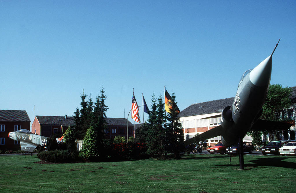
German Air Force Fighter Wing 71 (JG 71) barracks at Wittmund - Gate Guard is a Canadair CL-13B (F-86) Sabre JA-112 and a F-104G Starfighter 20+86
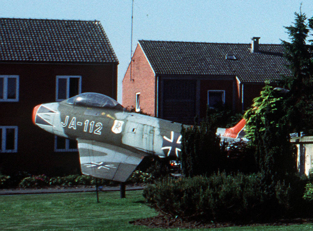
Enlargement: Canadair CL-13B Sabre (North American F-86F) JA-112 of JG 71
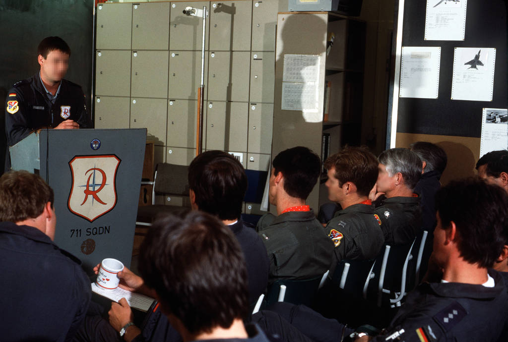
Mission briefing at the 711 Fighter Squadron - Jointly with pilots of the German Air Force and of the US Air Force 9th Tactical Fighter Squadron
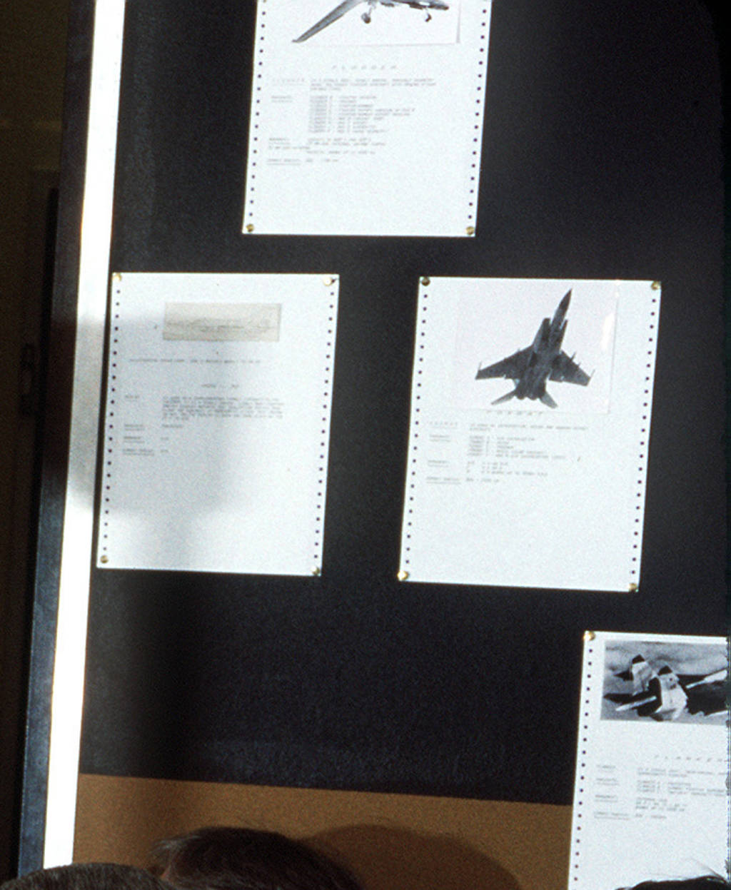
Enlargement: At the side are pictures of Soviet fighter planes: MiG-23/27 (top), MiG-25 (middle), MiG-29 (bottom right)
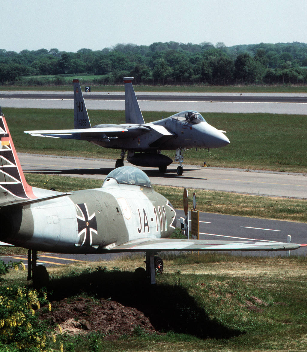
A F-15 Eagle taxies past a F-86 Sabre on display
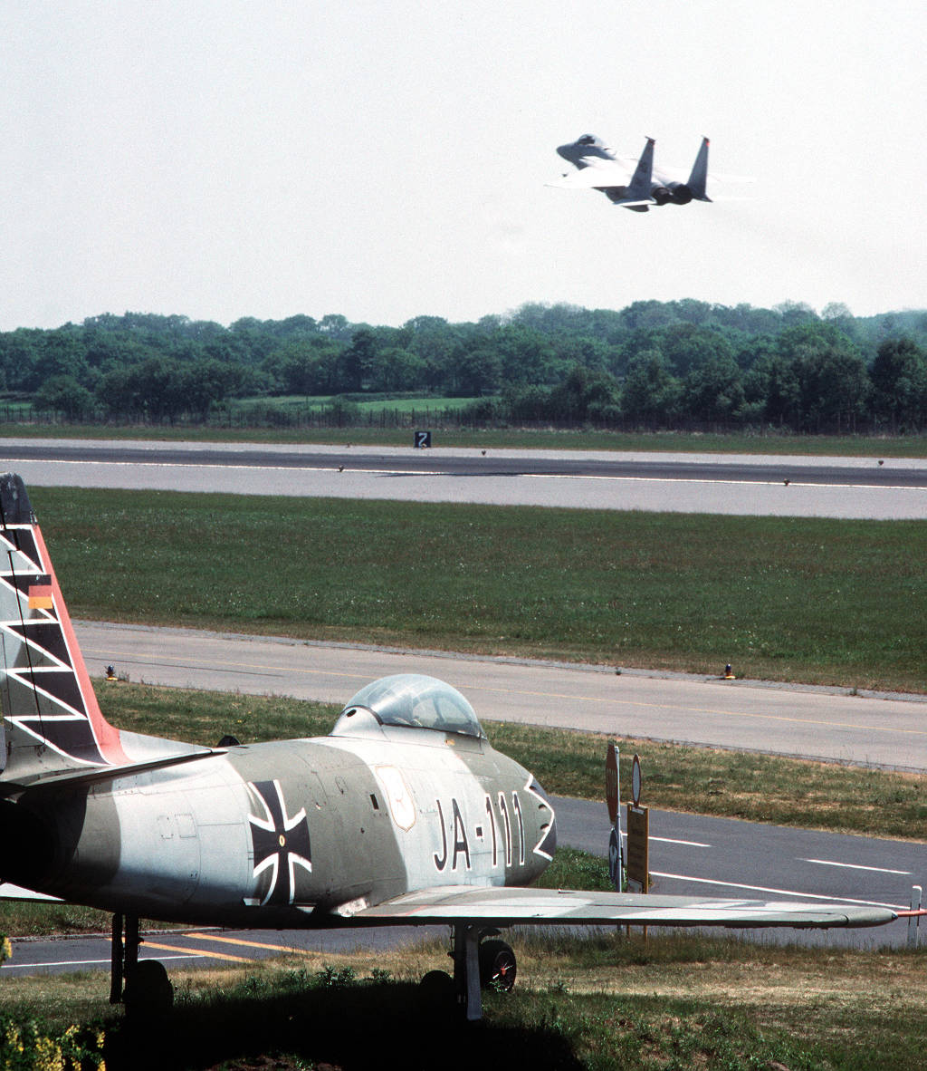
A 9th Tactical Fighter Squadron F-15 Eagle aircraft takes off
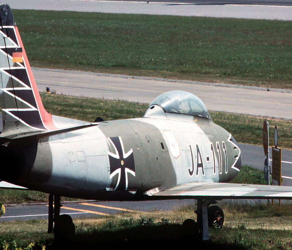
Enlargement: Canadair CL-13B (F-86) Sabre JA-111
Today
Use
Luftwaffe airbase.
Sources
- https://www.archives.gov - National Archives
Links
- https://www.relikte.com/wittmund/index.htm - Der Fliegerhorst Wittmundhafen
Bibliography
- Ries, Karl; Dierich, Wolfgang: "Fliegerhorste und Einsatzhäfen der Luftwaffe" Motorbuch Verlag Stuttgart, 1993 - Allied map
Airfields in the vicinity
Categories
Military Airfields GermanyMilitary Airfields in former West GermanyGerman Air Force Air BasesRecommended
Image credits are shown on the respective target page, click on the preview to open it.
 Follow mil-airfields on Facebook