For historical information only, do not use for navigation or aviation purposes!
| Coordinates | N495928 E0113757 (WGS84) Google Maps |
| Elevation | 1600 ft |
| Federal state | Bayern (Bavaria) |
| Region | Oberfranken |
| Location indicator | EDEL (1985) |
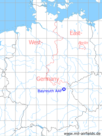
Germany during the Cold War Map
The history of the Cold War airfields: Bayreuth Army Airfield
Location of airfield
Bindlacher Berg, 1km northwest of Bayreuth Airfield. Bayreuth Army Airfield was located very close to today's Bayreuth Airport, but had its own runway.
During World War II
Use
Luftwaffe airbase.
During the Cold War
Use
US Army airfield.
In the 1960s
Overview
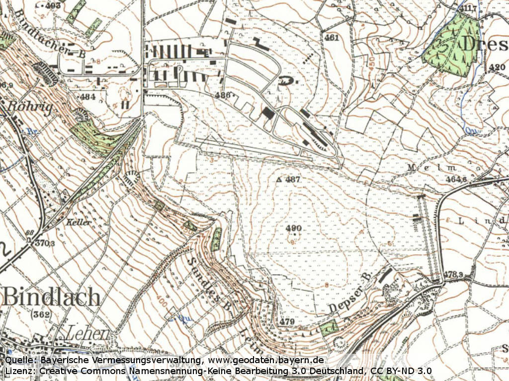
The area on a topographical map from 1968 - At the top is the Christensen barracks with the runway of the Army Airfield. The civil Bayreuth airfield is not yet shown here. In its eastern part, an enlongated object similar to a shooting range is drawn in.
Source: Bayerische Vermessungsverwaltung, License: Creative Commons Namensnennung-Keine Bearbeitung 3.0 Deutschland (CC BY-ND 3.0).
In the 1970s
Situation
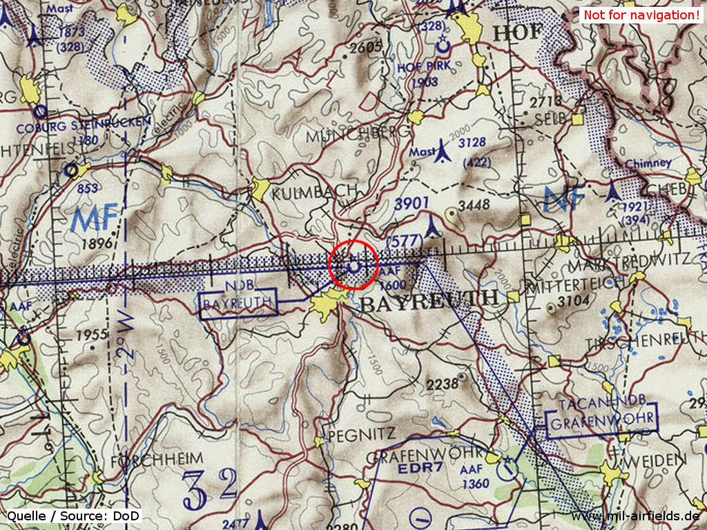
Bayreuth Army Airfield on a map of the US Department of Defense from 1972
Source: ONC E-2 (1972), Perry-Castañeda Library Map Collection, University of Texas at Austin
Overview
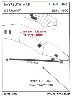
Map from 1971 - The runway length is 620 m (2,033 feet) and the width 15 m (50 feet).
Source: DoD
In the 1980s and early 1990s
Overview
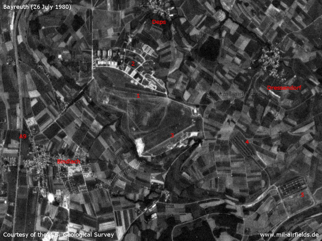
Bayreuth Bindlach on a US satellite image from 26 July 1980 - 1: Bayreuth Army Airfield; 2: Bindlacher Berg barracks / Christensen Barracks; 3: Bayreuth airfield; 4: ammunition dump; 5: shooting range. Other places: Bindlach, Deps, Dressendorf. Autobahn A9.
Source: U.S. Geological Survey
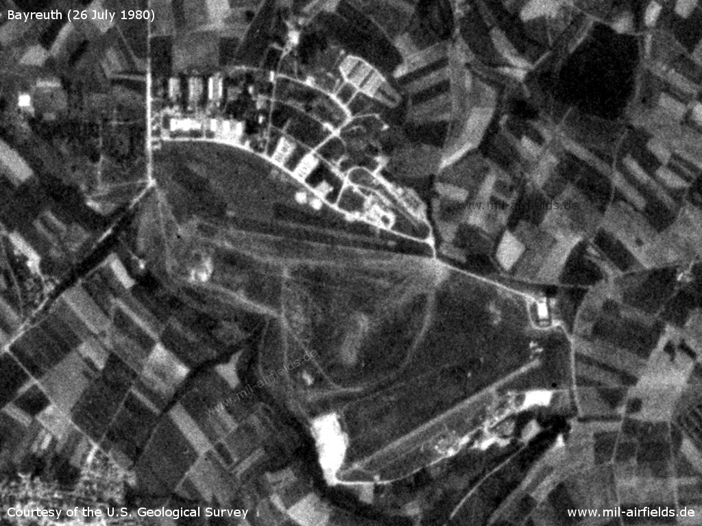
Bayreuth Army Airfield in the north and the Bayreuth Airfield in the southeast.
Source: U.S. Geological Survey
Today
Use
Closed.
Overview
Source: Datenquelle: Bayerische Vermessungsverwaltung www.geodaten.bayern.de, License: Creative Commons Namensnennung 3.0 Deutschland (CC BY 3.0 DE)
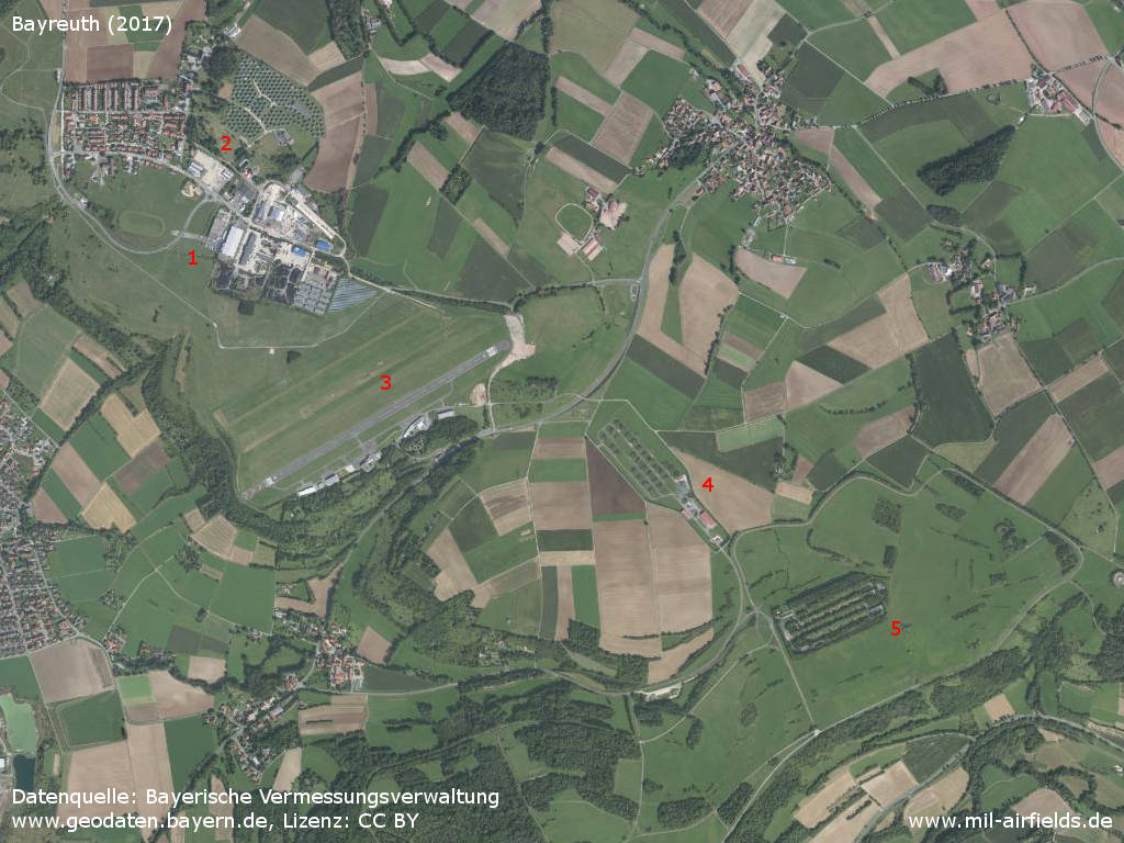
Aerial picture (2017) - 1: former Bayreuth Army Airfield; 2: former Bindlacher Berg barracks; 3: Bayreuth airfield; 4: former ammunition dump; 5: shooting range.

Bindlacher Berg: Former Fliegerhorst and Christensen Barracks with Army Airfield
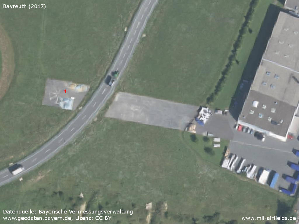
Enlargement: Last remains of the Army Airfield runway - 1: Maltese cross to mark the helicopter landing spot
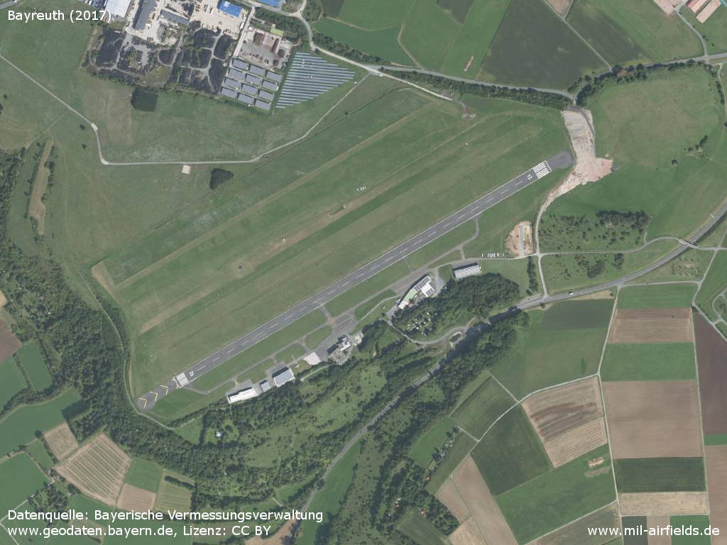
Bayreuth Airfield / Airport
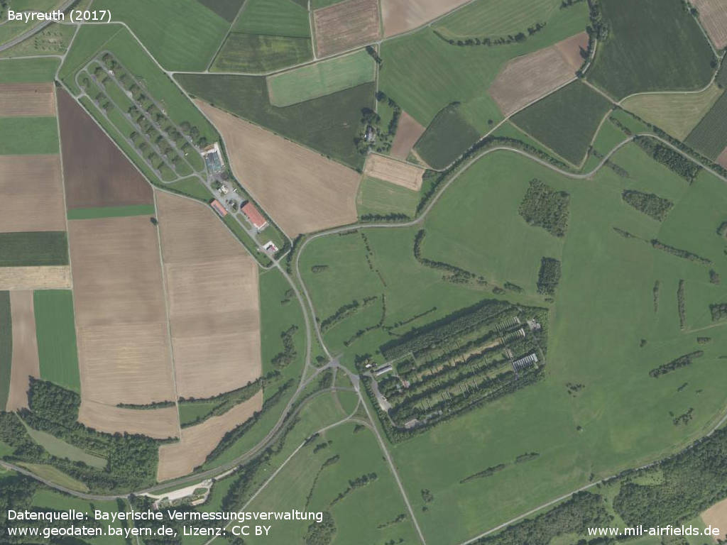
Former ammuntion depot (top left) and shooting range (bottom right)
Images
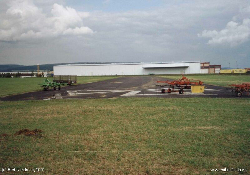
The relics of the former runway in 2001, before construction of the bypass road - The white maltese cross indicated the landing spot for helicopters.
Sources
- https://geoportal.bayern.de/ - Geoportal Bayern
Links
- https://www.bing.com/maps/?v=2&cp=s9ynw1hz2b4f&lvl... - Aerial picture with remains of the former runway and maltese cross of the helipad.
- https://www.bayreuth.de/rathaus-buergerservice/ver... - Airport Bayreuth (EDQD)
Bibliography
- Ries, Karl; Dierich, Wolfgang: "Fliegerhorste und Einsatzhäfen der Luftwaffe" Motorbuch Verlag Stuttgart, 1993 - Allied map
Airfields in the vicinity
- 146°/39km Grafenwöhr: Army Air Field (Grafenwöhr AAF)
- 262°/52km Bamberg: Army Airfield AAF (Breitenau)
- 347°/55km Lehesten: Helipad 3178 (HSLP 3178)
- 081°/56km Cheb: Airfield (Letiště Cheb, Horni Dvory, Oberschön)
Categories
Military Airfields GermanyMilitary Airfields in former West GermanyUS Army Airfields and Heliports in GermanyRecommended
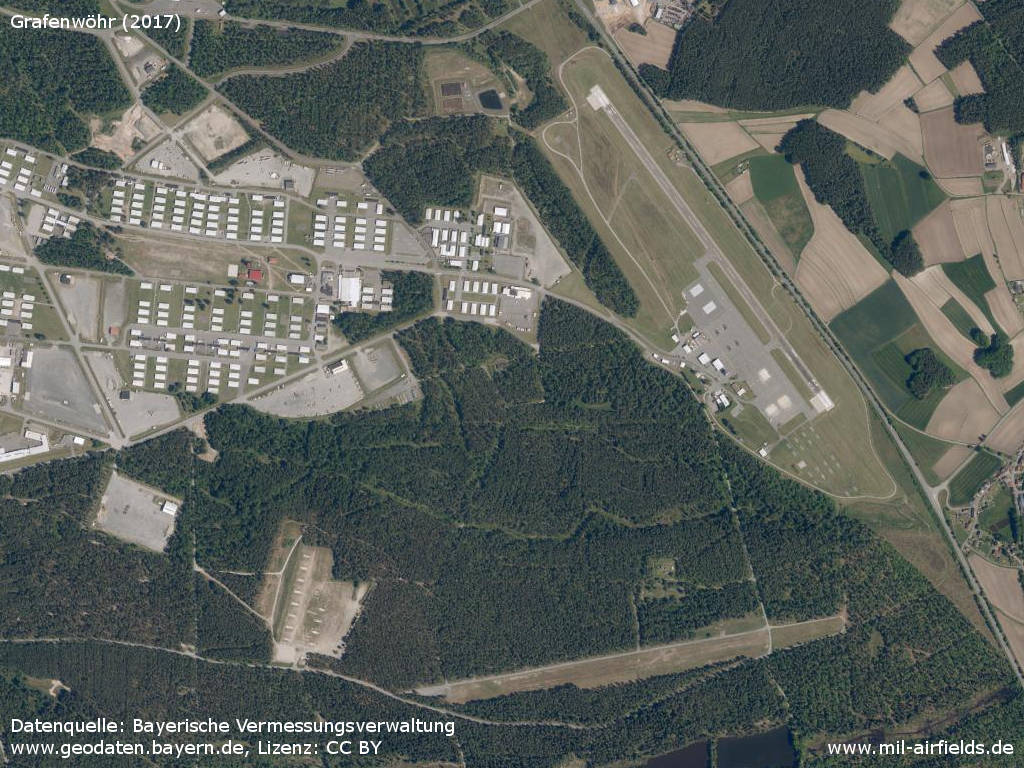
Image credits are shown on the respective target page, click on the preview to open it.
 Follow mil-airfields on Facebook