For historical information only, do not use for navigation or aviation purposes!
| Coordinates | N523204 E0130657 (WGS84) Google Maps |
| Elevation | 149 ft |
| Former East Germany (GDR) | District of Potsdam |
| Federal state | Brandenburg, Berlin |
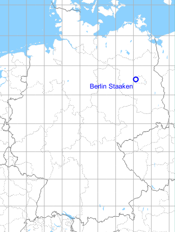
Germany during the Cold War Map
The history of the Cold War airfields: Berlin Staaken
In the 1920/30s
Overview
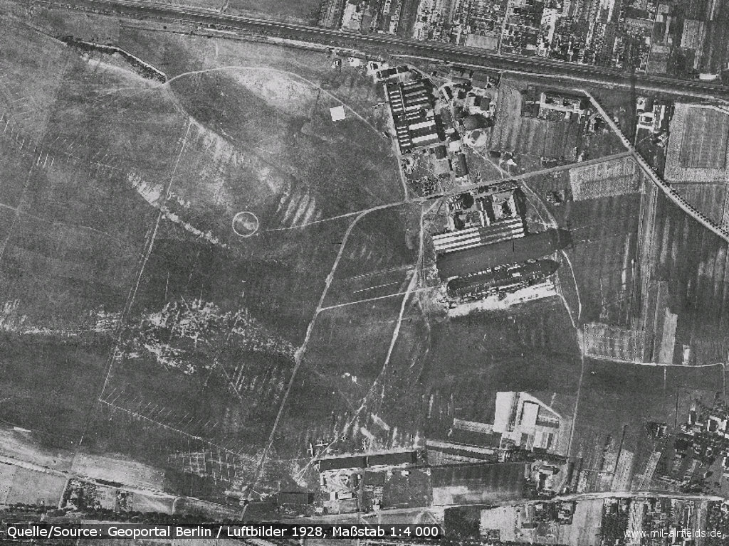
Aerial picture from 1928
Source: Geoportal Berlin / Luftbilder 1928, Maßstab 1:4000; Datenlizenz Deutschland - Namensnennung - Version 2.0, https://www.stadtentwicklung.berlin.de/geoinformation/fis-broker/
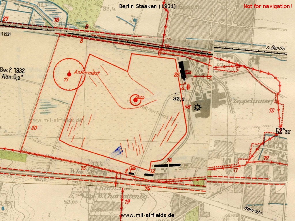
Staaken airfield on a map in the aeronautical publication from 1931
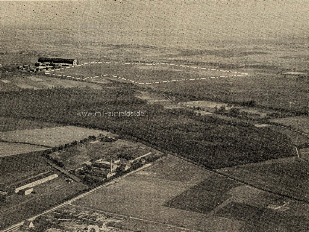
Aerial picture from the end of the 1920s or beginning of the 1930s - Looking to the southeast
Runways, taxiways, aprons
Good sod on sandy soil. Swamp formation in the southwest corner of the field. Shortest rolling distance 1000 m in all directions.
Hangars
6 Aircraft hangars:
2 hangars: 60,8 x 30,4 m
2 hangars: 99,0 x 25,0 m
1 hangar: 60,0 x 22,0 m
1 hangar: 25,0 x 8,0 m
2 hangars: 60,8 x 30,4 m
2 hangars: 99,0 x 25,0 m
1 hangar: 60,0 x 22,0 m
1 hangar: 25,0 x 8,0 m
Workshops
Workshops: Contain all machines and tools necessary to repair metal and wood aircraft. Electric current 220 V AC. Spare parts for all airplanes of the Deutsche Luft Hansa in stock.
Fuel equipment
Fuel Equipment:
For a total of 90,000 liters of gasoline, 3,000 liters of oxyde and 3000 liters of benzene. Hydrogen gas for airship purposes.
For a total of 90,000 liters of gasoline, 3,000 liters of oxyde and 3000 liters of benzene. Hydrogen gas for airship purposes.
Images
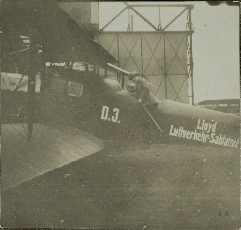
Sablatnig biplane in front of the hangar in Staaken
Source: ETH-Bibliothek Zürich, Bildarchiv / Fotograf: Unbekannt / Ans_05338-01-072-AL-FL / Public Domain Mark, http://ba.e-pics.ethz.ch/ShowRecord.jsp?catalogName=ETHBIB.Bildarchiv&recordID=90640&pn=ba
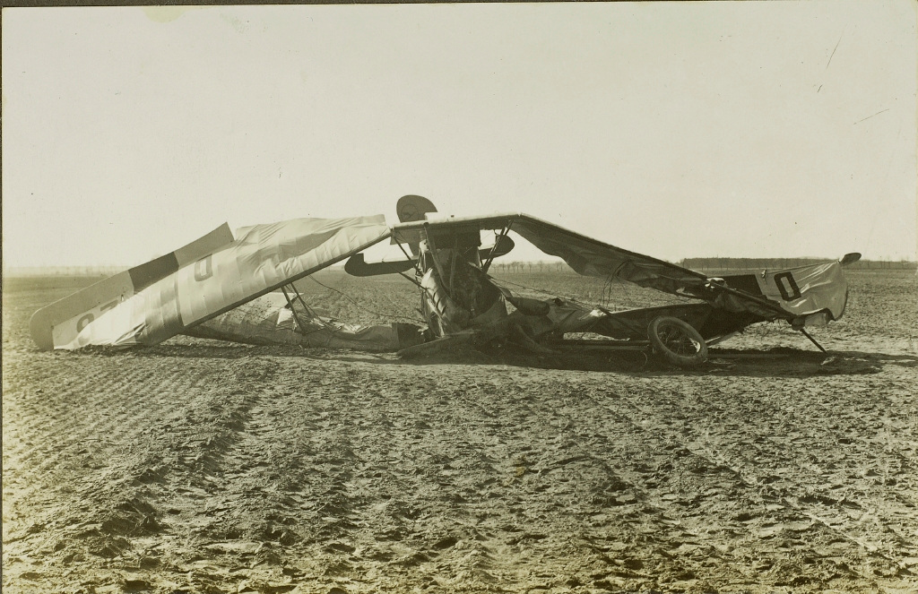
Crash landing of AEG JII K, D 26 of Deutsche Aero Lloyd at Staaken (April 14th, 1923)
Source: ETH-Bibliothek Zürich, Bildarchiv / Fotograf: Unbekannt / Ans_05338-01-034-AL-FL / Public Domain Mark, http://ba.e-pics.ethz.ch/ShowRecord.jsp?catalogName=ETHBIB.Bildarchiv&recordID=90602&pn=ba
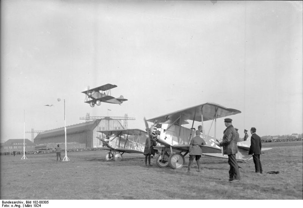
Staaken 1924
Source: Bundesarchiv, Bild 102-00305 / CC-BY-SA 3.0, via Wikimedia Commons, https://commons.wikimedia.org/wiki/File:Bundesarchiv_Bild_102-00305,_USA,_Man%C3%B6verflug_eines_Kampf-Flugzeuges.jpg
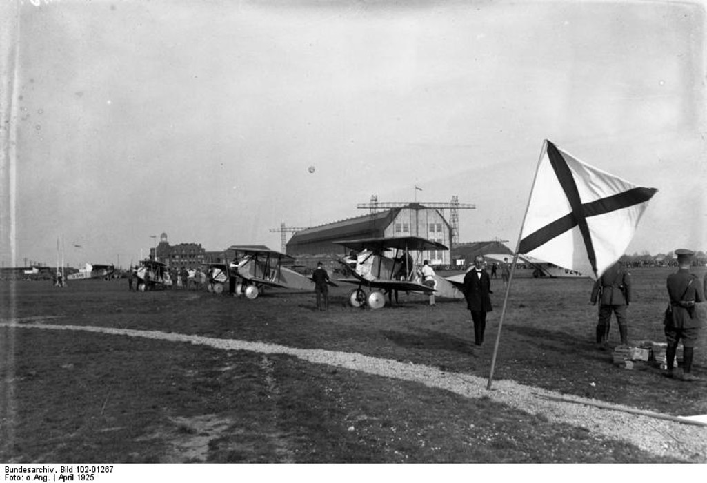
Flugzeug-Schaufliegen in Staaken in 1925, Blick auf den Startplatz mit Luftschiffhalle
Source: Bundesarchiv, Bild 102-01267 / CC-BY-SA 3.0, via Wikimedia Commons, https://commons.wikimedia.org/wiki/File:Bundesarchiv_Bild_102-01267,_Staaken,_Schaufliegen,_Flugplatz.jpg
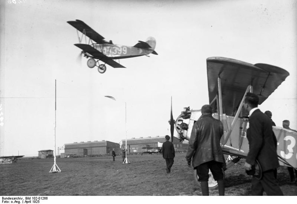
Staaken 1925
Source: Bundesarchiv, Bild 102-01266 / CC-BY-SA 3.0, via Wikimedia Commons, https://commons.wikimedia.org/wiki/File:Bundesarchiv_Bild_102-01266,_Staaken,_Schaufliegen.jpg
Airship LZ 127 Graf Zeppelin in Staaken in 1928
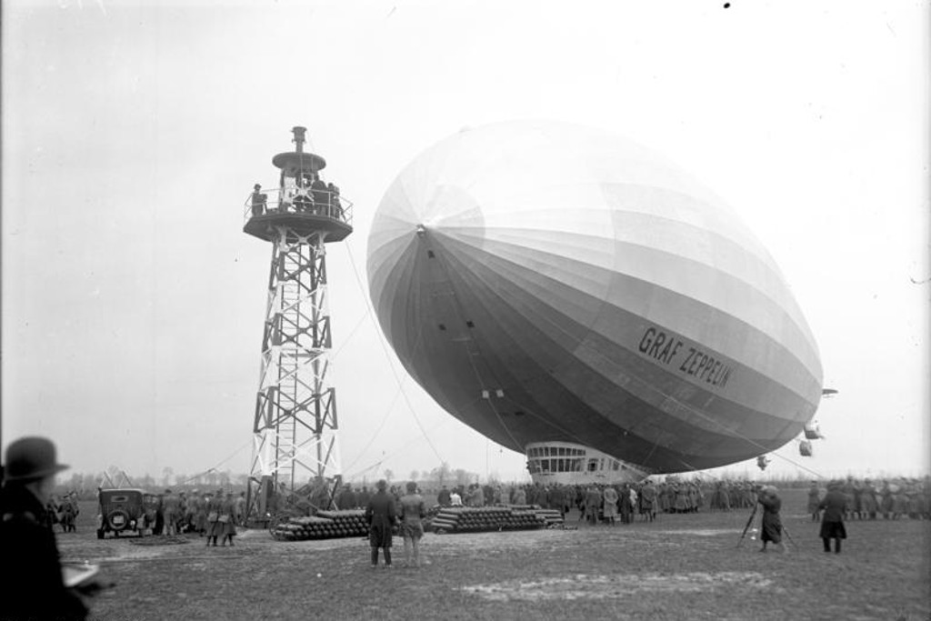
"Graf Zeppelin" airship in Staaken 1928
Source: Bundesarchiv, Bild 102-06793 / CC-BY-SA 3.0, via Wikimedia Commons, https://commons.wikimedia.org/wiki/File:Bundesarchiv_Bild_102-06793,_Staaken,_Landung_des_Luftschiffs_%22Graf_Zeppelin%22.jpg
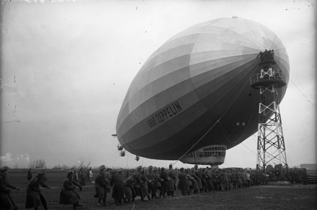
Airship LZ 127 in Staaken
Source: Bundesarchiv, Bild 102-00845 / CC-BY-SA 3.0, via Wikimedia Commons, https://commons.wikimedia.org/wiki/File:Bundesarchiv_Bild_102-00845,_Staaken,_Graf_Zeppelin_am_Ankermast.jpg
During World War II
Use
Airfield.
Situation
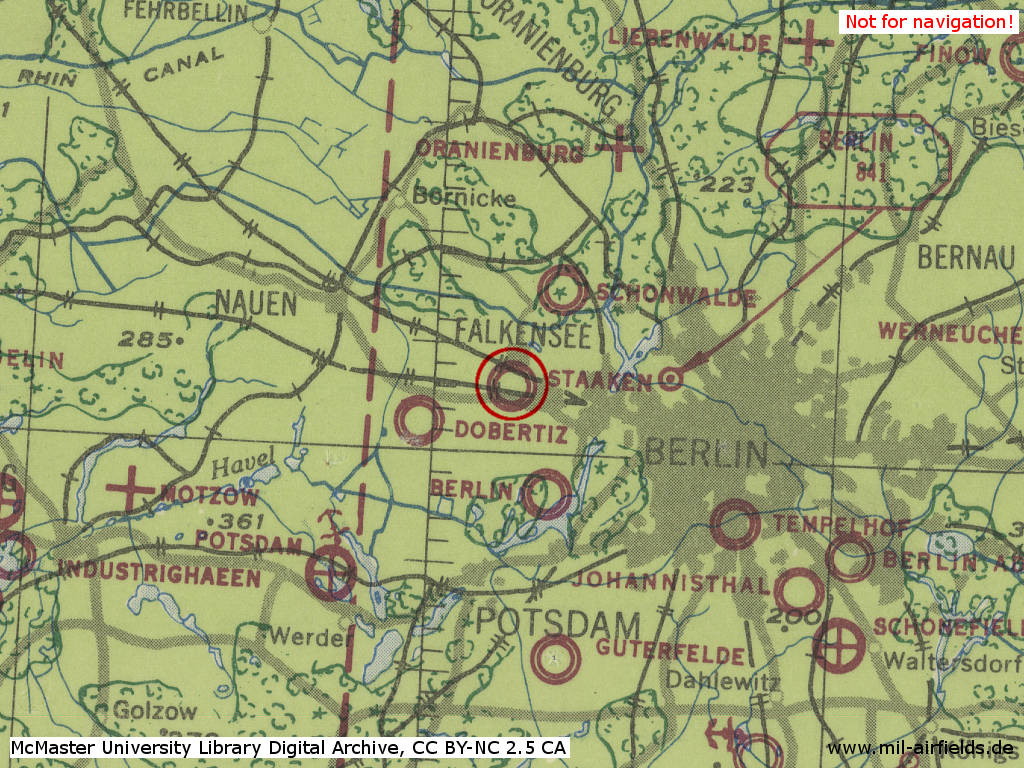
Berlin Staaken Airfield in World War II on a US map from 1943
Source: McMaster University Library Digital Archive, License: Creative Commons Attribution-NonCommercial 2.5 CC BY-NC 2.5 CA
Additional information
The Staaken airfield was used in 1942 twice for scenes in the Karl Ritter Ufa film BESATZUNG DORA (D. 1943, banned). On 27/28 August 1942 the scenes with actress Charlott Daudert on a bicycle were shot there. On 31 October various take-offs, circling, and landing shots with a Junkers Ju 88D aircraft were filmed. The film was an air reconnaissance (Fernaufklärer) propaganda film.
Source: William Gillespie, author of the book THE MAKING OF THE CREW OF THE DORA (2016).
Source: William Gillespie, author of the book THE MAKING OF THE CREW OF THE DORA (2016).
During the Cold War
In the 1940/50s
General
After World War II, Staaken airfield was used by Soviet flying units, presumably until the 1950s. Previously, an exchange of territories was made: The eastern part of the airfield was located in the British sector of Berlin. At the same time, the western part of the British Berlin Gatow Airfield was located in the Soviet zone. In order to allow reasonable operations at both fields, Soviets and British exchanged the territories. With this, West Staaken became part of East Berlin, later of East Germany. It was not until the political change that West Staaken returned to Berlin again in 1990.
The following map from 1952 shows the location of the Staaken airfield in relation to the other post-war airfields in and around Berlin: Gatow, Johannisthal, Schönefeld, Schönwalde, Tegel und Tempelhof.
Situation
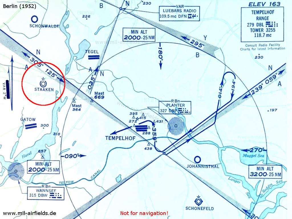
Map with airfields in the Berlin area from 1952
Source: USAF
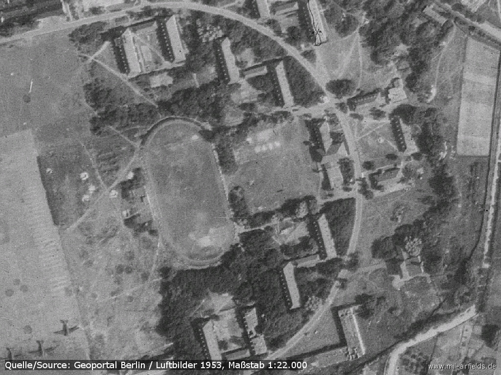
Overview
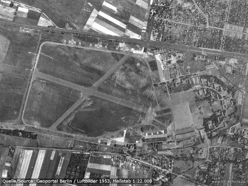
Aerial picture from 1953
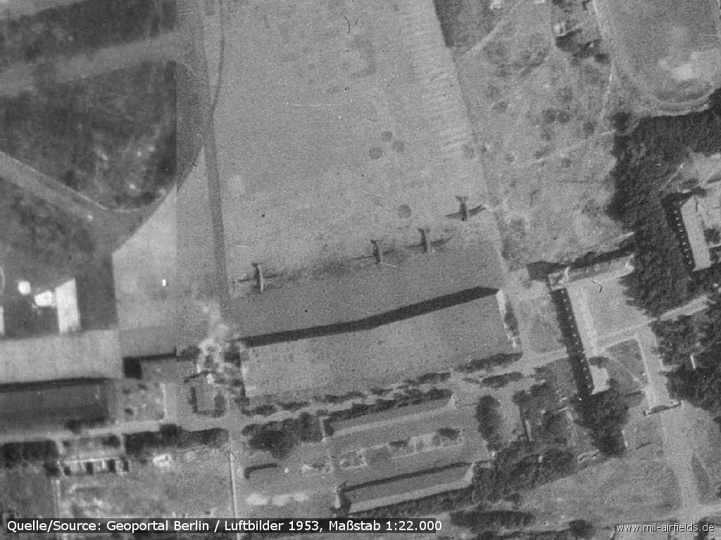
Parked aircraft in the southeastern part
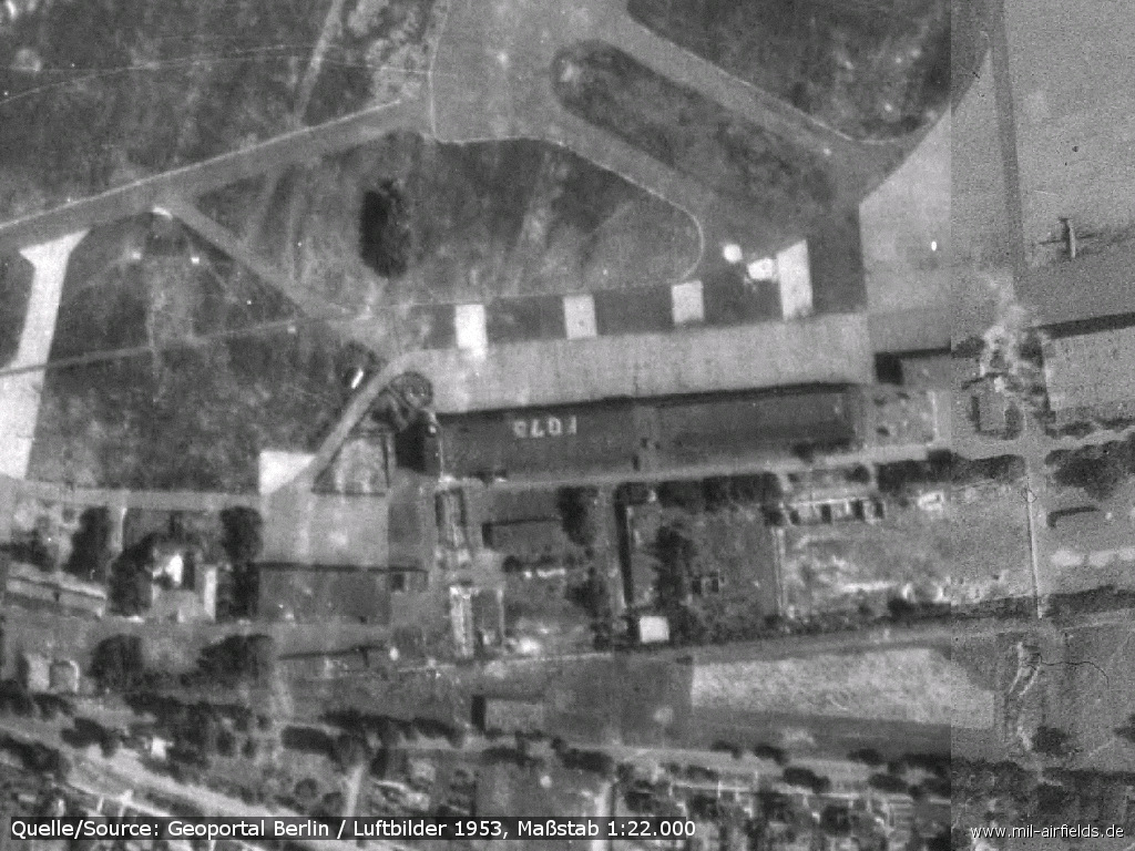
Hangar with control tower and marking on the roof - The inscription should name the Jägertrapez ("fighter trapeze") "FG7.." in which the airfield was located. The Jägertrapez was a coordinate system which was used by the German Luftwaffe until 1945 to locate places. These coordinates were visibly shown on many airfields.
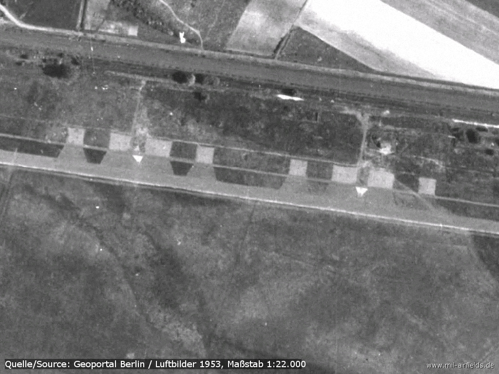
Aircraft revetments in the north
Barracks
Radio beacons
- NDB: 459 "T"
Radio communication
The Soviet radio station was working on 4150 kc, with the call sign BRONZA.
Railway siding
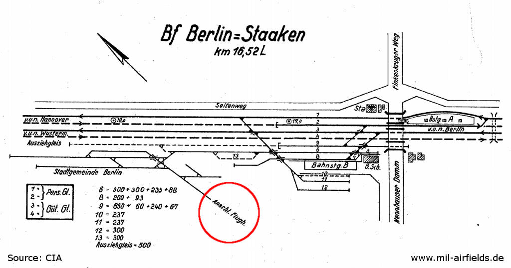
Track diagram of Berlin Staaken railroad station, 1952 - Red marked is the railway siding to the airfield.
Source: CIA / Deutsche Reichsbahn
In the 1960s
Overview
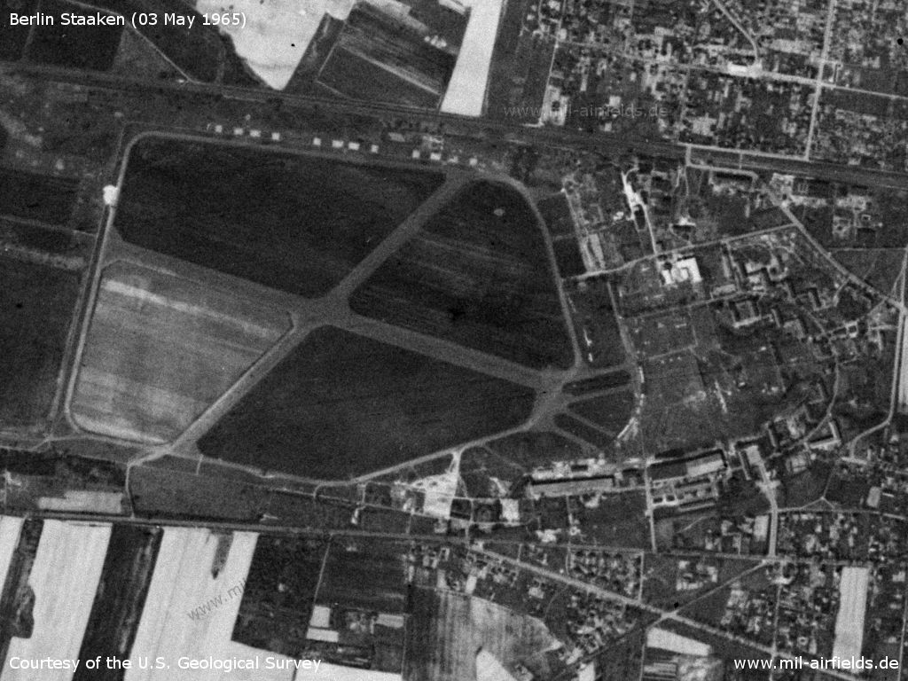
Berlin Staaken Airfield on a US satellite image from 03 May 1965 - The airfield is out of operation, but the two runways are still clearly visible.
Source: U.S. Geological Survey
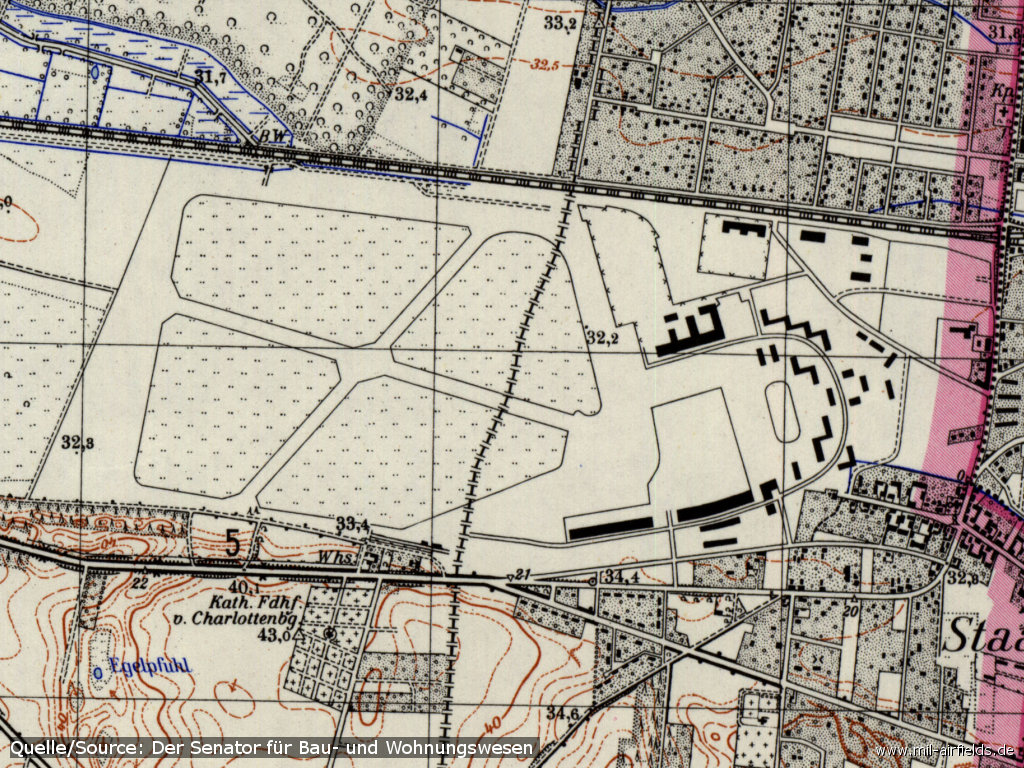
The airfield on a map from 1967 - The former and now again valid city border running across the airfield is clearly visible. The border which was valid between 1945 (?) and 1990 after the exchange of territories runs along the right side of the map (Courtesy Harold B. Lee Library, Brigham Young University /BYU/)
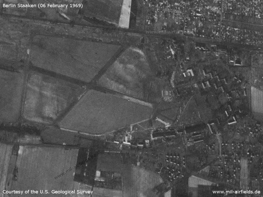
The former airfield on 06 February 1969
Source: U.S. Geological Survey
Today
Use
Closed.
Situation
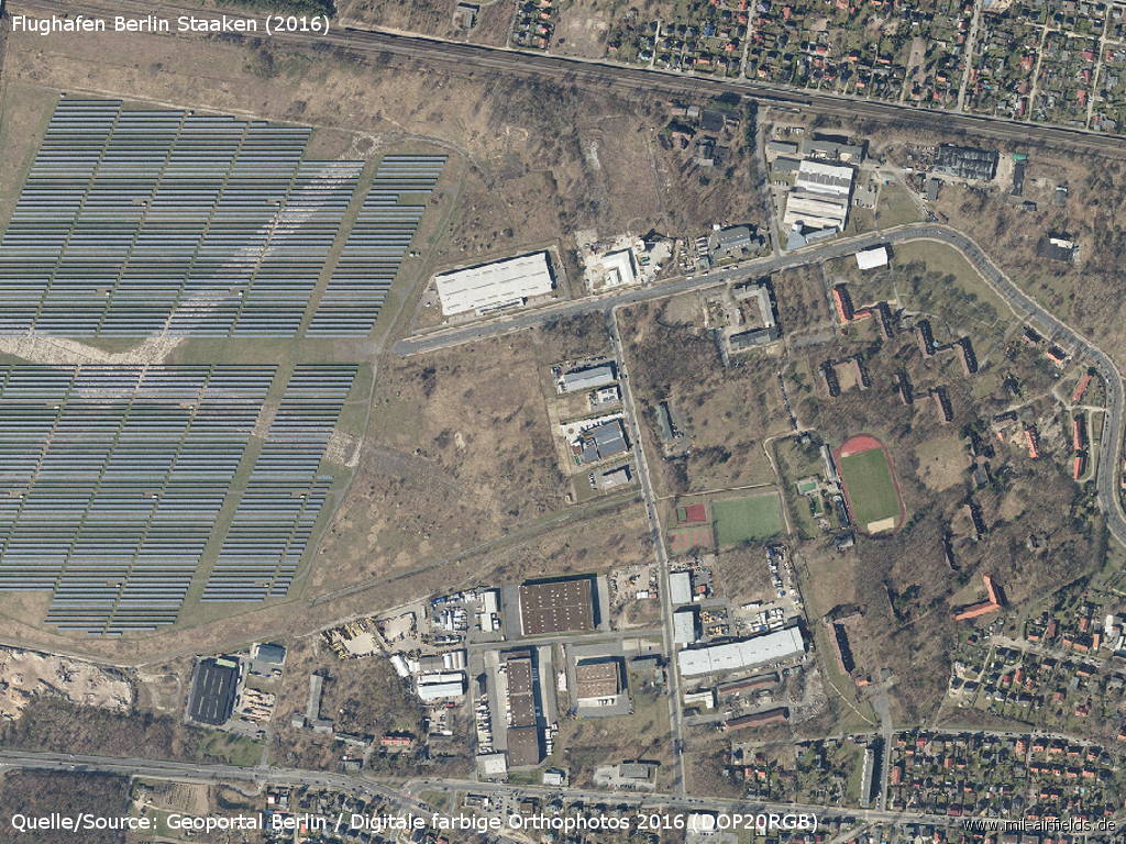
Aerial view 2016 - There is a solar park on the former runways
Sources
- https://www.e-pics.ethz.ch/ - ETH E-Pics
- https://www.cia.gov/ - CIA: Central Intelligence Agency
- https://www.usgs.gov/ - USGS: U.S. Geological Survey
- https://www.stadtentwicklung.berlin.de/geoinformat... - Geoportal Berlin
Bibliography
- Ries, Karl; Dierich, Wolfgang: "Fliegerhorste und Einsatzhäfen der Luftwaffe" Motorbuch Verlag Stuttgart, 1993 - Alliierte Planskizze
- Freundt, Lutz (Hrsg.), Büttner, Stefan: "Rote Plätze - Russische Militärflugplätze in Deutschland 1945 - 1994" AeroLit Verlag, 2007
Airfields in the vicinity
- 167°/7km Berlin: RAF Gatow Airfield (Kladow)
- 018°/10km Schönwalde: Airfield (Fliegerhorst Schönwalde Glien)
- 076°/12km Berlin: Tegel Airport
Categories
Airfields in GermanyMilitary Airfields GermanyMilitary Airfields in former East GermanyAirfields of the Soviet Forces in GermanyRecommended
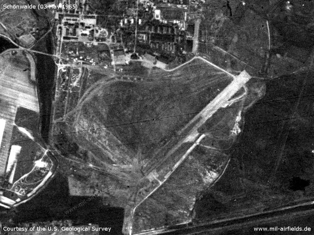
Image credits are shown on the respective target page, click on the preview to open it.
 Follow mil-airfields on Facebook