For historical information only, do not use for navigation or aviation purposes!
| Coordinates | N490806 E0100235 (WGS84) Google Maps |
| Elevation | 1387 ft |
| Federal state | Baden-Württemberg |
| Location indicator | DBCA (195x), EDER (196x-198x) |
Germany during the Cold War
The history of the Cold War airfields: Crailsheim
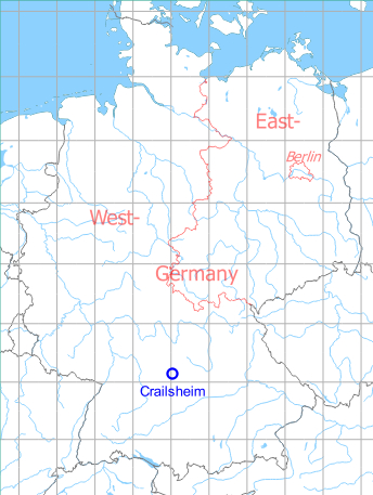
Location of airfield
2 km west of Crailsheim city center, at the former World War II air base (Fliegerhorst).
During World War II
Use
Luftwaffe air base (Fliegerhorst).
Situation
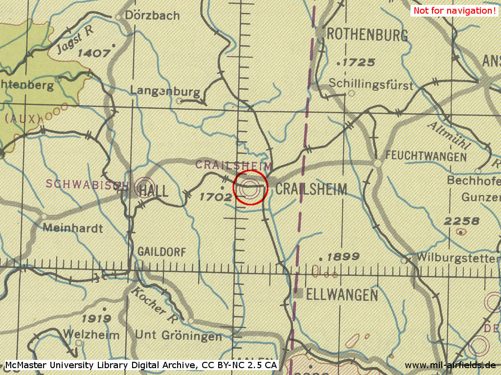
Crailsheim Air Base in World War II on a US map from 1944
Source: McMaster University Library Digital Archive, Lizenz: Creative Commons Attribution-NonCommercial 2.5 CC BY-NC 2.5 CA
Overview
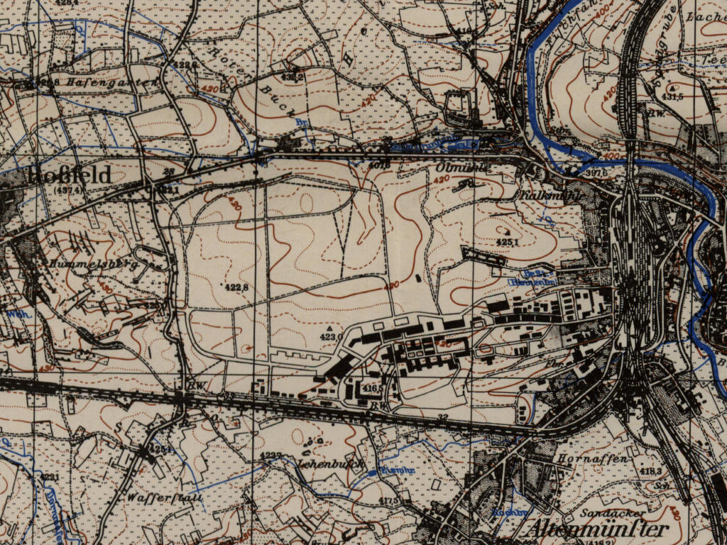
Crailsheim airfield on a US map from the 1950s
Source: AMS M841 GSGS 4414, Courtesy Harold B. Lee Library, Brigham Young University
During the Cold War
Use
US Army airfield, probably used until the early 1980s. Already in 1971, the airfield was declared as closed to all transient aircrafts and that there were holes in the runway. 10 years later, while still being listed as an Army airfield, it was closed to all aircrafts. Helicopters were advised to use the nearby McKee heliport. From the mid 1980s, there were no signs that it was used as airfield anymore.
In the 1960s
Overview
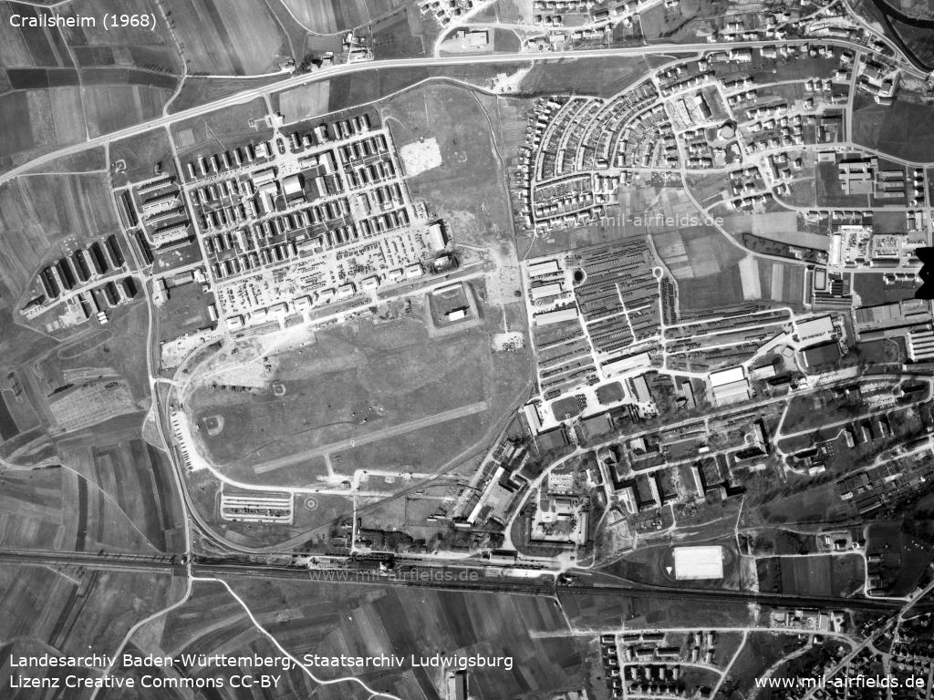
Aerial image of former Crailsheim Air Base from 1968
Source: Landesarchiv Baden-Württemberg, Staatsarchiv Ludwigsburg, EL 68 IX Nr 5853, http://www.landesarchiv-bw.de/plink/?f=2-5949668-1
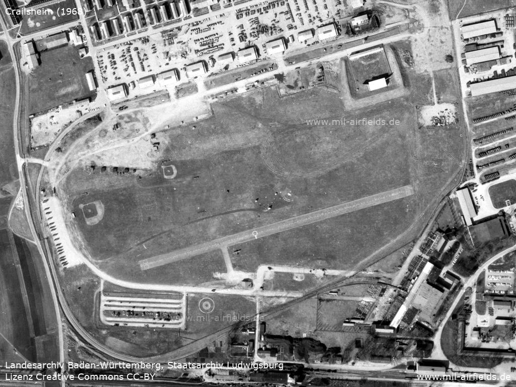
Enlargement: Crailsheim Army Airfield with a paved runway
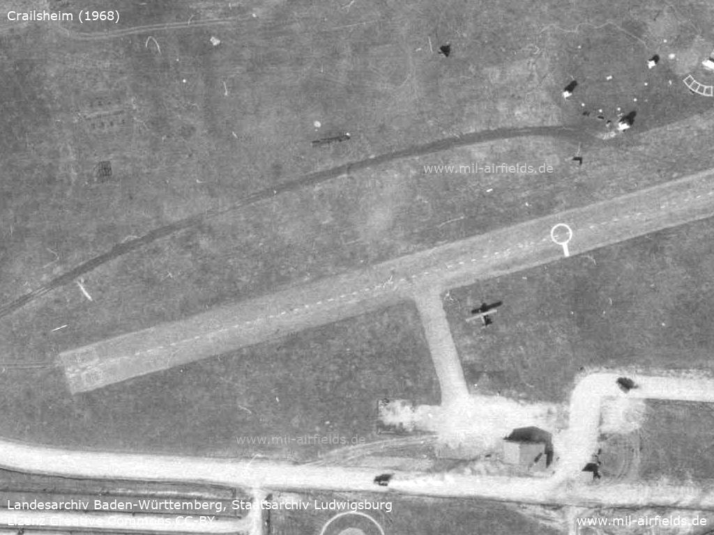
Enlargement: Plane
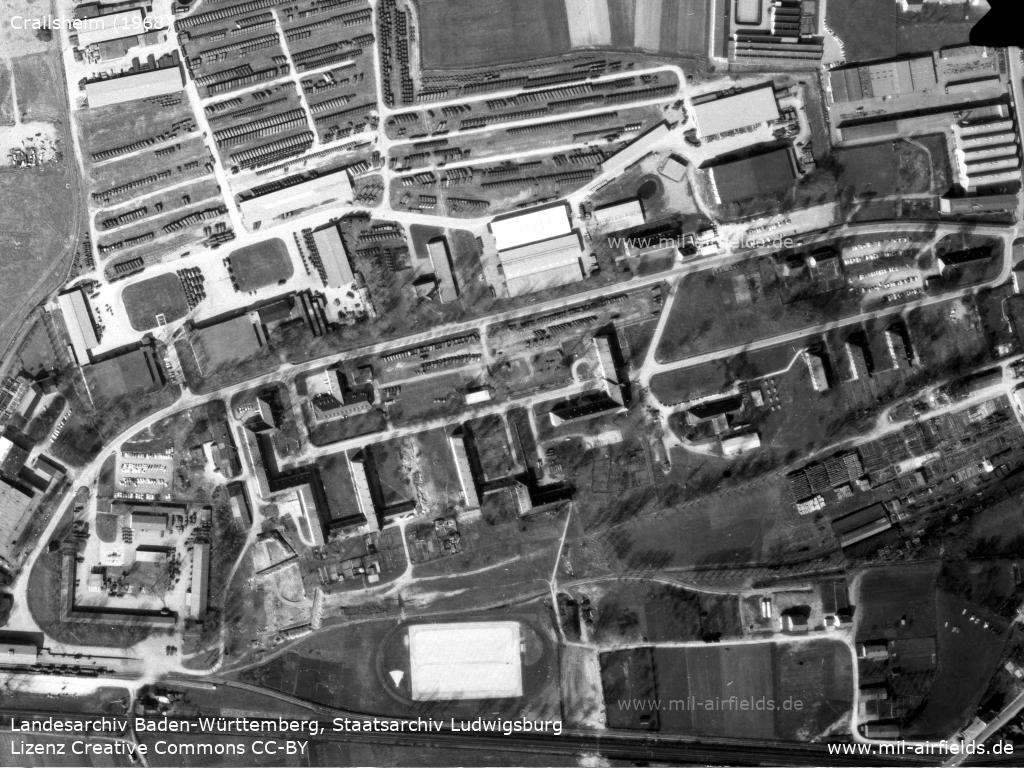
Enlargement: Air base buildings in the southeast
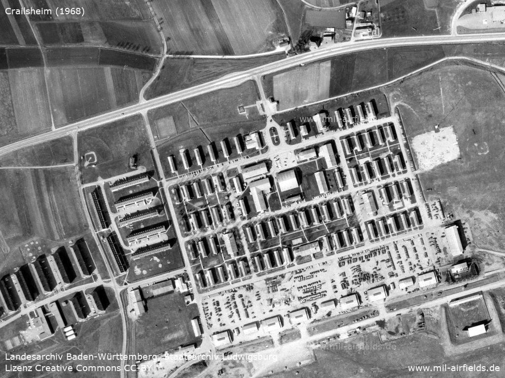
Enlargement: McKee Barracks in the north
In the 1970s
Situation
Overview
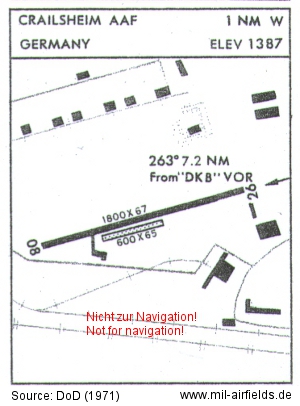
Army Airfield (AAF) map from 1971 - Shown are a 549 m long (1,800 feet) and 20 m wide (67 feet) paved runway 08/26 and a parallel grass runway with 183 m x 20 m (600 feet x 65 feet). The field is located 263° and 7.2 nautical miles from the Dinkelsbühl "DKB" VOR radio beacon and has a height of 423 m (1,387 feet) above sea level.
Source: DoD
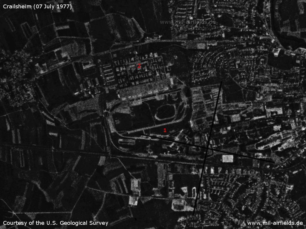
Crailsheim Army Airfield on a US satellite image from 07 July 1977 - 1: airfield; 2: McKee Barracks
Source: U.S. Geological Survey
Runways
Data for the year 1971:
- 08/26: 549 m x 20 m
- 08/26: 183 m x 20 m Grass
The runway of the Army Airfield was situated south of the old air base take-off platforms, close to today's Ludwig-Erhard-Straße and ran parallel to this road.
In the 1980s and early 1990s
Additional information
I was an American Soldier stationed at McKee Barracks between 1984-1987. One day a small privately owned jet made an emergency landing on post. The pilot was a former member of the German Luftwaffe. He said that he was flying in the area and started having some serious problem with his aircraft. He remembered that there was a airfield at McKee Barracks from his experience in World War II. He headed for McKee Barracks. The airfield is still there but it was covered with grass. Somehow he put the plane down on the parking lot and street at the back of the post. He put this aircraft in such a position that after it was repaired he had to hire a stunt pilot to get it out of there.
Delbert S. Buttman
Thanks Delbert for this nice story!
Delbert S. Buttman
Thanks Delbert for this nice story!
Today: Industrial park
Use
Closed.
Links
- https://maps.google.com/maps/ms?ie=UTF8&msa=0&msid... - The approximate align of the former runway is shown in blue
- https://lib.byu.edu/collections/german-maps/ - German Maps (topographic maps 1:25,000)
Bibliography
- Ries, Karl; Dierich, Wolfgang: "Fliegerhorste und Einsatzhäfen der Luftwaffe" Motorbuch Verlag Stuttgart, 1993 - Allied map
Airfields in the vicinity
- 338°/0,6km Crailsheim: McKee Barracks Army Heliport AHP
- 314°/7km Kleinallmerspann: Highway Strip (Autobahn-Notlandeplatz NLP)
- 264°/19km Schwäbisch Hall: Hessental Army Airfield AAF (Hessental, Camp Dolan, Dolan Barracks, Adolf Würth Airport)
- 348°/29km Niederstetten: Airfield
- 206°/40km Schwäbisch Gmünd: Army Airfield, Army Heliport (AAF, AHP, Mutlangen)
Categories
Military Airfields GermanyMilitary Airfields in former West GermanyUS Army Airfields and Heliports in GermanyAirfields in Baden-WürttembergRecommended
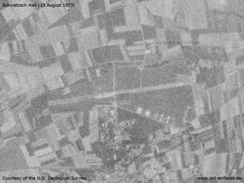
Image credits are shown on the respective target page, click on the preview to open it.
 Follow mil-airfields on Facebook