For historical information only, do not use for navigation or aviation purposes!
| Coordinates | N535516 E0131309 (WGS84) Google Maps |
| Former East Germany (GDR) | District of Neubrandenburg |
| Federal state | Mecklenburg-Vorpommern (Mecklenburg-Western Pomerania) |
| Location indicator | EDUW (200x) |
The history of the Cold War airfields: Tutow
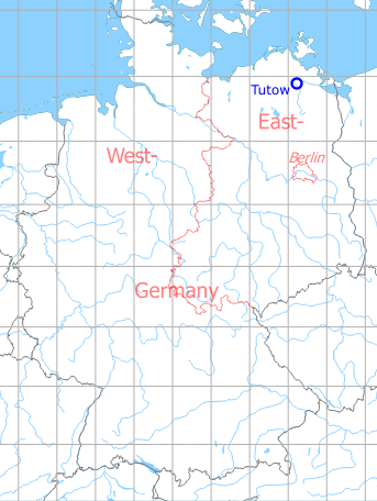
Location of airfield
11 km east-northeast of Demmin; northwest of Tutow.
During World War II
Situation
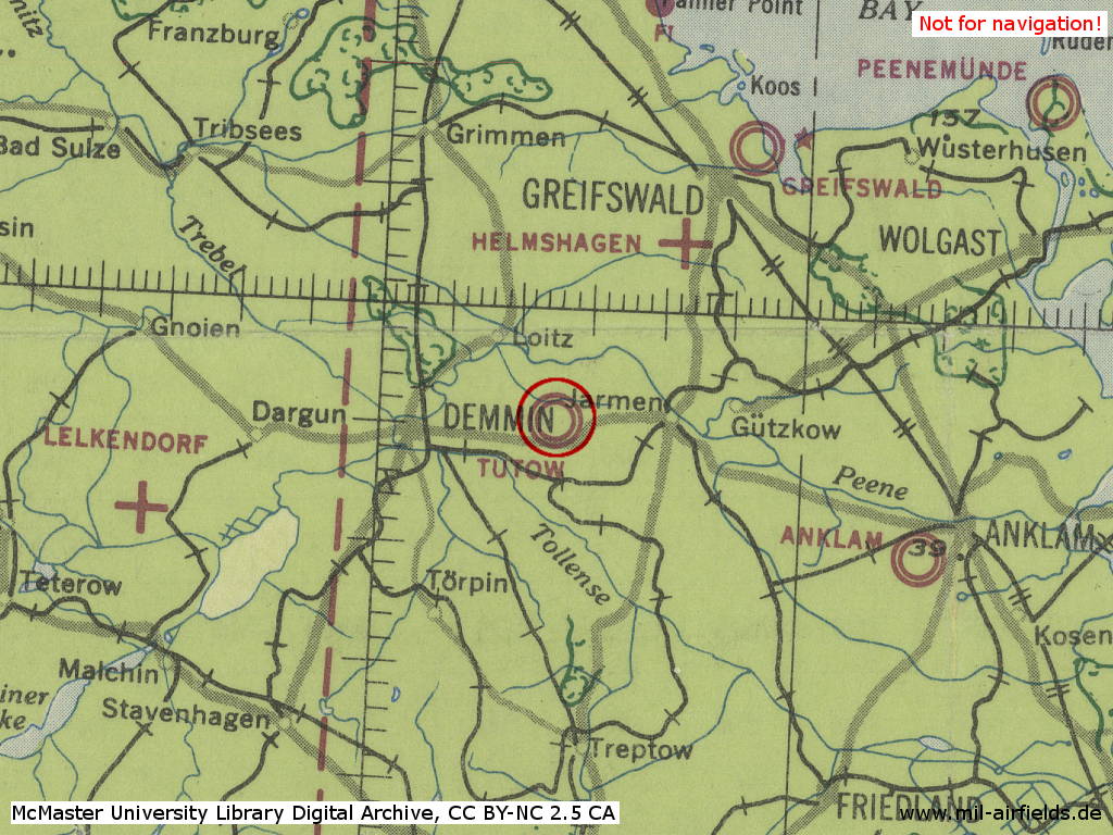
Tutow Air Base in World War II on a US map from 1943
Source: McMaster University Library Digital Archive, License: Creative Commons Attribution-NonCommercial 2.5 CC BY-NC 2.5 CA
Overview

On this US map from 1952, the former Fliegerhorst Tutow is shown in its state until 1945. - Reichsstraße 110 runs to the south and east.
Source: AMS M841 GSGS 4414, Courtesy Harold B. Lee Library, Brigham Young University
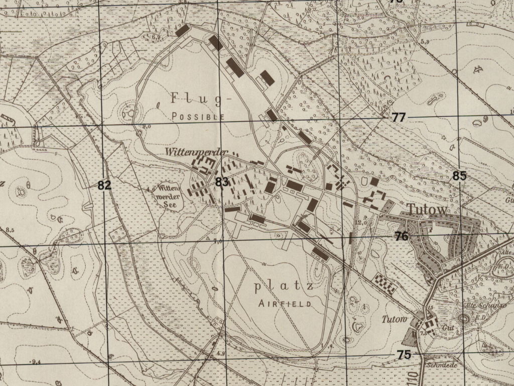
The air base consisted of two separate airfields - The map still mentions the village of Wittenwerder, which had to give way to the construction of the airfield.
Source: AMS M841 GSGS 4414, Courtesy Harold B. Lee Library, Brigham Young University
During the Cold War
Use
Airfield of the Soviet occupation forces.
Installations
The airfield covered 534,6 ha
In the 1950s
History
- 28 June 1951: Status
Hangars and barracks buildings are destroyed, field is not guarded. (Source: CIA) - 03 October 1951: Status
A private firm was salvaging usable material at Tutow airfield. No Soviet soldiers were observed in and around Tutow. Allegedly it was not permissable to plugh the field. The local population still believes that the field will be reoccupied in the future. An untested source, who applied to the local labor office for a job as a foreman for excavation work at the field, was told that the surveying work for the improvement of the field was completed, but that the date on which work was to be started was not yet fixed. (Source: CIA) - 1954: Construction work
- Construction work at the airfield was done by VEB Tiefbau Brandenburg.
- On 28.04.1954, 58 employees and 420 workers were engaged at the field.
- After 1945, all installations at the field were demolished except for one building, which was used as workshop, and another building in the southeastern section which served as auxiliary waterworks. The debris from both sides of the runway was removed. At the end of April 1954, this work was still under way west of the runway.
- The runway was 2,200 meters long, 60 meters wide, and had a 20-cm concrete cover on a 10-cm gravel bedding. Drain pipes leading into Wittenwerder Lake were laid along the runway at intervals of 50 meters. The middle section of the runway was to be concreted by 31 October 1954. Grass-covered safety strips 100 meters and 200 meters wide respectively were scheduled to be established at the eastern and western sides of the runway. The taxiway with a width of 14 meters, a 20-cm concrete cover and a 10-cm bedding was also planned to be terminated by 31 October. Allegedly, the width was to be changed.
- In April, the previously planned construction of barracks buildings was cancelled. No hangars were seen or heard of at the field. The workers and employees of the VEB Tiefbau Brandenburg were quartered in temporary buildings near the railroad line.
- The fuel dump just north of the curve of the railrad line was to be completed by 31 October 1954. The construction of an ammunition dump was planned in the northern section of the field.
- Soviet Major ... with a detail of 80 men of a construction unit was to arrive at Tutow airfield on 5 May in order to do grading work and construction work on sharpnelproof revetments at the field. The Soviets were to be quartered in a temporary building.
- On the 26 November 1954, a workforce of 566 men was at the field.
- (Source: CIA)
In the 1960s
Overview
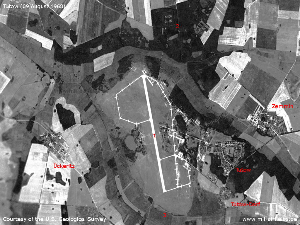
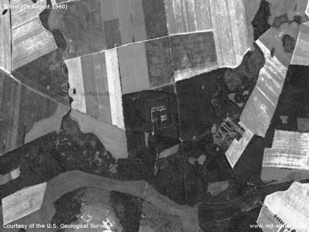
Tutow Air Base on a US satellite image from 09 August 1968 - 1: Airfield; 2: Dump; 3: Railway siding. Places Tutow, Tutow-Dorf, Ückeritz, Zemmin.
Source: U.S. Geological Survey
Dump (ammunition dump?) in the north
Source: U.S. Geological Survey
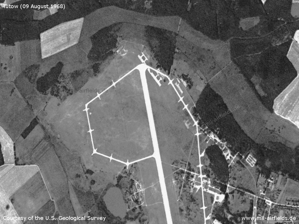
Northern part - At the northern end of the runway, remains of the old taxiways can still be seen. There's no rubber abrasion of the wheels visible on the runway, which could indicate rare use by airplanes.
Source: U.S. Geological Survey
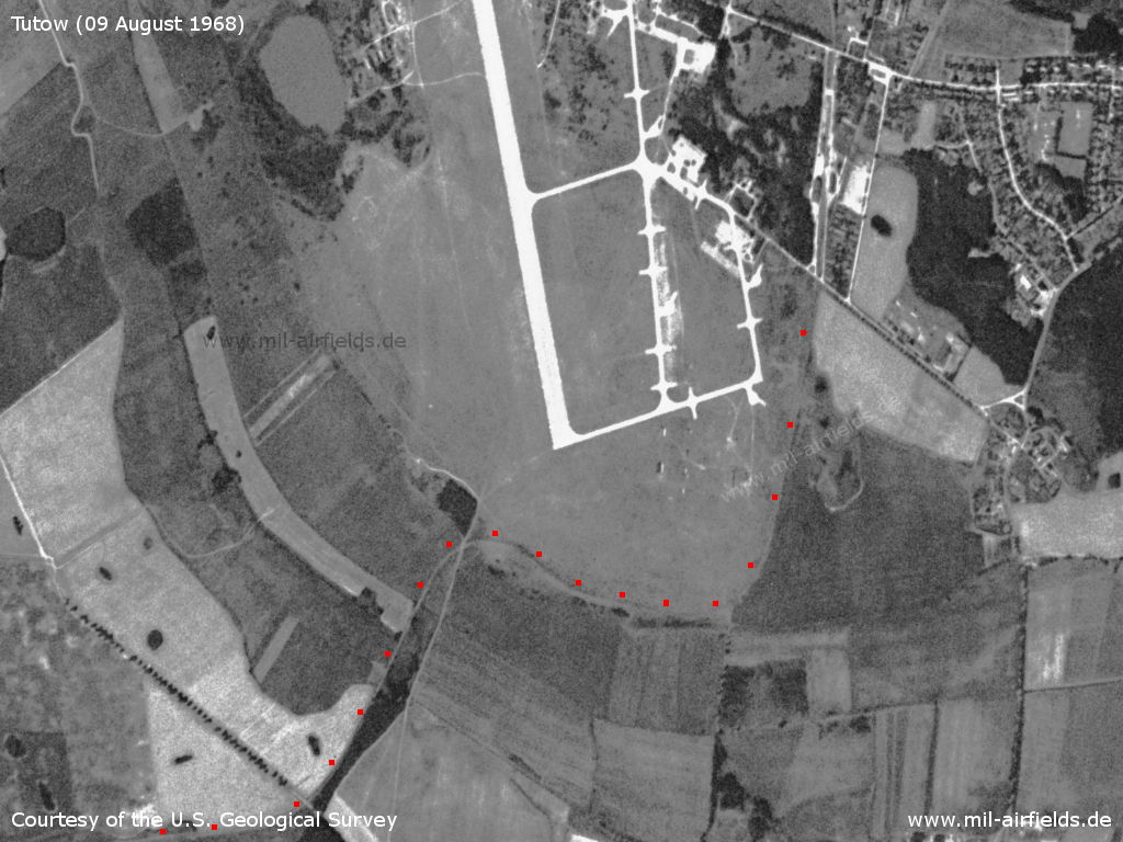
Southern part - No rubber abrasion at the southern end either. The red dots mark the railway connection from Demmin to the airfield
Source: U.S. Geological Survey
In the 1970s
Situation
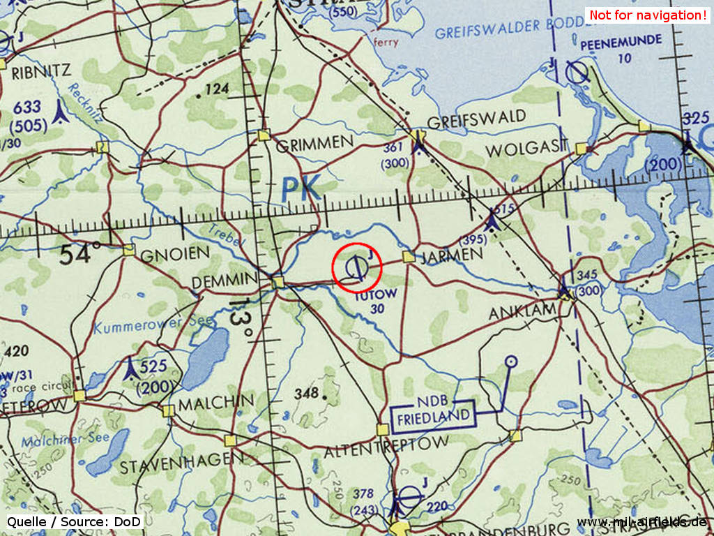
Tutow Air Base on a map of the US Department of Defense from 1972
Source: ONC E-2 (1972), Perry-Castañeda Library Map Collection, University of Texas at Austin
Radio communication
Radio call sign: MISERNIJ
In the 1980s and early 1990s
Overview
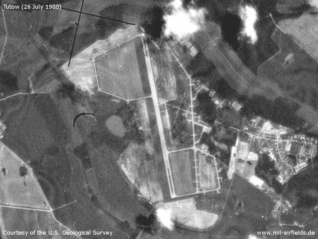
Satellite image from 26 July 1980
Source: U.S. Geological Survey
Runways
- 17/35: 2200 m
Radio beacons
- LOM 35: 803 "YC"
- LMM 35: 398 "Y"
Radio communication
Radio call sign: BAATH
Units
1990: 368 OShAP (Su-25, Su-25UB, L-39)
Installations
Most of the buildings were constructed between 1985 and 1991
Railway track from Demmin
Today
Use
General aviation airfield (since 28.03.2002), solar park.
Overview
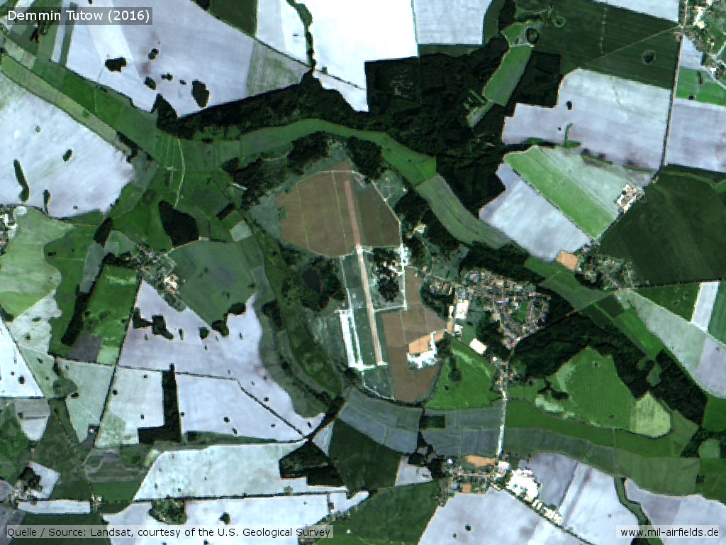
Landsat image from 2016 - The brown areas are solar plants.
Source: U.S. Geological Survey
Bibliography
- Ries, Karl; Dierich, Wolfgang: "Fliegerhorste und Einsatzhäfen der Luftwaffe" Motorbuch Verlag Stuttgart, 1993 - Alliierte Planskizze
Airfields in the vicinity
- 245°/7km Sanzkow: Helipad 3040 (HSLP / HLP 3040)
- 279°/14km Wotenick: Agricultural Airfield (Demmin)
- 335°/21km Grimmen: Appelshof Agricultural Airfield
- 222°/26km Basepohl: Heliport
- 130°/27km Spantekow: Helipad 3386 (HSLP 3386)
Categories
Military Airfields GermanyMilitary Airfields in former East GermanyAirfields of the Soviet Forces in GermanyRecommended
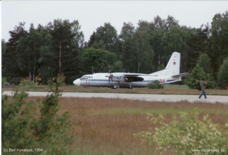

Image credits are shown on the respective target page, click on the preview to open it.
 Follow mil-airfields on Facebook