For historical information only, do not use for navigation or aviation purposes!
| Coordinates | N490140 E0082247 (WGS84) Google Maps |
| Elevation | 375 ft |
| Federal state | Baden-Württemberg |
| Location indicator | EDIL (1990) |

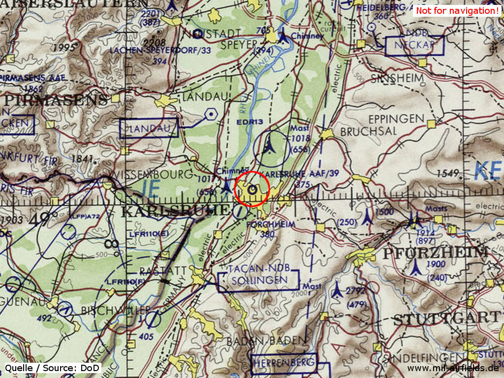
Germany during the Cold War Map
The history of the Cold War airfields: Karlsruhe
General
Karlsruhe airfield was built on the parade ground of a barracks area in the northwest of the city. After the First World War, the field was initially closed before it was reopened in the mid-1920s as a commercial airfield and integrated into the air traffic network. At that time, the airport's facilities were located in the south-western corner of the site.
From the mid-1930s onwards, the airport was expanded, the movement area was extended to the north and airfield facilities were built on the east side. A flight school of the Nationalsozialistischen Fliegerkorps (NSFK) was established at the field. In World War II, the airfield was occupied by individual units.
At the end of World War II, the airfield was occupied by US troops. Later, the US Army takes over and used it with individual aircraft and helicopters. In 1993 the site was closed and the US Army withdrew completely until 1995. Today the airport is a nature reserve.
German Empire until 1918
Images
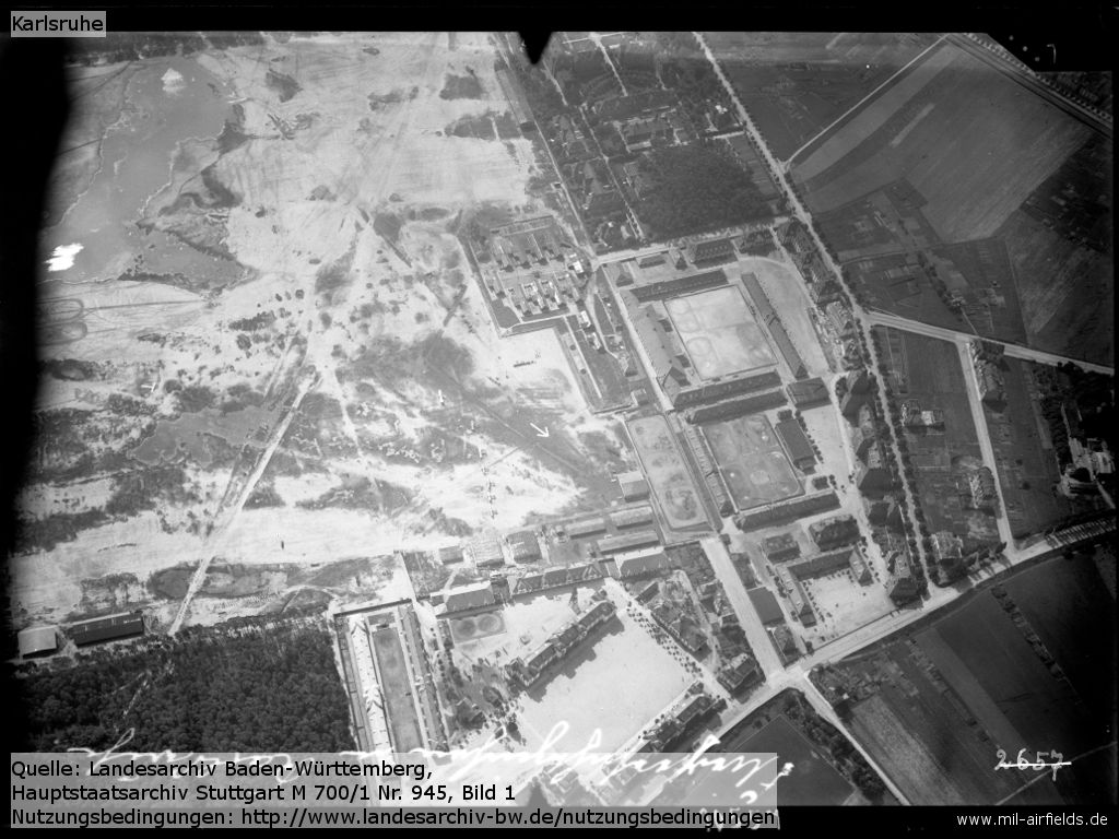
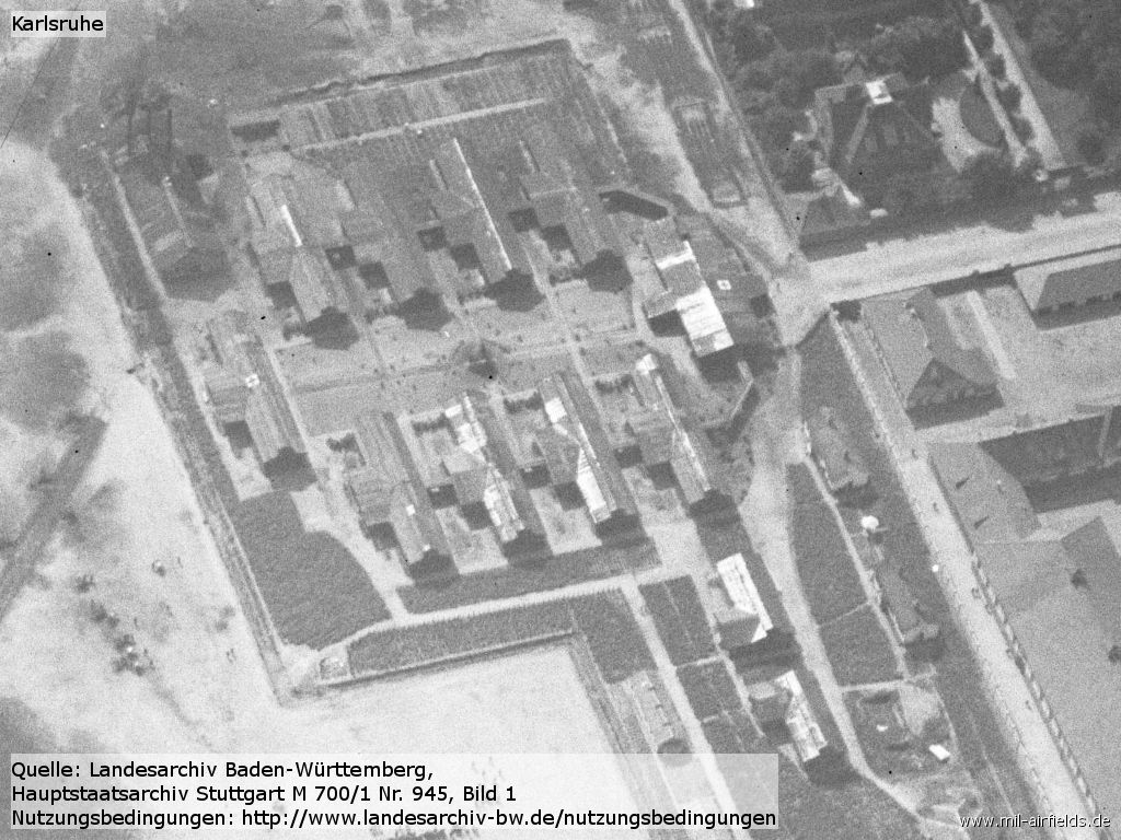
Aerial photograph, probably from the end of World War I. - The picture shows the south-western corner of the field, facing southeast.
Source: LABW 1-851356-1
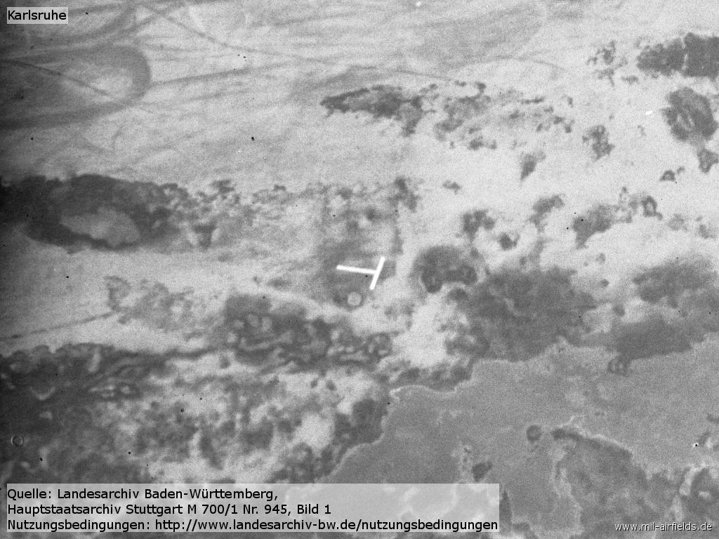
Enlargement: Landing-T?
Source: LABW 1-851356-1
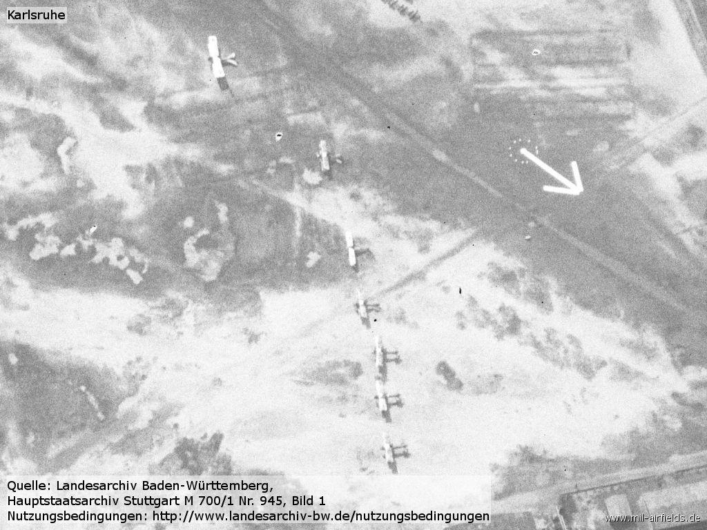
Enlargement: Aircraft and arrow
Source: LABW 1-851356-1
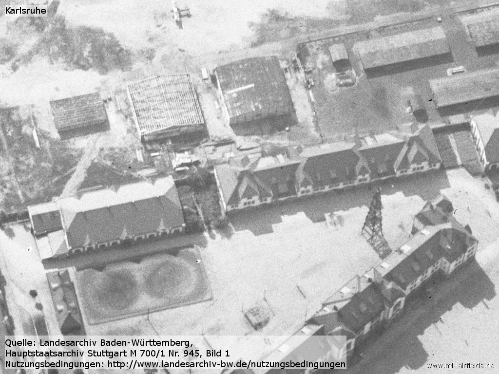
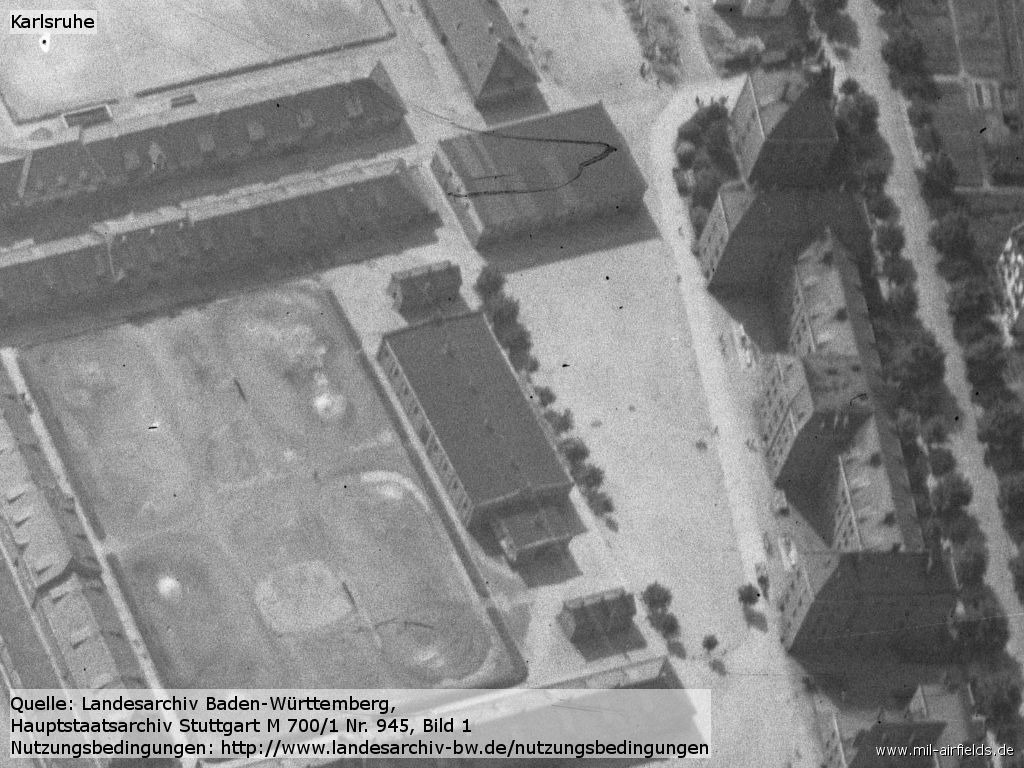
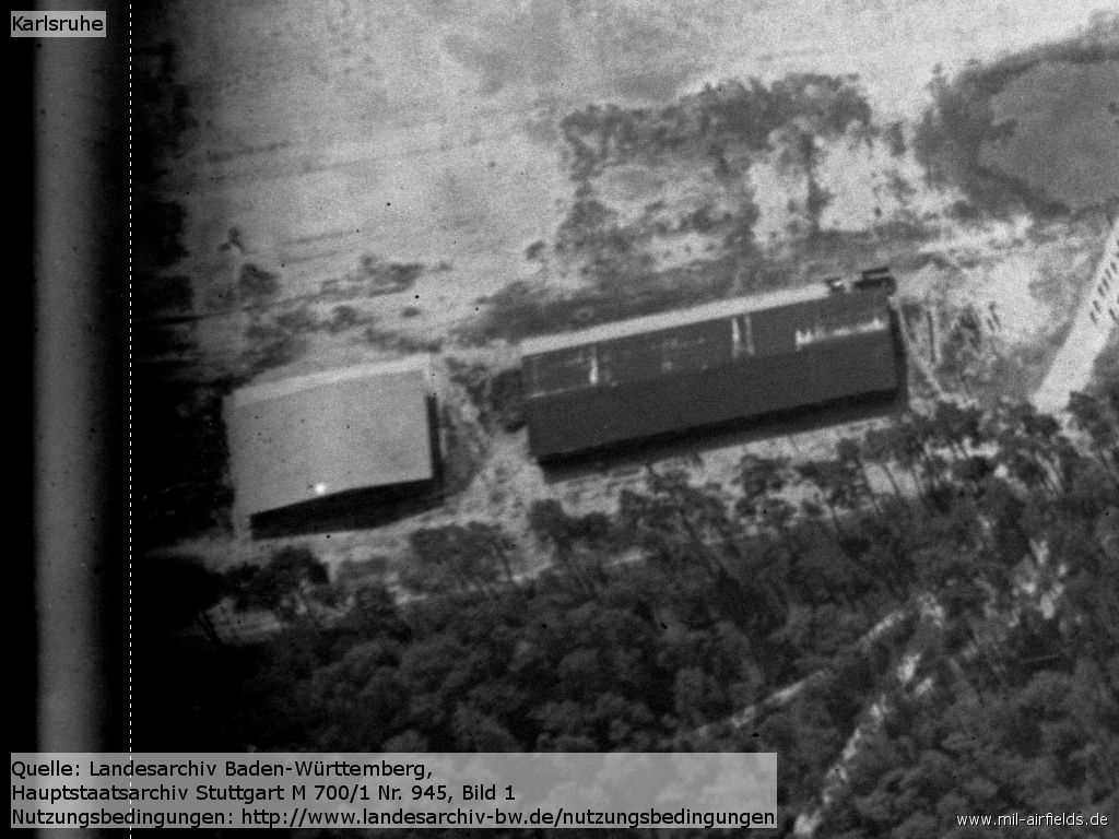
Enlargement: Hangars
Source: LABW 1-851356-1
Enlargement: Warehouse or hospital?
Source: LABW 1-851356-1
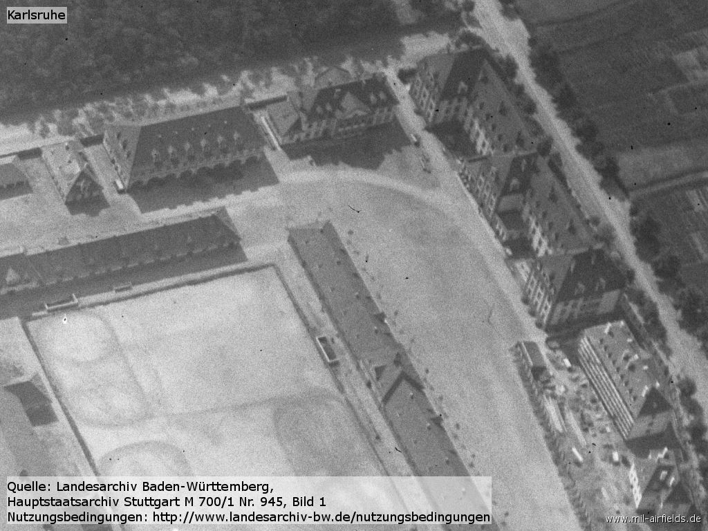
Enlargement: Barracks
Source: LABW 1-851356-1
Enlargement: Barracks
Source: LABW 1-851356-1
Enlargement: Barracks
Source: LABW 1-851356-1
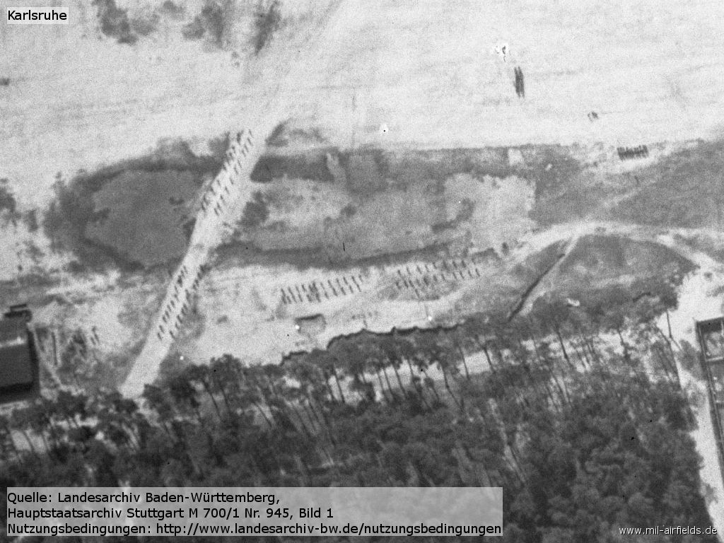
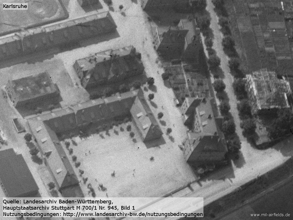
Enlargement: Traning troops?
Source: LABW 1-851356-1
Enlargement: Sheds
Source: LABW 1-851356-1
During the 1920s/1930s
Information from the Aeronautical Information Publication as of June 1928
For historical information only, do not use for navigation or aviation purposes!
Operator
Magistrat der Landeshauptstadt Karlsruhe, Karlsruhe.
Administrator
Badische Luftverkehrs-G. m. b. H.‚ Karlsruhe, Drahtanschrift: Badenflug Karlsruhe.
Transport companies / Airlines
Badisch-Pfälzische Luft Hansa A. G., Werft Karlsruhe, Drahtanschrlft: Badenpfalzflug Karlsruhe.
Situation
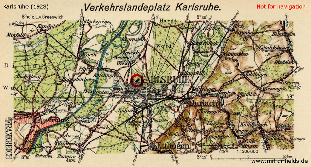
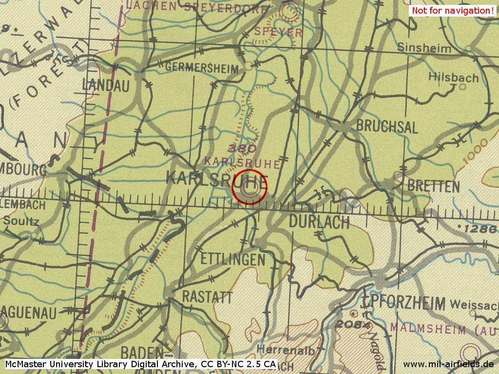
Karlsruhe landing ground on a map from about 1928
Overview
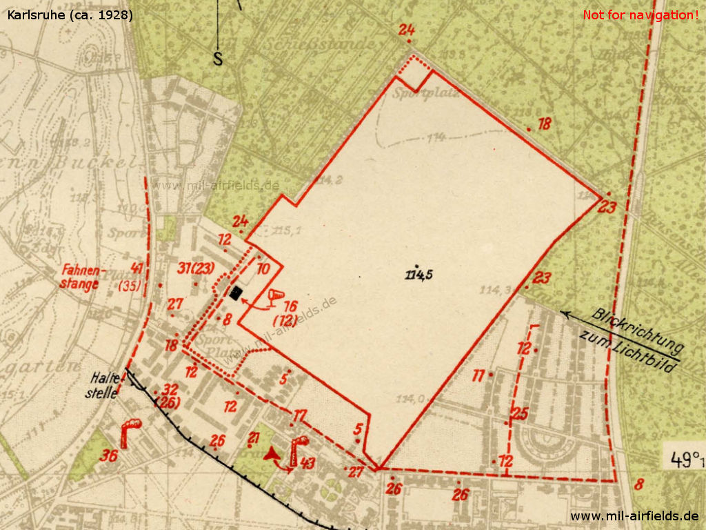
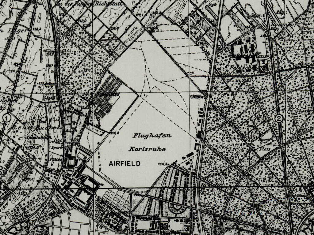
Map with installations from about 1928
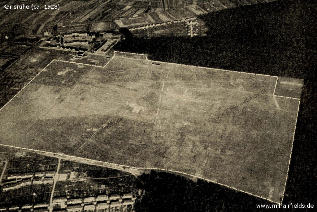
Aerial view ca. 1928 - looking west-northwest
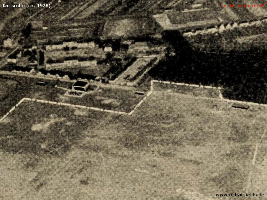
Enlargement: Buildings - In comparison to the aerial photo from the First World War above, a large hangar is now visible.
Karlsruhe airfield in the mid 1930s on a US military map from 1952 - Compared to the map of 1928, it is evident that the field has been expanded to the north
Source: AMS M841 GSGS 4414, Courtesy Harold B. Lee Library, Brigham Young University
Airfield characteristics at daytime
White inscriptions "Karlsruhe" on the roof of the hangar. On request at the administrator, landing sign is laid out and smoke oven is lit. Windsock on the hangar.
Airfield characteristics at night
No permanent night lighting. On request at the administrator landing lights of green, white and red fires in a row parallel to the wind direction. It is to land from green over white to red, right of the row. In the south and southwest of the runway, several chimneys, barracks and hospital unlit.
Runways, taxiways, aprons
Good sod on sandy soil. Shortest rolling length: 800 m in west-northwest-east-southeast direction.
Hangars
1 aircraft hangar 30,0 x 21,0 m, door width 30.0 m.
Workshops
Contains all machines and tools necessary for the repair of wooden and metal aircraft. Electric current: 220 volts alternating current. Spare parts for Junkers-F 13 aircraft models as well as for the most suitable engine types are available.
Fuel equipment
For 5000 l petrol and 2000 l benzene. In addition, 3000 litres of standard fuel from Deutsche Luft Hansa are always in stock.
First aid in the case of accidents
Provided by the administrator, first-aid kit and stretcher available; nearest doctor in Town Hospital (0.5 km distance).
Customs, post office, passport
Customs and post office with telephone and telegraph available. Passport control by police department.
Accommodation of passengers
In the city
Connections
Feeder car available at the airfield. Taxi cabs on request at the administrator. Tram stop in the immediate vicinity
Timetable
Spring/Summer 1939
The timetable for spring/summer of 1939 shows the following scheduled flights:
(Days: 1=Monday ... 7=Sunday)
(Days: 1=Monday ... 7=Sunday)
36: Cologne (Butzweilerhof) - Frankfurt (Rhein/Main) - Mannheim (Neuostheim) - Karlsruhe - Freiburg
- Deutsche Lufthansa, Junkers Ju 52:
123456– | Cologne 10:30 - 11:20 Frankfurt/M 12:15 - 12:40 Mannheim 12:50 - 13:10 Karlsruhe 13:20 - 14:00 Freiburg - Deutsche Lufthansa, Junkers Ju 52:
123456– | Freiburg 16:45 - 17:25 Karlsruhe 17:35 - 17:55 Mannheim 18:05 - 18:30 Frankfurt/M 18:50 - 19:40 Cologne
113: Karlsruhe - Frankfurt (Rhein/Main) - Hannover (Vahrenwald) - Bremen (Neuenland) - Wangerooge - Langeoog - Norderney
- Deutsche Lufthansa, Junkers Ju 160, Ju 52:
123456– | Karlsruhe 06:20 - 07:00 Frankfurt/M 10:20 - 11:45 Hannover 12:00 - 12:30 Bremen 12:40 - 13:15 Wangerooge 13:25 - 13:40 Langeoog 13:50 - 14:00 Norderney
(01 May - 23 June. & 01 September - 07 October 1939: Karlsruhe -Bremen, Ju 160; 24 June - 31 August 1939: Karlsruhe - Norderney, Ju 52) - Deutsche Lufthansa, Junkers Ju 160, Ju 52:
123456– | Norderney 14:50 - 15:00 Langeoog 15:10 - 15:25 Wangerooge 15:35 - 16:10 Bremen 16:20 - 16:50 Hannover 17:10 - 18:35 Frankfurt/M 18:50 - 19:30 Karlsruhe
(01 May - 23 June. & 01 September - 07 October 1939: Karlsruhe -Bremen, Ju 160; 24 June - 31 August 1939: Karlsruhe - Norderney, Ju 52)
Departures and arrivals by time
| Days | Time | Dep/Arr | Route | Operator | Aircraft type | to/from |
|---|---|---|---|---|---|---|
| 123456– | 06:20 | Dep | 113 | Deutsche Lufthansa | Junkers Ju 160, Ju 52 | Frankfurt/M - Hannover - Bremen - Wangerooge - Langeoog - Norderney |
| 123456– | 13:10 | Arr | 36 | Deutsche Lufthansa | Junkers Ju 52 | Cologne - Frankfurt/M - Mannheim |
| 123456– | 13:20 | Dep | 36 | Deutsche Lufthansa | Junkers Ju 52 | Freiburg |
| 123456– | 17:25 | Arr | 36 | Deutsche Lufthansa | Junkers Ju 52 | Freiburg |
| 123456– | 17:35 | Dep | 36 | Deutsche Lufthansa | Junkers Ju 52 | Mannheim - Frankfurt/M - Cologne |
| 123456– | 19:30 | Arr | 113 | Deutsche Lufthansa | Junkers Ju 160, Ju 52 | Norderney - Langeoog - Wangerooge - Bremen - Hannover - Frankfurt/M |
During World War II
Use
Airfield.
Situation
Karlsruhe Airfield in World War II on a US map from 1944
Source: McMaster University Library Digital Archive, Lizenz: Creative Commons Attribution-NonCommercial 2.5 CC BY-NC 2.5 CA
During the Cold War
Use
US Army airfield.
In the 1960s
Overview
Map from 1967 - The airfield has two runways with grass surface. The "propeller" marks the landing spot for helicopters. The installations in the northeast have a railway connection.
In the 1970s
Situation
Karlsruhe Army Airfield (AAF) on a map of the US Department of Defense from 1972
Source: ONC E-2 (1972), Perry-Castañeda Library Map Collection, University of Texas at Austin
Overview
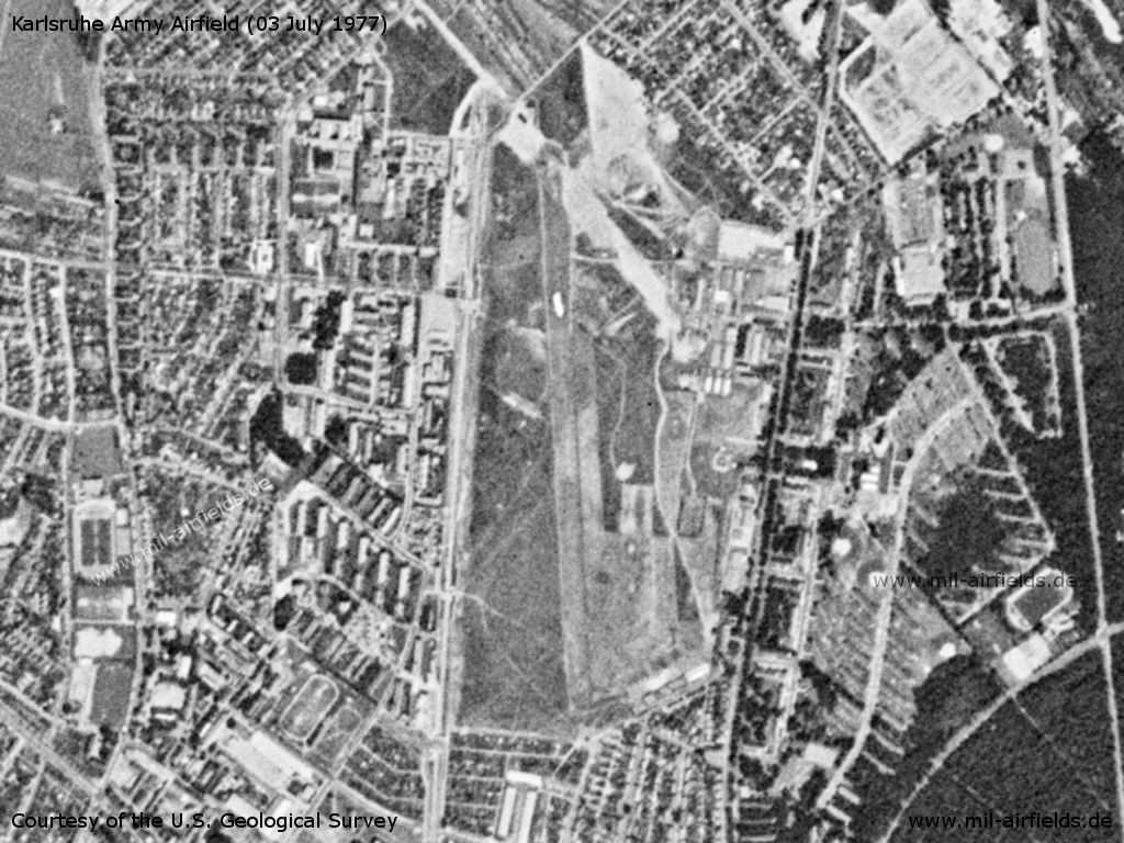
Karlsruhe Airfield on a US satellite image from 03 July 1977
Source: U.S. Geological Survey
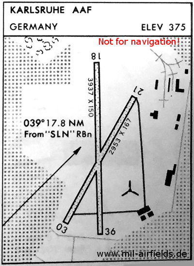
Runways
Data for the year 1971:
- 03/21: 900 m x 51 m Grass
- 18/36: 1200 m x 46 m Grass
In the 1980s and early 1990s
Overview
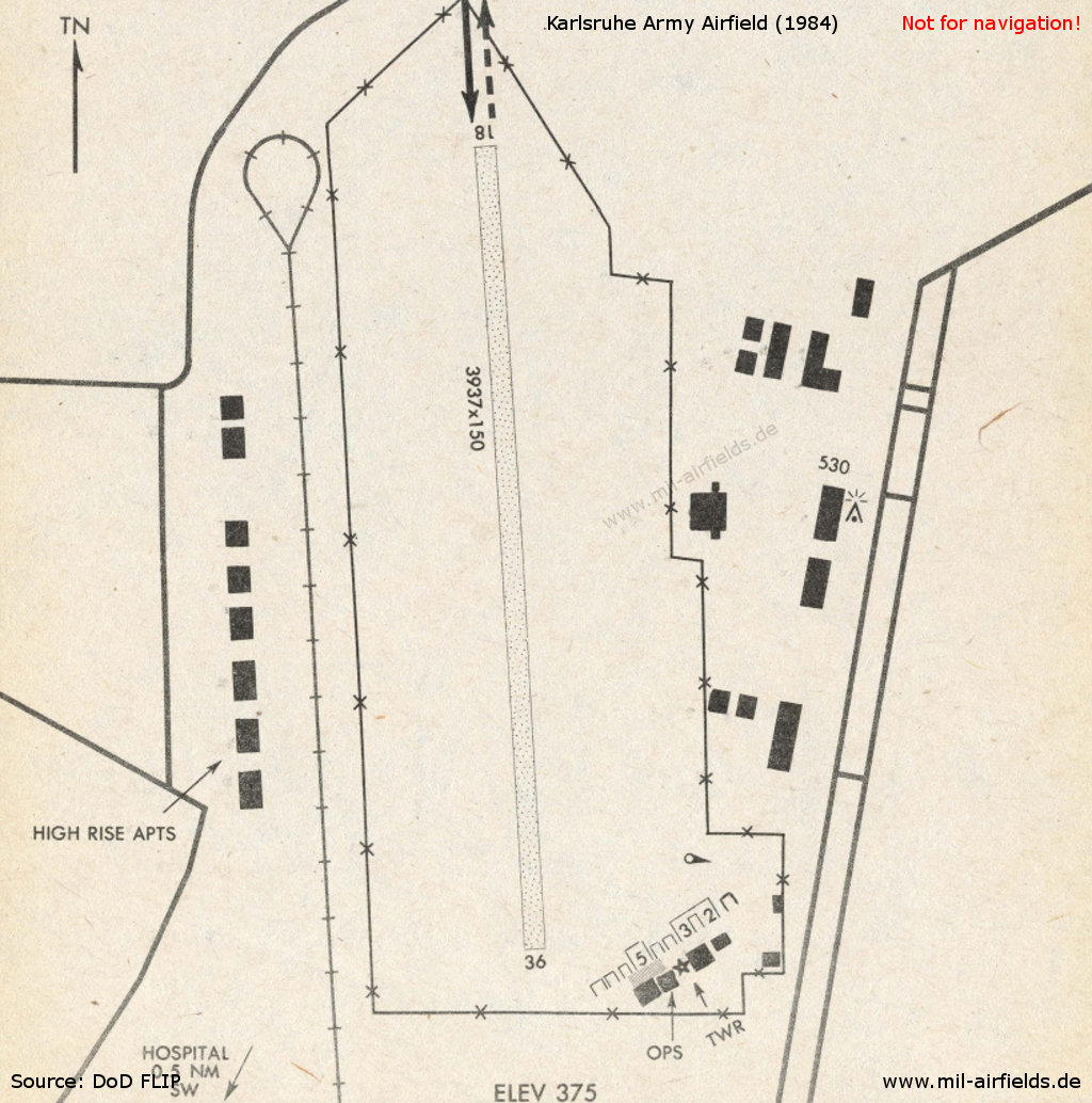
Karlsruhe in 1984 - The runway 03/21, which still existed in the 1970s, has meanwhile disappeared. The airfield facilities are located in the southeast corner of the field.
Runways
Data for the year 1990:
- 18/36: 1200 m x 46 m Grass
Installations
The airfield covered an area of 80 ha.
Additional information
Sgt Perkins about the Karlsruhe airfield:
I thank you for the historical information on my beloved airfield. I was the flight operations NCOIC back in the early/mid 1980s. My ops office was in the hangar building just below the tower. In fact notable(s) I had the rotating beacon replaced (double white/green). I saw the need and hosted the first ever joint egress training there for the local U.S. Army MP's and Emergency response crews (Medics), also for the local national fire, police and emergency response teams with lectures and static displays of aircraft, year I think was 1985/86.
I would like to have seen mention of the Hinkel (sp) factory and others that played a role in the German aircraft design/manufacturing (ME-262).
When I coordinated the apron and helipad replacement it uncovered rooms and structures below, in fact speaking the locals that live nearby, who informed that post war giant holes were dug and all types of vehicles and equipment was put in and buried with most in working condition.
Sgt Perkins, thank you very much for this insight into the history!
Today
Use
Closed.
Pictures from 2017
The following pictures were provided by Christian, whom I thank very much!
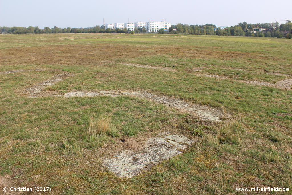
Numbers "36" laid out with stones at the southern beginning of the former runway
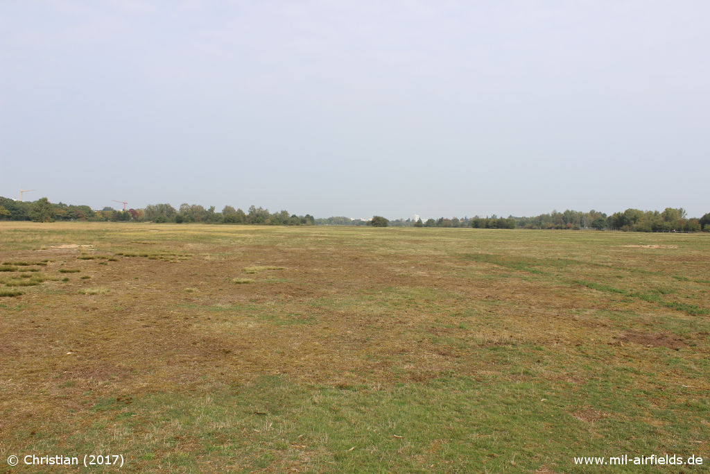
View to the north over the former runway
Sources
- /LABW 1-851356-1/:
http://www.landesarchiv-bw.de/plink/?f=1-851356-1 - Landesarchiv Baden-Württemberg
Bibliography
- Ries, Karl; Dierich, Wolfgang: "Fliegerhorste und Einsatzhäfen der Luftwaffe" Motorbuch Verlag Stuttgart, 1993 - Alliierte Planskizze
Airfields in the vicinity
Categories
Military Airfields GermanyMilitary Airfields in former West GermanyUS Army Airfields and Heliports in GermanyAirfields in Baden-WürttembergRecommended
Image credits are shown on the respective target page, click on the preview to open it.
 Follow mil-airfields on Facebook