Malmsheim: Airfield
For historical information only, do not use for navigation or aviation purposes!
| Coordinates | N484653 E0085507 (WGS84) Google Maps |
| Elevation | 1400 ft |
| Federal state | Baden-Württemberg |
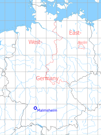
Germany during the Cold War Map
The history of the Cold War airfields: Malmsheim
General
Malmsheim airfield was built in the 1930s for the Luftwaffe. After 1945 it served as a auxiliary airfield. On the area to the north of the concrete runway, a gliding airfield has been established, which is also used for parachute jumps by the Bundeswehr and the US troops. At the north-west end, a mobilization base was set up, on which a SAR helicopter was temporarily stationed.
In the meantime, the auxiliary airfield has now been closed. In the northern area, the mobilization base was demolished and a research center has been built. The glider field is still used, but is to be closed in the long term.
During World War II
Use
Luftwaffe airfield.
Situation
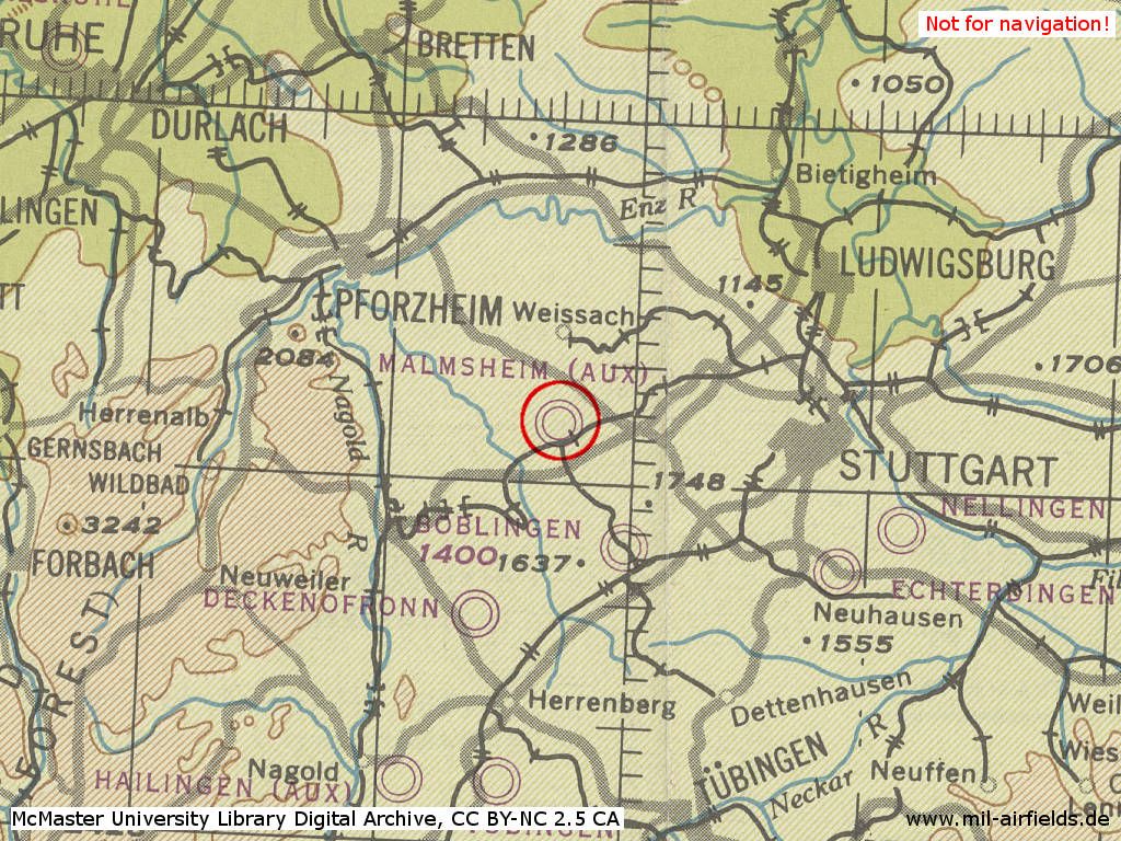
Malmsheim Airfield in World War II on a US map from 194x
Source: McMaster University Library Digital Archive, Lizenz: Creative Commons Attribution-NonCommercial 2.5 CC BY-NC 2.5 CA
During the Cold War
Use
Reserve airfield.
In the 1960s
Use
Malmsheim Army Flight Activities (AFA) is a reserve airfield for the Nellingen Army Heliport (AHP).
Runways
- 08/28: 945 m (ca.) hard surface
Numerous dirt-filled demolition craters on the runway.
Airspace and procedures
No facilities, unattended auxiliary airfield.
Call Nellingen Mil 835/675 for information and/or clearance to use.
Glider flying on weekends and German holidays.
Traffic pattern south in 2000 ft MSL.
Obstacles
Antennas, 12 m (40') high, and buildings on both sides of the runway at western end.
In the 1970s
Overview
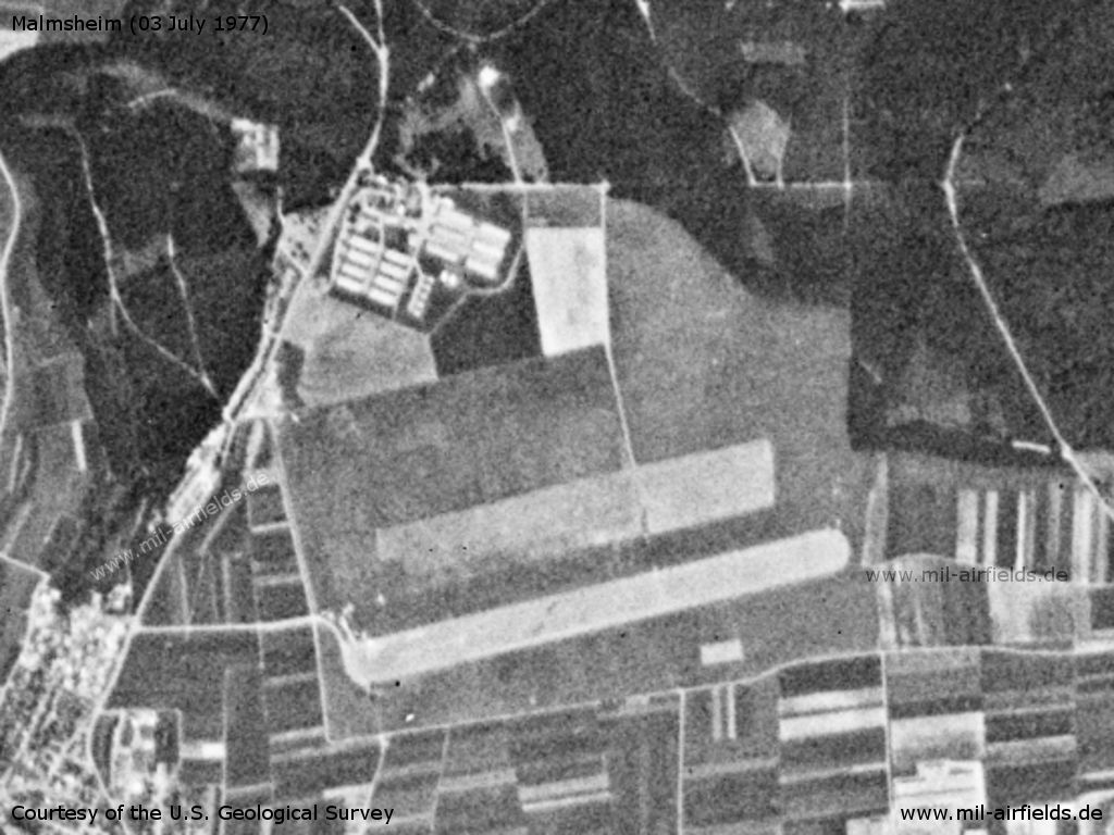
Malmsheim Airfield on a US satellite image from 03 July 1977 - The mobilization base, which has since been demolished meanwhile, can be seen in the north.
Source: U.S. Geological Survey
In the 1980s and early 1990s
Runways
Data for the year 1990:
- 08/26: 980 m x 80 m Asphalt
- 08/26 Grass
In the 1990s and 2000s
Overview
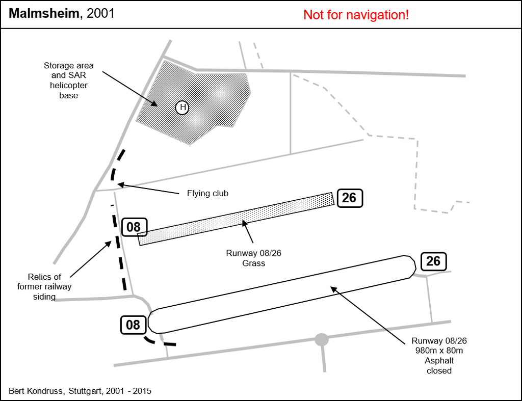
Images
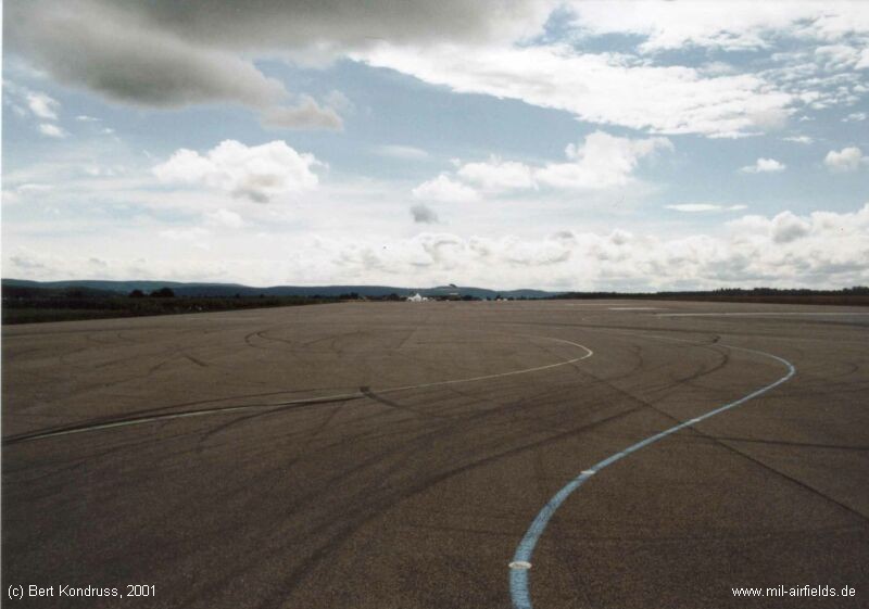
Former runway (2001)
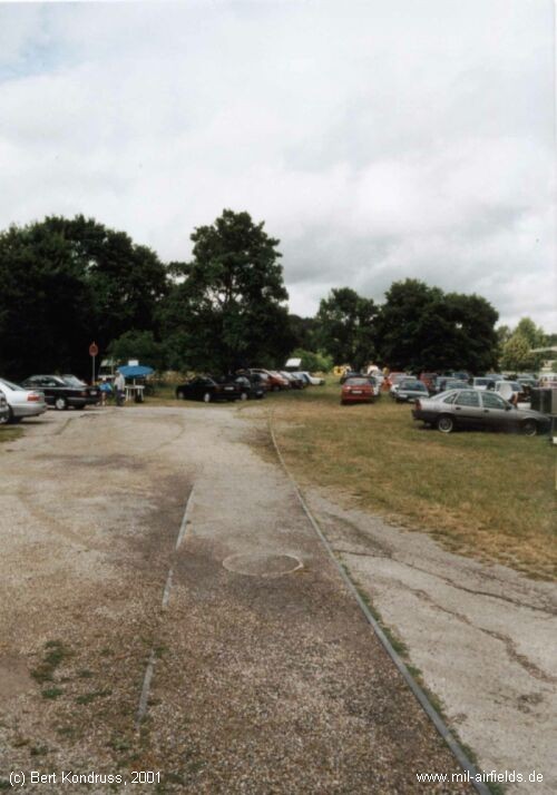
Remains of former railway to the Luftwaffe airfield - Western part of the airfield, looking north (2001)
Today
Use
The hard-surfaced runway is used for car test driving. A glider airfield with a grass runway is next to it. The mobilization depot in the north has been demolished, the area is used for a research and development center.
Bibliography
- Ries, Karl; Dierich, Wolfgang: "Fliegerhorste und Einsatzhäfen der Luftwaffe" Motorbuch Verlag Stuttgart, 1993 - Alliierte Planskizze
Airfields in the vicinity
- 151°/12km Böblingen: Stuttgart-Böblingen Airport, Maintenance Facility (Flugfeld)
- 314°/21km Pforzheim: Army Heliport (Army Heliport)
- 082°/23km Stuttgart: Bad Cannstatt Hospital AHP
- 068°/24km Ludwigsburg: Army Airfield AAF (Pattonville Airfield, Kornwestheim)
- 114°/24km Stuttgart: Airport, Army Airfield (Echterdingen AAF)
- 105°/27km Nellingen: Army Heliport AHP (Nellingen Barracks)
 Follow mil-airfields on Facebook