For historical information only, do not use for navigation or aviation purposes!
| Coordinates | N525628 E0124713 (WGS84) Google Maps |
| Former East Germany (GDR) | District of Potsdam |
| Federal state | Brandenburg |
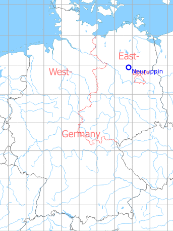
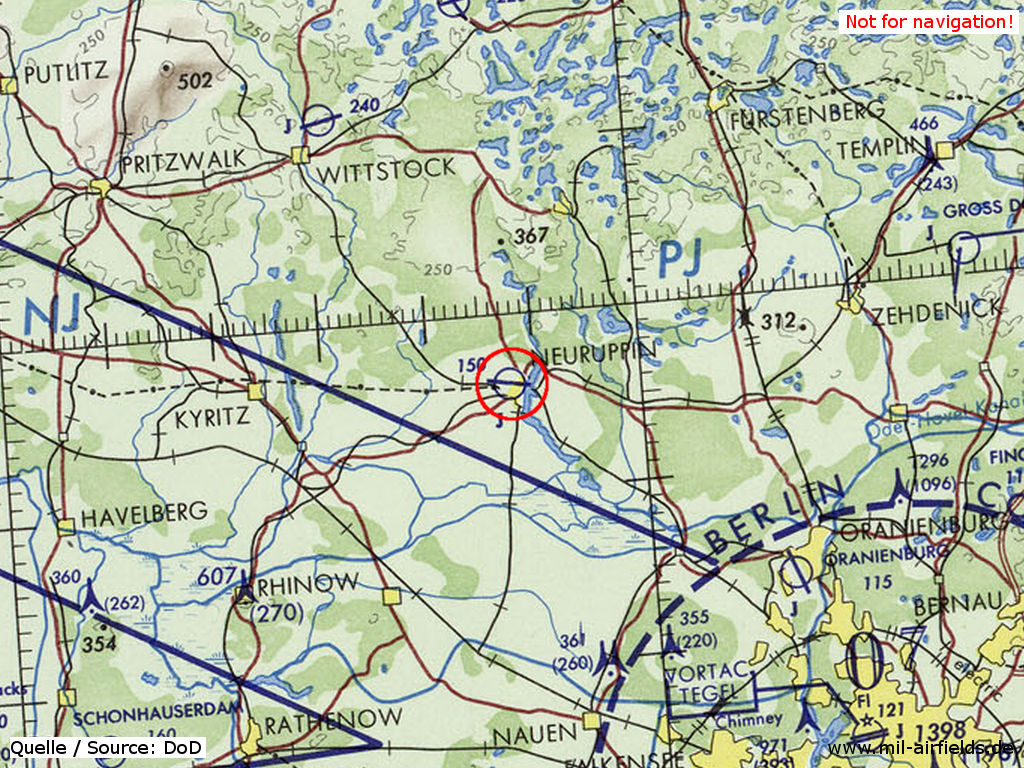
Germany during the Cold War Map
The history of the Cold War airfields: Neuruppin
During World War II
Usage until 1945
Luftwaffe airbase.
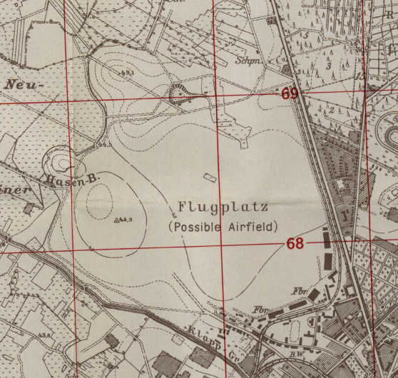
Situation
Neuruppin airfield on a US map from 1943
Overview
Neuruppin air base on a US map from 1952
Source: AMS M841 GSGS 4414, Courtesy Harold B. Lee Library, Brigham Young University
During the Cold War
Use
Soviet airbase until 1991.
In the 1950s
Units
1954
- Soviet fighter regiment (P. O. Box 62 319),
- A total of 30 (?) MiG-15/MiG-15U were counted at the airfield.
Source: BND/Bundesarchiv B 206/3033
(For the P. O. Box numbers the digits 3 and 5 may be confused, because they are difficult to distinguish in the source document)
- A total of 30 (?) MiG-15/MiG-15U were counted at the airfield.
Source: BND/Bundesarchiv B 206/3033
(For the P. O. Box numbers the digits 3 and 5 may be confused, because they are difficult to distinguish in the source document)
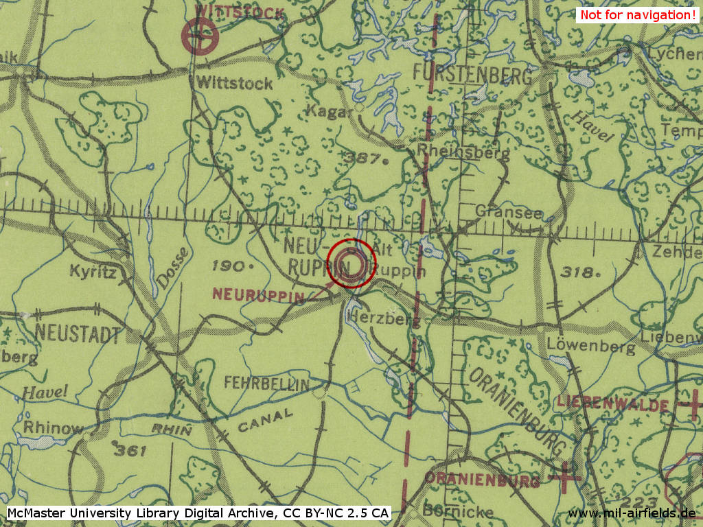
In the 1960s
Situation
Neuruppin Air Base on a US map from 1969 - The Berlin-Rostock autobahn did not exist at this time.
Source: Earth Sciences and Map Library, University of California, Berkeley
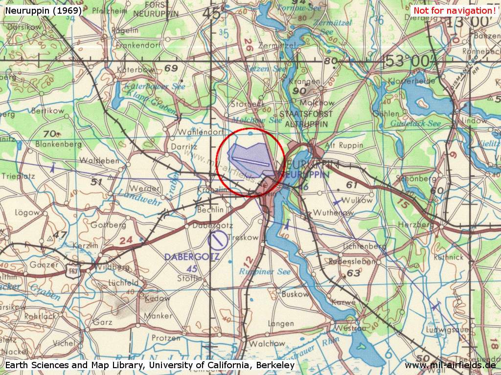
In the 1970s
Situation
Neuruppin Air Base on a map of the US Department of Defense from 1972
Source: ONC E-2 (1972), Perry-Castañeda Library Map Collection, University of Texas at Austin
Overview
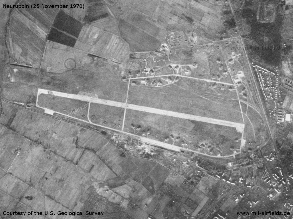
Neuruppin Air Base on a US satellite image from 25 November 1970
Source: U.S. Geological Survey
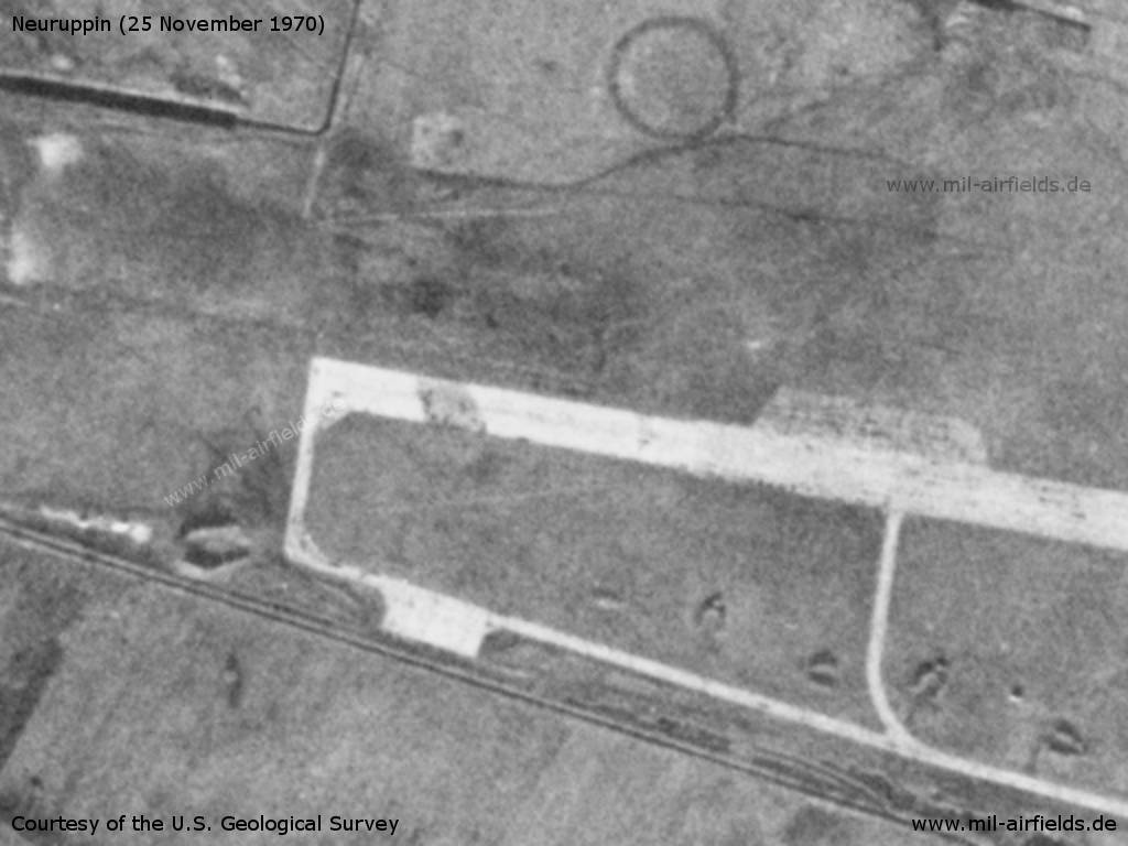
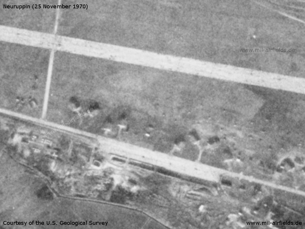
Runway in the west
Source: U.S. Geological Survey
Aircraft shelter in the north
Source: U.S. Geological Survey
Flight line
Source: U.S. Geological Survey
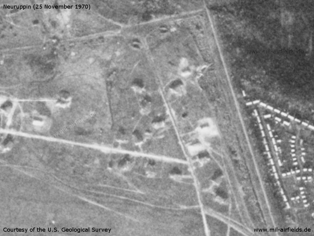
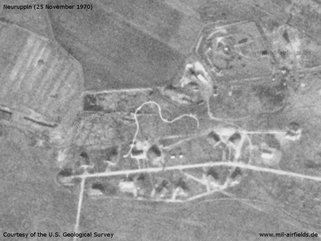
Shelter area in the norheast
Source: U.S. Geological Survey
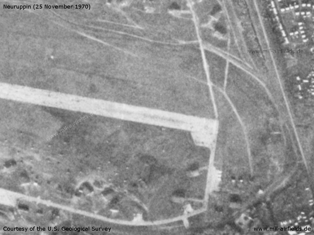
Runway in the east
Source: U.S. Geological Survey
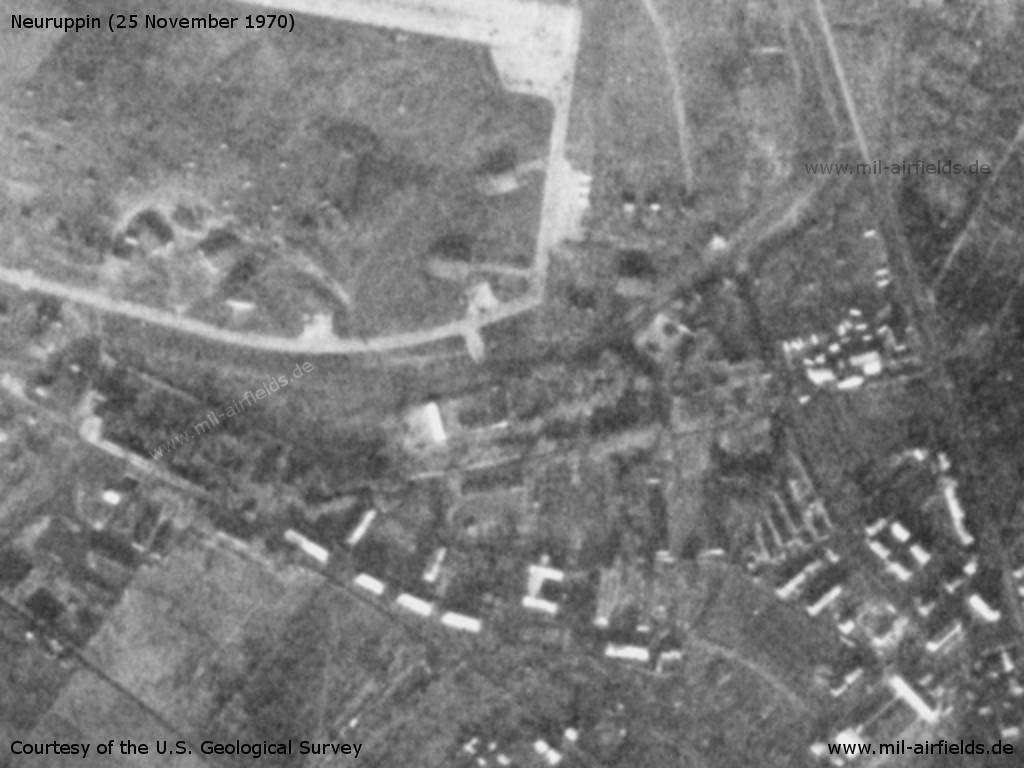
Installations in the southeast
Source: U.S. Geological Survey
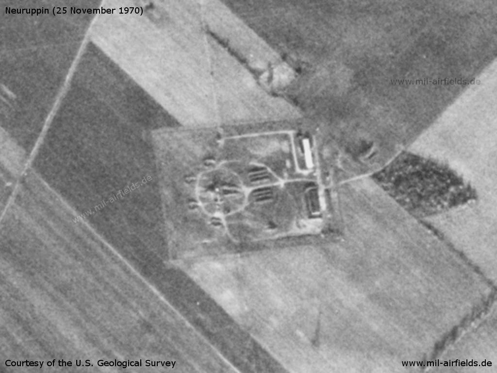
Anti-aircraft missile site, 4.5 km south-southwest of the airfield
Source: U.S. Geological Survey
Radio communication
Call sign: GIDROSTAT
In the 1980s and early 1990s
Runways
Data for the year 1990:
- 10/28: 2400 m Concrete
Radio beacons
Data for the year 1990:
- LOM 28: 842 "WÖ"
- LMM 28: 412 "W"
- LOM 10: 842 "GK"
- LMM 10: 412 "G"
Radio communication
Call sign: CHUTOROK (1990)
Units
1990: 730 IBAP (Su-17M-4, Su-17UM-3); 9 OVE (Mi-6, Mi-8, Mi-9)
History
- 1988
Crash of a Neuruppin FITTER in early 1988. The US Military Liaison Mission is able to forward 50 pounds of parts of the aircraft. (Source: USMLM 1988)
Images
Pieces of wreckage from a Neuruppin Su-17 FITTER Source: USMLM 1988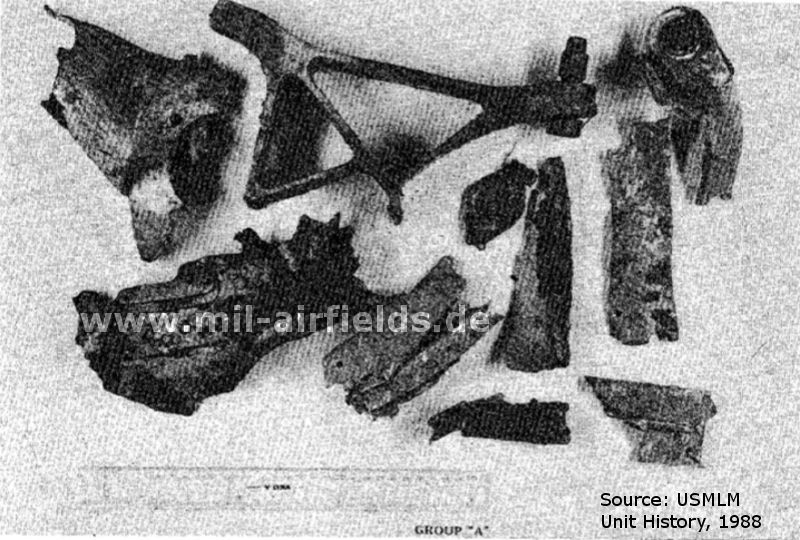
The aircraft crashed in early 1988. The parts have been collected by the US Military Liaison Mission.
Today
Use
Closed. A part of the former area is used as glider airfield.
Links
- /BYU/:
http://lib.byu.edu/collections/german-maps/ - German Maps (Topographische Karte 1:25,000)
Bibliography
- /USMLM 1988/:
United States Military Liaison Mission: "Unit History 1988"
Related topics
Airfields in the vicinity
- 298°/14km Netzeband: Highway Strip (Autobahnabschnitt Netzeband)
- 331°/14km Neuglienicke: Airfield (Glienicke)
- 189°/16km Fehrbellin: Helipad 3118 (HSLP / HLP 3118)
- 333°/18km Gadow: Airfield Replica
- 073°/22km Schönermark: Helipad 3117 (HSLP / HLP 3117)
- 056°/23km Wolfsruh: Helipad 1034 (HSLP / HLP 1034)
- 124°/23km Sommerfeld: Helipad 3116 (HSLP / HLP 3116)
Categories
Military Airfields GermanyMilitary Airfields in former East GermanyAirfields of the Soviet Forces in GermanyRecommended
Image credits are shown on the respective target page, click on the preview to open it.
 Follow mil-airfields on Facebook