For historical information only, do not use for navigation or aviation purposes!
| Coordinates | N481423 E0113342 (WGS84) Google Maps |
| Elevation | 1596 ft |
| Location indicator | DBOS (195x), EDOS (US Army), EDPO (Heer), EDNX (civ), EDMX (BuPol) |
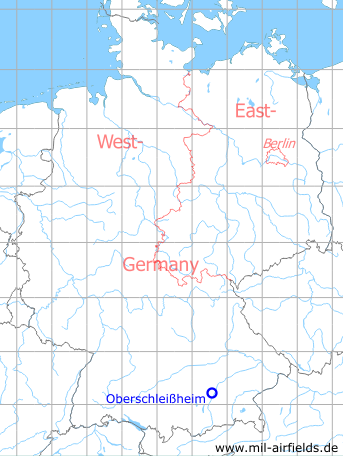
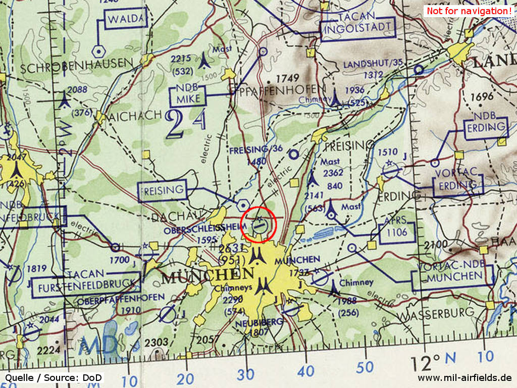
Germany during the Cold War Map
The history of the Cold War airfields: Oberschleißheim
General
Oberschleissheim airfield was opened before the World War I and served the Bavarian Air Force. In the 1920s and 1930s, it was used for civil aviation and later developed into a Luftwaffe air base. In 1945, US troops took over the airfield, which was used by the US Army until the 1970s. From 1958 to 1981 there was also an German Army aviation squadron based here. Then the Federal Border Guard, or later, the Federal Police took over the field, which is also used again for general aviation.
From the 1950s onwards, an extensive antenna system from Radio Free Europe / Radio Liberty was located in the eastern part of the airfield.
During the 1920s/1930s
Situation
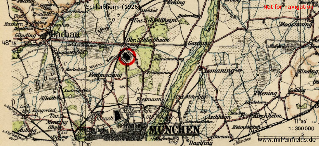
Location of Schleissheim airfield, ca. 1926
Overview
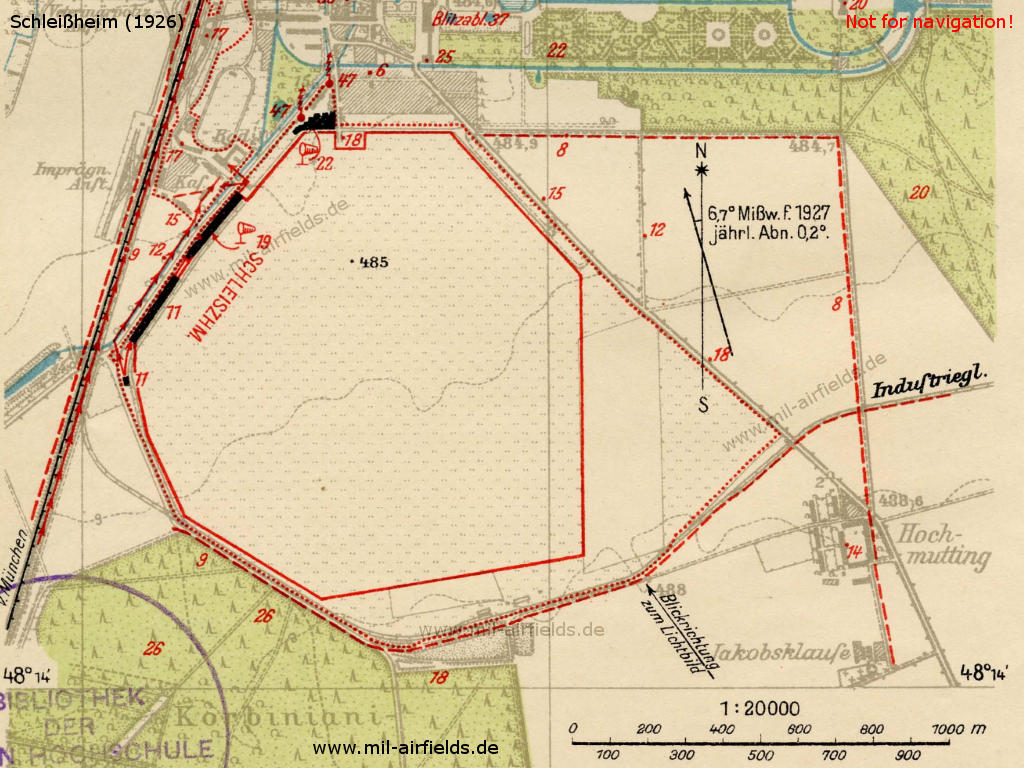
Schleißheim airfield, ca. 1926
Schleißheim airfield, ca. 1926
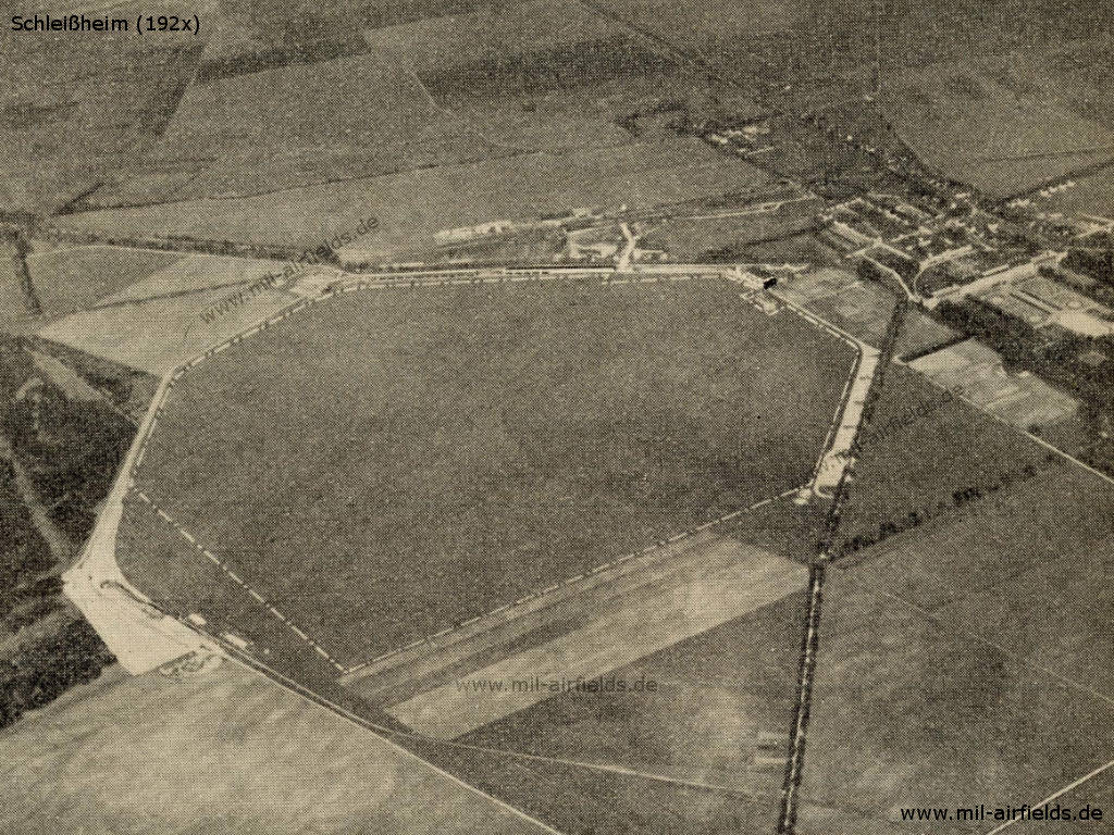
Airfield characteristics at daytime
Just south of Schloss Schleissheim. In the north-west of the movement area is the inscription "Schleissheim" and 2 white-red radio towers. Landing sign is always deployed. Black-white-red windsack on the central hangar. Movement area boundaries in the north, east and west marked by roads.
Airfield characteristics at night
Permanent night lighting not available. On request at Bavaria South flight control, green, white and red landing lights, in line parallel to the wind direction. Land from green over white to red, to the right of the row.
Runways, taxiways, aprons
Terrain: Good sod on firm ground; About 15 cm Humus layer on gravel.
Shortest rolling length: in direction northeast-southwest 700 m.
Shortest rolling length: in direction northeast-southwest 700 m.
Hangars
3 aircraft hangars, including 1 hangar 215.0 x 15.85 m, 1 hangar 89.5 x 15.9 m, 1 hangar 51.0 x 27.3 m. The hangars contain a total of 4 cranes with 0.6 t load capacity each and 2 suspension devices with a load capacity of 1.0 t each.
Workshops
Include all machines and tools necessary for repairing wooden aircraft and for minor repairs of metal aircraft. Autogenous welding system. Electricity: 110/190 V AC. Spare parts accessible not guaranteed from the transport company's stock.
Fuel equipment
For 63 000 l gasoline and benzene. Always 4 000 liters of benzene and benzene in stock.
Railway siding
Without ramp available.
First aid in the case of accidents
Done by airfield's police. Medical room available. Nearest doctor in Schleissheim (1 km distance).
Customs, post office, passport
Customs clearance and passport control by police station.
Accommodation of passengers
In the Schloßwirtschaft Schleissheim or in Munich.
Connections
Kraftdroschken auf Anruf zu erhalten. Vorortbahn nach München.
/FHB 1928/
During World War II
Use
Luftwaffe air base.
Situation
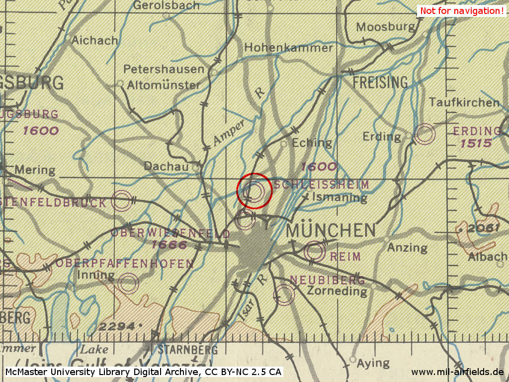
Schleißheim Airfield in World War II on a US map from 1944
Source: McMaster University Library Digital Archive, License: Creative Commons Attribution-NonCommercial 2.5 CC BY-NC 2.5 CA
During the Cold War
Use
Used by US Army and by German Army.
Units
1958-1981: Heeresfliegerstaffel 8 (relocated to Landsberg/Lech: Air Base).
In the 1950s
Situation
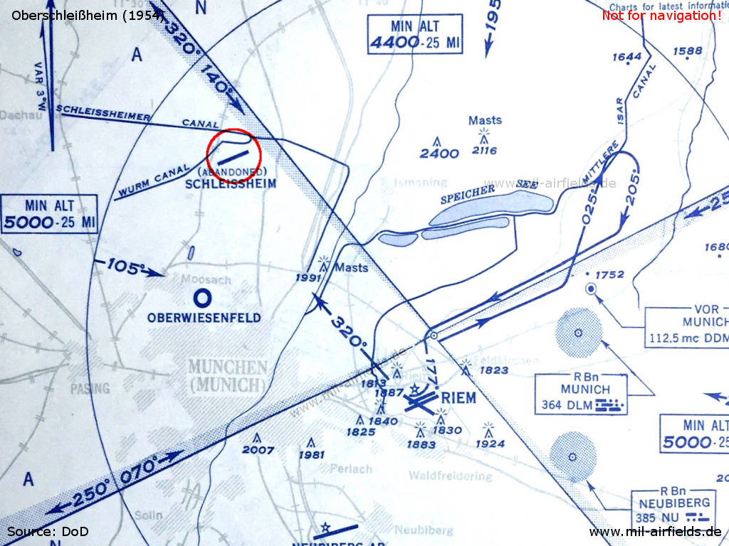
The airspace in the Munich area with the abandoned Schleissheim airfield in 1954
In the 1960s
Use
The airfield is used jointly by the US Army and German Army Aviation. Therefore it has two location indicators: EDOS for the US Army and EDPO for German Army.
Situation
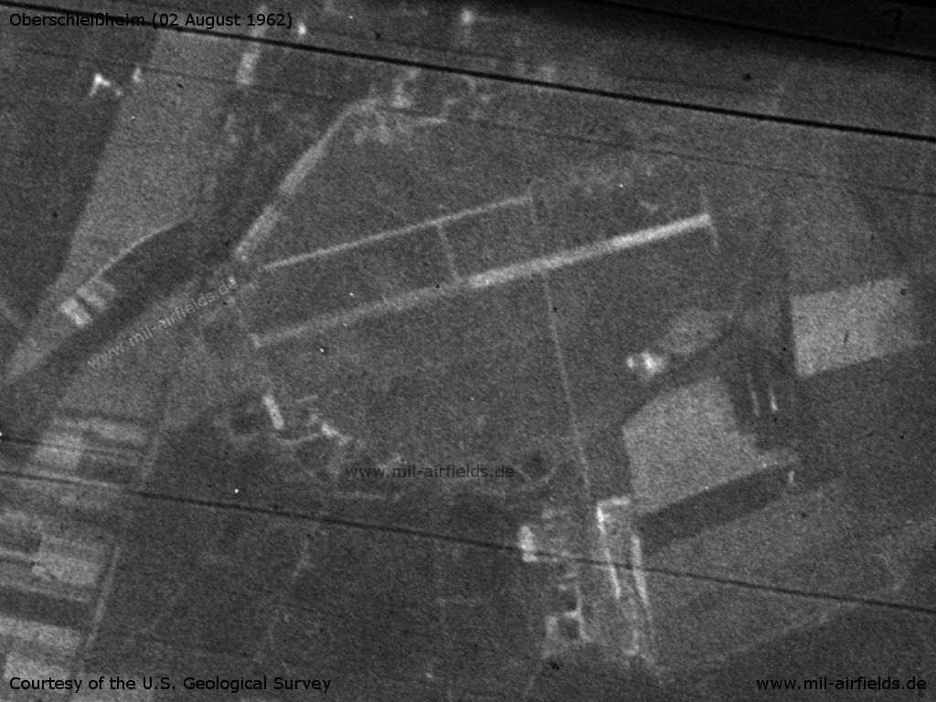
Oberschleissheim Airfield on a US satellite image from 02 August 1962
Source: U.S. Geological Survey
Overview
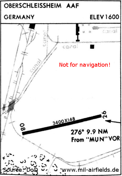
Oberschleißheim Army Airfield 1967
Radio communication
- Tower 304.5, 138.35, 122.1, 35.4
Airspace and procedures
Operating times of the US Army Airfield: 24 h
Operating times of the German Army: Monday till Friday 06:00-17:00Z, Saturday and Sunday PPR until 15:00Z, closed on holidays.
Traffic pattern for fixed wing aircraft only north 2500 ft MSL; for helicopters north 2500 ft, south 2100 ft.
Glider flying Monday-Friday from 15:30Z till sunset, Saturday from 12:00Z till sunset, Sunday from sunrise to sunset.
Obstacles
Numerous radio towers on the eastern end of the airfield.
In the 1970s
Situation
Airfields in the Munich area with Schleißheim in 1972
Source: ONC E-2 (1972), Perry-Castañeda Library Map Collection, University of Texas at Austin
Runways
Data for the year 1971:
- 08/26: 1006 m x 45 m Concrete
In the 1980s and early 1990s
Situation
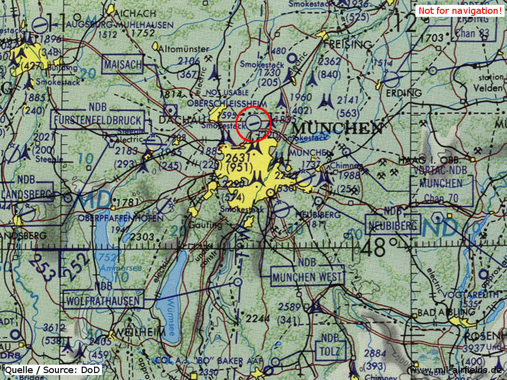
Oberschleißheim Airfield shown as "not usable" on a map of the US Department of Defense from 1981
Source: ONC F-2 (1981), Perry-Castañeda Library Map Collection, University of Texas at Austin
Today
Use
General aviation.
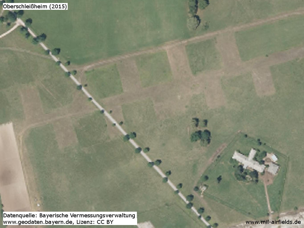
Situation
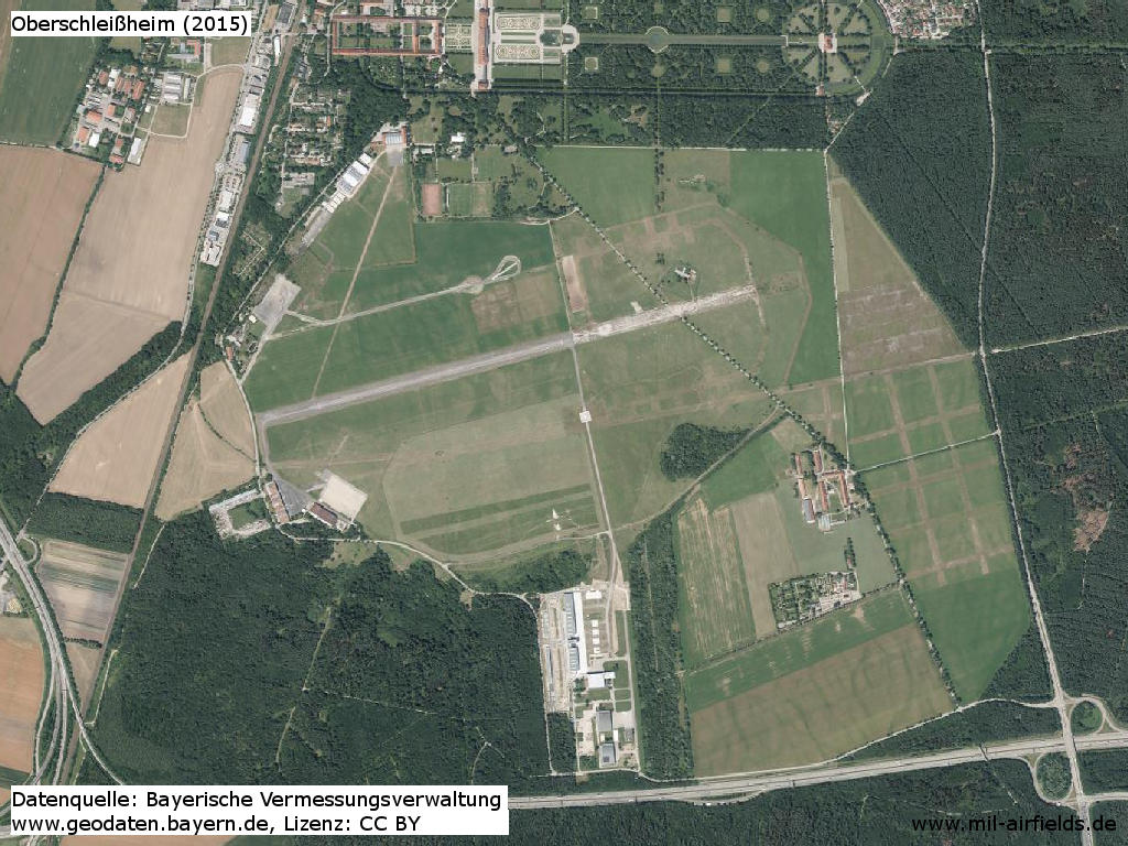
Orthophoto 2015
Former hardstands in the northeast, constructed by US forces - From the 1950s onwards, there was an extensive antenna system from Radio Free Europe / Radio Liberty
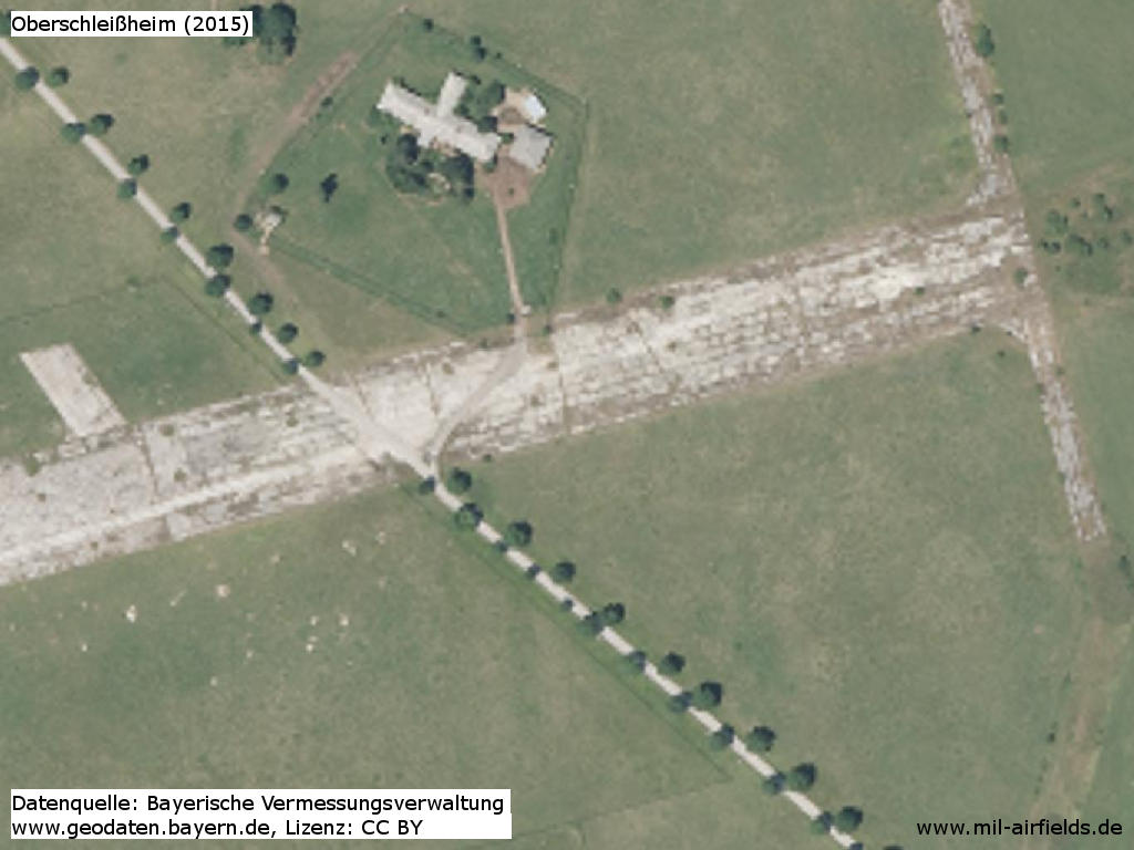
Relics of the runway
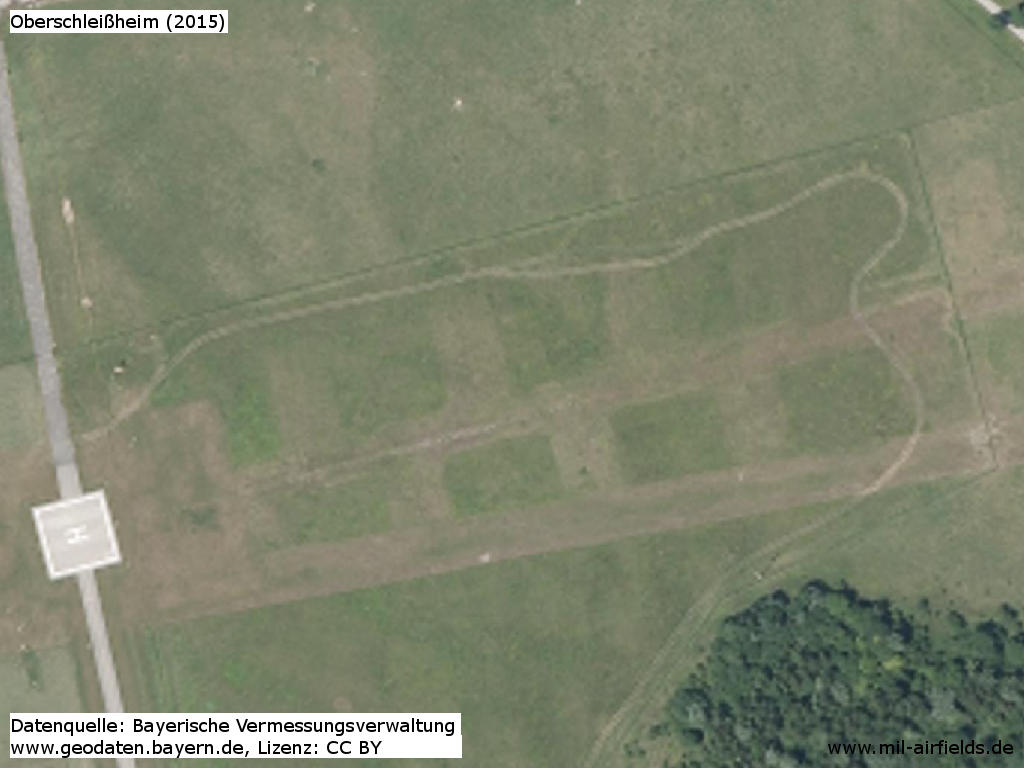
Former hardstands in the southeast, police helipad
Links
- http://geoportal.bayern.de/ - Geoportal Bayern
Sources
- http://geoportal.bayern.de/ - Geoportal Bayern
Airfields in the vicinity
- 148°/3km Munich: Warner Strip Airfield (Panzerwiese) (München, Warner Kaserne)
- 188°/7km Munich: Oberwiesenfeld Airfield (München)
- 139°/16km Munich: Riem Airport (München, Munich Old Airport)
- 163°/19km Neubiberg: Airfield (Neubiberg Air Base)
- 260°/22km Fürstenfeldbruck: Air Base (Fürstenfeldbruck Airfield)
- 230°/27km Oberpfaffenhofen: Airfield
Categories
Military Airfields GermanyMilitary Airfields in former West GermanyGerman Army AirfieldsUS Army Airfields and Heliports in GermanyRecommended
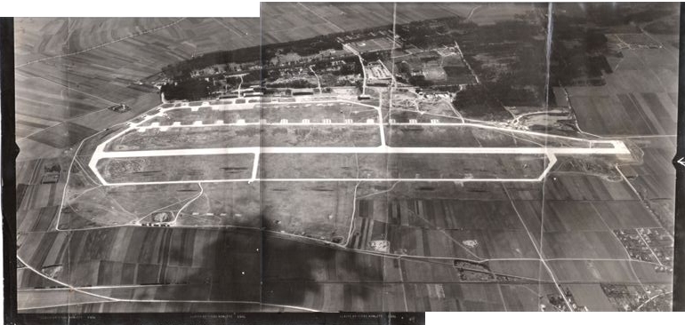
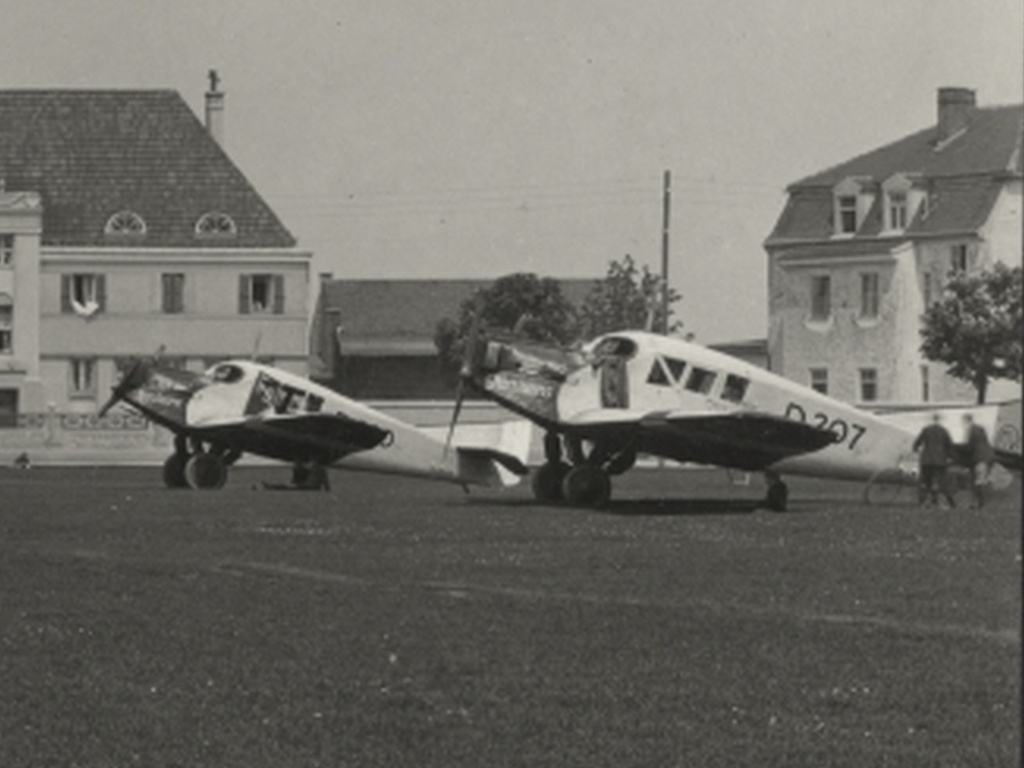
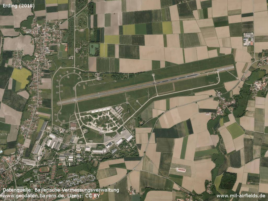
Image credits are shown on the respective target page, click on the preview to open it.
 Follow mil-airfields on Facebook