For historical information only, do not use for navigation or aviation purposes!
| Coordinates | N514019 E0121220 (WGS84) Google Maps |
| Elevation | 249 ft |
| Former East Germany (GDR) | District of Halle |
| Federal state | Sachsen-Anhalt (Saxony-Anhalt) |
| Airfield Id | 2033 |
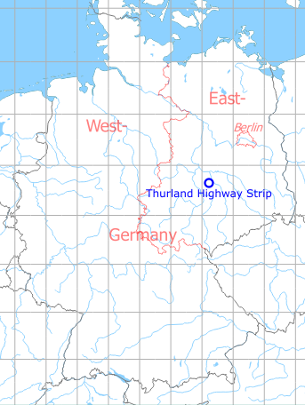
Germany during the Cold War Map
The history of the Cold War airfields: Thurland
Location of airfield
Autobahn A9 between exits Dessau-Süd and Zörbig. In the times of Eastern Germany, this highway also had the number A9.
During the Cold War
General
Part of the East German Autobahn Berlin-Leipzig which was earmarked for flight operations. In the former East German National People's Army, it was registered with the airfield ID 2033. During operation, radar support would have been the responsibility of Radar Company 412 (FuTK-412) in Hinsdorf.
Situation
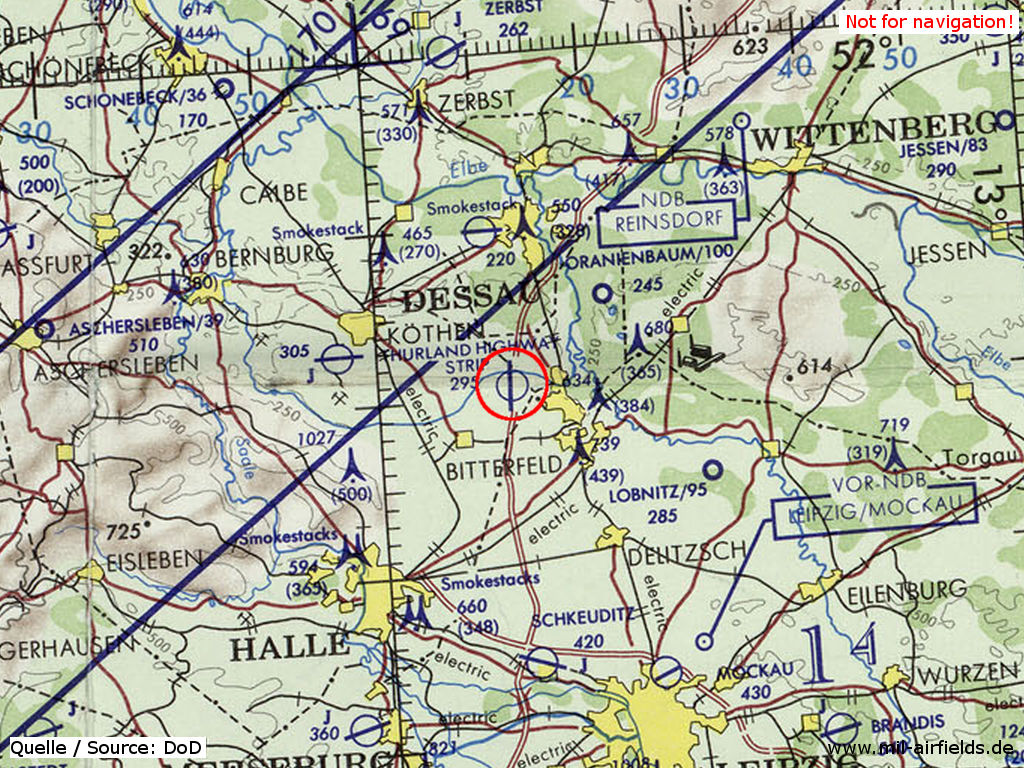
Thurland Highway Strip on a map of the US Department of Defense from 1972 - The blue lines mark the southern allied air corridor from and to Berlin (ONC E-2 (1972), Perry-Castañeda Library Map Collection, University of Texas at Austin /PCL MC/)
Runways
Data for the year 1990:
- 18/36: 2700 m Concrete
Today
Use
Closed.
Airfields in the vicinity
- 306°/6km Hinsdorf: Radio-Technical Company 412 (FuTK-412) (Helipad 3170)
- 040°/15km Oranienbaum: Airfield
- 288°/18km Köthen: Air Base (Koethen, Kothen, Аэродром Кетен)
- 357°/18km Dessau: Airfield (Alten, Junkers-Flugzeugwerk)
- 118°/23km Löbnitz: Airfield (Roitzschjora)