For historical information only, do not use for navigation or aviation purposes!
| Coordinates | N505739 E0060229 (WGS84) Google Maps |
| Elevation | 286 ft |
| Federal state | Nordrhein-Westfalen (North Rhine-Westphalia) |
| Location indicator | DAGK (RAF 195x), EDUI (RAF 196x), EDNG (NATO 198x-1995), ETNG (1995-) |
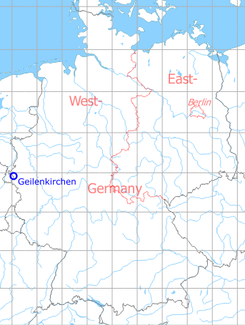
Germany during the Cold War Map
The history of the Cold War airfields: Geilenkirchen
General
Used by Royal Air Force from 1953 until 1968. Thereafter base for German Missile Wing 2 with Pershing I/IA. From the early 1980s NATO base for AWACS E-3A aircrafts.
During the Cold War
In the 1950s
Use
Royal Air Force base.
Situation
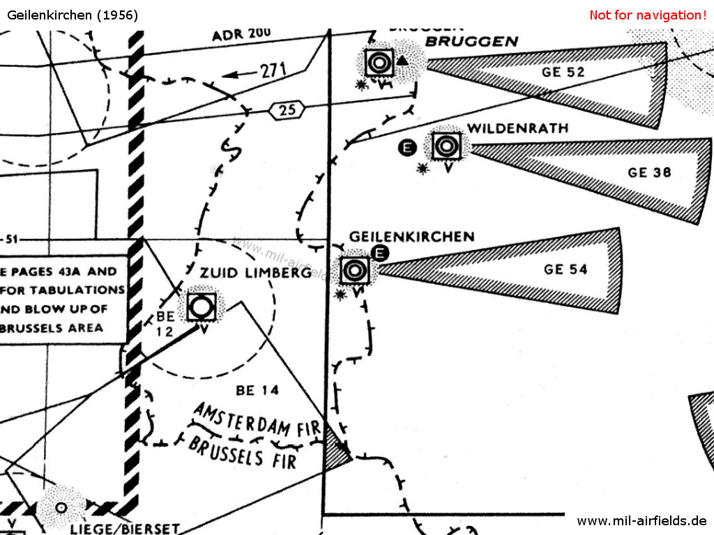
RAF Geilenkirchen on a map from 1956 - The approach areas of the three British airfields Geilenkirchen, Wildenrath and Brüggen are protected by restricted areas. The white "E" in the circle symbolizes the Eureka radio beacon, used by the British at this time. The square around the airport symbol with the "V" underneath shows an VHF direction finder. The black star stands for the coded beacons which is characteristical for British airfields
Lights
Identification beacon with morse code GK.
Radio beacons
- NDB: 285 "GK", at field, power 300 W
- Eureka: 224R, 230T "KN"
Radio communication
- Approach 102.06, 106.74, 111.42, 117.9, 243.0, 257.8
- Tower 106.74, 102.06, 117.9, 111.42
A cathode ray VHF direction finder was available.
In the 1960s
Use
Royal Air Force base.
Runways
- 10/28
Radio beacons
- ILS, the localizer beam had an offset of 3° to the extended runway centerline.
Radar
ASR, PAR (glide slope 2.75°)
Radio communication
- Approach 314.8, 362.3, 275.6, 154.62, 123.3, 136.35, 117.9
- Tower 275.6, 154.62, 360.1, 314.8, 283.1, 257.8, 253.6, 136.35, 135.54, 123.3, 117.9
In the 1970s
Overview
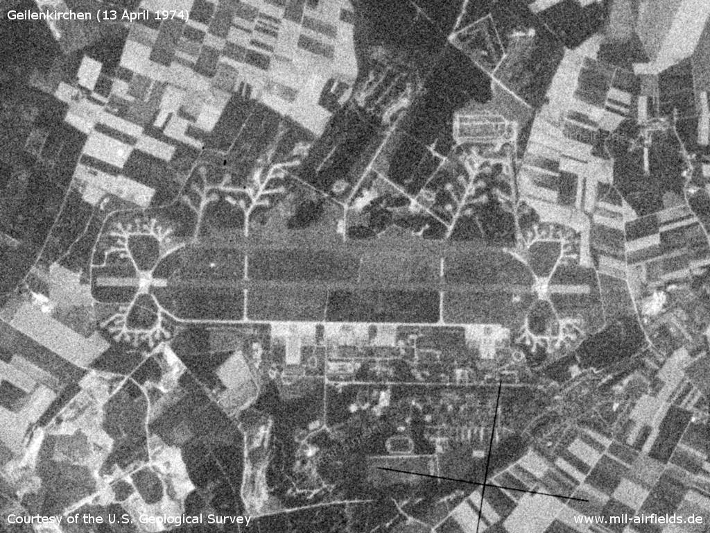
Geilenkirchen Air Base on a US satellite image from Saturday 13 April 1974 - At this time, Geilenkirchen is not used as an airfield anymore. However, the basic structures typical of RAF aerodromes in Germany are still recognisable.
Source: U.S. Geological Survey
Communication
Missile Wing 2 had the radio call sign DHK 87.
In the 1980s and early 1990s
Overview
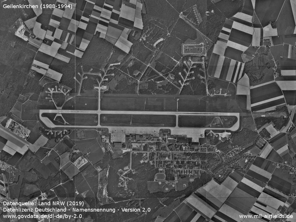
Aerial picture from the late 1980s or early 1990s - Even after the conversion to the base for NATO's AWACS aircraft, the numerous former small revetments are still visible.
Source: Datenquelle: Land NRW (2019)
Datenlizenz Deutschland - Namensnennung - Version 2.0
www.govdata.de/dl-de/by-2.0
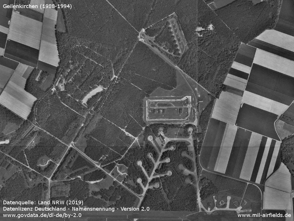
Enlargement: Northern part with munitions store, special weapons store and former aircraft revetments.
Source: Datenquelle: Land NRW (2019)
Datenlizenz Deutschland - Namensnennung - Version 2.0
www.govdata.de/dl-de/by-2.0
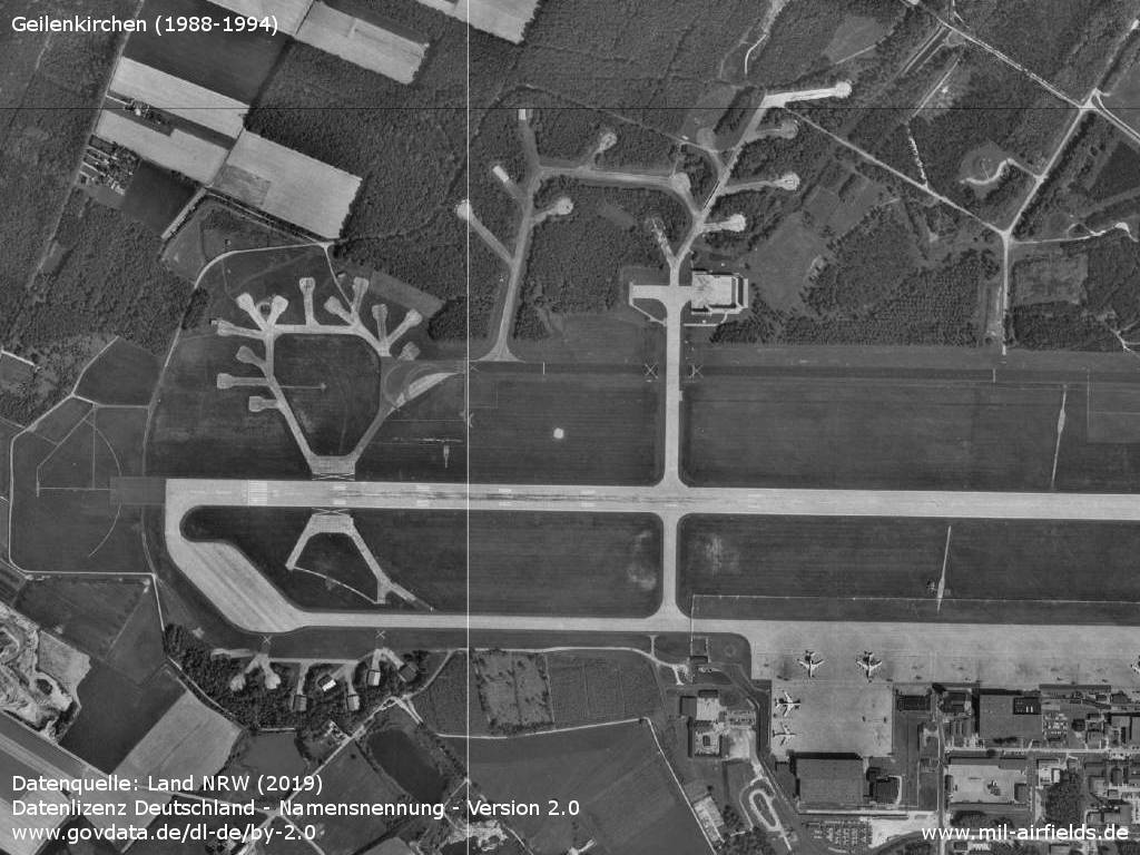
Western part
Source: Datenquelle: Land NRW (2019)
Datenlizenz Deutschland - Namensnennung - Version 2.0
www.govdata.de/dl-de/by-2.0
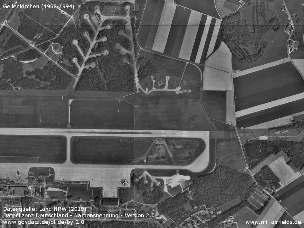
Eastern part
Source: Datenquelle: Land NRW (2019)
Datenlizenz Deutschland - Namensnennung - Version 2.0
www.govdata.de/dl-de/by-2.0
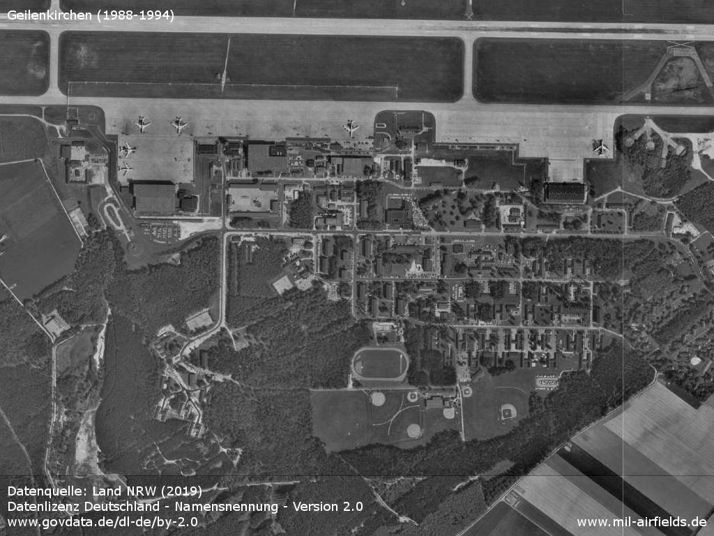
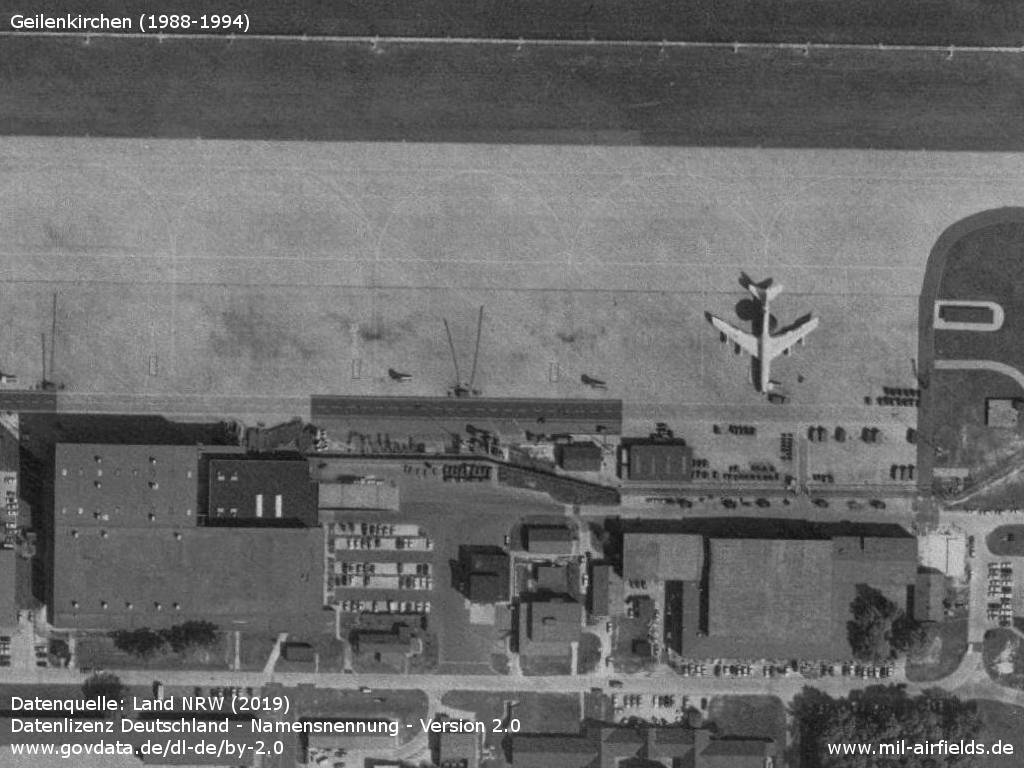
Flightline and barracks
Source: Datenquelle: Land NRW (2019)
Datenlizenz Deutschland - Namensnennung - Version 2.0
www.govdata.de/dl-de/by-2.0
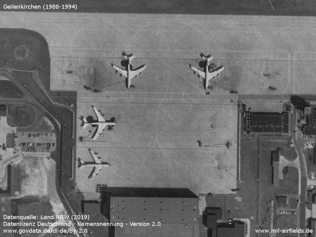
Three AWACS aircraft E-3A Sentry and another probably military version of the Boeing 707
Source: Datenquelle: Land NRW (2019)
Datenlizenz Deutschland - Namensnennung - Version 2.0
www.govdata.de/dl-de/by-2.0
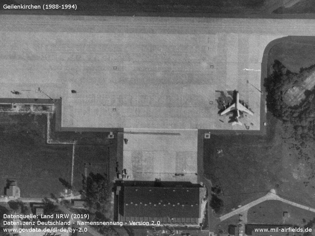
Further E-3A and hangars
Source: Datenquelle: Land NRW (2019)
Datenlizenz Deutschland - Namensnennung - Version 2.0
www.govdata.de/dl-de/by-2.0
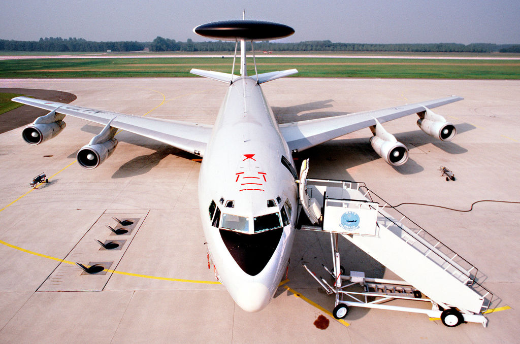
AWACS E-3A Sentry
Source: Datenquelle: Land NRW (2019)
Datenlizenz Deutschland - Namensnennung - Version 2.0
www.govdata.de/dl-de/by-2.0
Runways
- 09/27: 2901 m x 45 m Concrete
Radio beacons
- TACAN: CH39 "GIX", at field
- ILS 27: 110.1 "GIX"
Radio communication
The call sign is FRISBEE.
Pictures from 1982
Airplane E-3A Sentry from the front
Source: US DoD, scene camera operator: STAFF SGT. Bill Thompson
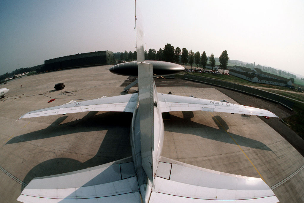
Airplane E-3A Sentry from behind
Source: US DoD, scene camera operator: STAFF SGT. Bill Thompson
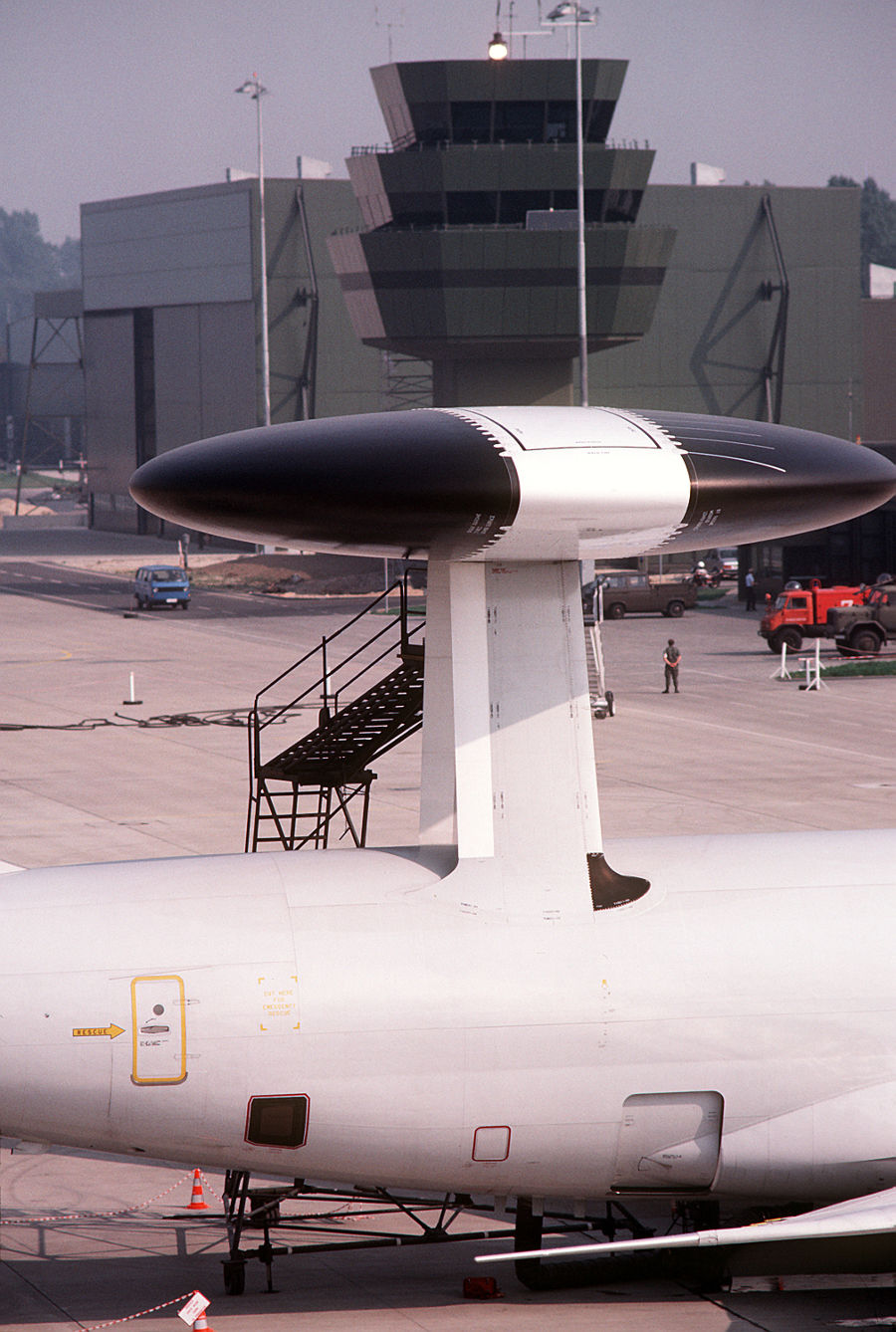
Radar, Geilenkirchen control tower in the background
Source: US DoD, scene camera operator: STAFF SGT. Bill Thompson
Today
Overview
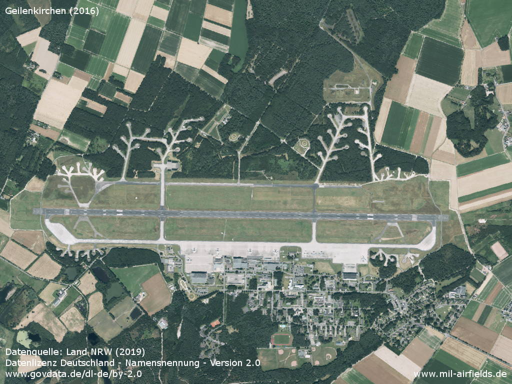
Aerial image 2016
Source: Datenquelle: Land NRW (2019)
Datenlizenz Deutschland - Namensnennung - Version 2.0
www.govdata.de/dl-de/by-2.0
Sources
- https://www.geoportal.nrw/ - Geoportal NRW
- https://www.archives.gov/ - National Archives
Airfields in the vicinity
- 146°/18km Aachen: Merzbrück Airfield
Categories
Military Airfields GermanyMilitary Airfields in former West GermanyRoyal Air Force (RAF) Bases in GermanyRecommended
Image credits are shown on the respective target page, click on the preview to open it.
 Follow mil-airfields on Facebook