For historical information only, do not use for navigation or aviation purposes!
| Coordinates | N500260 E0081932 (WGS84) Google Maps |
| Elevation | 461 ft |
| Location indicator | DBWB, EDAW, EDOU, ETOU |
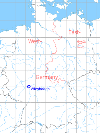
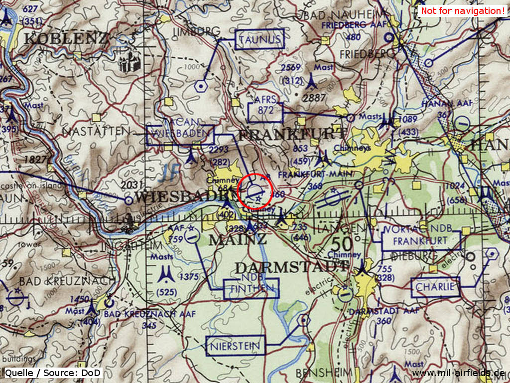
Germany during the Cold War Map
The history of the Cold War airfields: Wiesbaden
Contents
During the Cold War
Overview
Use
US Air Force and later US Army airfield. The following aspects were remarkable during usage:
- One of the US Air Force during the Berlin Airlift
- Stationing of the U-2 reconnaissance aircraft in 1956 with secrets flights over Eastern Europe
- Through the headquarters of the US Air Forces in Europe, there was extensive traffic of visiting VIP aircraft until the early 1970s.
- In the 1980s, regular reconnaissance flights of the 1st Military Intelligence Battalion along the inner-German border with aircraft OV-1 Mohawk and RC-12 Guardrail (alternating with the 2nd Military Intelligence Battalion at Stuttgart Army Airfield)
- In the 1980s, Forward Operating Location for A-10 aircraft of the US Air Force
Units
Over the years these units were stationed in Wiesbaden:
- 1971: 7407th CSW: 7405th SS (C-97G)
- 1975: 601st TCW: 20th TASS (OV-10A), 601st TASS (CH-53C)
- 1985: 62nd AviCo
- 1990: 1st Military Intelligence Battailion - 1st MIB (6 RC-12D, 8 OV-1D, 7 RV-1D); 5-6 Cav (18 AH-64A, 13 OH-58C, 3 UH-60A); B 6-158 Avn (15 UH-60A)
- 1994: 3-56 Avn (U-21A); E 5-158 Avn (UH-1H, UH-60A); H 3rd Avn Co (UH-60A, EH-60C); 159th Med Co (UH-60A); 1st MIB (RC-12K)
In the 1940s
Berlin Airlift 1948/1949
During the Berlin Airlift, Wiesbaden was one of the starting points of the US Air Force for the flights to Berlin.
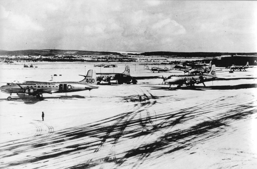
Aicraft Douglas C-54 Skymaster during the Berlin Airlift at Wiesbaden (March 1949)
Source: US DoD, Public Domain
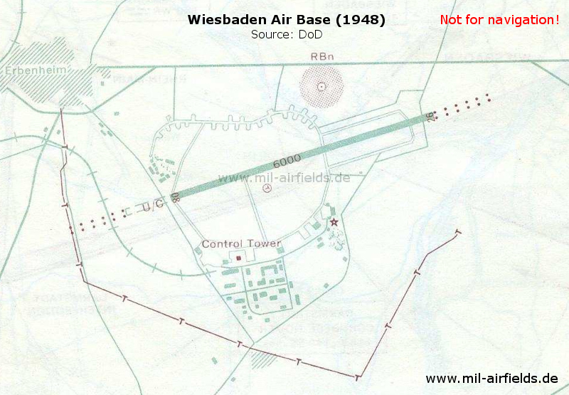
Map from 1948, during the times of the Berlin Airlift - At this time, the runway has a length of 1,829 m (6,000 feed). An extension is under construction at the western end (U/C=under construction). On both sides there are approach lights. Also marked are a non-directional radio beacon (RBn), the control tower and an airfield beacon (star).
Source: US DoD
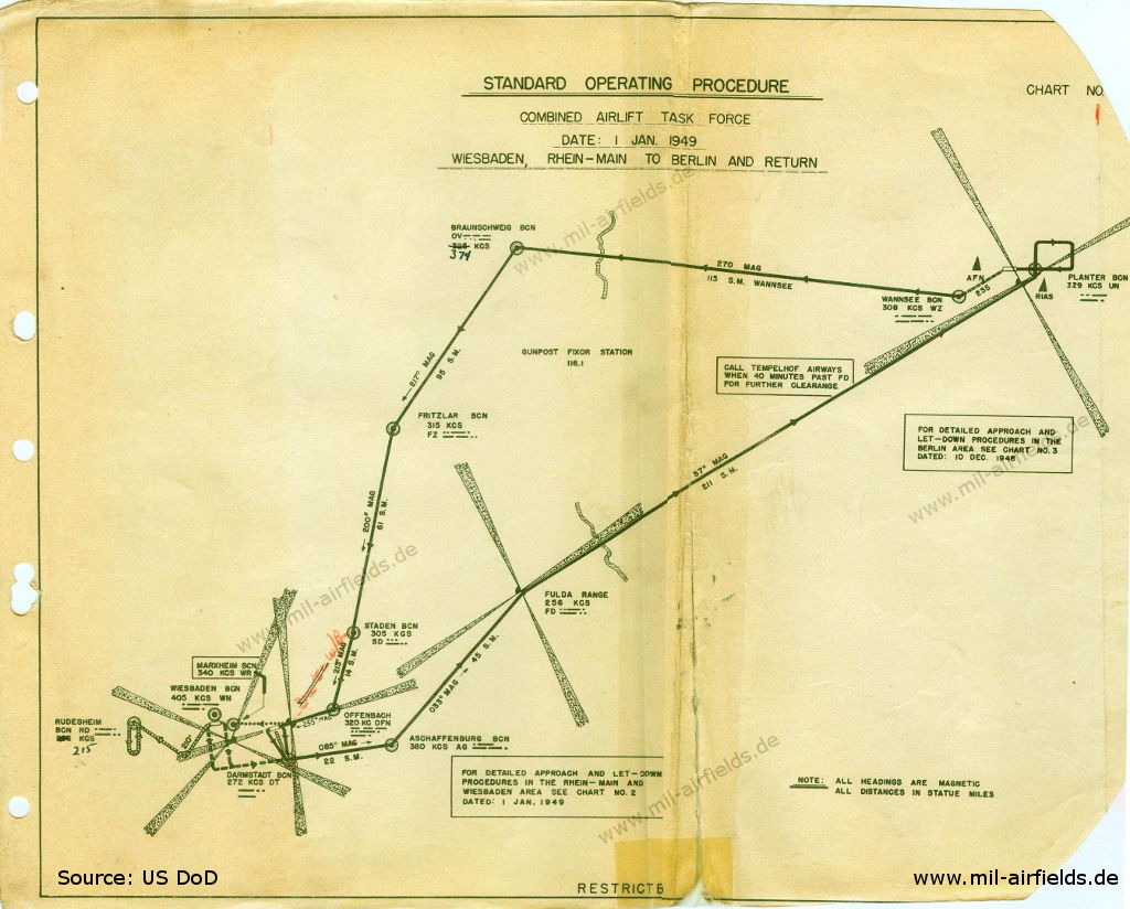
Berlin Airlift: Standard Operating Procedure Combined Airlift Task Force (01 January 1949)
Source: US DoD
Enlargement - After taking off from Wiesbaden, planes will first turn south and then fly to the Darmstadt radio beacon. Afterwards they will fly via the Aschaffenburg radio beacon to Fulda. Here the southern corridor begins, which leads to northeast over the Soviet zone to Berlin. The return flight takes place via the radio beacons Fritzlar, Staden and Offenbach.
Source: US DoD
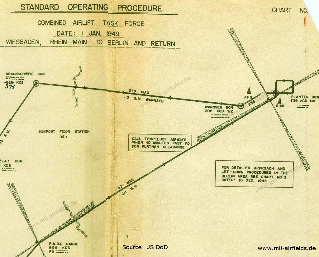
Enlargement - The flight to Berlin is via the southern corridor from Fulda to Berlin, the return flight via the central corridor from Berlin to Braunschweig. In Berlin, in addition to the Tempelhof, Planter and Wannsee radio beacons, the AFN and RIAS radio stations are also marked as a further navigation aid.
Source: US DoD
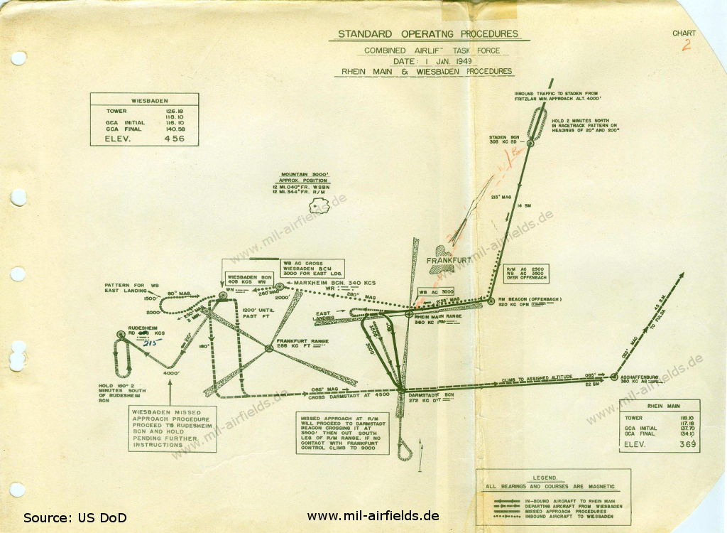
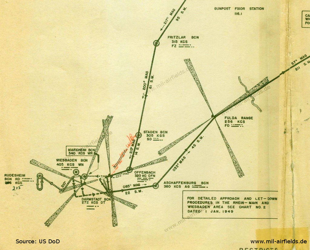
Berlin Airlift: Procedures around Wiesbaden and Frankfurt Rhein/Main - Radio beacons Aschaffenburg, Darmstadt, Frankfurt Range, Marxheim, Offenbach, Rhein Main Range, Rüdesheim, Staden
Source: US DoD
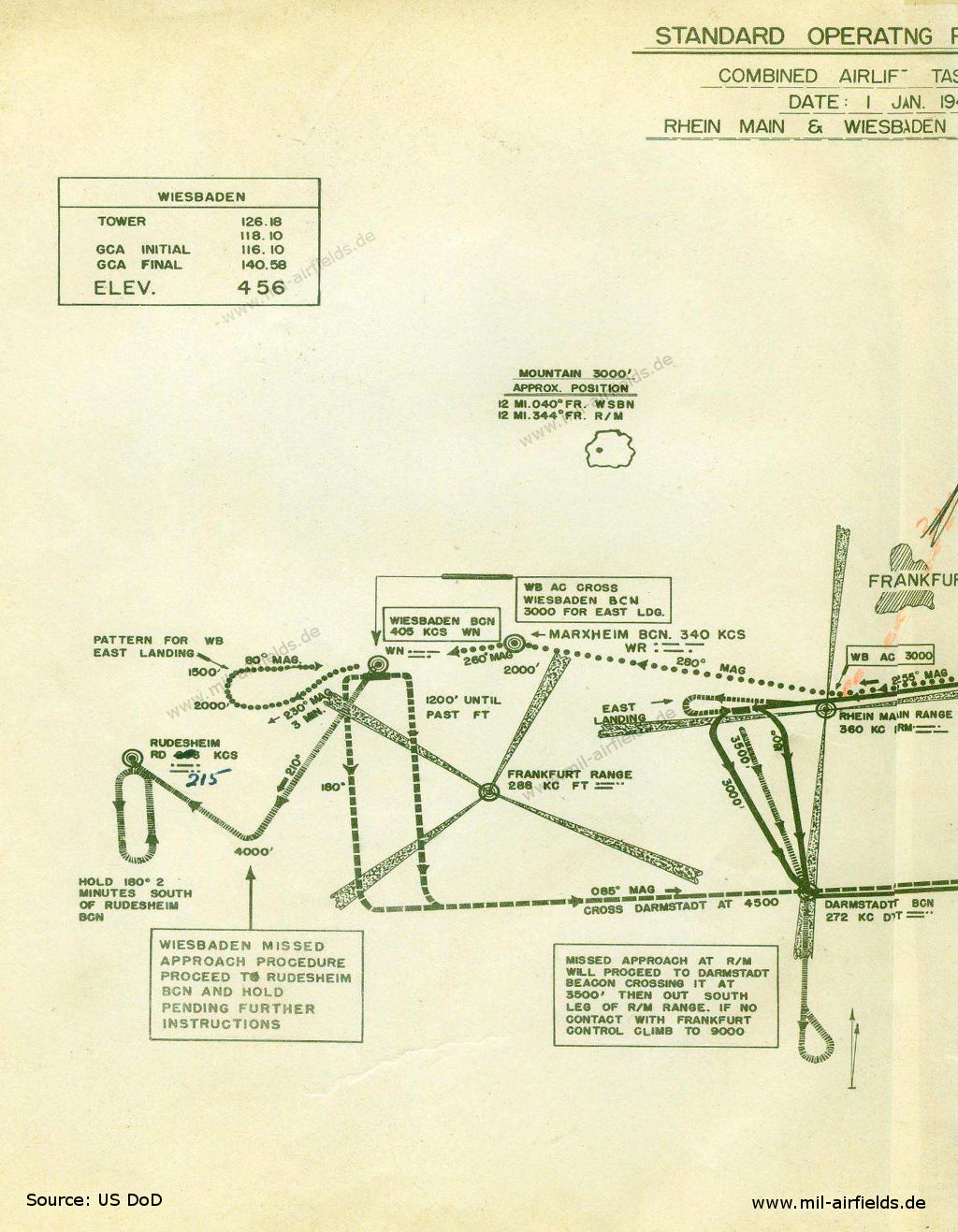
Enlargement - Immediately after take-off in Wiesbaden, planes will turn south. For landings from the west, the Wiesbaden radio beacon will be crossed 3,000 feet, to fly a loop in the west afterwards. In case of a missed approach, planes shall fly to the Rüdesheim radio beacon.
Source: US DoD
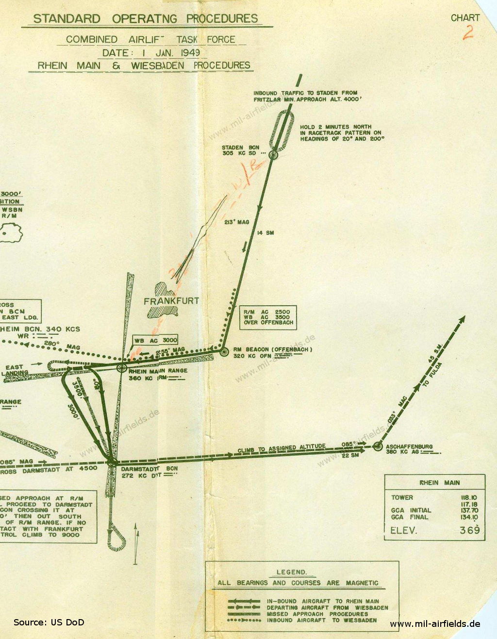
Enlargement - Route from Darmstadt via Aschaffenburg to Fulda and from Staden to Offenbach.
Source: US DoD
In the 1950s
Overview
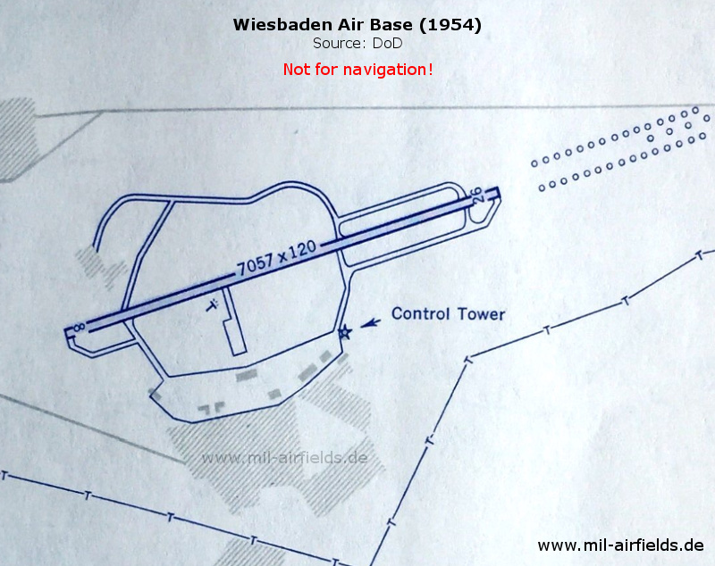
Map from 1954 - The length of the runway is now 2,150 m (7,057 feet), the width 37 m (120 feet). The control tower has moved to the eastern side.
Source: US DoD
Images
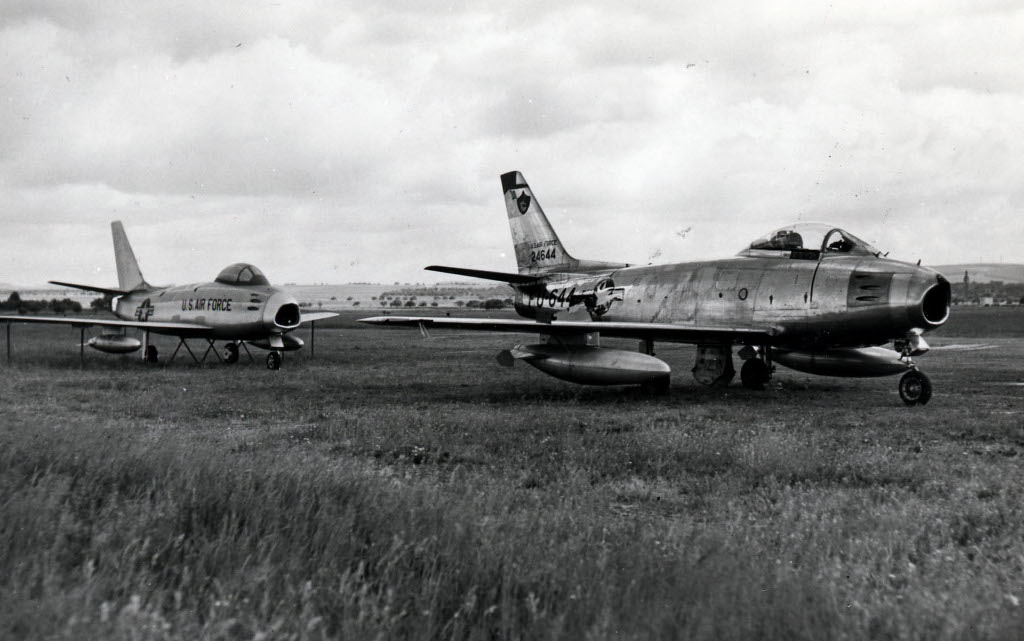
Aircraft North American F-86 Sabre 52-4644 as decoy on 06 June 1955 at Wiesbaden Air Base
Source: U.S. Air Force photo / National Museum of the US Air Force, Public Domain
Stationing of the U-2 reconnaissance aircraft in 1956
In 1956, U-2 aircraft were stationed in Wiesbaden for several months. They belong to the CIA and carry out espionage flights at great heights above the Eastern bloc states.
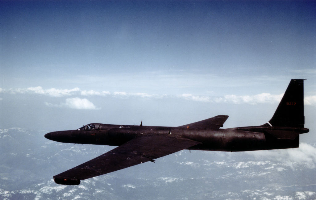
A U-2 of the US Air Force
Source: US Air Force, Public Domain
Timeline
● 11 June 1956: Relocation of Detachment A or "Weather Reconnaissance Squadron (Provisional) WRSP-I" from Lakenheath (Great Britain) to Wiesbaden. It is operational with 4 airplanes U-2.
● 20 June 1956 - Mission 2003:
First mission flight of a U-2. The route leads over East Germany and Poland.
First mission flight of a U-2. The route leads over East Germany and Poland.
● 02 July 1956 - Mission 2009:
Reconnaissance flight over Czechoslovakia, Hungary and Bulgaria
Reconnaissance flight over Czechoslovakia, Hungary and Bulgaria
● 02 July 1956 - Mission 2010:
Reconnaissance flight over the GDR, Poland, Hungary and Romania
Reconnaissance flight over the GDR, Poland, Hungary and Romania
● 04 July 1956 - Mission 2013:
First flight of a U-2 over the Soviet Union, airplane is the Article 347. Route: Wiesbaden - Poznan (Poland) - Belarus - Leningrad - Baltic Soviet Republics - Wiesbaden
First flight of a U-2 over the Soviet Union, airplane is the Article 347. Route: Wiesbaden - Poznan (Poland) - Belarus - Leningrad - Baltic Soviet Republics - Wiesbaden
● 05 July 1956 - Mission 2014:
Flight over the Soviet Union, similar route as the day before, but a little more to the south and further east. It also led over Moscow and it remained the only U-2 flight over the Soviet capital
Flight over the Soviet Union, similar route as the day before, but a little more to the south and further east. It also led over Moscow and it remained the only U-2 flight over the Soviet capital
● 09 July 1956 - Mission 2020:
Wiesbaden - GDR - Poland - Kaliningrad - Lithuania - Belarus - Poland - GDR - Wiesbaden
Wiesbaden - GDR - Poland - Kaliningrad - Lithuania - Belarus - Poland - GDR - Wiesbaden
● 09 July 1956 - Mission 2021:
Wiesbaden - Czechoslovakia/Prague - Austria/Vienna - Hungary - Ukraine/Lviv/Kiev - Belarus/Minsk - Poland - Czechoslovakia - Wiesbaden
Wiesbaden - Czechoslovakia/Prague - Austria/Vienna - Hungary - Ukraine/Lviv/Kiev - Belarus/Minsk - Poland - Czechoslovakia - Wiesbaden
● 10 July 1956 - Mission 2023:
Wiesbaden - GDR southern part - Poland southern part - Ukraine - Soviet Union/Moldovan SSR - Crimea - Moldovan SSR - Romania - Hungary - Czechoslovakia - GDR - Wiesbaden
Wiesbaden - GDR southern part - Poland southern part - Ukraine - Soviet Union/Moldovan SSR - Crimea - Moldovan SSR - Romania - Hungary - Czechoslovakia - GDR - Wiesbaden
● 29 August 1956 - Mission 1104 and 1105:
Reconnaissance flights on the Suez crisis from Wiesbaden to the Middle East. The landing took place in Turkey in Adana. On the following day, further reconnaissance flights with return to Wiesbaden.
Reconnaissance flights on the Suez crisis from Wiesbaden to the Middle East. The landing took place in Turkey in Adana. On the following day, further reconnaissance flights with return to Wiesbaden.
● 17 September 1956: Crash of U-2 "56-6679" (Art 346).
Approximately eight minutes after take-off the aircraft was seen by two pilots in a T-33 and four pilots in a flight of Royal Canadian Air Force F-86's at 35.000 feet. About five seconds after passing the F-86's and 500 feet above them the U-2 disintegrated and fell. The pilot was fatally injured. The cause of this accident could not be definitely determined beyond an initial failure of the right wing. Metal fatigue over stress or high internal wing pressures were suggested as possible causes of the wing failure. The possibility of sabotage was thoroughly investigated and sufficient evidence was produced to rule out sabotage as a cause.
Approximately eight minutes after take-off the aircraft was seen by two pilots in a T-33 and four pilots in a flight of Royal Canadian Air Force F-86's at 35.000 feet. About five seconds after passing the F-86's and 500 feet above them the U-2 disintegrated and fell. The pilot was fatally injured. The cause of this accident could not be definitely determined beyond an initial failure of the right wing. Metal fatigue over stress or high internal wing pressures were suggested as possible causes of the wing failure. The possibility of sabotage was thoroughly investigated and sufficient evidence was produced to rule out sabotage as a cause.
● Autumn 1956: Detachment A relocates to Giebelstadt Air Base.
After the first flights, it was recognized that when taking off on a wet runway, splash water came onto the camera covers and affected the image quality. As a result, the runway was cleared of puddles in an elaborate manual process before each take-off.
(Source: CIA)
In the 1970s
Situation
Wiesbaden Air Base / Army Airfield on a map of the US Department of Defense from 1972
Source: ONC E-2 (1972), Perry-Castañeda Library Map Collection, University of Texas at Austin
Overview
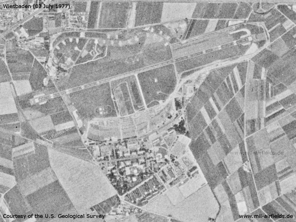
Wiesbaden Army Airfield on a US satellite image from 03 July 1977
Source: U.S. Geological Survey
In the 1980s and early 1990s
Overview
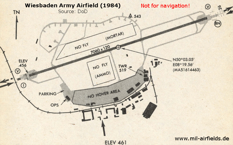
Map from 1984
Runways
Data for the year 1990:
- 08/26: 2154 m x 37 m Asphalt
Radio beacons
Data for the year 1990:
- NDB: 399 "WBD", at field
- TACAN: CH88 "WIB", at field
Images
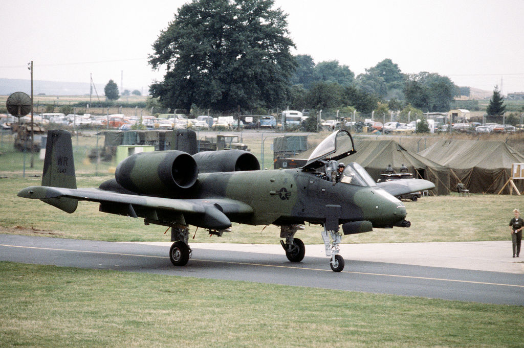
Aircraft A-10 Thunderbolt II of the 81st Tactictal Fighter Wing during exercise REFORGER / AUTUMN FORGE '83 (September 1983)
Source: US DoD / National Archives, Public Domain
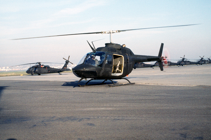
An OH58 Kiowa helicopter preparing to take off (29 November 1984)
Source: US DoD, photographer: SSGT Fernando Serna / National Archives, Public Domain
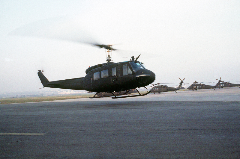
Right side view of a UH-1H Iroquois helicopter hovering over a landing pad (11 December 1984) - A row of parked UH-60A Black Hawk helicopters can be seen in the background
Source: US DoD, photographer: SSGT Fernando Serna / National Archives, Public Domain
Today
"Berlin Airlift 70th Anniversary", 10 June 2019
A great event, many thanks to all who made it possible!
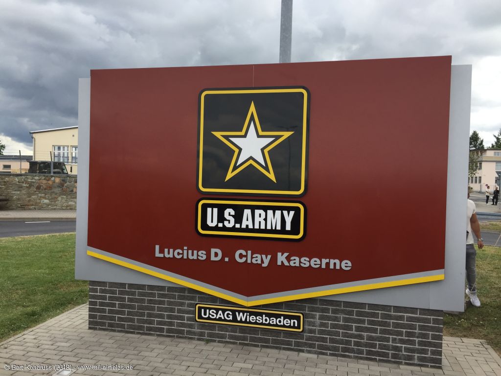
Gate sign Lucius D. Clay Kaserne / USAG Wiesbaden
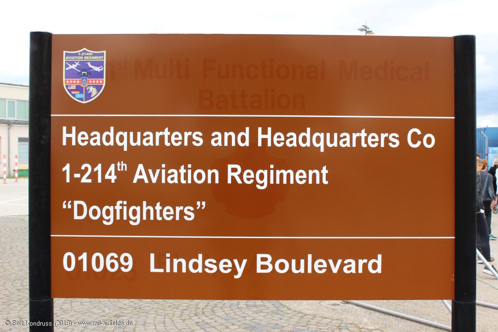
Sign: Headquarters and headquarters Co 1-214th Aviation Regiment "Dogfighters"
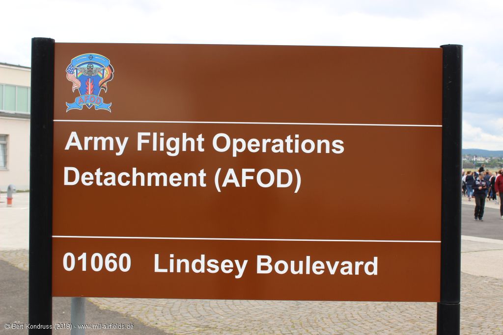
Sign: Army Flight Operations Detachment (AFOD)

Sign: Welcome to the U.S. Army Garrison Wiesbaden
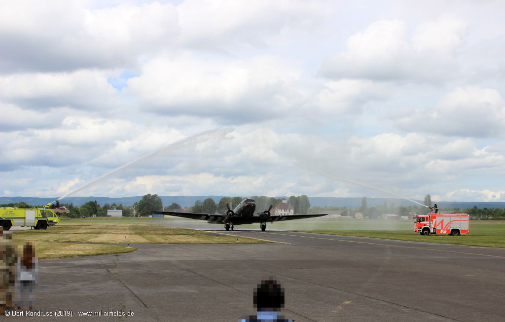
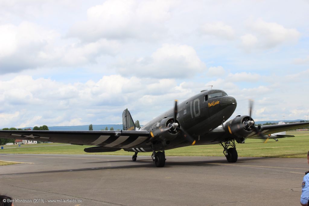
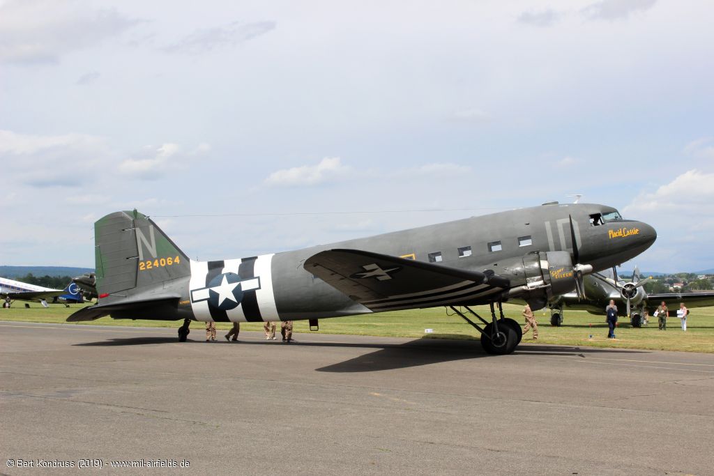
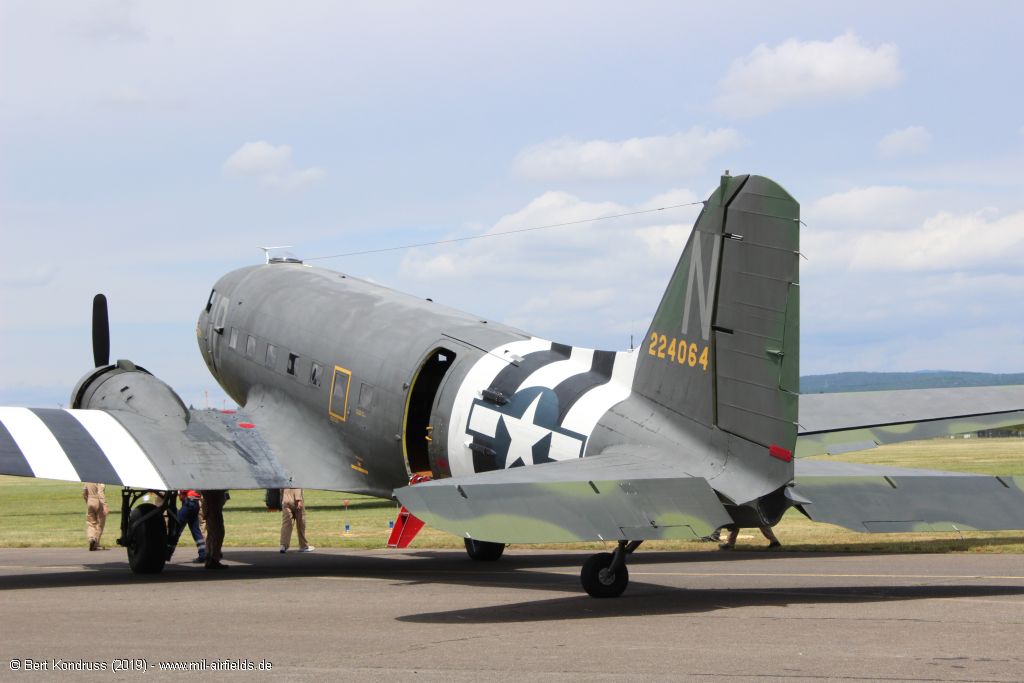
Water salute for the C-47A Skytrain N74589 "224064"
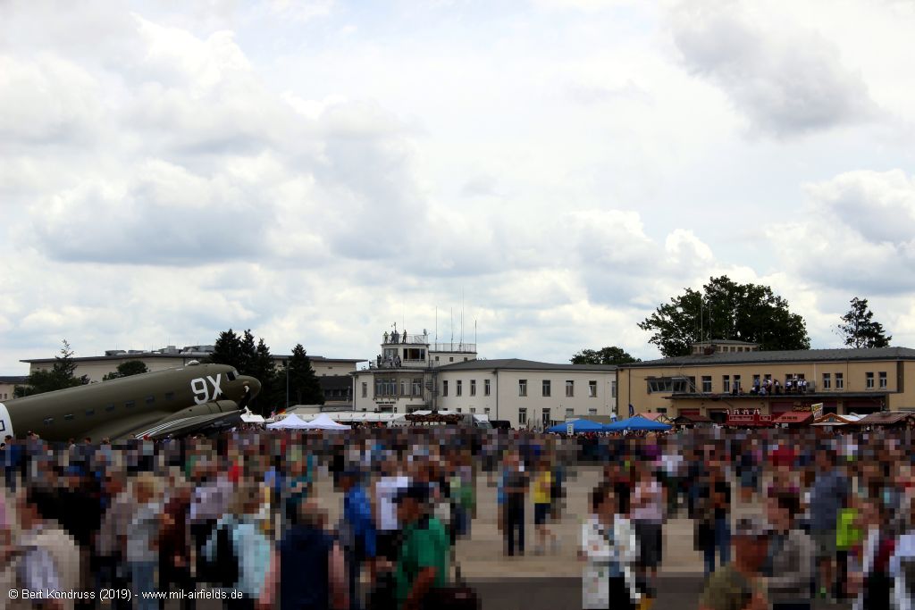
Flight line Wiesbaden
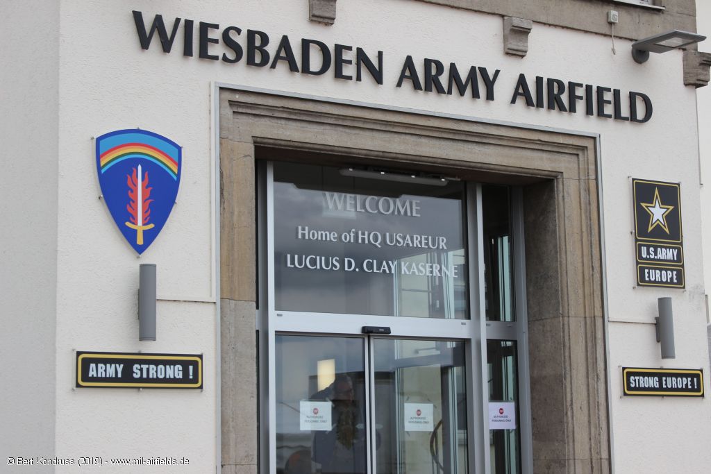
Wiesbaden Army Airfield
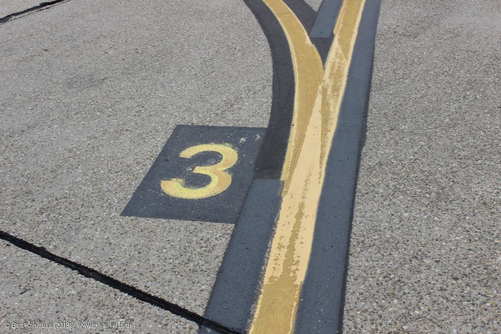
Ground marking
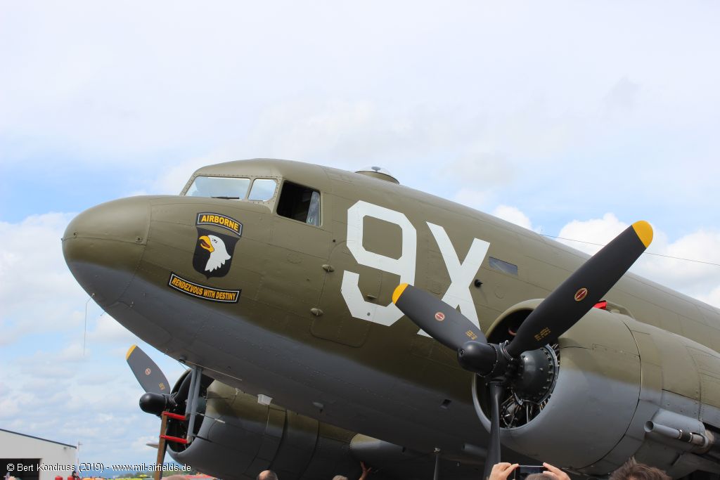
C-47 Dakota N150D "Airborne Rendezvous with Destiny"
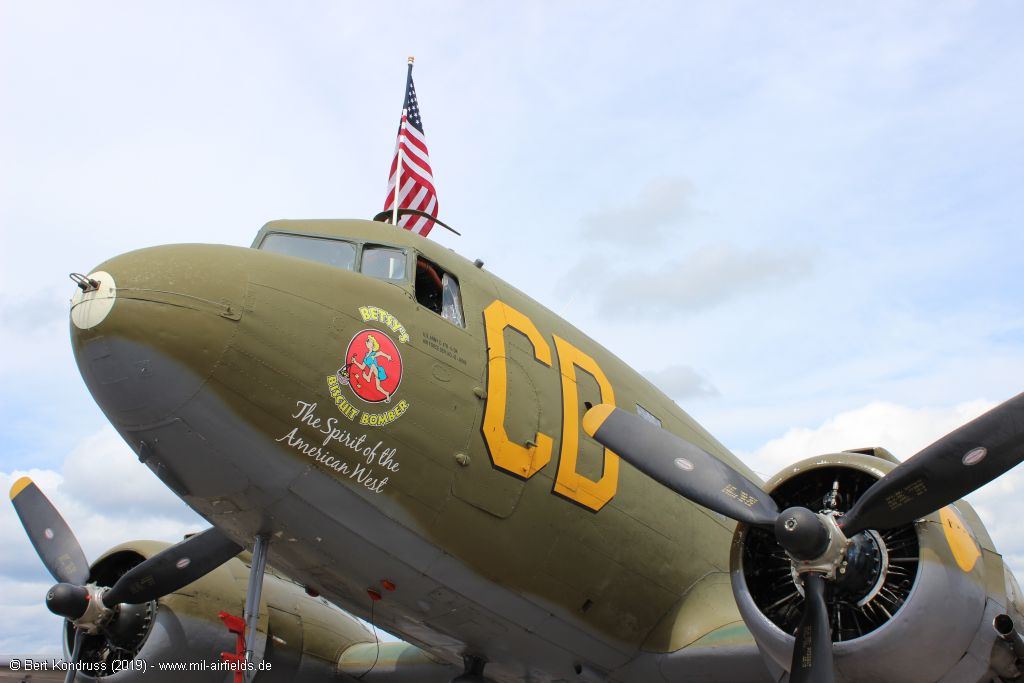
C-47 Dakota N47SJ "Betsy's Biscuit Bomber" / "The Spirit of the American West"
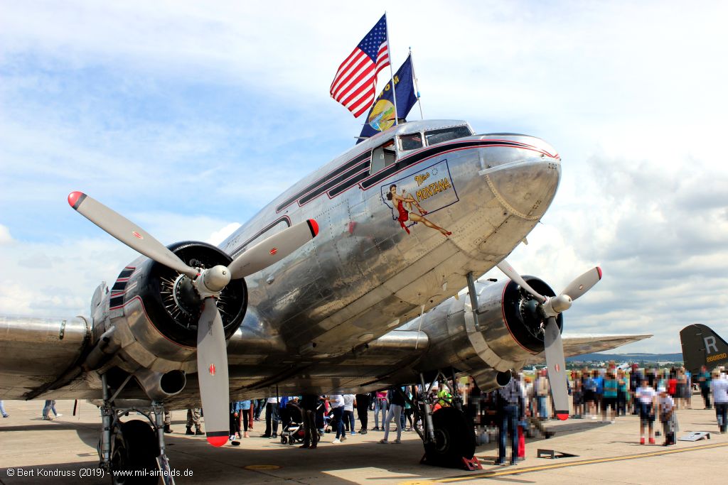
C-47 "Miss Montana"
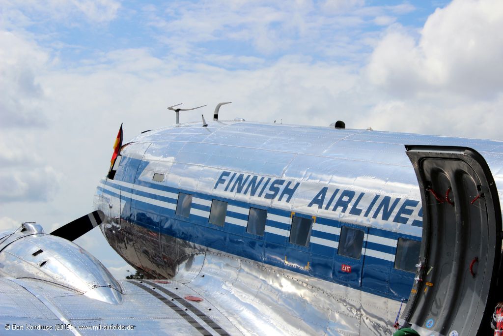
DC-3A OH-LCH "Finnish Airlines"
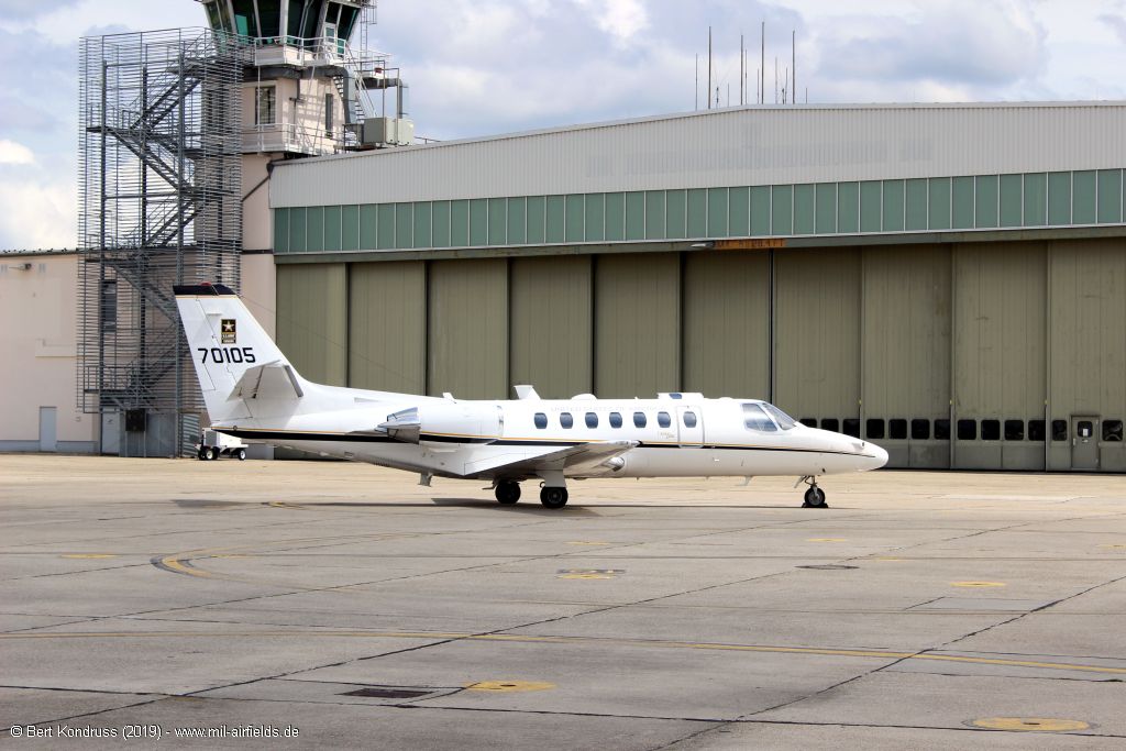
Cessna UC-35A Citation Ultra 97-00105 / 70105 of the US Army
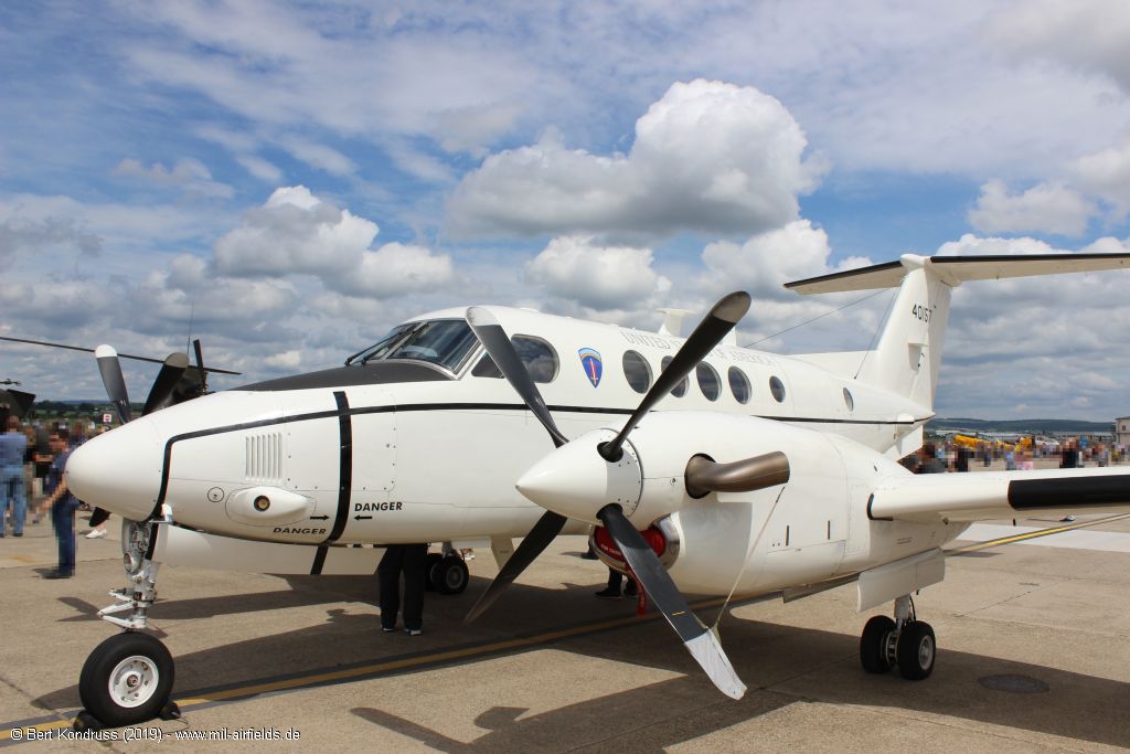
Beech C-12 Huron 40175 of the US Air Force
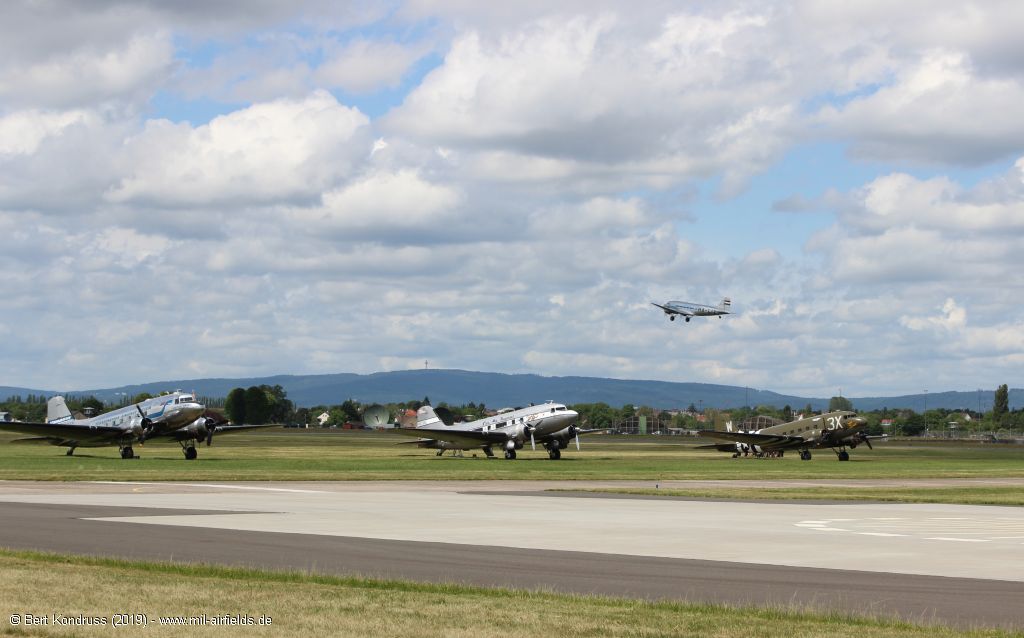
Flight operations with C-47
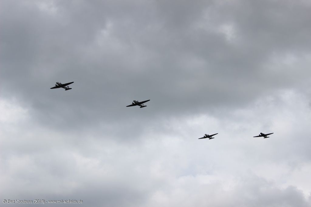
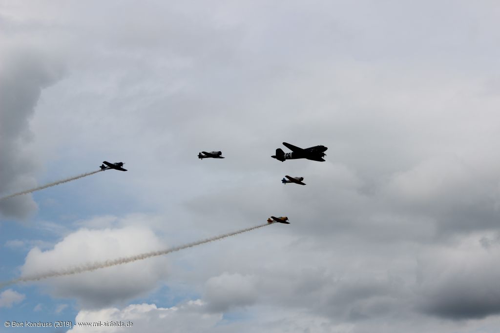
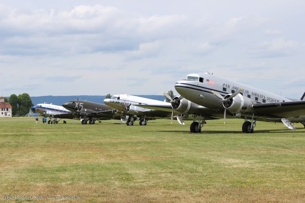
Aircraft C-47 Dakota / Skytrain
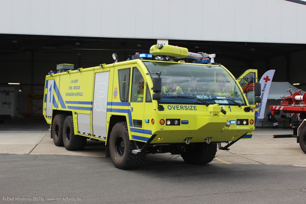
Fire rescue vehicle
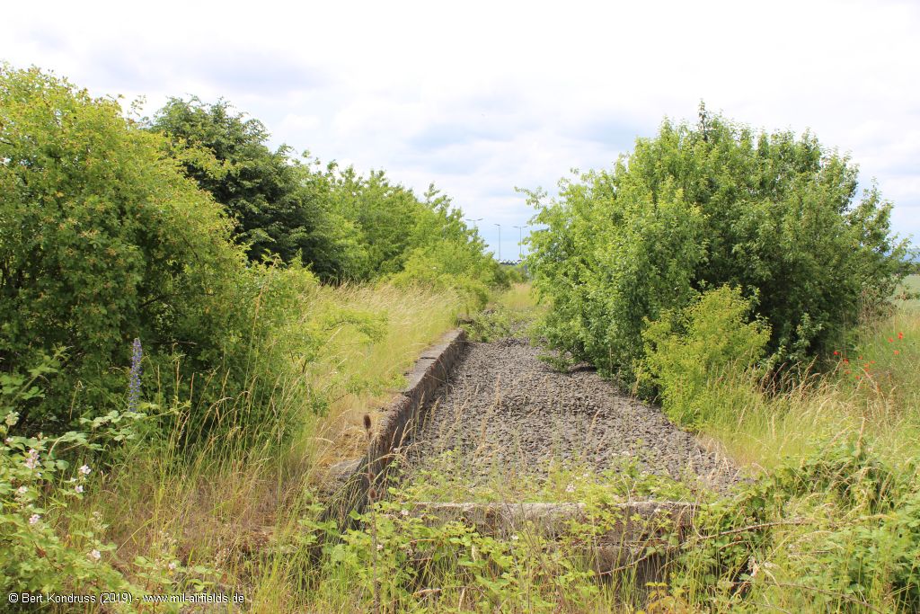
Former railway track to the airfield
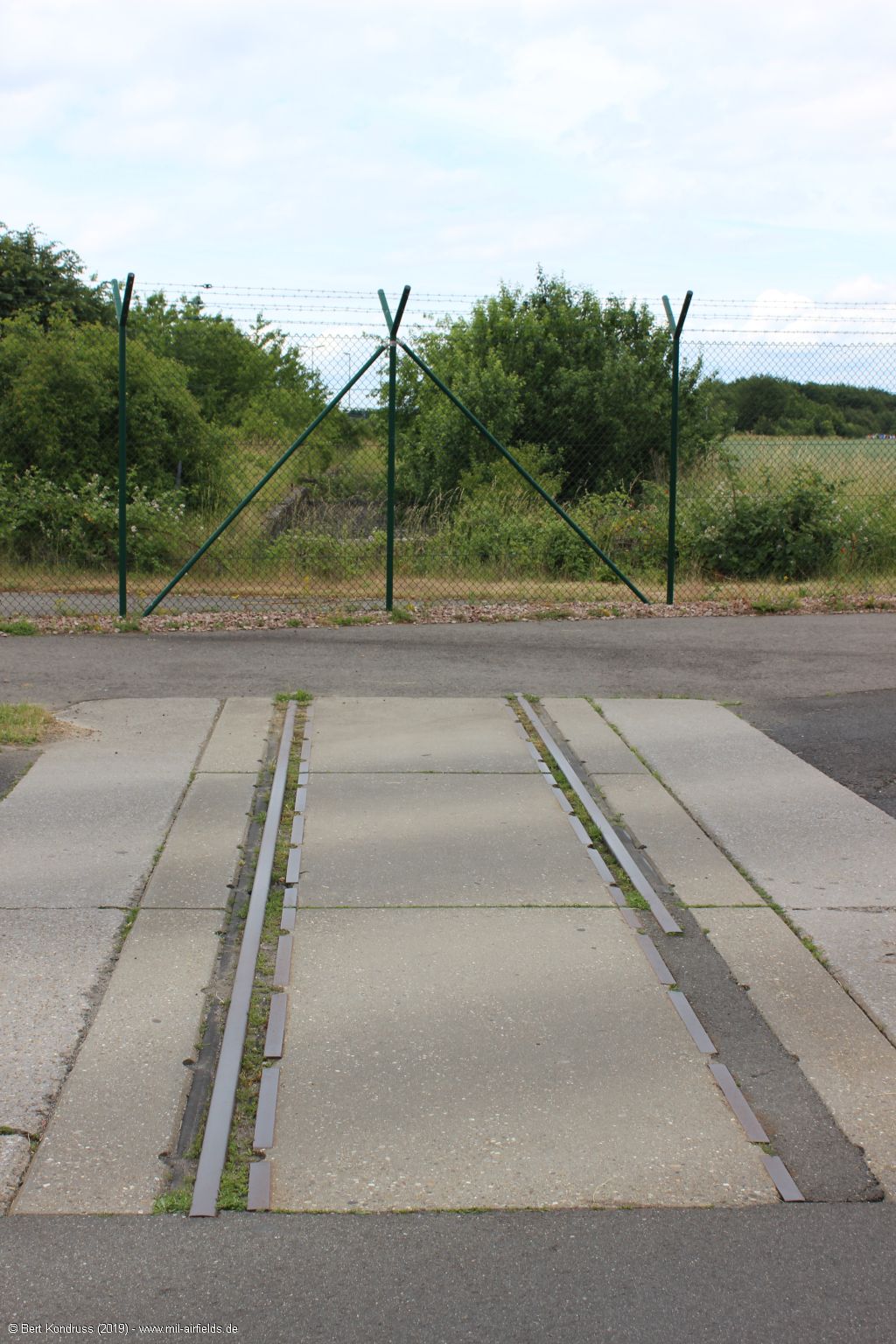
Track remains
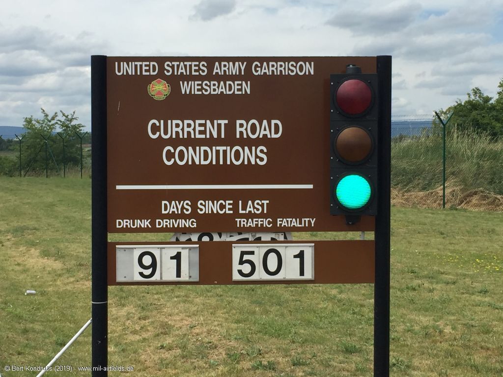
Sign: Current Road Conditions
Approach and aerodrome charts
The development of Wiesbaden Erbenheim Air Base / Army Airfield over the years can also be seen from historical maps. Here is a collection of approach and airport maps from the 1940s, 1950s and 1960s:
Approach maps + aerodrome maps Wiesbaden
Approach maps + aerodrome maps Wiesbaden
Sources
- https://www.archives.gov/ - National Archives
- https://archive.defense.gov/news/newsarticle.aspx?... - Anniversary Evokes Memories of Berlin Airlift
- https://www.af.mil/ - U.S. Air Force
- https://www.nationalmuseum.af.mil/ - National Museum of the US Air Force
Airfields in the vicinity
Categories
Military Airfields GermanyMilitary Airfields in former West GermanyAir Bases of the United States Air Force (USAF) in GermanyUS Army Airfields and Heliports in GermanyRecommended

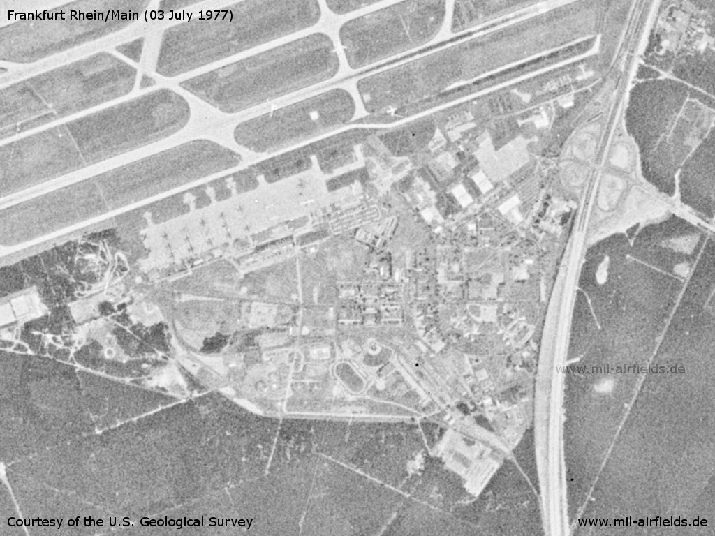
Image credits are shown on the respective target page, click on the preview to open it.
Contents
 Follow mil-airfields on Facebook