Range 76: Altes Lager Air Base as Target
Eastman Airfield Target, Korean Airfield, Target 76-14
For historical information only, do not use for navigation or aviation purposes!
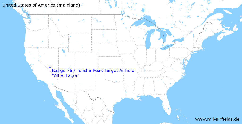
| Coordinates | N372146 W1164940 (WGS84) Google Maps |
The history of the Cold War airfields: Airfield immitation Altes Lager near Tolicha Peak
General
In the west of the Nevada Test and Training Range (NTTR), USA, lies Range 76, which is used by the Tolicha Peak Electronic Combat Range (TPECR), among others. Here are two replicas of the former Soviet airfield Altes Lager near Jüterbog. This airfield was located in the East Germany, about 60 km southwest of the city center of Berlin.
Location of airfield
51 km north-northwest von Beatty, Nevada and 52 km southeast of Goldfield, Nevada.
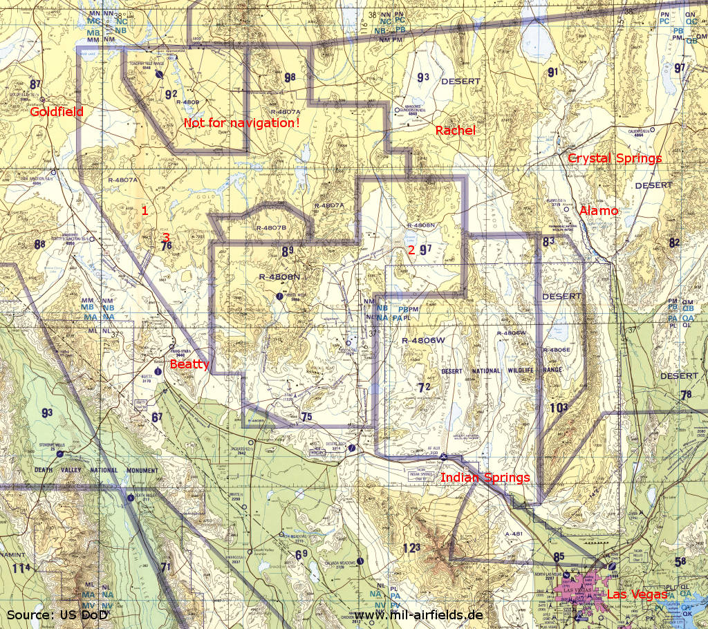
Nevada Test and Training Range north of Las Vegas an a map from 1993 - The map covers an area of about 250 km (155 miles) in east-west direction and 220 km (137 miles) in north-south direction. Numerous nuclear weapons were also tested here. 1: Airfield replica Altes Lager / Jüterbog; 2: Groom Lake ("Area 51") Air Force Test Center; 3: Tolicha Peak. Places: Alamo, Beatty, Crystal Springs, Indian Springs, Goldfield, Rachel.
Source: U.S. Defense Mapping Agency Aerospace Center, via Perry-Castañeda Library
Map Collection, The University of Texas at Austin
During the Cold War
In the 1970s
Overview
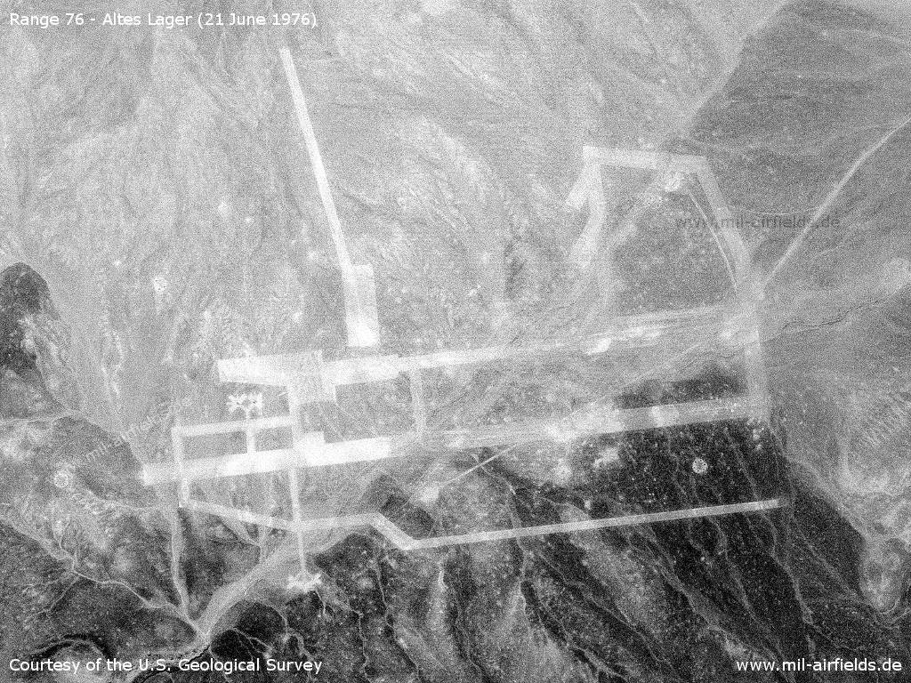
Aerial image from 21 June 1976
Source: U.S. Geological Survey
In the 1980s and early 1990s
Overview
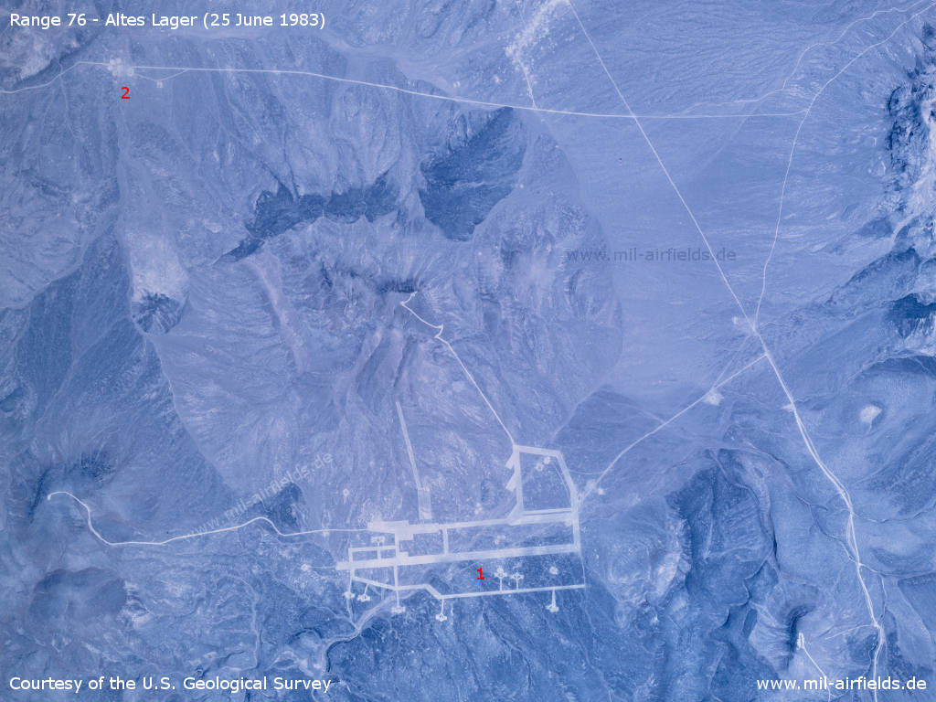
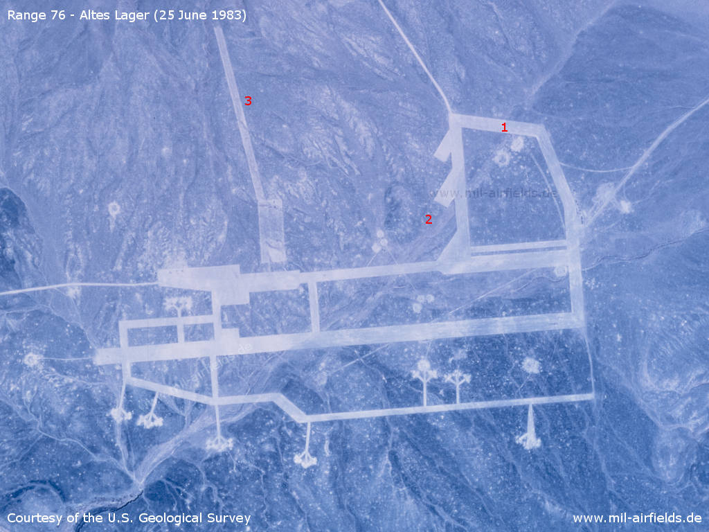
The air base immitation on an aerial image from 25 June 1983 - 1: airfield; 2: Surface-to-Air Missile (SAM) site
Source: U.S. Geological Survey
Airfield - The runway was turned counterclockwise by approx. 20° and shortened by 400 m, compared to the original. Distinctive: 1: northeastern taxiway loop; 2: three diagonal parking areas in front of the hangars. 3: There is no equivalent for this in the original.
Source: U.S. Geological Survey
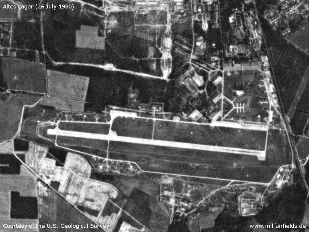
For comparison: The original Soviet air base in East Germany on 26 July 1980
Source: U.S. Geological Survey
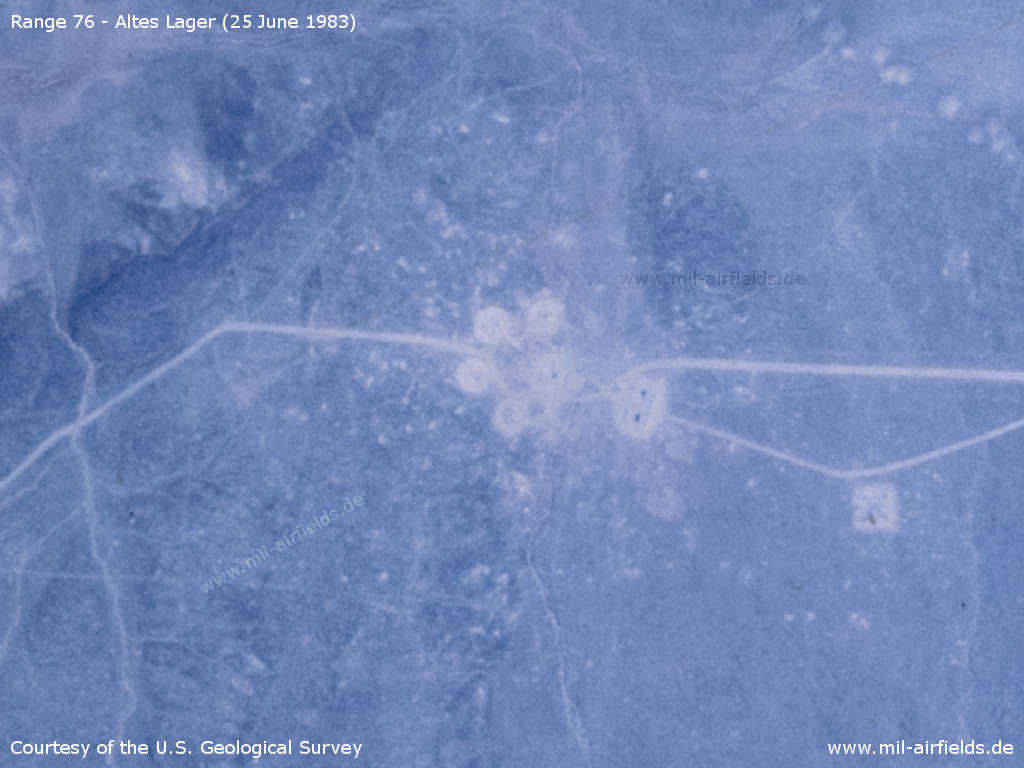
The Surface-to-Air Missile (SAM) site - There are four launch positions, which would correspond to the original missile type S-125 (NATO designation SA-3 Goa). Later, the copied SAM site was converted to a hexagonal arrangement, which corresponds to missile type S-75 (NATO designation Guideline).
Source: U.S. Geological Survey
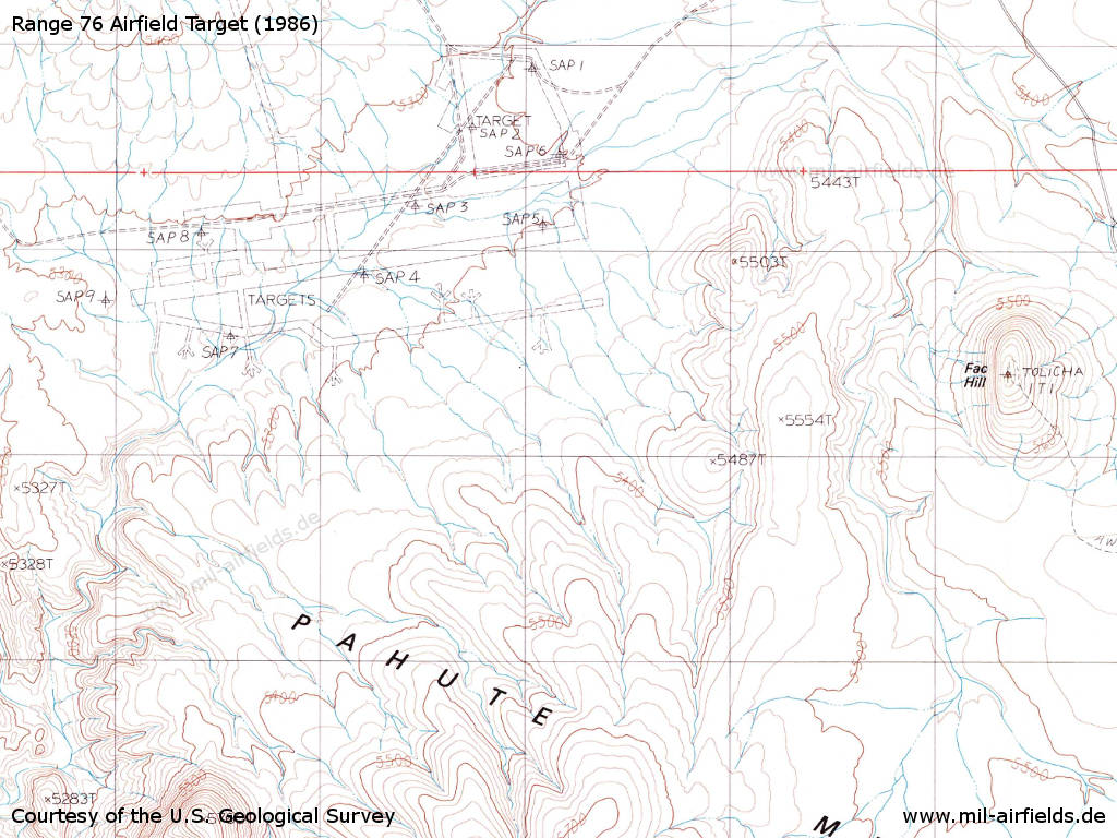
Map (1986) - The airfield is shown in the upper left corner. About 2 km east there is a hill "Tolicha ITI", together with the name "Fac Hill". Fac could stand for "Forward Air Controller", i.e. the officers who direct attacking aircraft to their target.
Source: U.S. Geological Survey
Today
Use
Between 2004 and 2005 a second replica of the airfield was built about 8 km north-northwest of the first one.
Sources
- https://www.usgs.gov/ - USGS: U.S. Geological Survey
- https://legacy.lib.utexas.edu/maps/ - Perry-Castañeda Library Map Collection
Links
- Google Maps - 1st airfield replica at N372146 W1164940
- Google Maps - 2nd airfield replica at N372545 W1165108
Warning!
Never enter active military installations without prior approval. It is dangerous, it is illegal and you can be punished for it.
References
- Learn more about the original airfield in Germany:
Altes Lager
- In the Kawich Range, about 50 km to the east, another East German airfield was rebuilt:
Kawich Range: Altenburg Air Base as Target.
Recommended
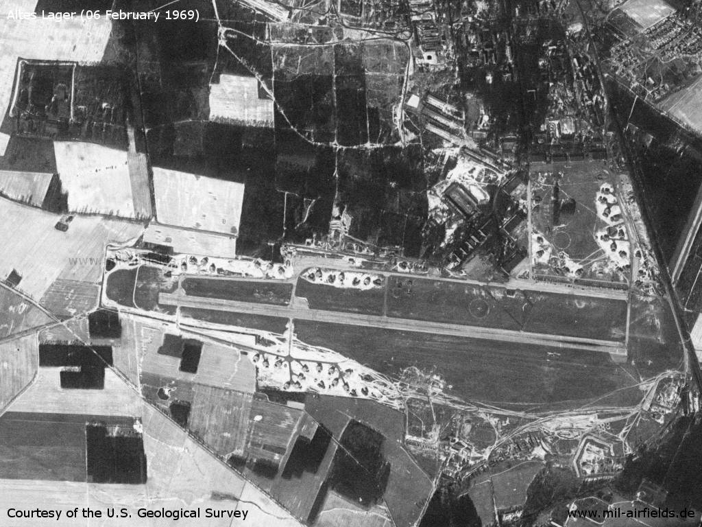
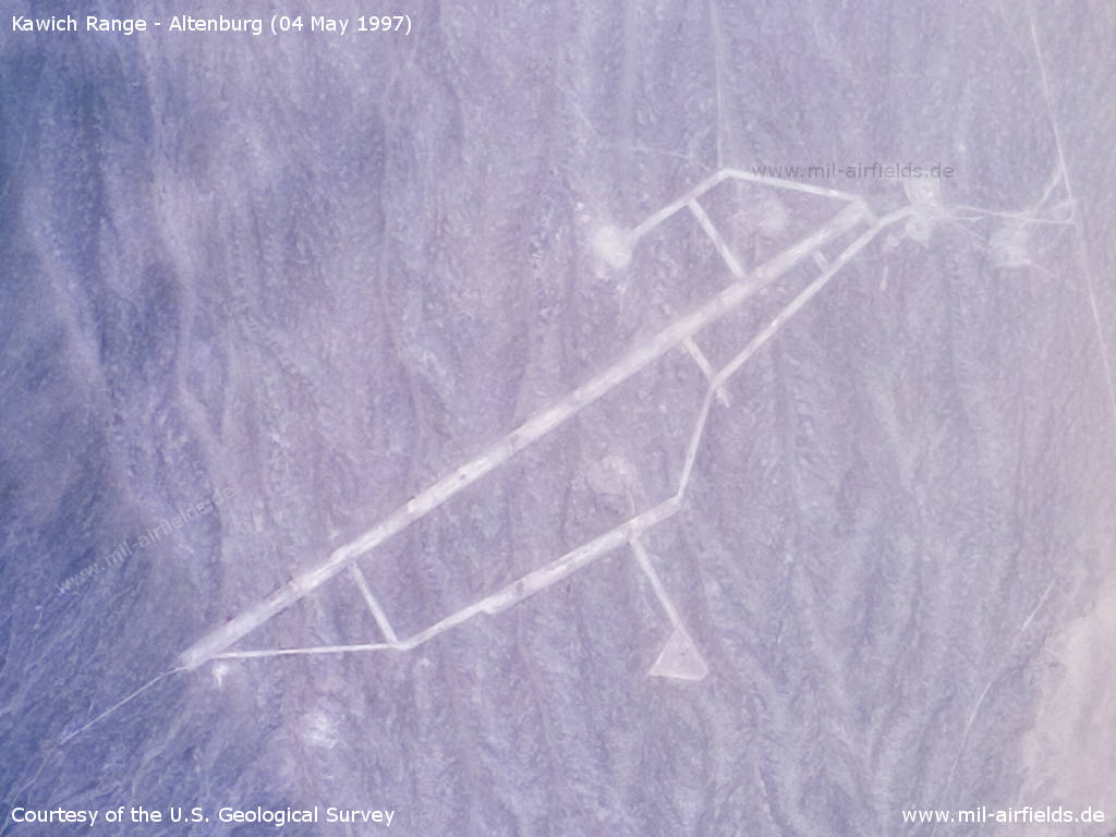
Image credits are shown on the respective target page, click on the preview to open it.
 Follow mil-airfields on Facebook