For historical information only, do not use for navigation or aviation purposes!
| Coordinates | N541123 E0130038 ca. (WGS84) Google Maps |
| Former East Germany (GDR) | District of Rostock |
| Federal state | Mecklenburg-Vorpommern (Mecklenburg-Western Pomerania) |
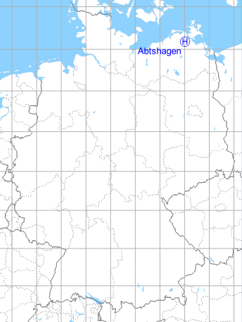
Germany during the Cold War Map
The history of the Cold War airfields: Abtshagen
General
In East Germany, near Abtshagen was an anti-aircraft missile site of the National People's Army (NVA), last operated by the Fla-Raketenabteilung 4321 (FRA-4321). This site had a helicopter landing pad west of the village.
Location of airfield
600 m west of Abtshagen, probably at the athletics field north of the road to Franzburg.
During the Cold War
Use
Helipad 3310 for anti-aircraft missile unit 4321 (FRA-4321) of former East German Air Force (NVA LSK/LV).
Overview
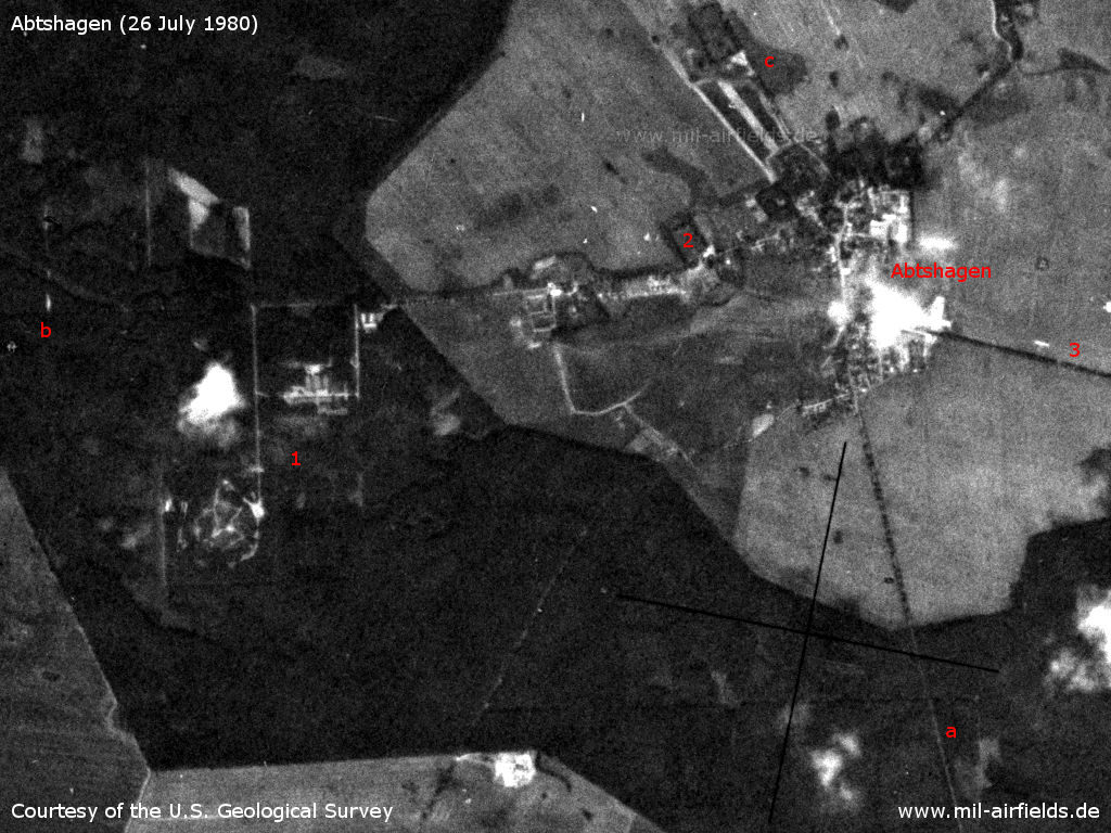
Abtshagen and Anti-aircraft Missile Unit 4321 (FRA-4321) on a US satellite image from 26 July 1980 - 1: Surface-to-air missile site; 2: presumed landing field (sports field); 3: Abtshagen agricultural airfield at the road to Wittenhagen. a: Highway F 194 to Grimmen; b: road to Franzburg; c: F 194 to Negast and Stralsund.
Source: U.S. Geological Survey
Runways, taxiways, aprons
Dimensions: 75 m x 100 m
Main takeoff and landing direction: 0°
Surface: grass
Capacity: 1 helicopter
Main takeoff and landing direction: 0°
Surface: grass
Capacity: 1 helicopter
Telephone
Stabsnetz S1 6428-531
Airspace and procedures
Usable at day during good weather conditions
Alert time: 40 minutes
Alert time: 40 minutes
Obstacles
Power transmission line: distance 120 m, height 10 m
Unit hierarchy in 1989
- Ministry of National Defense (MfNV)
-- National People's Army (NVA)
--- Air Force/Air Defense (LSK/LV)
---- 3rd Air Defense Division (3. LVD)
----- 43rd Anti-aircraft Missile Brigade (43. FRBr)
------ Anti-aircraft Missile Unit 4321 (FRA-4321)
-- National People's Army (NVA)
--- Air Force/Air Defense (LSK/LV)
---- 3rd Air Defense Division (3. LVD)
----- 43rd Anti-aircraft Missile Brigade (43. FRBr)
------ Anti-aircraft Missile Unit 4321 (FRA-4321)
Address:
Post box 65209
Post box 65209
Installation:
- NVA object ID: 01/900
- Area: 269,3
- Housing capacity: 247
Technical zone:
- NVA installation ID: 01/958
- Area: 15
- Housing capacity: 17
- NVA object ID: 01/900
- Area: 269,3
- Housing capacity: 247
Technical zone:
- NVA installation ID: 01/958
- Area: 15
- Housing capacity: 17
Today
Use
Closed.
Airfields in the vicinity
- 106°/2km Abtshagen: Agricultural Airfield
- 156°/12km Grimmen: Appelshof Agricultural Airfield
- 013°/20km Parow: Airfield
Categories
Military Airfields GermanyMilitary Airfields in former East GermanyHelipads of former National People's ArmyRecommended

Image credits are shown on the respective target page, click on the preview to open it.
 Follow mil-airfields on Facebook