For historical information only, do not use for navigation or aviation purposes!
| Coordinates | N523529 E0100125 (WGS84) Google Maps |
| Federal state | Niedersachsen (Lower Saxony) |
| Location indicator | DECE (195x), EDCL (196x-199x), ETHC (199x-) |
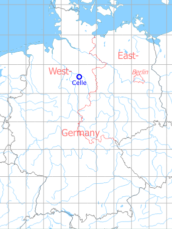
Germany during the Cold War Map
The history of the Cold War airfields: Celle
During World War II
Use
Luftwaffe airfield.
Situation
Celle airfield in World War II on a US map from 1943 - (McMaster University Library Digital Archive, License: Creative Commons Attribution-NonCommercial 2.5 CC BY-NC 2.5 CA /MULDA/)
During the Cold War
Usage during the Cold War
Airfield used by Royal Air Force, German Air Force and German Army.
In the 1950s
Radio beacons
- NDB: 325 "CL", at field
In the 1960s
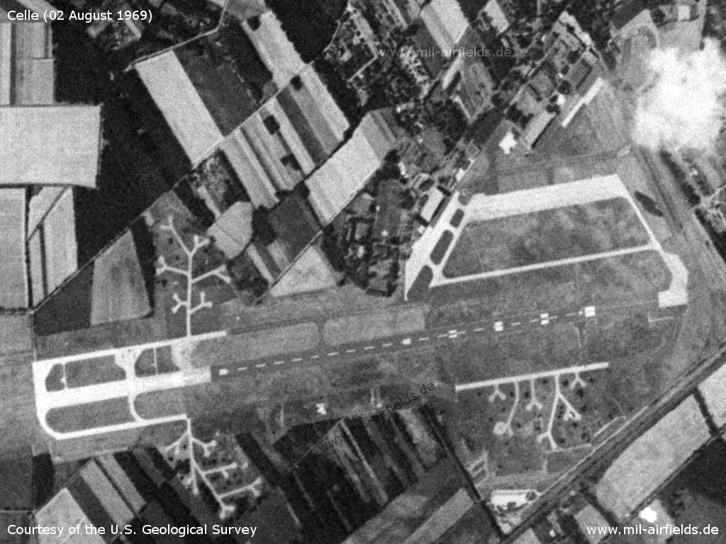
Overview
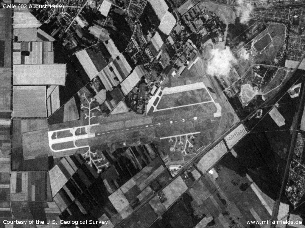
Celle Air Base on a US satellite image from 02 August 1969
Source: U.S. Geological Survey
Airfield
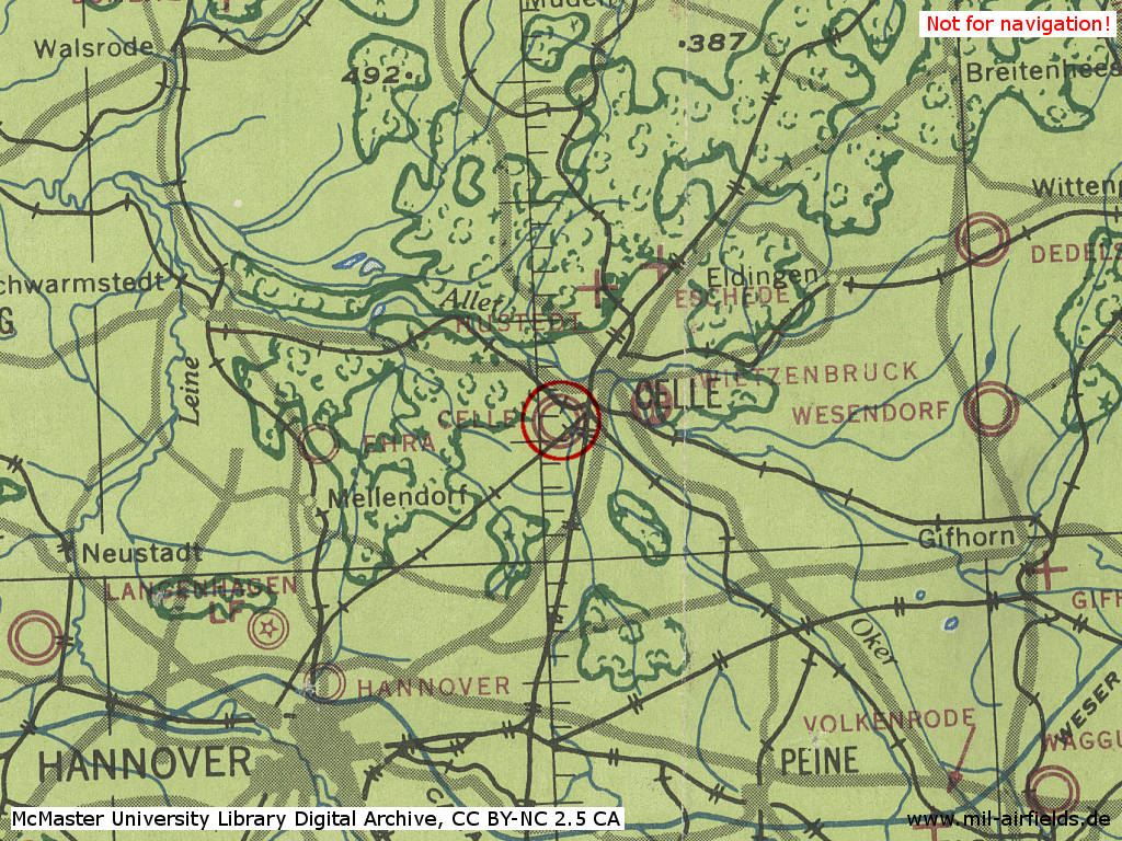
Maps
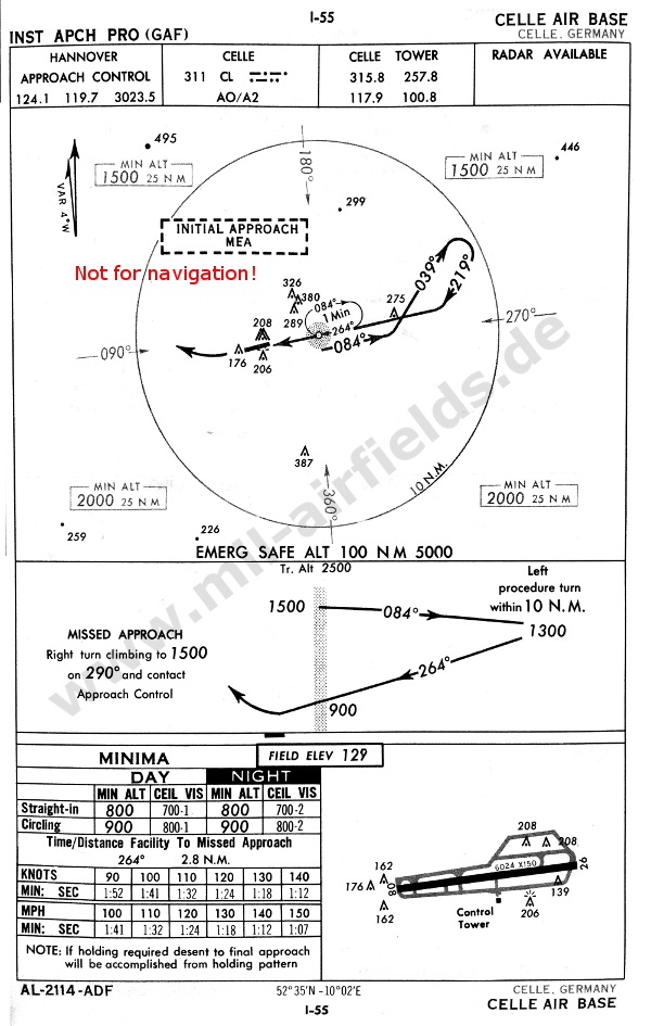
NDB approach to Celle in 1960. Hannover Approach can still be reached via a shortwave radio frequency (Source: USAF/USN FLIP 1960)
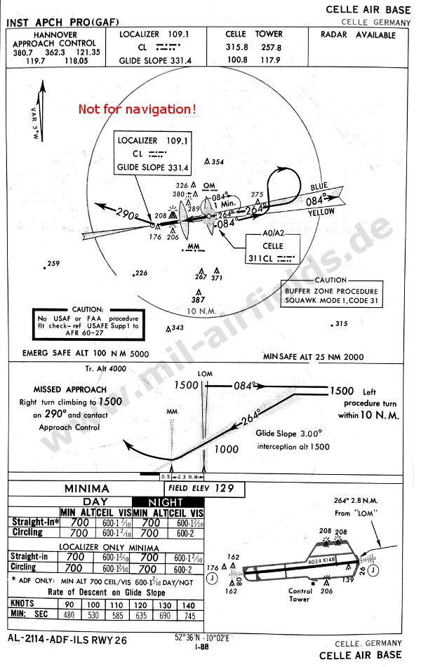
1966: Meanwhile, the airfield has an Instrument Approach System (ILS) (Source: USAF/USN FLIP 1966)
In the 1970s
Situation
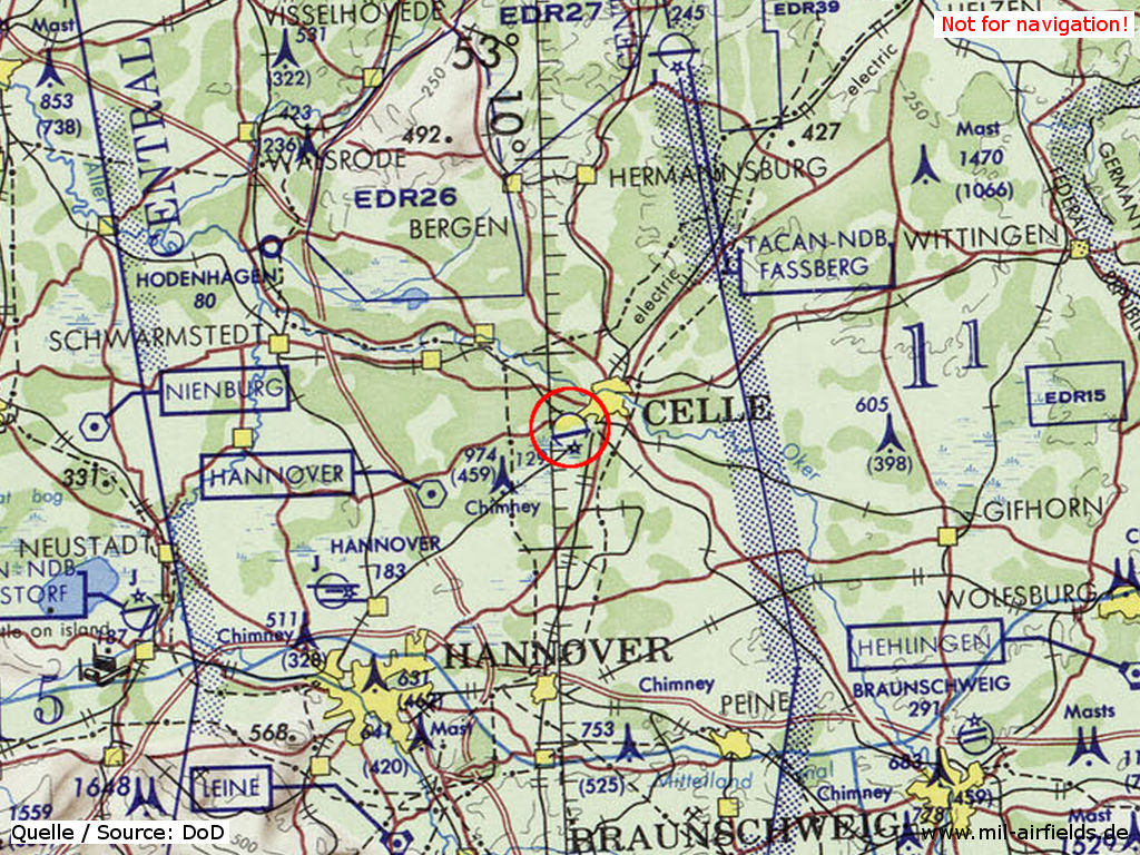
Celle Air Base on a map of the US Department of Defense from 1972 - (ONC E-2 (1972), Perry-Castañeda Library Map Collection, University of Texas at Austin /PCL MC/)
In the 1980s and early 1990s
Overview
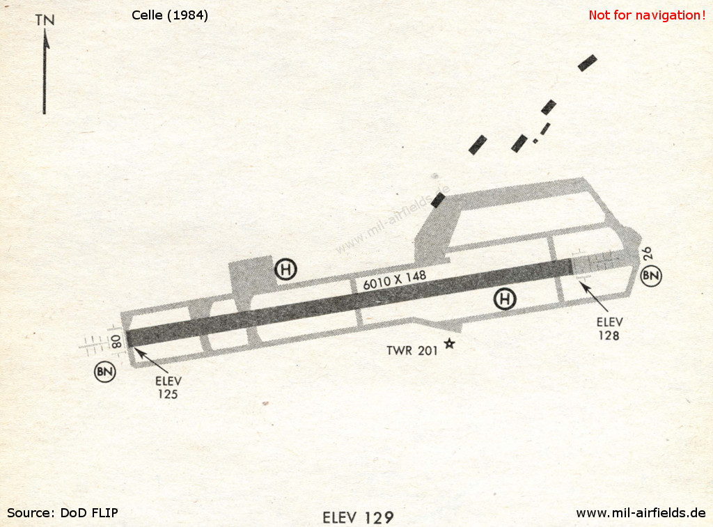
Celle in 1984
In the 1990s/2000s
Runways
- 08/26: 1831m x 45m Asphalt/Concrete
Radio beacons
- NDB: 311 "CL", 262°/3.5NM to field
- ILS 26: 109.1 "CL"
Today
Use
German Army airfield.
Links
- https://en.wikipedia.org/wiki/Celle_Air_Base - Celle Air Base
Airfields in the vicinity
- 017°/38km Faßberg: Air Base (RAF Fassberg)
- 250°/43km Wunstorf: Air Base (Kleinheidorn)
- 187°/46km Hildesheim: Airfield (Steuerwald, Tofrek Barracks)
Categories
Military Airfields GermanyMilitary Airfields in former West GermanyGerman Air Force Air BasesGerman Army AirfieldsRoyal Air Force (RAF) Bases in GermanyRecommended
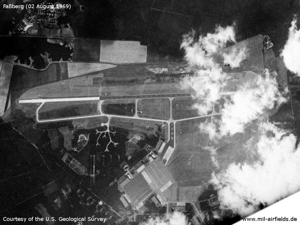
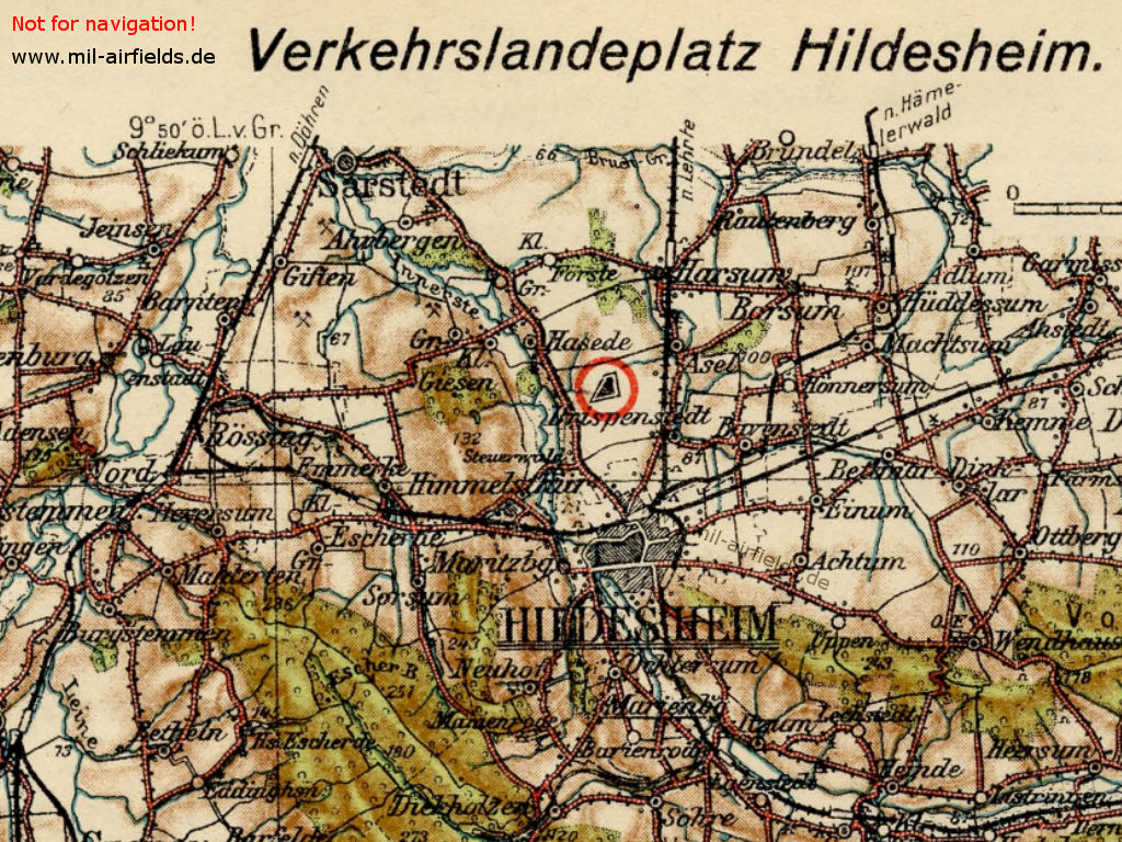
Image credits are shown on the respective target page, click on the preview to open it.
 Follow mil-airfields on Facebook