Diepholz: Airfield
For historical information only, do not use for navigation or aviation purposes!
| Coordinates | N523508 E0082027 (WGS84) Google Maps |
| Elevation | 127 ft |
| Location indicator | EDND (-1995), ETND (1995-) |
The history of the Cold War airfields: Diepholz
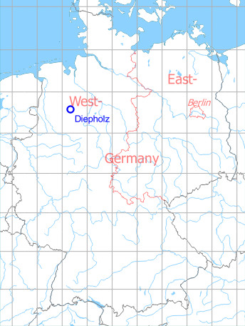
Location
Federal State of Niedersachsen (Lower Saxony).
Germany during the Cold War
During World War II
Usage until 1945
Luftwaffe airbase.
Situation
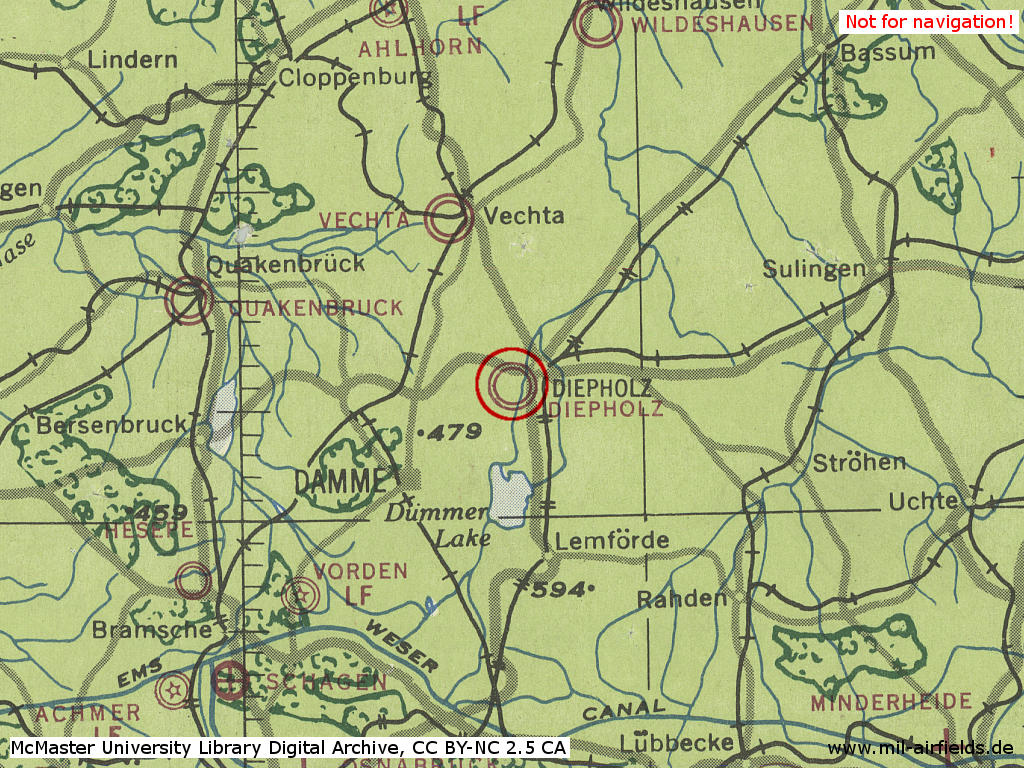
Diepholz Air Base in World War II on a US map from 194x - (McMaster University Library Digital Archive, License: Creative Commons Attribution-NonCommercial 2.5 CC BY-NC 2.5 CA /MULDA/)
Overview
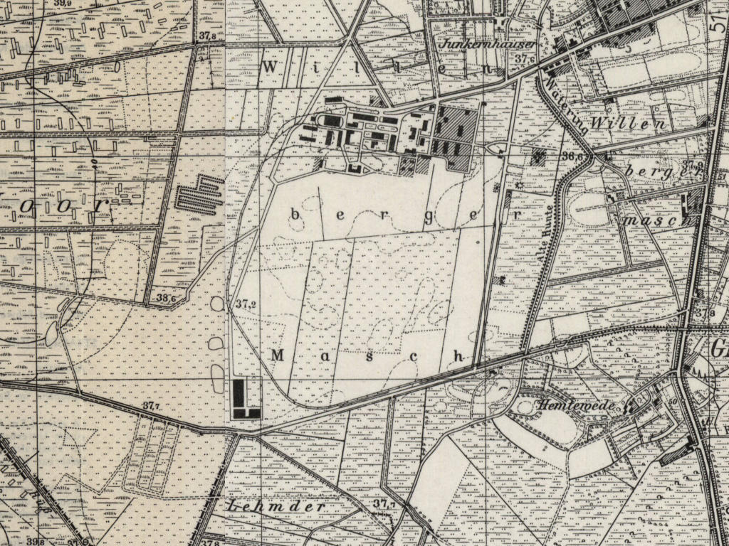
Former Diepholz Air Base on a US map from 1955 - (AMS M841 GSGS 4414, Courtesy Harold B. Lee Library, Brigham Young University /BYU/)
During the Cold War
Usage during the Cold War
German Airforce airfield.
In the 1950s
Additional information
Airfield Survey 1954
In 1953 and 1954, survey tours took place to identify future air bases for the German Air Force. Old airfields were visited and assessed, if a field can be used, if technical facilities and housing are available und if an extension of the runway up to 2500 m or 3000 m is possible.
In 1954, it was found for Diepholz that the former airfield of 800 m x 1000 m is now farmland and meadow and hence unusable. The runway could only be extended economically up to 1800 meters because of adjacent marshlands. Housing is available for 1000 persons, but first requires repair and relocation of 500 civilians. Warehouses with transport facilities up to 20.000 square meters. Technical buildings have to be contructed completely anew.
Courtesy of Norbert. Thanks!
In the 1970s
Location
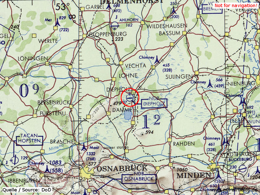
Diepholz Airfield on a map of the US Department of Defense from 1972 - (ONC E-2 (1972), Perry-Castañeda Library Map Collection, University of Texas at Austin /PCL MC/)
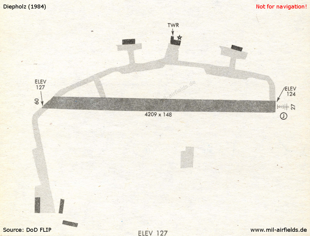
In the 1980s and early 1990s
Overview
Radio beacons
Data for the year 1990:
- ILS26: 109.1 "IDIW"
- NDB: 325 "DP", 266°/4.1NM to fld
Today
Use today
Luftwaffe airfield and civil aviation.
Links
Airfields in the vicinity
- 287°/14km Holdorf: Highway Strip (Notlandeplatz, NLP)
- 321°/18km Bakum: Highway Strip (Notlandeplatz NLP)
 Follow mil-airfields on Facebook