For historical information only, do not use for navigation or aviation purposes!
| Coordinates | N540708 E0134928 (WGS84) Google Maps |
| Former East Germany (GDR) | District of Rostock |
| Federal state | Mecklenburg-Vorpommern (Mecklenburg-Western Pomerania) |
| Airfield Id | 3361 |
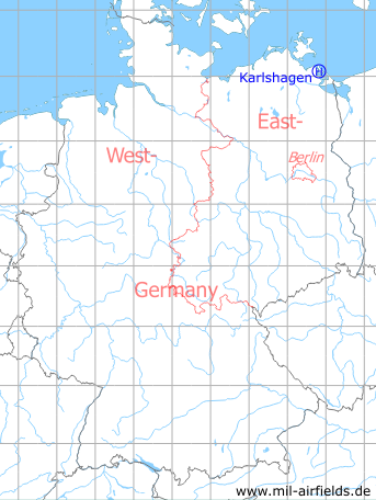
Germany during the Cold War Map
The history of the Cold War airfields: Karlshagen
Location of airfield
Northwestern limits of Karlshagen.
Usage during the Cold War
Helipad 3361 for HQ Fighter wing 9 (JG-9) of former East German Air Force (NVA LSK/LV).
Use today
Closed.
Runways, taxiways, aprons
Dimensions: 90 m x 150 m,
main takeoff and landing direction: 316°,
surface: solid sand, partly grass (drill ground),
capacity: 1 helicopter.
main takeoff and landing direction: 316°,
surface: solid sand, partly grass (drill ground),
capacity: 1 helicopter.
The approach and take-off direction of 316° was probably caused by the near-by approach course to Peenemünde Air Base, which was also 316°.
Telephone
Stabsnetz S1 4323-832
Airspace and procedures
Usable at day during good weather conditions.
Alert time: 60 minutes.
Alert time: 60 minutes.
Obstacles
Smokestack: direction 226°, height 25 m.
Airfields in the vicinity
- 323°/5km Peenemünde: Air Base
- 193°/14km Seckeritz: Agricultural Airfield
- 179°/18km Lassan: Agricultural Airfield
- 141°/24km Pudagla: Helipad 3360 (HSLP / HLP 3360)
- 198°/33km Anklam: Airfield
- 141°/34km Garz: Airfield (Heringsdorf Airport)
 Follow mil-airfields on Facebook