For historical information only, do not use for navigation or aviation purposes!
| Coordinates | N531756 E0114918 (WGS84) Google Maps |
| Airfield Id | 3346 |
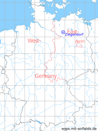
Germany during the Cold War Map
The history of the Cold War airfields: Ziegendorf
Location of airfield
Northeast of Ziegendorf.
Usage during the Cold War
Helipad 3346 for Anti-aircraft missile unit 133 (FRA-133) of former East German Air Force (NVA LSK/LV).
Use today
Closed.
Runways, taxiways, aprons
Dimensions: 250 m x 100 m.
main takeoff and landing direction: 230°.
surface: Grass (Athletic field).
capacity: 2 Helicopters.
main takeoff and landing direction: 230°.
surface: Grass (Athletic field).
capacity: 2 Helicopters.
Telephone
Stabsnetz S1 8487-843
Airspace and procedures
Usable at day during good weather conditions.
Alert time: 60 minutes.
Alert time: 60 minutes.
Obstacles
School building: direction 310°, height 15 m,
Settling pit: direction 70°.
Settling pit: direction 70°.
Airfields in the vicinity
- 350°/14km Parchim: Airfield (Schwerin-Parchim)
- 276°/18km Ludwigslust: Airfield
- 005°/22km Parchim: Helipad 3340 (HSLP / HLP 3340)
- 120°/23km Steffenshagen: Helipad 3348 (HSLP / HLP 3348)
- 076°/26km Retzow: Airfield
- 338°/27km Tramm: Helipad 3344 (HSLP / HLP 3344)
 Follow mil-airfields on Facebook