Estonia: Air Bases and Military Airfields
For historical information only, do not use for navigation or aviation purposes!
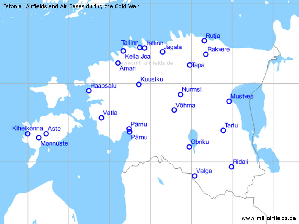
Select an airfield from the list to see details:
Estonian airfields (23)
Glossary
The following terms might help you for your own research on search engines. I'm not an expert for estonian, so it is without warranty. Corrections and additions are welcome!
Estonian:
| Airfield | Lennuväli |
| Estonia | Eesti |
| soviet | Nõukogude |
Russian:
| Airfield | аэродром |
| Airport | аэропорт |
| Call sign | позывной |
| Estonia | Эстония |