Flugplatz Ramstein / Ramstein Air Base
Landstuhl Air Base, Landstuhl-Ramstein
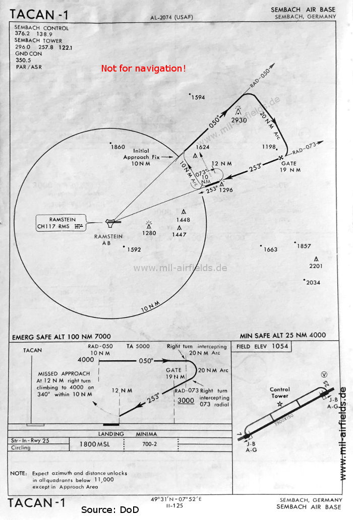
Historische Anflugkarten
Nur zur geschichtlichen Information, nicht zur Navigation oder zum Fliegen verwenden!
| Koordinaten | N492608 E0073560 (WGS84) Google Maps |
Location Indicator: DBRA, EDAR, ETAR
Nutzer: US Air Force (USAF)
1950er Jahre
Zu diesem Zeitpunkt lief der Flugplatz noch unter der Bezeichnung "Landstuhl Air Base"
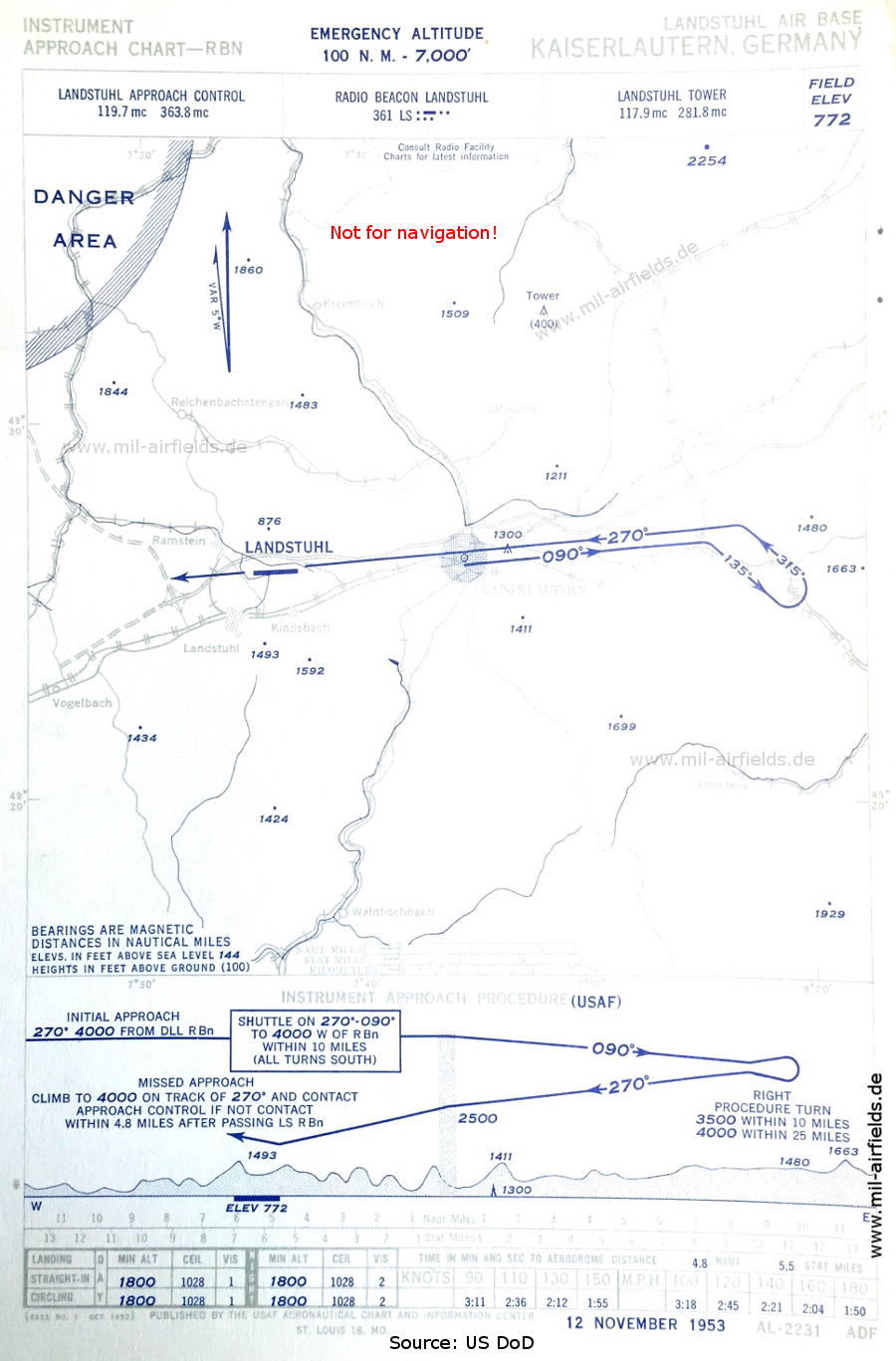
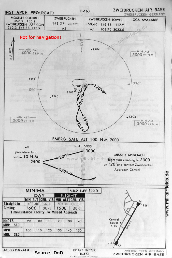
NDB-Anflug (November 1953)
Die Anflugkontrolle erfolgt durch 'Landstuhl Approach Control'.
(Quelle: US DoD / USAF)
Die Anflugkontrolle erfolgt durch 'Landstuhl Approach Control'.
(Quelle: US DoD / USAF)
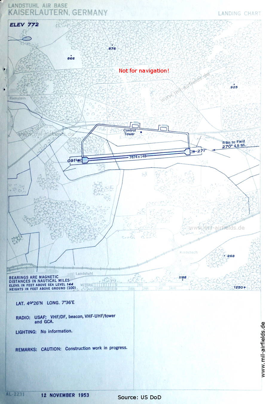
Flugplatzkarte (November 1953)
Es sind Bauarbeiten im Gang.
(Quelle: US DoD / USAF)
Es sind Bauarbeiten im Gang.
(Quelle: US DoD / USAF)
1960er Jahre
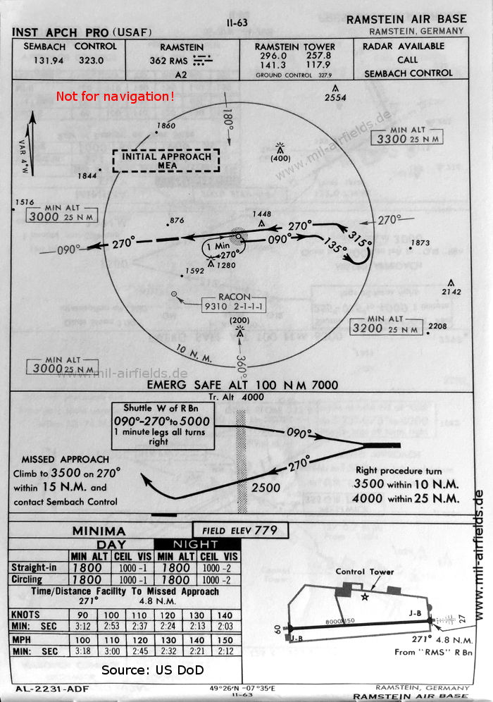
NDB-Anflug Landebahn 27 (Oktober 1960)
(Quelle: US DoD)
(Quelle: US DoD)
NDB-Anflug Landebahn 09 (Oktober 1960)
(Quelle: US DoD)
(Quelle: US DoD)
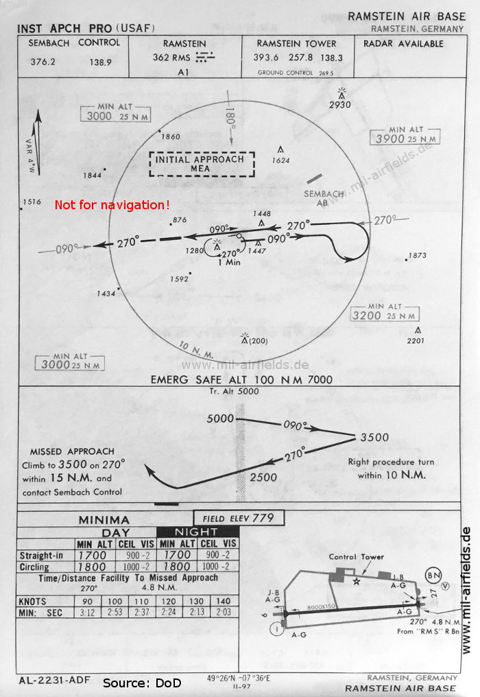
NDB-Anflug Landebahn 27 (Mai 1966)
(Quelle: US DoD)
(Quelle: US DoD)
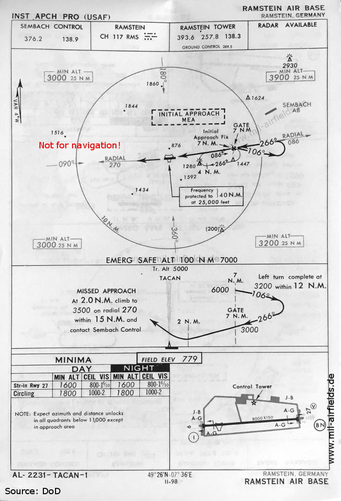
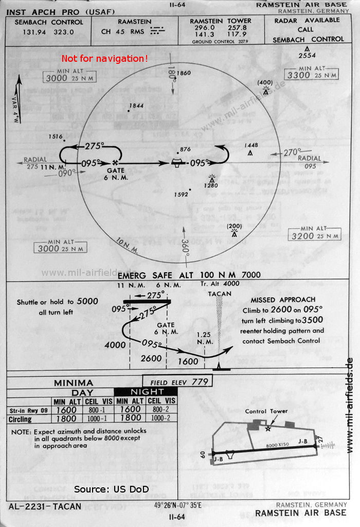
TACAN-Anflug Landebahn 27 (Mai 1966)
(Quelle: US DoD)
(Quelle: US DoD)
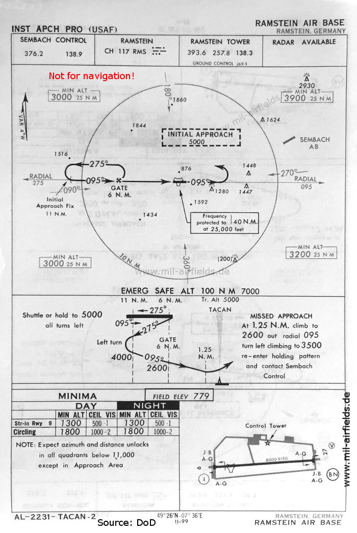
TACAN-Anflug Landebahn 09 (Mai 1966)
(Quelle: US DoD)
(Quelle: US DoD)
Quelle für alle Karten, sofern nicht anders gekennzeichnet: US Department of Defense (US DoD)
Empfohlen
Bildquellen sind auf der jeweiligen Zielseite angegeben, klicke auf die Vorschau um sie zu öffnen.