Ramstein Air Base
Landstuhl Air Base, Landstuhl-Ramstein
Historical approach charts
For historical information only, do not use for navigation or aviation purposes!
| Coordinates | N492608 E0073560 (WGS84) Google Maps |
Location Indicator: DBRA, EDAR, ETAR
User: US Air Force (USAF)
In the 1950s
At that time the airfield was still called "Landstuhl Air Base".
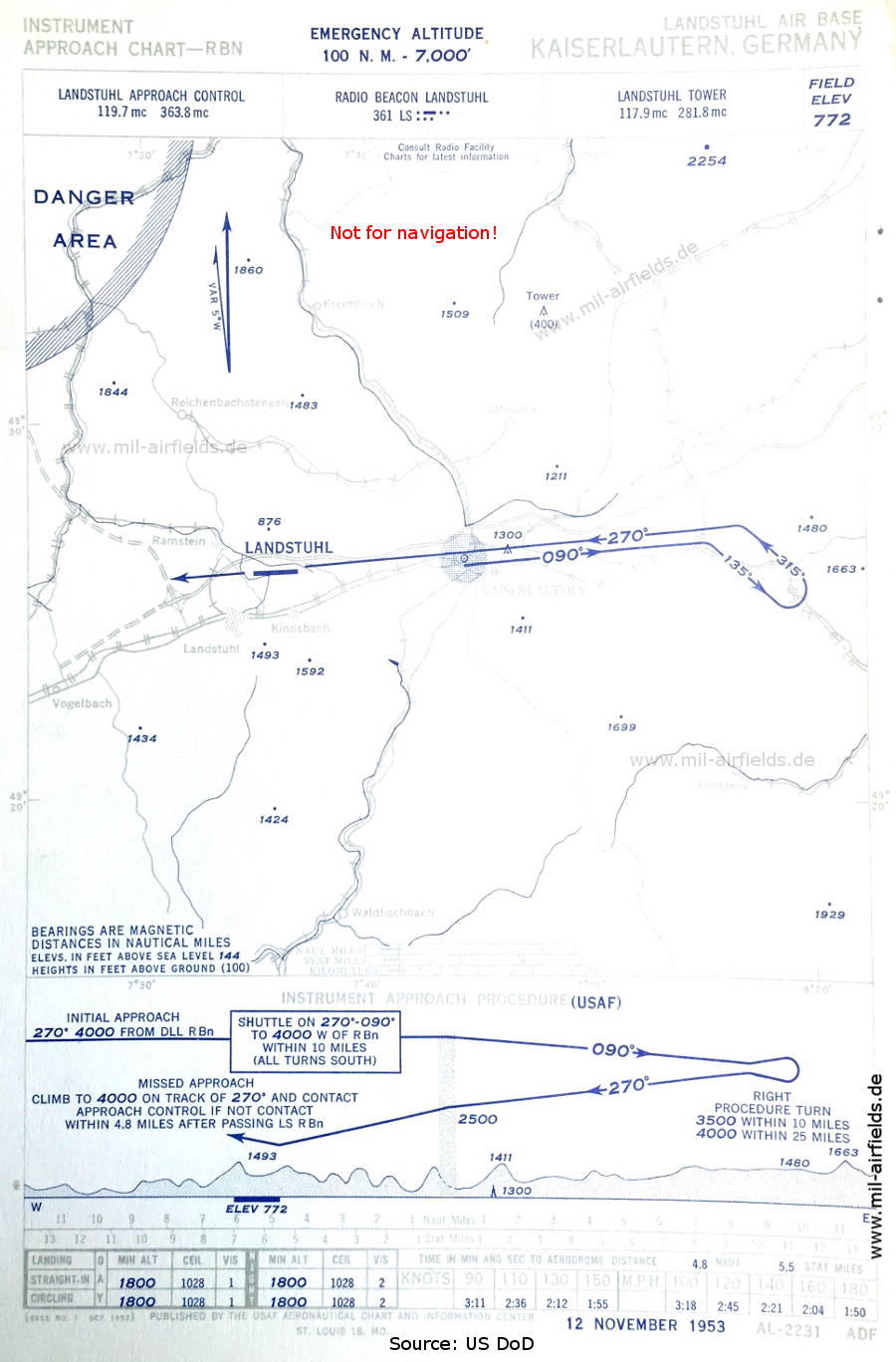
NDB approach (November 1953)
Approach control is provided by 'Landstuhl Approach Control'
(Source: US DoD / USAF)
Approach control is provided by 'Landstuhl Approach Control'
(Source: US DoD / USAF)
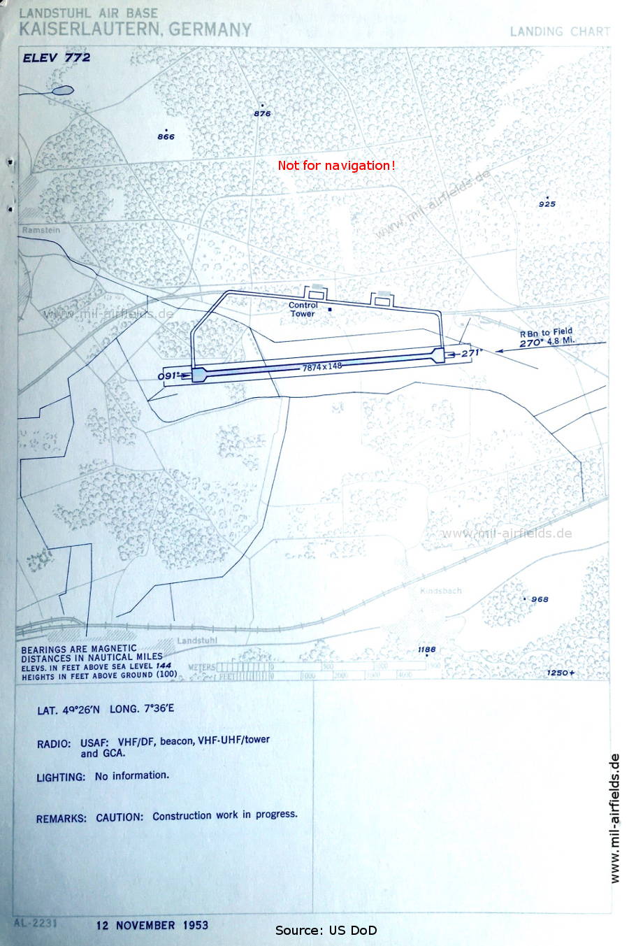
Aerodrome chart (November 1953)
Construction work is in progress.
(Source: US DoD / USAF)
Construction work is in progress.
(Source: US DoD / USAF)
In the 1960s
NDB approach runway 27 (October 1960)
(Source: US DoD)
(Source: US DoD)
NDB approach runway 09 (October 1960)
(Source: US DoD)
(Source: US DoD)
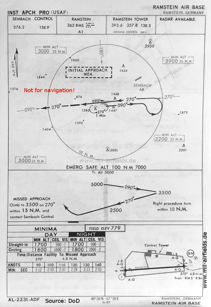
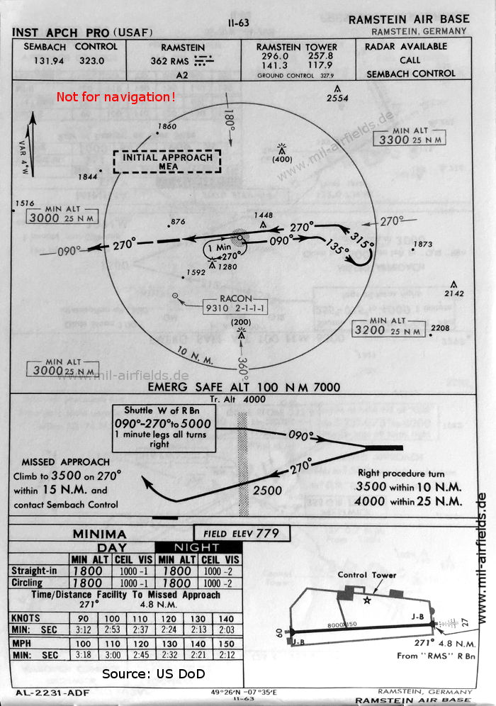
NDB approach runway 27 (May 1966)
(Source: DoD)
(Source: DoD)
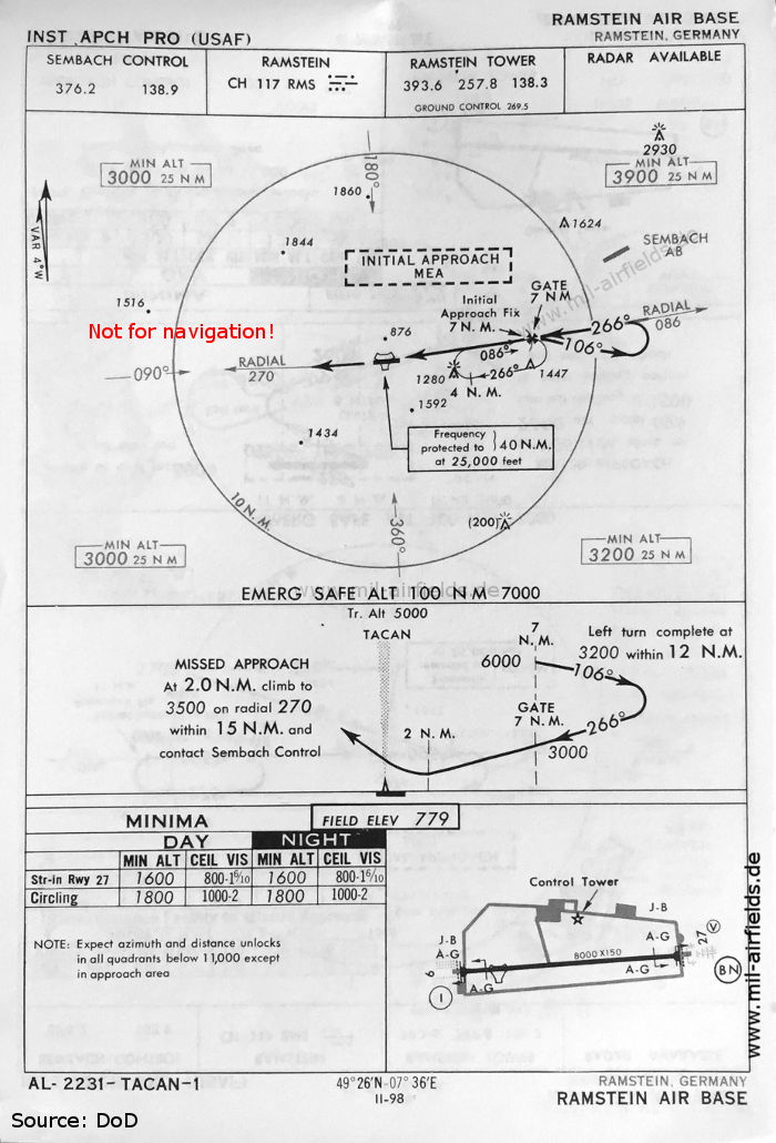
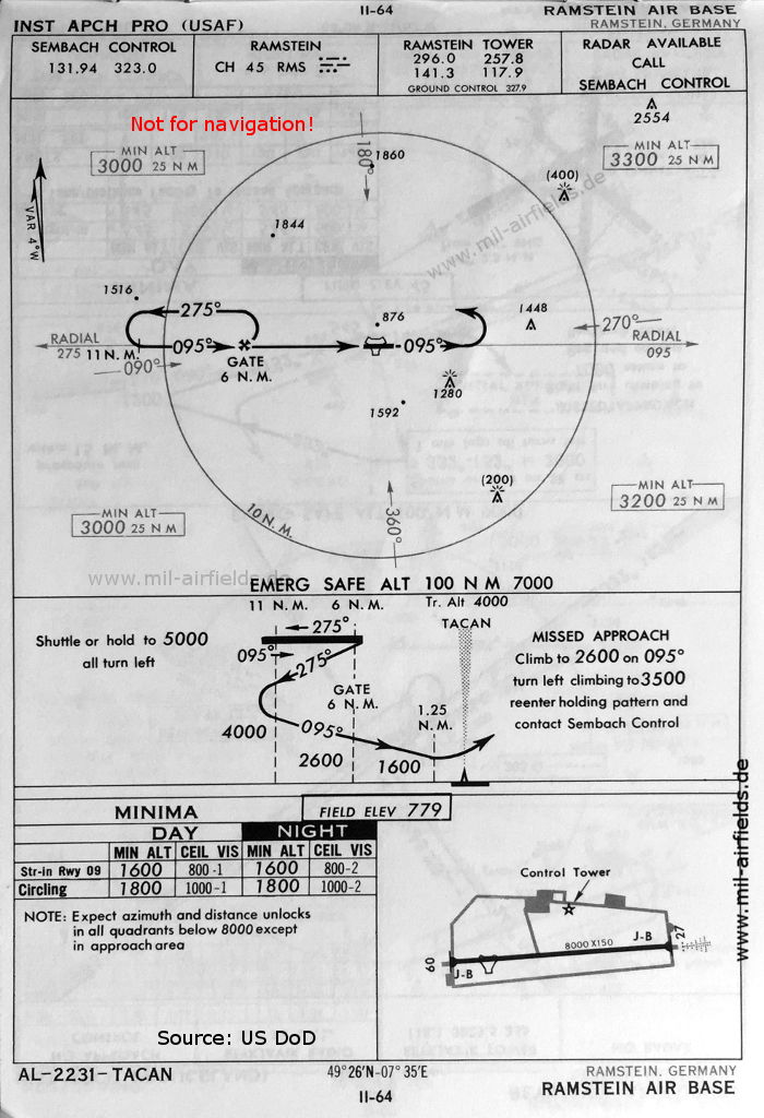
TACAN approach runway 27 (May 1966)
(Source: US DoD / USAF)
(Source: US DoD / USAF)
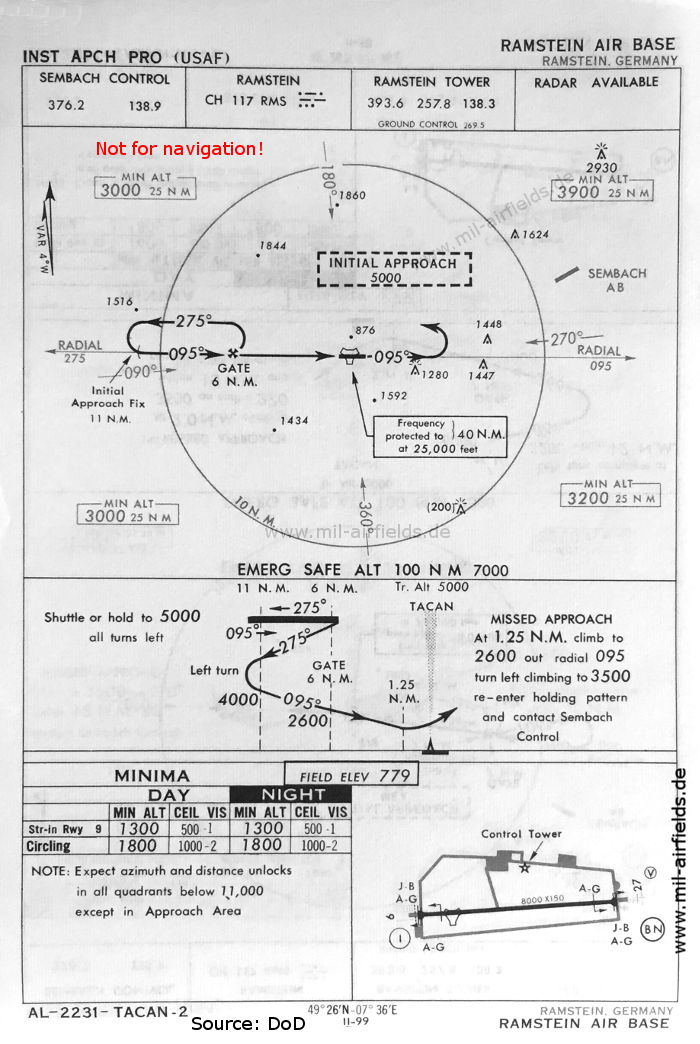
TACAN approach runway 09 (May 1966)
(Source: US DoD / USAF)
(Source: US DoD / USAF)
Source for all maps, if not marked otherwise: US Department of Defense (US DoD)
Recommended
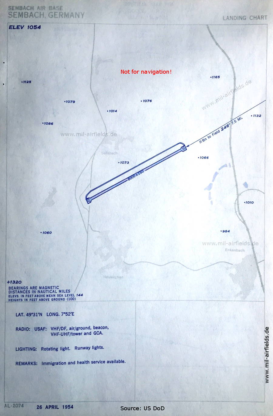
Image credits are shown on the respective target page, click on the preview to open it.